Mount Strachan
November 15, 2015
1459m
North Shore Mountains, BC
Mt. Strachan is the highest peak in the southern portion of Cypress Provincial Park and because of the ski hills one can easily drive up to elevation of 900+ m on a paved road, making it one of the easiest hikes in the North Shore. It’s a great objective when I don’t have enough time, energy or motivation and the ideal time is off-season when the snow makes some more dramatic views. This past Sunday was one of “those days” that I didn’t want to push too much. I wasn’t even planning to go out initially but once I saw clouds beginning to lift up in the morning I made the spontaneous decision to head out. My mom could join since it’s a Sunday trip and after lunch, off we went.

Mt. Strachan ascent route. GPX DL
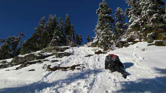
Apparently we could start snowshoeing right from the start but it’s also appeared to be heavily tracked by snowmobiles, snowshoeers and (mostly), hikers. In fact, we had to park fair a ways back in the parking lot thank to the hordes of people getting out. We didn’t want to take a chance so strapped the ‘shoes on. There’re infinitely many ways to get up this summit and we picked the easiest one – up the Collins run (a green line). Well, we were following the snowmobiles and previous parties’ tracks anyway. We did take one short-cut near Hollyburn/Strachan col on our way to the top of “Lions Express”. There’s a small down-hill following before the final rise towards the south summit.
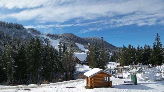
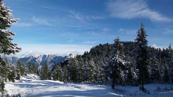
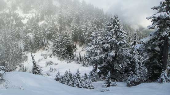
The start of this hike

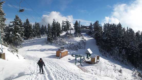
Following the green ski run up
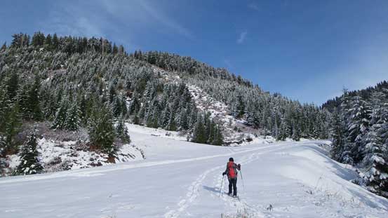
Snowshoeing
Looking back towards Black Mountain
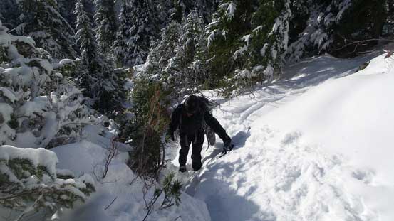
Here we took a short-cut

Snowshoeing up the short-cut (a blue ski run)

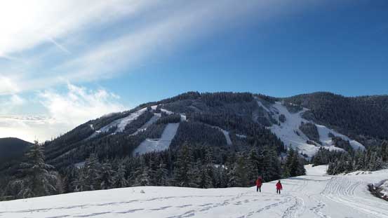
Rejoining the main track. Hordes of people were coming down
That forested bump is Hollyburn Mountain
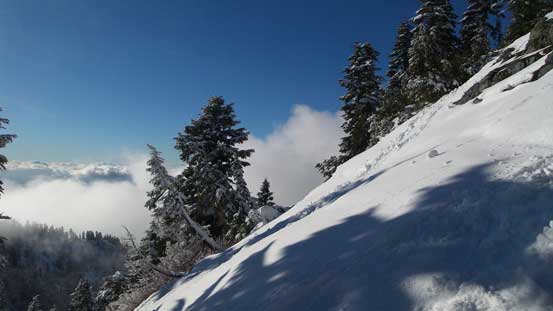
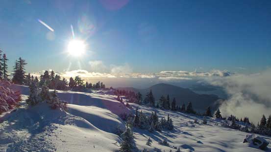
Now what we needed was nothing but following the road up (in this case, keep following the snowmobile/snowshoe/boot tracks). Higher up there were a few switch backs and since we were wearing the ‘shoes we took a few short-cuts to save some distance. After a while we reached the top of the next chairlift. Turning right following the broad ridge we soon reached the south summit. Some clouds were rolling in but it appeared they gonna dissipate soon.
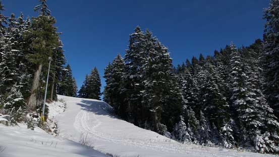
Passing the top of “Lions Express”
Getting higher than Black Mountain now. Looking down at Howe Sound

Beneath the chairlift

On the south summit now. Clouds were building up
The north (true) summit ahead
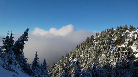
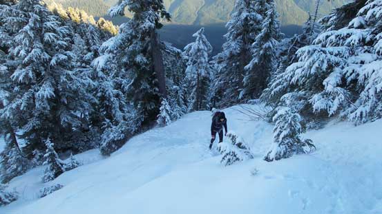
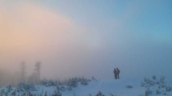
Getting to the north (true) summit was the real adventure of this trip. There’s a steep descent off the south peak into the col and the terrain was too steep for snowshoes. We soon took them off and booted down the slope. Thankfully the parties ahead had made the steps for us and even that it was fairly icy. Ascending the other side was again, steep and icy but didn’t impose too much of a problem to us. We waited for almost an hour on the summit and the weather was indeed getting better and better. The clouds rolling in and out made some dramatic views.
Looking into the col between south and north summits

Steep descent into the col
Still steep up the other side
Looking across the slopes
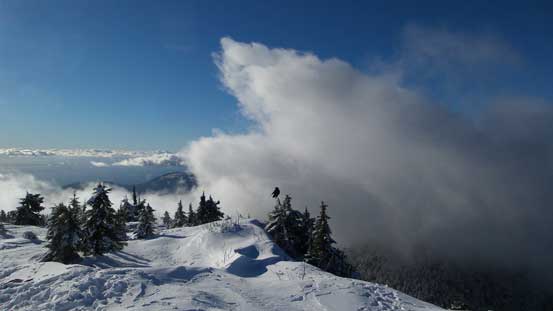
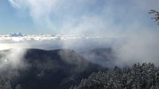
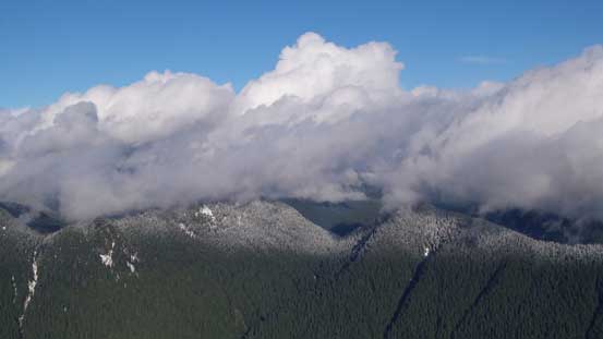
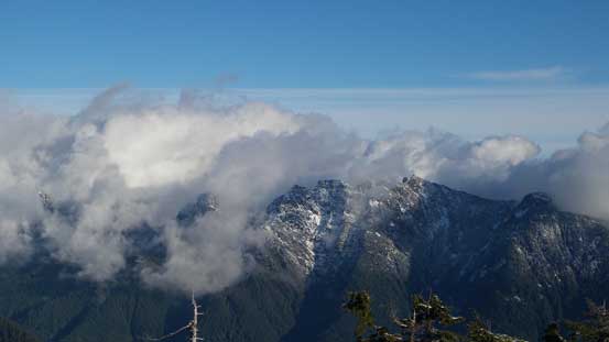
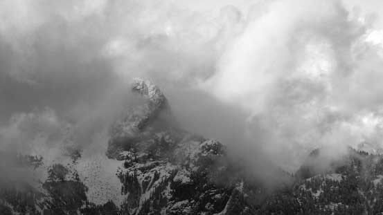
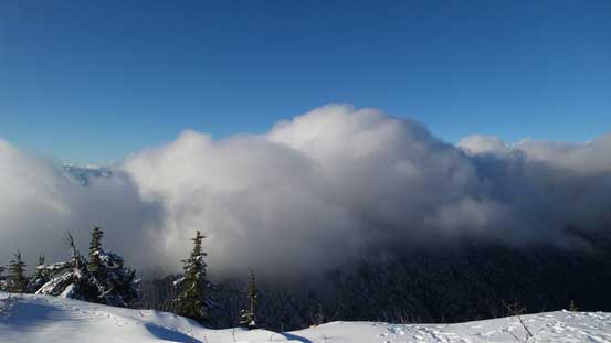
Cool clouds formation

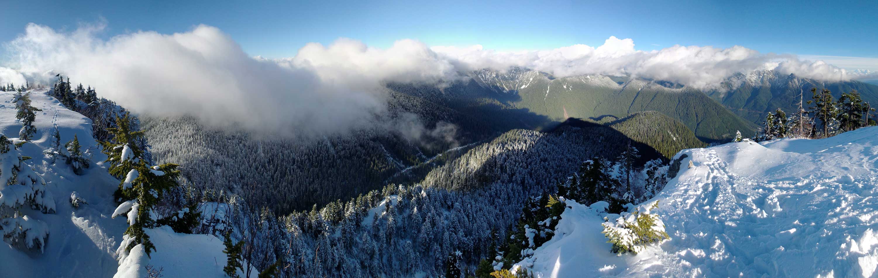
Summit Panorama from Mt. Strachan. Click to view large size.
Clouds hovering above the forested bumps – Wizard Peak and Magic Peak
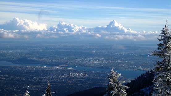
A zoomed-in view of the city of Vancouver

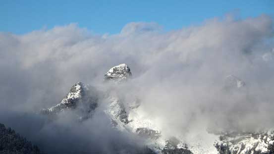
The tip of West Lion showed up
More about the Lions
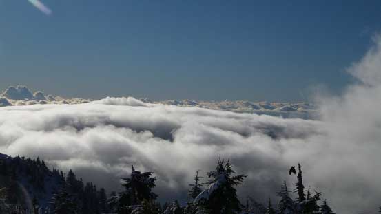
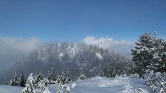
Temporary low clouds inversion scenery
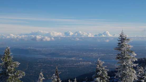
Another picture of the Great Vancouver
Crown Mountain is the highest summit behind “Grouse Grind”
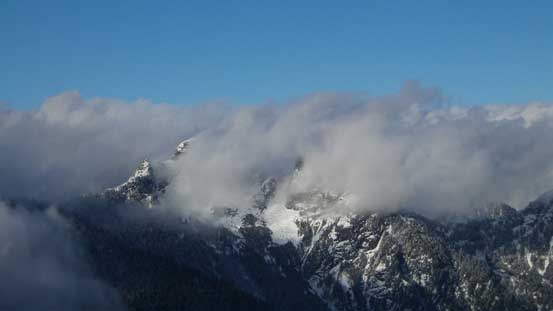
As far as the views I got for the Lions
East Lion finally showed up – a peak that I bagged in September
Cool clouds…

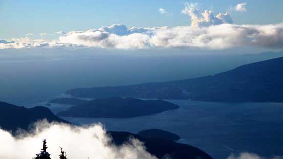
Started to see Bowen Island down by Howe Sound

Soaking in the views
Other Islands
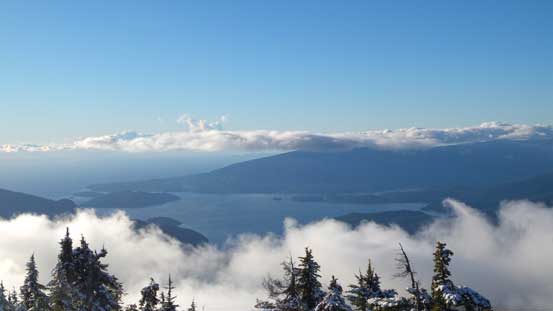
As far as the view goes for Howe Sound

Looking down at the forested ridge along HSCT (Howe Sound Crest Trail)
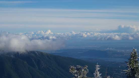
Looking towards Burnaby and further east by Lower Mainland
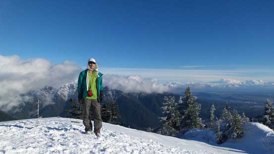
Me on the summit

Mom and I on the summit
Another panorama from the summit. Click to view large size.
Eventually it’s the time to get down. We paid extra caution on the slippery slopes from the north peak down to the col and then up the other side. Once we got back to the south peak the tricky stuffs were over. Now there’s about 1 hour before sunset so I made the call to wait for more pictures. Unfortunately a layer of clouds rolled in obscuring all of our views. We did wait for 1 hour but it was no good, so went down. Lower down we got out of the cloud layer but it was already too late for the sunset (but OK for some dusk and night views).
Carefully descending the slippery slope

Looking across the shoulder of the south summit
Partway up the south summit, looking back
The girl from another group on her way back up the south summit
On the south summit now

Looking back towards the true summit

The other group

A layer of misty clouds rolled in…

Almost sunset time
But we couldn’t see much at all…
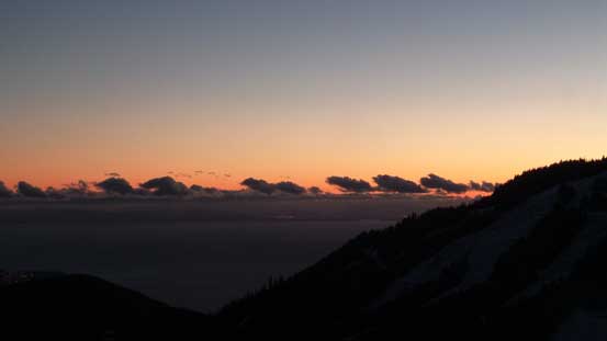
Lower down we got some dusk views
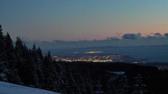
It’s passing dusk already…
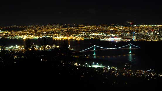
Night scenery towards Lions Gate Bridge and Vancouver
Mt. Strachan turned out to be an excellent half-day outing. It was actually my second time up here. A few weeks ago I went up there solo hoping for sunset and low clouds scenery but got nothing but white-out. I didn’t bother with the true summit nor did I bother to write a trip report. I’m glad I came back for the views.
