Golden Hinde
August 25-28, 2017
2197m
Strathcona Park / Vancouver Island, BC
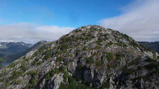
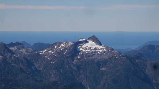
In the middle of Strathcona Provincial Park of the central Vancouver Island sits a rugged and iconic massif – Golden Hinde, the highest peak on the entire island. This status draws significant attention from everybody making Golden Hinde one of the most famed mountaineering objectives on the island. Thankfully, the associated logistics including the expensive ferry rides had done its job keeping most tourists at bay as otherwise this fragile area could definitely not sustain the crowds. If the weather cooperates (which is a very rare case in this part of the country), the summit offers unobstructed views of the entire Vancouver Island stretching out below, with Mt. Waddington and the Pacific Ocean dominating the east and west horizons, respectively. It’s that good… The standard route via SE Gullies isn’t particularly technical, but the approach involves a multi-day, contrived and extremely arduous cross-country trek from Arnica Lake over Phillips Ridge with massive amount of up-and-downs, on mostly unpleasant island terrain.
The peaks on Vancouver Island had not really caught my interest until late in this year for two main reasons. The super expensive ferry rides had kept me from even thinking about it but at the same time, the peaks on Vancouver Island aren’t particularly tall in elevation. As a mountaineer coming from the Rockies the absolute elevation plays a big roll when I evaluate the “quality” of objectives. This was no longer the case after a friend of mine did a week-long traverse across the entire Stratchona Park. Reading his account with the high-quality photos I knew instantly that I had to ascend at least Golden Hinde. Meanwhile believe or not, the famed American peak-bagger Adam (Gimplator) had also thrown this idea out as Golden Hinde is one of the “ultras” in SW BC (an “ultra” is a peak with at least 1500 m prominence). This proves Golden Hinde as being one peak that catches EVERYBODY’s attention no matter what exactly you are up for. Upon a block of high pressure system kicked in towards the last week of this August we instantly knew there’s a golden opportunity ahead. Our plan was to do the trip in a course of 3 days aiming to ascend Golden Hinde, The Behinde, Mt. Burman and Phillips Ridge. This sounds ridiculous as most parties would spend 5 days for just the main prize, but neither Adam nor myself are the “average” persons when it come to weekend-worrier style of peak-bagging.
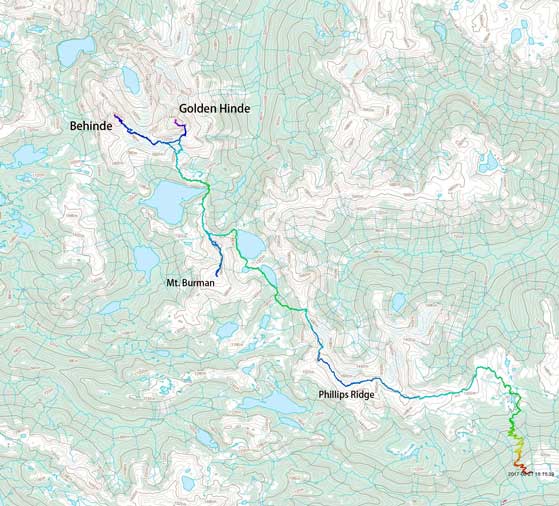
Golden Hinde standard route from south approach. GPX DL
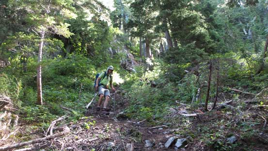
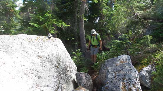
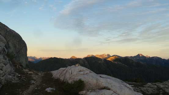
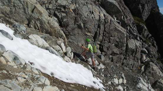
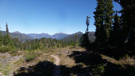
Towards the last minute we decided to extend the trip by one day and in particular we would knock off the initial 5 km Arnica Lake approach in the evening of Day 1. This would shorten our main approach day by at least a couple hours. To make full use of that day we did a detour into the city of Victoria and then did a short hike up Mt. Douglas. By the time we finally got to the trail-head in the hours of late afternoon it was a bit of tough going at the start. The temperature was hot, the air was humid and there’s at least a hundred mosquitoes around. It’s very tempting to get lazy but that’s not the right spirit so we just sucked it up. After an hour into the game the tiredness had eased away and then we had a cruise sailing up the endless switchbacks. The elevation of Arnica Lake was more than 1000 vertical meters above the parking lot. There’s a couple empty (and excellent) tent pads but I said let’s keep pushing further. Carrying on up onto the lower reach of Phillips Ridge we eventually settled beside an empty tarn near a 1400-meter plateau.
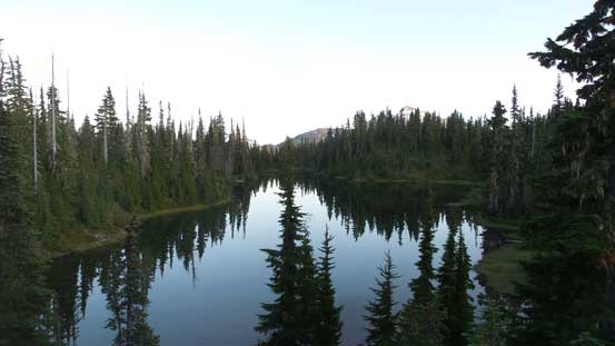
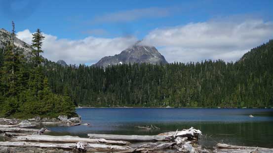
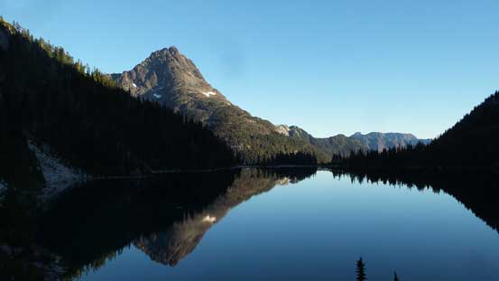
Arnica Lake in the evening of Day 1
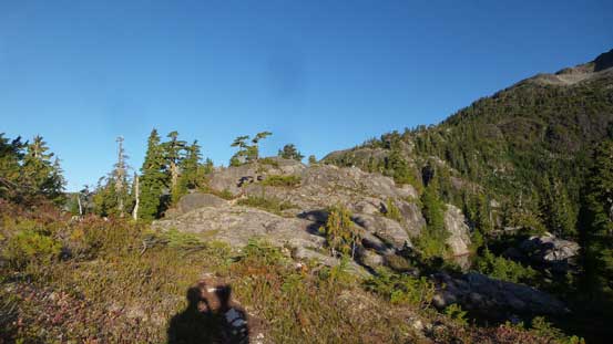
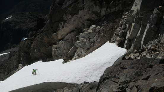
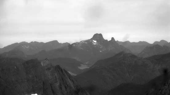
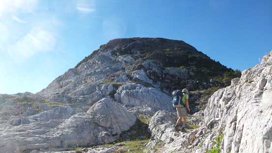
The next morning saw us waking up a bit later than planed but there’s no need to rush. The problem arose sooner than expected as a layer of low clouds rolled in and in no time we were in a complete white-out. There’s even some light drizzle which made lots of four-letter words flying around, mostly to curse the weather forecasters. But then we could see the ceiling layer was thin and there’s blue skies around so there’s little to worry about. The theme of up-and-downs had already started as soon as we got to the treeline zone of Phillips Ridge. I had lost count how many bumps we had to ascend up and over. The good thing we did not have to ascend the two highest bumps on Phillips Ridge’s alpine. To claim that summit we’d simply tag them on the return but right now let’s push as far as possible.
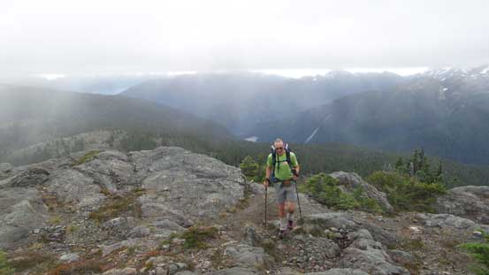
Where’s the forecasted bluebird sky?

We traversed the entire stretch of Phillips Ridge in low visibility
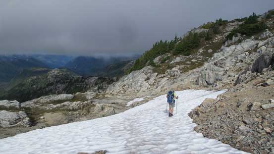
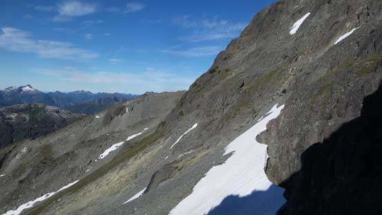
Towards the end of this Phillips Ridge traverse the ridge crest turned a more northwards direction and it was here that the terrain became super rugged. Right off the bat we lost the trail and then had to down-climb a 3rd class chimney. We rejoined the trail lower down and then did a long descent into a “waterfall chasm” before regaining all of the lost elevation back up to the next bump. And then three consecutive bumps followed in a sequence and it sure didn’t disappoint us, as we had to ascend up and over all of them and then drop down into a broad, 1350-meter saddle. Two routes split up here and the nowadays standard option descends the steep forest all the way to about 50 meters below the surface of Carter Lake. The only positive thing – there’s no bushwhack whatsoever thank to the popularity of this objective. The place where we crossed the outflow of Carter Lake was a good spot to take a long break and after that we carried on to the shoreline of Carter Lake where at least three tents were pitched.
Near the end of the highland Phillips Ridge traverse

Descending an off-route 3rd class chimney
The first of the several bumps after Phillips Ridge section.
The terrain continues the descending trend, into the “waterfall chasm”

Meanwhile the clouds finally lifted up

This is that “waterfall chasm”. There’s a waterfall to fill up water bottles
Then, re-ascending a ton of elevation up the first major bump after Phillips Ridge

A cool tarn on this undulating bump traverse stage

After a long while we dropped to the 1350-meter saddle
Then, a steep drop into the forest to the first major low point of this approach
After a bit of re-ascending we reached the shore of Carter Lake
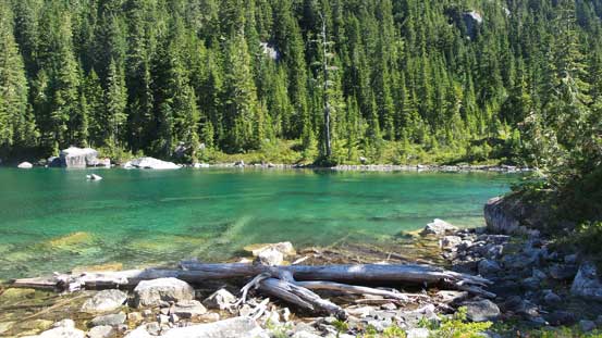
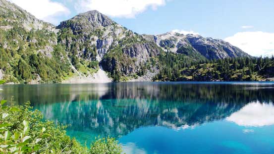
Carter Lake has pretty cool colours
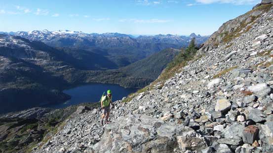
The next stage was traversing the west shoreline of Carter Lake and believe or not, this section was also easier than expected due to the lack of bushwhacking. There’s a good trail for most of the way but we lost it towards the end. The punishment was some unpleasant side-hilling but nothing’s terrible and we soon rejoined the trail at the rear end of this lake. The trail then led us ascending the gentle grassy slopes due NW to a small, unnamed lake below the impressive east face of Mt. Burman. We did no lingering but immediately carried on, crossing over a divide and then we saw the larger, but prettier Schjelderup Lake. Descending and then traversing the west shore of Schjelderup Lake was more difficult than Carter Lake but again, the lack of bushwhacking made it a fairly tame undertake. The only downside was now we had to deal with a fair amount of tedious boulder hoping along with at least two major up-and-downs.
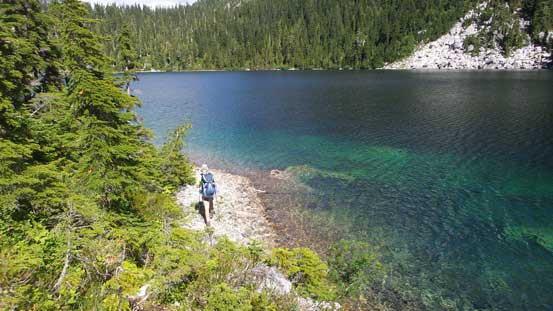
Traversing the shoreline of Carter Lake
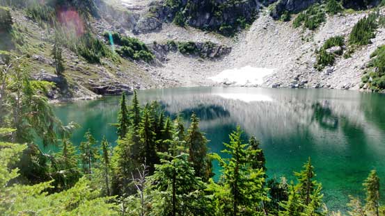
This is the small, unnamed lake between Carter and Schjelderup Lakes

Arriving at the bigger Schjelderup Lake now
Traversing around this lake involved lots of boulder hopping
At least the colour was still great

Just another shot of the Schjelderup Lake traverse
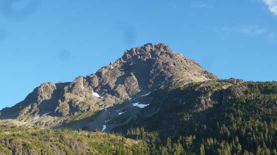
After a short break we resumed the approach, picking up the trail again heading upwards into the forest. The next stage was a near-300-meter grunt to the crest of “Burman Ridge” and needless to say, this is not a stage that any of us was looking forward to, especially at this time of a day. The grunt was however, easier than expected probably due to the fact we now had a head-on view of the south face of Golden Hinde and also The Behinde. Having the main objectives in sight definitely helped boosting our motivation. According to the others this “Burman Ridge” was the last 5-star campsite so we had some discussion. My original plan was to push all the way to the “climber’s tarn” below the south face of Golden Hinde but here I changed my mind. The new plan was to set up camp and then bag Mt. Burman in the evening of this day as it’s right here and made sense. This turned out to be an excellent plan. The other groups – four kind and helpful locals, also pitched their tents at this “Burman Ridge” camp site and we all enjoyed a spectacular sunset.

Partway up towards “Burman Ridge” we got a good view at Golden Hinde
After a long grunt we made to the highpoint on Burman Ridge

This campsite was 5-star with our objectives directly behind
A really cool tarn on the way up towards Mt. Burman

After ascent of Mt. Burman we were back at camp

Time to watch some evening colours on the horizon

It’s sunset time.. That’s the end of Day 2
On the morning of Day 3 Adam and I woke up around sunrise. The sky was perfectly clear so this was THE DAY.. The other group had planned to start an hour later and our strategy was to minimize the time spent in that loose SE couloir together as a group-of-six would be too much for rockfall hazard. The day started by a very frustrating 400-meter elevation loss down to the outflow of Burman Lake aka. the “Burman Chasm”. Ironically this would put us at the lowest point of the whole approach since climbing onto the Phillips Ridge from Arnica Lake. For all of the up-and-downs we had gained literally nothing and tell me how frustrating that was.. But let’s face it. The descent into Burman Chasm was done in a couple stages but with each section being a little bit steeper than the previous one. The last part was a near-vertical forested plunge down on mostly tree root ladders and we sure had lots of “fun”. I even turned my face inwards just to make the photos sexier… Then up the opposite side we had a equally steep climb out of the chasm.
We started our summit day right after sunrise
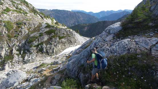
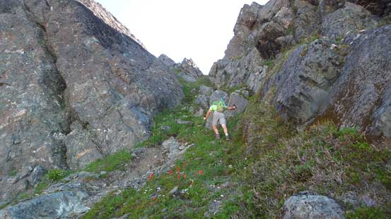
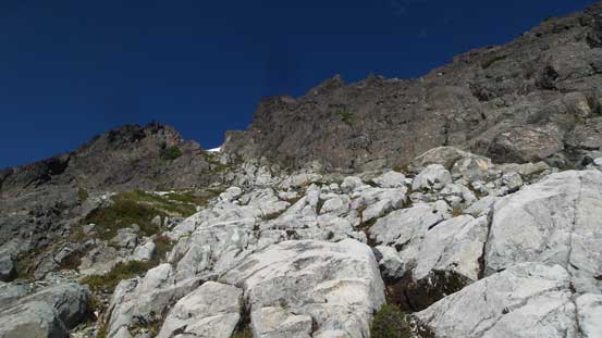
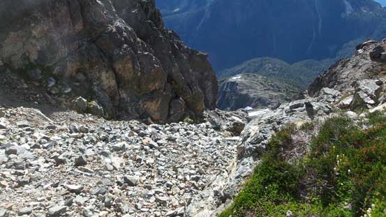
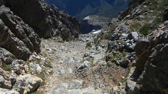
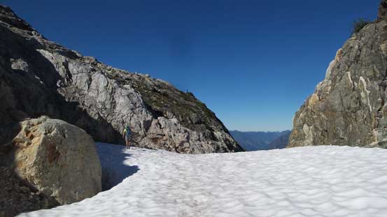
Once out of the chasm we entered a zone of sparsely forested granite steps and the going was fairly simple. For a long while we could still follow the trail/path which eventually led us to the “climber’s tarn”, albeit after a long section of grunt. The tarn was indeed, much less pleasant for camping as the shoreline was just steep boulders with little place to pitch out a tent. Upwards again we initially ascended on snow but soon merged onto scree. The obvious path led up trending slightly climber’s right and eventually into a gully feature. Ascending this narrow gully/couloir was pretty straightforward and then we were dumped on the edge of SE Face. From there we had to do a diagonal rising traverse to the base of “SE Gullies” but this stage was the worst. Rockies type of treadmill scree punished us and to push through the shitty terrain required lots of perseverance. Eventually the looseness eased and then we saw a strip of white rocks coming down from the uphill side. And here we go, this is the correct start of SE Gully.
Out of “Burman Chasm” now we finally got some sunshine
Our objective – Golden Hinde finally getting closer

Arriving at the beautiful “climber’s tarn”

We resumed on, this is a section of scree slog on the lower S. Face
This is a key gully that you must get it correct.
From the top of this gully looking back at the lower South Face
Traversing the middle SE Face towards our main gully
These white rocks mark the start of that “SE Gully”
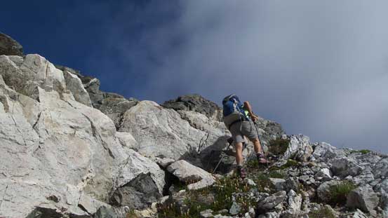
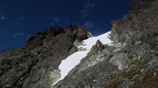
The gully was much easier than expected with scrambling difficulties not exceeding “low 3rd class” until we hit a (permanent) patch of steep snow. This pitch of snow was about 50 meters long and ran at 40-45 degrees ish at the steepest. Most parties including our reference trip report did a detour on climber’s right side. With good route-finding skills one can stay within “low class 4” terrain but as mountaineers we figured the easiest option was simply ascending the middle of this snow field. This snow climb looked tamely easy to me. I did take out the axe but didn’t bother to don crampons, but after 2/3 of the way up I regretted for not using the crampons. For the last 20 meters I had to kick multiple times as the snow was hardpacked and icy, and meanwhile the exposure was pretty real.
Ahead is that pitch of snow
Adam decided to squeeze through the moat

Looking ahead towards the upper gully
Looking down at Adam finishing his snow climb
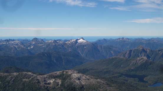
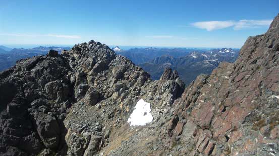
The pitch of snow was overall short-lived and then we were back onto rock. There’s nothing overly fancy in the upper gully although the ground was quite loose in general. The scrambling was however, “low 3rd class” at its hardest and before long we were at the top of this SE Gully looking down the north side. Then turning right following paths and cairns we had a leisure walk to the highest point. The scrambling was disappointing. The views were as expected, million-dollar towards each direction especially with the mighty Mt. Waddington visible on the skyline. About 40 minutes later the other group showed up and then it’s party time on the summit.

Adam leading the upper gully scramble

Me in the upper gully. Photo by Adam
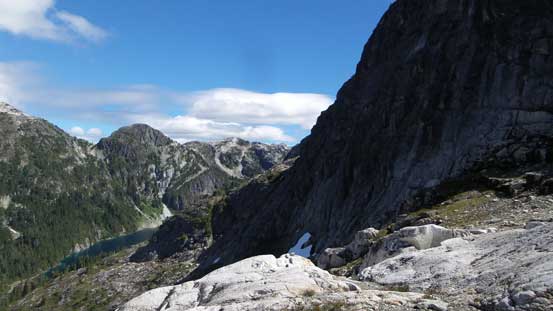
Looking down from the exit of this SE Gully

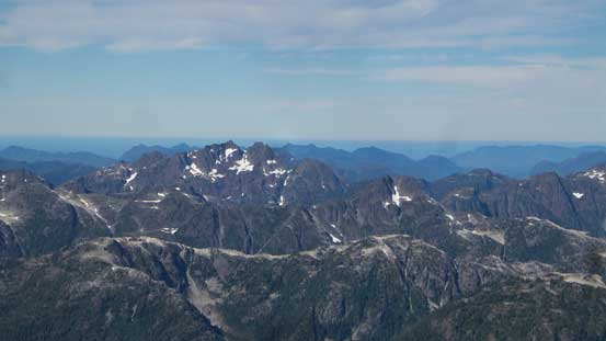
Summit Panorama from Golden Hinde. Click to view large size.

Looking down at The Behinde

Looking north into the core of Strathcona Park

Mt. McBride right of center and the Wolf River Valley
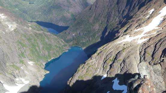
Two very cool lakes to the north

A zoomed-in shot of The Behinde

Mt. Colonel Foster one of the hardest objectives on the island

The majestic Elkhorn Mountain is only a couple meters lower than the hinde

The bulk mass of Mt. Waddington dominating the NE skyline
The sexy Victoria Peak along with the attached Warden Peak
This is looking at a bunch of super remote peaks behind Tofino area
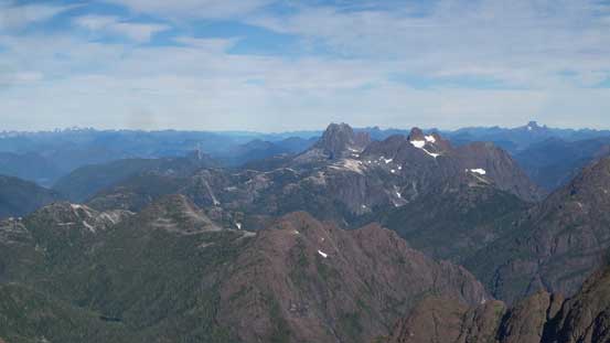
A wider view towards Mt. Colonel Foster et al.

This is looking way up north. There’s another big peak that way – Rugged Mountain
Matchlee Mountain left of center apparently has some pretty good history
Splendor Mountain. Note the Pacific Ocean behind

Me on the summit of Golden Hinde
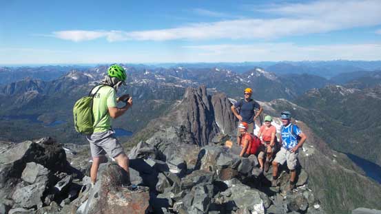
Party time on the summit!

Another panorama from the summit of Golden Hinde. Click to view large size.
Eventually we had to go down. It’s hard to leave this summit but let’s face it. The plan was again, Adam and I descending roughly half an hour ahead of the other group so that the rockfall hazard was minimized. Reversing the loose gully was tamely easy as we could just (sort of) scree ski down the middle of the fall line. Back to the snow field, I didn’t fuck around with the gears this time, donned crampons and then down-climbed the entire path facing inwards. The snow surface was homogeneous which made a very enjoyable process. Only a few kicks got me into the rhythm I wanted. Adam played more cautiously but joined me soon afterwards. The gear transition took a couple more minutes and then the next thing we were down to the bottom of this SE Gully, and then easily reversed the lower SE Face. To locate the lower couloir I pulled the GPS out because we descended too low and missed the path.
Time to head down…
The upper, loose gully

Adam carefully works his way down the couloir
Me down-climbing snow. Photo by Adam

Fun scrambling in the lower couloir.
At this point Adam wanted to just head back to camp but I was still very keen on trying The Behinde so we departed from each other with me side-hilling across the entire lower south face, aiming for the distant Behinide/Golden Hinde saddle. The solo ascent of The Behinde turned out to be the scrambling highlight of this trip with sections up to 4th class and super exposed. A few hours later I was back at the “climber’s tarn”, picked up the trail and then descended into “Burman Chasm” at perhaps the most leisurely pace ever. The temperature and humidity was brutal on this day plus I was running low on water. Re-ascending out of the “Burman Chasm” back to camp felt like the most dreary 400-meter ever but at least the views were improving in the later afternoon sunbeams.
Adam plunging down the easy scree towards the climber’s tarn

Going for The Behinde

The north face of Golden Hinde from The Behinde

After an ascent of The Behinde I was back at the climber’s tarn

Another shot of the climber’s tarn

Descending…

The typical terrain with granite slabs and heather ledges

Into the Burman Chasm

The infamous tree root ladder out of the chasm
A good ways up the opposite side now

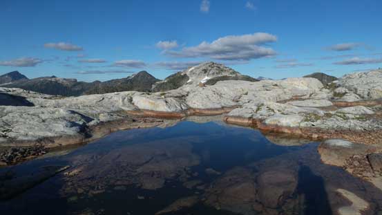
One of the many cool tarns along the way

Just another shot of that tarn with Mt. McBride behind
Back to camp I was totally beat but the good news, none of us was in the mood of moving camp. That meant we could have a pretty relaxed evening but then the 4th day would be a long death-march all the way back to the parking lot. The deal was made and then sleep came fairly easily although the temperature was still hot. The morning of Day 4 saw us departing at just after sunrise. Right off the bat we had to face that 300-meter descent to Schjelderup Lake which got our knees a good work out. And then there came the two consecutive unpleasant lake shore traverses, another 50 meters of plunge down Carter Lake’s outflow and then the 300-meter forested slog back to the 1350-meter saddle. Thank to the “alpine start” we had the pleasure to do this whole stage in the absence of sun beams.

The morning of Day 4 we also started at sunrise
Reflection of Golden Hinde in Schjelderup Lake

The steep forested grunt back up to that 1350-meter saddle
Now onto the lower north end of Phillips Ridge we had to face that whole bunch of bumps traverses. At least three if not four bumps had to be ascended up and over with each one bigger than the previous. Immediately after the last, biggest bump we lost all of the hard won elevation in this “roller coaster traverse” by plunging steeply into that “waterfall chasm”. Then upwards again we did manage to avoid re-ascending that 3rd class chimney by following game paths on climber’s right side. The path was however, confusing as hell in such way that without GPS technology we sure would get disoriented. There’s only one solution that the northernmost bump on Phillips Ridge proper could not be bypassed so we did the expected, ascending to its top only to lose the elevation in the next stage.
This section has lots of limestone

As you can see it’s not a simple hike along this ridge
It’s that waterfall chasm again…

At least there’s no clouds whatsoever. This is the typical island views

A review shot of Golden Hinde and The Behinde

Another shot of the Vancouver Island terrain.

Mariner Mountain behind Thelwood and Moyeha
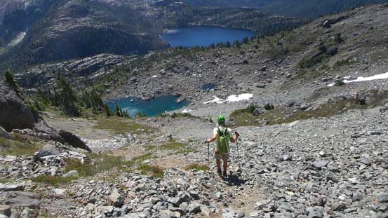
Just when I thought the constant up-and-downs were (briefly) over we made the decision to ascend both highpoints of Phillips Ridge just to be sure we actually made its summit. The first summit was just a short detour from the trail so not a huge deal, but the second summit required an extra 100+ meters of elevation gain to reach. The view from the second summit was good so I’m happy about this decision overall. Now what?! In the height of afternoon heat with temperature probably exceeding 30 degrees Celsius we had to resume the death march. The lower reach of Phillips Ridge traverse involved more up-and-downs with “downs” more than “ups” of course. The combined physical challenges of this trip had finally taken its toll on me. By rough estimate we had gained more than 6000 vertical meters of elevation in the last three days and now we still had to face another 1000+ meters of descent to the parking lot. Needless to say, the last few hours of descent to, and then from Arnica Lake was the most miserable slog ever.

A view from the farther summit of Phillips Ridge

One last look at Golden Hinde, from Phillips Ridge
As typical as the slog went…
Crossing the outflow of Arnica Lake

Taking a long break at a creek

The endless switchbacks slog…
In the evening hours we drove to Campbell River and then I stuffed THREE 6-in Subway sandwiches into myself and pretty sure that’s a first-known-time for me.. The rest of this day was spent in a McDonald (with free wifi), making all sorts of decisions about the next couple days. The weather was still good for another day so we naturally threw out the idea of making another 2000-meter ascent (yes, immediately after pulling off Golden Hinde). Finding a roadside spot to pitch our tent wasn’t easy but after searching around back and forth we did find one beside a quarry (yes, a loud, active quarry). Homeless style as typical as my fashion in the last six years. Not very aesthetic but I’ve saved probably thousands of dollars by just sleeping randomly in either urban areas or the backcountry, while not paying a single penny. The next morning we pulled the plug on H’kusam Mountain as our muscles had not gone a full recovery. The last minute decision was simply exploring a couple small peaks on the nearby Quadra Island.
In the end, successfully pulling off Golden Hinde, The Behinde, Mt. Burman and Phillips Ridge in a course of 3.5 days as my first trip onto the Vancouver Island was huge success. The ascent of Golden Hinde is more about backpacking and exploring the rugged island landscape than the classic mountaineering. There’s no aesthetic climbing on this (standard) SE Gully route other than perhaps the single pitch of 40-degree snow, but the vast variety of rugged terrain one travels through to get to just the base of this peak is something that one will never forget.
