Phalanx Mountain
January 24, 2017
2441m
Whistler / Garibaldi Provincial Park, BC
Phalanx Mountain sits right at the northernmost edge of Spearhead Range and diverges from the main Spearhead Traverse which goes as a clockwise loop from Blackcomb to Whistler along the spines of Spearhead and then Fitzsimmons Ranges. For that reason I figured it’s easier to tag Phalanx Mountain as a separate trip while saving the whole bunch of others while doing the Spearhead Traverse. There are quite a few classic backcountry ski routes that goes to and/or from the summit of this peak including the “Stairmaster” which essentially goes up a steep couloir on the SE Face, the “Corona Bowl” on the SW side and the famous Phalanx Glacier that usually offers some of the best snow in this general area, thus draws fair amount of heli-skiing activities.
This January has been good on the weather and there’s no exception for this past Tuesday. It didn’t take me long to convince Vlad to join for a plod up Phalanx Mountain. The problem with the aforementioned routes is that all require purchasing the gondola ride and that’d cost at least 40-50 bucks per person. With only 1400 m elevation gain shaved off and a much-later start than my usual trip plan this just doesn’t sound right. I came up with another idea which starts from Whistler Village and essentially goes up the NW flanks beside the “Poop Chutes”, and later on merges onto the upper Phalanx Glacier. This avoids the complication with the chairlift all together but the downside is that we had to start way in the dark in order to not get kicked out of the resort. That’s perfectly fine to us. Meeting at 4:00 am in West Vancouver it’s then a cruise sailing up the Sea-to-Sky Highway to Whistler.

Phalanx Mountain ascent route via NW Flanks. GPX DL
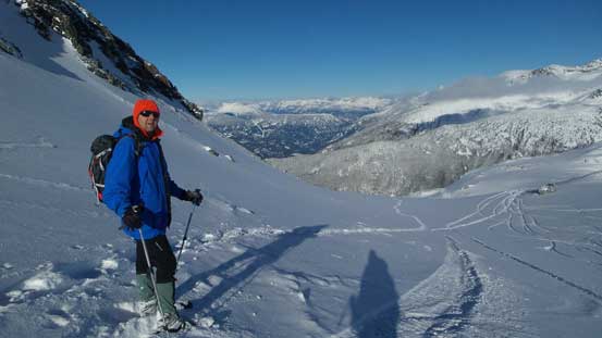
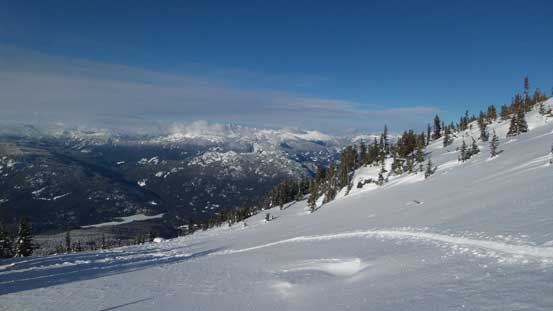
Parking did not come easily, unfortunately, as Lot 6 was closed for some reasons and that left us to make a decision. I hate going back (to Lots 4 and 5) so kept driving towards Lots 7 and 8. I knew the other two would be gated too as they are meant for day-parking, but luckily for us we did find a (singular) spot, in a townhouse neighbourhood. Quickly equipping with the gears we walked up the rest of the road to the uppermost parking lots and then traversed northwards to the start of my planned route. Initially we walked on foot but after a while I dropped the pack and strapped the snowshoes on as the grade was fairly steep and I’d appreciate the help with those heel-lifts. After that it’s a staircase walk up a “blue” ski run and 300 m elevation gain was knocked off in no time. In this stage we caught up with a solo skier who’s also going uphill. From the upper terminal of one of the lower gondolas the route swung left following “Glacier Road” on the edge of the resort and this part was quite a long plod.
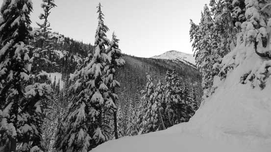
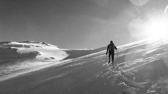
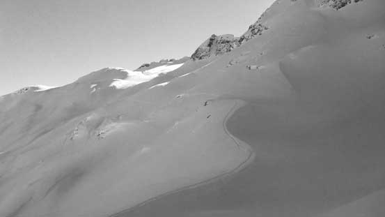
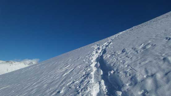
After what seemed like quite a long time the “Glacier Road” took a gradual turn due south-east into Blackcomb Creek valley. The sky’s getting bright enough at this point and half an hour later we watched some neat alpenglow looking back at Rainbow Mountain. Now deep into the valley we left the road at the base of “Poop Chutes” following some ski tracks, and minutes later we deviated from the tracks and entered the forest. The next stage was the most experimental as it’d involve some steep forest with very little beta on the internet. Upon close inspection it didn’t look too bad and all we needed was to keep a diagonal traverse line due climber’s left. It’s a bit difficult to keep that diagonal mode given how steep that forest was, but we did fine. Vlad and I took turn breaking trail and one hour or so later we broke out of the forest on the broad NW flanks of Phalanx Mountain.
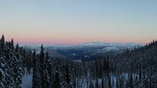
Morning colours on the horizon looking towards Ipsoot Mountain

Rainbow Mountain just about to glow
Plodding up Glacier Road. The steep forested section is where we’d go next

Directly beneath “Poop Chutes” now.

Vlad coming up the typical country in this wooded section.
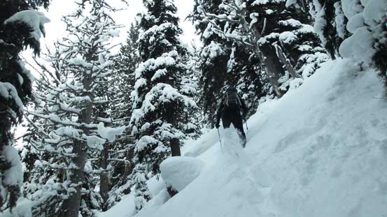
It’s steep and the trail-breaking was arduous
Breaking out of the forest now, looking at Rainbow Mountain
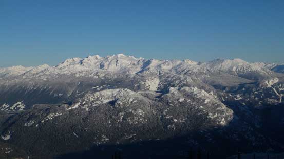
Ipsoot Mountain looms behind Cougar Mountain
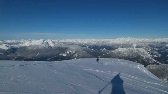
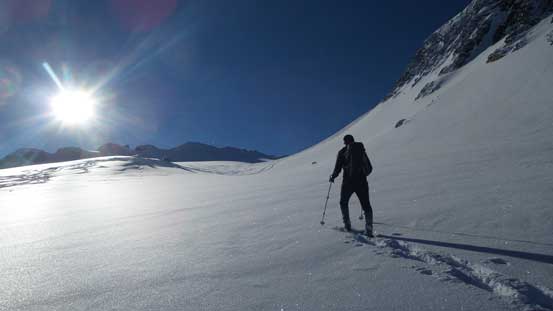
Not doing any unnecessary lingering we kept plodding up the broad NW Ridge hoping to take a break somewhere in the sunshine higher up. This turned out to be quite a drag as the slope ahead seemed never-ending, but eventually we did come to a plateau feature and there’s plenty of sunshine to warm things up. Resuming the ascent we overcame another big rise and then came to the next plateau. Onwards it’s obvious that we could no longer follow the spine of NW Ridge up and instead we had to find a way down to Phalanx Glacier skirting around the jagged obstacles ahead on the left (east) side. Getting down to the glacier involved one steep slope with substantial elevation loss and once down there we picked up a set of tracks from the heli-skiers.

Plodding into the alpine zone on the broad NW Ridge

Coming to the first plateau under sunshine. Looking towards Pemby direction

Mt. Currie looks good under the morning sun

The massive S. Face of Wedge Mountain

The striking Black Tusk sticks out of the backdrop
Vlad coming to the next plateau.

Looking north, that wooded “Rethel Ridge” displaced in front.

We had to find a way down to Phalanx Glacier as the spine of the ridge doesn’t connect
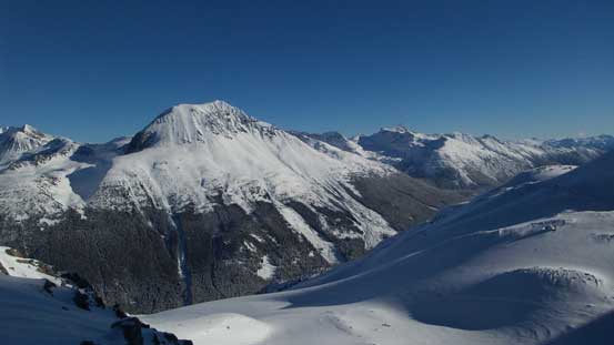
Another look at the south face of Wedge Mountain

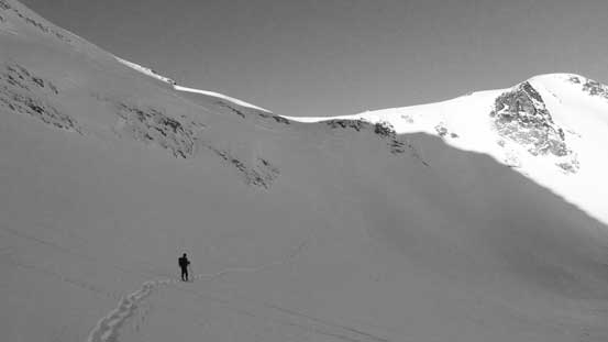
Looks like we’d deal with fair amount of elevation loss/regain

The slope leading down to Phalanx Glacier was steep…

Down to the low point now
Looking back at the steep slope we just descended
Vlad leading the way plodding up onto Phalanx Glacier
The typical glacial plod…
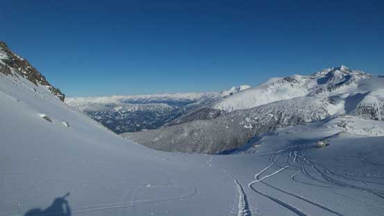
Started to pick up some sets of heli-skiers’ tracks.
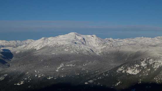
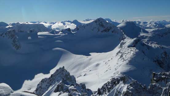
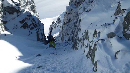
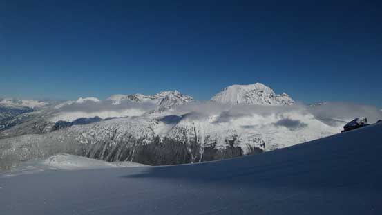
The heli-skiers were surprised to see us showing up out of nowhere. I’m pretty sure those guys will never consider the Type II and III fun I’ve been doing in these days. The plod up Phalanx Glacier was easy and tame but the summit was quite a ways behind meaning we still had a fair bit of ways to go. Towards the end we opted for a line shooting straight up the middle of the steep slope ahead and that dumped us just left (north) of the summit. There were two highpoints that looked equally high and we checked both just to be sure. In between the two highpoints there’s that “Stairmaster” and looking down we could see at least 10 skiers boot-packing up the couloir.

That group of heli-skiers enjoying their morning run down Phalanx Glacier
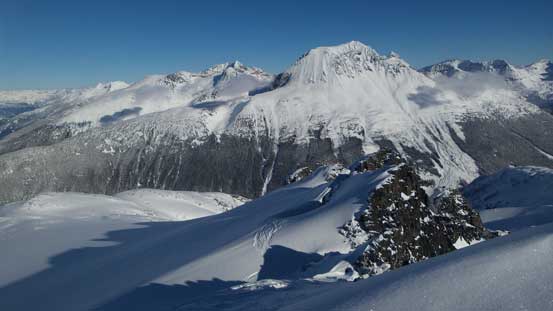
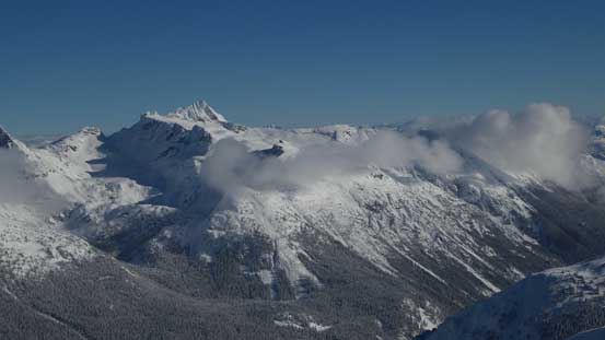
After a long while we crested the summit ridge. Wedge Mountain behind

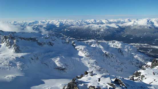
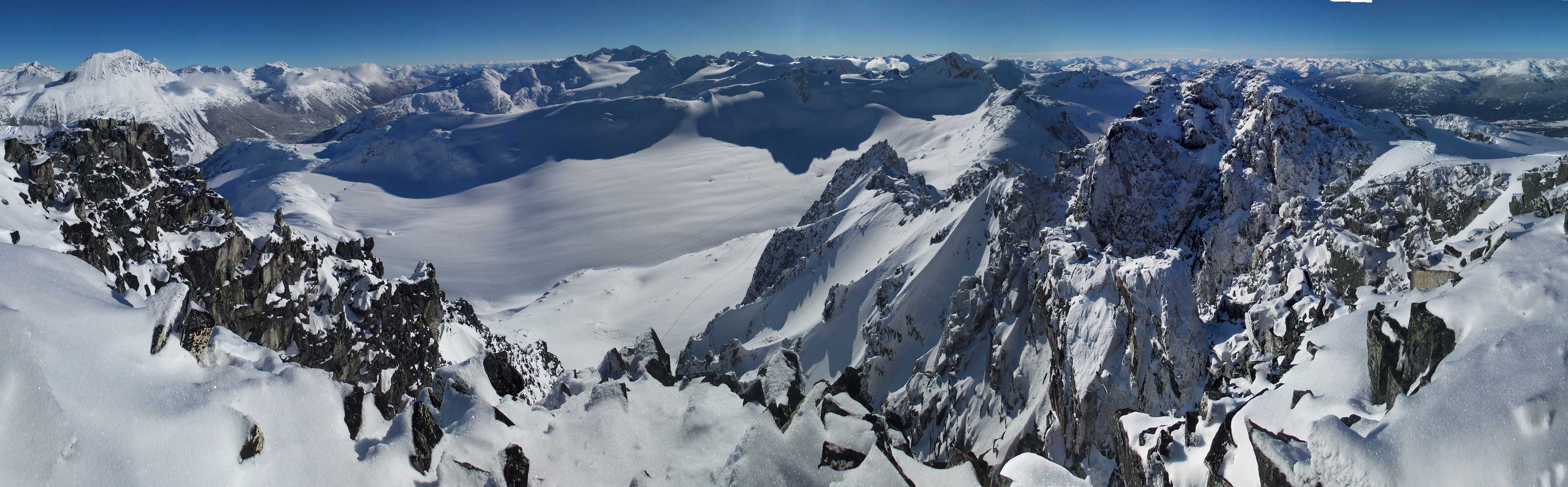
Summit Panorama from Phalanx Mountain. Click to view large size.
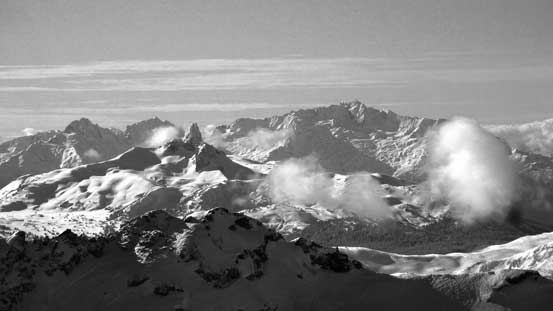
Looking towards The Spearhead and where the other skiers all came from

The frozen Saucer Lake at the toe of Spearhead Glacier
A wider shot of Mt. James Turner and its surrounding area
Tremor, Shudder and other peaks at the heart of Spearhead Range
The Black Tusk in front of Mt. Tantalus

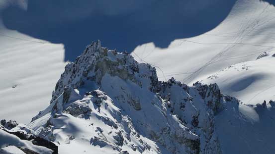
A zoomed-in view of the summit pyramid of Mt. James Turner

Lots of rugged peaks in this picture including Ashlu Mountain (left skyline) and Mt. Cayley

Looking over Rainbow Mountain towards the remote Elaho Mtn. and Manatee Range

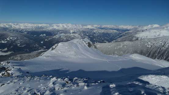
Mt. Weart

Skiers boot-packing up the “Stairmaster” on the SE Face
The exit of the “Stairmaster”
From the other highpoint, looking across the ridge separating Horseman Gl. with Blackcomb Gl.
One of the pinnacles on the S. Ridge of Phalanx Mtn.
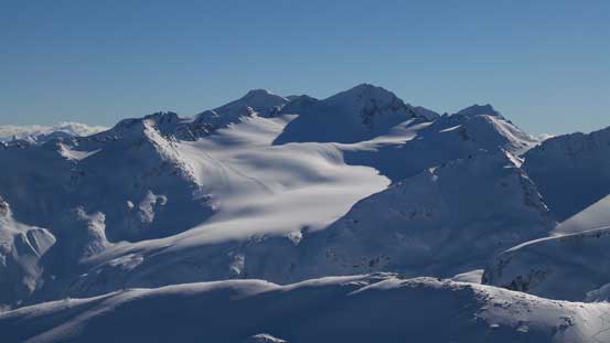
Another view at Phalanx Glacier

Vlad and myself on the summit of Phalanx Mountain

Me on the summit of Phalanx Mountain
Another panorama from the summit of Phalanx Mountain. Click to view large size.
We took a lengthy break on the summit as part of me didn’t want to deal with the Vancouver’s rush hour traffic had we descended too quickly, but eventually it’s still the time to leave this beautiful place. Plunging down Phalanx Glacier was effortless and then we made a call to explore a lower route as we didn’t want to re-ascend that aforementioned steep slope. This route did avoid that slope but only to dump us onto more steep slopes including fair amount of trail-breaking and elevation regain. I don’t know how the two compare but in the end I don’t think our return route gives much advantage. Once back onto the broad NW Ridge we easily plunged down to treeline and then had some interesting time slipping and sliding down that steep forested slope to Blackcomb Creek.

Plunging down Phalanx Glacier
Another look at Wedge Mountain
Vlad taking a short break from the fast plunging

Exploring a different route on the way back and ended up having to deal with a few difficulties
Cool perspective of the lower Phalanx Glacier though

Traversing another steep slope to rejoin our uptrack

Here’s where we rejoined our up route. On the ascent we went up this big hill.

The Spearhead looks fairly impressive from this angle. Blackcomb Peak to its right.

Continuing down.
Snowshoe tracks.

Down into treeline
One last look at the treeline zone

Down, down, down…

Into that steep wooded section.

Down to Blackcomb Creek now, looking back at our objective
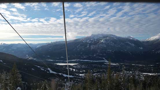
Removing the snowshoes all left for us was a cake walk following the “Glacier Road” and then the resort runs back to Whistler Village. The danger came from dodging skiers as I’m pretty sure some of them don’t pay attention to what’s going on ahead. And unlike snowmobiles these skiers don’t generate too much noise from behind so we can’t get the alert. Luckily, none of us got hit and we even managed to catch a downloading gondola ride in the end. This dumped us right onto Lot 6 and in daylight time we easily spotted the trail traversing to where we parked. Unfortunately I got a ticket for parking on residential place but at least my car was still there and didn’t get towed…

Walking down the Glacier Road which is also a resort run
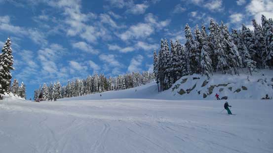
More about the walk down the resort runs
Catching a fast way down the last part.
Our round trip time was 9.5 hours and that’s pretty much as planned. Not sure how much I’d recommend this route given all the logistic issues associated with the ski resort but in terms of scenery it’s one that offers some unusual views of the surrounding giants. The traffics going back to Vancouver wasn’t bad but I was really tired.
