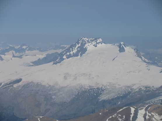
Mount Bryce, Center Peak
July 26-28, 2018
3370m
Bush River / Columbia Icefield Area, BC
Among the remaining dozen 11,000ers I could safely say “Bryce Center” would be the hardest one to find partner(s) to climb with. Except for Ben N. whom I did the main summit of Mt. Bryce a couple years ago with in May on skis/snowshoes, I don’t think there’s anyone else willing to do just the center summit with me. And yes I do need this overlooked peak to eventually finish the fabled list. Why is an unnamed, center summit of a massif recognized as a separate 11,000er is still mystery to me, but reading through Bill Corbett’s book I think that has something to do with the history. By 1960 this peak was considered as the only unclimbed 11,000-feet summit in Canadian Rockies so that’s how it gained attention. The first ascent party of Mt. Bryce bypassed this bump (I would do so too, if I were there on the first ascent)… The climb would require 4 days return from Vancouver covering all kinds of characters.
The weather was looking very promising anywhere in BC, WA or Alberta and I had lots of objectives in mind. Ben got me committed to “Bryce Center” without much of persuasion. I had lots of other cool peaks on the to-do list but I knew Ben really needed this peak for his 11,000ers project. There wasn’t much in the way of planning. We both could manage as many days as we wanted so why in a hurry. We’d plan three days truck to truck and in addition to that, we’d camp in truck at Bush River Road the night before just to make things more relaxed. I don’t like to push physically hard in this year anymore, if I don’t have to… In terms of the route we really liked to do the NE Ridge but a recent report said it still needed some time to dry off. Going back to the standard route meant we had already done 90% of it on our Mt. Bryce trip. The crux would be climbing the 600-m south couloir with two tools. The SW Ridge of “Bryce Center” is reported to be a “difficult scramble” and having a Rockies background we kinda knew what that meant.
On the morning of Wednesday I drove out of Vancouver in my trusty Tacoma and made a couple usual stops in Abbotsford and Kamloops for gas and food, and then somewhere past Sicamus I pulled over for a nap. Resuming the drive I bought a dinner and a breakfast in Revelstoke and got up the Bush River Road by the evening hours. The logging road was in an excellent shape and I was able to cruise down in averagely 60 km/h. Ben was waiting patiently at Alexandra’s staging area with four or five Calgarian’s trucks and then we piled everything into my truck. I only managed to drive up Rice Brook Road for a couple switchbacks before a major pile of downed trees stopped any upwards progress. Those trees were pulled by logging company. This added an hour of walking in the morning but we were OK with that. The night was super toasty that sleep didn’t come easily in the truck.
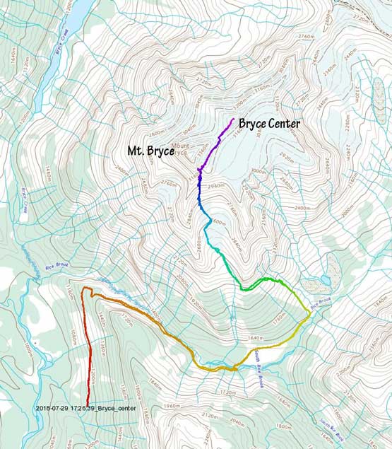
Bryce Center via South Couloir standard route. GPX DL
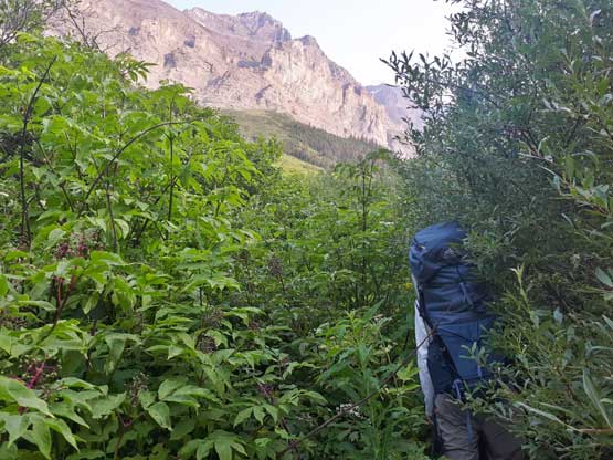
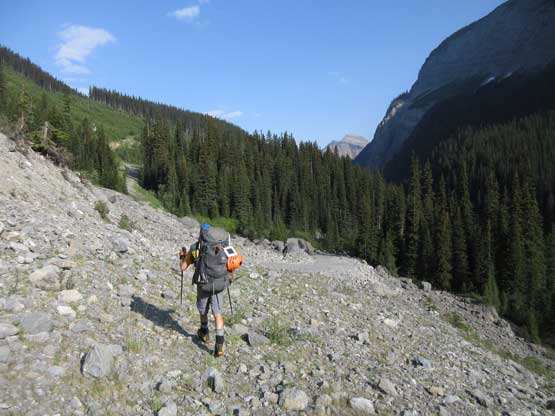
In the morning we woke up at around 5 am and got going within an hour. Right off the bat we had to handle that downed trees section and for about 50-100 horizontal meters the bushwhacking was horrible. Thankfully they did not pull the entire road so once we bashed through the stretch the rest was just hiking. In fact the road was perfectly drivable so too bad. About an hour later we arrived at the site of old bridge and the river was easily waded. It wasn’t flowing slow, but only knee deep. The trick – don’t cross at the site of old bridge and instead, walk upstream for 50 meters or so. Onto the north side of Rice Brook the road was overgrown and we got wet from the morning dew.

Bushwhacking at the start to work around the pulled logs

Hiking up the otherwise, drivable Rice Brook Road. Photo by Ben N.

Fording the first channel of Rice Brook
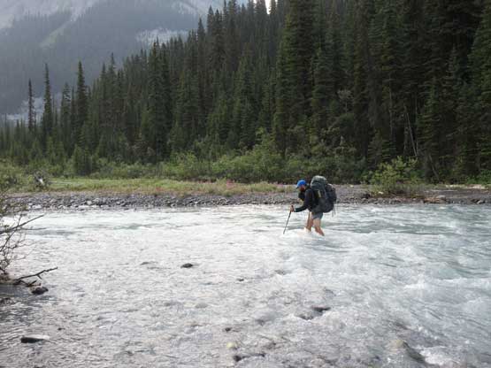
This is the cold, fast-flowing main channel. Not a big deal
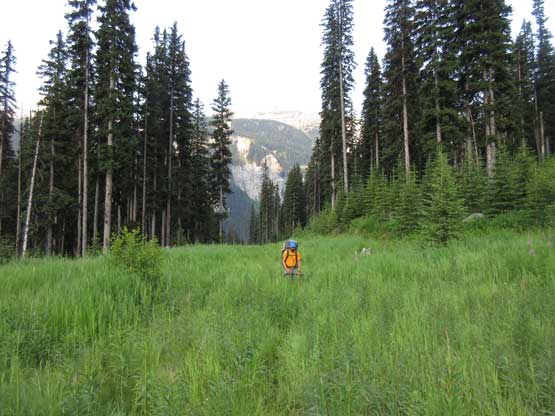
Ben hiking across the grass on this old road bed.
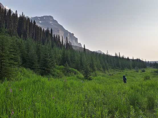
Onto the north side the road was more overgrown. Photo by Ben N.
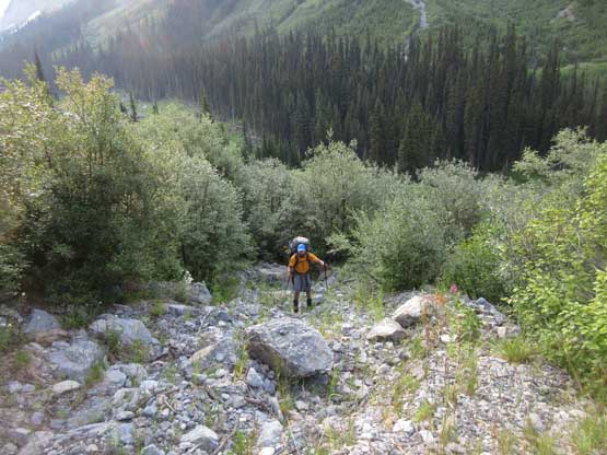
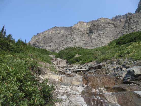
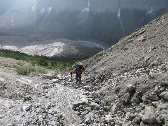
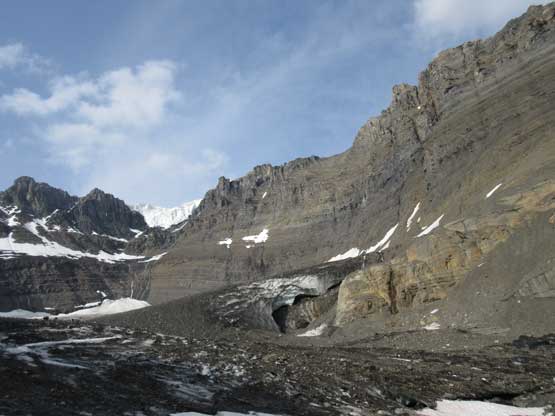
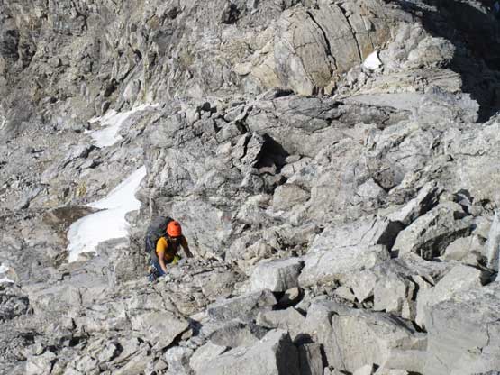
The length of the old road plod seemed longer than what I remembered from the last trip, but once at the bottom of that avalanche gully we found a path that involved next-to-zero bushwhacking. That was a bonus. The gully was a 600 vertical meters of grunt on ledges and slabs and a couple steeper bits required brief detouring into the bush. Scrambling on approach shoes meant I could tackle the slabs fairly easily. The horizontal traverse part sucked without snow though as we had to deal with compact hard moraine type of ground. Thankfully it was nowhere as bad as on Whitehorn and in no time we were around the corner scrambling scree and ledges to the infamous waterfall. I had worries about crossing this waterfall but it turned out to be trivial. The hardest thing was actually to find a flat camping site. We found a one at the toe of the glacier that marginally fits our green tent and called it “good enough”. It was just past noon. Ben had some fun time playing with his drone while I pretty much just slept through the whole afternoon.
Me picking a line to avoid bush. Believe or not the bush was easy
Ben emerging out of the trees
This is the typical terrain in the main avalanche path…

This step was tricky on mountaineering boots. Vege-belay was the key
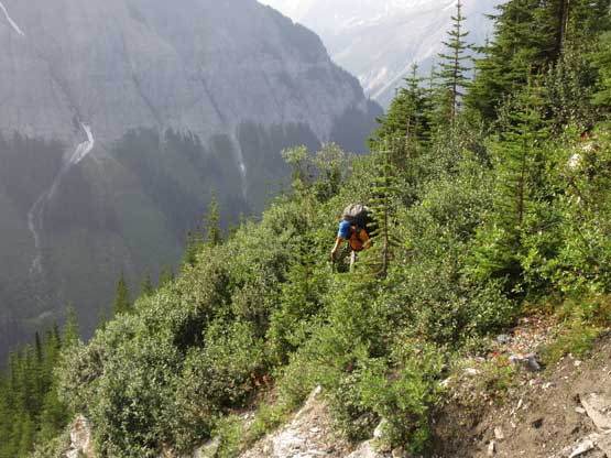
At places we had to detour into dense bush
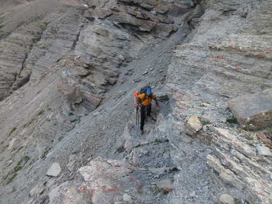
Unpleasant terrain… We were near the top of this gully now

Time to start traversing. Note the hard-packed ground

Me on the long, long side-hill bashing. Photo by Ben N.

Me taking a rest break. Photo by Ben N.
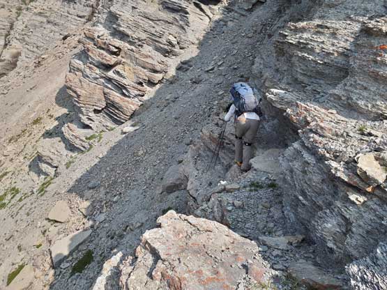
This is me leading across a narrow ledge. Photo by Ben N.
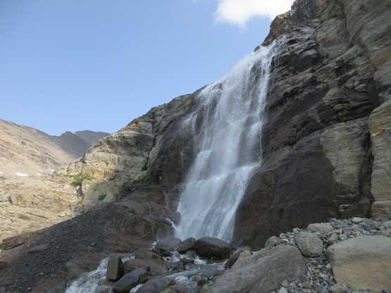
After a while we made to this waterfalls

Ben thrashing across the waterfalls. It was cold and very windy…
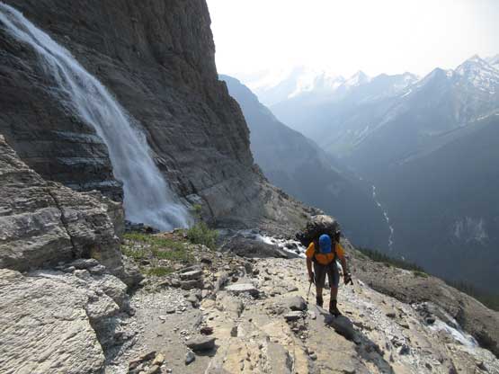
Leaving the waterfall behind.

Around another corner we were almost in the upper hanging valley

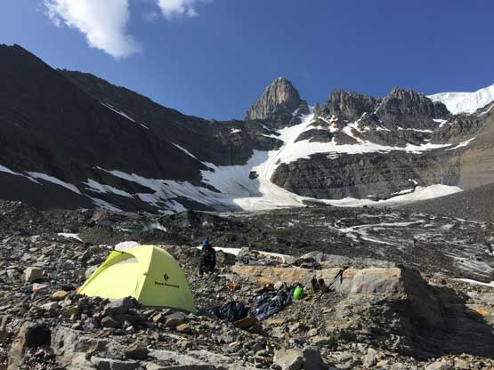
The tent’s erected and time to rest

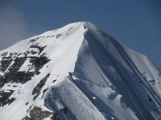
The couloir looks pretty intimidating but we both had climbed it before
Just another view from camp. The toe of this glacier was all covered in black choss
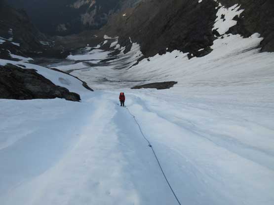
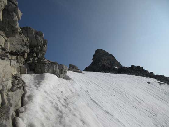
The night got pretty cold that once the alarm went off I was too lazy to get out. We slept in and after a leisure breakfast routine we didn’t get going until it’s already bright enough to see. This was OK as the couloir could be done in soft snow and we weren’t going to climb the challenging SE Face of main peak at all. For the glacier we stayed on the climber’s left but cut over to the right side. I picked a path that stayed mostly on snow and pretty much free of crevasse. The bergschrund was crossed easily on a piece of snow bridge but what surprised us was the mellowness of this couloir. It felt a hell lot easier than last time and I would say the slope was 35-40 degrees averagely and never exceeded 45 degrees. There had gone a radiation freeze overnight so we were front-pointing for most of it making for fast, albeit tiring climbing. It still took forever to top out but once there we could have a long break soaking in the sun.
Ben climbing up the couloir. Note the large runnels

This was right in time of morning alpenglow. Not too spectacular though
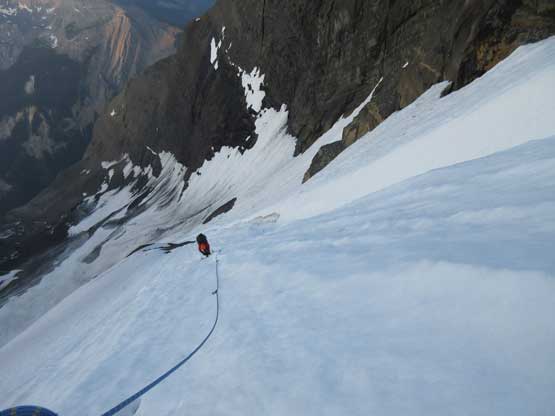
Higher up in the couloir. It felt never-ending

Almost topping out now. It took a while but easy
This is the SE Face of Mt. Bryce. We didn’t have to do it

This flat spot offers a good rest stand.
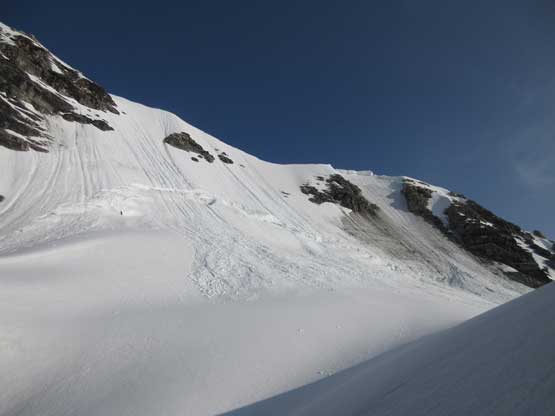
Traversing over to main/center col required some elevation loss but at least I was happy to be finally on new ground. The glacier was tame and easy but there’s a small bergschrund to cross to get onto the actual main/center col. That piece of snow bridge was questionable in the softening conditions but we just had to probe carefully. The SW Ridge of center peak didn’t look as easy as expected but let’s face it. Right at the start we had to traverse and ascend some very ugly scree on the right (south) side and then climb a pitch of steep snow to get back onto the ridge.

Descending the upper glacier with at least 100m of elevation loss

Another look at the SE Face of Mt. Bryce

Fast forward. Now at Main/Center col looking at main summit
Our first view of the north side. It’s a familiar view
This is the typical terrain on SW Ridge of center peak
Ben handling some choss

And then, some steep snow
We climbed this patch of steep snow to as high as we could

Getting back onto the SW Ridge
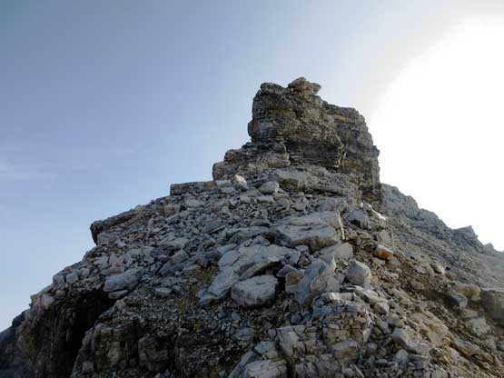
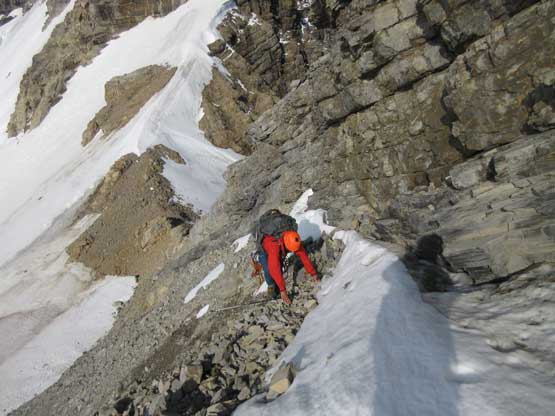
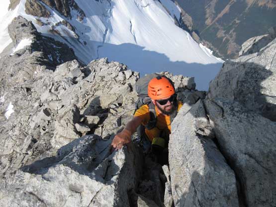
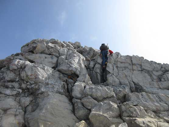
The terrain ahead still appeared challenging with a couple “noses” to climb over or bypass around. For the next nose Ben opted to explore a line on climber’s right as per Corbett’s book. I didn’t like the need to do another annoying gear transition so went for climber’s left. It turned out that my route was definitely the way to go, but still no cake walk. It’s exposed “4th class” on loose terrain and after regrouping we both agreed to rappel that pitch on descent. Thankfully no further complication on the upper route although there’s still a lot of hands-on scrambling involved. The true summit was on an icecap that required crampons to get to. Ben did his homework here and convinced me to bring the crampons which was a damn right call. It would suck a big time having to turn around here…

The massive face of Mt. Bryce North Face
Ben picking his line on the south side of ridge crest. I went north side

Back onto the ridge crest now. It’s getting easier
The last obstacle – pulling up a vertical chimney

Onto the summit ridge “board walk” now

Main summit of Mt. Bryce behind
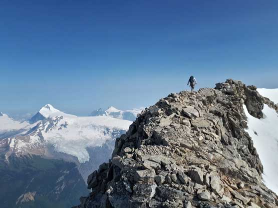
Me dashing for the summit. Photo by Ben N.

Summit Panorama from Bryce Center. Click to view large size.

Ben arriving on the summit.

This is looking at the lower NE summit. Thankfully that isn’t an 11,000er…

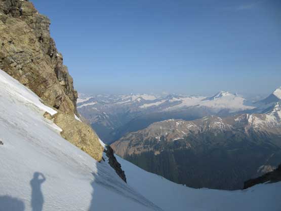
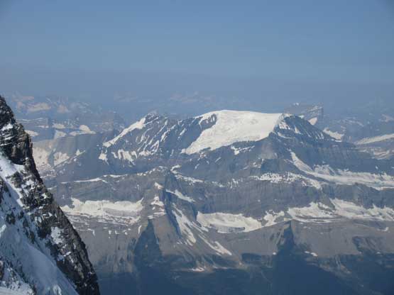
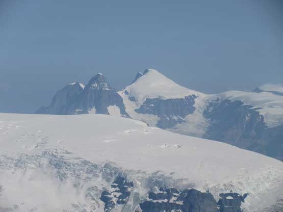
The million-dollar view of Mt. Columbia from Bryce
Pawn Peak in Chess Group
Mt. King Edward which I ascended in spring time

Mt. Columbia
The 4 Twins that we bagged in one long day from Stutfield Col
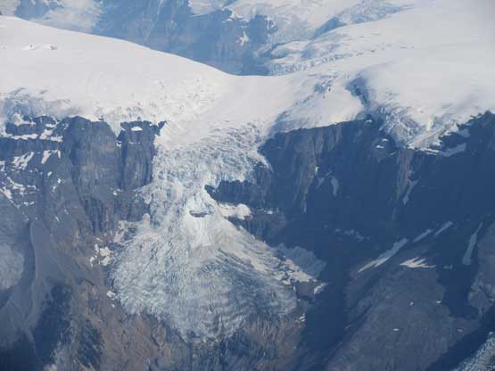
Cool glaciers draining from “The Trench”
Massive ice scenery on Columbia Icefield. Only mountaineers get to see this

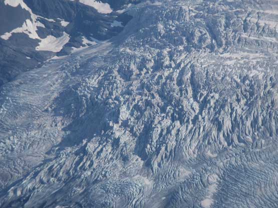
Snow Dome and Columbia Icefield
A zoomed-in view of the uppermost NE Ridge of Mt. Bryce

Me on the summit of Bryce Center. Canadian Rockies 11,000ers #47/58
Down-scrambling the ridge was slow but not too bad and then we did find a rappel anchor to get down that “nose”. Lower down I explored further down the rib. I wanted to rappel the initial scree section because I hated that hard-packed shit. It turned out that we couldn’t find a bomber boulder to sling around so backtracked. Down-climbing that patch of snow was quite tricky. The thin layer had turned slush and we had to down-climb a few steps on ice. Lower down we opted to keep the crampons on for that choss traverse which actually made things easier. After another long break at the col we slowly plodded back to the entrance of Bryce’s south couloir.

Leaving the summit behind. As you can see you need crampons here
Down-climbing that chimney

More careful down-climbing
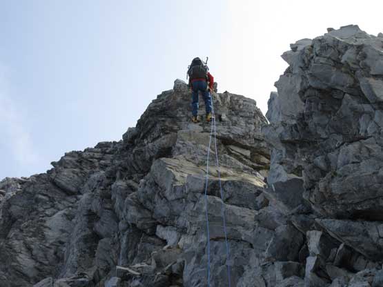
This is the place we opted to rappel. There’s an existing anchor

Back to the choss traverse part

Onto the upper south glacier
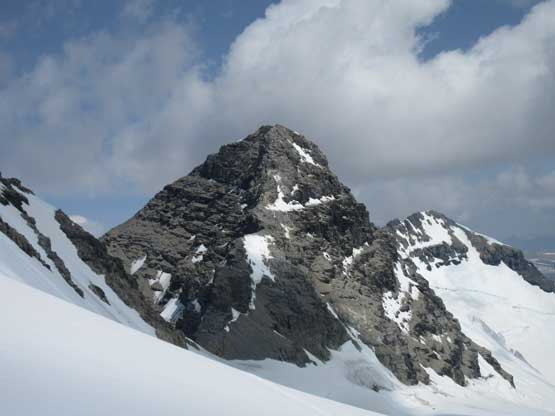
Looking back at our objective – Bryce Center
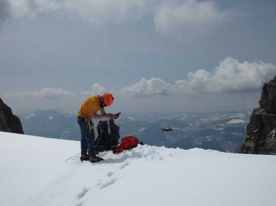
Ben playing with his drone

Looking down the south couloir. It’s a long but easy way down
After playing around with the drone we decided to drop in. The condition was soft, but not too slushy that we pretty much flee down in no time. It felt more like a facing-in plunge kind of descent. In probably just over an hour we were down at the bergschrund which itself was then easily crossed. We didn’t bother with rope for the hike back to camp as the route we picked earlier in the morning was really good. And of course the rest of Day 2 was spent sleeping in our tent. I was too lazy to push hiking out. Why doing that if we had three days…

Start down the couloir down-climbing

Down, down and down…

Back to that runnels section

The bergschrund is easily crossed

Back down to the lower glacier

Choss-covered glacier…
Back to camp now, time to relax again

View around camp. In spring we had “BOOM” for every minute
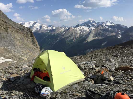
Our green tent on Bryce’s bivy
We had some concern with the river crossing so decided to wake up early on Day 3. By 6 am we got our asses going and the descent down and around those loose ledges went by pretty much without incidence. That side-hilling still sucked. We opted to explore a bushier route down into the avalanche path which did get us rid off some unpleasant hard-packed stuffs, but still wasn’t pleasant. The rest of the descent down the main path wasn’t pleasant neither, and neither did the hike along that old road bed. The river crossing was refreshing though. To our surprise we crossed path with two groups of three heading in for Mt. Bryce. I was shocked how popular our 11,000ers are getting these days. This is a 11,000er that might only get attempted two or three times in a whole year in the past…
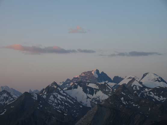
Alpenglow on Cockscombs Mountain

Easily crossed the waterfall. The water did get higher though
Back across those ledges

And then into the major avalanche gully. Route-finding was an issue

Looking down the path. It was not fun…

A little bit of dense bush near the end

Back to the river crossing we crossed path with another party. Photo by Ben N.

Onto Rice Brook Road now.
Lots of road walking…

That fire was still burning. It’s been burning wince we got here…

Time to bushwhack.. This part was horrible. Photo by Ben N.
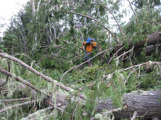
Ben negotiating the giant logs…

It’s Taco time!

Done. This is the beautiful Kinbasket Lake’s Bush Arm
There’s not much change in the road’s status and that fire was still burning on the opposite side of the valley. Ben decided to drive up the Valenciennes FSR to check out the access to Lyells while I had other plans in mind so drove straight out and then west into Revelstoke. After a lunch stop in its uber-busy A&W I continued westwards into the city of Vernon. I drove straight to the Silver Star resort and hiked up the summit of Silver Star Mountain. I’ve been looking at that peak for a couple years and finally got a perfect window for it. lol…. I then continued southwards into Kelowna and enjoyed some nice lakes scenery before pushing all the way back home before midnight. 11,000ers #47/58 down and I’m glad to have finally done with Mt. Bryce. This is a beautiful mountain, but it doesn’t need to see me again.
