Mount Daly
January 18, 2021
2166m
Chilliwack Lake / Paleface FSR, BC
Not to be confused with Mt. Daly on Waputik Icefield in the Canadian Rockies, this one is much less-known and locates in the headwaters of Paleface Creek not far from the Canada/U.S. border. The access is from Chilliwack Lake Road via Paleface FSR but the portion of the road beyond “Meroniuk Spur” junction had been reported to be increasingly bushy and overgrown. The beta of this peak was very difficult to find as the only online trip reports dated back to a dozen years ago. Even back in 2008 the roads were washed out and bushy so I expected this access being impossible nowadays without a thick snowpack coverage. In fact, a brief report of bivouac.com in 2019 (inserted as a road bulletin) indeed showed the road being a total mess and the reporter didn’t even make to the base of Mt. Daly.
The status of this road had suddenly gained spotlight thank to the exploration of Matt Juhasz’s “Midnight Crew” a couple days ago. Their party of four snowshoed Thompson Peak by plodding Paleface FSR to the broad pass between Thompson Peak and Mt. Daly. I instantly decided to use their beta to do Thompson Peak but my ambitious plan was to also bag Mt. Daly as well. The ascent of Mt. Daly was much steeper than Thompson Peak and required a bomber stability in the snowpack, which seemed like the case of this week. Earlier in the day Katie, Ilia, Alana and myself had just made the summit of Thompson Peak but the other three opted out for the twofer challenge. I insisted to press on as I even drove out separately to give myself more flexibility.
Thompson Peak and Mt. Daly via Paleface FSR. GPX DL
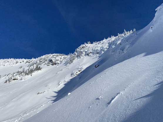
I came here with zero beta (I didn’t happen to read Simon’s trip report on ClubTread) but I did spend a few days looking at various maps. I had several route choices in mind and would decide spontaneously at the last minute based on observations. From Thompson/Daly pass I ascended a short stretch of steep forest (35+ degrees) towards a traversing bench. There were a few rocky bluffs in the forest but all easily avoided. The traversing bench out to the right crossed several large avalanche slopes but as mentioned earlier, avalanche wasn’t a concern on this particular day and my problem was actually trying to not slip off the icy slopes. The bench brought me to a lower “bowl” feature where I spontaneously decided to take the left side variation picking the most efficient line to access the upper mountain. I ascended a steep and open gully for about half an hour and eventually came into the “upper bowl”.

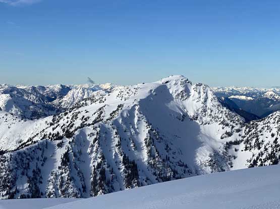
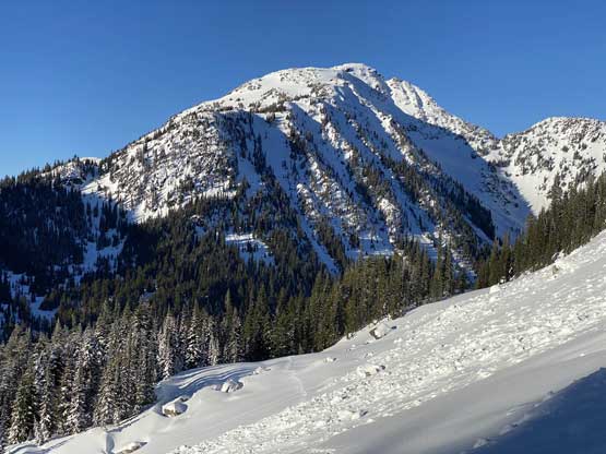
Mt. Daly seen from partway down from Thompson Peak
Emerging out of the woods
Ahead was the traversing bench. It wasn’t as steep as I thought

Looking back towards Thompson Peak
Ascending the gully in the lower bowl now, looking back

The gully leading out of the lower bowl

My tracks into sunshine

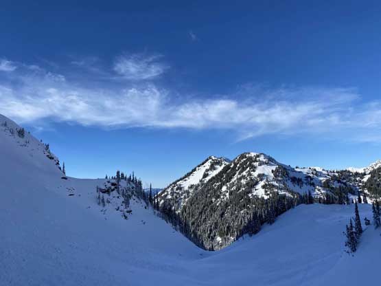
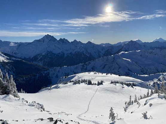
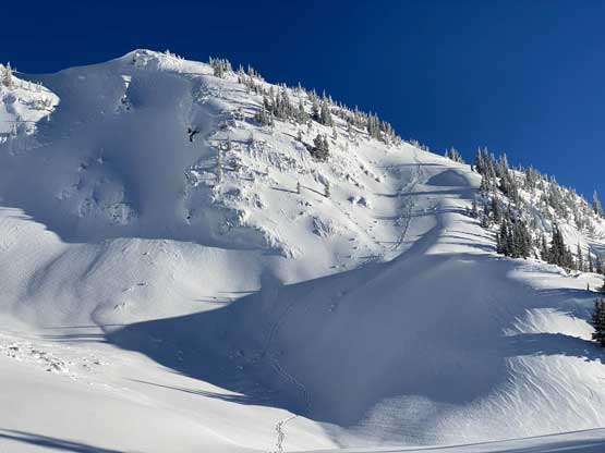
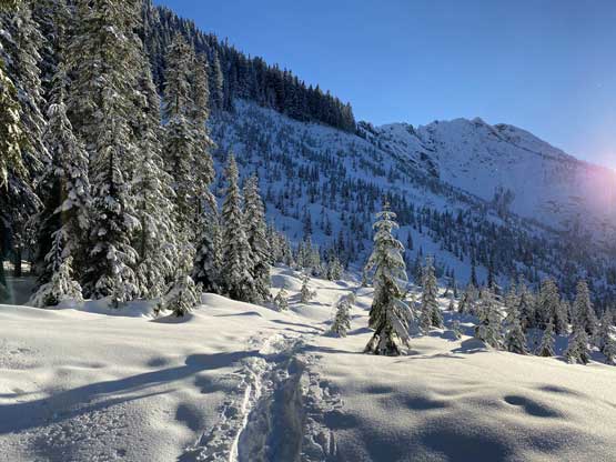
Here’s a view of the upper bowl. My route goes up right of center
I again, had three ideas to get out of this “upper bowl” to gain the summit area based on the pre-trip mapping work and upon seeing the actual terrain I opted for the rightmost choice to gain SW Ridge. This looked to be the least steep line that also avoided a small question-mark zone on the NW Ridge. Once the decision was made I plodded across the bowl and ascended another steep gully/chute feature (35+ degrees) and then some steep and sparsely-treed slopes to gain the broad SW Ridge. The ridge was not as flat as the topographical maps suggested and involved one more steep roll higher up, but imposed no problem. The lighting towards Mt. Redoubt and Mt. Custer was better in late afternoon so I spent another half an hour on the summit soaking in the views.

My tracks across the upper bowl
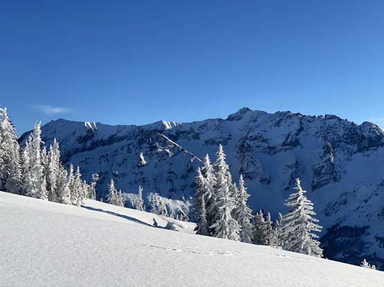
As you can see, all routes to gain the upper mountain are steep

Partway up the steep chute to gain SW Ridge, looking back down

A random tree on the flatter SW Ridge with Mt. Custer behind
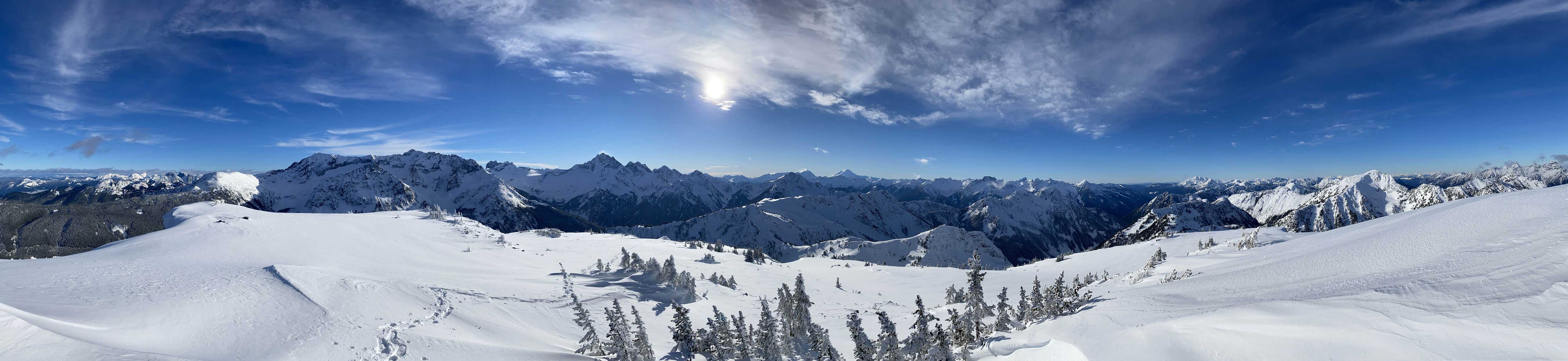
Partial Summit Panorama from Mt. Daly. Click to view large size.
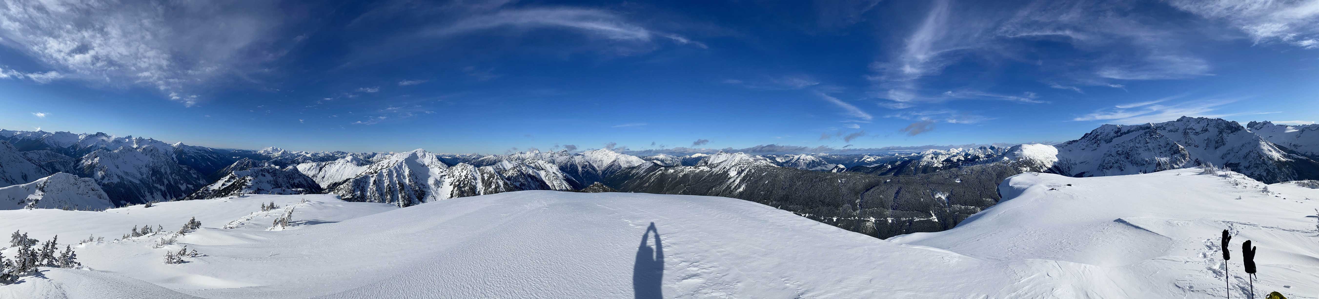
Partial Summit Panorama from Mt. Daly. Click to view large size.

Shawatum Mountain at center that I ascended a month ago

The lower north ridge of Mt. Rahm in foreground

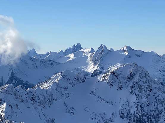
Mox Peaks and Mt. Redoubt

Nodoubt Peak in front of Mt. Shuksan
Slesse Mtn. and Mt. Rexford poke behind Macdonald Peak
Thompson Peak – my previous objective

Welch Peak, Foley Peak and Williams Peak in one photo

Mt. Edgar in foreground now looks small

The prominent peak in foreground is Whitworth Peak

The rugged Mt. Payne, “Rideout’s Pup” and Mt. Rideout
The north and south peaks of Hozomeen Mountain

Me on the summit of Mt. Daly
I thought about to explore a different route down to short-cut some distance but based on the crusty and icy conditions I decided to just go with the known. I retraced my exact tracks back down to Thompson/Daly pass and then followed the (much bigger) set of tracks back to the logging roads. I was hoping that the other three would take “Al’s short-cut” to avoid a few switchbacks on the logging roads but apparently they just re-ascended that 30 m gain to the road. Being alone I did not feel like doing unnecessary exploring and just followed their tracks regaining elevation back onto the road. The rest of the slog out on the FSR wasn’t as bad as I thought. The alders really didn’t slow me down at all and the creek crossings were all pretty easy on the return.
Looking down at my tracks on the SW Ridge of Mt. Daly

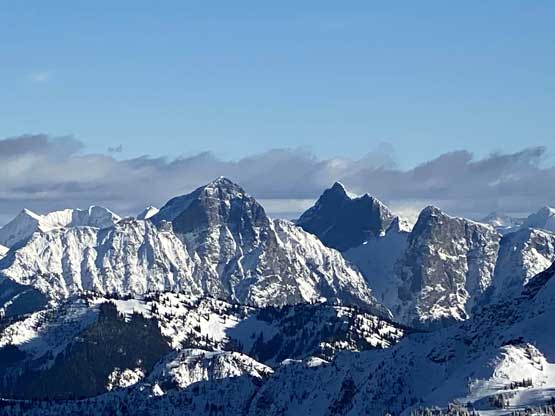
Looking south into Washington state – Mt. Custer and Mox Peaks

Mt. Redoubt is my favourate peak in this area
Mt. Custer might looks nice but is really a choss bastard

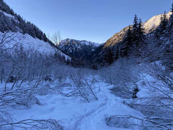
Looking down into the Paleface Creek drainage that I’d descend into

My tracks down into the upper bowl
A review shot of my route from the bowl to gain SW Ridge
Crossing slide paths on the traversing bench
I took a photo looking down a major slide path
Looking back at the slide debris path that I just crossed
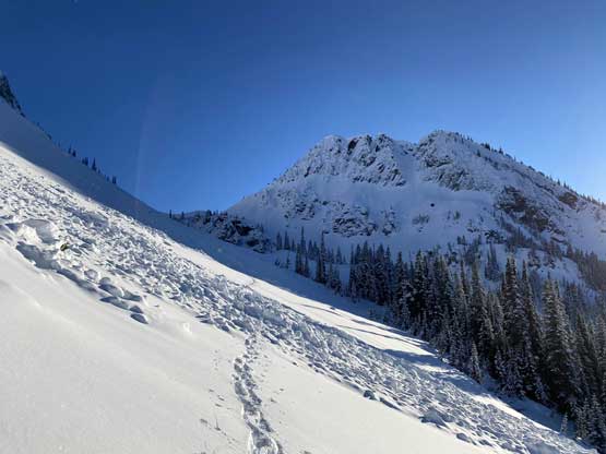
A while later I was down below Thompson/Daly pass
Tracks into the highest logging cut in this zone

Mt. Edgar now looms impressively above

The late afternoon sun.

Leaving the last rays of sunlight behind, into the dark and cold
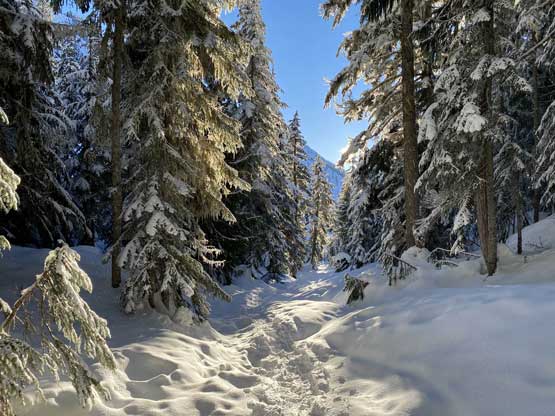
A typical shot of the Paleface FSR. Alders yes but manageable

Just one of the many stream crossings

Taco parked… Done…
My round trip time for the two peaks was 9.5 hours covering over 23 km distance and 1800 m elevation gain. I even got back to the truck before head-lamp time. The drive down the snowy road was much easier than in the morning and in no time I was back down to the main Chilliwack Lake FSR. Fortunately the road had just been graded while we were up on the peaks so the pot-hole nightmare was no longer there. The rest of the drive back home was uneventful.
