Opal Cone
October 11, 2009
1736m
Garibaldi Provincial Park, BC
In the last day of summer in 2009 (or I should say autumn), dad and I did the longest hike to date, over 40 km round trip in one day. Garibaldi Provincial Park is definitely the best place to visit near Vancouver. With a blue sky day, it worth to explore the southern section of this park – Diamond Head Area, located just to the NE of Squamish. Although this area is not nearly as popular as Garibaldi Lake, the trails offer absolutely equal-quality views. Our intention was to hike up Opal Cone and explore some other trails if we had time. We drove up the road to its end and that dumped us hundreds of meters above sea level shaving off a whole lot of elevation regain as for the typical coastal trips. The approach was via Elfin Lakes trail.
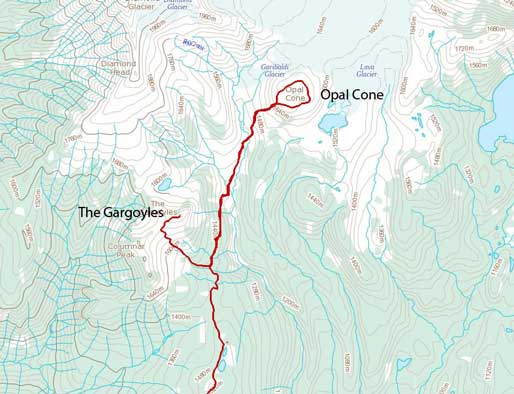
Opal Cone and The Gargoyles hiking route
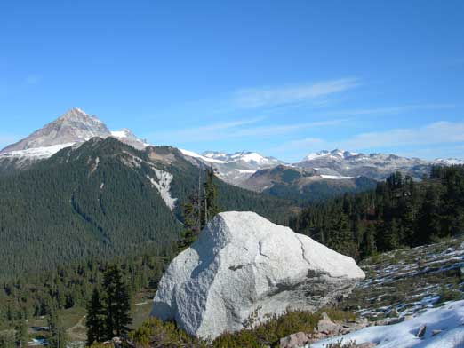
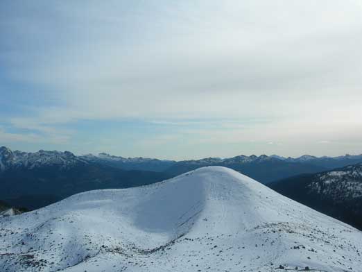
After 5 km mundane hike, we made to Red Heather meadows, and then the view opened up completely, with Atwell Peak (part of Mt. Garibaldi massive) and Mt. Tantalus being the most eye-catching. These are great mountaineering objectives that attracts me coming back to Vancouver someday in the future. We also encountered lingering snow patches. I believe it was my first time actually hiking on snow covered terrain, and it was exciting. In short time this trail brought us up and over the highpoint of Paul Ridge, and then we got great view of Elfin Lakes, as well as our objective – Opal Cone in the far distance. It looked awfully small compared to Mt. Garibaldi nearby…
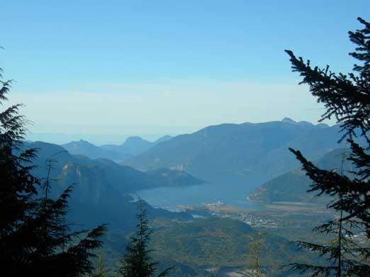
Howe Sound seen from a mini viewpoint along the trail
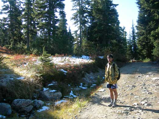
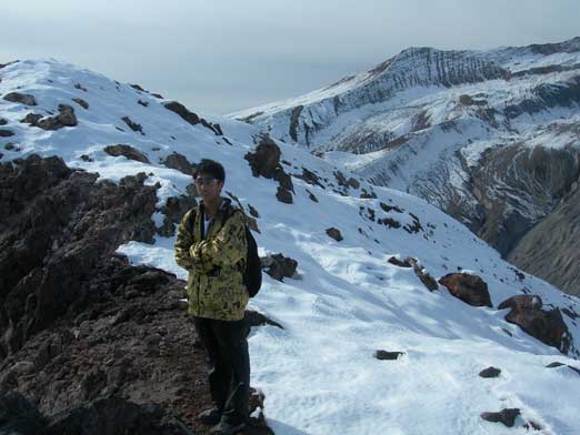
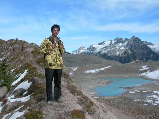
Me on the trail

Dad posing with Mt. Tantalus behind

Atwell Peak stole the show

Mt. Tantalus trying her best to compete!
An erratic
From the two famous Elfin Lakes we got great views there of the surrounding mountains. There was a well-defined trail leading to Opal Cone. We followed it, losing quite a bit of elevation towards Ring Creek. There was some scrambling to get down to this creek. It’s easy scrambling, but for us at that time, we felt it being quite sketchy. After that bit, we followed a set of faint trails up to the Cone. We walked around the crater for almost a full loop, soaking in excellent views towards each direction, before heading down via the official trail.

Elfin Lakes seen from partway down Paul Ridge

Elfin Lakes
Down to Ring Creek already

Me at the creek bed. Atwell Peak behind

Looking back at another group negotiating the scrambling section
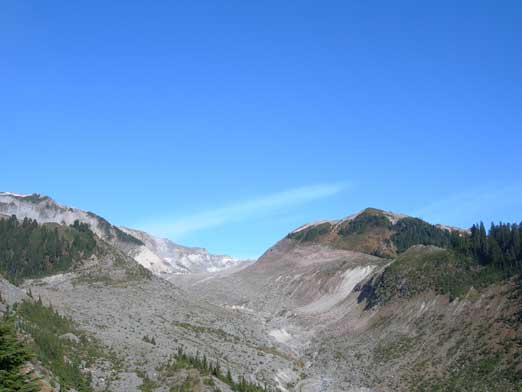
Atwell Peak and Mount Garibaldi
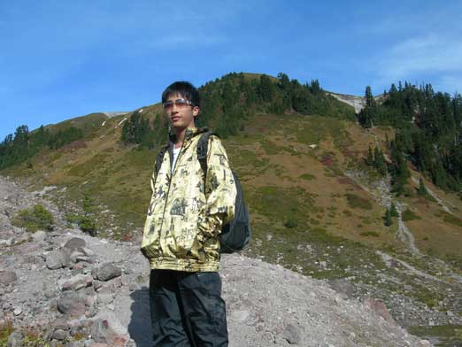
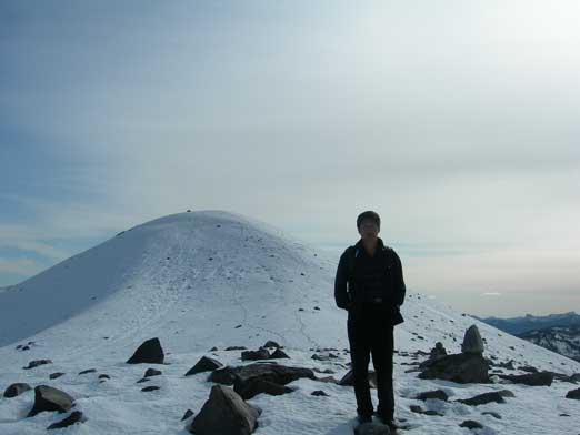
Me with the innocent looking Opal Cone’s slope behind.
Mount Garibaldi again
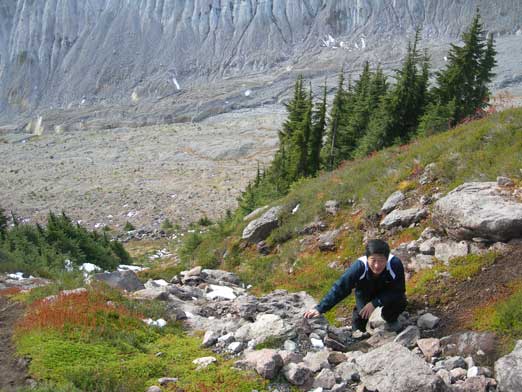
Dad scrambling up some off-trail terrain
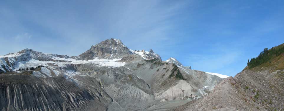
Atwell and Garibaldi
Me topping out on the crater. Behind me is one of the highpoints on this Cone

Another highpoint. Note the fresh snow
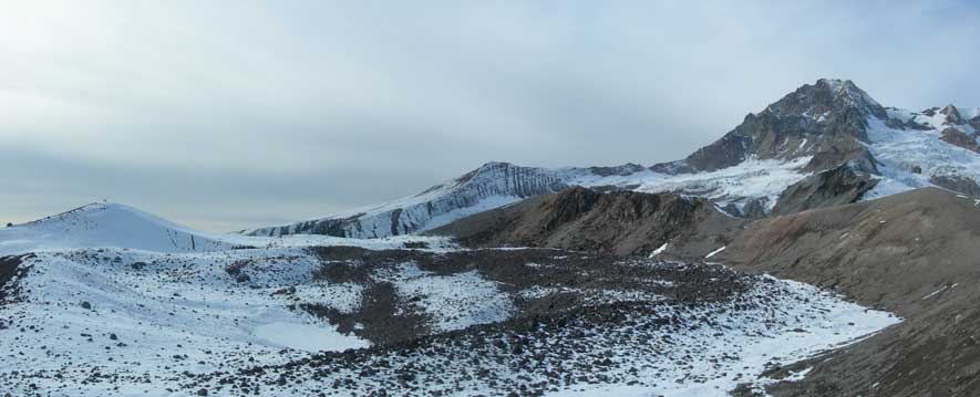
Great view of Mamquam Mountains

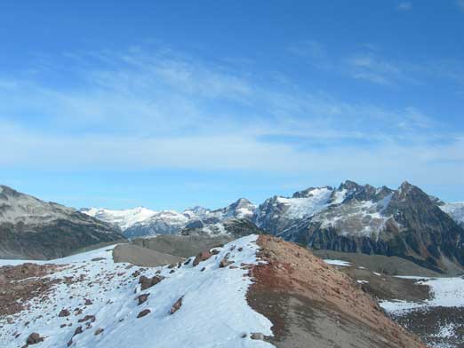
The Gargoyles, our next objective. Sky Pilot behind on left skyline
Dad on Opal Cone
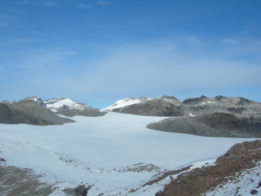
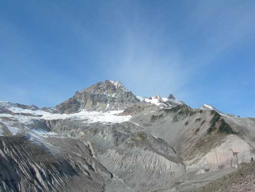
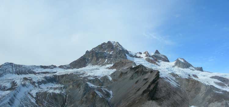
Garibaldi Glacier
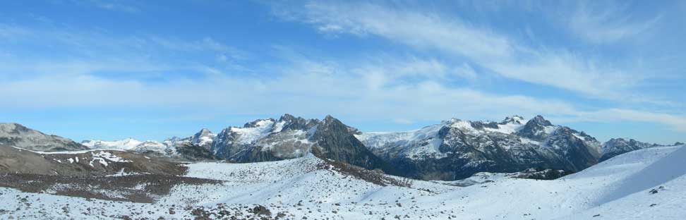
More views from the Cone
Looking south from the summit.
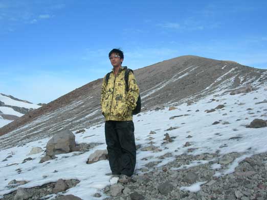
Me near the summit
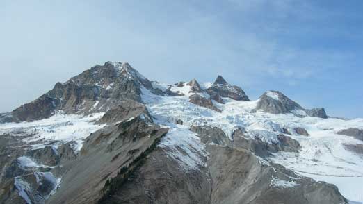
Atwell and Garibaldi
Look at this crater.
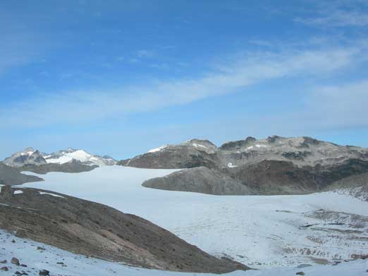
Garibaldi Glacier
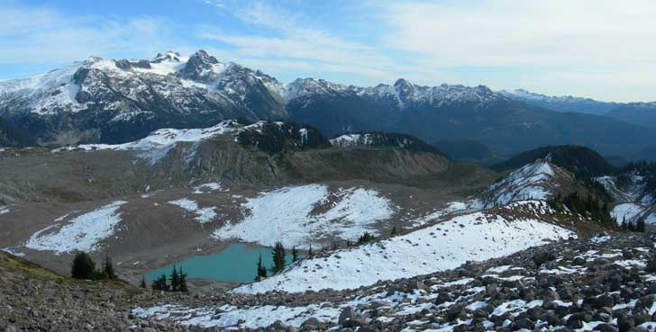
Around the corner, a green/blue tarn showed up

More about this tarn. Mamquam behind
Me descending the Cone.
The return hike felt long but at the trail junction to the saddle I started to get more ambitious. Checking my watch I realized there’s still a few hours daylight time so why not take full advantage of it…
