Volcán La Malinche
December 27, 2018
4420m
Puebla/Tlaxcala States, Mexico
The rocky volcano of La Malinche is commonly treated as an acclimation objective for those hoping to climb the higher Pico de Orizaba and/or Iztaccihuatl. However, at an elevation of 4420+ m this peak itself is not to be treated lightly. It’s taller than Mt. Whitney by a margin and certainly requires some degree of acclimation itself. I’ve heard climbers staying in the cabins at the trail-head (under 3100 m) for a couple nights before making the attempt. Lily and I decided to hike it on Day 2 after staying at the trail-head for just one night. This is considered as “aggressive” by many, but I knew I could day-hike to 4400+ m without any need of acclimation. I had pushed to the summits of Mt. Rainier, Mt. Shasta, Mt. Whitney and Mt. Fairweather all within 24 hours after leaving sea level and felt only slightly affected by the altitude on those descents, without having to slow my pace down throughout. On this particular one we would hike uber slow to give our bodies more time to adjust to the altitude. This was just an acclimation hike and our goal was to not develop even a slight sign of altitude sickness. The only way to achieve this was by going at a slow ass pace…
On the first day after landing in Mexico we had made a short but sweet hike up Cerro del Cuatlapanga. The downside of pushing so hard on Day 1 was the lack of sleep. Thankfully we managed to turn in by around 8 pm and sleep came pretty damn easily. I had set the alarm at 5 am but failed to wake up. We ended up waking up at well past 6 am and didn’t manage to get going until 7 am. In terms of gears I would simply use my trail-runners while bringing nothing. From earlier observation we saw no fresh snow on the mountain so there’s no need to go fancy.
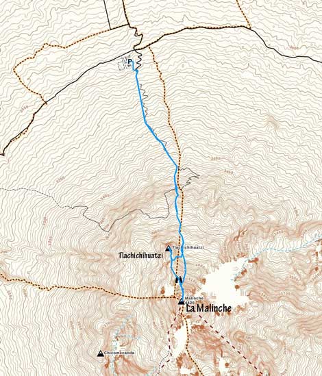
Standard routes for La Malinche and Tlachichihuatzi. GPX DL
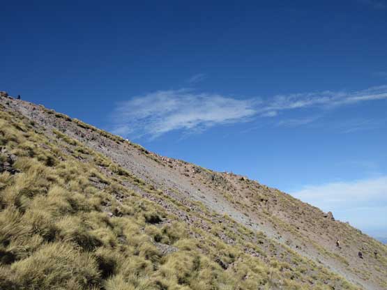
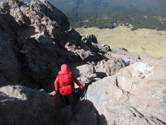
I had downloaded a set of GPS tracks from peakbagger.com and there’s nothing to speak of in terms of route-finding. On the lower slopes the trail made some endless criss crosses with a (gated) private road. It was far from a “pretty” trail but it did do its job bringing us into the alpine. It seemed to take forever to reach the treeline because of our slow ass pace and I started to get super bored, but once the views kicked in my motivation was suddenly boosted. For the next 300 m grunt to gain the broad ridge separating La Malinche with the sub-summit Tlachichihuatzi we followed the GPS track staying way on climber’s left deviating from the hordes. I soon understood why the guides didn’t go this way because this is better used as a the “descent route”. We had to trudge up some treadmill scree and to avoid more frustration we had to ascend some very steep grass slopes.
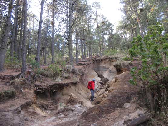
Lily checking out an eroded zone
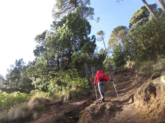
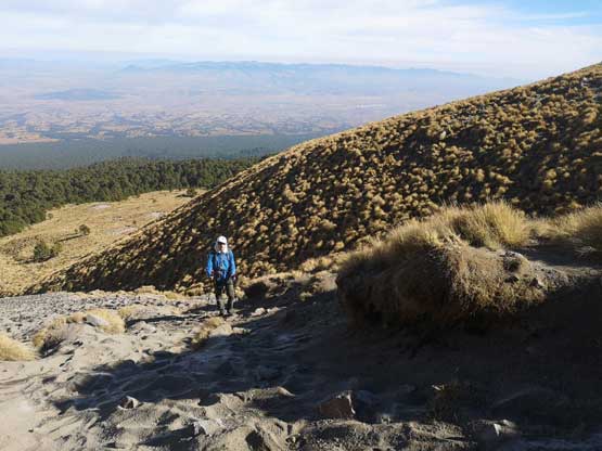
Hiking up the typical trail. As you can see, this is a boring hike..
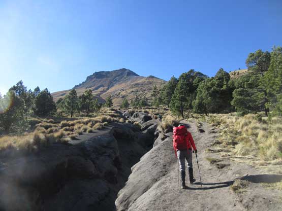
Breaking treeline
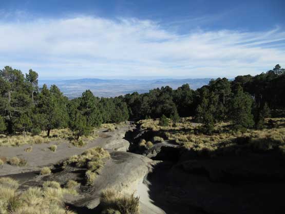
At treeline, looking down.
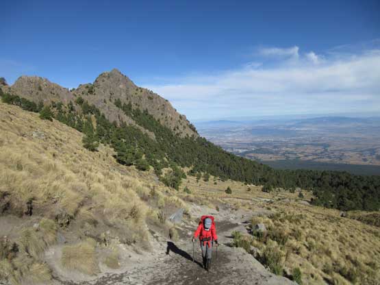
Lily marching up with Tlachichihuatzi behind
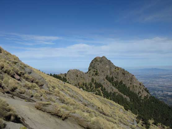
Another look at Tlachichihuatzi
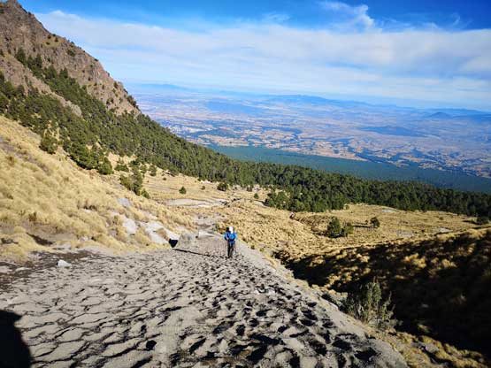
Me slowly trudging up the sandy trail. Photo by Lily Q.
Another photo of me trudging up. Photo by Lily Q.
By veering too far climber’s left we had to ascend a steep slope to gain the ridge
Lily marching up the never-endless grass-and-scree slope
Slowly, but steadily gaining elevation…
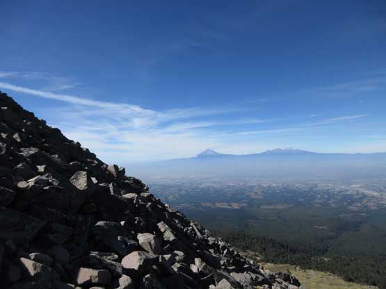
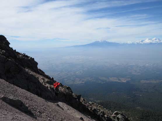
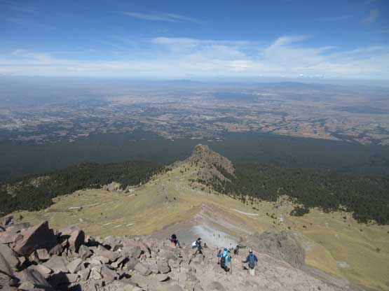
This never-ending slope eventually came to an end at elevation of 4250 m and once cresting the shoulder our view into the east side completely opened up with Popocatepetl and Iztaccihuatl stealing the show. At this point I opted to sit down and take a long food break but Lily decided to slowly but steadily hike up. Once the snack break was done I easily caught up, and passed Lily at a steeper section. The trail became undefined and lost in a field of boulders and at times it felt like “easy scrambling”. It’s still easy going by our standard. The only real scrambling was on the summit block but that’s because I went to attack it head on. There’s one short 4th class step followed by a bit of exposed 3rd class scrambling. The majority of hordes bypassed the challenge on climber’s right side but to bypass it involved some minor elevation loss. The view was certainly far-reaching from this summit, as expected, and we on purposely stood there for over half an hour for the sake purpose of acclimating…
The uppermost N. Ridge with Popocatepetl and Iztaccihuatl dominating
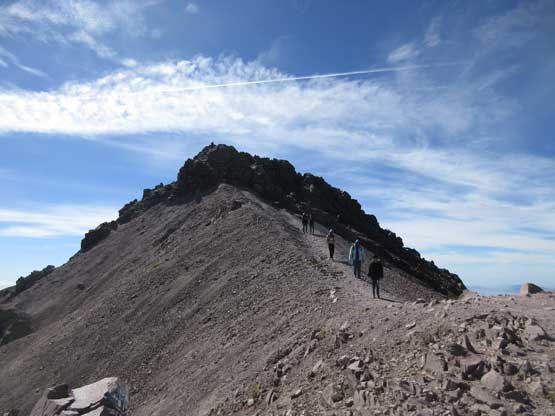
The summit is finally not far ahead…
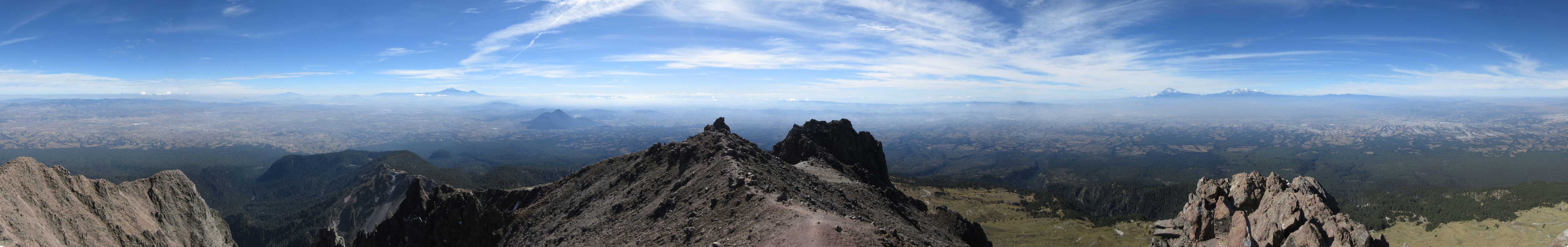
Summit Panorama from Volcan La Malinche. Click to view large size.
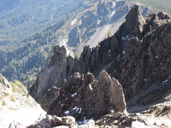
Looking into the extinct, but very broken crater
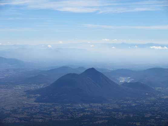
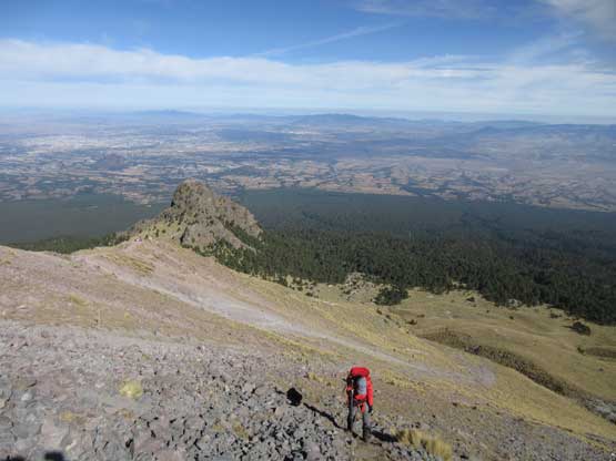
El Pinal is that forested cone

Pico de Orizaba dominating the eastern skyline, with Sierra Negra to its right
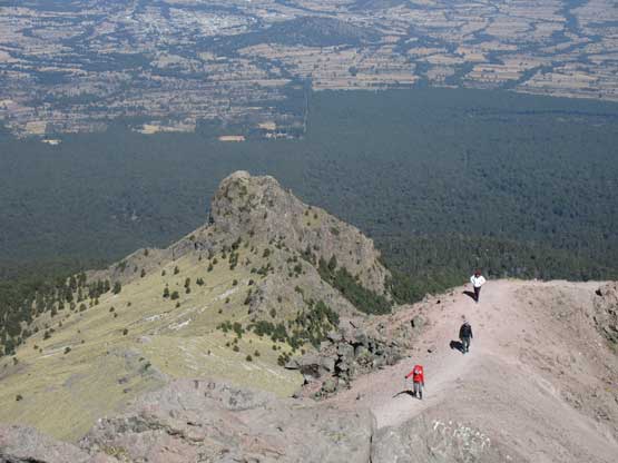
If you look closely you can see Lily slowly approaching the summit.
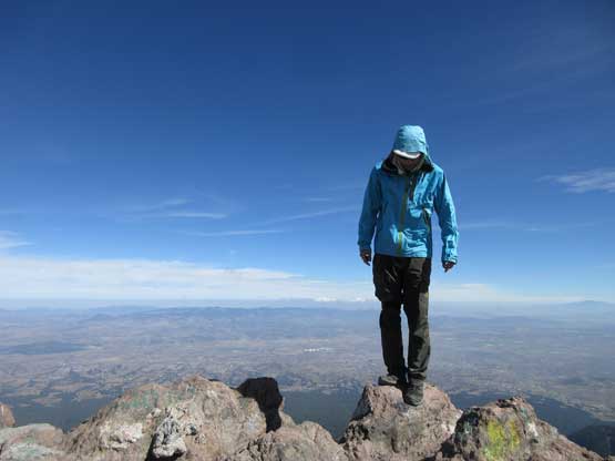
Me balancing on the summit rock of Volcan La Malinche
Another photo of me on the summit of Volcan La Malinche
Earlier in the day we had made an agreement to check out the sub-peak Tlachichihuatzi as well. It doesn’t have enough prominence to qualify as a separate summit for those into mathematics, but it’s a striking-looking spire and the profile of it attracts peakbagger-climber like myself, so we had to put the extra effort in. To get there we followed the connecting ridge down to the saddle. The ascent of Cerro Tlachichihuatzi is written in a separate trip report.
Descending the scrambling bits right under the summit
Lily bypassing the 4th class step while I opted to down-climb
Descending the steepest stretch which consists of mostly boulders

Onto mellow ground now. We were following the ridge down to Tlachichihuatzi
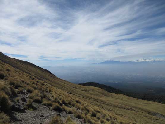
The vast grassy land…

Lily enjoying the hike down
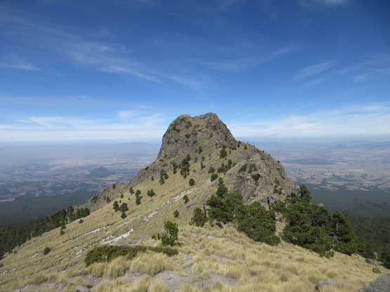
Tlachichihuatzi is looking much bigger now. It’s pretty fun to ascend too…
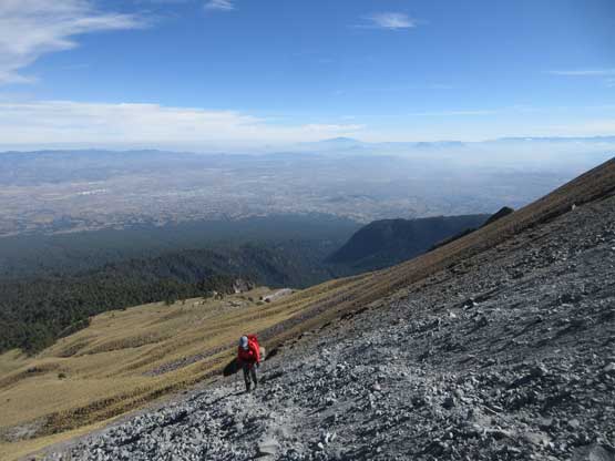
After completing both objectives we bailed down the open grassy slopes and rejoined the hordes on the main trail. The rest of the descent was uneventful, and despite the fact we on purposed hiked slow I still went down probably too fast… For me it’s uber difficult to hike at a below-normal pace because I’m simply not used to that, so if you want me to hike slow, then lead it. I’m often OK to follow an ascent (or descent) at the leader’s pace…
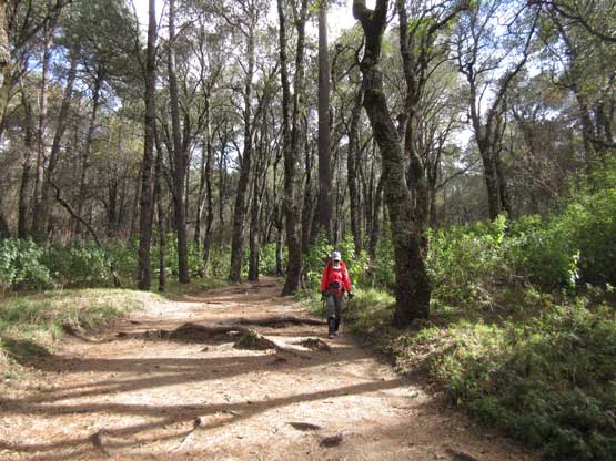
As much as the forested descent went…
I was very tired after completing the hike, but opted to start the long drive to Zoapan at the base of Pico de Orizaba nonetheless. I figured if I got too tired I could always pull out and sleep. It turned out that the level of excitement and the vast desert landscape did their job to keep me very awake throughout the journey. The drive wasn’t too crazy in the rural area and I actually felt pretty comfortable about this stretch. The small village of Zoapan looked like a deserted place but the OMG (Orizaba Mountain Guide) hostel was much better than anticipated. And following this move, our next objective over the next two days would be Pico de Orizaba.
