Mount French
August 26, 2014
3244m
Kananaskis – Smith Dorrien Valley, AB
I’ve been wishing to ascend Mt. French ever since I read Vern and So’s trip reports two years ago. The scenery, the challenging terrain combined with the fact it’s the 3rd highest peak in Kananaskis Country kept attracting me. It’s by no mean easy though. To reach its summit one has to do glacier travel and overcome a narrow and loose ridge section with absolutely no room for error. These factors had deterred most scramblers from even just thinking about it. Over the past few months Doug Lutz and I had been talking about giving French a shot sometime in this summer and everything finally lined up nicely on this past Tuesday. I needed a bit more convincing since I only had 1 day to rest after the exhausting Cinnamon/McKirdy back-to-back. However, with the glorious weather forecast there’s no way I could reject this opportunity. This might be my only chance in this year.

Mt. French and Mt. Jellicoe scramble route. GPX DL
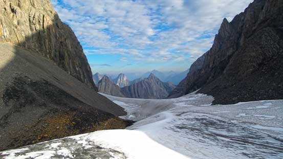
We both had a somehow busy day on Monday. I met Doug at Gasoline Alley by 9:20 pm and off we went towards Kananaskis Country. Doug managed to convince me the French Creek approach being doable in dark so in the next morning, we woke up by 4:30 am and started shortly after 5. Doug had previously done Mt. Murray so he knew exactly where to go. We firstly hiked on Burstall Pass trail for a short distance before talking a old logging road branching to the left. This old road eventually downgraded to a narrow trail, and shortly after that we picked a log jam to cross French Creek without wetting our feet. On the left side of French Creek we picked up another trail and this trail would eventually lead us to the alpine. The trail was mostly easy to follow with the exception of a few spots. Even with GPS tracks we still got off-trail for a few times but we managed to quickly correct ourselves without doing too much of a detour. The dead-falls were annoying but we generally managed to stay off from any real bushwhacking terrain. It was a long way to the treeline and once there we decided to continue up the moraine on climber’s left. We went a bit too far left and had to do either a long horrible sidehill traverse or lose elevation to access French Glacier. This glacier was mostly free of snow. There were a few crevasses but we managed to step across them easily. By the time we reached the French/Robertson col we were 3.5 hours after leaving the parking lot.
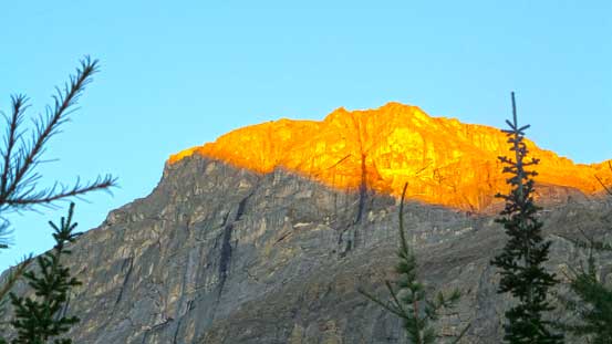
Alpenglow on Piggy Plus.

Morning colours on the familiar Kananaskis peaks – Galatea et al.

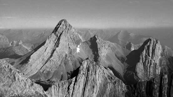
Piggy Plus and Mt. Burstall
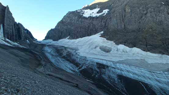
We had to lose some elevation to access French Glacier
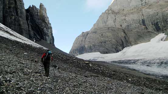
Doug side-hilling on moraine
Doug ascending French Glacier

Easy going towards French/Robertson col

A gigantic moat at the col
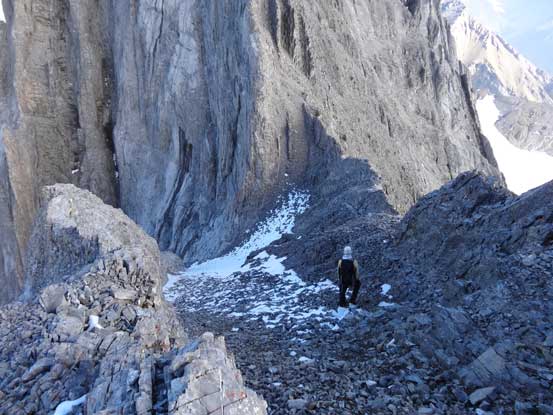
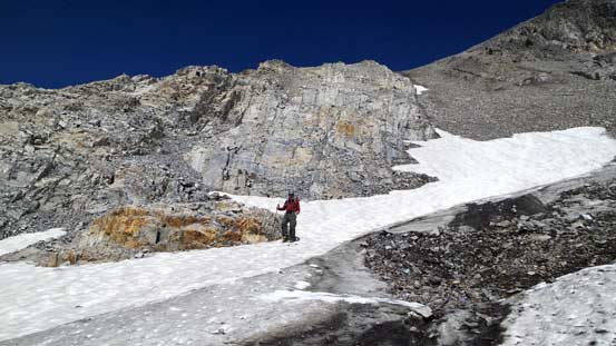
Most of the crevasses on this approach was near French/Robertson col on the Haig Glacier side. We had to step/jump across 3 or 4 of sizeable holes or use the snow bridges which were very strong in this morning. There was also a big crevasse on the slope of French which was exactly where So’s GPS track led towards. We managed to avoid it by staying a little higher. Once onto the rocks we firstly picked a line up a mini rib instead of the scree. The rib was relatively short lived so scree slog was unavoidable once we gained the SW slopes. The scree on this mountain was horrible for going up but excellent for coming down. It was a tedious process and the slope was very foreshortened. I knew we had to get higher than Robertson first before cresting the south ridge.
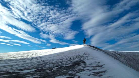
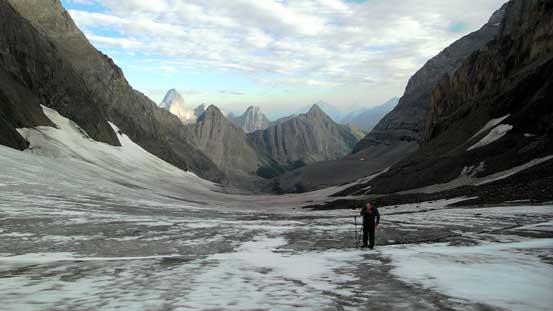
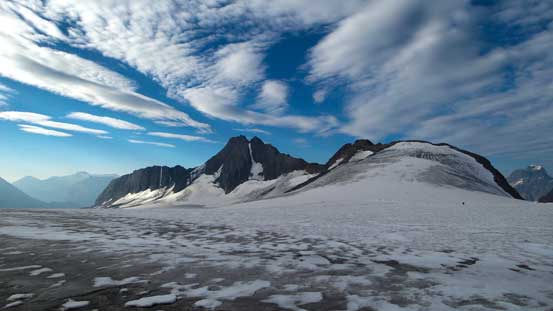
Ascending into the sunshine and onto Haig Icefield
French/Robertson col
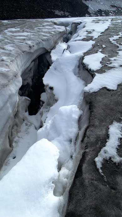
There’re a few sizable crevasses like this – this glacier isn’t as tame as you think!
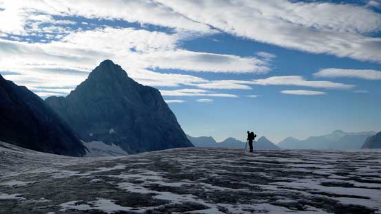
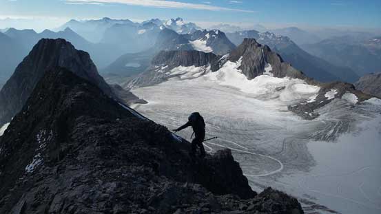
Doug on Haig Icefield with Mt. Jellicoe behind – our next objective
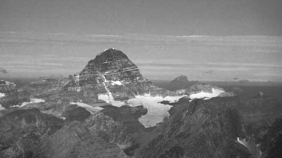
Mt. Maude with the obvious snow ramp.
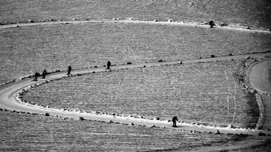
Cross-country skiers training on this icefield
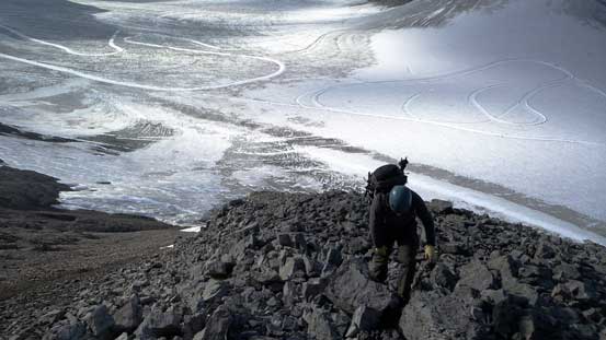
Doug ascending the initial rock rib
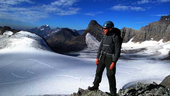
Doug with Haig Icefield behind

Me picking my way up. Photo by Doug Lutz
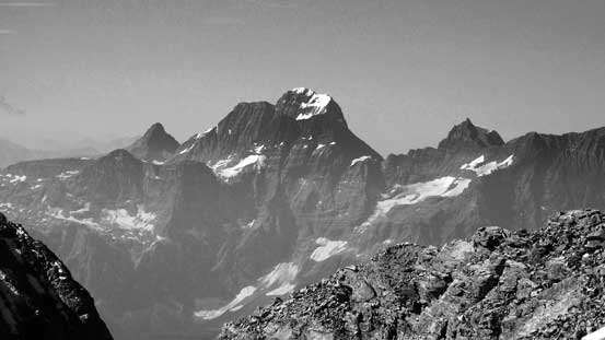
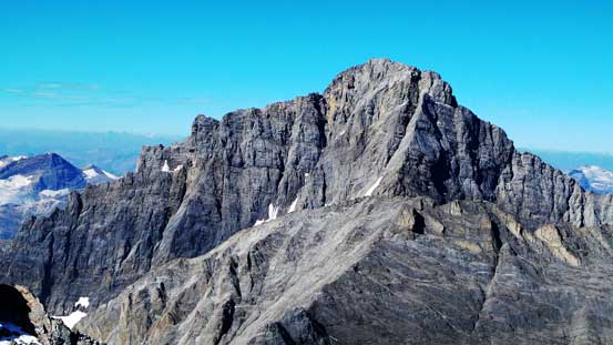
Impressive Mt. Birdwood..

Doug slogging up scree
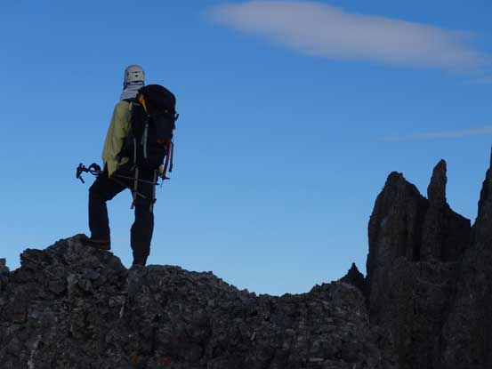
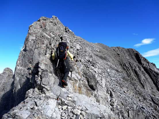
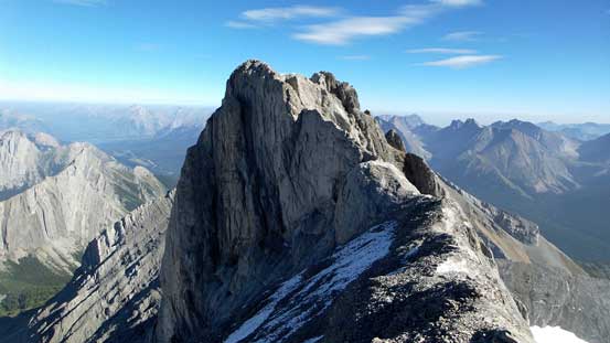
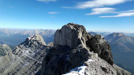
Cresting the south ridge.
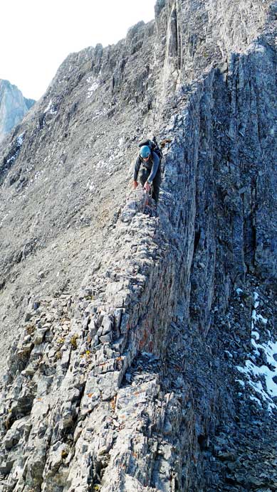
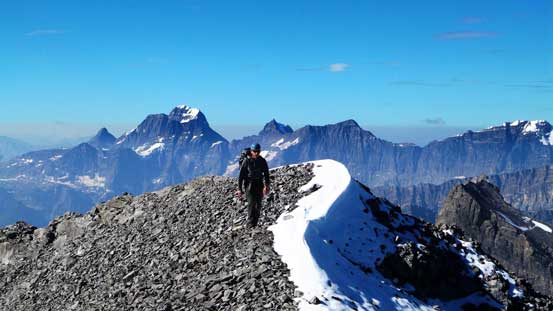
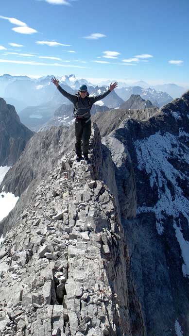
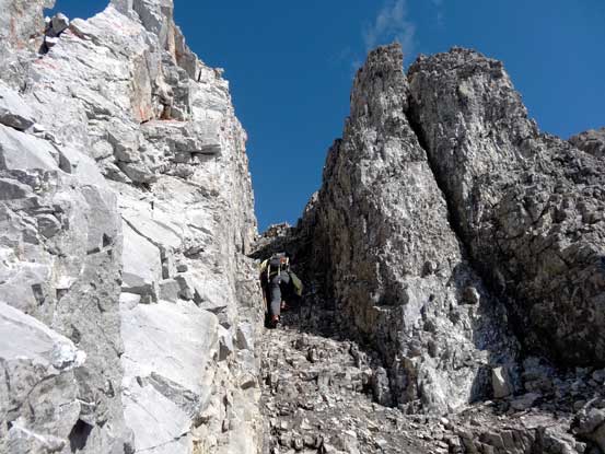
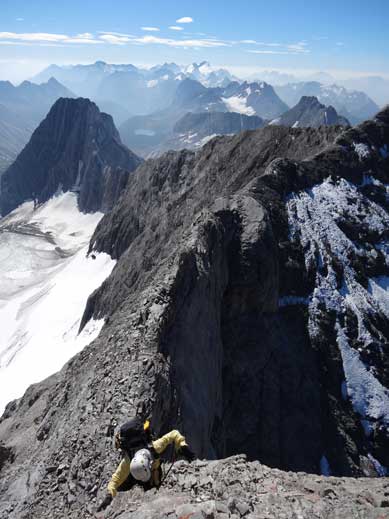
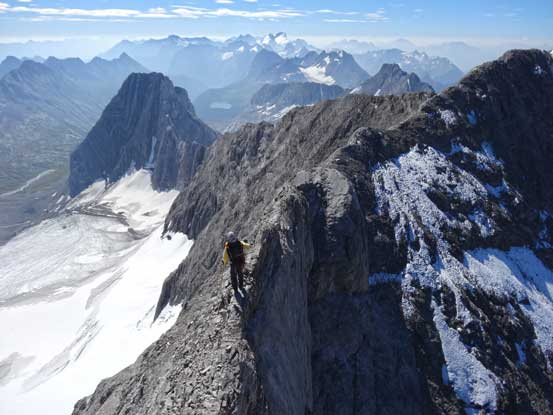
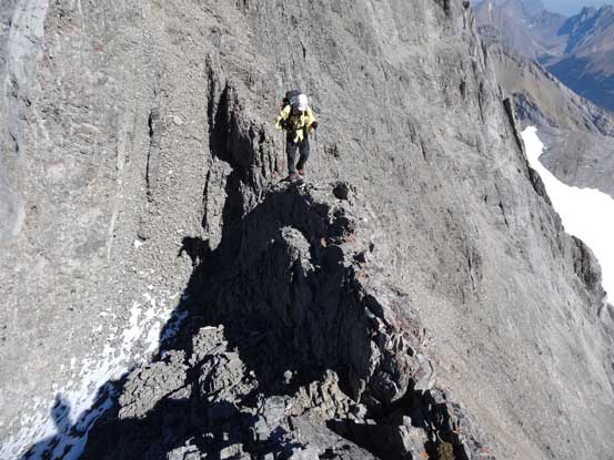
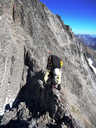
Right at the start of the ridge we had to dip down a little bit. Here we had two choices. I picked a line down skier’s left on scree or snow while Doug tackled the direct knife-edge ridge. That gave him a bit of warm-up for the real crux. After this bit there’s some moderate but very loose terrain to overcome before the false summit. Then a bit of easy ridge walk brought us to the crux – “French Guillotine”… At places the ridge narrowed down to within 1 feet with shear drop-off on each side. While there’s absolutely no room for mistake, there’s little hands-on climbing involved and we both got through quickly. Immediately after that we left the ridge crest and picked a traversing line on scree to intersect the ridge up high. The directly line would also work but more difficult. The last bit to the true summit involved ascending a loose gully. Thankfully all the snow had melted in this shady place and it was only class 3 scrambling for us, and soon after that we stood on the summit, with incredible vistas all around.
Me on the south ridge, checking the views. Photo by Doug Lutz
The immediate dip we had to deal with
I went down skier’s left. Photo by Doug Lutz
While Doug taking the direct route
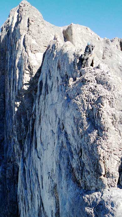
After the dip, I ascended the ridge towards the false summit. Photo by Doug Lutz
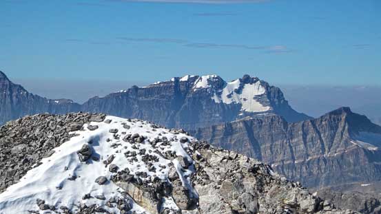
Doug on the false summit, with the Royal Group behind
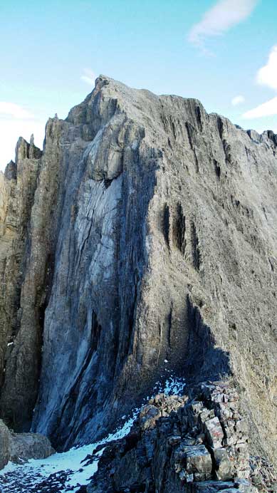
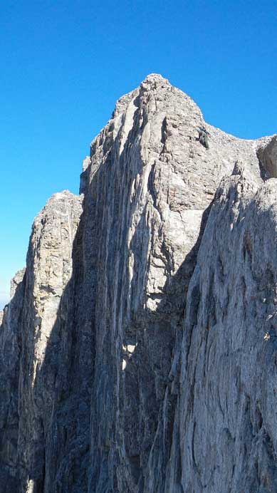
The summit block
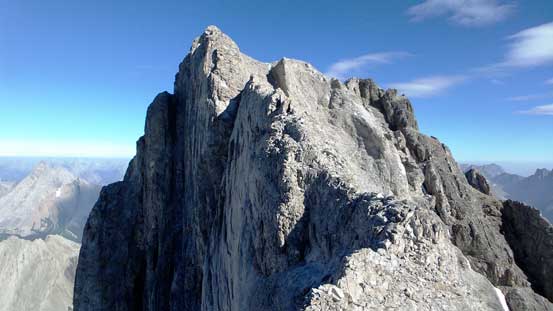
The crux – French Guillotine ahead
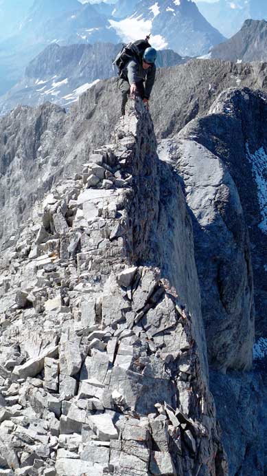
Doug balancing over the most exposed section
Doug on the crux
True summit ahead
Me ascending the shady gully
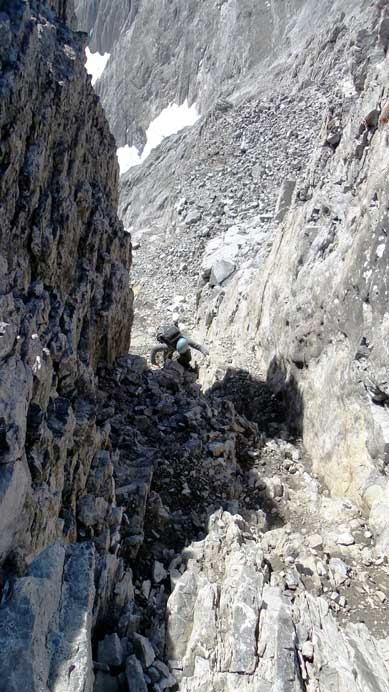
Doug ascending the gully
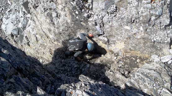
Doug finishing the gully
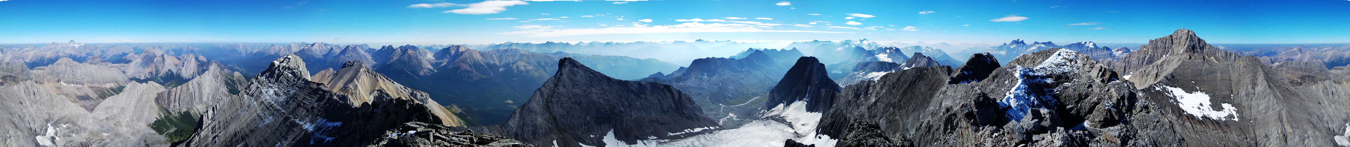
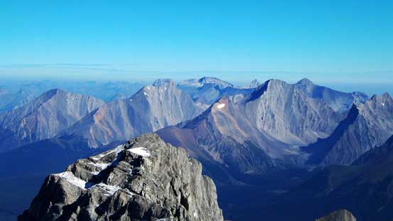
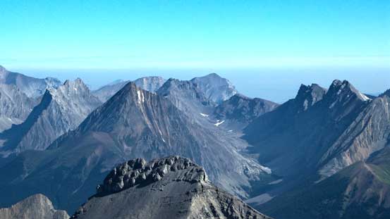
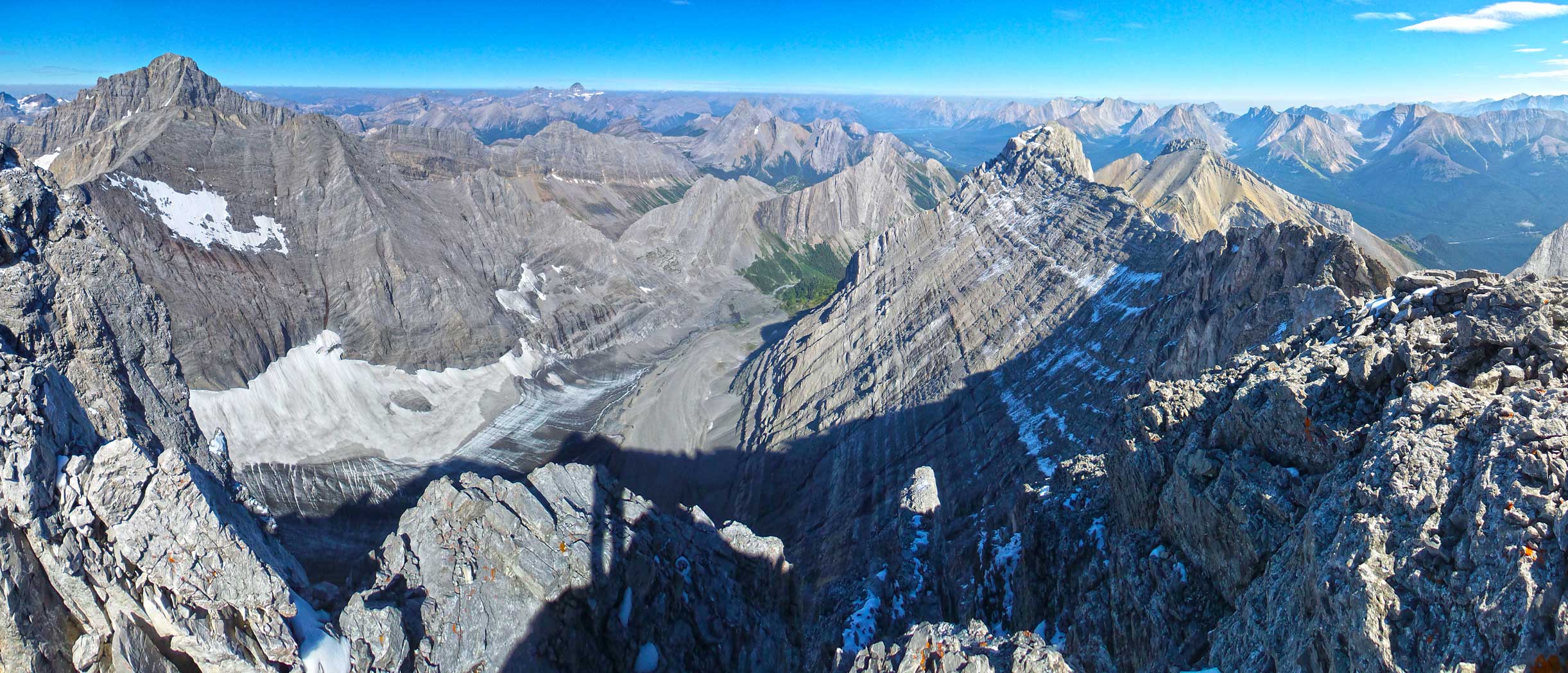
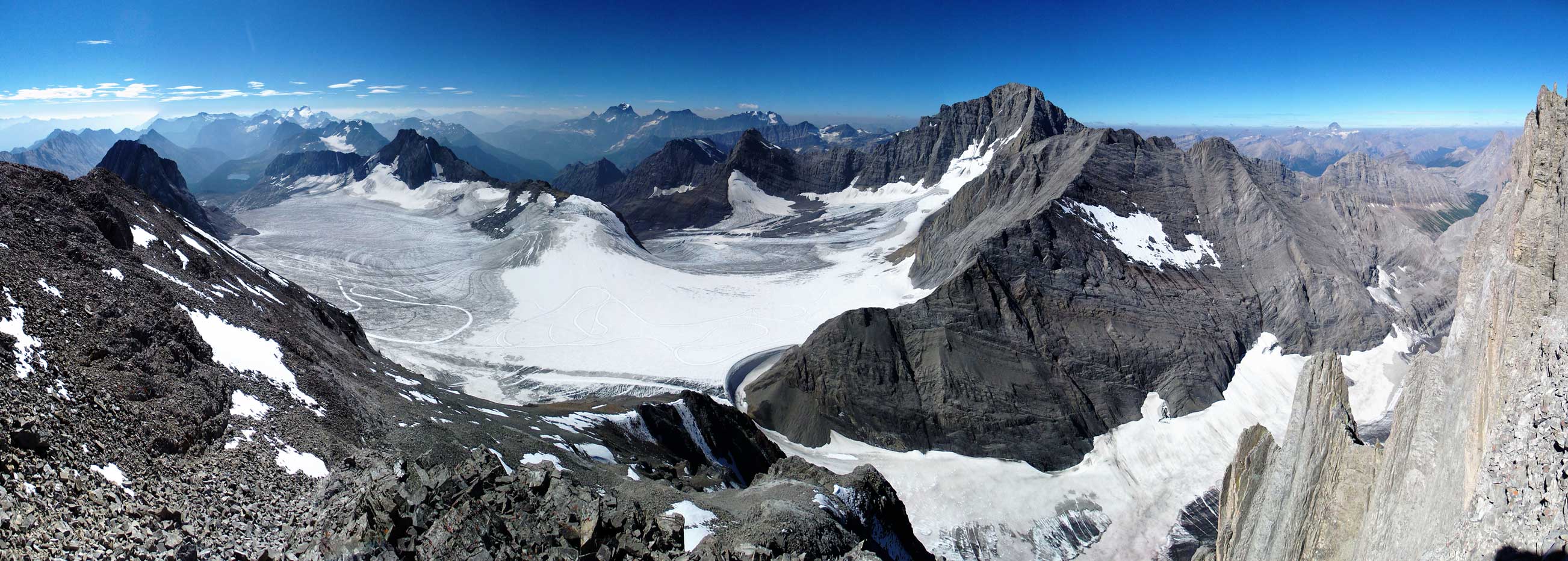
Summit Panorama. Click to view large size.
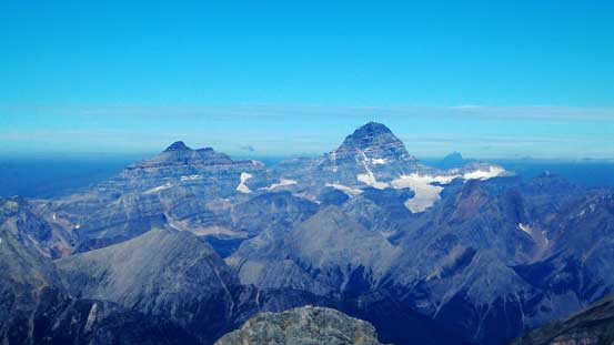
Mt. Assiniboine – highest in the southern Canadian Rockies

Mt. Joffre – highest in K-Country

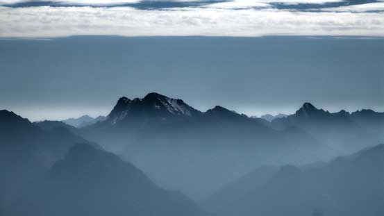
Mt. Harrison tries its best to poke through the smoke layer
Mt. King George – what a majestic peak
Mt. Prince John and Mt. Queen Mary
Mt. Sir Douglas is the 2nd highest in K-Country
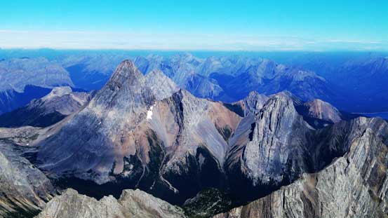
Mt. Birdwood, Pig’s Tail and Commonwealth Peak
The Tower and Mt. Galatea
Popular Kane scrambles – Gusty, Fortress, Chester
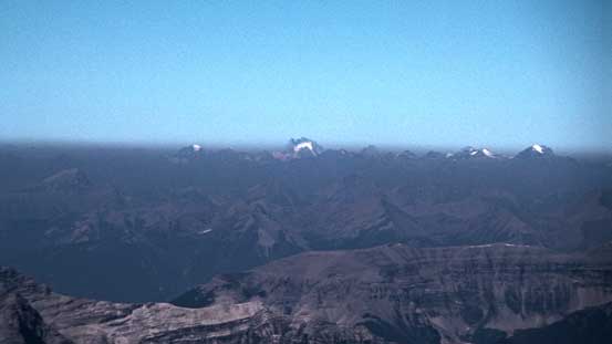
Eon Mountain and Mt. Assiniboine

The Highwood Pass group

The southern K-Country area
Joffre et al.
Mt. Rae – 4th highest in K-Country
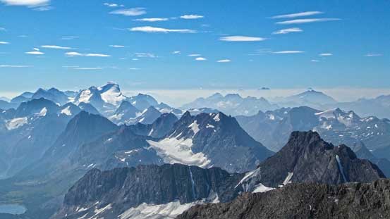
Even the Howser Towers were trying to stick their heads through the smoke

Looking way down at French Glacier

Doug and I on the summit. Photo by Doug Lutz
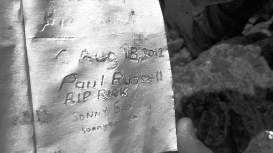
Familiar names in the register.
Another panorama from the summit. Click to view large size.
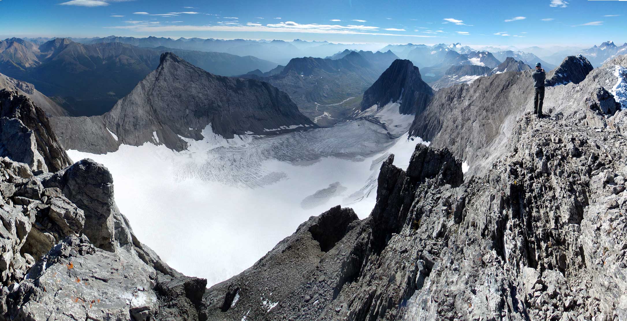
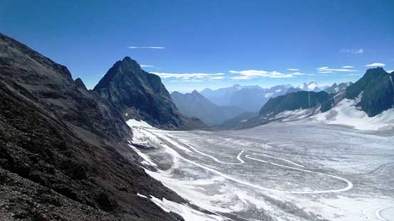
Panorama of Smith-Dorrien glacier. Click to view large size.
It was very early in the day so we stayed on the summit for a long time. While eating lunch Doug started to think about why not giving Piggy Plus a shot. I had some doubt about this idea as I knew by the time we got down into the forest I’d have little motivation to slog back up, so I threw out my idea – why not do Mt. Jellicoe instead. While, that would work perfectly so that’s it. After making this decision we immediately started the descent. We missed the scree ramp just above the crux and had to down-climb some loose and exposed terrain on the ridge crest. Nothing too terrible though. Back across the crux was a little bit more interesting than on the way up thank to the little bit down-hill factor. Back at the first avoidable crux we all picked the directly knife-edge line fore more “fun”.. The scree surf down the SW slopes was fast and furious but there were a few shallower or slabby spots to give us a bit of surprise if not paying attention. Snow had softened considerably but there’s minimal snow coverage so we still had to strap the crampons on.

Doug down-climbing the gully

Me descending challenging terrain just above the crux. Photo by Doug
Me down-climbing loose and exposed terrain. Photo by Doug
Me balancing over French Guillotine. Photo by Doug

Continuing down French Guillotine. Photo by Doug
Doug descending exposed terrain just above the crux
Doug on French Guillotine
Me balancing on the avoidable 1st crux. Photo by Doug
Me finishing this bit of knife-edge. Photo by Doug
Panorama from the south ridge. Click to view large size.
Mt. Jellicoe will be out next objective

Scree skiing!
Merging onto snow
And the day continued with an ascent of Mt. Jellicoe. It’s originally our back-up plan but now became our bonus objective.

Crazy man , that was a gnarly trip. Makes me want to do it now! I scramble with Allan Ask sometimes @ truedino.com. But this trip report really makes me want to stretch my limits. Thanks for sharing. Ill be sure to check your site out more often. Adeem
Awesome pictures and details!
My most epic scramble, especially my solo’s. A long day alone, doing that guillotine alone… Wow.
I did in Jul 2020, blue skies, still tons of snow. No smoke issues last year.
Would love to scramble with you guys someday.