Mount Oleg
October 30, 2021
2587m
Pemberton, BC
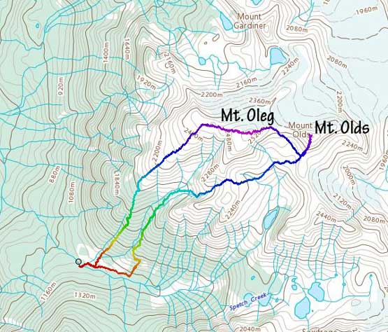
“Mt. Oleg” is the unofficial name of the highest summit in Place Glacier Group very much immediately to the north of Pemberton. It’s worth noting that almost every other summit in this group has been officially named, but not the highest one. “Mt. Oleg” is a broad and dome-shaped glaciated massif that offers no technical challenge, but the access can be an ordeal and because of that, this peak is not often ascended. The “normal” way is to take the trail that goes to some geologist’s huts on the north side of Placer Glacier but such is a contrived and long approach. Over the years I’ve spent countless hours studying the maps and I noticed the forested SW slopes from the end of Spetch Creek FSR could potentially be the “better” way to get into this area, albeit for only Mt. Oleg and Mt. Olds. For the other peaks near Place Glacier one still has to take the standard approach.
Mel, Elise and Ben happened to have this Saturday ready to pull the trigger for something interesting and the weather was looking amazingly for a weekend, at last. The idea to finally go for Mt. Oleg was actually Matt’s suggestion but he had to bail because of some family commitments. I initially was rejecting the idea but I went back to the maps and concluded that the SW slopes could be doable in our “shoulder season” conditions. I also convinced the group to add Mt. Olds to the agenda because I have to eventually bag all the named summits and missing out Mt. Olds on this trip was simply unacceptable. There was some major snowfall events in the South Coast ranges the few days prior to the trip. The end of Spetch Creek FSR was at 1100 m elevation and I do not have the skills/experience to drive on snow, so the extent that we could drive on this road was the major uncertainty. I was also not sure about the snowpack conditions up high. I figured the warm precipitation associated with an atmospheric river event followed by a cold snap would result in some firmer conditions but without first-hand beta nothing’s guaranteed. I decided to bring both pairs of snowshoes in the truck – the women’s 25′ for mountaineering use and the men’s 30′ for powder days so that I could make the final decision at the very last minute. To make sure we had essentially 100% chance of success we must accommodate all of these uncertainties so I set the 4 am meet-up time in West Vancouver to give us more than enough time contingency.
A few hours later we drove passed Pemberton and the small community of Mount Currie. The start of Spetch Creek FSR was wrongly marked on our Gaia maps but we found the correct turn-off a few hundred meters to the north. The road condition was better than expected. There were some water bars higher up that required decent amount of clearance but none of them challenged my truck. The temperature was below freezing and there was frost on the ground, but we surprisingly encountered no snow whatsoever all the way to the driveable end at 1100 m elevation. I had refreshed the Duffey Lake’s webcam page at least 30 times prior to this trip and this was not what I predicted. The Duffey area got a good dump from Wednesday night to Friday morning. Not having to walk the FSR was a bonus for us and with the lack of snow I eventually made the decision to carry my 25 inches snowshoes, which was the correct call.
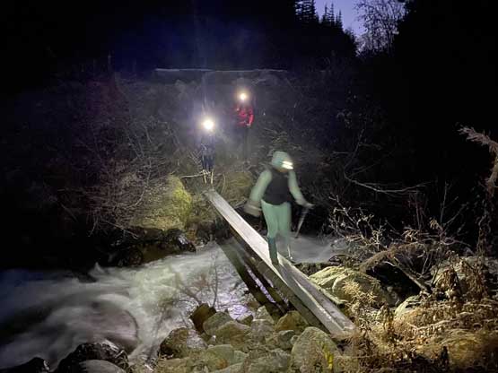
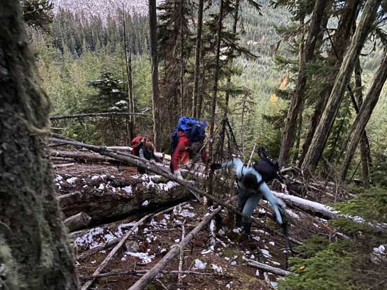
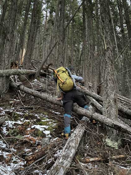
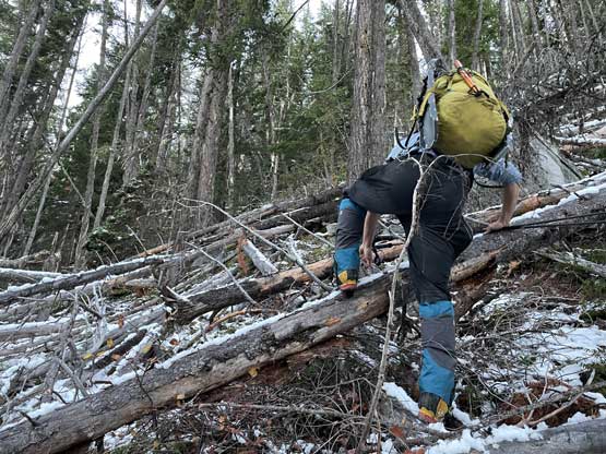
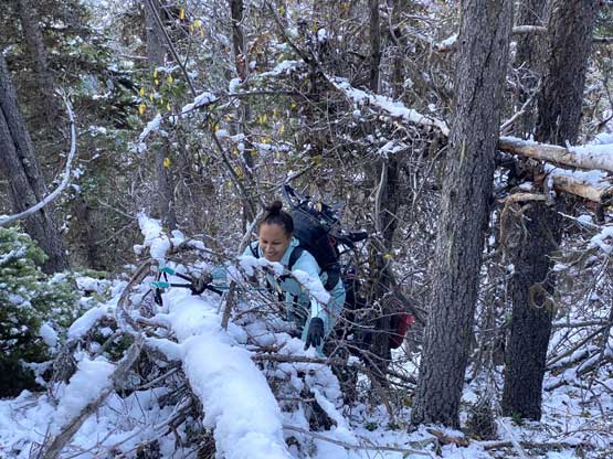
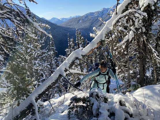
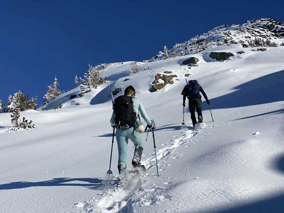
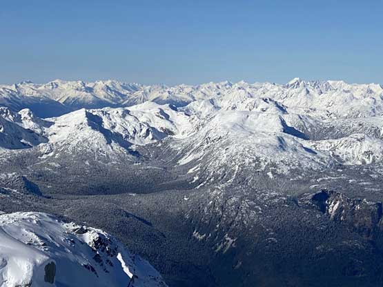
Right off the bat in the pitch dark we faced the crossing of Spetch Creek. The flowing was high enough that rock-hopping would be impossible. I thought we might have to wade across but then I saw there’s actually a nicely-placed foot bridge. The log was extremely slippery with the frost but we all managed to carefully walk across without incidence. We then walked on the deactivated portion of the FSR for a short while until a “reasonable” spot to dive into the forest. There were a few forested ribs/flanks on the lower SW slopes and I picked the one that had the gentlest contour lines, but don’t get too excited as the term “gentle” is relative. From the road to treeline there’s 1000 m straight-up bushwhack on sustained 35-40 degrees slope and sure enough the forested sections turned out to be the crux of this day. The initial 100 m gain was a shit show but I was expecting that. We had to dash our way up some secondary growth mess and then hop across a tributary creek with some insanely tight trees to push through. I thought once we finished the secondary growth the going would become easier, but boy I was wrong. The mature forest higher up provided nothing but a consistent game of pick-up-sticks. This was actually one of the worst pick-up-sticks bushwhack I have done in my entire peak-bagging career. For about 600 vertical meters the bushwhacking grade was consistent level 3 or 4 and the fresh snow and frost only served to add more fun. However, most of us was still smiling…
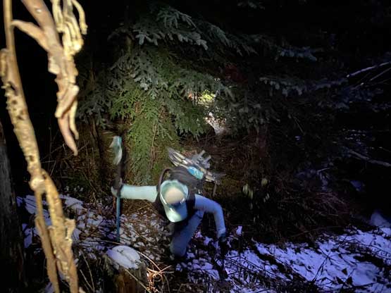
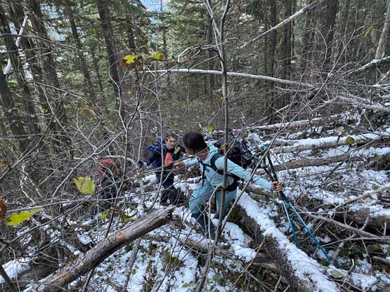
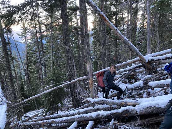
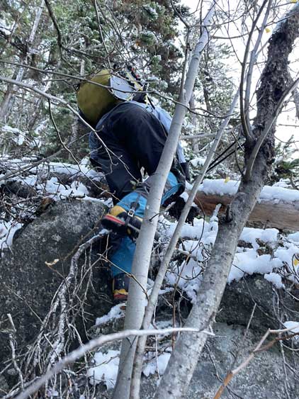
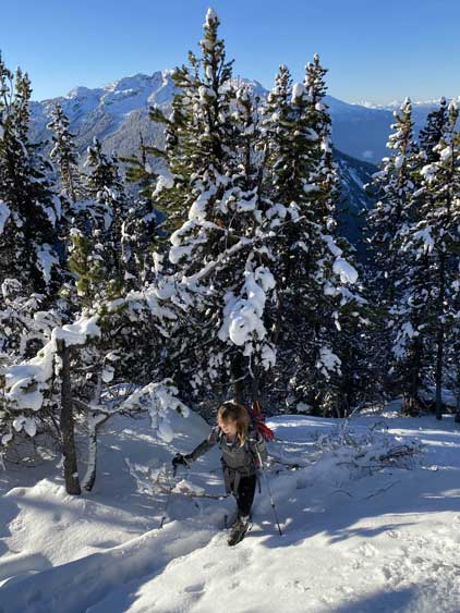
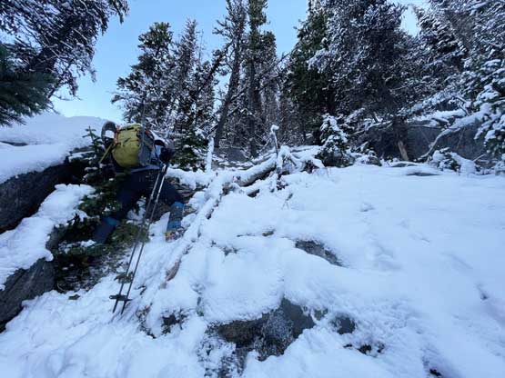
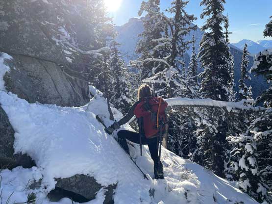
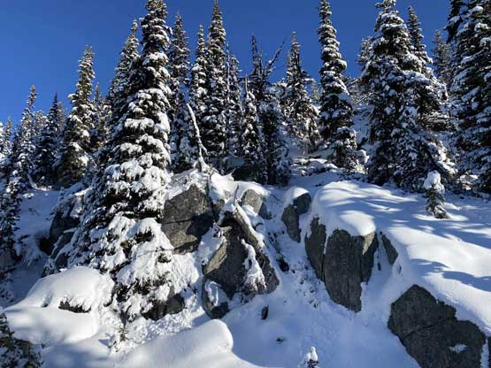
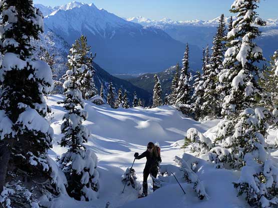
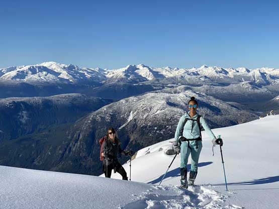
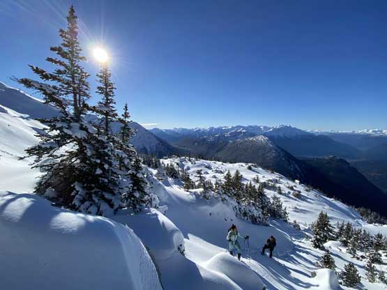
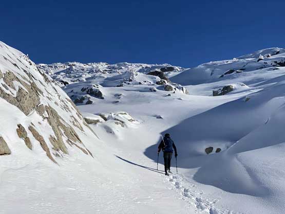
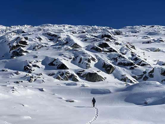
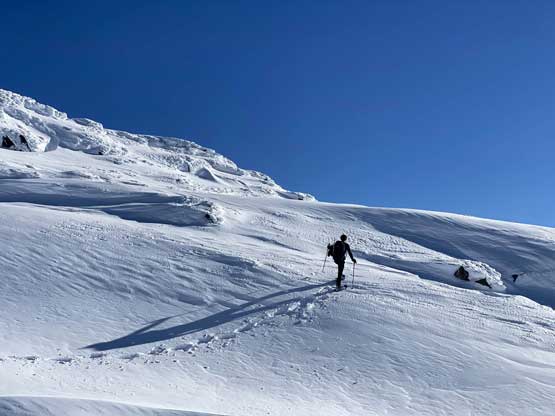
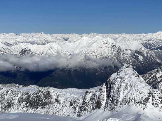
The pick-up-sticks eventually gave way to more stiff and tight timbers along with one-after-another thin snow covered bluffs. Route-finding up through those bluffs was challenging at times that we even back-tracked a couple times to find some “3rd class” bushy breaks. Eventually at around 1900 m we finally strapped the snowshoes on. There was still substantial amount of bushwhacking and route-finding but in another 200 m we would completely escape the green zone into a stunning alpine environ and that kept our stoke level high.
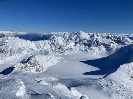
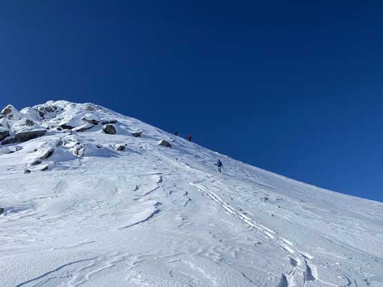
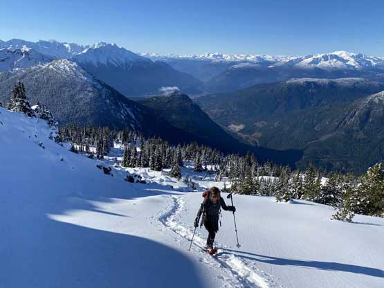
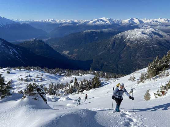
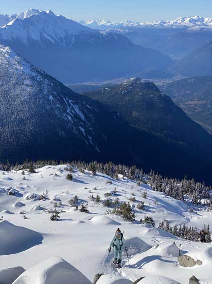
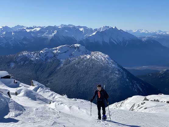
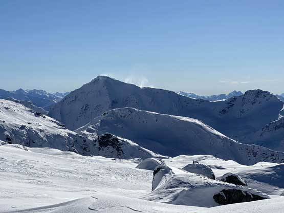
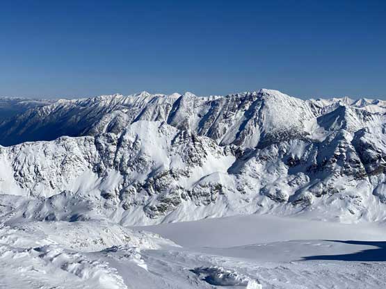
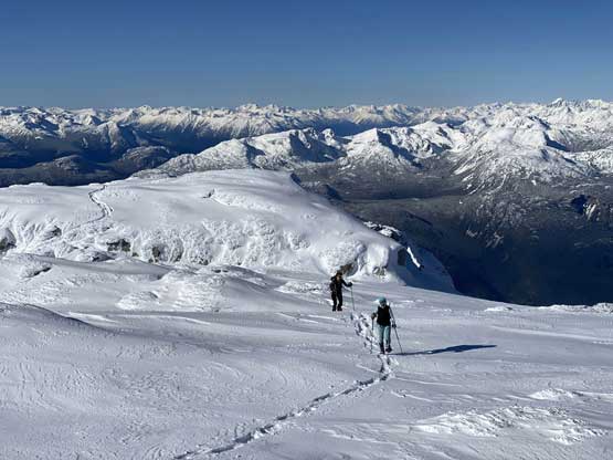
The transition into the alpine was fast and in short time we were in a world of white. We ascended a bit climber’s right into an obvious gully to break the last bluff and after that we just needed to put one foot in front of another to reach the summit ridge, about 400 m higher. Ben was high on stoke and broke trail up this entire stretch. Once hitting the summit ridge we had to overcome some minor up-and-downs and false summits. The plod up the final rise to the true summit was easy, but we had to fight the bitterly cold wind. I had to put on all layers on the summit including the MEC Storm Degree parka and I was still cold.
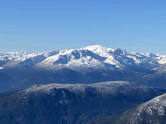
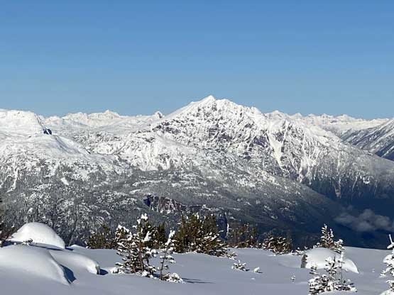
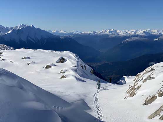
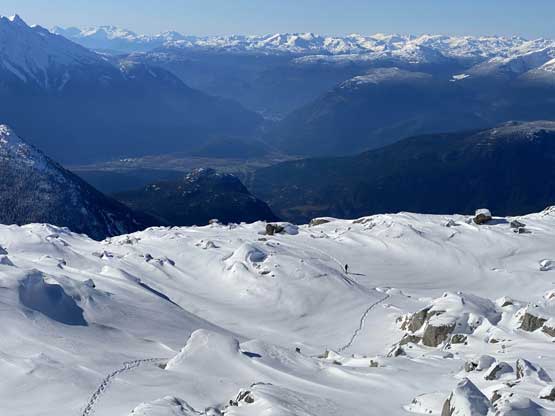
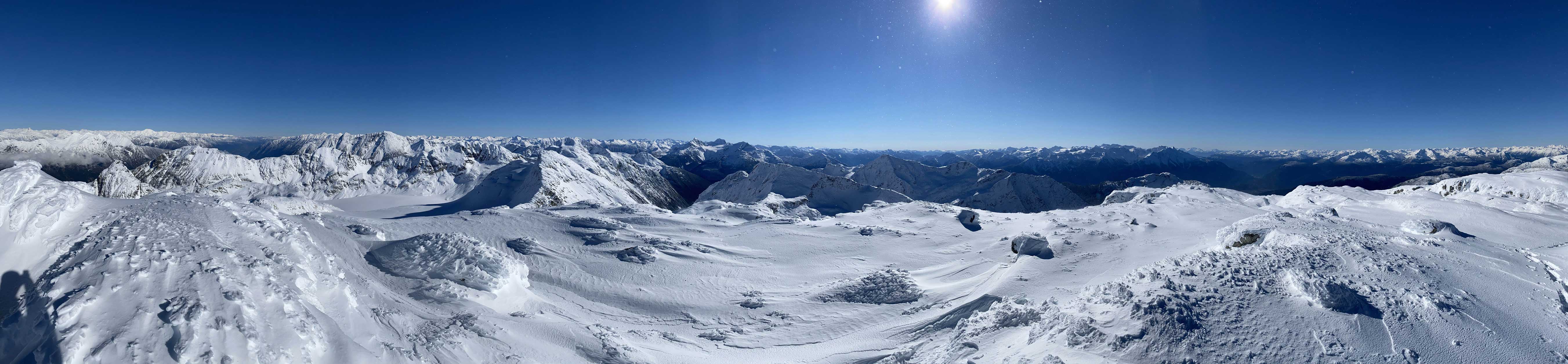
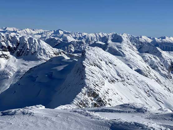
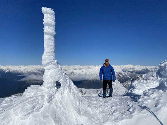
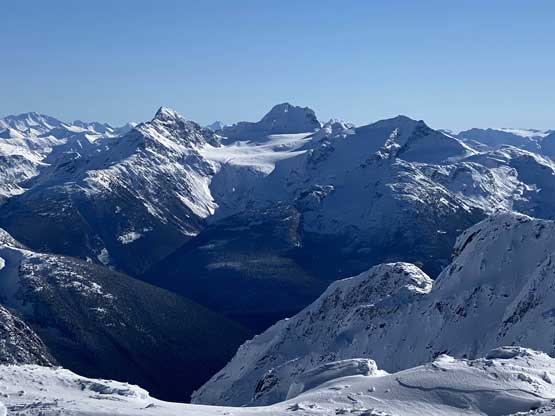
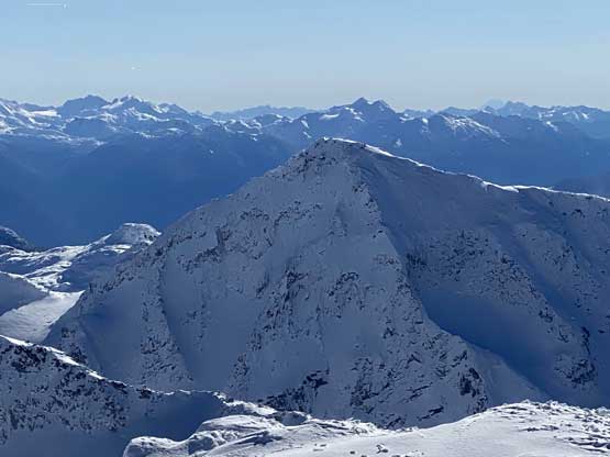
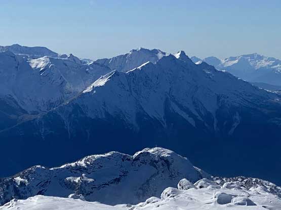
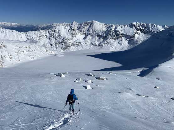
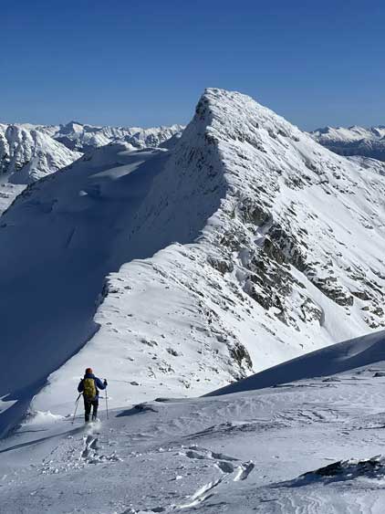
The summit celebration was short mostly because of the cold wind. I peeked over the edge and saw our next objective, Mt. Olds. The original plan was to ascend the connecting ridge but such was looking sketchy on this day but I had the back-up plan and that was to take the roundabout route to the south slopes of it. This meant an extra 150 m elevation loss but we would worry about that later. Our first business was to descend the easy east slopes off Mt. Oleg into Oleg/Olds col. We stayed on the north side of the ridge to plunge down on dry powder and the snowshoeing was fast and furious and from there Mel and I went ahead to break trail up towards Mt. Olds.