The Castle
June 12, 2018
1969m
Mt. Rainier National Park, WA
Immediately to the south of Mt. Rainier is the Tatoosh Range. Most peaks on this range are rugged in nature but not terribly hard to ascend. The approach is nice and short thank to the roads winding up Mt. Rainier. Among the dozen peaks out there Pinnacle Peak is the most popular but The Castle is probably the most technical, requiring a pitch of 4th class rock to reach the summit even by the easiest route. For the sake of this reason The Castle is the one I wanted to do the most, but while in the area already it makes sense to combine a bunch of them in a single trip.
The weather was nice throughout anywhere in SW BC and Washington but I was tired and didn’t want to do anything outrageously exhausting, but I wouldn’t mind a longer drive especially since I had two volunteers joining from Vancouver side – Lily Q. and Alan B. I suggested we made our first trip into the Tatoosh Range and aim to bag as many peaks as we wanted to do. The plan was heading down south in the previous evening and car-camp at the trail-head. The night driving was easy and fluent without too much of traffics sans a major construction on I-405. The rest of the drive was repeating Alan and I’s ascent of Mt. Rainier two years ago and surely brought some memories back. I was awake the whole time and managed to pull off the entire drive in a single shot without any intermediate stop.

Traverse of Castle, Pinnacle, Plummer, Denman. GPX DL
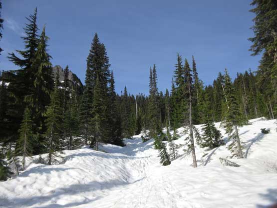
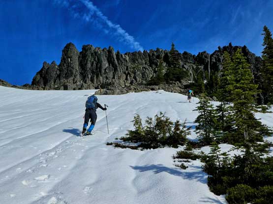
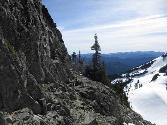
The next morning we didn’t wake up until 7 am for simple reason of why-rush. The purpose of driving down the previous day was to avoid traffics in Seattle areas. The trip itself would be pretty damn short no matter how you look at it. There’s snow right from the start and the snow had gone through an overnight freeze, but the terrain’s steepness combing with the previous parties’ tracks meant we didn’t need to don crampons nor ice axes. The summer trail wasn’t visible but who cares, as we just had to follow the boot path veering off climber’s left into a couple basins. The route was easy to follow and in no time we were in the open area heading towards the base of The Castle.
As much as the view from the start.
The morning snow provided easy travelling conditions

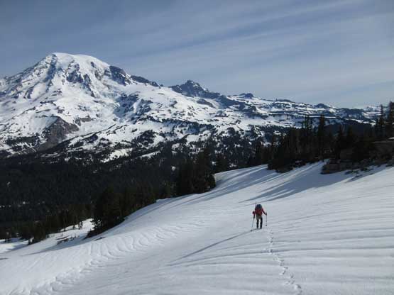
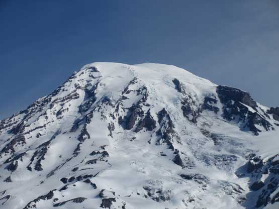
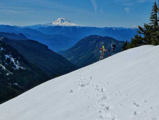
After a while we could see Mt. Rainier without obstruction

Mt. Rainier the tallest peak in Washington.

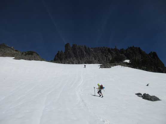
Marching up towards the base of The Castle
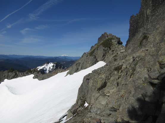
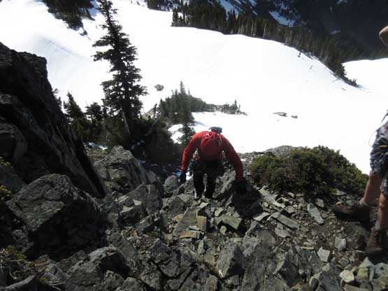
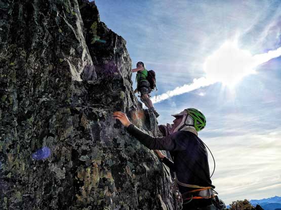
Once around to the south-east side of The Castle we could finally see the route. The face appeared to have lots of texture on it and didn’t look as hard as we were expecting. We had brought two 30-m ropes and a full rack of rock pros and the closer we got to the base the easier it looked. Once at the base we ditched the backpacks and decided to just solo the pitch. The route we took had a couple airy moves near the top but probably only “low 4th class” or “stiff 3rd class” by B.C. standard so we definitely should have left the gears at home. The traverse to the true summit is exposed but has ledges on the opposite side. The summit itself doesn’t have too much room though.

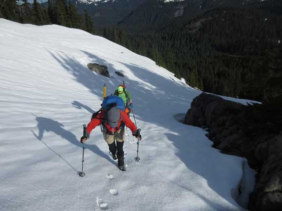
Alan breaking trail up a steep roll
Lily with Mt. Rainier behind
Me topping out on the broad east shoulder. Photo by Lily Q.
Al and I trudging up towards the base of route. Photo by Lily Q.
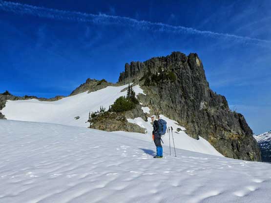
At the base of the route. That’s the lower south summit behind
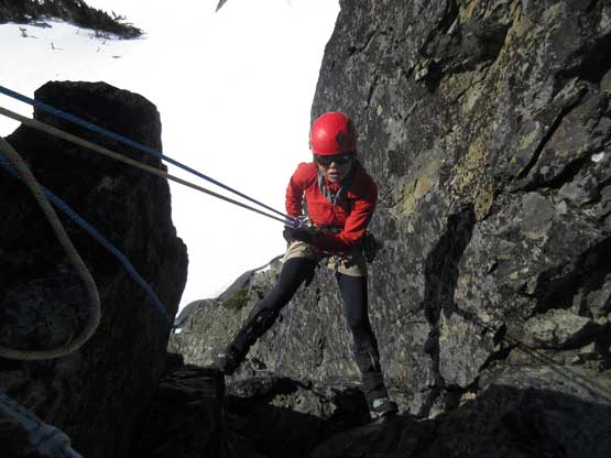
Lily starting the initial scrambling.
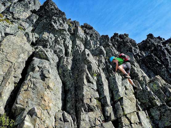
Al picking his way up the wall. It’s steep but has lots of holds. Photo by Lily Q.
Al and I figuring out the route. Photo by Lily Q.

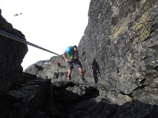
Me scrambling up. Photo by Alan B.

Lily decided to pick a different line
Lily topping out on the summit ridge

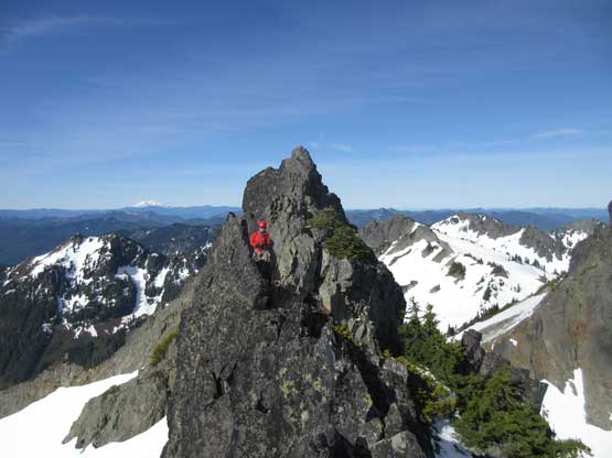
Continuing up towards the true summit

Al topping out on the summit ridge

The traverse has superb position but is exposed

Summit Panorama from The Castle. Click to view large size.
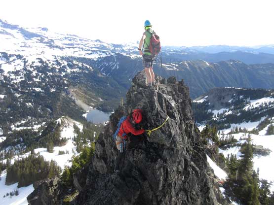
This is the true summit. Note the rappel anchor.

Pinnacle Peak will be our next objective

Mt. Rainier

This is looking over the lower south summit
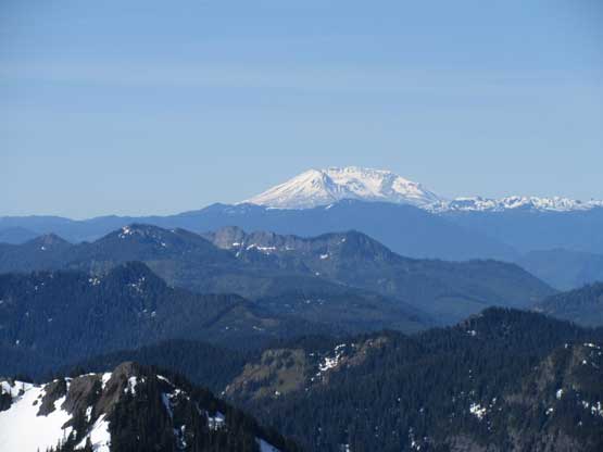
Mt. St. Helens in the distance. She doesn’t have her top anymore.

Mt. Adams looks pretty majestic
A closer view of Mt. Rainier’s upper mountain

Me on the summit of The Castle
To justify the purpose of hauling two 30-meter ropes we opted to rappel off directly from the summit. There’s a huge rock horn with an old sling and rappel rings suggesting previous parties had gone down this way. The rappel route appears vertical. I’m sure all three of us could have just down-climbed our scramble route but it seemed silly to haul those technical gears without having to use them. The rappel was fun although I wished I had brought the gloves up with me instead of ditching them in the backpacks.
Lily leading down the single pitch of rappel
Al rappelling
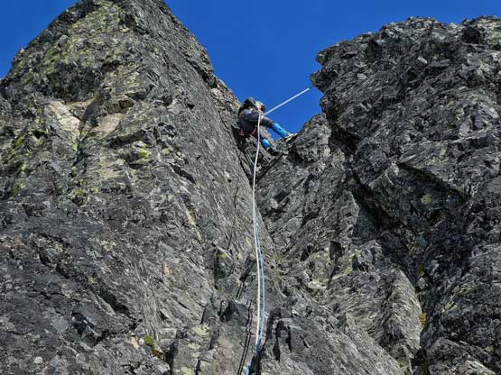
Me on rappel. Photo by Lily Q.
Back to the wide ledge. Time to retrieve our backpacks
Going down the SE side on snow. We had to find a round to SW side
Me and Al searching for a route (following GPS track). Photo by Lily Q.
The traverse towards Pinnacle Peak wasn’t very obvious coming from The Castle side but thankfully we all armed with the previous GPS tracks. We simply descended the south/south-east side until the previous tracks drop abruptly into the south-west basin. Peeking over the lip I saw a viable scramble route to get down onto the snow so there we came. Unfortunately the snow was too hard to kick steps into so we had to don crampons and ice axes.
And then the day continued with ascents of Pinnacle Peak, Plummer Peak and Denman Peak.
