Emerald Peak
January 3, 2013
2545m
Yoho National Park, BC
After an exciting day on Mosquito Mountain, Ben and I were looking for another ascent. Temperature dropped down to -20 again and we slept in Lake Louise Hostel. Having a warm dorm was definitely nice, but having 4 people in one room wasn’t that pleasurable. We had lots of discussion regarding the possible objectives and Emerald Peak was selected. It’s usually not done in early season, and it sounded pretty involved in Nugara’s snowshoeing book.
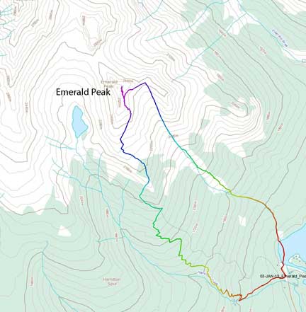
Emerald Peak snowshoe/ski ascent route. GPX DL
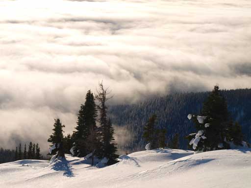
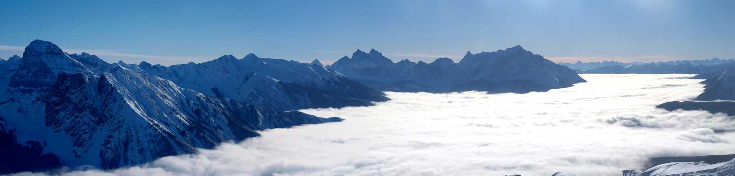
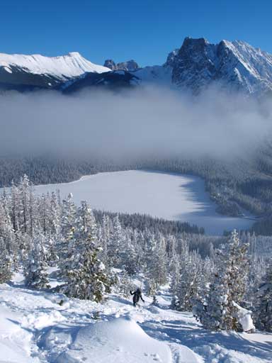
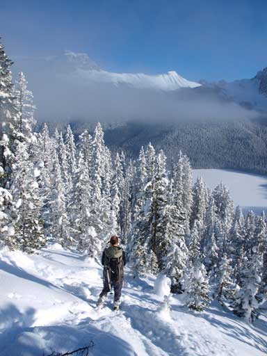
We woke up in cloudy weather, but given the stable weather pattern, we were hoping for inversion, and yes it did. There was a solo skier at the parking lot, but we didn’t know where he gonna go. The Hamilton Lake trail was hard-packed which gave us a full relieve, otherwise we could easily spend hours just post-holing up the treed rib. We marched up on a steady pace, and eventually broke through the low clouds. This was motivating enough and we speeded up a bit. It took us more than 1.5 hours to get to the point where I thought we were too high on the trail. Instead of backtracking and losing elevation, we decided to go up the avalanche slope on climber’s right side. The next 150 vertical meters or so was the most exhausting part of the trip, wallowing up 30-35 degree unconsolidated snow, post-holing knee to waist deep, and there was not much room for switch-backing. I even stepped into one weak spot and spent a good 5 minutes just to pull out my leg (and snowshoe). We took turn breaking trail, and eventually made to south ridge.

Inversion view in the morning.
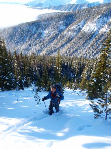
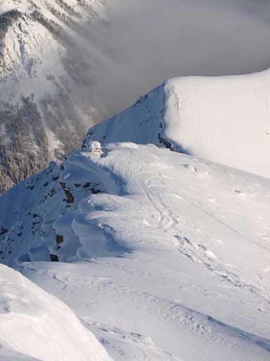
Trail-breaking is tedious up this slope.
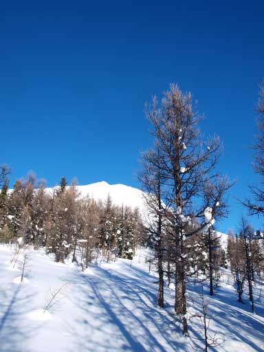
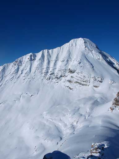
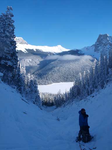
We got the first view of false summit.
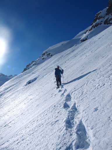
We were still in the trees at this point… This is typical for BC climb. You spend what seems like eternity to get to treeline, but after breaking through the trees, you are close to the peak. Ahead of us was the final slope up the false summit. I was slow at this point since I didn’t eat anything yet. I quickly took a short break consuming a muffin, while Ben kept marching up the slope. There was an old ski track so we didn’t follow the ridge, instead traversing diagonally up towards climber’s right. The temperature was well above freezing and we noticed the surface hoar on the snow. Condition would get interesting after the next storm.

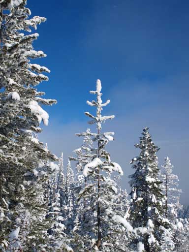
Going towards treeline.
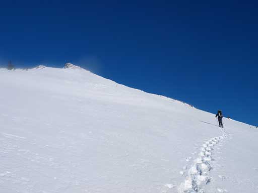
The final slope to false summit.
Looking down at the low clouds
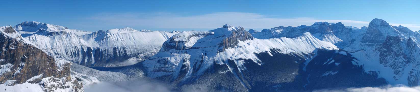
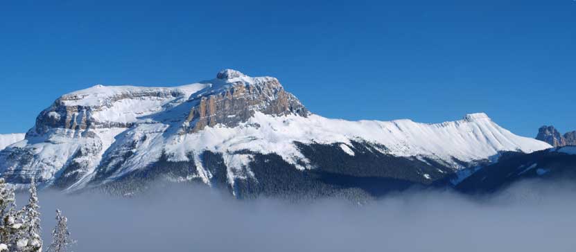
The view also fully opened up at this point, and once we were at the false summit, we could see the snowy Mt. Carnarvon, Mt. Marpole, The Presidents, and they looked very impressive. Since we hadn’t get our objective finished, we didn’t take time soaking in the views. I soon looked down at the first down-climb. I had some thoughts about descending the slide path, so I packed my snowshoes inside pack, and went down this step. It’s a moderate scramble. Ben left his snowshoes on the false summit.
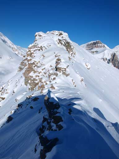
The summit ridge ahead.
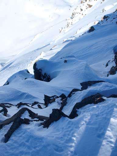
Looking down the first rock band from false summit
Ben down-climbing the first rock band

Same as above
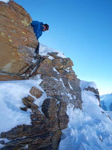
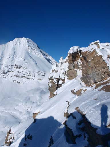
The next obstacle was a couple of pinnacles. We circumvented them on climber’s left side, easy going. Soon we were at the crux. I immediately noticed this point from Bob Spirko’s site. He went through a tunnel in summer. In winter, we couldn’t see the tunnel, but climbing directly up the wall didn’t look to be that bad. So we ditched our packs here, and took out ice axe. I firstly ascended a steep snow lip on climber’s left side, and then traversed towards right over a couple of awkward moves. It’s definitely a difficult scramble.
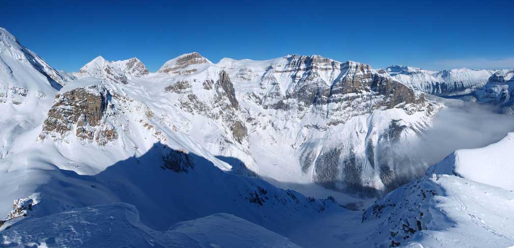
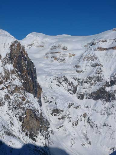
Carnarvon provides an impressive backdrop.

It was tropical hot in this scoop
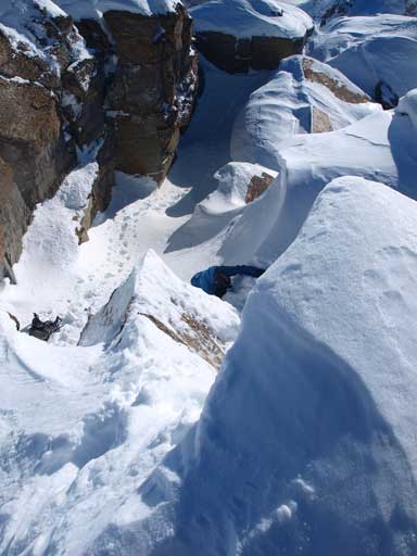
Ben challenging the crux step on Emerald Peak’s south ridge

Same as above
After this bit of exciting, we were staring at the summit cairn, and it’s only a few minutes’ walk. We noticed a solo skier coming up the slide path, and we decided to wait for him. It turned out to be the one we met at parking lot… Well, guess our snowshoeing pace was faster as he had a nice skin track to follow for the entire ascent.
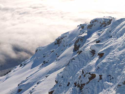
Wapta Mountain dominates the SE skyline.
Across Kicking Horse Valley are the big peaks – Mount Goodsir and Vaux
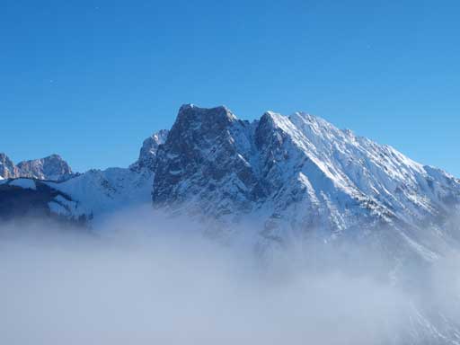
Winter view of Mount Carnarvon
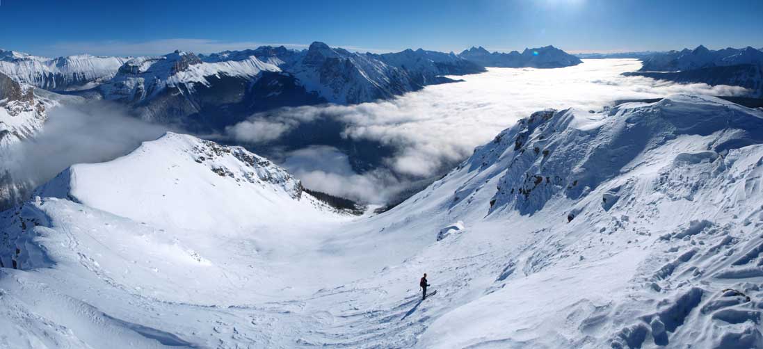
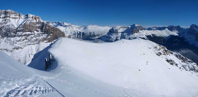
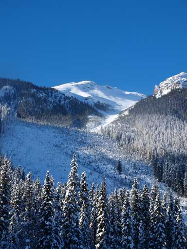
Panorama of Emerald Peak Slide Path. We decided to go down this way.
Impressive view of Marpole and The Presidents

Ben and I near the summit
Beautiful snow formation
Looking down the east ridge
We all had concern of the warm weather, so we didn’t stay long on the summit. There were more and more skiers coming up the slide path. Descending the crux was easier than going up it, and Ben went up the false summit to retrieve his snowshoes. We decided to descend the slide path, and the initial slope was quite dicey, but soon we joined the skier’s track. I really wished to have my skis on, and the slope wasn’t as steep as expected, I could definitely ski it.
This part was the steepest…

Rejoined the ski tracks now
There is an outlier on the east ridge that you can bag, but we didn’t bother with that. Lower down, the path narrows considerably and the snow was completely destroyed by skiers. We were trying to stick to fresh powder, and were forced to ventured into trees on skier’s left side. Thankfully there were enough powder snow to give relieve on our knees. We both enjoyed the fast descend.
We could have bagged this East outlier, but didn’t bother.
Impressive The Vice President

Beautiful views were with us throughout the descent

Looking back towards the upper slide path

This is the middle section of slide path

We veered into trees seeking some powders to give our knees some relief
Walking down some fun powder
Further down we dropped back into the cloud layer and temperature dropped dramatically thank to the inversion. The trees hadn’t de-frosted yet. The slide path went all the way down to the lake, and we followed skier’s tracks crossing the lake. The lake crossing was quite scenic too. Awesome day in the mountains again. Round trip time: 7 hours.

Back to the frosty winter land
Wapta Mountain and a tiny bump on the right – Mount Field
Walcott Peak and Mount Burgess above the clouds
Back to the frosty winter wonderland
More beautiful scenery
The lower path becomes a gully
Looking back at the slide path
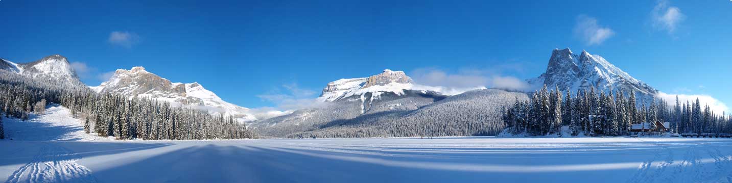
A panorama view from Emerald Lake.
