Tulameen Mountain
July 28, 2019
2285m
Hope / Sowaqua FSR, BC
Tulameen Mountain is a sizeable summit in the northern part of Cascade Ranges south of Coquihalla Pass area but north of Manning Park. It boasts an impressive north face and although not as iconic as some of the greater peaks in SW British Columbia, the shape of Tulameen Mountain is very recognizable from many vantage points in the vicinity of BC Cascades. There are two published routes and both require at some some driving on logging roads. The more popular approach is by a direct 1000-m bushwhack from Sowaqua Creek while a longer, but less bushy option goes up the NE side from Huldra Mine Road which is accessed from Coquihalla Pass. The south side approach has a few decent trip reports on ClubTread and for once again, our reference was Simon’s excellent write-up.
The original objective of this weekend was a 3-day trip north of Pemberton but the weather forecast for Saturday downgraded. Instead of soaking wet in the rain Alex and I opted to wait till Sunday to start our trip but then we would only have two days instead of three. The Pemberton option was out but Alex threw out the idea to tag Tulameen Mtn. and Mt. Snider in one trip and I quickly agreed. There’s nothing exciting from technical perspective but I had been wanting to ascend Tulameen Mtn. for years so the trigger was pulled. Alex managed to put together a 4-man team with Paul S. joining from Princeton and also Marius. I sat in front of my computer on that rainy Saturday doing my usual pre-trip homework and quickly noticed a big problem. Our friend Daniel has sent me a website link that stores up-to-date satellite images and the recent images showed the entire ridge crest was already free of snow. There’s no other reliable water source. Alex was more experienced in this type of adventure and he suggested we should haul at least 6 L of water each. This would not be something I looked forward to but given the situation I reluctantly agreed. I liked to do trips in a light-and-fast manner and carrying both overnight equipment and 6 L of water seemed very much against it, but I figured this would be a good trip to test new things out anyway.
The drive out of Vancouver was uneventful but the McDonald’s time in Hope had taken us longer than expected. We picked Paul up from a secret pull-out (to park his 4Runner for two days), and resumed the drive onto Coquihalla Highway and then Sowaqua FSR in my Tacoma. The forestry service road was narrow and windy but recent logging activities had smoothed out the road bed such that we could drive the 14 km stretch in a timely manner. We turned onto the spur road that Simon mentioned in his trip report just before Montigny Creek and parked at the end.
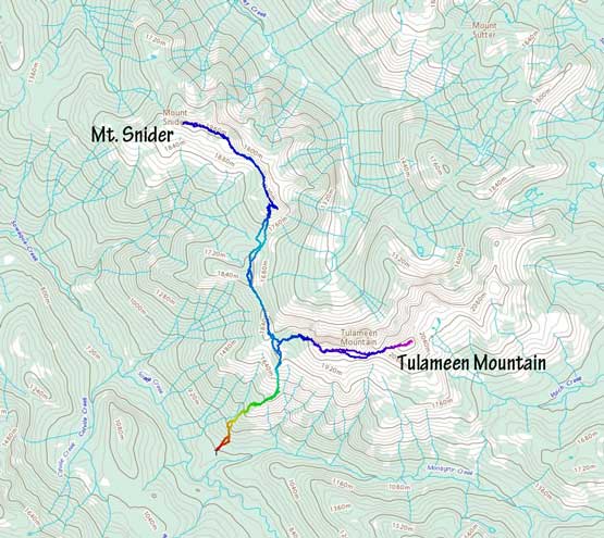
Tulameen Mtn. and Mt. Snider from Sowaqua FSR. GPX DL
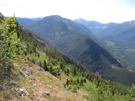
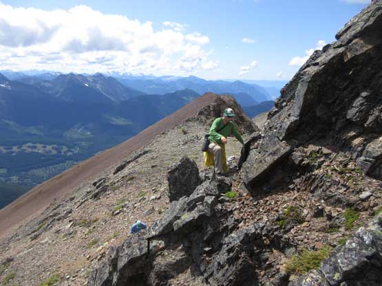
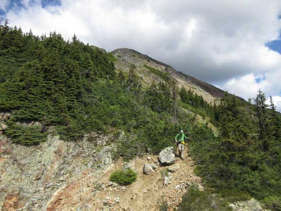
The ascent through the cut block was shitty as expected. What made it worse was the morning dew, that we all got soaked in short time. Thankfully the forest was dry and wasn’t very bushy. We picked up a game trail and found flagging here and there so decided to follow to see where it would lead us to. I vaguely remembered reading Simon’s trip report saying there’s a trail here and there even high up on Mt. Snider so this wasn’t to our surprise. The trail did more zig-zaggin’ than the absolute minimal but without the trail we would be dealing with a lot of bushwhacking in secondary growth forest. About 500 m elevation gain later we came to an opening on the ridge and stuck close to the edge for the next while, avoiding as much bushwhacking as we could. The next 300 m gain was shitty because of the loose rock and the steep grade but once pushing through the misery we were almost at the high shoulder on West Ridge of Tulameen Mountain. We took the second lengthy break trying to come up with a decision.
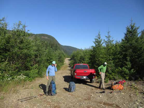
Taco parked at the road’s end.
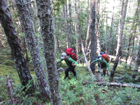
The start of the forested grunt wasn’t pleasant at all

After a long while this is Paul breaking out of the woods, temporarily

Macleod Peak to the south

More forested ascent. Not much bushwhacking anymore thankfully
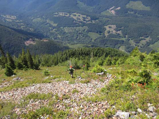
This stretch of hardpacked scree sucked
Mt. Davis behind in the background

Soldering on…

Alex with Mt. Outram, Mt. Hatfield and Macleod Peak behind

This is a closer look at Hope Mountain
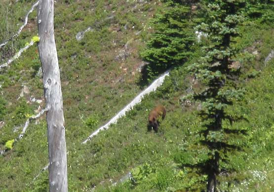
I don’t get to see bears often but there was one not far from us…

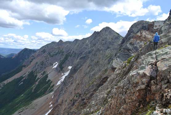
Alex heading for the high shoulder on Tulameen Mtn.
The day was young and the general consensus was to take advantage of the blue skies right now instead of waiting till the following morning. I voted to go for Tulameen Mtn. right away in the afternoon of Day 1 and carry on to as close to Mt. Snider as we wanted to set up camp, and everyone else agreed. I’m a big fan to push hard on Day 1 to make a shorter Day 2. There’s still a bit of ways to the summit of Tulameen Mtn. but we decided to ditch everything carrying only a water bottle. The challenge was how to carry the bottle but I found a way to clip it into my waist belt. It wasn’t comfortable but still better than carrying (and re-packing) the backpack. The grunt upward onto the first (false) summit was not pleasant with minor bushwhacking, but with good route-finding in micro-terrain it wasn’t too bad.
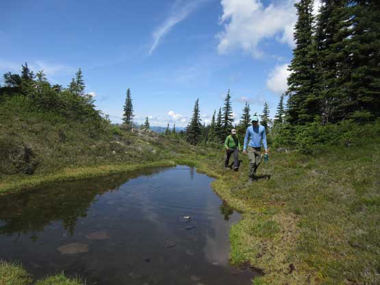
We found a pond but very stagnant and full of bugs

Started scrambling on the long long Tulameen’s west ridge
Alex working his way up
Me posing in front of the north face of Tulameen Mtn. Photo by Alex R.

Alex with the shaded Mt. Snider behind

Alex, Paul and Marius on the ridge.
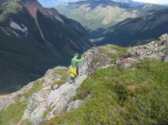
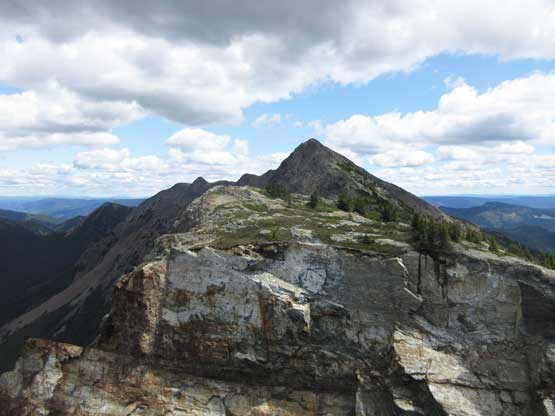
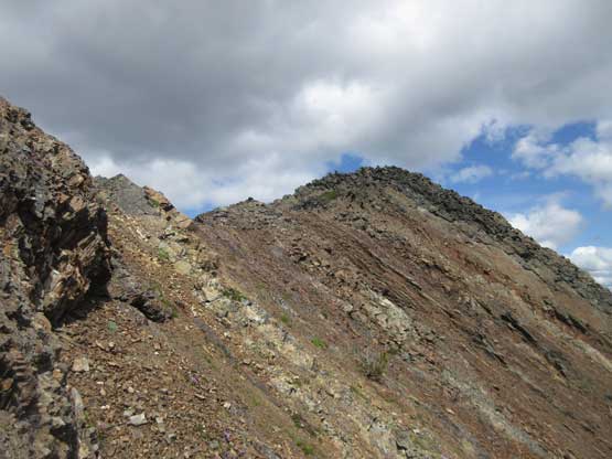
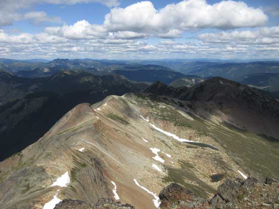
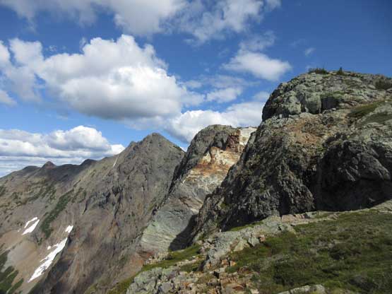
A deep notch marked the start of the summit ridge. We had to lose some elevation at the notch to bypass the obstacle and then there came the major false (west) sub-summit. I did do my homework before coming here and the decision was to bypass this west peak on some unpleasant side-hilling country. The side-hilling sucked with a lot of micro up-and-downs but I figured it’s still better than losing/regaining over 100 m elevation on 3rd class terrain.
There came the notch. West Peak behind

The notch was quite impressive…

Me leading a way around the south side of west peak. Photo by Alex R.
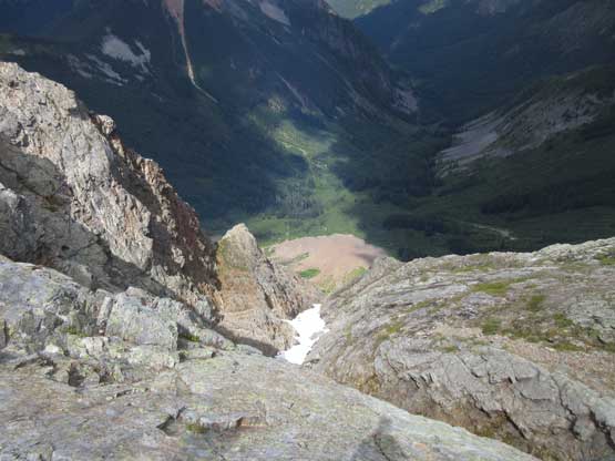
Looking straight down the north face. You don’t want to fall off this way…
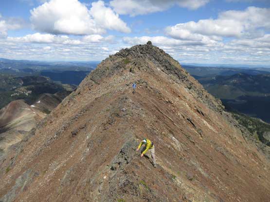
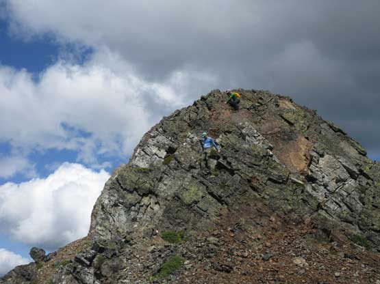
The final grunt towards the true summit started easily but became trickier near the summit. The terrain was 3rd class with lots of loose rocks and moderate exposure. The easiest way was to stick on the ridge crest even though it might appear steeper. I went around on climber’s right and had to down-climb an awkward 4th class slab corner to bypass another false summit pinnacle. Everyone went onto the top of this pinnacle and found 3rd class, albeit exposed terrain leading to the true summit. The cairn was huge. Someone had taken a shit right at the base of it…
Marching up the true summit with the west peak behind as a backdrop

A panorama shot from this stage. Click to view large size.

Me heading along the summit ridge. Photo by Alex R.
Alex following me trying to stay on climber’s right. Not the best way
I had to do a few tricky down-climbs on this side.

After a while this is me celebrating on the summit of Tulameen Mtn. Photo by Alex R.

Summit Panorama from Tulameen Mountain. Click to view large size.

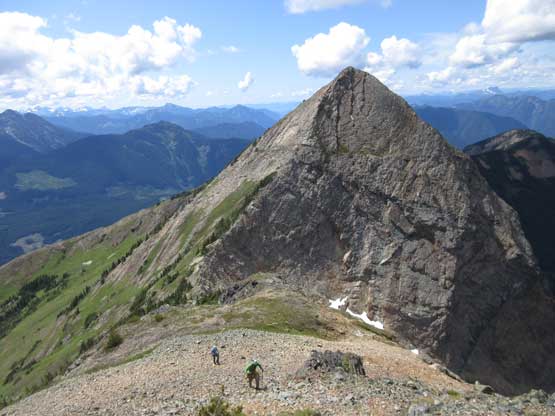
Alex and Paul arriving on the false peak pinnacle now

This is looking over the lower west peak
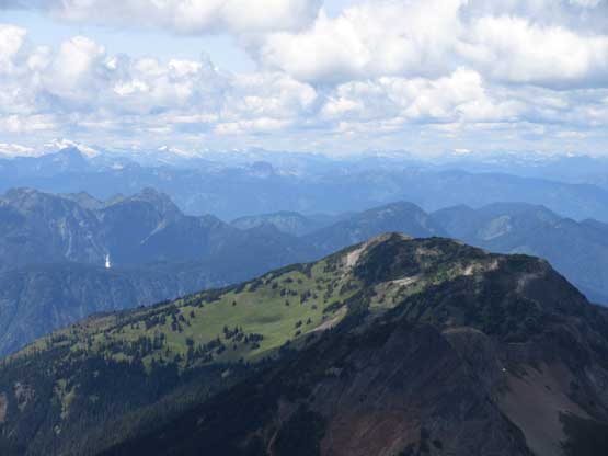
A bit of sunlight shown on the south slopes of Mt. Snider in foreground

The north face of Mt. Outram looked impressive

A very zoomed shot of Hope and Fraser Valley

Paul carefully working his way down the exposed 3rd class ridge

The Old Settler
Snazzy Peak (L) and Snass Mountain (R)

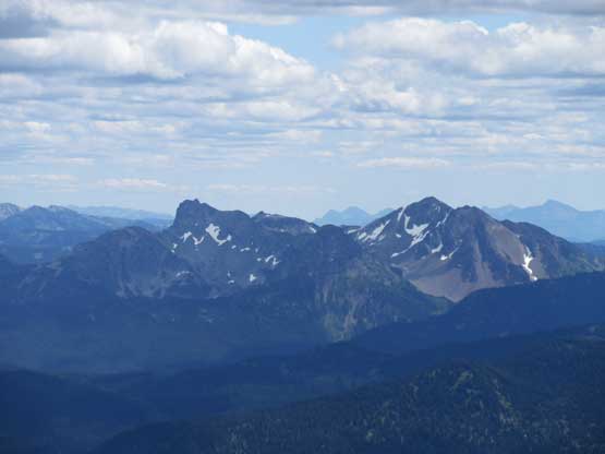
The double summits of Hozomeen Mtn. in front of the bulk mass of Jack Mtn.
This is looking down onto the NE side approach. Looks pretty straightforward
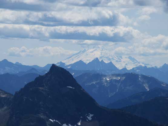
Mt. Hatfield in foreground in shade, with Mt. Rexford and Mt. Baker looming behind
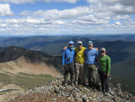
Our group shot on the summit of Tulameen Mountain

Me on the summit of Tulameen Mountain
We didn’t want to linger too long because of the pile of shit but did stay long enough for photos. On the way back we all stuck on the ridge crest and this way also made for better photos. I managed to pick a slightly better line traversing around the south side of the west peak avoiding almost all bushwhacking. The descent off the first false summit wasn’t as pleasant though as we entered some unnecessary bushwhacking due to not paying attention. I eventually just followed the GPS track closely to make sure we wouldn’t do more bushwhacking there. Back to where we ditched backpacks we were all tired so took another long break.
Alex scrambling back across the chossy 3rd class ridge
Paul down-climbing the false peak pinnacle

More about the walk back across the upper summit ridge

Descending the typical talus field on this peak

Me heading down with the west peak in front. Photo by Alex R.

A zoomed-in shot of Coquihalla Mtn. and Jim Kelly Peak
Alex back at the true/west notch

There were snow at this notch for water but not easy to access

Starting the long side-hill bash back around the west peak
More side-hilling…
The side-hilling isn’t over yet…
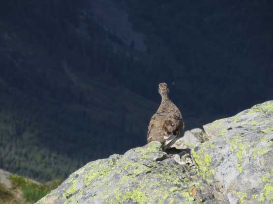
Chicken on the ridge.
The north face looks more impressive in the afternoon lighting

Another shot of the north face of Tulameen Mountain
The shoulder of Tulameen Mtn. wasn’t very nice for camping plus we still had a few hours before sunset so we had to press on. The decision was to carry over at least two bumps and camp high up on the SE Ridge of Mt. Snider.
