Ernest Peak (Lyell III)
June 26, 2015
3511m
Lyell/Mons Icefields, AB/BC
After 3 weeks in a roll of “physically easier” scrambling or rock climbing a high pressure system was finally forming up towards this past weekend and it was time to get back to mountaineering. Vern, Ben and I settled on a group of 5 remote 11,000er objectives, namely the Lyells. The down-side would be the record-breaking temperature all over southern BC with some areas approaching 40 degrees in the daytime high. We all had a big question mark for the snow condition but figured it’s usually not as bad as one would think based on experience. Obviously post-holing would be unavoidable and with the lengthy crossing of the Lyell Icefield we decided to haul snowshoes up – another decision that we weren’t 100% sure, but better safe than sorry… As usual we’d give multiple chances to attempt our objectives so booked 3 nights in Lyell Hut (quite expensive) and planned 4 full days. The particular peak-bagging sequence would be determined at the last minute based on our field observation, energy level and so on, but since I’m writing Lyell III (Ernest Peak)’s trip report first that’s gotta be the first one on our bag list. It appears like a formidable fortress or rock buttress from all sides and the standard route up its NE slope is an Alpine II steep snow climb with a bergschrund crossing (which can be challenging later in the season).
There’re 3 known approach routes for the Lyells. The most obvious one is a long bash up the Glacier Lake valley, well documented in Bill Corbett’s The 11,000ers book, but not the one we took. After doing that approach for the nearby Mt. Forbes a month earlier there’s no way I was going to do that “death march” again. Indeed, two easier options exist from the BC side. The longer of the two is via Icefall Lodge and then either Crampon Col (snowier conditions) or Trivoli Shoulder (drier conditions), while the shorter, but more scenic option is via the rim of Icefall Brook traversing high on Mons Peak’s west slopes on an obvious ledge system. (A big thank to Ray Cossette’s K7 Climbing for publishing their trip report). This is the one we took and apparently not many people are aware of this approach option. In my mind it should be the standard way up either Lyell or Mons Icefield.
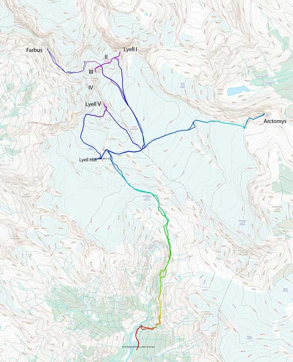
Approach and ascent routes for Lyells 1, 2, 3, 5, Farbus and Arctomys. GPX DL
The problem with the BC side approach is the complicated driving including roughly 94 km on logging roads. I’ve been on the Bush River FSR previously for Mt. Alexandra (last September) and then Mt. Bryce (earlier this year in May), and this time we’d leave the main road earlier after kilometer 68 onto the decommissioned Valenciennes River FSR. The 24 km of driving on this road was very rough and dangerous. There’s many challenges including 3 major cruxes – a collapsed bridge, a door-deep fast flowing river/swamp section and then a very washed out creek crossing. It’s a ballsy decision to tackle them with Ben’s SUV. It simply does not have the required clearance even though it’s 4×4. Thankfully we negotiated one crux after another and got to the trail-head by 9 pm on Thursday evening. There’s another truck parking at the same place which looked awfully familiar – it turned out to be the local legend Trevor Sexsmith going for Mt. Forbes (skiing the N. Face) with Ian Holmes. Small world!
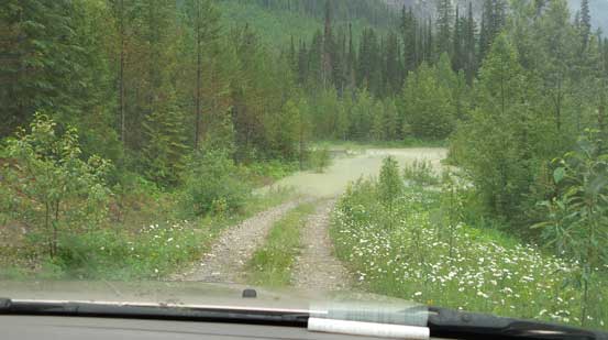
The first creek crossing is just a warm-up for Ben’s SUV…

Now comes the first crux… That collapsed bridge…
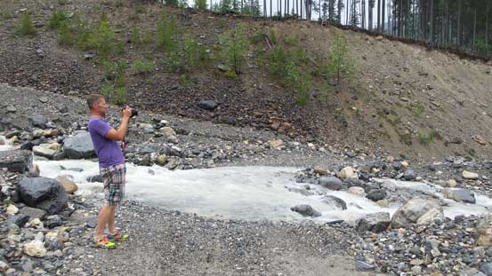
And here’s the second crux – the swamp/lake crossing…
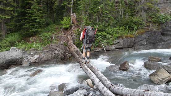
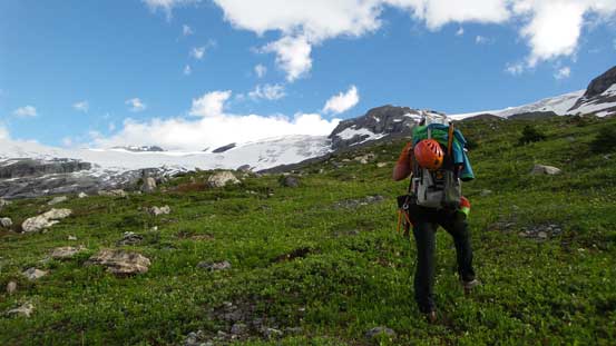
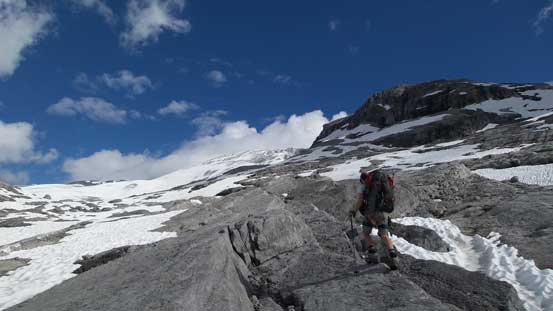
Due to the heat we figured it’s better to knock off as much elevation gain as possible before the sun really came out, so we woke up at 4 am and started half an hour later (car camping). The initial approach followed the rest of this logging road for another 1 km or so to a “big bend”. En route we passed a complete wash out using a log bridge to cross a raging stream. After the bend we ventured into the bush staying on the climber’s left side of an obvious drainage. We thought there’s a trail nearby but didn’t bother to find as it’s very easy travel. We pretty much went all the way to where this drainage narrowed down and then found the trail cutting sharply into the trees. The trail was in a better shape than expected. Though steep, it’s easy to follow and we gained height very quickly and shortly after we were on the key ledge traverse, and the trail seemed to continue onto this traverse.
There’s a couple tricky parts near the start with some exposure on down-sloping terrain. One of them was actually bolted (I bet the guides do bring some inexperienced hikers up there)… We lost the trail briefly (stayed too low) but realized our mistake soon and regained the trail. Then it led us into the forest again which was a dramatic change in scenery. Some easy hiking in the forest we came to a critical intersection – a log bridge. Without detailed instruction we naturally went over the log bridge and soon the trail started to disappear… We were then punished by half an hour’s miserable bushwhacking. On the way down we stayed high above the vegetation, crossed that creek and went straight down on climber’s right side which proved to be a much better choice. But either case it’s not a huge deal. Out of the forest we got to see the terrain ahead – easy and very scenic as advertised.
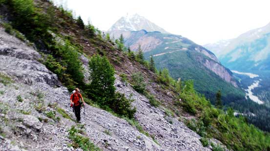
Vern traversing on some down-sloping terrain at the start of that ledge

Looking back we were impressed by Arras Mountain and Icefall Brook valley

There’s some hard work to cut this trail through the krumholtz field…

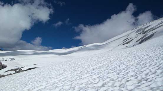
Typical terrain

Arras Mountain and its banana shaped couloir.
We crossed this log bridge by mistake. Should have gone straight up to exit the trees

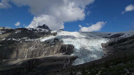
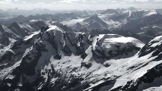
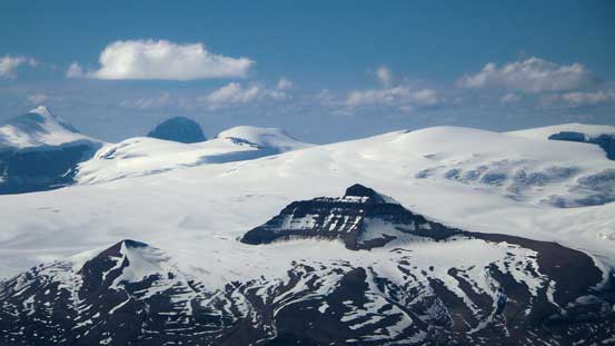
The Lyell Icefield draining the Icefall Brook
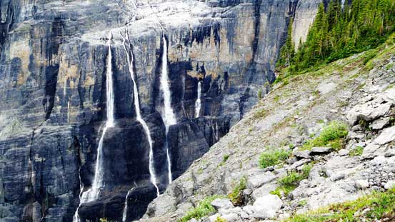
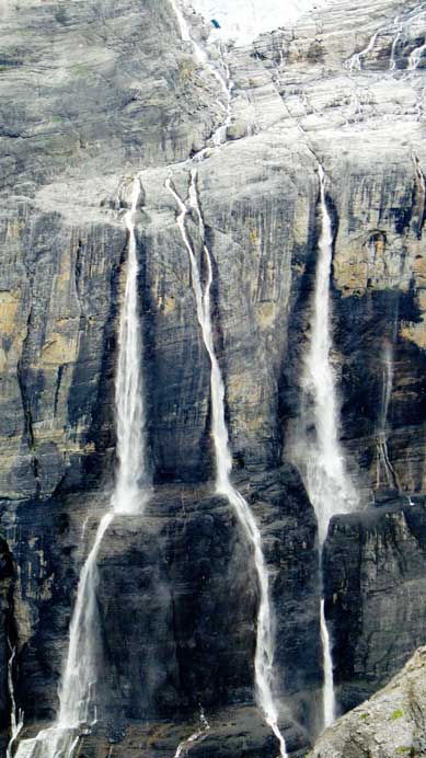
Here has some of the best waterfalls I’ve ever seen in the Rockies

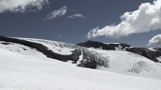
The seracs on Lyell Icefield
Another picture showing the icefall plunging hundreds of meters down

One of the many small creek crossings
Another picture of the Lyell Glacier
Traversing easy grassy terrain – would be a prime bivy spot too.
After traversing on some easy ground we came to a large moraine feature. We ascended it on climber’s left side and then a long way up its crest before dropping down the far side. Soon after that we found (surprisingly supportive) snow and utilized it for a long ways up to a set of beautiful lakes, which I believe was once or twice used as ACC base camp. We circumvented the two lakes on its left side and then either scrambled easy slabby ground or on snow to gain the edge of Lyell Icefield. The views were amazing in this section with the banana-shaped couloir on Arras Mountain as well as the sexy summit pyramid on Mons Peak stealing the show.

Looking back

Vern ascending the crest of that moraine

Fossils
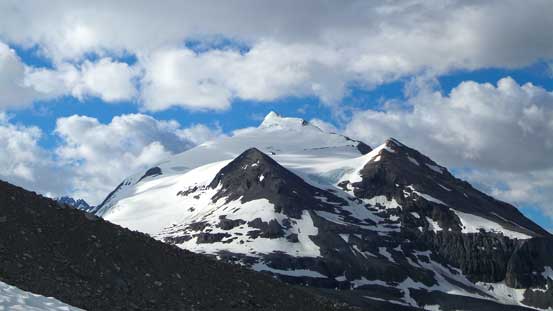
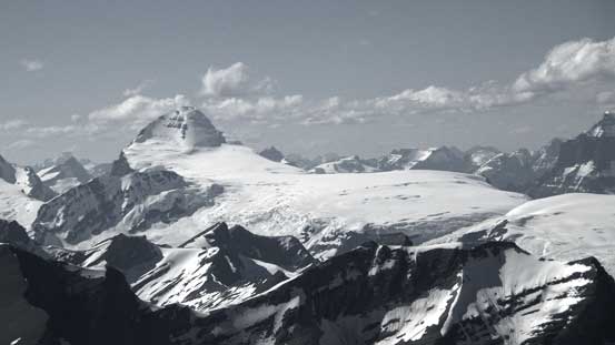
Mons Peak stealing the show. You can see the summit pyramid that we climbed via the left skyline
Snow greatly assisted our ascent

One more picture of the icefall

The first Lake
We ascended easy slabby ground
More of the hike on slabs
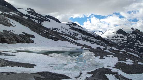
The second Lake – campsite for the big ACC group years ago
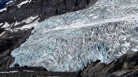
A zoomed-in view of the Lyell’s icefall
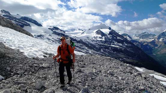
Vern enjoying the approach

The views were simply kick-ass!!
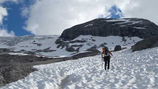
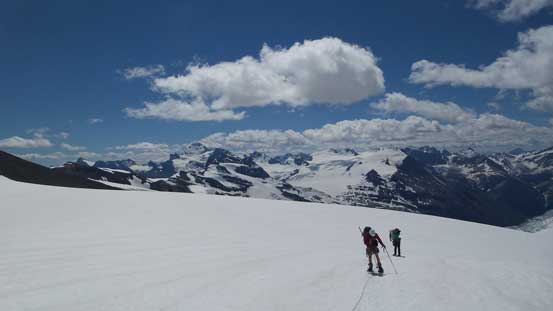
Finally onto the Lyell Icefield
We geared up and strapped snowshoes on (finally could ditch some weight after hauling them for hours)… At this time of a year the Lyell Icefield was very easy to navigate but the initial part was a bit painful with snowshoes due to side-hilling terrain. It was very twisty on our ankles but oh well, it’s still better than post-holing. Once it made sense we started to aim directly towards our destination – Lyell Hut on a rock buttress. It didn’t look very far away but as usual for glacier travel the view was very foreshortened. It took us a very long time to get to the base of that rock buttress and to gain the buttress we had to gain and lose some height on climber’s right side – a tedious process especially considering we had to do it multiple times in the next few days.. Our approach time was 8 hours. The Hut was well built and provided a comfortable shelter for us – our home for the next few days.
Side-hilling wasn’t very pleasant
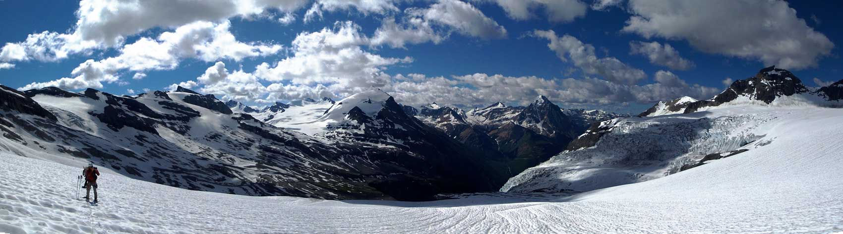
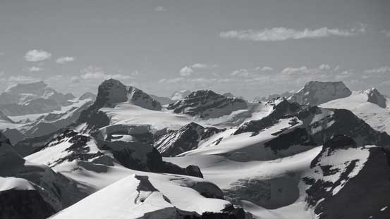
Panorama from Lyell Icefield. Click to view large size.
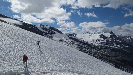
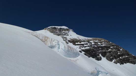
Scenery on Lyell Icefield
It’s a long grind to Lyell Hut
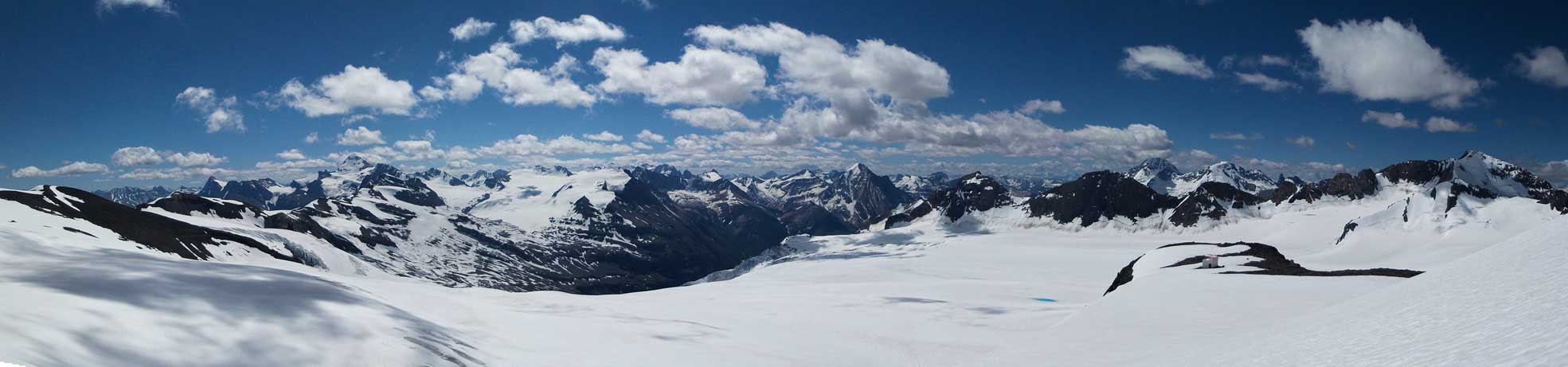
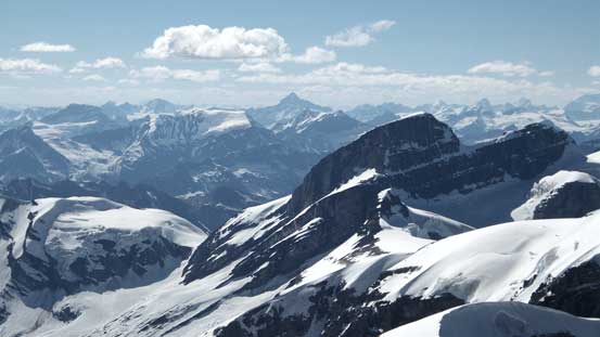
Panorama from the big hill just before the Hut. Click to view large size.
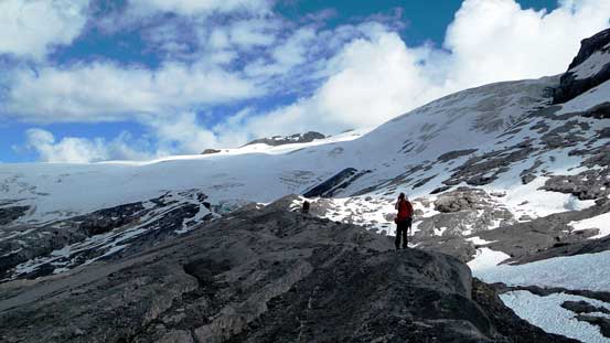
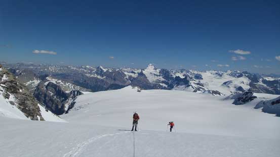
It’s only 12:30 so we had roughly 10 more hours of daylight time. As usual for my trips that doesn’t mean we’d just sit in the hut doing nothing. In fact we had to bag the peaks then as 10 hours was more than enough to give some of the Lyells a realistic shot. I was considering just Lyell V but Ben asked why not going for Lyell I, II and III… I guess yeah, why not.. So an hour later, off we went. To access these three Lyells we had to firstly cross over to the Alberta’s side of the Icefield. Based on our research there’s a couple options but we chose the longer, but safer one. We basically snowshoed all the way around the broad southern extension ridge/plateau of Lyell V before dropping some height to the Alberta’s side. After that it’s an easy, albeit long and foreshortening plod to the base of Lyell III/II. The ascent to Lyell III/II col appeared to be steep but actually not. There’s numerous large crevasses en route but all filled in. With snowshoes on the crevasse crossings were relatively straightforward.
Around the broad shoulder of Lyell V we got to see the 5 Lyells
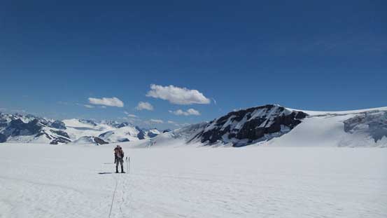
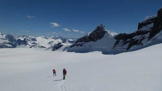
The typical slog across Lyell Icefield
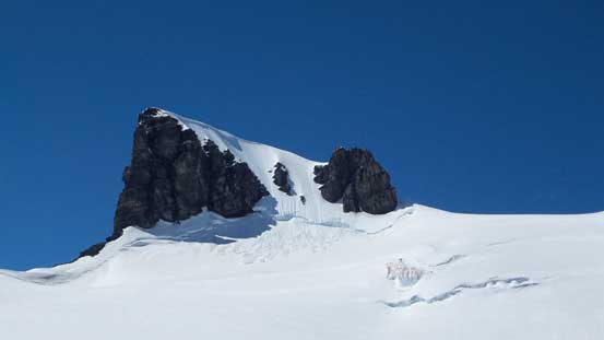
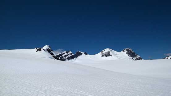
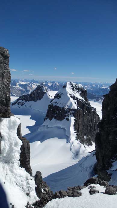
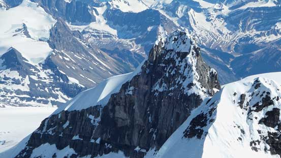
Lyell III – our first objective
Ascending steeply towards Lyell II/III col, looking towards Lyell II
Ben and Vern on the icefield
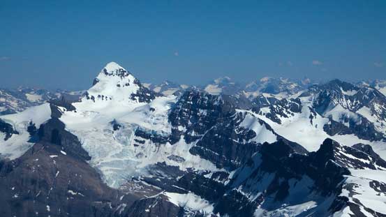
The impressive Lyell IV and Lyell V
Almost cresting the high col. The mighty Forbes behind
Cresting the col we got a head-on view of the Columbia Icefield
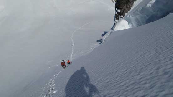
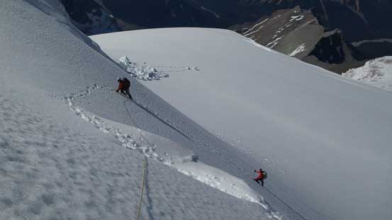
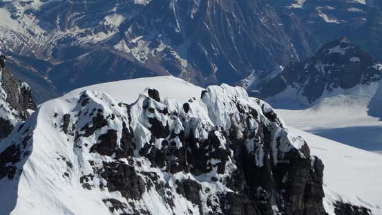
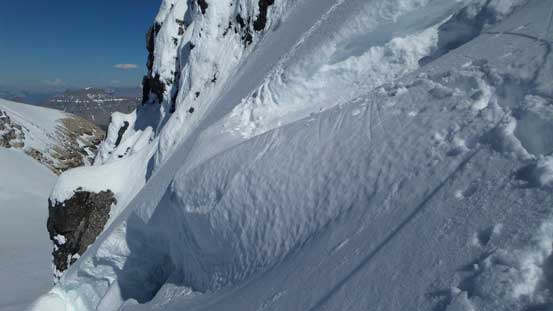
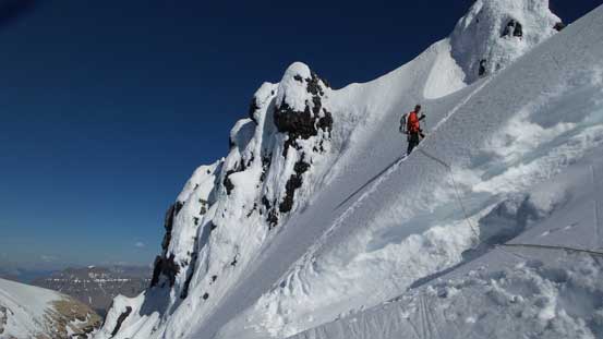
The ascent slopes on Lyell III appeared very steep leading towards a broken bergschrund. After ditching the snowshoes and switching gears to crampons and ice axe we started the ascent. The snow was quite soft at this time of the day (makes sense given the heat) but not too bad. Near the ‘schrund I figured there’s two ways to cross. Based on my memory I knew some other groups ascended relatively to the climber’s right but that bridge looked too thin for my like. Instead I realized the bridge just to my left appeared a little bit more “solid”, so went for it. I still plunged my right foot into a crevasse but managed to cross over without too much of a trouble, and after that I gained the steep slope above on some soft, knee-deep post-holing snow. Once the terrain levelled out I gave Ben a simple boot-axe belay, and Ben gave Vern an axe belay, just to be a little bit safer on the ‘schrund.
Starting the snow climbing
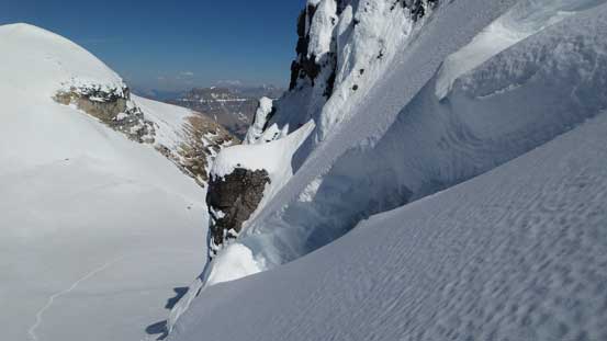
There’s monster sized crevasses
Ben and Vern and the bergschrund
Here’s the view of the North Ridge of Lyell IV…
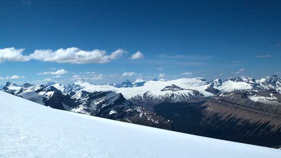
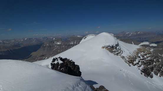
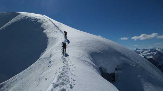
Now we were focusing on the final ascent towards the summit. It still wasn’t easy at this point with some exposure but nothing terribly hard. The summit ridge traverse was a bit longer than I thought especially with the post-holing but once topping out on the apex we got treated with one of the finest panoramas the Rockies offer. The view down towards the intimidating N. Ridge of Lyell IV would likely take your breath away, and not mentioning the sea of peaks into BC Rockies, the Columbia Iceifield towards North and Mt. Forbes sticking out like a white tooth towards South.
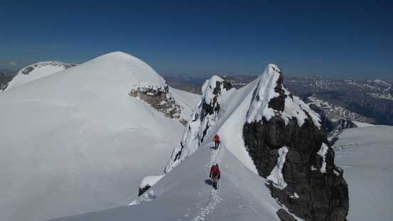
Cresting the summit ridge, looking back at Ben and Vern on a narrow section
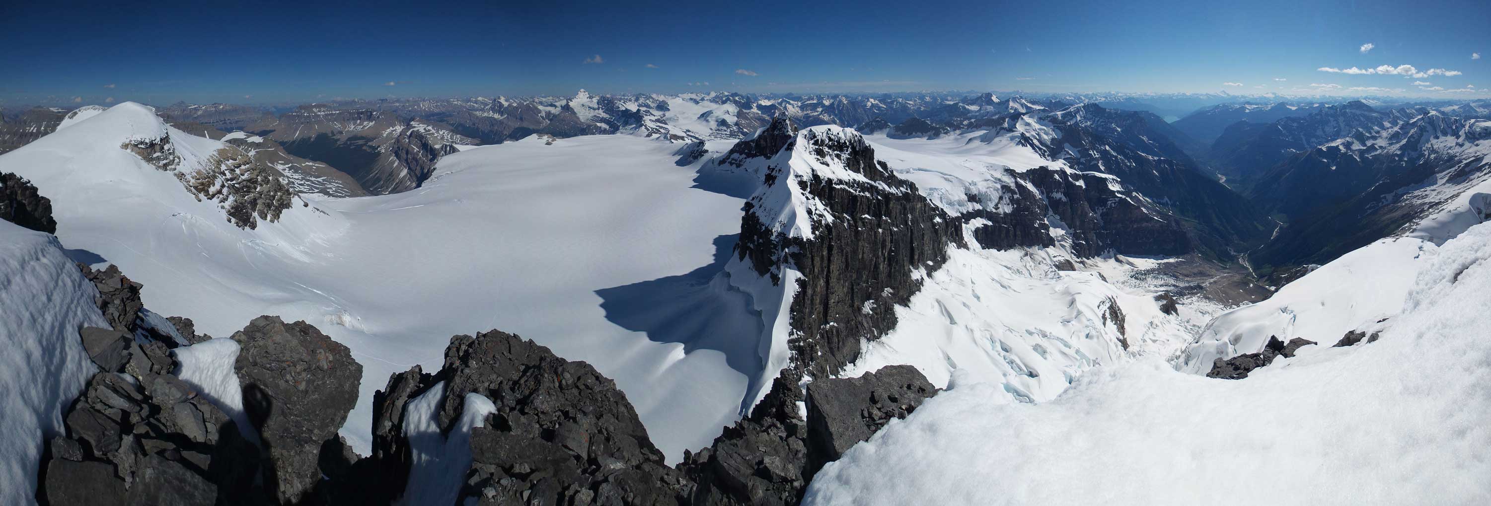
Partial summit panorama from Lyell 3. Click to view large size.
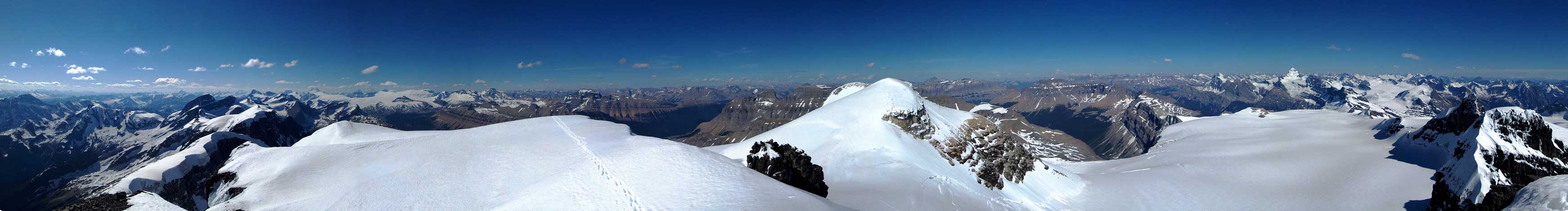
Partial summit panorama from Lyell 3. Click to view large size.
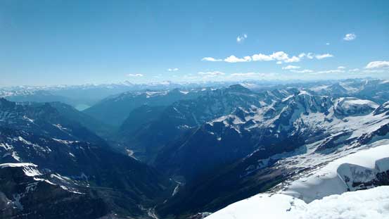
The Lyell Creek valley and BC Rockies
Rostrum Peak and Icefall Peak on Bush Mountain massive
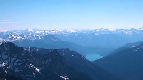
We could also see Kinbasket Lake at more than 2500 vertical meters below
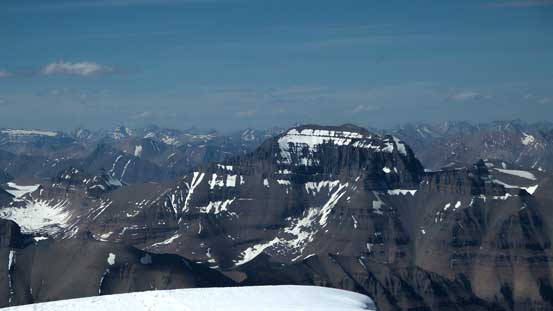
Whiterose Mountain doesn’t look impressive from here
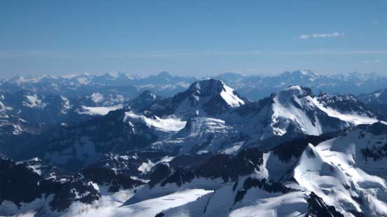
Mt. Alexandra which we bagged last year. Behind is the sexy Tsar Mountain
Mt. Bryce which we bagged earlier in this year.
Mt. Columbia – another 11,000er that we bagged earlier this year
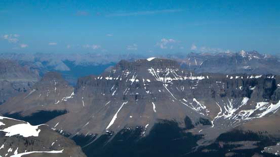
Castleguard Mountain looks tiny – it’s my first peak on the Columbia Icefield

Andromeda and Athabasca – the classics
Mt. Saskatchewan – a near-11,000er. Have to go up there and check it out…

The mighty Mt. Cline rises behind the massive Mt. Wilson – bagged them both two years ago
Mt. Erasmus is apparently a difficult climb

Howse Peak left of center rises behind Mt. Outram
The mighty Mt. Forbes that we bagged a month ago

Peaks on Freshfield Icefield rise behind peaks on Mons Icefield
The very snowy and out-of-shaped N. Ridge of Lyell V

Arras Mountain
The “broken tower traverse” on the S. Ridge of Lyell IV – looks very snowy too…
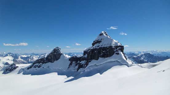
Lyell II and Lyell I – our next objectives
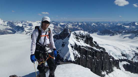
Me on the summit of Lyell III, my 29th 11,000er!!
Since we still had two more 11,000ers to ascend and it was getting late in the day we had to hurry up. We still gave each other an axe belay while descending the bergschrund but the process was relatively quick. Shortly after we all got back down and strapped snowshoes on.
Descending the summit ridge
Oh here’s that gigantic bergschrund
Vern ready to descend the ‘schrund

Looking back at our tracks from Lyell 2/3 col
Now it’s time to focus on our next objective – Edward Peak (Lyell II). It’s the highest in this group but also the easiest. The ascent appeared nothing but a straightforward snowshoe slog..
