Sirdar Mountain
October 24, 2014
2804m
Jasper, AB
Ben and I had been talking about giving Sirdar Mountain a try for more than a year already – at elevation more than 2800-meter it’s the highest peak in Colin Range, and one of the most prominent peaks in its vicinity. However, just like most of the Jasper mountains there’s no route information available on the Internet and our only reference was Liam’s words. He described it as “a scree slog” so we figured it should be a good late-season objective. But on the downside, the lengthy approach including uncertainties in the bushwhacking section combined with the short daylight time in October would make it a fairly demanding day.
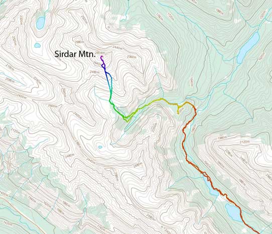
Sirdar Mountain scramble route. GPX DL
This past Friday seemed like a reasonable day especially given the gloomy forecast over the weekend. Forecast for Friday wasn’t the greatest neither, but at least more reliable. We figured if there’s any chance to bag a “worthwhile” objective it had to be on Friday. Checking webcams we saw snow accumulation already in the alpine but not so much in the valley bottom. Our choices were once again, limited to long but technically easy objective and among the few options we decided on Sirdar Mountain. However, weather always had other plans… The forecasters did a last-minute downgrade but by that time we already made to Hinton. And once driving into the mountains we got hit by rain and snow storms, sometimes quite heavy. It was quite a demotivating drive so we slept in on Friday morning.
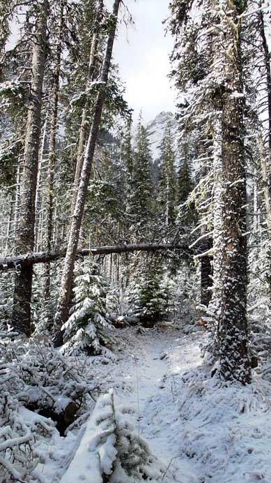
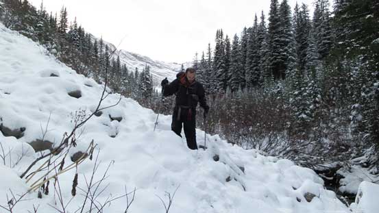
At about 8:30 am we woke up with at least 20 cm fresh snow on the ground. The rain/snow did stop but the sky was still overcast, and bigger peaks were still soaked in. Oh well… It was slow going and eventually by almost 9:30 am we started our day. That was a very none-alpine start for such a long objective. The initial 9 km or so was following the well-maintained Jacques Lake trail. Jacques Lake is a very popular backpacking destination in Jasper and starts near the south end of Medicine Lake in Maligne Valley. This was my first time visiting it and the surrounding mountains really reminded me Opal Range in Kananaskis – steep, slabby and jagged.
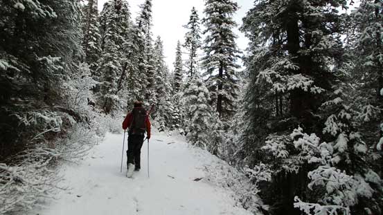
Hiking on Jacques Lake Trail. Continuous snow from the start!
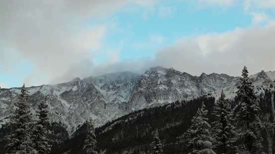
Typical rock formation in this area. Very similar to Opal Range in K-Country

Arriving at Beaver Lake.
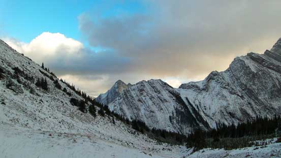
A typical view from this 9-km approach trail.
The trail got narrower
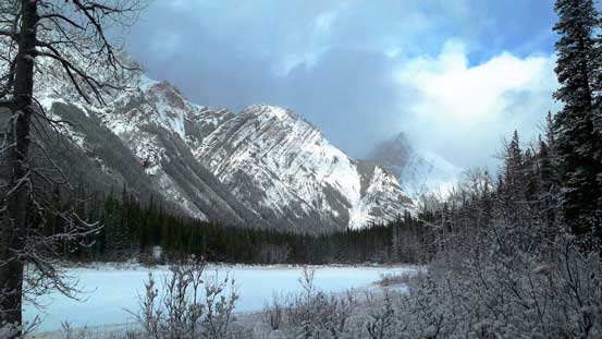
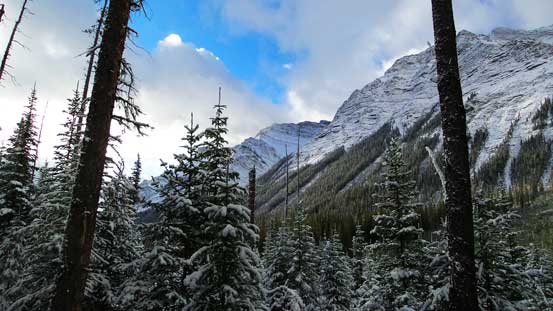
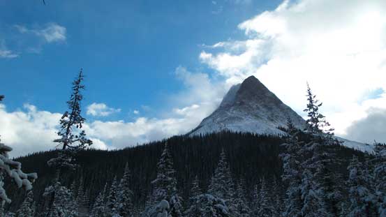
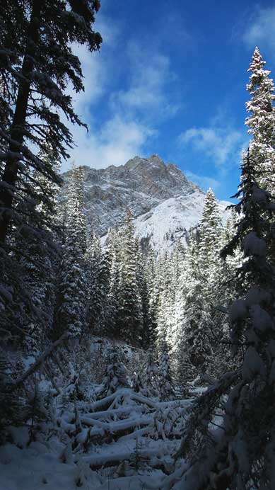
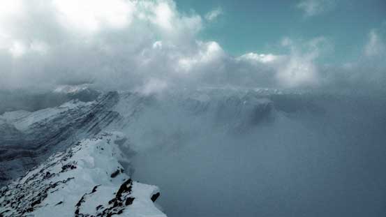
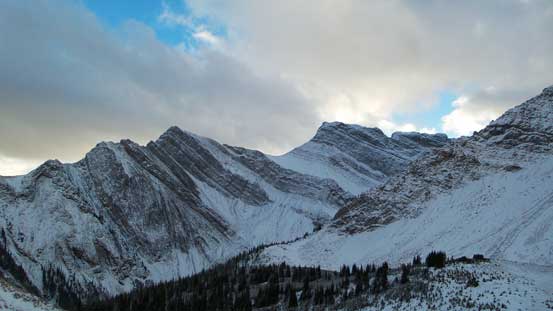
Occasionally we could see our objective (peak in background), but mostly it’s soaked in clouds.
Most of the impressive peaks nearby are unnamed though.
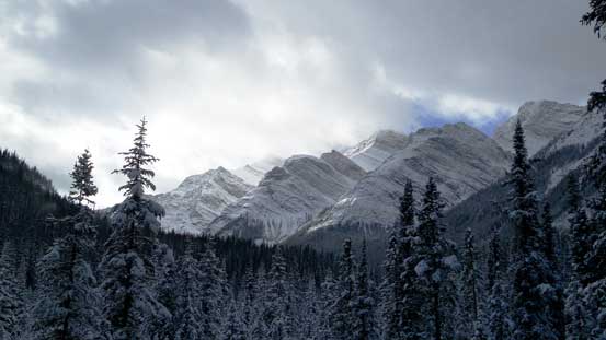
Another view of peaks on Colin Range. As far as I know none of these are named.
Time fled by fast while hiking on a well-defined trail. In less than 2 hours the trail started descending towards Jacques Lake and here’s where we started the experimental part of this lengthy approach – the bushwhack. I’d divide the bushwhacking into 3 stages – the first stage from Jacques Lake Trail to an unnamed side creek; the second stage following this side creek up; the final stage ascending steeply up a hanging valley to the base of Sirdar Mountain. The overall bush density wasn’t horrible but each of the three stages had its own challenge and combined with the fresh snow it made some miserable and challenging travel. For the first stage it was the navigation. Before we realized we already did a 180-degree U-turn and we mistakenly thought Beaver Creek Valley (where we approached from) as the ascending valley. Thankfully I did a quick GPS check and corrected our bearing.

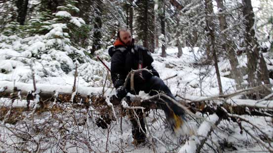
Starting the bush.
The second stage had the most dense bush. Following this creek up started easily but became quite difficult once it steepened. We stayed on climber’s left side of the creek and had to overcome snow covered alders on steep and side-hill terrain. In retrospect it might be easier if we crossed to the other side lower down but doing so would require strapping crampons on to cross a sketchy log (or stepping on snow/ice coated rocks while risking slipping into the creek). I was too lazy to take out my crampons so led the way keeping charging on the left side. Eventually the creek banks did flatten out and soon we found a reasonably place to cross the creek, and then followed it upstream for another 800 m or so (with much easier bush).

The creek started easily. We stayed on its left side.
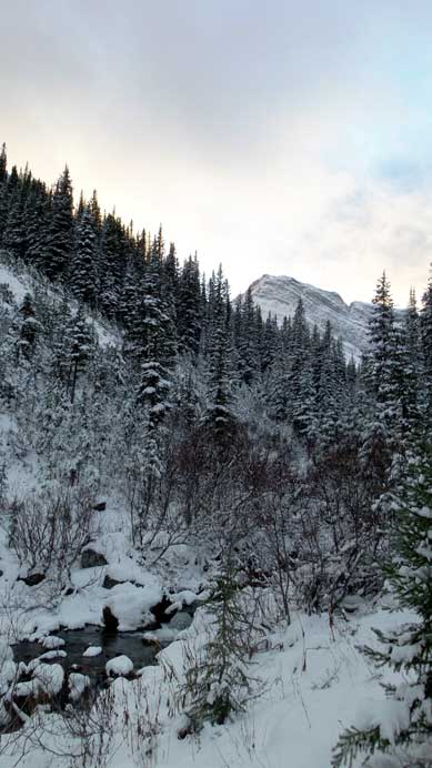
The mighty Sirdar showed up again.

This is the typical bushwhacking along 2nd stage…
Now came the third stage. According to my GPS we had to ascend steeply up climber’s right side into a hanging valley at the base of our objective. We made a mistake following too closely to a stream, and this led us to some very steep forested terrain. The new snow made ground extremely slippery and we had to grab grass and tree branches to pull ourselves up against gravity. In retrospect we should have strapped crampons on here (as discovered on return), but pulling up tree branches also worked. Ben’s hiking shoes performed poorly on this type of terrain but my mountaineering boots did a reasonably good job. Just when we thought the bushwhacking was almost over we entered a field of krumholtz near treeline. With fresh snow it was very miserable… (Thankfully I wore both rain jacket and rain pants otherwise I’d get soaked in no time).

Ascending a section of near-vertical forest.

We had to grab whatever we could to haul ourselves up this slippery slope…

Gorgeous view looking back though.
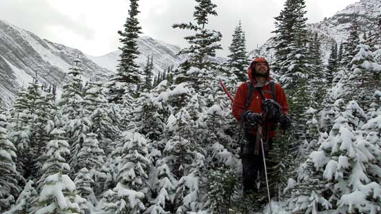
Oh the krumholtz… We had to bash a long section of these. Got soaked in no time…

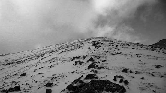
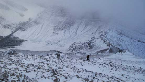
Finally could see our objective. Believe me or not it’s 800 m height gain from here…
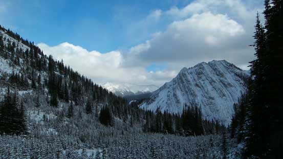
Another view taking advantage of the temporary blue sky. Note the young trees in foreground.
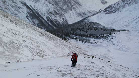
Up until now all we did was just getting to the base of this mountain. The actual ascent didn’t appear to be that big, but from treeline to the summit we had almost 800 m to go thank to the foreshortening view… Remember that we had to get higher than all of the nearby peaks. Oh well.. The ascent did appear easy but wasn’t quite a “scree slog”. There was lots of moss and grass on the lower part to deal with and with fresh snow it was again, very slippery especially for Ben wearing his hiking shoes.. That wasn’t bad compared to the wind though. We had to bash against gusting wind that could knock our feet off ground, and with the ice crystals smashing on our faces as well as the deteriorating weather it was absolutely horrible. We also encountered some slabby sections on the ridge that forced us to detour either right or left. We went climber’s right around the first major obstacle but that dumped us into some deep snow. Sometimes it was knee deep post-holing and our pace got slowed down significantly. Around the second obstacle (near the summit) we went climber’s left, but on this side we had to deal with very slippery rocks. Nonetheless with good perseverance we made to the summit, 6.5 hours after leaving our car. It was cold, windy, blizzard and near white-out, and it was getting late (4 pm) so we had to immediately focus on getting off this mountain.
Starting the ascent – slippery moss. It wasn’t bad on mountaineering boots, but Ben really picked the wrong footwear for this trip..
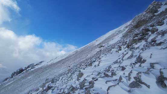
Long and foreshortening slope.
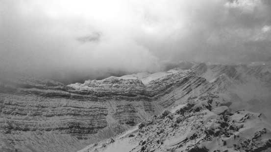
This impressive wall is part of Sirdar. And yes, we had to get higher than it.

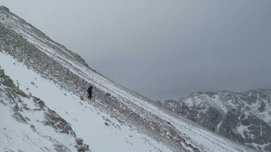
Could see the summit way in the distant. It also shows the wind…
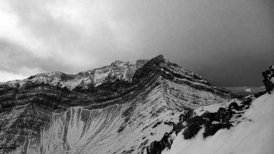
This peak is connected to Sirdar by a high col. It also doesn’t have a name.

Detouring to climber’s right to bypass a slabby section. Knee deep post-holing here.
Back to the ridge, immediately we had to detour climber’s left.

Battling against the wind.

Weather temporarily cleared again!

The summit is within touching distance now!

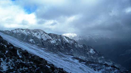
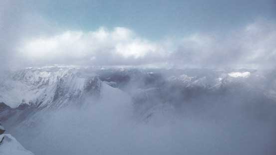
All the impressive peaks we saw earlier in this day was way below now!
Ben on the final slog.
As much as the view we got looking into the front-country.
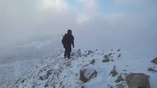
Ben arriving at the summit.

Me on the summit of Sirdar Mountain
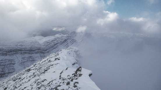
Clouds were forming on the north side of this peak.
Same as above.
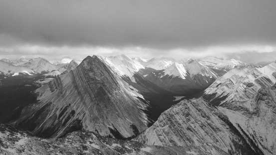
We were much higher than the peaks on Colin Range.
On the descent we initially stayed on the wind-blown side but soon we realized those slippery rocks were just as hard to descend as on the way up. So we quickly bailed to the wind-deposited side and opted for more post-holing. That wasn’t fast neither but at least easier on our knees. By going down this (skier’s left) side we naturally entered a major gully that provided us a continuous snow line almost all the way back to treeline (thus, avoiding the steep moss part). On average it was knee-deep post-holing but given the down-hill factor it wasn’t too bad.
Descending

A view from the descent
A zoomed-in view of peaks on Queen Elizabeth Range.
Almost down to treeline now. These peaks started looking big again.
Could already see some orange colours on the clouds. It was getting late.
Back into the trees we made the call to retrace our footprints exactly except for the steepest section. There’d be lots of bushwhacking and lots of side-hilling but we figured it’s better to go with terrain we already knew. The steepest part would be very difficult to descend even with crampons so we had to find another way. We basically continued down our ‘rib’ using common sense and avoided any section that’s near vertical. It was still very steep though, but with crampons on we felt pretty safe. Once joining our tracks again we had to hurry up in order to get back to trail before headlamp time. At about 7 pm it started to get very difficult to see our tracks without headlamps on but at this point we were only about 20 minutes from the trail, so that was okay. Worst comes worse we could use GPS to navigate back so I wasn’t concern about the darkness.
Bushwhacking with crampons on.
Down to the creek
Now, follow our tracks out.
Now the rest would be simply putting one foot in front of another, for 9 km back to the parking lot. We made a “mistake” talking about dinner options and as a result, we started racing back. We managed to maintain a 5-6 km/h speed and got back by 9:30 pm, exactly 12 hours after leaving our car in the morning.

Night scene from Jasques Lake trail. Photo by Ben
Overall, this was a satisfying ascent, but certainly not my favourite. There was lots of unpleasant terrain especially with fresh snow and I really wished we had better views. But on the upside I’m really glad we made the summit, and sometimes that’s good enough. Not sure if I’d recommend Sirdar Mountain but if you like those rarely-ascended peaks but don’t mind quality suffering then this could be a good choice. Even that I’d suggest staying a night at Jacques Lake to make your approach or return easier.
