Mount McGillivray
June 27, 2013
2450m
Kananaskis – Exshaw / Bow Valley, AB
I thought that Kananaskis was out of reach after probably the most serious flood in Alberta’s recent history, until seeing a message from Travelin’ Jones (Neil) asking if I was interested in either Mt. McGillivray or Mt. Cory. Of course yes! I haven’t done a trip with Neil since Mt. Bryant last year. A quick check revealing that Highway 1 was open already, and that meant I would have no problem driving to Canmore. It was such a last minute decision, and I quickly packed all the gears, and headed out of Edmonton at 10 pm. However, just after passing Red Deer, I saw a big slogan saying Highway 1 got closed between Highway 40 and Canmore… I hoped that it was them wrong, so I kept driving, and thankfully the highway was indeed open, single lane though. It was 2 am when I got to Canmore.
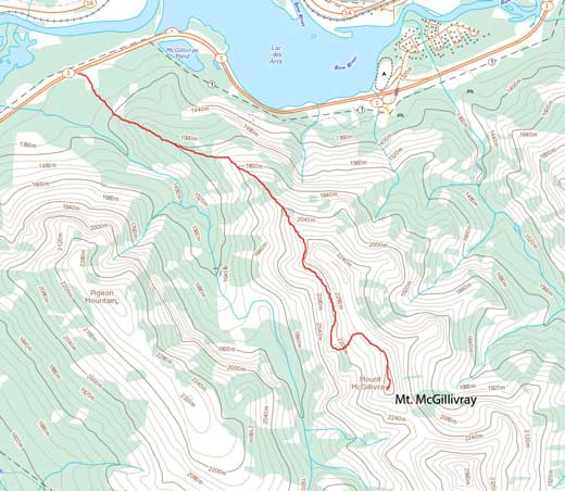
Mt. McGillivray scramble route
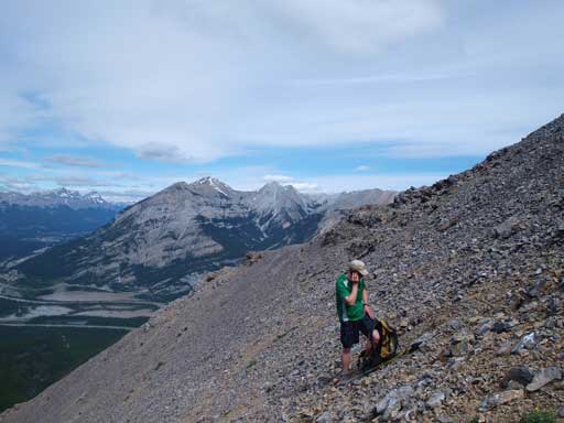
Due to the great weather forecast, we felt like an early start wasn’t necessary. The trail-head is more obvious than I thought would be, and we had no problem locating it. It’s also the trail-head for McGillivray Canyon if you know where that is. After following an old road in for a couple minutes, we started the bushwhacking. The worst bit was near the beginning. You probably want to find a weak spot otherwise the first 50 meters or so would be very miserable. We did locate a thin spot. The bush was generally not bad. It’s a typical Canmore styled open forest. We managed to stay climber’s right to avoid the mossy ground in the shady spots. At lower section the trail wasn’t obvious, but higher up we came across a quite well-defined trail that probably came from near Lac des Arcs (not sure though).
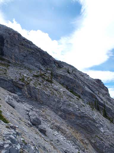
There’s one treed bump to go over, and from its top we got a view of the north buttress which looked farther than we thought. One wouldn’t expect this mountain to be a far way in, but it is. It is much further in than we expected. After 1.5 hours trudging in the forest we finally got closer to the base of north buttress. Here, we followed Nugara’s direction to side-slope towards climber’s right. My suggestion is to get up to the base before turning right. The first side-sloping section was very short, but once around a corner, the most tedious was just about to come. Across the first bowl was the worst part since there wasn’t an obvious trail to follow. We generally stayed higher up along some rocky ledges which was still tedious but better than just scree.

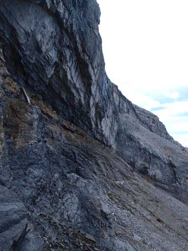
Depends on how lucky you are, you might have to deal with this…

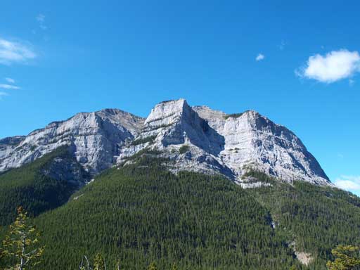
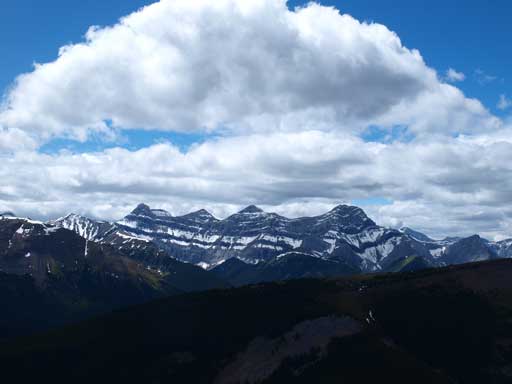
A look at Grotto Mountain
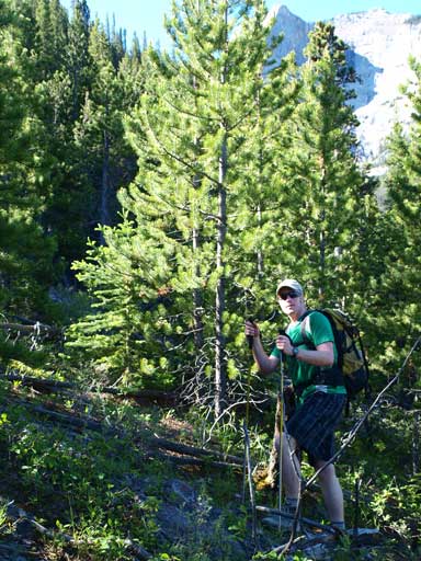
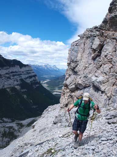
Neil hiking up the forested slope
Pigeon Mountain looks quite impressive from this side.
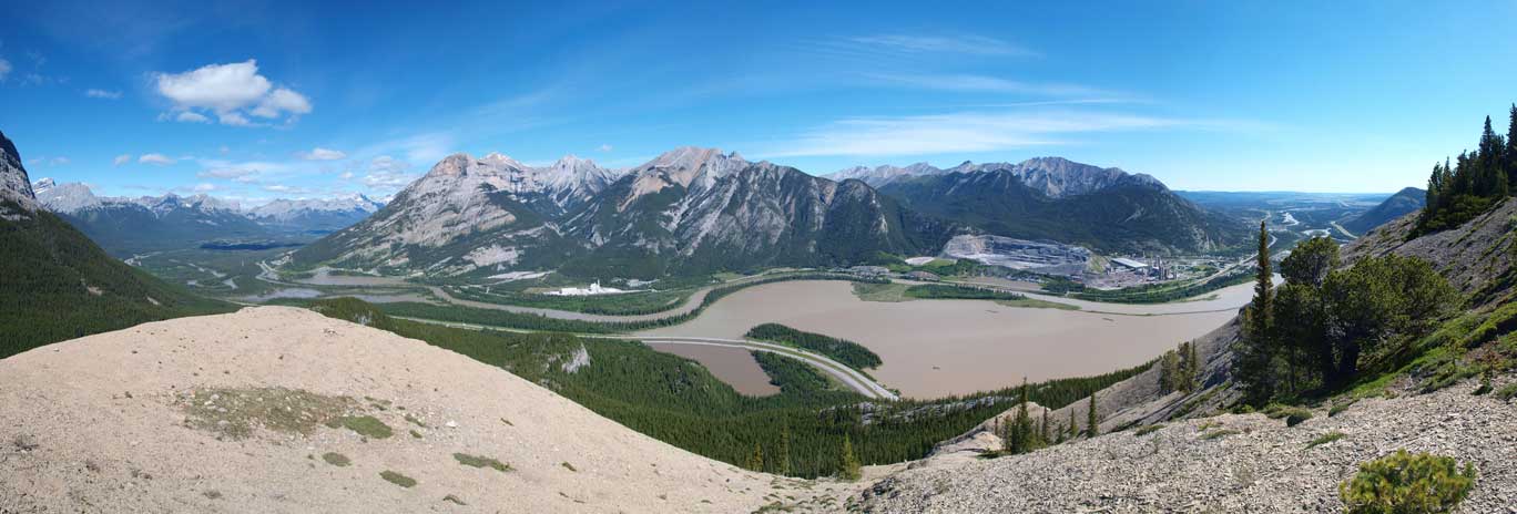
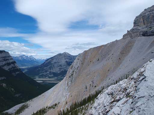
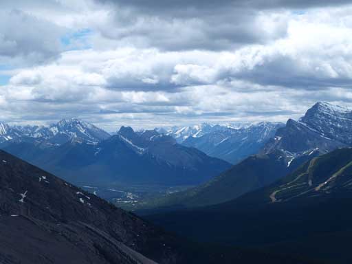
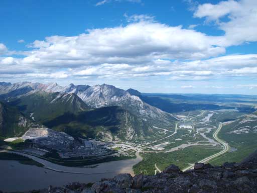
Panorama of Bow Valley. Oh look at the colour of Lac des Arcs…

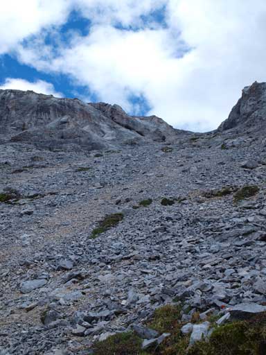
You need to go all the way up to the base

Another photo showing the gorgeous weather
The side-hilling started here…

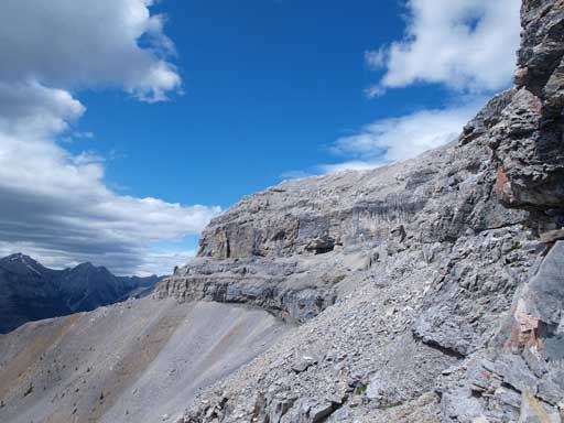
Any route would work. Red dots show our route.

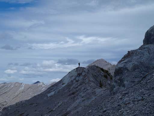
Near the end of first side-hill traverse

Neil traversing around the last corner
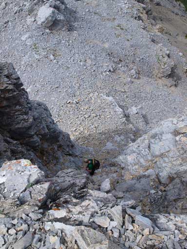
Once around the next corner we finally could see the major scree bowl and the distant summit. Here according to Andrew Nugara, we had two options, the difficult route and the easy route. We decided to go for the difficult route, but after making through the first chimney gaining the upper bench we decided to go for the easier one since the rock was very loose. Down-climbing this chimney was a bit awkward but still managable. Traversing around this bowl was slightly better than the first one since we could generally stick close to the rock wall and there was a path that offered some flat ground rather than purely side-hilling. We probably lost at least 100 meters elevation, and once around another corner, we would feel all of the regain. The terrain was loose everywhere and it was nearly impossible not knocking down rocks to each other. We pretty much climbed up parallel to each other. I aimed directly towards a big scree gully while Neil took a line more on climber’s left. My line was the correct one, and after gaining the crest it was the time for the summit ridge.
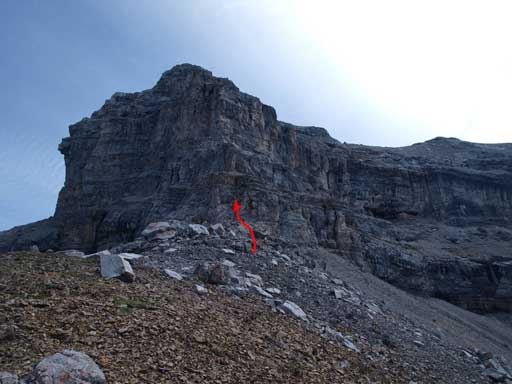
This arrow shows where you need to gain the upper ramp for the difficult route. Not recommended unless you on purposely seek extra challenges

The easy route loses more elevation
Neil just about to climb up the chimney on difficult route

It’s pretty steep
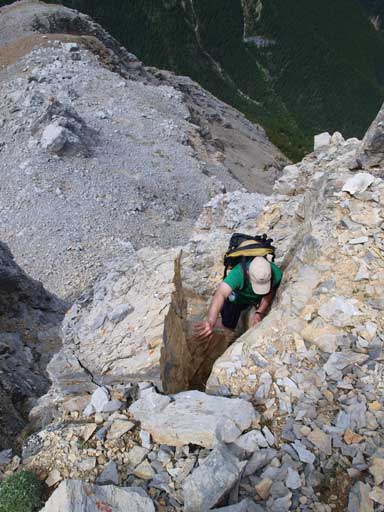
And, very loose, even the larger rocks could move

We went down the chimney since the other side of difficult route was supposed to be even more loose and difficult

Neil down-climbing the steep terrain
So we started the traverse under huge cliffs
And lost quite a lot of elevation
Typical terrain on the other side of side-hill terrain. Still very loose
Neil
Mount Lougheed

Zooming-in towards Bow Valley. Note the colour of Gap Pond
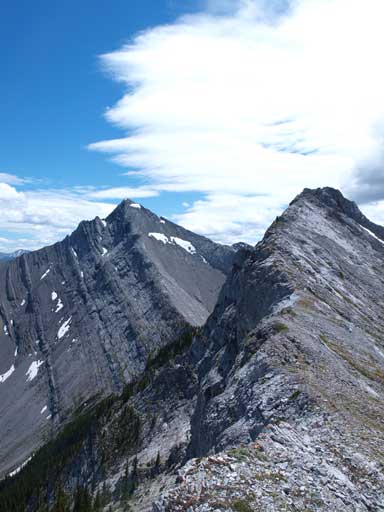
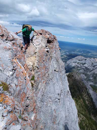
It went easy until the last bit where it suddenly narrowed to knife-edged. It wasn’t as exposed as Mount Lady MacDonald, but the crux move was more difficult since the rock was much looser. Thankfully the crux wasn’t long and we soon stood on its top. The impressive summit immediately towards south is unnamed.
Neil on the ridge

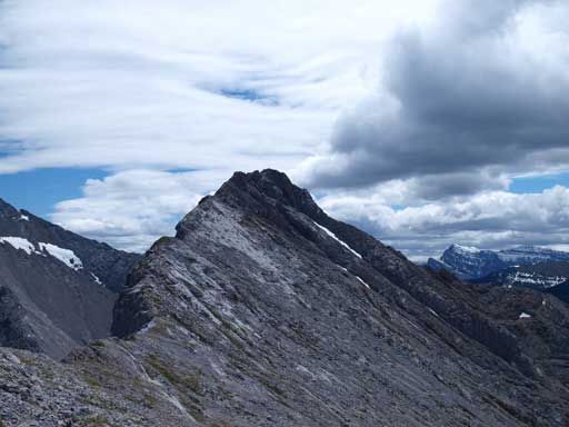
This is the lower north summit, the summit of north buttress

Neil trying to get up a slab to short-cut the route, but too bad it was more difficult than expected

It was a windy day. Any sign of chinook?!

This is the true summit
Getting closer, still quite easy
The east side is quite steep

Looking back at Neil

Panorama view of the east side

I really like the colours in this photo

Neil challenging up a very loose step

Neil just about to challenge the crux

Firstly he had to get over this first pinnacle
And down to the gap.

And up the other side

Summit Panorama. Click to view large size

Great view of Goat Mountain and Yamuska
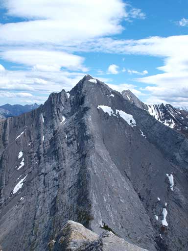
This impressive summit is unnamed
Peaks on Highway 40 was out-of-reach due to road closures
Neil on the summit
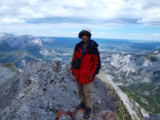
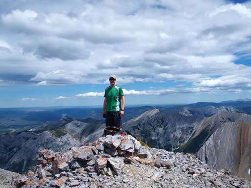
Me on the summit
Coming down was simply retracing our uptracks. We got a couple nice and long scree runs but overall it was still very tedious. It was not easy to spot the “easier route” viewing from above though, and glad we took a mental note on our way up. Side-hilling back across the two bowls was needless to say, very tiring and terious especially considering the elevation regain. Descending the forest went smoothly until the last bit where it got a bit confusing. We sticked close to ridge crest which worked out well. A GPS would come handy if you have one.

Neil getting down a loose step. What you don’t see in this photo is the exposure of this step

Getting back a modestly exposed slab
Scree skiing!!
And getting ready for the long side-hill
One last view before dropping down into trees

Flowers
Our round trip time was just over 8 hours which was certainly longer than expected. Overall, it probably wan’t a smart idea to head up this mountain right after an intense rainfall since rockfall hazard is quite high. But, it was another great day in the mountains.

[…] one of the more recent friends that had completed the Nugara scramble route, so I settled on using his beta and route as my main guide for the day. As with my recent ascent of Abraham Mountain, I could see no clear reason for the […]