Sasin Peak (Pretty Peak)
April 20, 2020
1338m
Chehalis Area / Fraser Valley, BC
This is one of those insignificant peaks on the immediate north side of Fraser Valley east of Stave Lake but west of Chehalis River. There isn’t an official name. About half of the sources call it “Sasin Peak” and the other half calls it “Pretty Peak”. This is because Sasin Creek locates on its southern flanks close to the summit, but to reach the summit one needs to drive and/or walk up the logging roads in Pretty Creek drainage on the north side. The summit area is mostly free of vegetation hence offers some neat views on a clear day. The ascent from Pretty Creek drainage is mostly just a plod on logging roads plus some rambling in mature forest and gradual ridges. If not because of the unofficial status of this peak’s name I’m sure it’ll see a lot more traffic as it has most of the elements of being popular.
Alex and I made the last minute decision while driving back home from Lillooet in the previous day. The forecast was calling for one last “sunny” day on Monday before a long stretch of wet weather so despite our tiredness and the fact I had to be back home by 3 pm for work we still wanted to bag another peak. To ensure I had enough contingency of taking a much-needed nap before work we decided to leave Vancouver at 4:30 am. An hour and half later we arrived at the start of Chehalis River FSR and five or so kilometers up the bumpy road later saw us turning onto Pretty Creek FSR. I worried that this spur road might be gated but the worrisome proved to be unnecessary. The road was steep and loose but generally in a “decent shape” by BC standard. There was one stretch of 18% incline crawling on loose rocks that forced me to switch to 4Low but otherwise the Tacoma handled the challenge pretty well. I opted to park at about 550 m elevation at a good turnaround spot. In retrospect I should have driven to 600 m elevation right before hitting snow, but at this point it didn’t really matter.

Sasin Peak (Pretty Peak) via Pretty Creek. GPX DL
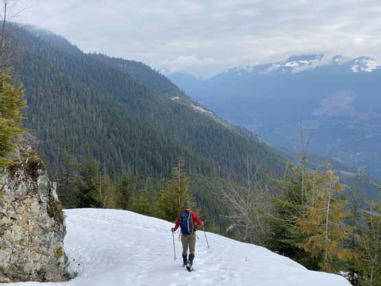
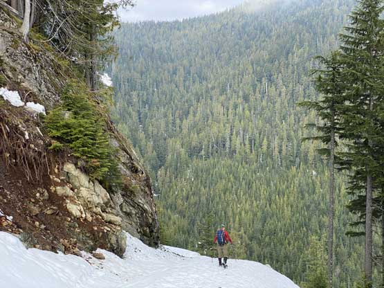
About 20 minutes into the road walk we started encountering patchy snow and the snow soon become continuous. We walked on some packed ATV tire tracks until they ran out and then we strapped the snowshoes on. The snow condition was shitty as expected with minor post-holing right from the start, even at 6 am in the morning. After a switchback we started encountering what seemed like remnant snowshoe tracks that significantly reduced the post-holing through breakable crust. For the next hour or so we opted to follow the road doing some unnecessarily flat switchbacks instead of short-cutting through some clear-cuts. The snow condition did improve a little bit as we ventured higher and so was the views. The weather was nowhere “sunny” as forecasted but we did see some cool morning lighting.
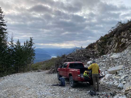
Taco parked. I was surprised we could drive this far up…
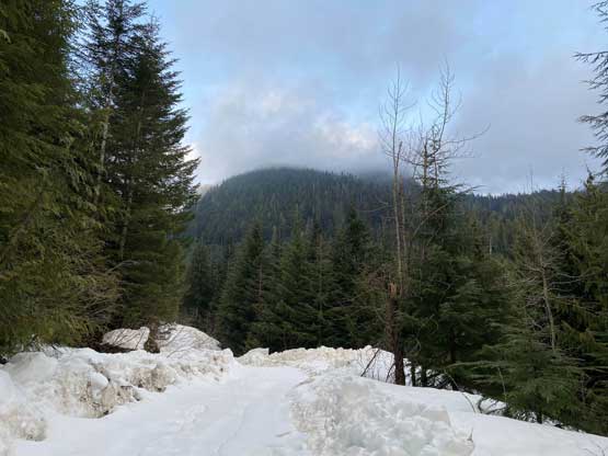
Not long after the start we hit continuous snow.

Morning lighting above Harrison River
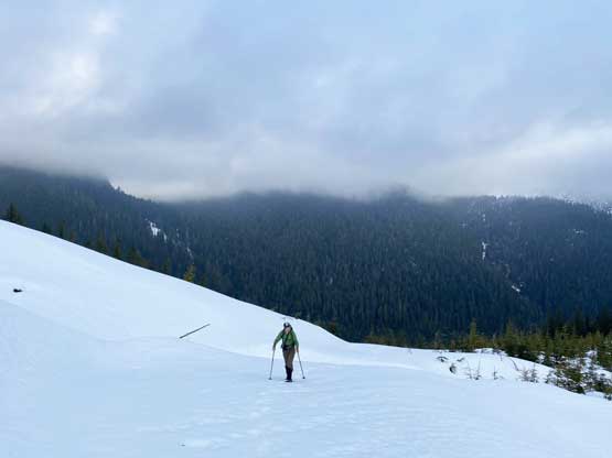
Alex plodding up the typical road…

The Fraser Valley and the Chilliwack peaks horizon

Another photo of Harrison River, with Mt. Agassiz right of center
We did not follow the snowshoe tracks and instead, we followed the road to its very end and then ascended a short but steep slope to reach the crest of Sasin Peak’s long NE Ridge. The travel on this broad ridge was longer than I thought with a few steeper rolls. We also had to break our own trails here as the snow had undergone zero freeze in the densely vegetated forest. We broke through the first layer of clouds but unfortunately there’s a higher layer hovering around under 2000 m elevation blocking the sun. The last roll to get onto the true summit was quite steep (35+ degrees) and required some concentration.
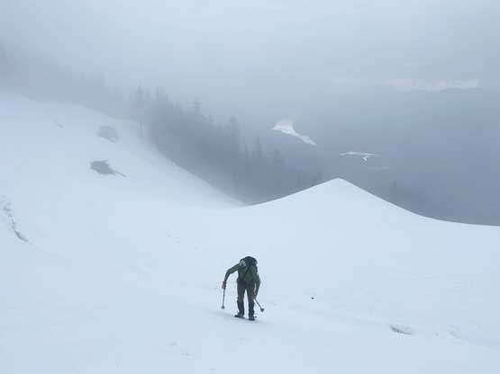
Entering the first layer of clouds and some white-outs

Onto the NE Ridge proper now
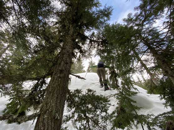
Alex breaking trail up the steep forest.
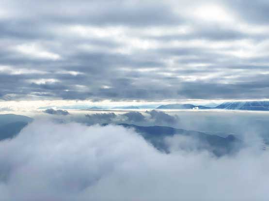
Above the first layer of clouds now, looking up Fraser Valley

Partial Summit Panorama from Sasin Peak (Pretty Peak). Click to view large size.

Another unnamed peak to the north. Doesn’t look very interesting..

Me on the summit of Sasin Peak (Pretty Peak)
I checked the forecast from the summit and it still called for “mostly sunny” but based on observation we determined there’s zero chance of improving anytime soon, so we reluctantly started the descent. The plunging down the NE Ridge was fast and furious on the softening snow that in no time we were back to the logging roads. We opted to short-cut some large switchbacks through open clear-cuts which proved to be a good call. In no time we were down to the lower roads. The final leg was kinda tedious and we also had to do a quick gear transition (taking off snowshoes) about 10 minutes before the truck.

Me starting the descent in deteriorating weather. Photo by Alex R.
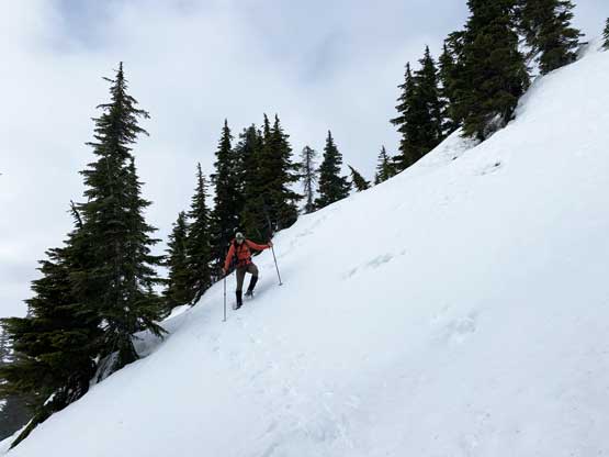
Alex negotiating the steep slope right below the summit
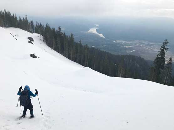
Me snowshoeing down onto the upper end of logging road. Photo by Alex R.

Harrison River and Fraser Valley

Me finishing the short-cut through the cut blocks. Photo by Alex R.
Alex leading down the logging road
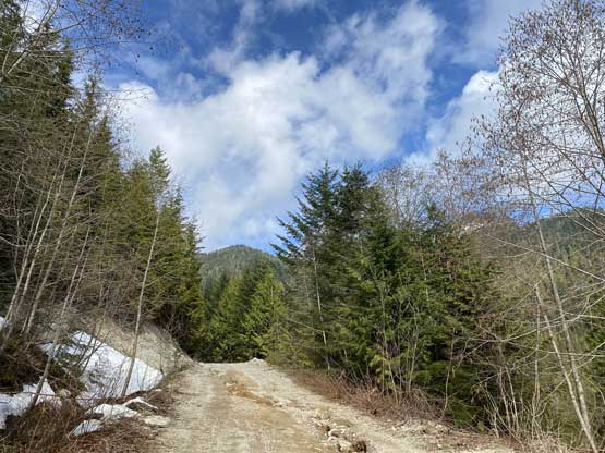
More about the plod down Pretty Creek FSR

Running out of snow
Looking back from near the end. The weather finally improved a bit

Back to my Taco at 550 m elevation. Done.
The drive down Pretty Creek FSR required a lot of concentration but generally speaking the downhill drive is always easier than the uphill crawling and this one wasn’t an exception. I was really tired on the last hour driving back home but I did manage to fight against the tiredness and got back home by 11:30 am.
