Sourdough Mountain
October 10, 2019
1861m
North Cascades Highway, WA
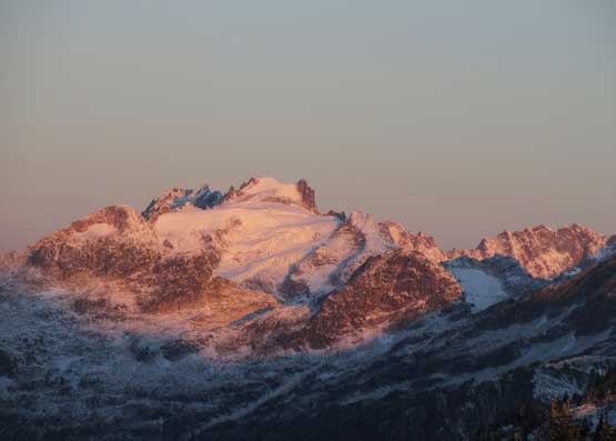
Sourdough Mtn. itself is probably not as famous as the fire lookout on its broad south-east ridge. The lookout is one of the first few built in US more than a century ago with some historical significance, and offers some of the finest views in the North Cascades, but the lookout itself isn’t on the summit of this mountain. The true summit lies about one mile to the north-west and is more of a “bump” on the long, undulating Stetattle Ridge and has a prominence of under 100 m. The ridge can be traversed on mostly open terrain with some up-and-downs from the lookout site. The hike to the lookout is strenuous with whooping one-vertical-mile of elevation gain, but because of the excellent views this hike is fairly famous in the state of Washington.
My original plan of Sourdough Mtn. was to hike the “winter route” on snowshoes in a gorgeous winter day, but I knew such bluebird weather in winter is a rare thing, so the hike didn’t happen in the last couple seasons. Then it came to October this year when a unseasonably cold winter storm dumped a foot of snow in the Cascades. The system left and a high pressure ridge kicked in granting three bluebird days but I was struggling to find a worthwhile objective. I had to be back home by mid-afternoon for work, on all three days but because of the weather and the fresh snow I wanted something with grand views. After messaging a couple friends Mel and Vlad agreed to join on Thursday. The original plan was Hidden Lake Peaks but I pulled the plug because my concern of driving on snow-covered logging roads. An ascent of Sourdough Mtn. (and the fire lookout) isn’t quite a half-day outing but I figured with an all-nighter push we could still make it happen by ascending all night and watching sunrise from the summit.
It took me a while to convince them that an all-nighter was indeed required by showing them backwards mathematics. Mel rented a Mercedes SUV on Wednesday afternoon, picked up Vlad from Richmond at 12:00 AM midnight and then me from White Rock at 12:30 am. The border and the drive was uneventful sans a speed ticket delay and we made to the trail-head at the north shore of Gorge Lake at just past 3 am.

Sourdough Mountain hiking route. GPX DL
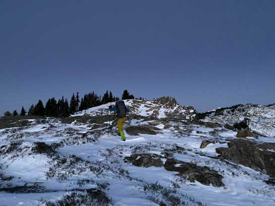
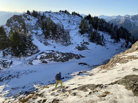
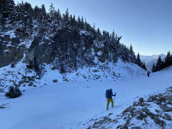
It took us a few minutes to locate the trail in dark as it’s behind a house. The trail was in an excellent shape and the grade was very good – not too steep and not too flat neither. We made progress in good time. I on purposely kept our pace down because we had about 4 hours till sunrise and didn’t want to freeze our asses off while waiting on the summit. We started encountering fresh snow at around 1000 m elevation and the snow became continuous at around 1300 m once starting the traverse into Sourdough Creek drainage. It was here that the trail condition also degraded but for someone coming from BC this was still considered an “excellent” trail. The fresh snow was about boot-top and the brushes were wet. We took our one (and the only) break along this section. The crossing of Sourdough Creek was a little bit confusing in the dark but we came prepared with a GPS track so no big deal. After a good while of traversing we came to a large opening area (although nothing to see) and more switchbacks.
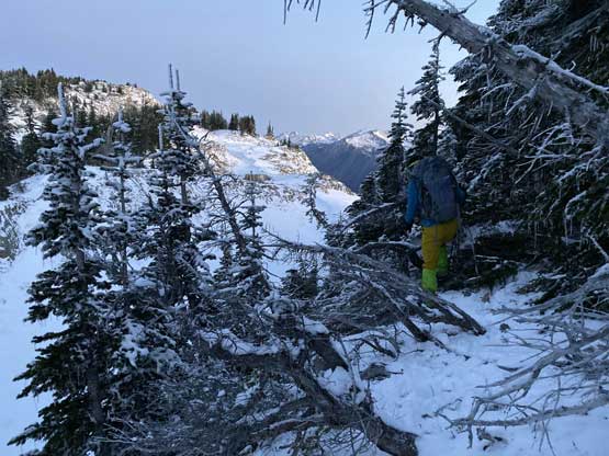
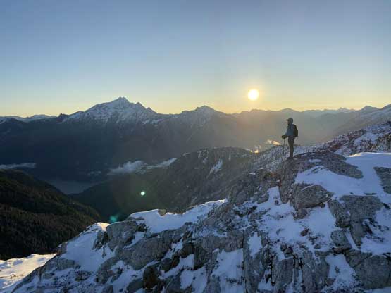
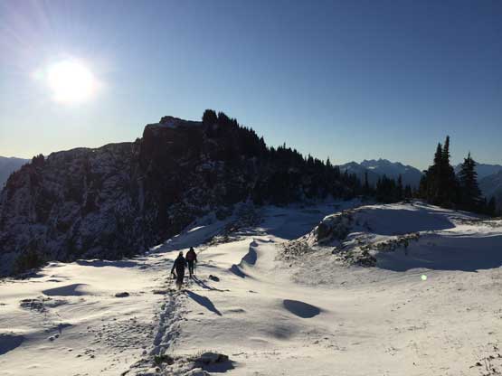
The grunt to the upper south-east ridge took longer than expected, that by the time we got there the sky was already getting a little bit bright. We turned left to ascend the true summit first, and right off the bat we encountered knee-deep wind drifts. There was no trail anymore and the post-holing was slow and tiring. Thankfully we could stay on the bare ground for at least half of the distance. The ascent required traversing over a few subsidiary summits including a major dip with more than 30 m elevation loss and route-finding. That drop also required some 3rd class bushwhacking (with fresh snow) and was annoying to say the least. Beyond that we raced to what we thought was the summit, post-holing as fast as we could in order to be there in time for alpenglow. We did manage to get there in time and watched an incredible sunrise, but another bump down the ridge definitely appeared higher.
Me ascending a bare section of the ridge at dawn. Photo by Mel O.
Me tackling a bushy spot on the descent off a subsidiary bump. Photo by Mel O.

Looking back towards the subsidiary bump while post-holing along the ridge
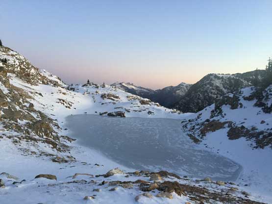
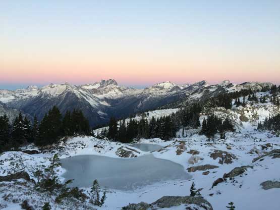
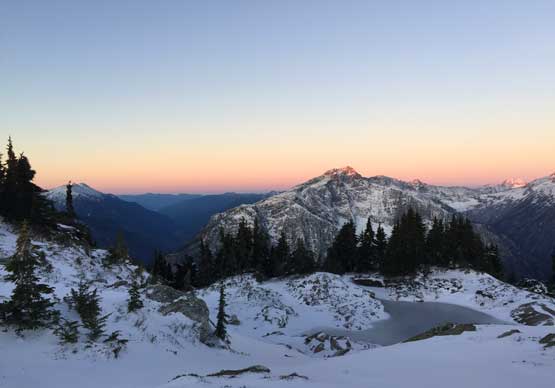
One of the few larger frozen tarns on the ridge…
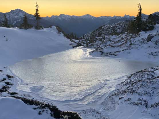
Another frozen tarn, closer to the summit. Photo by Mel O.

The morning horizon looking west towards Davis Peak
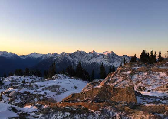
The morning horizon towards the Pickets from the sub-summit.

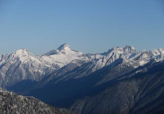
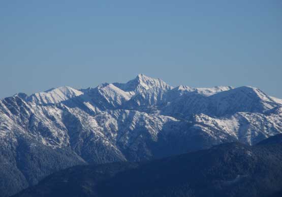
“Peak 6607” on the north-east side of Stetattle Ridge
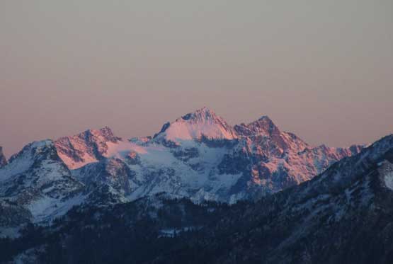
The very tip of Snowfield Group catching sunbeams, looking south
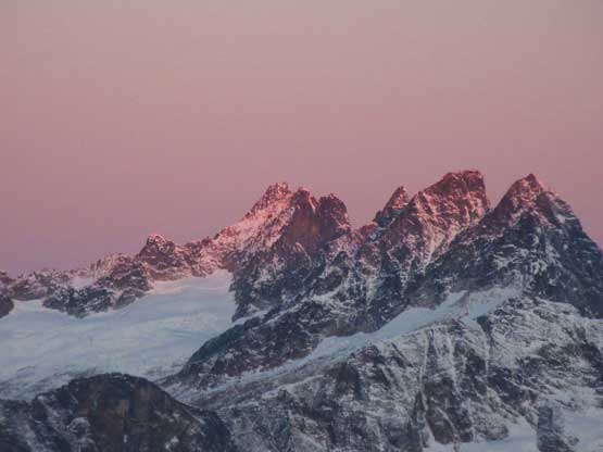
The tip of Mt. Terror, Inspiration Peak, McMillan Spires catching alpenglow
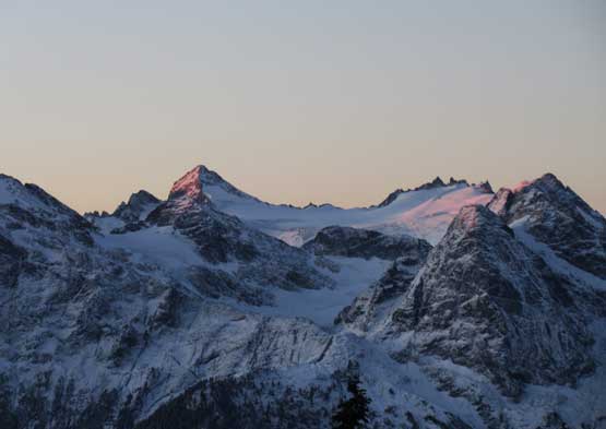
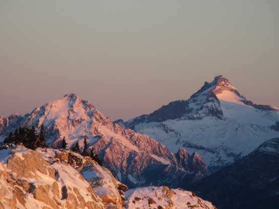
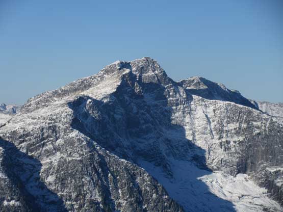
Snowfield Peak and The Horseman
The south face of Mt. Spickard catching alpenglow
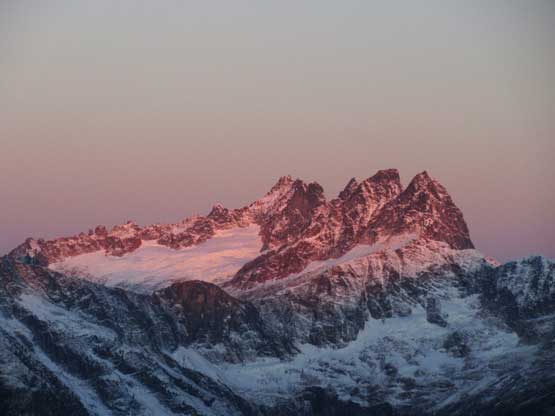
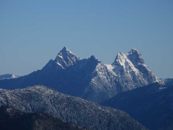
Mt. Terror – McMillan Spires on the southern Pickets
A very zoomed-in shot towards Mox Peaks on alpenglow
The big peak behind is Mt. Redoubt
Another photo looking towards Davis Peak
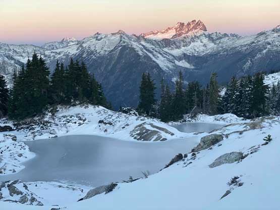
Another photo of that frozen tarn with Southern Pickets behind. Photo by Mel O.
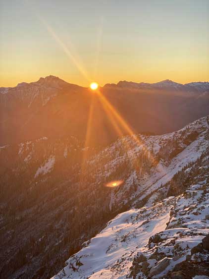
Sunrise behind Crater Mountain. Photo by Mel O.
Luna Peak is the highest in Picket Range, catching alpenglow
The glaciated Mt. Fury – east peak on show; west peak hidden behind
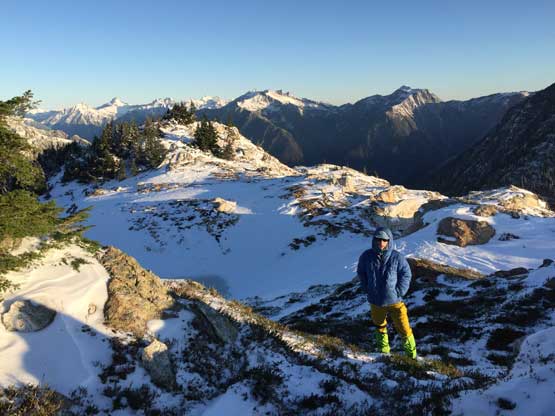
After taking in the views we reluctantly traversed to the next bump, and actually found a summit register. The register was frozen that we couldn’t open it, but looking back we could definitely confirm that the far bump was the true summit, and that further meant the dot on peakbagger.com was wrong. The temperature and wind was definitely more winter-like and I was very glad I brought the storm-degree parka on this trip. I was cold even with the parka..
Mel heading for the true summit in my giant parka. Photo by Mel O.
Mel posing with the morning sun behind.
Me on the summit of Sourdough Mountain
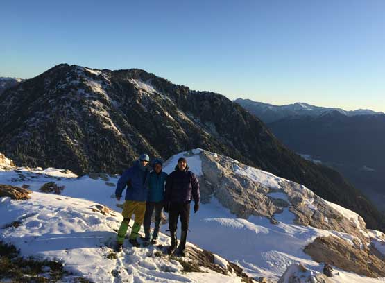
Our group shot on the summit of Sourdough Mountain.
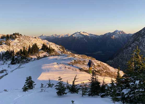
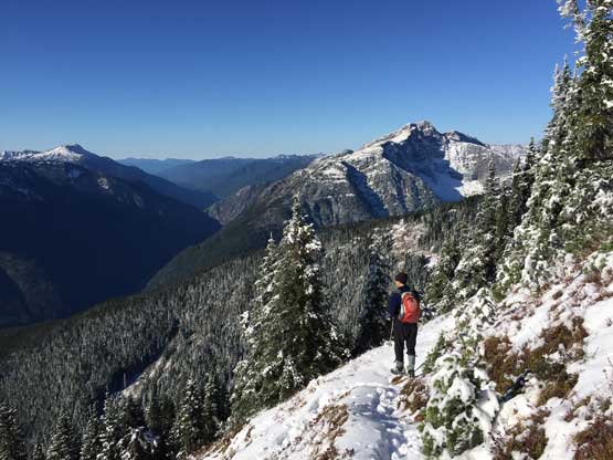
As the sun warmed things up we slowly started the return hike, taking a shit ton load of photos on the ridge. At the trail junction Vlad suggested we should also tag the lookout site. I wasn’t sure about that because we were in a time constraint, so agreed only if someone else offered to break trail. Vlad volunteered to break trail and in about 20 minutes we were on the lookout site. The structure was locked but the views were worthwhile. We got to see a bit of different things including the double-summits of Hozomeen Mtn., the north face of Davis Peak and the deep valley that the North Cascades Highway travels westwards into.
Me heading down from the true summit. Photo by Mel O.

Me plodding in deep snow. Photo by Mel O.
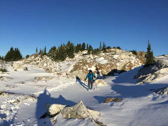
Mel traversing the typical terrain along the broad ridge.
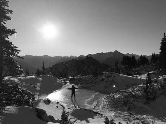
Vlad testing the early October’s ice strength…

A larger tarn.
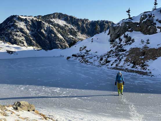
I couldn’t resist to test the ice strength on that tarn… Photo by Mel O.
Plodding back along the ridge with that subsidiary summit ahead
Me plodding back in the shade. Ahead’s that regain section. Photo by Mel O.
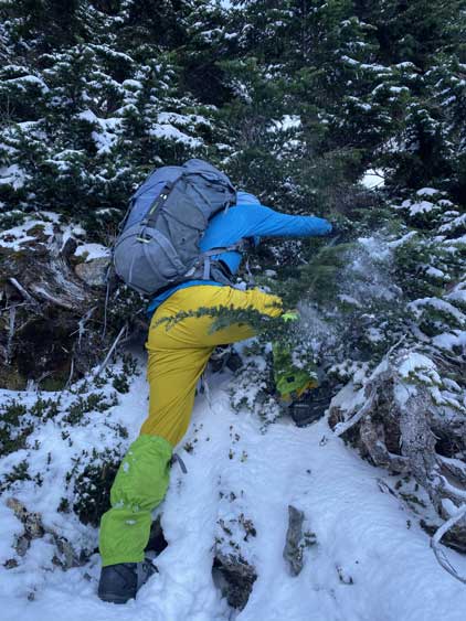
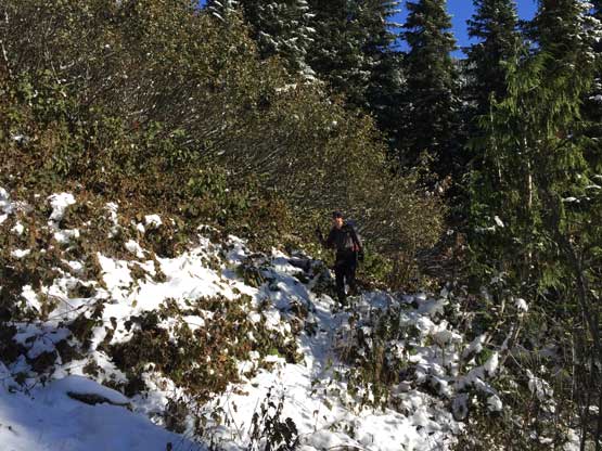
Bushwhacking… Photo by Mel O.

Some nice views of Jack Mountain across Ross Lake
Ross Lake far down below

Another photo of “Peak 6607”

Me exploring a mini ridge to take in more views. Photo by Mel O.
A zoomed-in shot of Big Devil Peak

Mt. Fury – East Peak in display
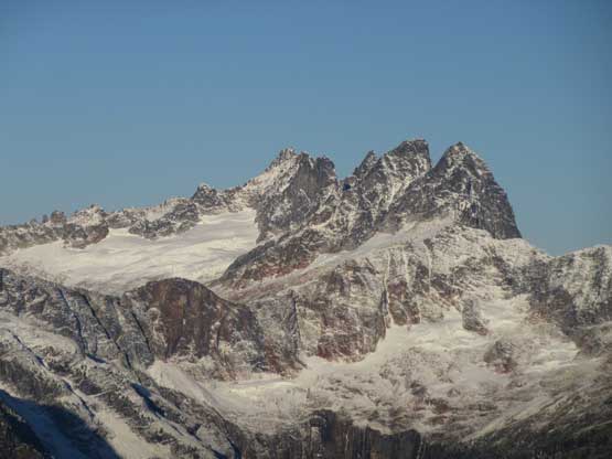
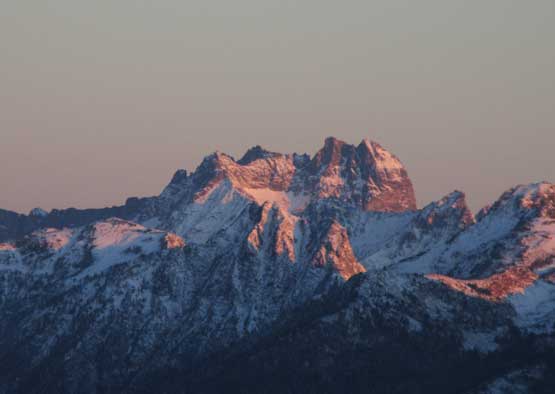
Mt. Terror, Inspiration Peak, McMillan Spires in the southern Pickets
Mt. Prophet
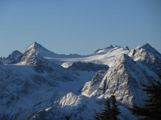
Snowfield Peak and The Horseman to the south
A wider view of Mt. Redoubt and Mox Peaks
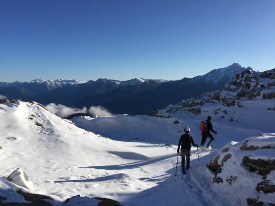
Vlad and Mel heading for the lookout site

Me approaching the lookout. Photo by Mel O.

Me taking in the views with Jack Mountain behind. Photo by Mel O.

Me, Vlad and the lookout. Photo by Mel O.
North Hozomeen (L) and South Hozomeen (R)
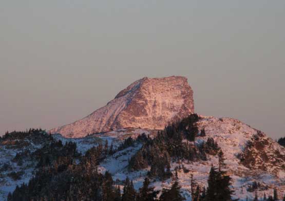
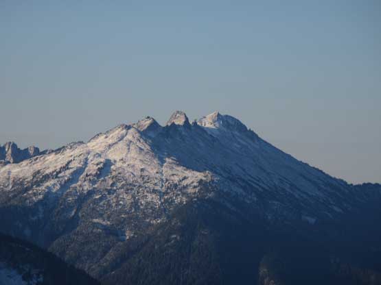
Castle Peak is also an important summit in Washington state
The north face of Davis Peak is apparently one of the biggest faces in WA

Mel and I on the lookout.
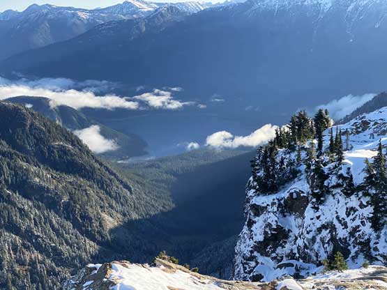
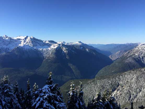
It was past 9:30 am and we had to hurry up. We made quick work down to the trail junction and then into the south side basin. The opening area with switchbacks offered excellent views of Diablo Lake with Snowfield Peak group behind as a backdrop. After that we were in the woods, and the plod seemed never-ending.. We got back to the parking lot in about 2 hours after leaving the lookout site, making a total round trip time just over 8 hours.
The deep Skagit River valley that North Cascades Highway travels through

Starting the long descent.
Vlad with David Peak behind
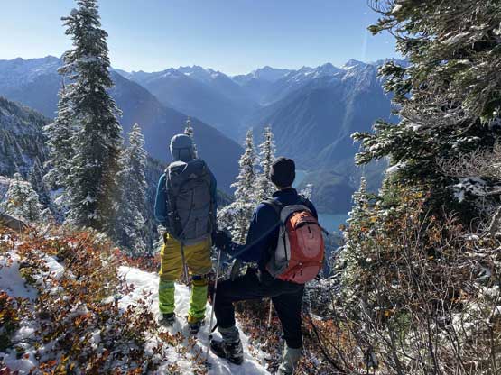
Me and Vlad taking in some views into Thunder Creek valley. Photo by Mel O.

Me practising “grassneering”. Photo by Mel O.
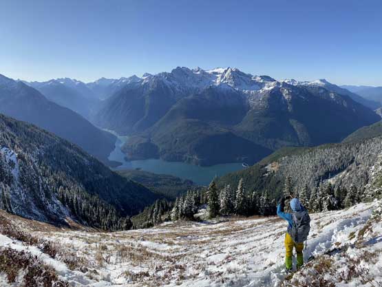
Me taking in the view of Snowfield Group and Diablo Lake. Photo by Mel O.
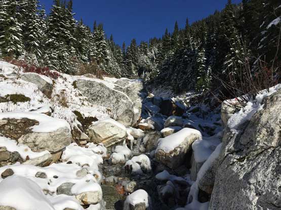
Crossing Sourdough Creek
Vlad on the snowy trail.
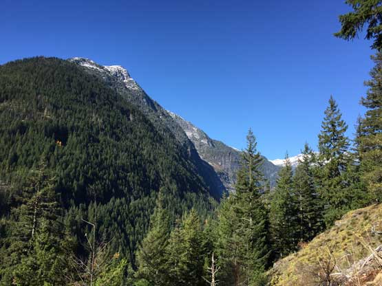
Fast forward. At the lower portion of the trail now looking into Stetattle Creek valley
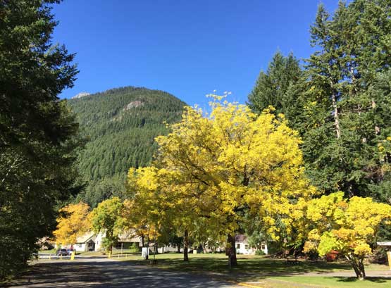
Still having fall colours at the parking lot…
Mel did an excellent job driving all the way back despite the zero sleep she had. I slept for most of the time on the back seats and I was really glad that I didn’t have to drive, because I had to work till 8 pm that night which would surely be exhausting, even with that extra hour of sleep while driving back. I got back to White Rock by around 2 pm with barely enough time to cook lunch, have a shower and make some preparation for work…
