Signal Peak (AZ)
December 30, 2021
1487m
Kofa Mountains, AZ
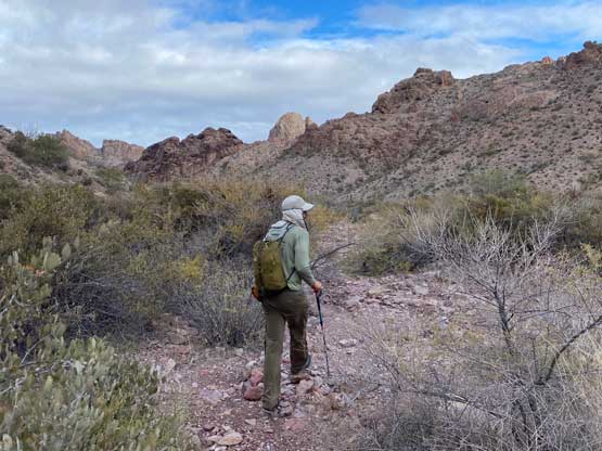
There are too many peaks named “Signal Peak” and “Signal Mountain” out there in North America. This one is the highest peak in Kofa Mountains in SW Arizona with over 1000 m prominence and is also written in the Sierra Club’s “Desert Peaks Selection” list. This one is a major allure for peak-bagging in this part of the desert speaking from statistics perspective, but the ascent is nothing fancier than a “walk-up”. The route does not have an official trail, but a well-travelled path with cairns had marked the whole way and hands-on scrambling is also not required. The hardest part is actually the drive-in as the 20-km dirt road does require a high clearance vehicle with good tires. Earlier in the day Adam and I had scrambled Ten Ewe Mountain which is the smaller, but harder neighbour that shares the same approach. Adam had already bagged Signal Peak years ago, but with only 250 m extra elevation gain I eventually convinced him to join.
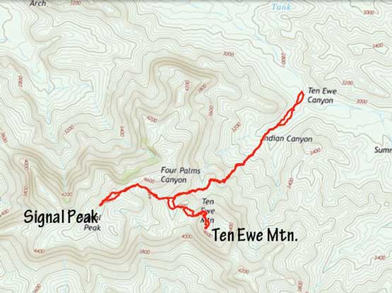
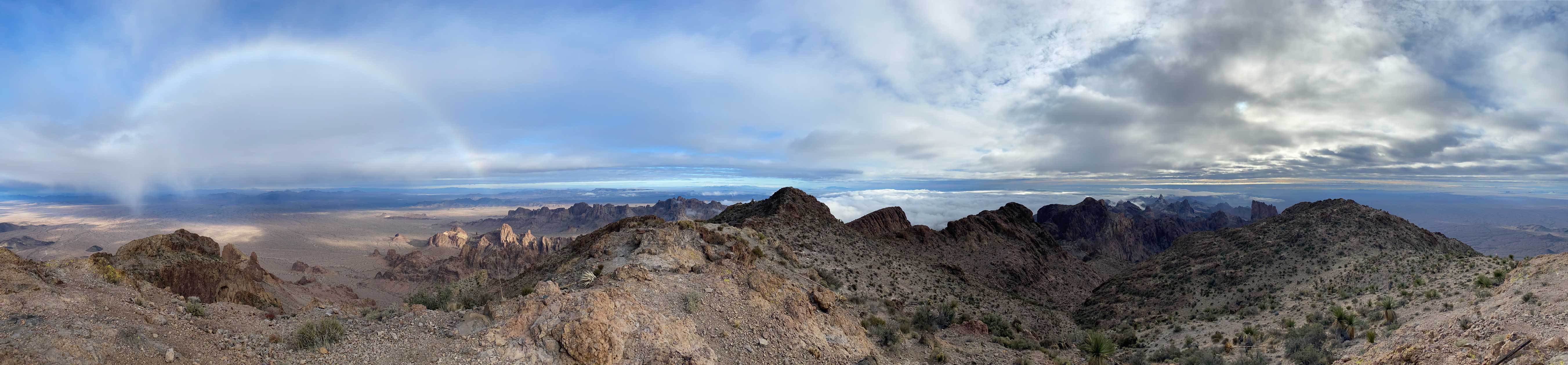
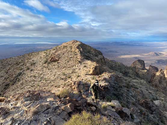
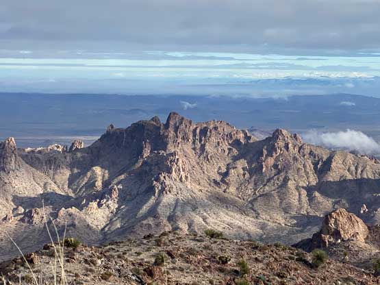
We side-hilled across some open slopes to avoid unnecessary elevation loss and regain to intersect the main Signal Peak’s trail above Ten Ewe/Signal col. The trail was very easy to follow. At one point we were hiking beside some dry slabs and to make the ascent more memorable we opted to just scramble the middle of these slabs. Still, nothing was harder than class 2 but I felt this considerably better than just plodding on that path. A while later we topped out on the broad NE slopes and from there to the summit felt like a slog. We also traversed to the north summit that had the same contour line on the map, just to make absolutely sure that we had reached the highest point on this mountain. The views were great though, so the slog fest was worthwhile.


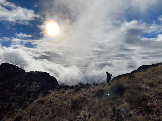
It still appeared like we were going to get some rain very soon, so the decision was to rush back to the vehicle and drive the hell out of that sketchy road. None of us planned to race down the mountain but we somehow got into that trail-running mode. We eventually finished the hike in 2 hours 15 minutes round trip and that included the time spending on these summits. That was a tad faster than planned. We even thought about to make another ascent in the afternoon, but we were both tired from the previous few days’ pushing and desperately needed some rest. We drove north and then west back into the state of California and made to Blythe in lunch time. This time, Adam’s favourate Mexican restaurant, La Paloma was open so we got some massive burritos. The afternoon was then spent catching up emails and social media using the free wifi in Blythe’s McDonalds while making plans about what we would do in the next few days.