Barnaby Ridge
June 30, 2012
2471m
Castle Wilderness, AB
The plan for this Canada Day long weekend changed a dozen times and eventually it was Eric and I heading to the South Rockies to join Raff for this 400th summit. We didn’t know what exactly to expect given the not-so-great weather forecast but neither Eric nor myself had done anything around or south of the Crowsnest Pass so we didn’t really care. By 8:30 am we all met in the Tim Hortons in Pincher Creek and Raff had made his mind to hike up the not-so-often-ascended Barnaby Ridge in the “West Castle” area. I didn’t know anything about this objective other than its name (saw it on the maps before), and off we went towards the Castle Ski Resort along Highway 774.
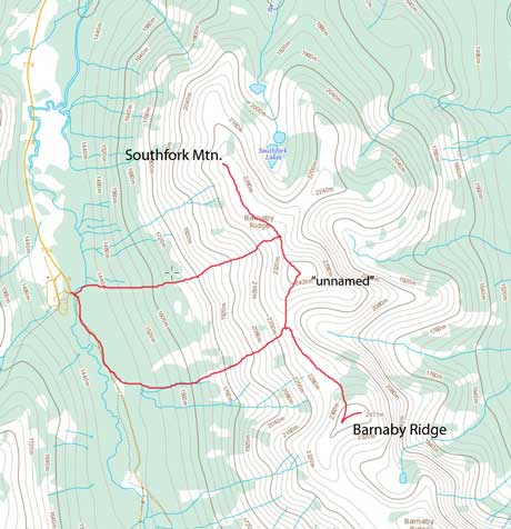
Barnaby Ridge to Southfork Mountain scramble traverse route
The road turned gravel for the last 10 km or so but was in a really good shape (much better than the familiar Smith Dorrien Road). There were campgrounds everywhere along the road thank to the fact this area isn’t in any Parks. The approach was a 1.2 km hike along a logging road which required 4WD so we parked at the resort and walked from there. Despite Raff had a GPS, we still had some trouble finding the correct gully to ascend. They looked all doable from below, so rather then figuring out what was the “correct” gully we just chose the one that was the most obvious. The bush looked okay from afar, but after getting into it, we realized it’s way worse than expected.
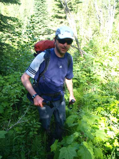
Raff starts his bushwhacking

Bushwhacking
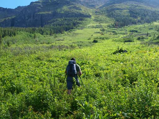
Eric leads the way up towards the obvious gully
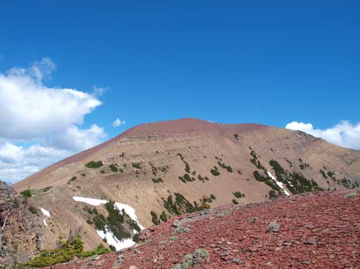
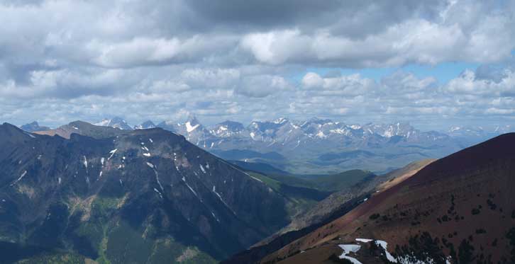
There was little to describe for this gully apart from bushwhacking. We were able to even find flaggings here and there. The bush got better about 1/3 of the way up, and non-existence about 1/2 way up. We had lots of talking during the ascent, so we were on a relatively slow pace. You gonna have to ascend more than 1000 m elevation in this foreshortened gully, and plus the tiring bushwhacking below, I felt it took us forever to get through. Once out of the gully, we were treated by the view towards the other side (East Castle area). The most impressive feature was Castle Peak, a super difficult climb according to Raff. The reddish peak immediately to our left is an unnamed peak at GR907662, while Barnaby Ridge is to our right.

Panorama of the peaks on Continental Divide

Interesting vegetation.

Eric and Raff going up the big gully

Mount Haig is the pyramid shaped one
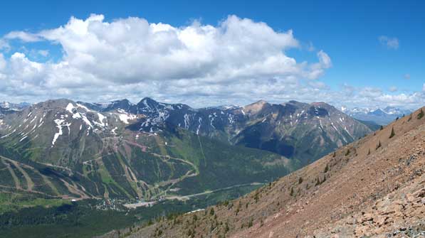
You can see the Castle Ski Resort Ski-runs. St. Eloi and Syncline behind.
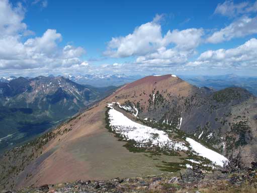
The unnamed GR between Barnarby Ridge and Southfork Mountain
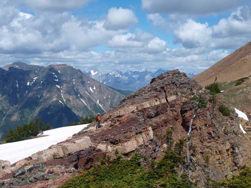
Raff tops out on the ridge
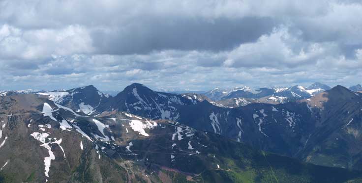
A scenic ridge walk brought us to the summit of Barnaby Ridge. To our surprise, there was even a register on the summit. Not to our surprise, we were the 2nd party signing the register apart from the guys who brought it up… That makes sense because I believe the majority peak-baggers don’t even know the existence of this peak. We cheered by beers for Raff’s great achievement. Towards NW is the 4-peak-traverse that I’ve mentioned before, Syncline – St. Eloi – Haig – Gravelstefal Ridge. Towards SW is another interesting traverse, the unofficially named “Middle Kootenay Mountain” to Rainy Ridge to Three Lakes Ridge.

Looking far south towards some bigger peaks in Glacier Park, MT
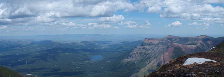
Towards NE is the prairie. Table Mountain on right.
St. Eloi Mountain left of center
Looking over Syncline Mountain (L) towards the distant Flathead Range south of Crowsnest Pass

Mount Haig on left

“Middle Kootenay Mountain” on right.
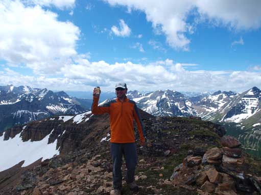
Raff on his 400th summit.

Me on the summit

There is a register, and we are the 2nd group signing it after being placed.
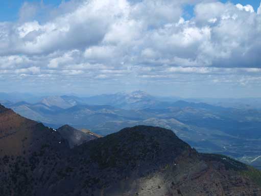
At center in the far distance is Livingstone Range
The unnamed peak again.
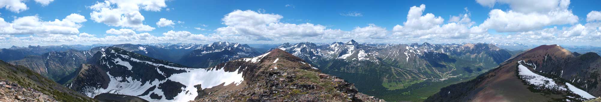
Panorama view from the slightly lower East summit. Click to view large size.

Looking East from the East summit.
The weather held nicely so after soaking in the views we decided to traverse to Southfork Mountain.
