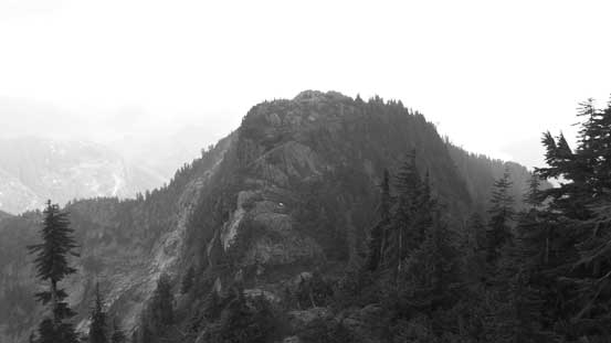
Mount Robie Reid
August 17, 2017
2095m
Golden Ears Provincial Park, BC
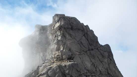
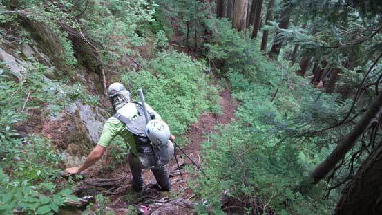
The rugged rocky massif of Mt. Robie Reid is one of the icons of Fraser Valley visible from a wide range of areas in SW BC and the northern Washington state. This is a peak that everybody wonders about hence, doesn’t need a lot of introduction. It’s buried behind the core areas of Golden Ears Provincial Park but the access does not start from the park’s main entrance. And in fact, the access challenge has been significantly reduced in this past decade thank to the construction of Florence Lake Road as well as a “Robie Reid Trail” built by Wulf2 among other ClubTread members. The trail is very steep and unrelenting but nonetheless, it beats west coast sea-level bushwhacking such that a fit party should be able to complete the ascent as a mere day-trip, and this seems like the standard nowadays.
Over the past few months I’ve been discussing a lot of trip ideas with a very accomplished American peak-bagger – Adam the “Gimplator” but it seemed like our schedule would never line up. Eventually there came around this mid August when he’s up for something in Canada and meanwhile the fresh dump of snow in Rockies alpine meant I’d need a break from the 11,000ers trips. It didn’t take long for us to pick Mt. Robie Reid as our first trip together. The challenge is “moderate” at most but weather had downgraded towards the last minute. After some debates we decided to keep the original plan nonetheless. At least there’s no precipitation in the forecast but white-out navigation seemed inevitable. No problem as I just got a GPS track from a friend. Our approach was to bring a 30 m rope along with some rock climbing gears for the two 4th class pitches. Remember that “4th class” in BC west coast is nowhere as easy as in Rockies and sometimes beyond my comfort of ropeless climbing. Adam showed up at my house around 9 pm and we quickly loaded all the gears in my truck. An hour or so later we parked at the supposed gate near the end of Florence Lake Road.
Mt. Robie Reid standard ascent route. GPX DL
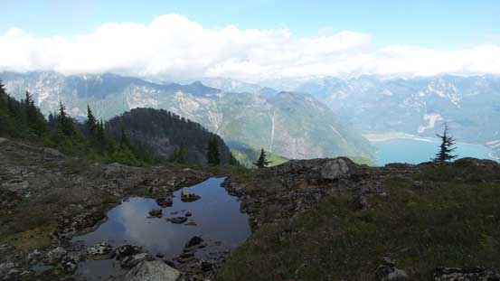
By 4:30 am we woke up in pitch dark and the stars had all gone just as forecasted. The first stretch was hopping over the gate and then descending over 200 vertical meters down towards Alouette Lake. The trick is to not drop all the way down to the lake shore but apparently I missed this part. A very frustrating backtrack along with at least 50 m of elevation regain later we found the start of the “Alouette Lake Connector” trail. Traversing this trail involved numerous up-and-downs and one steep stretch aided by a fixed rope. There’s supposed to have an old cabin at the end of Alouette Lake but we didn’t bother to check. Resuming along “Robie Reid Trail” and then up we went. The grade was pretty mellow for a while but gradually increased. It never got as steep as some made it sound in other trip reports as I never had to frequently use hands for balance. The pace was blistering for one reason there’s nothing to see in the dark and our first break did not come until way up high, literally within 200 m elevation to the famed “tarns”.
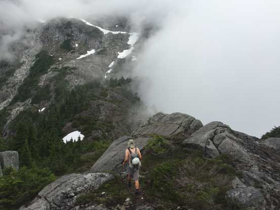
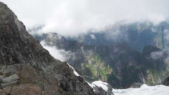
This picture sets the tone – into the mist we went
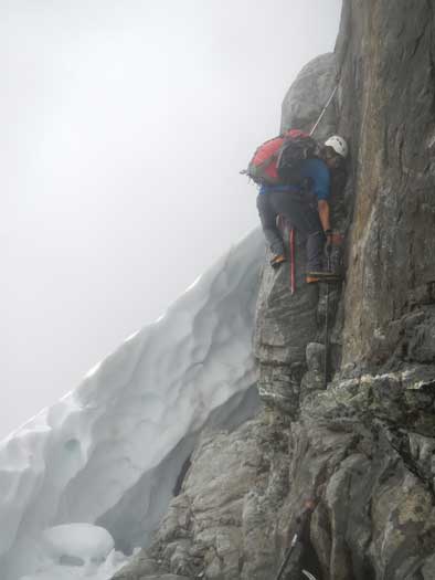
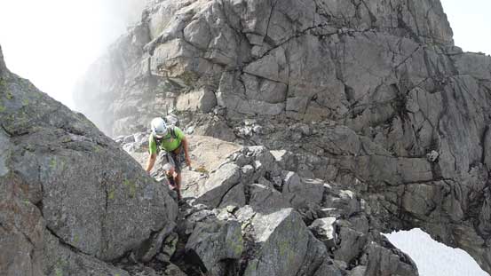
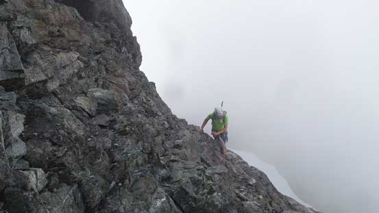
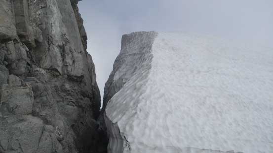
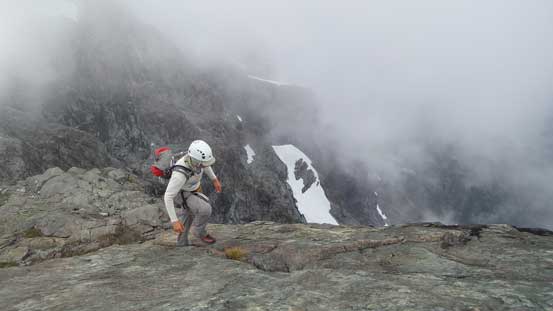
The muddy and buggy “tarns” are more of a joke. The sky was still 100% overcast and the peak was soaked in. There’s not much point in lingering so we resumed on, up and over a couple minor bumps along the ridge at treeline country. And then upwards again we ascended on the edge of a piece of wet slab and then broke out of the forest in the end. The ascent direction was trending climber’s left from here onwards and we also on purposely stayed more on snow. After a shallow gulch feature there came a long leftwards traverse on a snow bench (following Jeff’s GPS track) but without any sight of the surrounding terrain I only had a rough idea about our position. Once the GPS track turned right I knew we were now on the edge of the “snow field” mentioned on every other trip report. This field of snow is probably permanent. Now ascending straight up this snow field trending slightly to the climber’s right the white-out only became worse and “mountaineering inside a ping pong ball” was exactly how we felt. For that reason we missed the easiest exit point. The punishment was one sketchy moat crossing and then a 5-meter tricky 4th class corner.

Crossing the moat above the snowfield. Photo by Adam

Now it’s Adam’s turn to cross the moat.
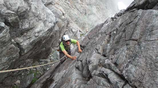
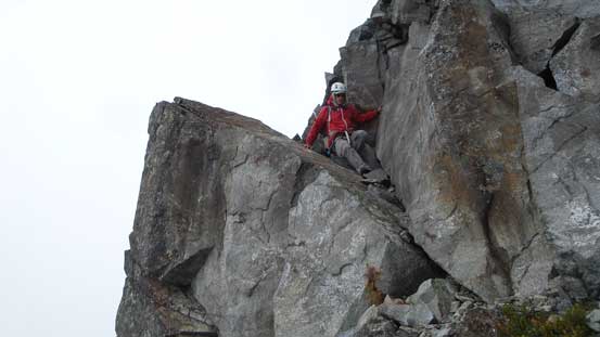
Me climbing up the 4th class corner.

And then it’s Adam’s turn to climb up the corner.
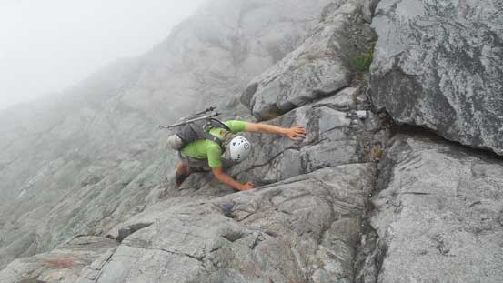
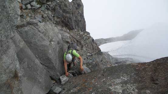
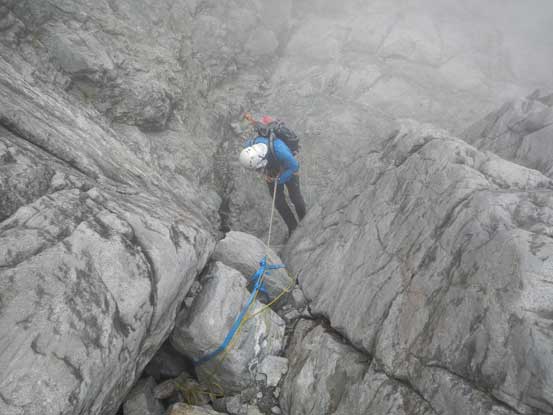
I checked the route photos on my iPhone for multiple times along with the GPS track and eventually figured out our position. We had to ascend diagonally further to the right to find the start of that “crux gully”. More tricky scrambling on slabs soon followed and also more white-outs. Not realizing at all we actually completely bypassed the first crux (lower boulder with sling) by ascending a line of down-sloping 3rd class terrain on climber’s left. Then into the gully we soon reached the upper crux (red sling on a chockstone). The rope soon came out and then I led up the wall on climber’s left, putting two pieces of cams in. Easier side of 4th class with plenty of good holds and then I belayed Adam up using the sling station. And then we were not far from the high col where we finally got a little bit of views.
We bypassed the lower chockstone by scrambling up this terrain

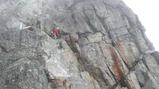
Me leading up the upper pitch. Photo by Adam
Adam climbing up the crux
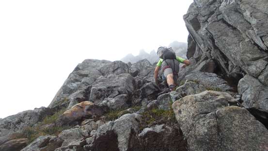
Then we continued upwards in the gully on easier terrain
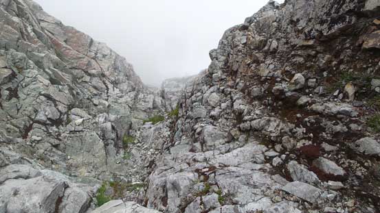
Looking down from near the top of this gully
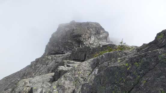
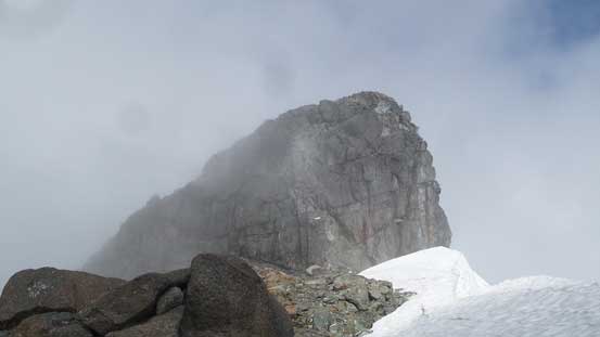
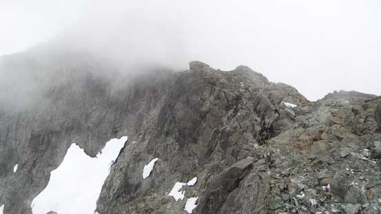
Ahead is the first false summit that we had to bypass on the obvious ledge
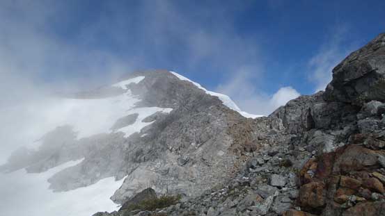
From the col looking at another false summit – we didn’t have to do this one.
The clouds came back in literally no time as we traversed around the false summit, on ledges and gradually gaining height. At one point we came to a dead end (steep slabs and drop-offs) so turned right and climbed straight up to near that false summit followed by losing about 20 meters of elevation. And then there came that kilometer-long summit ridge traverse. This section was supposed to be the highlight for views but we had no such luck so just kept going. One steeper rise was attacked on climber’s left and the summit block 4th class pitch went easier than expected (no rope this time). We had some hope that the clouds would eventually lift but gave up after half an hour’s hopeless waiting.
After a short break we started up from the high col
Traversing on exposed ledges
Probably the only time we had blue sky above
The snow depth is ridiculous here
The true summit block ahead

Adam tackling the crux move on the summit block
Finishing the last few moves

Looking back at the false summit with a misery green tower

A glimpse down the north face reveals some rarely-seen glaciers
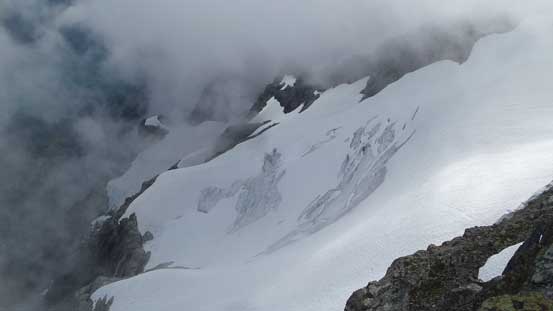
This is the hanging glacier on the east face
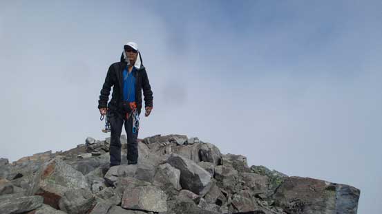
Me on the summit of Mt. Robie Reid
Down-climbing the summit block went without an issue, and then at the bottom of the block I spotted a loose piece of red sling with a locking biner. Twenty dollars worth of gears so why not but getting there required one tricky step-across move. Traversing back across the summit ridge was smooth going although we still didn’t get much of a view. There’s one glimpse looking down at Stave Lake more than 1700 vertical meters below. Back to the “high col” we did two short rappels off the two chockstone cruxes. It might have taken longer than down-climbing but since we had the equipment and skills it made no sense to not use them. And then some careful down-climbing on slabs later we found an easier entrance point to get back onto snow, followed by a fast plunge/boot-ski down the snow field to rejoin that snow bench traverse. This entire section was done in a pure white-out but fast going. The views did not come back until that undulating ridge traverse above the “tarn” as we now had descended below the ceiling.
Descending from the true summit. Lots of careful work required
Adam just above to down-climb the 4th class crux on summit block

Me retrieving a loose piece of sling. Photo by Adam

Stave Lake and the east face glaciers.
The summit ridge was still engulfed in thick clouds
As much as the views we got.
Adam enjoying the summit ridge walk

Me rappelling into the upper gully. Photo by Adam
Me rappelling the lower chock stone. Photo by Adam

Adam finishing the second rappel

Lower down the ceiling lifted a bit
Ahead is that undulating ridge traverse part
Just some random views.

Stave Lake again.
It seemed like all other peaks had cleared up but not the one we were on. The scenery was surely disappointing but having the peak successfully bagged is what matters. After a short break we continued down, picking up the trail and then plunging into the forest. For the next 1000 vertical meters down to Alouette Lake we took only one break to rest our knees. Boring and tedious but not too overly slow. The undulating trail traverse on the east shore of Alouette Lake was such a drag and the 200 meters of elevation regain was a pure shit show in the end. 13.5 hours round trip on a pretty damn fast pace, I was totally bagged.
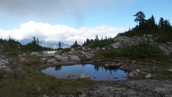
This is that “tarn”. Much more of a mud pond
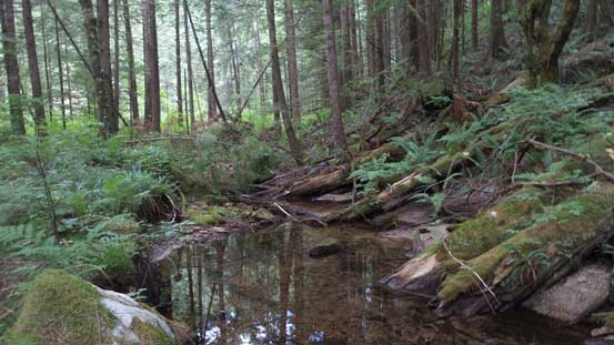
Plunging into the lower forest now
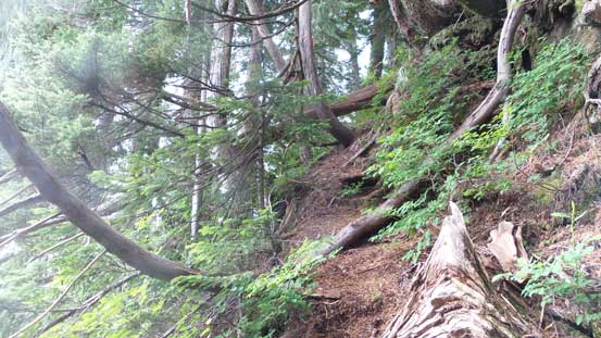
As much as the trail goes
Down to Alouette Lake level now. Still fair a bit of work to do….
The only good news is that there’s no longer a long drive to get back home. After 20 km of logging road all left was a mere hour’s drive although crossing Golden Ears Bridge did cost some toll fees. Too bad I did not wait till September to do this trip as otherwise I could have avoided paying that toll fee all together. Overall I was very glad to have successfully ascended Mt. Robie Reid on my first try, but man I wish that clouds had cleared up earlier.
