Big Bend Peak
April 21, 2013
2814m
Icefield Parkway (North), AB
After two weekends in a roll of questionable weather, the forecast finally called for promising conditions and I was ready to head out again. By last weekend, 4 out of 5 of my final exams were over. The only one that I hadn’t done yet was English which didn’t really depend too much on the reviewing. The English exam was on Tuesday, so I had Friday to Monday open for any plan. After more than 100 emails back and forth Eric, Vern, Ben and I eventually locked our objective on the mighty Mt. Wilson on Monday, with a shorter ascent up Big Bend Peak the day before. “Big Bend Peak” is the unofficial name of the summit immediately south-west of the Icefield Parkway’s Big Bend. It’s well documented in Andrew Nugara’s Snowshoeing in the Canadian Rockies as a relatively short day-trip, but does require absolutely stable snowpack as a few steep and open slopes are required to ascend/traverse.
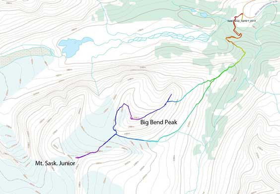
Big Bend Peak and Mt. Saskatchewan Junior snowshoe ascent route. GPX DL
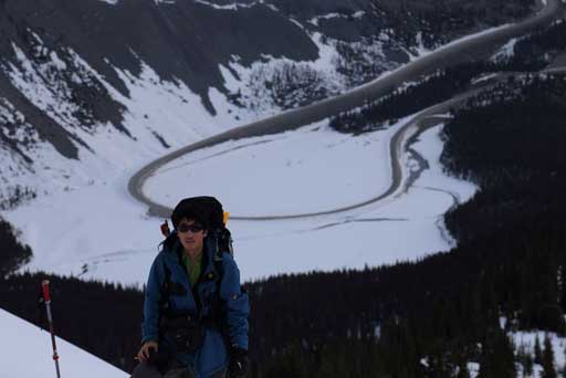
A 5:30 am wake-up call was in the order but to be honest I’d rather wake up even earlier to catch some alpenglow views. The snow bridge bridging North Saskatchewan River was still there but it’s getting thin and probably wouldn’t last much longer. Some ski tracks led us to the old road heading up the initial hill. From my Castleguard Mountain’s ascent in the previous year I had some fairly fresh memories about this area. We followed the road/trail to its highest point, and the bushwhacking started from there. The forest wasn’t too tight, but the terrain was steep and snow was crusty. It was definitely not a fun ski terrain. Snowshoes made some very quick travel straight upwards and since we could just float on the snow, we made to the treed col very quickly.
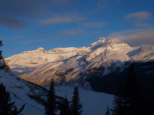
Even though we got views like this, we missed the alpenglow by about half an hour. This is looking towards Mt. Andromeda and Mt. Athabasca

Another interesting view across Highway.
From the treed col, we headed right following the broad ridge towards treeline. The clouds were moving in and we lost the blue sky. Once at treeline, we were facing the first significant avalanche slope of the day. It didn’t appear too much to us from afar but once actually on the slope we did appreciate its steepness and the exposure. The big slope up towards false summit was even sketchier. Our friend Mike Mitchell had warned us that “it was hard to find a safe line up” and he was right. We decided to traverse diagonally climber’s left aiming for the least steep terrain. There were slabs beneath for a good length of the traverse, and we nervously marched up. Ben led up a fast pace here and we were happy to be off this slope eventually. We made an agreement to use the alternate descent route since once the sun was out, the slope we just ascended would be even sketchier.
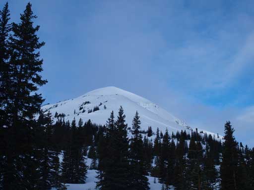
The first bump and false summit behind.
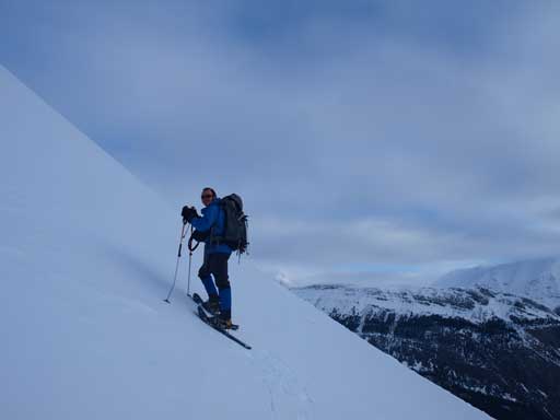
Ben on the steep slope of first bump
Me with the Big Bend below. Photo by Ben Nearingburg
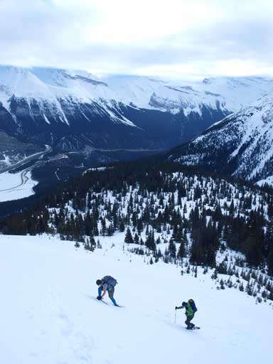
The first avalanche slope
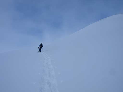
Now it’s the time to ascend false summit. Ben led a way towards climber’s left.
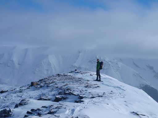
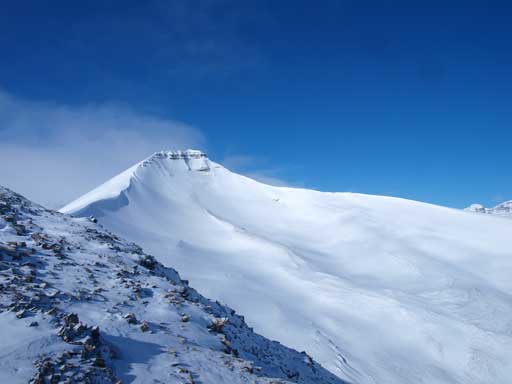
And once we cleared this slope, we were at the false summit. We got here in the perfect timing that the clouds were lifting up and we were treated with blue skies. Since we had good views we went up the false summit, and traversed further down for a good distance to soak in the views. The true summit looks impressive from here. The day was already amazing by this point, and we were hoping that the weather could keep improving, or at least, not getting worse.
Vern decided to go down the false summit for a while checking things out

He would get some interesting views from there. I went down there too.
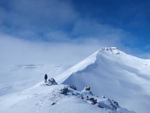
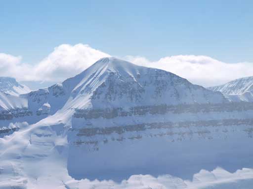
Looking back at Ben on the false summit, with the true summit behind.
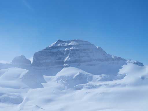
Another shot of the true summit
Athabasca rises behind

Vern going back towards the false summit.
Once back to false/true summit col, we started the final march towards Big Bend Peak. There were some interesting snow scoops and a couple rockier bands to provide some photo shooting opportunities. I was a bit tired since I hadn’t eat much yet so Ben swapped the lead about halfway up. The weather was getting better indeed, and we waited for about half an hour on the summit soaking the views. The mighty Mt. Saskatchewan eventually showed up. The views were big, even though this is just a small mountain in this area.

Going up some interesting snow terrain. False summit behind

Looking towards the true summit

Eric scrambling up a short band.
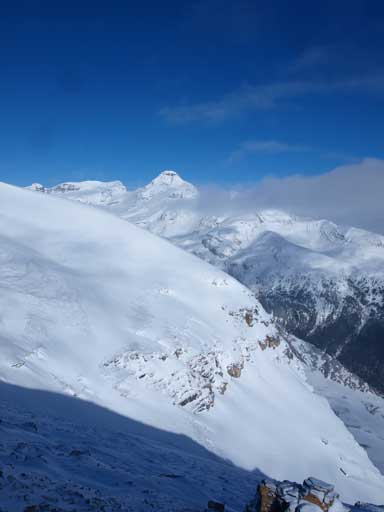
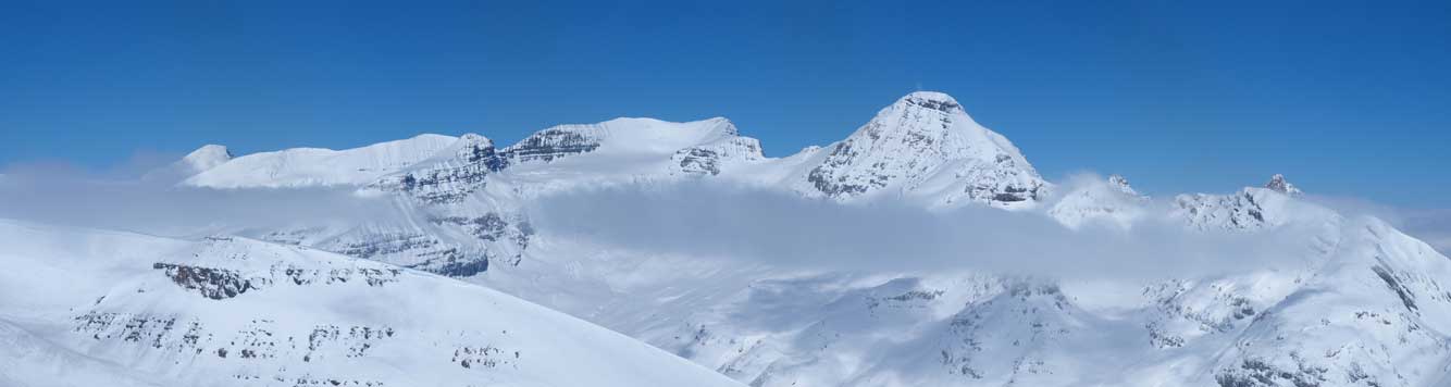
Looking towards Highway side from the summit. The high peak is Cirrus Mountain

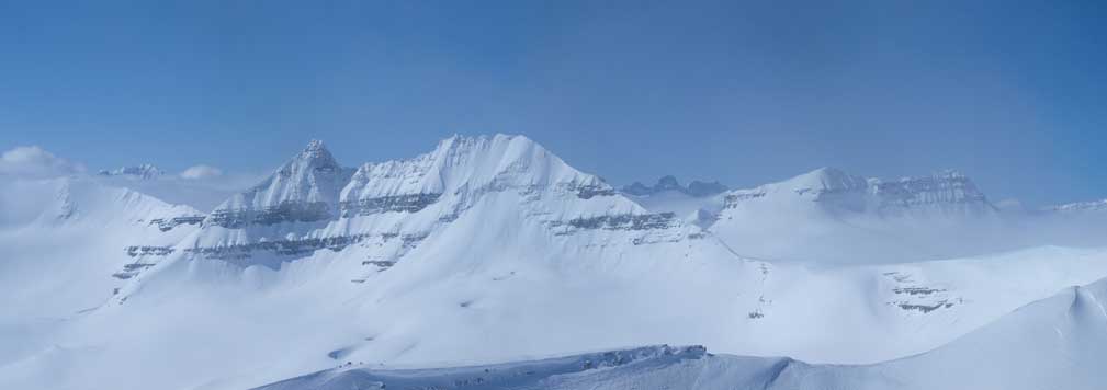
This was the view towards Columbia Icefield once we just got there.Click to view large size.

Cirrus Mountain (left), unnamed on right.
Mount Saskatchewan’s north face!
Spine Peak. A “difficult” peak in Nugara snowshoeing book. The route looks to be a serious mountaineering ascent to us. I mean, in winter…
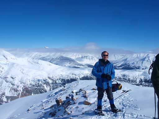
Ben on the summit
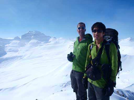
Vern and me on the summit
This rocky peaks is the “North Towers of Mt. Saskatchewan”
Bryce on left, Castleguard on right. In front of them are the twin peaks of “Mt. Saskatchewan Junior”
Columbia, Andromeda, Athabasca
Nigel Peak poking through clouds
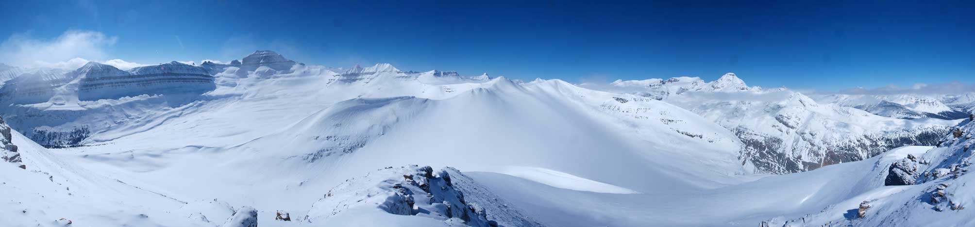
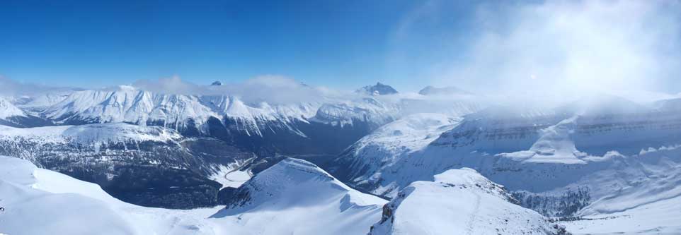
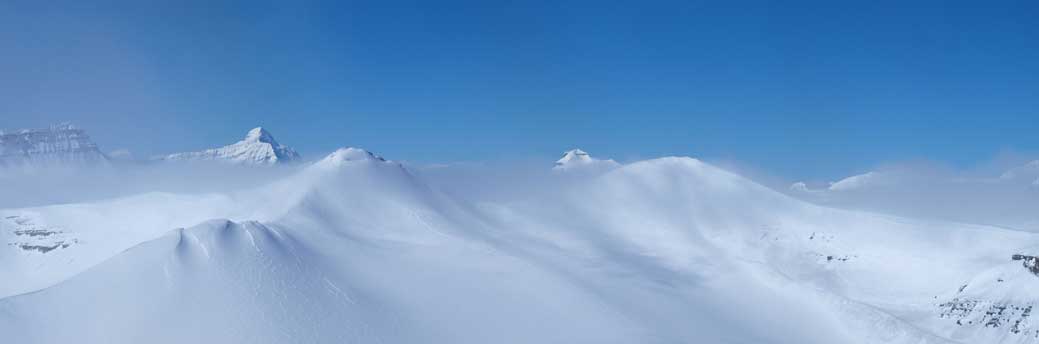
Another panorama of this area. Click to large size
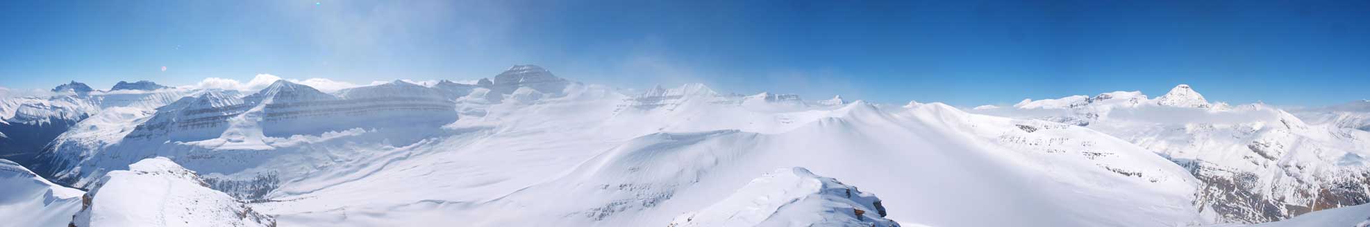
Same as above, but using snow/beach mode instead of scenery mode.
We decided to descend the other side hoping to drop down to the glacier and follow it contouring around Big Bend back to car. However, if we went down that way, why not just grab the nearby Mount Saskatchewan Junior, and the weather was keep improving helping motivating this variation. The day continues to an ascent of the more scenic Mount Saskatchewan Junior.
