Mount Cleveland
August 27-29, 2019
3190m
Glacier National Park, MT
Mt. Cleveland is the highest of the six 10,000ers in Glacier National Park not far from the Canadian border. It’s not significantly taller than the second and third highest, Mt. Stimson and Kintla Peak, but because they are relatively far away standing on the summit of Mt. Cleveland definitely gives a sense that one’s much taller than everything else. There’s no close comparison in the nearby Waterton Lakes National Park in Alberta, Canada and the closest higher peaks are Mt. Mike and Mt. Harrison, over 150 km to the north in the Canadian Rockies. Mt. Cleveland is also an “ultra prominence peak” with over 1500 m topographic prominence, making it one of the 57 candidates of “Ultras of Contiguous US” list. And because the profile of this peak is highly visible from Waterton Lakes to the north, it’s also not unheard in the Canadian Rockies scrambling community. Peak-baggers travel here from different corners on this continent hoping to stand on top of Glacier National Park’s highest peak.
An ascent of Mt. Cleveland is not technically challenging, but requires a multi-day sufferfest and some complication with logistics. There are two ways to approach. The standard access via Goat Haunt from Alberta, Canada is closed in 2019 making the alternative approach via Belly River the only viable option. The Belly River approach only gives access to the much-longer, but still considered the “standard” Stoney Indian Route. The shorter bushwhacky West Face route is only accessible from Goat Haunt approach. The advantage of the Stoney Indian Route is no bushwhacking whatsoever, and the 2-mile ledge traverse across the west and east faces of Stoney Indian Peaks is reported to have some of the coolest terrain in the entire country. The downside is another 70+ km round trip death-march but let’s face it. Connor, Adam and I were tired after the Type II fest on Mt. Phillips and Mt. Stimson but the weather didn’t want to give us a break. Connor was at 56/57 on his “Ultras of Contiguous US” list prior to this ascent and the list had only be completed 15 times in the past, so Mt. Cleveland had to come down in this trip no matter what. We secured our walk-in permits immediately after coming out of Mt. Stimson and only earned one rest day in between.
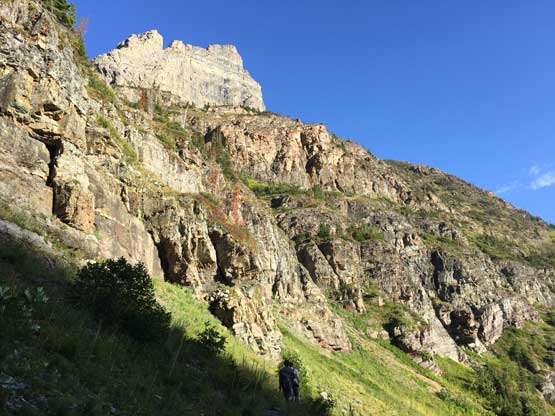
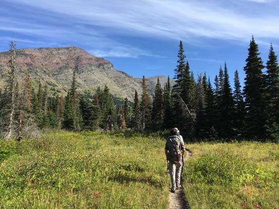
Obtaining backcountry permits is apparently one of the major cruxes in Glacier National Park and we were very pleased with the fact we just showed up, and got the permits. We did not however, find a suitable campground on the east side of the park so opted to car-camp at a random spot not far from Columbia Falls on the south-west side. We woke up at 4 am on Tuesday morning, packed up the very wet tents thank to the cold temperature and heavy dew, and drove up and over Going-to-the-Sun Highway to St. Mary. The road was a smooth sailing in the dark with no tourists but the animals were scary to say the least. Once entering the Blackfeet Indian reserve we had to pay extra attention to the black cows that almost caused a crash back in August 2015 during my first visit to this park. Black cows were literally on the road but by that time it was already bright enough to see them. The Belly River trail-head was right at the border crossing. It was still cold that Adam suggested we should take a nap, but Connor (driving a separate vehicle) came and suggested we should scramble Mt. Merritt, the six highest in the park right away on Day 1. I was instantly convinced because the weather was indeed much better on the first two days, so we got out of the cars, cooked some Indian breakfast and started the march as early as we could. Adam opted to skip Mt. Merritt as it’d involve an additional 1600 m elevation gain on bush, talus, scree and 3rd class chossy ledges, nothing but the perfect recipe of “unpleasant terrain”.
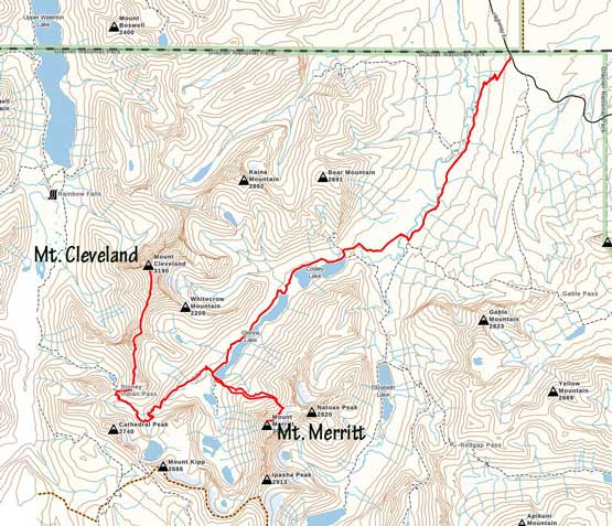
Mt. Merritt and Mt. Cleveland via Belly River. GPX DL
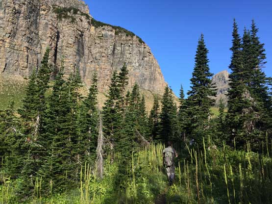
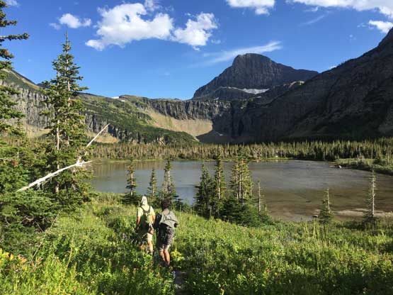
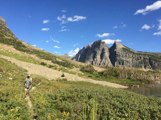
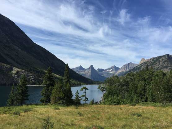
The approach to our camp at Mokowanis Junction would be 21 km slog on a well-maintained trail and we must get there before noon so that Connor and I could (hopefully) finish Mt. Merritt before dark. For a few days I was looking forward to a relatively leisure first day but all the sudden now it’s become a race with time that every minute mattered. This is the norm of my trip that if weather is good, we have to push. The first few kilometers was a constant downhill travel to the bottom of Belly River valley and then we had a few boring kilometers of march across what seemed like the typical southern Canadian Rockies landscape to the Elizabeth Lake junction. We turned north crossing Mokowanis River on a suspension bridge and then hiked gently into the Mokowanis River valley. The next 10 km or so was done by paralleling Cosley Lake and Glenns Lake with lots of micro up-and-downs and minimal views. Adam had set a blistering pace throughout most stages of the hike that we arrived at Mokowanis Junction at exactly 12 pm. The “camping routine” took us longer than expected with setting up the (wet) tents, cooking lunch and sorting food.

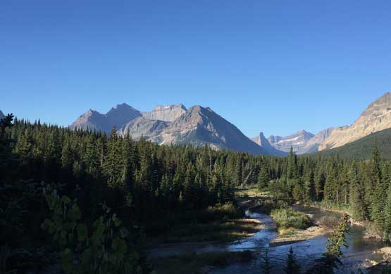
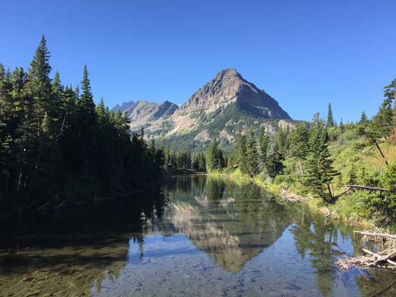
Sentinel Mountain and its reflections
Descending into the lower Belly River valley
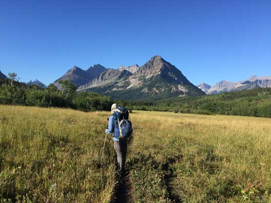
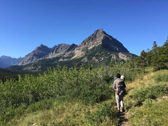
Adam plodding across the grassland with Cosley Ridge ahead
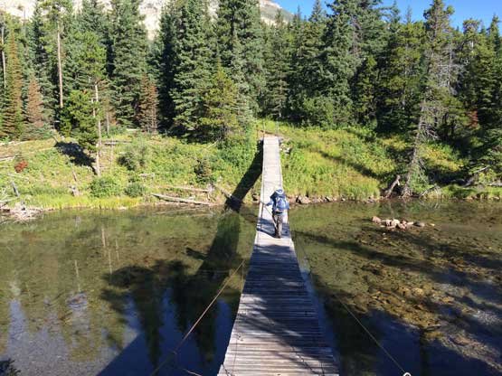
The suspension bridge across Mokowanis River
The northern tip of Cosley Ridge and its reflection in Mokowanis River
Plodding into the Mokowanis River valley
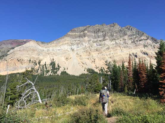
The SE Face of Bear Mountain ahead. Kaina Mountain behind on the far left
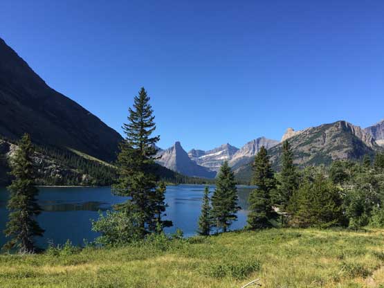
Arriving at the shore of Cosley Lake
Connor and I didn’t manage to start Mt. Merritt until 1:30 pm but at this point we were committed to it no matter what. This is one of the six 10,000ers in Glacier National Park. At this point I wanted to finish this (short) list and I would not be happy if I had to come back here for Mt. Merritt. I treat the six G.N.P. 10,000ers as sort of like an extension of the Canadian Rockies 11,000ers. In any case the ascent of Mt. Merritt is written in a separate trip report. In short words, Connor pushed me up and down this mountain on perhaps the fastest speed I could physically handle, and we got back to camp in less than 6 hours round trip, leaving plenty of time to do the evening routine things.
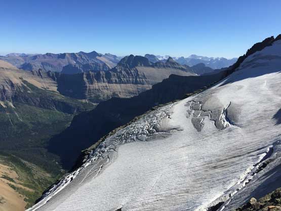
Old Sun Glacier from high up on the NE Ridge of Mt. Merritt

Natoas Peak a sub-summit of Mt. Merritt massif
Me on the summit of Mt. Merritt
Connor on Mt. Merritt with Mt. Cleveland behind
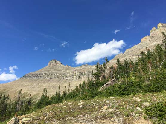
The ascent of Mt. Cleveland from Mokowanis Junction involved about 30 km round trip with over 2000 m cumulative elevation gain, with much of it on off-trail terrain. I was totally beat by the harsh first day but I was determined to make this happen on Day 2. Connor is one of the two strongest climbers I’ve ever met in person, and Adam was fresh from skipping Mt. Merritt. I struggled to keep up with them as soon as we started gaining elevation towards Stoney Indian Pass, but as the day went on my energy was slowly coming back. The hike past Atsina Lake into the basin south of Stoney Indian Pass was roundabout, but very scenic. We loaded 3 L of water each at the last stream crossing, and proceeded the last few kilometers to the pass. At this point we had done half of the distance and 1/3 of elevation. A short while later I finally swapped trail-runners for mountaineering boots as the scrambling began.
Connor hiking up the overgrown trail towards Stoney Indian Pass
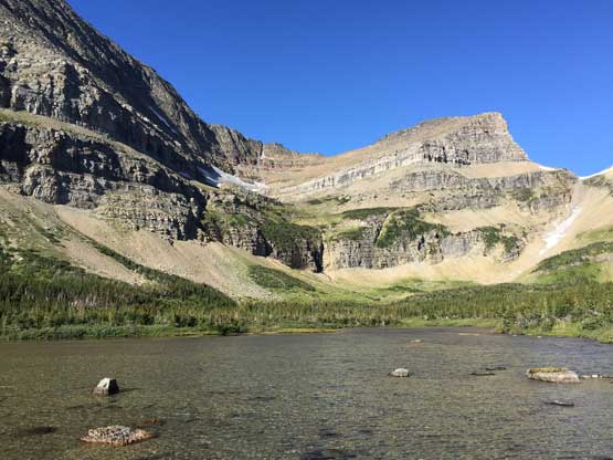
The typical scenery in the upper Mokowanis River valley below Atsina Lake
Past the Atsina Falls into the basin below the pass
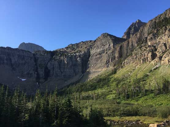
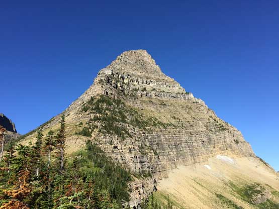
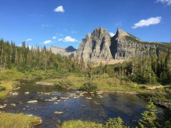
This is the bowl surrounded by the steep walls of Mt. Kipp and Cathedral Peak
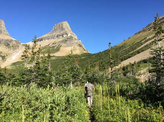
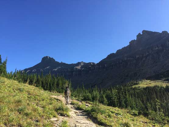
Hiking towards Stoney Indian Pass with Wahcheechee Mtn. in front
A muddy tarn at the basin
Arriving at Stoney Indian Pass
The E. Ridge of Wahcheechee Mountain from Stoney Indian Pass
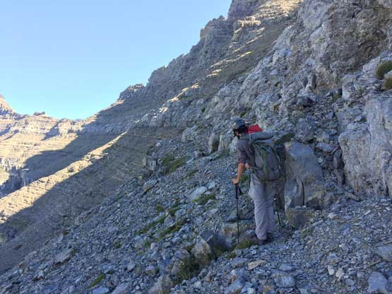
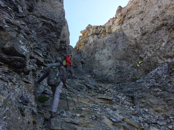
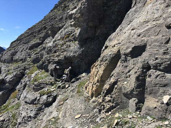
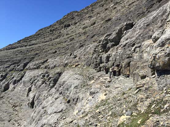
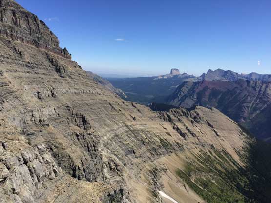
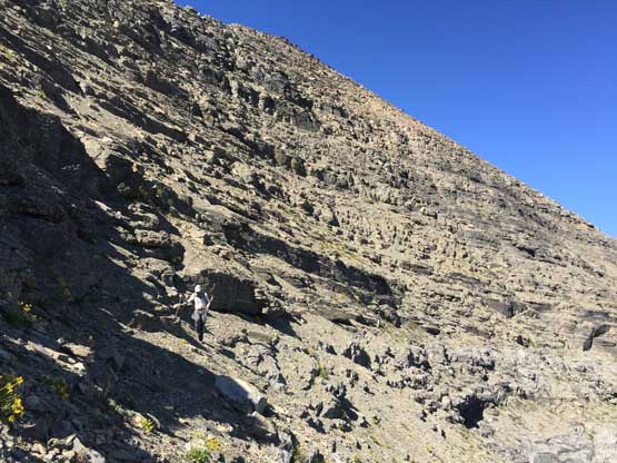
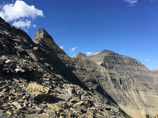
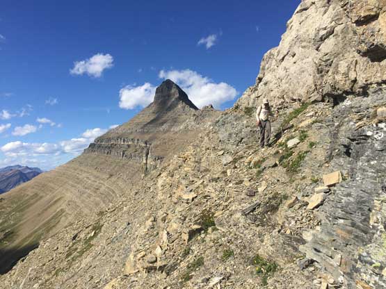
The first stage of the scrambling was to gain a few hundred meters on the south-west ridge of the “south ridge extension” of Stoney Indian Peaks. The objective was to gain the first of the two key ledges that traverses around Stoney Indian Peaks, but we were a little bit confused about the beta. Connor and Adam led in front, ignoring Greg Slayden’s GPX track and sticking on the ridge crest. The ridge crest was cold and very windy and I double-checked with the guys making sure they knew the beta. The ridge crest turned out to be some 3rd class scrambling and was probably more fun than the climber’s right side scree. Higher up an imposing band of cliffs forced us to traverse climber’s right merging onto the GPX track, and then we ascended some easy, but tedious treadmill scree back climber’s left to the obvious skyline. This dumped us right at the start of the west-side ledge traverse. The half-mile west side traverse was the warm-up of what’s coming up soon on the east side. The route-finding was easy and the ledge was more like a “scree bench”. There were one or two gullies that required some scrambling to cross, and the final gully ascent to the “cross-over notch” required a few 3rd class moves.
Adam scrambling above Stoney Indian Pass with Wahcheechee Mtn. behind
Adam and Connor starting the west side Stoney Indian traverse
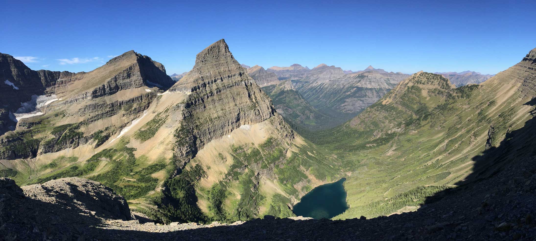
A panorama of Wahcheechee Mtn. and Stoney Indian Lake. Click to view large size.
More about the (easier) west side traverse
Wahcheechee Mtn. and Stoney Indian Lake
We scrambled up this steep gully to access the “cross over col”
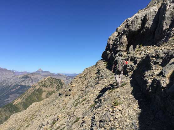
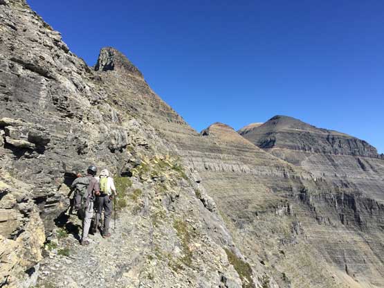
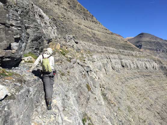
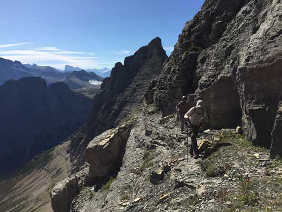
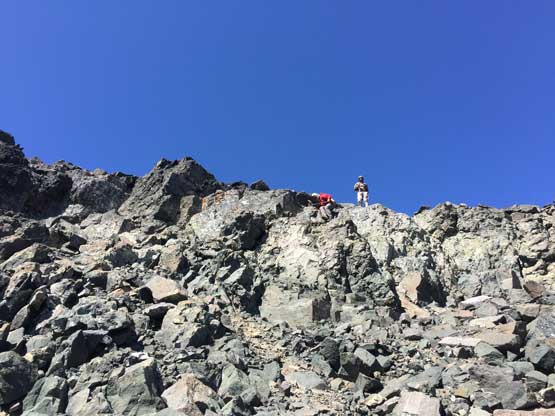
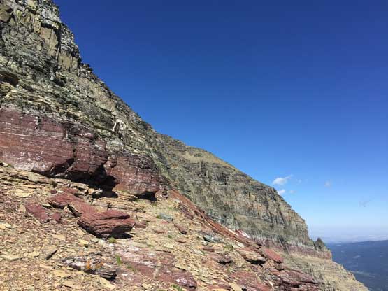
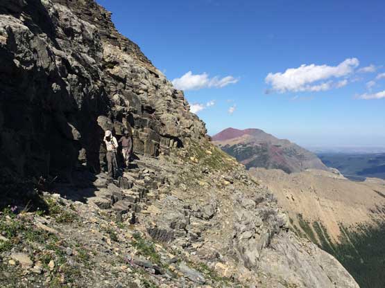
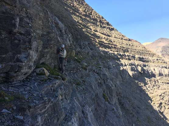
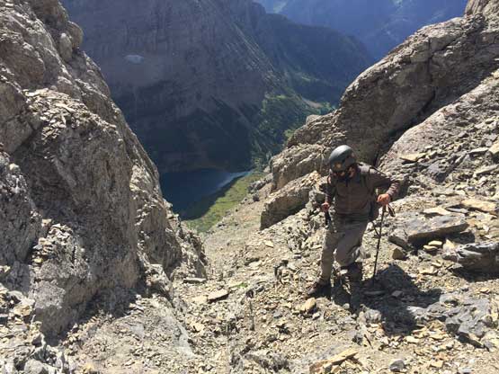
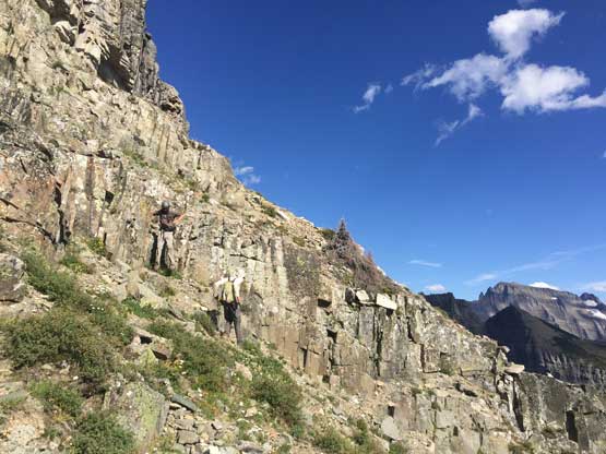
We took a long break at the cross-over notch in the sunshine, ditched some water and food before starting the 1-mile east side traverse. The exposure kicked ass in no time and it soon became a game of no-mistake-allowed. For the most parts across the east faces of Stoney Indian Peaks we were on a ledge with 1 meter wide, and a outward tumble would almost certainly mean death. However, the route-finding was easy as there’s only one way to go. There were two or three short stretches that we actually had to use our hands to traverse across some pebble-covered down-sloping terrain but for the most part we could just walk across.
The east side Stoney Indian traverse just about to start

Adam and Connor on the narrow ledge with no room of error
Adam just about to tackle the first crux zone.
Looking back at Adam and Connor on some typical terrain here
Crossing one of the many gullies
Typical, typical….
Traversing an easier stretch. Mt. Merritt behind
Traversing under the northernmost of the three Stoney Indian Peaks now
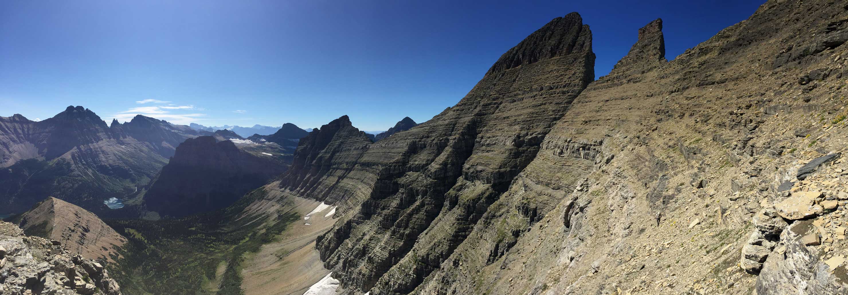
Panorama view from this traversing stage. Click to view large size.
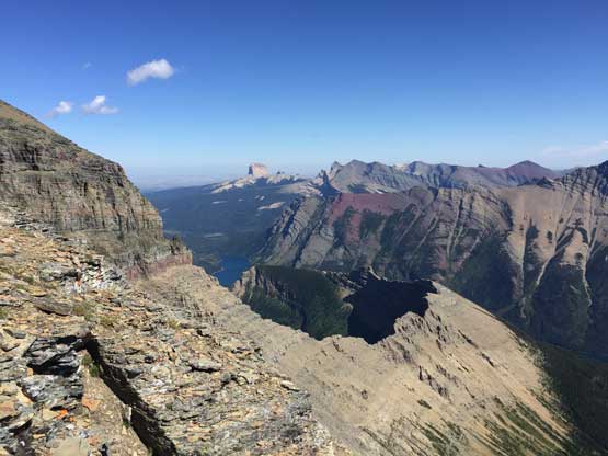
We finished the east side traverse with a view into the Waterton Valley
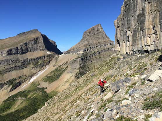
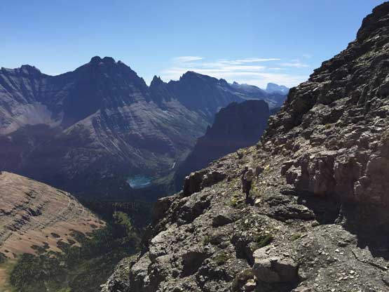
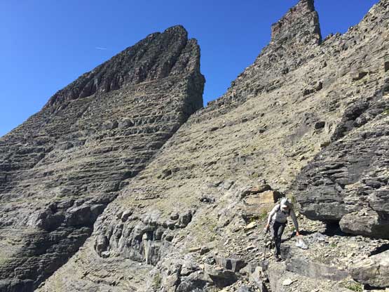
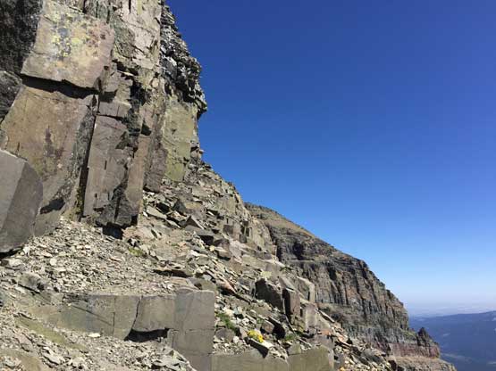
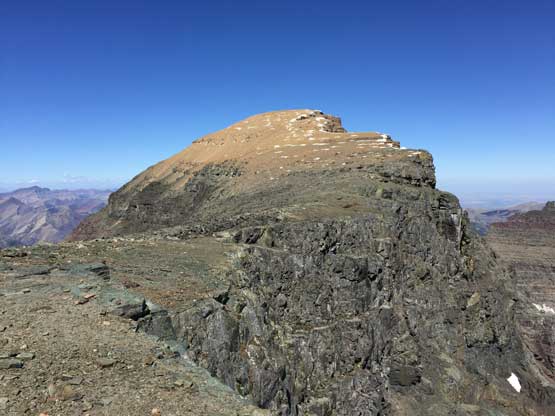
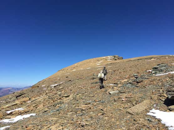
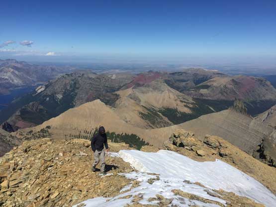
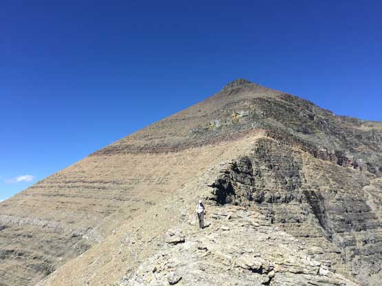
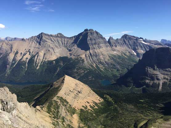
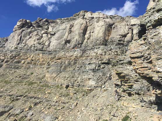
After finishing the Stoney Indian traverses we took another long break ditching more water and food, and went for the summit scramble. It was sad that we gained no elevation on the entire east side Stoney Indian traverses and now the summit was still a hell of ways up there. The scramble onto the false summit appeared like a true slog and it sure was. The crux band in the middle of the ridge was ascended on a diagonal ledge, climber’s right side and never exceeded “class 3-“. Adam and Connor went climber’s left and found some sketchy terrain and fell behind at least a few hundred meters back, but they caught up and passed me on the large summit plateau. I was already exhausted at this point but did manage to stumble the last few hundred horizontal meters to the summit. This summit plateau had probably the highest density of grizzly shit I’ve ever seen including one big pile right next to the summit cairn, and this was confirmed by other trip reports too. I’m almost certain that a family of grizzlies live on the large plateau. We lingered on the summit for a long time celebrating Connor’s list finishing, as well as the incredible views especially looking down Waterton Lakes into Canada. Almost all peaks in Waterton Lakes National Park looked awfully tame.
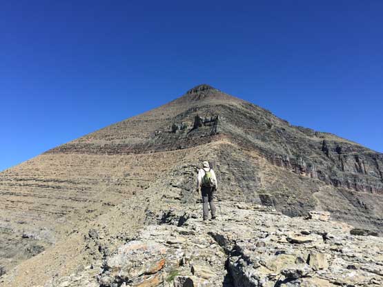
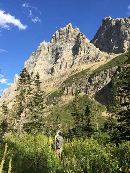
Adam with the upper Mt. Cleveland scramble
Vulture Peak, Rainbow Peak and Mt. Carter dominate the western skyline
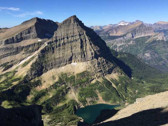
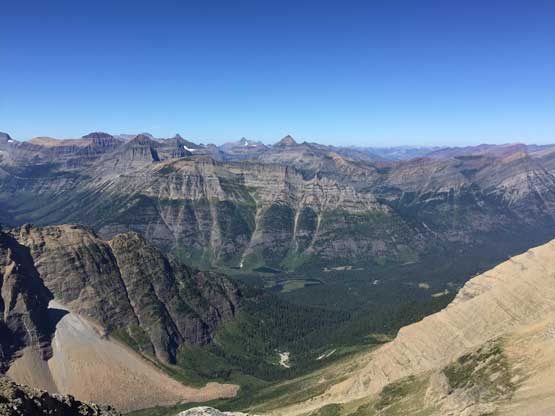
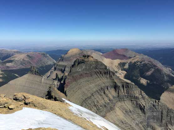
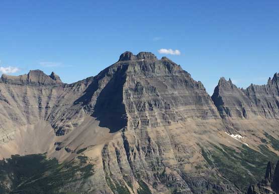
This is a sideways view across the massive SE Face of Mt. Cleveland
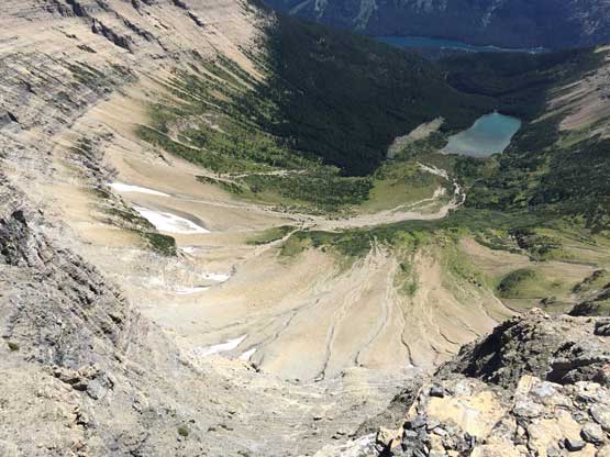
The bowl above Whitecrow Lake way the hell down there

Adam approaching the crux band on the upper mountain
I went on this obvious ledge, climber’s right and found mostly just “class 2+”
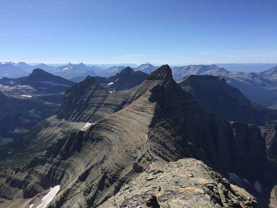
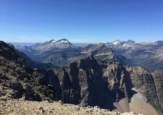
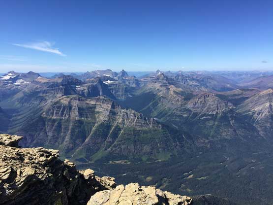
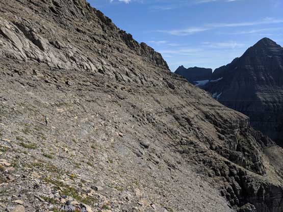
Much higher up now, looking back at Stoney Indian Peaks
Topping on the large summit plateau
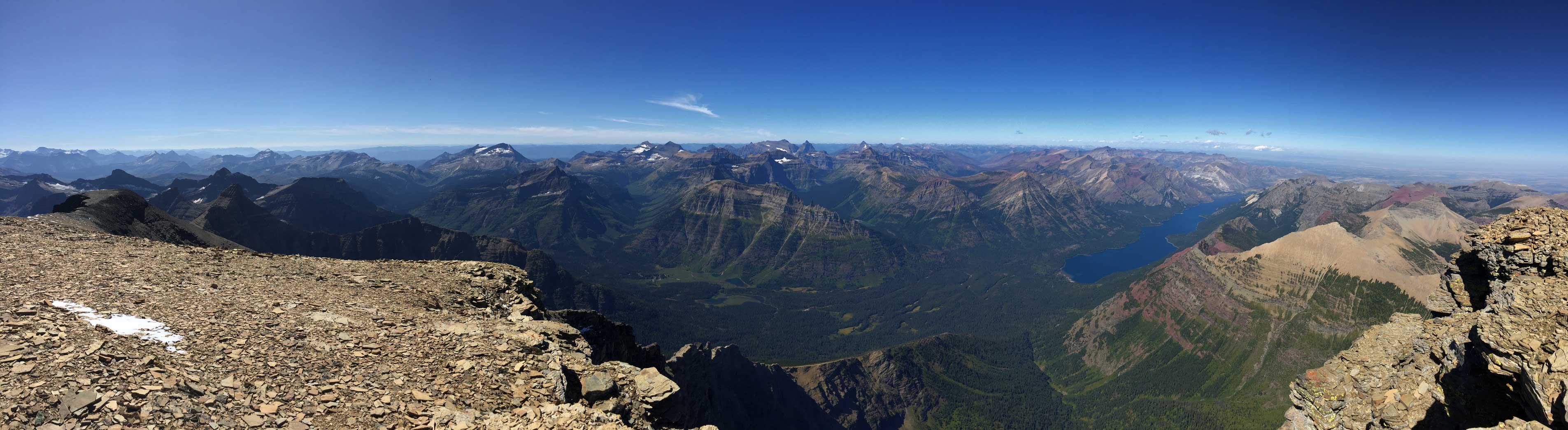
Panorama of the east side into the valley we came up from. Click to view large size.
Connor and Adam approaching the summit
A western view across the deep Waterton Valley. Kintla Peak dominates the skyline
This is a north-eastern view over the sub-summit of Kaiser Point
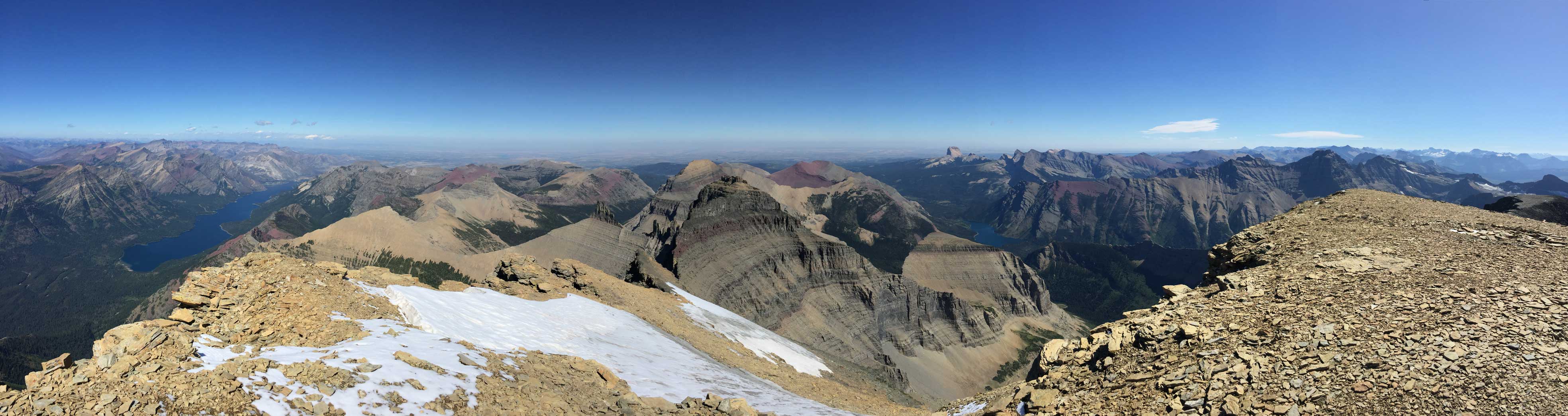
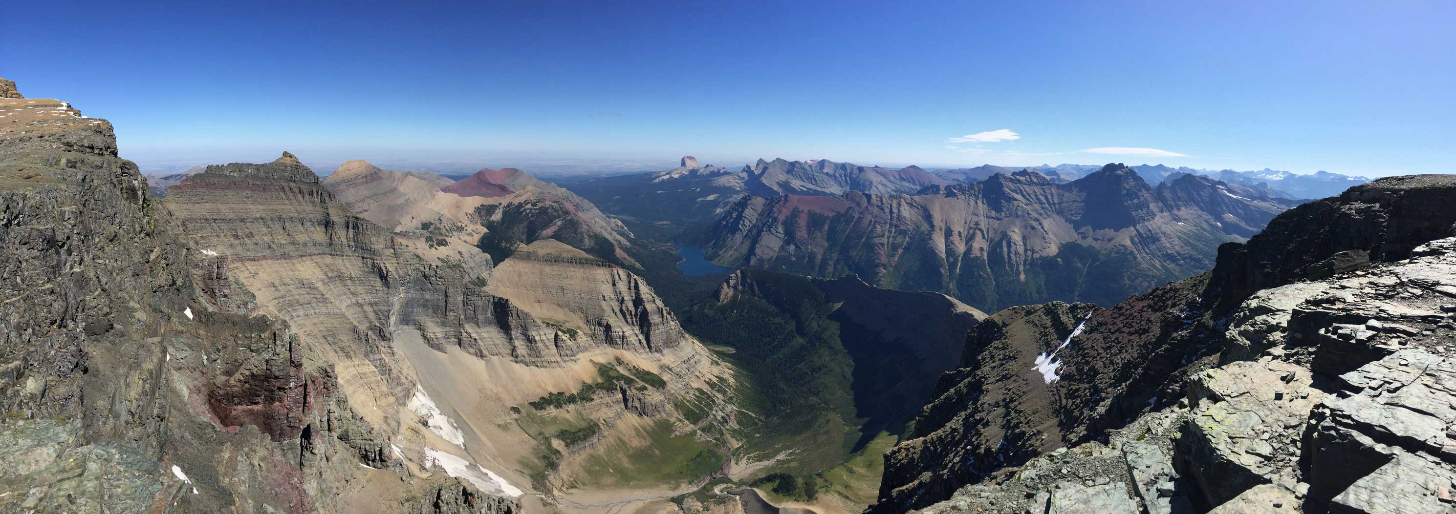
Partial Summit Panorama from Mt. Cleveland. Click to view large size.
Partial Summit Panorama from Mt. Cleveland. Click to view large size.
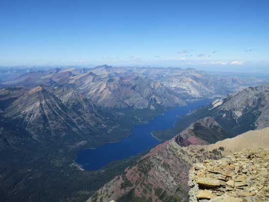
Waterton Lake more than one vertical mile down
Vulture Peak and Vulture Glacier

The peak in the distance at center horizon is Longfellow Peak
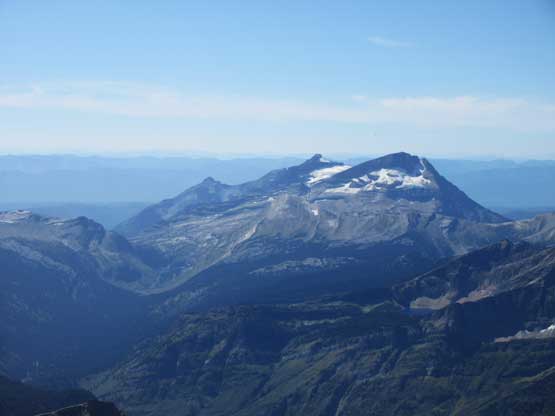
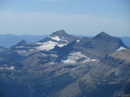
Mt. Stimson in the far distance and Mt. Jackson on the right

Behind Mt. Merritt (foreground) is the massif of Mt. Siyeh, another 10,000er
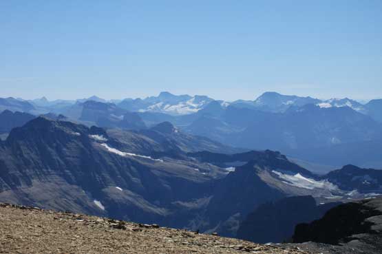
Mt. Blakiston to the north, highest in Waterton Lakes National Park

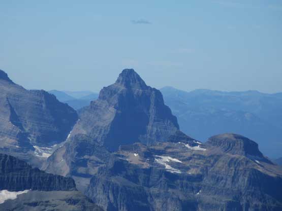
Long Knife Peak right next to Canada border boasts a very impressive south face
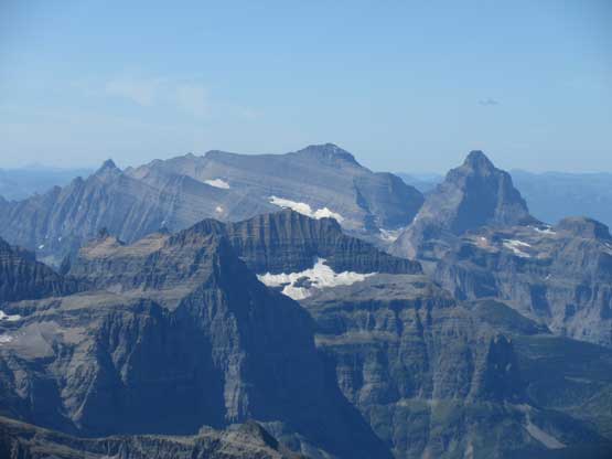
Kintla Peak and Kinnerly Peak are two icons of the northern Livingstone Range
Rainbow Peak (L) and Mt. Carter (R) are two of the taller non-10,000ers in the park
A closer look at Kinnerly Peak, only marginally lower than the 10,000 feet mark
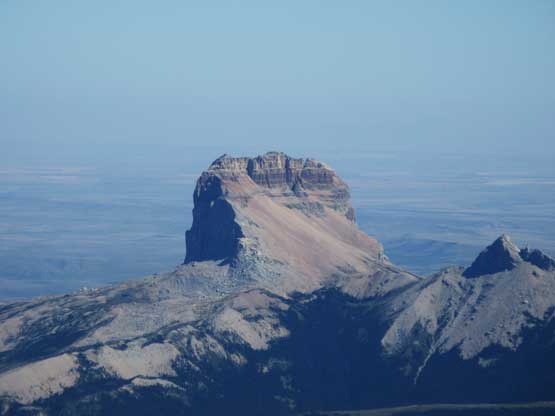
A very zoomed-in view of Chief Mountain far to the east.
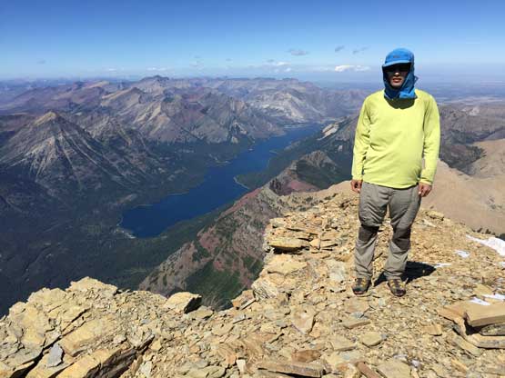
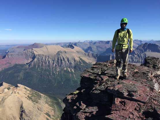
Me on the summit of Mt. Cleveland
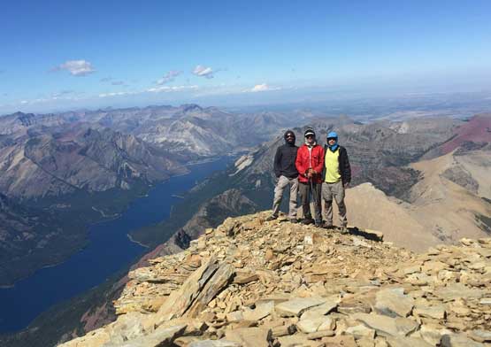
Connor, Adam and I on the summit of Mt. Cleveland
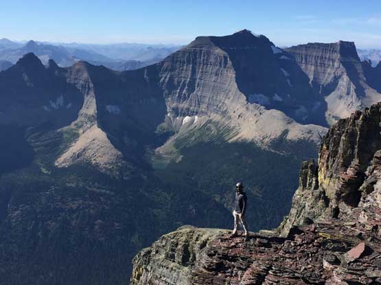
Connor exploring the summit of Mt. Cleveland, his last Ultra of Contiguous US
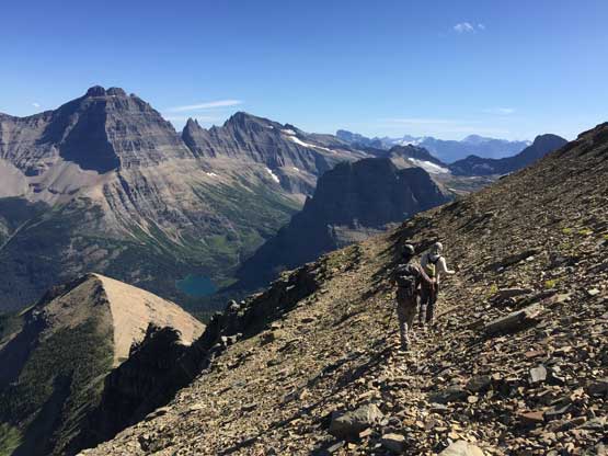
We all went down the route I took with no problem whatsoever, and in short time we had started the Stoney Indian traverses. The traverse was not difficult nor stressful, but did require lots of care and seemed to drag on forever. This was actually the only section of this day that I felt energetic about because the rest was all about slogging. Once the traverses were over we were in for some shitty choss terrain descending to Stoney Indian Pass. This time we followed Greg’s GPX track down the easiest route and our next stop was at the pass swapping footwear. My left feet was giving me lots of pain at this point and I was almost sure it’s another overuse injury, but at this point there’s nothing I could do other than sucking it all up and hiking all the hell out. The first business was hiking back to camp, a distance of 4.5 miles away. Thankfully the pain didn’t seem to give me some functional issue and I actually didn’t slow the guys down. Once back to camp I finally earned myself a night of recovery but based on my past experience with all kinds of overuse injuries I knew it’s only going to get worse on the following morning, and I was correct.
Scrambling down a field of large boulders under the false summit
Losing elevation rapidly down from the false summit, this is looking sideways east

We picked the right ledge to descend through the crux band. Stoney Indian Peaks ahead
Adam scrambling down the typical Glacier N. Park terrain
The south ridge of Mt. Cleveland is behind now

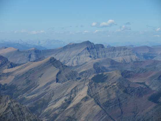
This long ridge (SE Ridge) of Mt. Cleveland descends over Whitecrow Mtn.
Adam and Connor starting the first (easy) section of the east side traverses
Mt. Merritt looks better in the afternoon lighting
Adam on the east side traverses
The typical terrain. Easy but no mistake allowed
Adam on the crux zone
A zoomed-in view of the NW Buttress of Mt. Merritt
A review shot of the east side sections, from the “cross over col”
Connor about to descend the steep chute on the west side of the col

Adam down-scrambling a 3rd class step
Picking up the west side traverses now
Me leading back across the west side traverse. Photo by Connor M.
Adam on the typical terrain of the west side Stoney Indian traverse
Descending the lower ridge towards the pass now
Back down to Stoney Indian Pass now
Descending into the bowl now with incredible views
Cannot beat this for a trail hiking experience
Pyramid Peak looks daunting

Atsina Lake
Hiking under the faces of Pyramid Peak

Looking down through the Mokowanis River valley
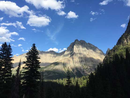
One last look at Mt. Merritt
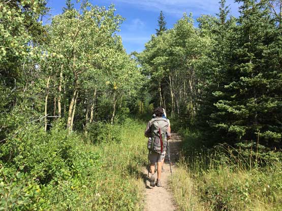
On the morning of Day 3 we started leisurely but once on trail we picked up the speed again, as usual. My leg and feet was feeling really bad but I forced myself to walk at a normal pace and to my surprise the pain actually went mellower as my body warmed up. For one push we knocked over 10 km down to the suspension bridge crossing Mokowanis Junction. We did one needed break but my leg wasn’t happy about that, as I then needed another 10 minutes to warm it up. We didn’t do many breaks after that and pushed all the way back to the parking lot by noon. There’s no cell services at the Customs so we drove south past St. Mary’s to East Glacier. There’s a fabled Mexican restaurant but it didn’t open until 5 pm. The online reviews were exceptionally good so we waited for over an hour, and the wait turned out to be very worthwhile. That same night we drove all the way west to the west side of the park and car-camped at the same secret spot we used a few days earlier.
Boring slog on Day 3…
I took the exact same photo of Cosley Lake as two days ago
Looking back towards the massive Mt. Cleveland
What a plod… This was on the final switchback to ascend back to trail-head
A curious doggy while we waited for the restaurant to open in East Glacier
The weather was getting a little bit unstable in the Rockies and the weather’s pushing us westward back towards northern Idaho and NE Washington. Adam had lots of ideas about the drive-up P2K objectives and I was happy to tag as many as we could, and then there came the “phase 4” of this peak-baggin’ road trip.
