Mount Schofield
December 16, 2021
1138m
Vancouver Island, BC
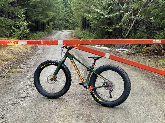
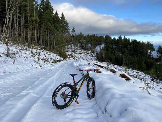
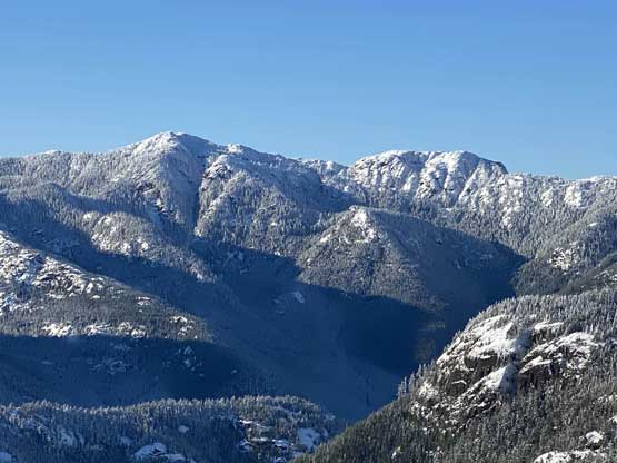
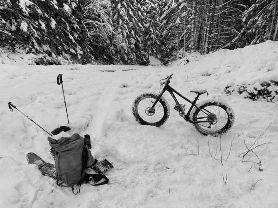
Mt. Schofield boasts over 600 m prominence and is the second most prominent summit on Beaufort Range of central Vancouver Island. Asides the prominence this peak is not attractive at all. From satellite images one can see that logging roads go almost to the summit from east and south sides but there’s very limited information about the status of these roads. It seems like most, if not all of eastern slopes had been logged. I happened to have most of this past Thursday available but I still needed to be back home by 8:30 pm for work. The best weather happened to be on the island. I could take the 5:45 pm ferry from Nanaimo back to Tsawwassen to position myself right on time for work, but the time deadline had limited my options. I could not leave home on Wednesday night so that further limited my options. Among the few easier P600m objectives I eventually picked Mt. Schofield. I opted to bring the bike since this was rather an exploratory ascent with unknown road conditions, and this turned out to be a great call.
I woke up at 3:50 am and made to Tsawwassen terminal half an hour later to take the first ferry. By 7:30 am I was dropped on the island and after a quick breakfast stop at McDonald’s I quickly made my way northwards on island highway. The weather was drizzling in Nanaimo but turned sunny north of Parksville, which was just as forecasted. I turned onto Cook Creek FSR which was the same one that I used to access Mt. Joan in this past summer, but turned south upon reaching the first major intersection. The road condition was good but a few kilometers later I came to a locked gate. Thankfully I came prepared with the bike, so I turned around and parked the truck.
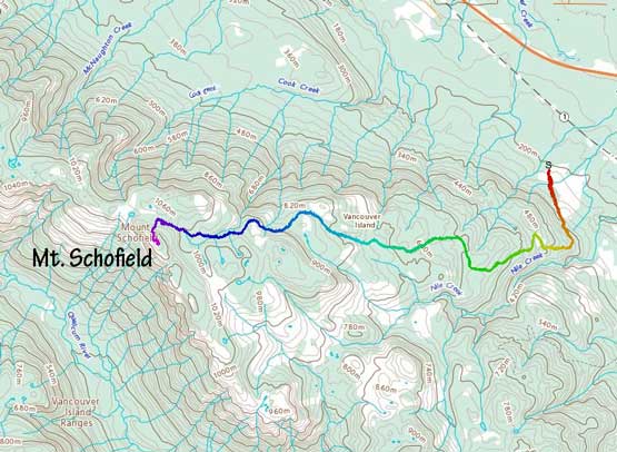
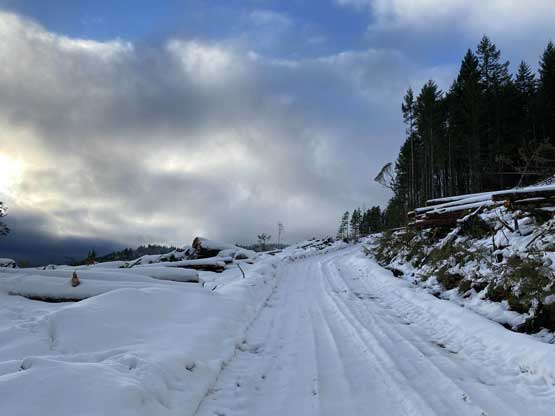
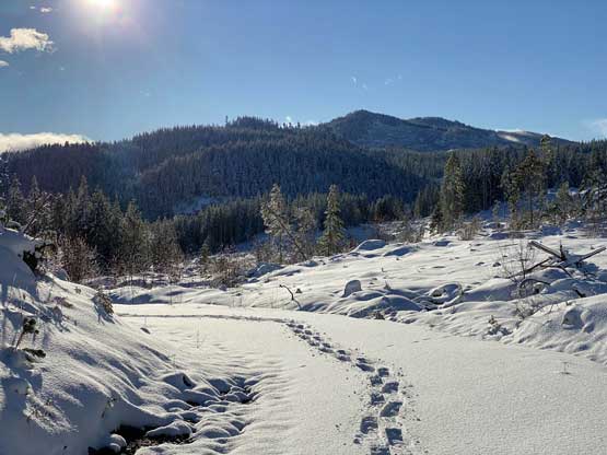
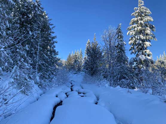
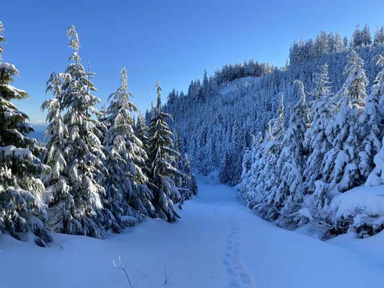
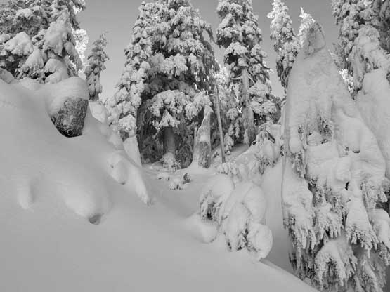
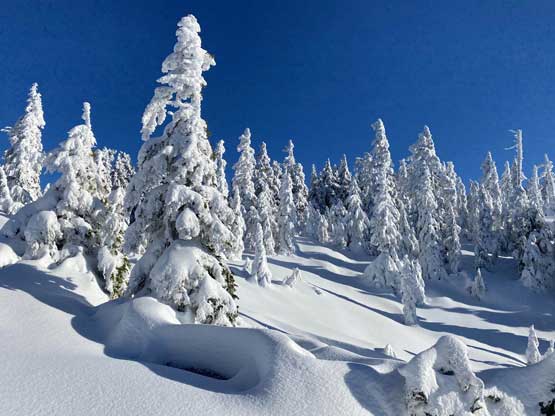
From this position I estimated the round trip distance would be around 20 km so I had to make this ascent in a timely manner to catch the ferry back. The FSR was mostly too steep to pedal up but there were some flatter stretches where I could ride the bike. Fresh snow started basically from the gate but there were also fresh tire tracks and the snow depth was rather shallow. The tire tracks were very icy at places and this road had a few insanely steep sections that made me worry about the ride down, but I kept pushing the bike to around 500 m elevation where the tire tracks stopped. There was about 30 cm of snow at this point so without the tracks I had to ditch the bike to immediately strap the snowshoes on. I had brought my trusty 30′ Lightning Ascents for maximum possible flotation and this turned out to be a great call again. Without the extra flotation I probably would have to turn around as the snow was very unconsolidated.

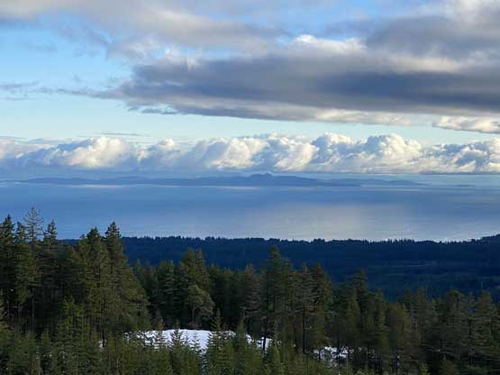
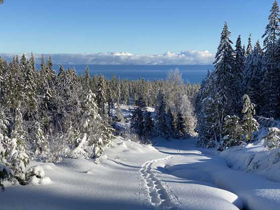
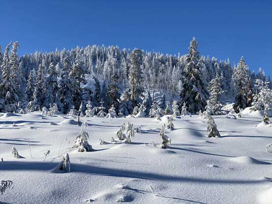
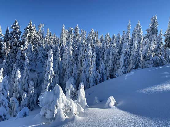
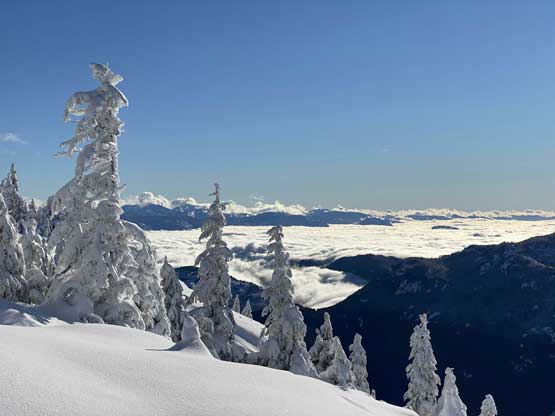
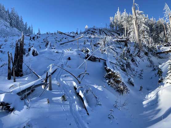
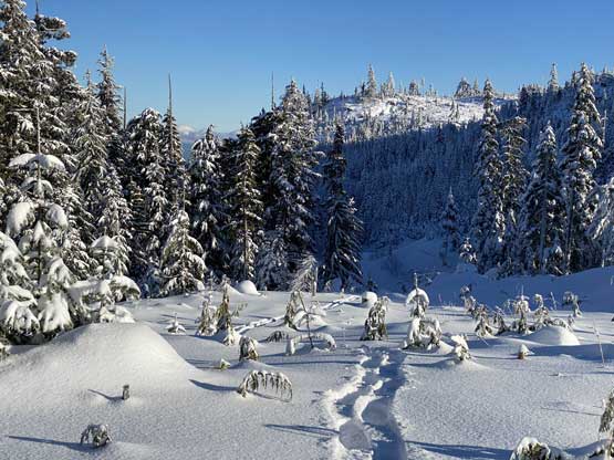
The trail breaking effort was heavy right from 550 m elevation and I still had 600 m to gain and at least 6-7 km distance (one way) to cover. The task was simple, just putting one foot in front of another. I tried hard to maintain a rhythm to let the time go fast. Thankfully the logging roads and the clear-cuts were open enough to offer some views. There were also a loads of spur roads on these slopes but with the Gaia map preloaded the navigation was not a problem.
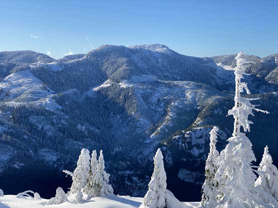
At around 950 m elevation I left the road to short-cut towards the summit area using the massive clear-cut directly under the east face of the peak proper. The trail-breaking wasn’t too terrible but occasionally I sank more than knee deep by discovering weak spots. The east face was much steeper than anticipated and it was actually not very clear where should I attack it from. The contour lines suggested the north-east side so I trended my bearing towards right to (hopefully) find a passage. I went into the forest too soon and the punishment was some next-to-impossible bushwhacking in some secondary growth with just the wrong amount of snow. After struggling for a while I made the call to turn around to search for a better way and I sure found one, further to the north-east. I bypassed that band of dense forest but I still had to ascend the higher band of forest to hit the summit ridge.
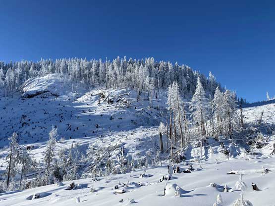

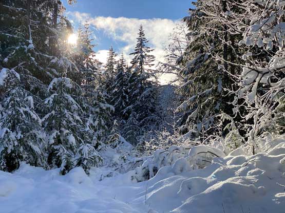
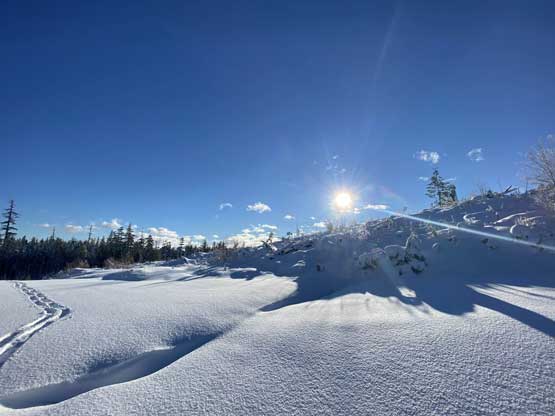
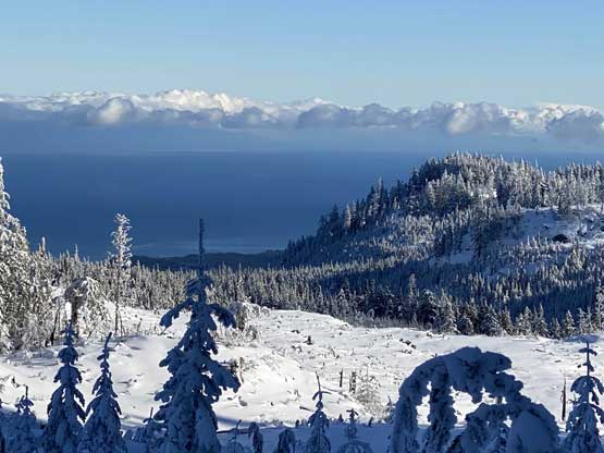
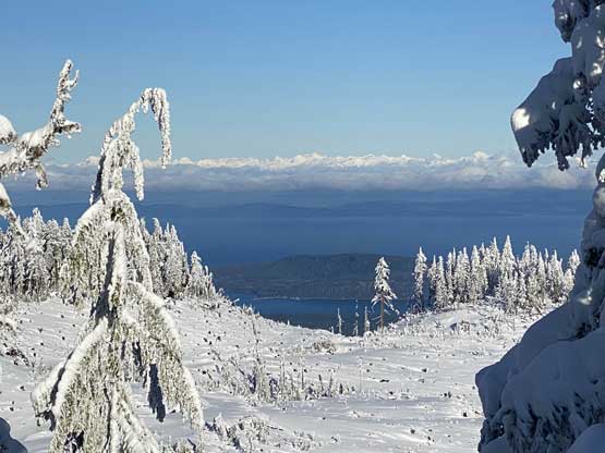
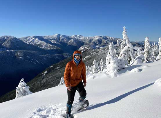
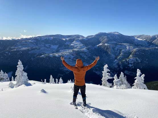
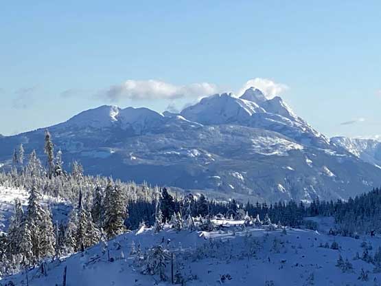
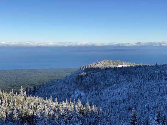
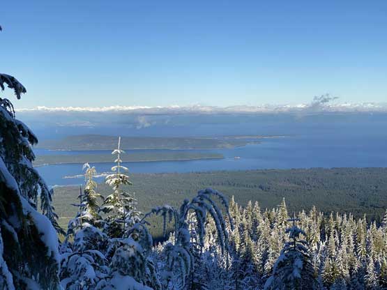
I aimed for a shallow gully feature that looked like the most friendly option. The going was difficult with deep, unconsolidated snow on steep terrain to start it with. The bushwhacking was actually not too bad but the steep terrain and the deep snow made things quite challenging. I eventually managed to reach the summit ridge but this section had taken me too long. The traverse to the true summit was scenic but involved more trail-breaking and some up-and-downs. The true summit was forested but the open bluff just to the west offered some views. It took me 4 hours to reach the summit and I had to stay there for at least 20 minutes for food, energy and photos.

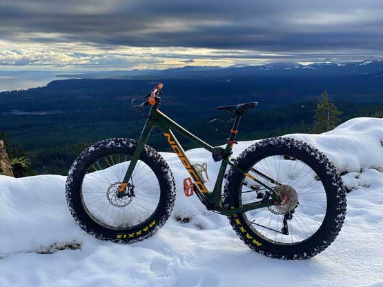
If I wanted to catch the 5:45 pm ferry I must make the descent in under 2 hours. Thankfully the unconsolidated snow was ideal for downhill snowshoeing that in no time I was back to the logging road. I then managed to maintain a 4-5 km/h pace plodding down following my own tracks. The bike ride on the last 3 km was tricky due to the steep grade and the icy conditions but the grip was much better than I thought. Being solo I had to ride slowly and in control but this was still fast and fun. I ended up finishing the entire descent in 1.5 hours and my round trip time was 6 hours.
I hassled the trail-head transition in just over 5 minutes and that included loading the bike and changing cloths and I eventually made to the ferry terminal with about an hour of spare. I had my dinner on the ferry and then took a short nap, and that kept me awake throughout the late evening work.
