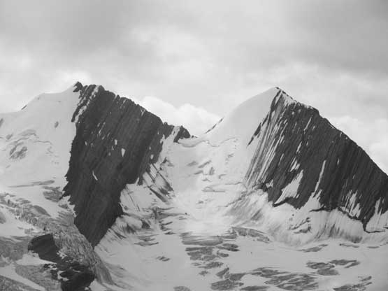
Mount Clemenceau
August 5-9, 2019
3658m
Clemenceau Icefield, BC
The glaciated massif of Mt. Clemenceau is the 4th highest peak in Canadian Rockies, one of the most illusive 11,000ers west of the Continental Divide in the most glaciated region of Canadian Rockies, Clemenceau Icefield, which is also the most difficult area to access. Even by mean of taking a helicopter this area requires more than 100 km one-way of flying from either of the three nearest base areas – Golden to the south, Valemount to the north or Cline River in David Thompson Country. An overland approach to Mt. Clemenceau would require week-long expedition over a great variety of terrain including water courses, and a trip into this area offers probably the most wilderness adventure in this mountain range, for purists seeking new challenges in the modern era. It’s not an impossible project but one has to fight hard and use all kinds of skills one has developed. A few years ago I was very keen on approaching Mt. Clemenceau and Tusk Peak self-propelled but things had changed in the last two years. I convinced myself there’s not even one remotely safe approach to climb Tsar Mountain, the 3rd 11,000er in this wild zone, without air support so joined Robb Schnell’s group in August 2018 to fly in. That trip was an ultimate success with all objectives achieved flawlessly but did deny my quest to complete all of Canadian Rockies 11,000ers sans air support.
In addition to that my primary focus in the mountains is timing and efficiency in peak-bagging which means to spend as little time/effort as possible to bag as many peaks as I can, across a great range of difficulty and across all regions in North America. There were only five 11,000ers left before this trip – Clemenceau, Tusk, Warren, Lunette and Lyell IV with the latter three being in areas I had already visited in the past. Mt. Warren supposes to have some of the finest views in Jasper N. Park but the sole region I’d climb Lyell IV and Lunette was to finish the list. I had little desire in pushing to complete this list in a speed manner even though I could very likely be the youngest, also the second fastest but I did want to bag the last five as efficiently as possible, which meant I should prioritize in maximizing the chance of summitting. I felt like I was almost done with the C. Rockies and wanted to spend much more time my local area – the BC Coast Mountains, and the neighbouring Washington state, but the unfinished business of 11,000ers kept drawing me back. This year I made the final call in flying to climb Clemenceau/Tusk as this allowed me to summit Mt. Clemenceau on Day 2 or even Day 1 after pulling the trigger, giving a much higher chance that the weather/condition would work out. Doing a heli camp also meant I could bring a shit ton of redundancy equipment such as double boots, double crampons, a whole rack of snow/ice and rock gears, five shirts and two sleeping bags with different temperature rating, such that I could simply decide what exactly to use after already being in the area and seeing the conditions. The bonus was bringing a full 110L duffle bag of luxurious food along with a brand new foldable chair, something that should not appear in the backcountry at all, let along in the most remote corner of Canadian Rockies.
Between Mt. Clemenceau and Tusk Peak there’s no doubt Mt. Clemenceau would be the crux because of the unknown factor of the glaciers. Tusk Peak actually has more technical climbing involved but with careful timing I was confident that Tusk Peak could go down exactly as planned, but such wasn’t the case for Mt. Clemenceau. The standard route on Mt. Clemenceau involves 1600 m elevation gain on heavily crevassed glaciers and it had been reported “not passable” by experienced climbers Barney Brown et al. in August 2018.
The planning started a few months ago through talking to Barney B. and my long time partner, Ben N. that had climbed or attempted. The consensus was that the easiest window when the glacier would mostly likely provide a safe passage through crevasses existed in April-May and I should aim to climb the two 11,000ers in this area on skis or snowshoes. I did manage to assemble a group-of-five to split the 6300$ round trip flying cost from Golden, but the group wasn’t flexible with the dates. This quickly became a gamble with weather and conditions and not to my surprise, the trip had to be cancelled because we faced some of the worst snow conditions in a decade, along with hopeless weather forecast. For the rest of May I talked to a guide and a wealthy client hoping to tag along in their trip but again, weather was horrible. It seemed like the spring idea was over but the continuous stormy weather meant we might have a healthy summer snowpack on the glacier. At this point I was contacted by Oakley W. working in Fortress Lake looking for a partner to climb Mt. Clemenceau and in no time I realized Oakley would actually be the perfect partner for this trip. Oakley’s company would be willing to get me free round trip flights from Cline River to Fortress Lake meaning we would only pay the short stretch of Fortress Lake to Clemenceau Icefield, reducing at least 80% of the monetary cost. Oakley had also just climbed Twins Tower so even though I hadn’t met him in person, it’s clear that he has adequate fitness and skills. We could not be 100% flexible with dates but there were flights every Monday and Friday and we just had to pick the “right week”. In the following two months at least two other climbers had jumped in the boat but had to be pulled out because their days-off didn’t work well with weather. The “right week” didn’t arrive until the first week of August and that’s when Oakley and I eventually pulled the trigger. I admit that the window wasn’t bomber neither with freezing level over 4000 m but in such a shitty year like 2019 this might be as good as we could get.
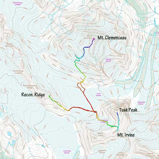
Ascent routes for Clemenceau, Tusk, Irvine and Reconnaissance Ridge. GPX DL
Oakley was already at Fortress Lake so we wouldn’t meet each other until I finished the first leg of flight, but thankfully the campsite he worked with had wifi and all kinds of luxurities that allowed us to communicate as if he’s in a city. Oakley informed me the fly-in would be at 11 am on Monday so I didn’t start the drive until early afternoon on Sunday. The drive into BC interior was a smooth sailing but it’s a long weekend and I was expecting something to come down, and there sure came one. A potentially fatal multi-vehicle crash west of Revelstoke had closed Highway 1 both directions with no estimated time of opening. The driveBC website said “no detour available” but such wasn’t the case if one’s equipped with Gaia GPS app. I spent about half an hour mapping a detour route into Three Valley Gap by using logging roads but such detour would cost 3 extra hours. It was a hard call whether or not I should go for it especially in the fading daylight time. Eventually after a bit of debating I opted to just sit and wait. I had time and driving around costed energy. At least sitting in my truck I could rest… It turned out that the highway closure lasted for only a bit more than 3 hours allowing me getting to Revelstoke by 10 pm. The McDonald’s in Revelstoke was such a gong show with long lineups at this time of the day thank to the highway closure and I could see the parking lots and “rest areas” were all packed with vehicles travelling opposite direction. I continued driving through Rogers Pass without traffic and slept in my truck in front of the Subway in Golden. The next morning I woke up at 6 am, had a breakfast in McDonald’s and resumed the drive to David Thompson Country. The weather was gorgeous and I enjoyed seeing my old playground. I arrived at Rockies Heli Canada two hours before the scheduled flight so after talking to the pilot I went back into my truck to sleep. However, the flight schedule changed again and the pilot came to wake me up at 10 am informing the heli would fly in 5 minutes.. What’s a show. Thankfully I had things all packed already, but had to jump into the heli wearing sandals..
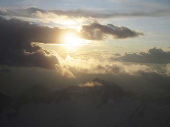
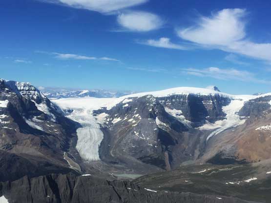
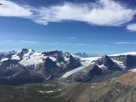
The heli flight from Cline River to Fortress Lake was the first highlight of this trip. In the first leg we flew up Cline River into some of the most remote areas in the Rockies’ front ranges in Whitegoat Wilderness. For years I had been wanting to see areas “behind” Mt. Coleman and Cirrus Mountain and a helicopter ride turned out to be a pretty good vantage point(s)… The pilot Ralph then flew us over towards the Columbia Icefield. I was looking forward to fly directly above the icefield but Ralph took a line aiming towards Woolley Shoulder then into the “black hole”. No complaint as they got us flying right beside Mt. Alberta – from its east face to NE Ridge and then over to the north face. The last leg of the journey involved flying beside Mt. Quincy, across Chaba River valley then over Fortress Lake. I had no words. Hands down the best view I had ever seen and it beats the 50-mile flight onto Mt. Fairweather in Alaska. In this section I’ll only show a few photos from the flight for illustration but I’m attaching a full series at the end of this trip report.
The east faces of Cirrus Mountain have some serious cliffs
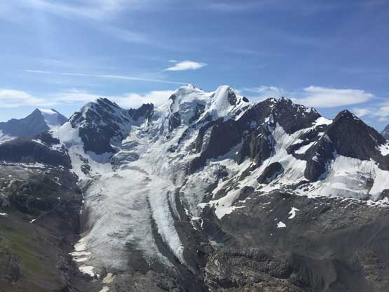
Flying beside Stutfield Glacier.
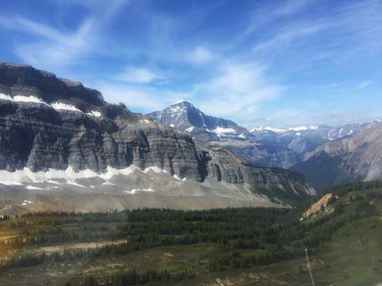
Now flying high above Woolley Shoulder beside Mt. Engelhard with Twins behind
The NE Ridge of Mt. Alberta displaces majestically in front
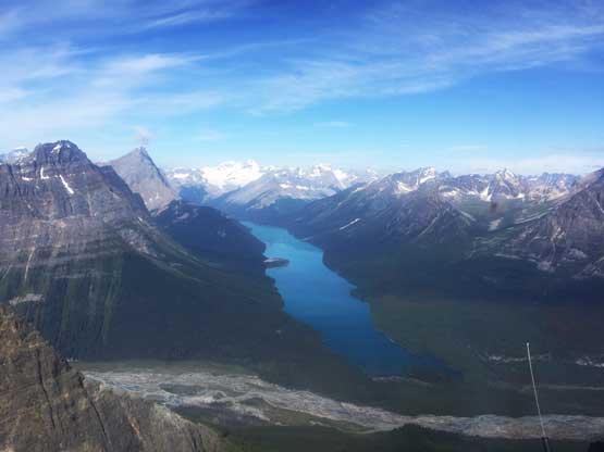
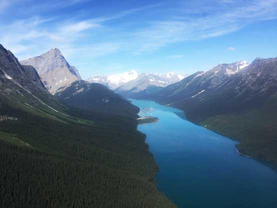
Flying towards Fortress Lake now
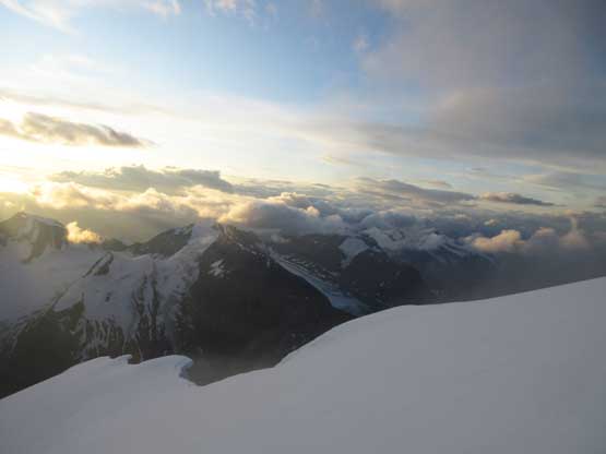
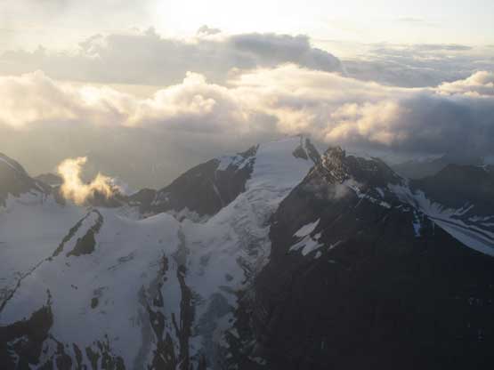
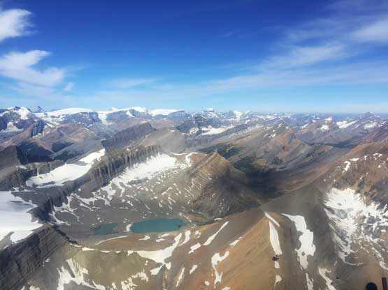
We had about 15 minutes of transition time at Fortress Lake camp and Oakley even briefly introduced me to the luxurious site. I told Ralph that we wanted to fly around the north/west side of Mt. Clemenceau instead of taking the most direct route because we wanted to scout of the route, if possible. For a while we were aiming at the north face of Mt. Clemenceau but he flight seemed too low to see our route so I informed Ralph to ascend up towards the summit, then descend over the “west shoulder” onto the lower SW Face. Meanwhile Oakley and I were busy taking beta photos. We had the whole route in sight and could clearly see that one way or another the route would go. The glacier had big crevasses but looked healthy for time of a year so our stoke level was very high. The scouting likely costed us 100 extra dollars but the photos we snapped came crucially on our later route-finding decisions, so very worth the spent. The landing at basecamp right underneath Tusk Peak’s NW Ridge would credit to Dean Lister’s detailed research last year and the beta Barney passed to me. We did the exactly same thing they did a year ago except for we didn’t bother to set up a huge base-camp tent. Ralph also didn’t have to land in the water pool and instead, dropped us off in the braided streams a little bit upstream. We did get our feet wet though so it wasn’t a bad idea to wear sandals on the flight…
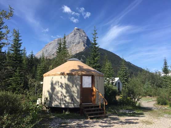
One of the cabins at Fortress Lake campground. Chisel Peak behind
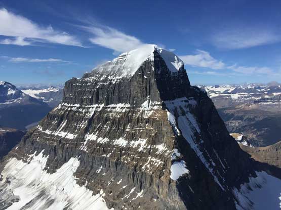
I inquired the pilot to fly over Mt. Clemenceau’s SW Face to scout it out..
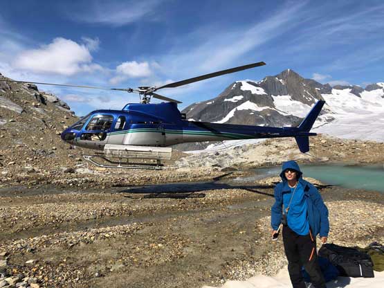
Helicopter landed us at the basecamp right underneath Tusk Peak. Photo by Oakley W.
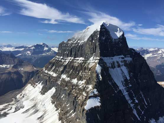
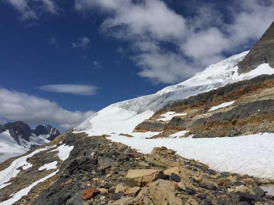
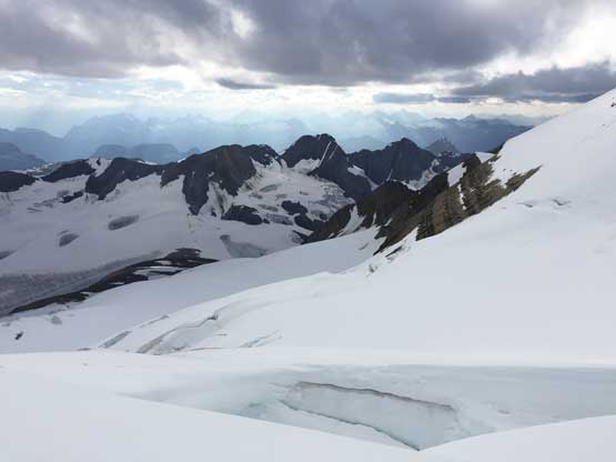
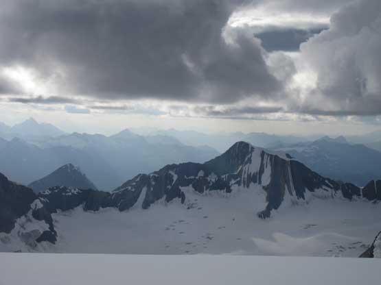
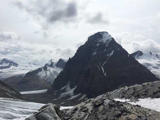
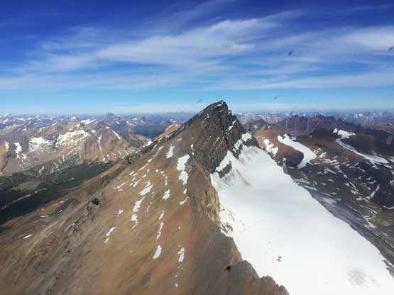
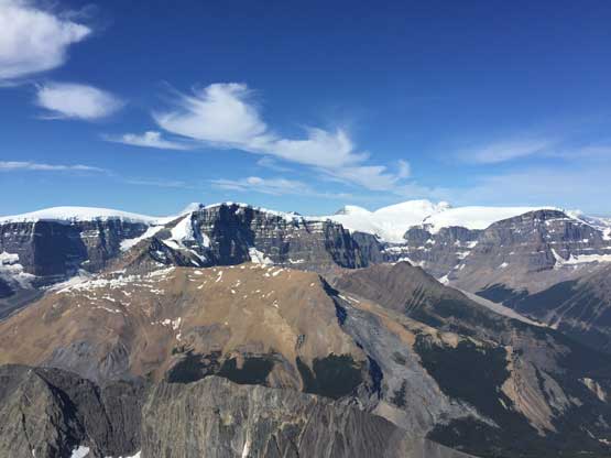
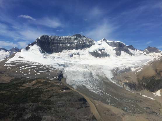
Mt. Clemenceau our first objective
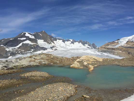
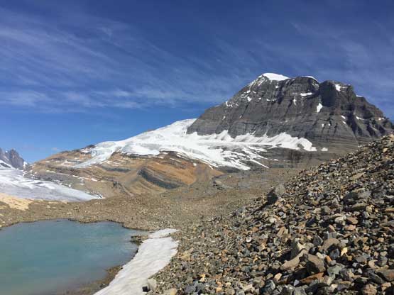
This tarn would become our home for the next few days.
It was 11:30 am and I told Oakley right away that we should aim to summit Mt. Clemenceau this evening. This meant carrying our overnight gears and camping somewhere on the route but in one way or another we shouldn’t waste the first day. The other option was to climb Tusk Peak on this day but we all wanted Mt. Clemenceau more than Tusk Peak and wanted to get the main prize first. The weather for the next day (Tuesday) was shitty so we brought enough food to last us until Wednesday morning but realistically we should get the summit near sunset on Day 1, at least that was the plan. We spent almost an hour to repack everything and gear up, which wasn’t bad at all considering the amount of shit we had to sort out. The descent from our campsite onto Tusk Glacier was tricky and a few cairns had led us to a vertical waterfall wasting time and energy. We then had to climb up and over some slabs and made a few sketchy 4th class down-climbing onto a patch of snow beside the glacier ice. The rest of the descent and the plod across Tusk Glacier to the base of Mt. Clemenceau was easy and scenic, but never seemed to end.
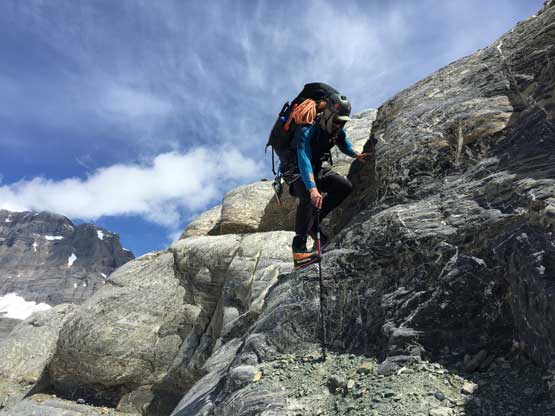
Oakley down-climbing tricky 4th class to access Tusk Glacier
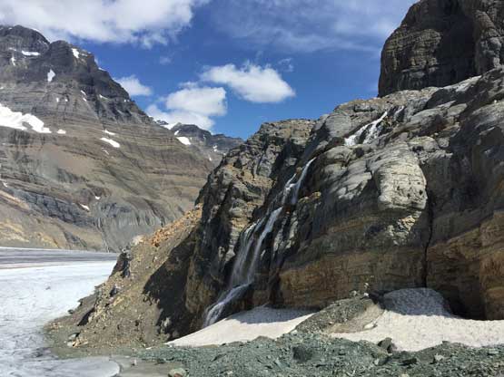
This set of waterfalls comes down from the tarn we camped at
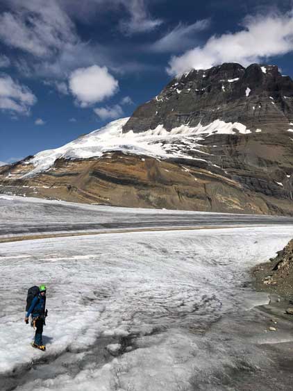
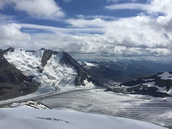
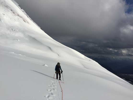
Me on Tusk Glacier now. Photo by Oakley W.
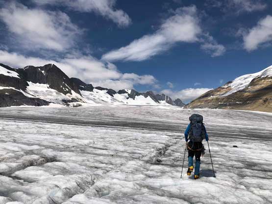
Me plodding across the long stretch of Tusk Glacier. Photo by Oakley W.
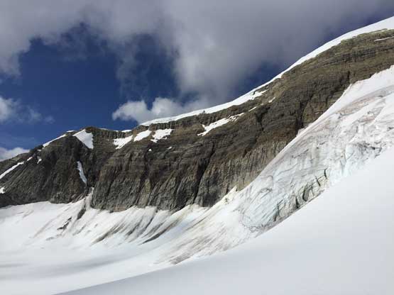
Gaining the glacier on Mt. Clemenceau was shitty. We evaluated a few options and decided on taking a direct route and what appeared to be scree turned out to be steep, compact moraine. It was not just unpleasant, but also sketchy given the heavy packs we were carrying. It was also unclear where exactly we should hop onto the glacier, but based on the earlier observation we should traverse far climber’s right to avoid a steep roll of ice.
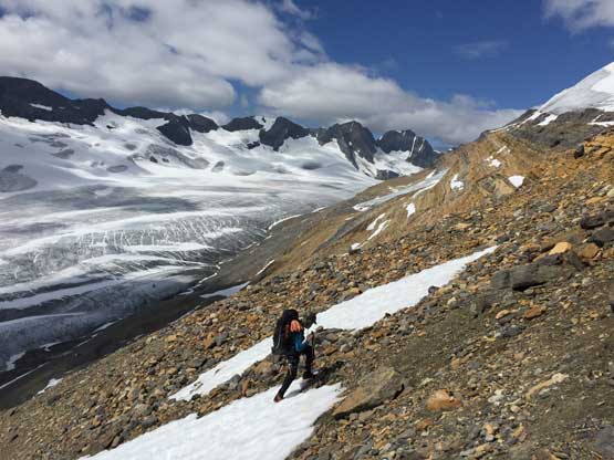
Oakley slogging up treadmill scree after the compact moraine section
It’s time to decide where exactly to gain the glacier. We opted for the far right
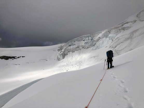
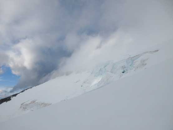
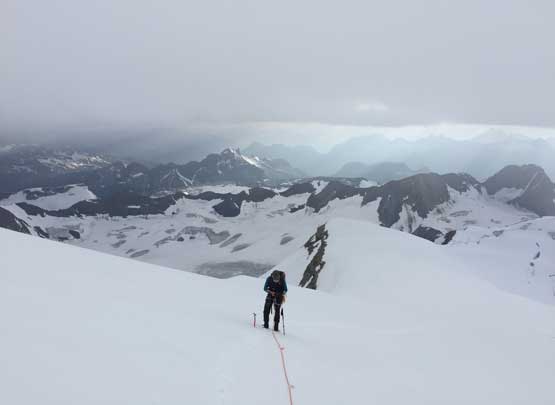
Right away we saw crevasses on the edge of the glacier and the snow condition was sloppy to say the least. The rope was out and I led in front probing as hard as I could on thin areas. After cutting onto the meat of the glacier we had a cruise sailing for the next 300 m elevation gain to beneath the “first icefall”, where the first major route-finding decision had to be made. I made a mistake taking the first (steep) ramp of snow on climber’s right side and after getting confused I pulled the GPS and beta out and found we were already off-route. Traversing over to Ben’s track in the middle of “first icefall” required crossing beneath active seracs that none of us felt comfortable with, especially at 2 pm in the afternoon. The sun was beating down mercilessly and glacier felt like an oven. This was when our heli-scouting paid its bill. Both of us spent the next minutes scrolling and staring on our phones and the conclusion was that we could indeed sneak through the climber’s right side on continuous snow. As modern as it seemed I have to say that one’s smart phone is the best friend in navigation in the new era. I could switch among Gaia topo, Canada topo, satellite images within a couple seconds, store numerous GPS tracks and waypoints and have book’s PDF file and hundreds of beta photos all on one device, so why not. We ascended straight up just to the right of the active seracs on some 40-degree snow and only had to deal with one crevasse which we easily stepped across but did require careful work in probing. Upon reaching a fork we went left and in a few minutes we were in a jumble of apartment-sized crevasses and seracs so nope, we backtracked and traversed 100 m horizontally out to the far right and weaved around a few crevasses, then we were at the 3000 m bench above the “first icefall”, where another major decision had to be made.
Starting to gain elevation quickly now. Looking back down onto Tusk Glacier
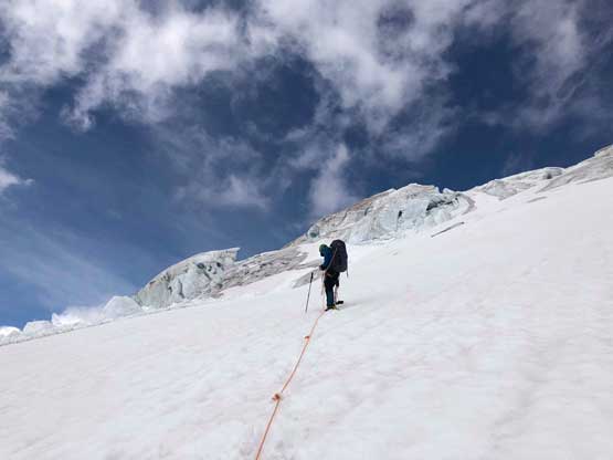
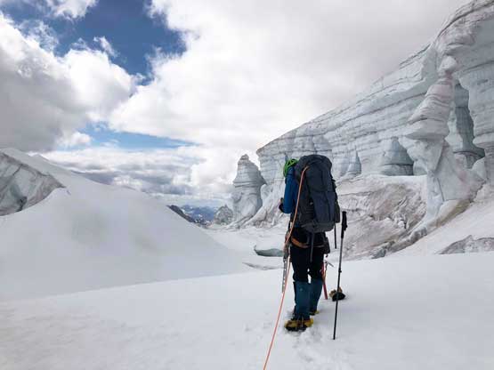
Me leading the way towards the first icefall. Photo by Oakley W.
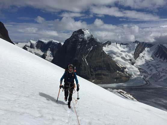
Oakley following up with Tusk Peak as the backdrop
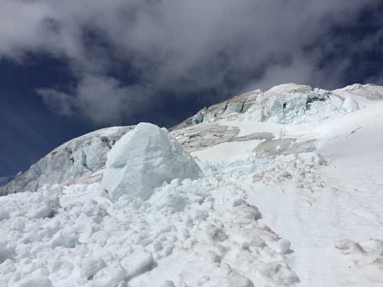
Coming across this zone of serac debris. Not good…
Me trying to find a way on climber’s left side of first icefall. Nope. Had to backtrack
The seracs here were house sized. We had to get out of here quickly
Oakley posing before we turned around to try the far right side.
This bench was flat and far enough from the seracs that we should pick a spot and drop our bivy gears but where exactly to camp depended on our route up and through the “second icefall”. I wanted to climb the gully-bypass that I had put at least a few hours into the research by some detailed studies over various photos I found in the past few years, including obtaining photos from private pilots. The gully bypass on the far climber’s left side would give us a glacier-free passage through the second icefall onto the higher west ridge shoulder hence bypassing all of the difficulties that Barney et al. had encountered last year. The downside was a 400-meter horizontal traverse with at least 30 m of elevation loss. The post-holing was brutal on this bench that in no time we were tired from the wallowing. The beta photos we got from the scouting were unclear whether a direct ascent of the second icefall would go with at least one troublesome crevasse that seemed to span across the whole face, but did show that the far climber’s right side had continuous snow albeit with some sagging. The climber’s right side looked 40-45 degrees but might be our best option. If it’s passable then we could shave potentially 1 hour off from my proposed gully-bypass option, so we backtracked to the climber’s right side, dug a hole and dropped a ton of overnight gears into it. We did carry all of the food as I didn’t bring my ursacks in this trip. I had lost my food on Columbia Icefield to ravens and didn’t want to risk that again.
Wondering around the 3000 m bench towards the left side gully bypass. Opted not
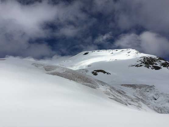
Then we looked for the far climber’s right snow face bypass. Yes let’s do that.
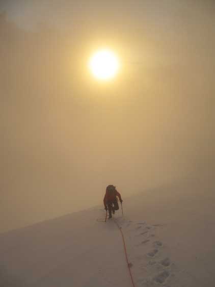
Up we went at 6:30 pm. The clouds had already obscured the upper mountain above the “west ridge shoulder” and we had three hours to climb the last 650 vertical meters to the summit. The descent would be done in dark no matter what but it’s better if we could summit before sunset, if possible. Based on our pace I was skeptical that we could make the summit before sunset but at least we should try. I felt pretty low on energy earlier in this trip but somehow managed to finally turn on my snow climbing mode, that once the grade steepened up I suddenly had what seemed like energy-of-infinity post-holing and kicking-step up the long zone of 40-degree. There were one or two crevasses but none imposed much of a problem. I aimed at a “rock island” feature and once near it we made a decision to climb up and around the island even though it meant more 40-degree climbing and potential elevation loss. The scouting photos showed that this way had less crevasses to deal with. The post-holing near that rock island was knee deep because the snowpack was shallow and isothermal down to ground. Too bad Oakley had to post-hole on top of my tracks making thigh-deep holes that I discovered on the descent. There was indeed some elevation loss (in flat light) and then we had to wallow up another stretch of steep, 40-45 degree south-facing slope down thigh deep to gain the upper west ridge shoulder. This stretch was very sketchy because the snow bridge across the bergschrund was soft and less trustful, and the snowpack was again, isothermal down to ground. Thankfully the sun was not directly on the face.
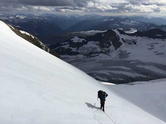
Oakley partway up the long stretch of 40-degree climb, far climber’s right
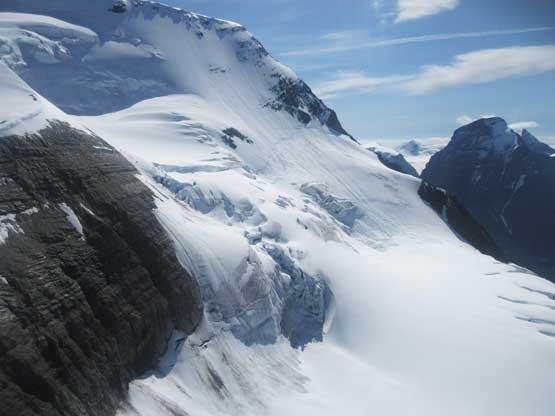
Above the second icefall now
There were still massive crevasses to dodge around but easy going
We had to drop ~30 m into this bowl above the second icefalls
Oakley and the evening sunlight shone on Mt. Clemenceau
Me looking at the 45-degree climb to access the upper mountain. Photo by Oakley W.
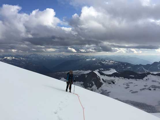
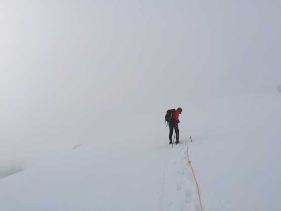
The next 200 m was a gentle ascent on the broad upper west ridge shoulder. There was no crevasse to worry about and the only problem came from 1. post-holing and 2. the rapid loss of visibility. The post-holing was much better than on the steep zones but still took lots of energy and once above 3450 elevation we entered the ping pong ball. The visibility was limited to just the two of us and the immediate ground in front of me, and on a snowy giant like this we had no other sight of reference. The GPS came out multiple times to make sure we picked the right leftward traversing bench on the next stage. At one point I suddenly saw a crevasse in front and looking around I found no obvious bypass so went for it and made a step-across. After that it’s time to traverse diagonally to the left. The next 150 m elevation gain on this long bench was mostly navigated by GPS (checked it about 10 times) but occasionally the clouds thinned and we could see something to confirm where exactly we were. The most notable feature was a wall of seracs on the climber’s right side that we ascended in parallel with. Eventually the traverse came to the end and I could make out the outline of the summit ridge on the horizon. Two manageable crevasses appeared on the right side and instead of traversing further with no sight of the supposed giant cornices I made the call to climb/crawl over those two crevasses n soft snow bridges (very sketchy). The climbing over the two crevasses involved putting some fate onto the snow bridges because it was already 9 pm and we didn’t want to set up proper belaying. Then a long stretch of 45-degree climbing followed in a full-on white out. I kept a general bearing up and climber’s left until seeing the outline of the summit ridge again and then magic happened. The clouds lifted up and we could suddenly see what’s underneath, and a bright beautiful horizon of sunset to the west. We then sped up on the final 50 meters to the summit and the clouds came in and out providing some of the most dramatic moments I had ever experienced. The last 5 meters were suspected to be on a giant cornice and we didn’t want to risk it. I knew Ben had climbed onto the corniced summit pinnacle (with a belay) but even with a belay we didn’t feel like taking a chance of a cornice fall at 9:30 pm and especially with just two of us. We were back in a white out anyway so wouldn’t get any better views so called it “good enough”, and down we went.
A closer look at Mt. Bruce now far beneath us
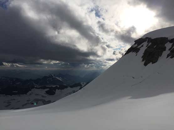
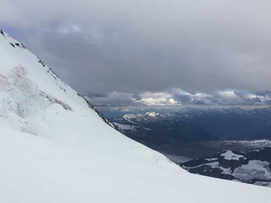
The upper 200 m to the summit was very soaked in. But let’s face it..
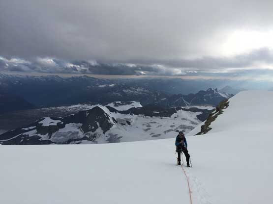
Oakley finally onto the “upper west ridge shoulder” onto easier terrain
Plodding up the “upper west ridge shoulder”, this is looking sideways
The last photo before entering the clouds
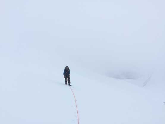
Mountaineering in a ping pong ball now. It didn’t help we had to navigate crevasses
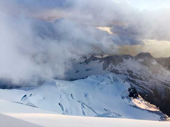
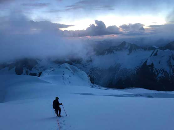
Now what… The clouds lifted once we were on the summit ridge..
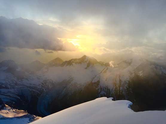
Sunset behind Mt. Bruce to the NW
A closer look at the evening sun
This is a northern view looking over the summit ridge.
A sideways view across the uppermost west face to show where we were at.
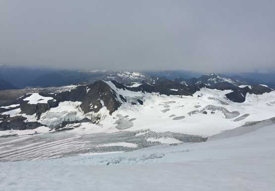
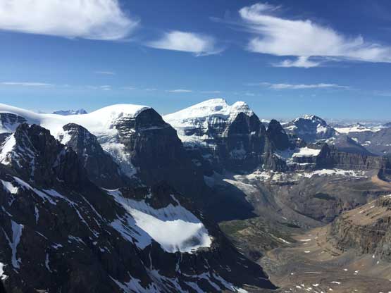
Mt. Mallory and Mt. Farrar on the northern end of Clemenceau Icefield
Oakley approaching the summit of Mt. Clemenceau
The down-climbing of the long 45-degree zone on the summit ridge required a lot of care given the soft snow conditions. Crossing back across the two snow bridges involved some yoga long-reaches but we all somehow got through without breaking a snow bridge. Then it was an easy plod down the ramp. I led down the next crevasse, simply jumping across and Oakley did the same, then we were post-holing down the “west ridge shoulder” and now below the clouds ceiling again. Descending that 45-degree south-facing slope required careful down-climbing facing into the slope. I had no idea how the isothermal snow held our weight but it did seem like the Rockies’ isothermal crap wasn’t be as bad as I thought. In the past years I did have climbed and down-climbed shitty snow like this. We had no issue with the snow bridge across the bergschrund and then the next stage was that short stretch of elevation regain. It was finally the time to pull the head-lamps out. The plunge down to the 3000 m bench was easy and fast and the only crevasse was descended by “butt sliding” across. The worst was diggin’ tent platform, erecting the tents, blowing air pad, melting snow and cooking. The boots were soaked and I did not bring a pair of booties and needless to say, it was miserable. Thankfully the temperature was warm. I did the exact thing on Mt. Columbia after summitting at 7:30 pm on Day 1 in April 2015 and this day was much more pleasant by comparison, so no complaint.
Descending the upper mountain in a white-out, but easy with the tracks
Me heading down in the rapidly fading daylight time. Photo by Oakley W.
The next morning we slept in till whenever we wanted and once I got out of the tent at 9 am I noticed the ceiling had dropped to just above our bench. There was no freeze whatsoever given the cloudy skies and warm temperature so we did make a great call pushing to summit Mt. Clemenceau on Day 1. I knew the morning of Day 1 had freezes but the temperature was skyrocketing through the week so we expected the evening of Day 1 to be the best window to summit even though 9:30 pm is by no mean a “textbook” time to summit anything… After leisurely breaking camp we were going again. Some of the tracks had already melted out (through the night) but the tracks was no problem to follow. The only sketchy crevasse was descended by butt-sliding this time and in no time we were off the glacier. As mentioned earlier I went to explore a different line down to avoid moraine type of compact choss and did find one. Oakley was worrying that the route might not work and I was too, but a diagonal ramp magically appeared breaking the cliff band at the bottom, then we were home free. The long slog across Tusk Glacier was boring especially under overcast skies, and the 4th class climb to get back to basecamp was just as sketchy as what I remembered from a day earlier.
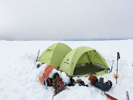
Our camp at 3000 m bench above the 1st icefall
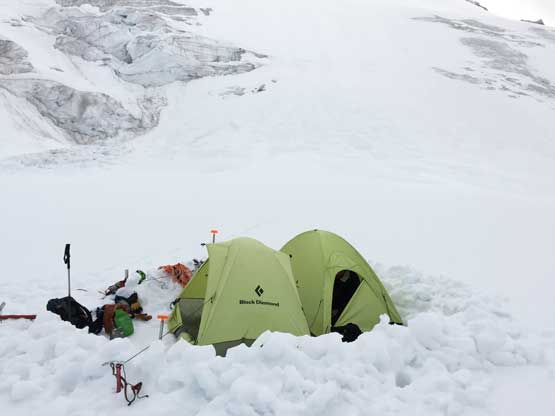
Another photo to show our double BD Firstlight tents high up on Mt. Clemenceau
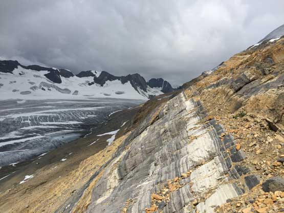
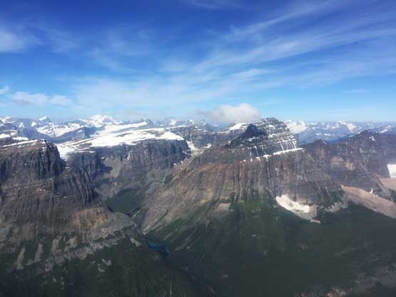
The ceiling was lower this morning. Reconnaissance Ridge in the background
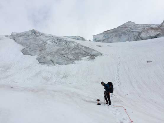
Oakley after finishing the 1st icefall descent

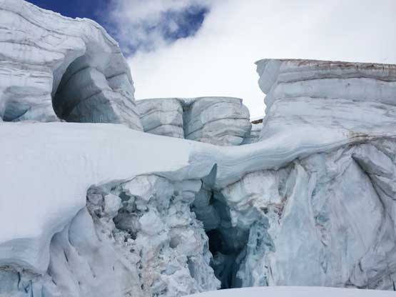
Seracs on the 1st icefall. Not a good place to linger around
Me leading down the lower glacier. The tracks were all melted out here.
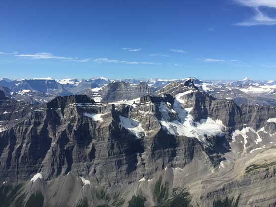
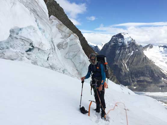
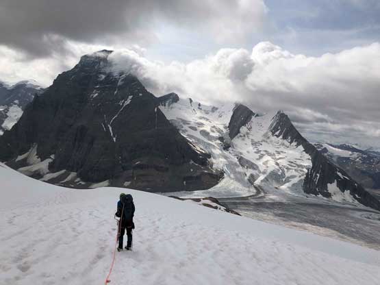
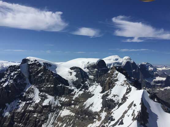
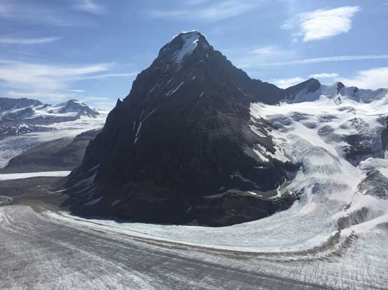
Mt. Chettan (L) and Mt. Shipton (R) two sub-summits of Tusk Peak
Tusk Peak is very impressively looking
Ready for some rock? This is C. Rockies and you gotta love choss…
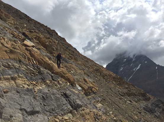
Oakley descending the typical Rockies choss with a heavy pack. It was brutal
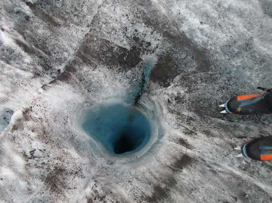
A deep moulin that we couldn’t see the bottom
The rain held off until in late PM but then poured hard on us until midnight. We barely found a window to cook dinner and as soon as the dinner’s ready we were back in a down pouring. The thunders were loud and lightnings were close. I wondered if our camp location was safe from lightning strikes but the nearby Tusk Peak should suppose be a natural lightning rod for us… The sky did clear up later at night, the alarms were set at 5:30 am and the next day it’s time to finish the 11,000ers in this area by a climb of Tusk Peak. It turned out to be a hard fight too.
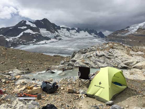
My tent and my chair with Reconnaissance Ridge behind
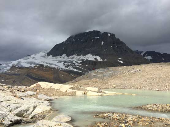
The tarn with Mt. Clemenceau behind. It’s going to rain soon
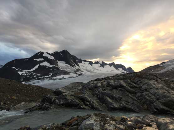
The rain let off briefly and we could finally cook some dinner
As mentioned earlier I’m going to show a bunch of photos from the heli flight Cline River to Fortress Lake then onto Clemenceau Icefield. For 500 dollars round trip it’s worth even just for sight-seeing, IMO.
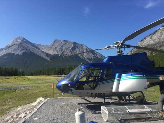
The heli that we took. Elliot Peak and Sentinel Mtn. behind
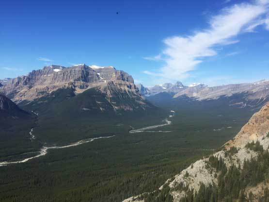
We gained elevation into Cline River valley and would follow it for a long while
Minister Mountain, Pinto Lake, Sunset Pass and Mt. Coleman
Starting to see huge cliffs on the east face of CIrrus Mountain
We flew right beside the SW Slopes of Mt. Stewart
This is some front country behind Nigel Peak.
Starting to see Athabasca Glacier now
Mt. Athabasca, Mt. Andromeda and Athabasca Glacier
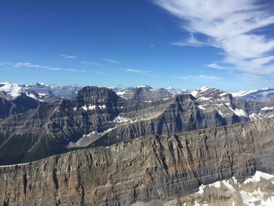
The east face of Mt. Kitchener shows up at left of center
This is taken from near the summit of Mt. Engelhard, looking towards Stutfields
Into the “Black Hole” now looking at North Face of Twins Tower/North Twin
Passing the East Face of Mt. Alberta
East Face, NE Ridge and North Face of Mt. Alberta all in one shot
The North Face of Mt. Alberta

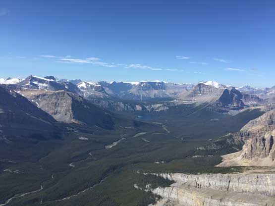
Flying over Athabasca River valley now. Mt. Confederation right of center
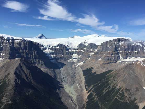
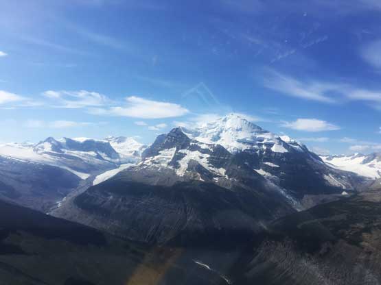
Flying towards Mt. Quincy now. Way in the distance we could finally see Mt. Clemenceau

Sundial Mountain is that iconic peak on the edge of Chaba Icefield
Fortress Mtn. and Catacombs Mtn. across Chaba River valley

Flying past this unclimbed buttress of Mt. Quincy massif
Descending towards the cabin at Fortress Lake
Flying up again. Mt. Bras Croche in the background
Ghost Glacier on the north face of Ghost Mountain has some Peru feel…
Flying towards the looming mass of Mt. Clemenceau
The east face of Mt. Farrar on Clemenceau Icefield
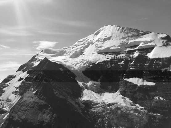
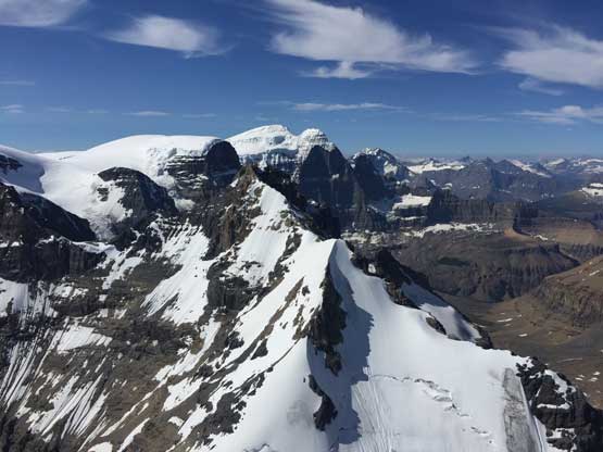
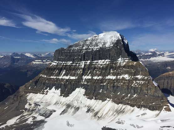
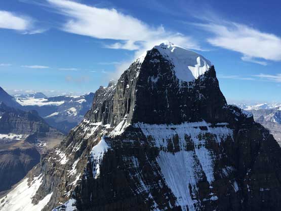
A closer look at the North Face of Mt. Clemenceau
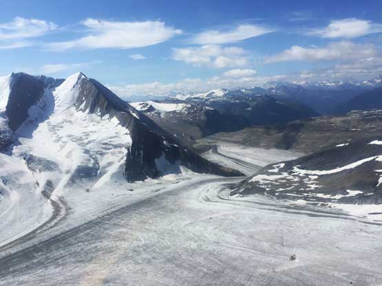
Flying over Tusk Glacier now. Mt. Shipton on left
Flying towards the base of Tusk Peak which would be our campsite
And finally, I’m attaching a beta photo to show the route we took. This is different than Ben’s ski route, David P. Jones’ in a dry August year or Barney Brown et al.’s in August 2018 attempt. I had put tens of hours into researching Mt. Clemenceu’s glacier so if you have any specific question then feel free to PM me.
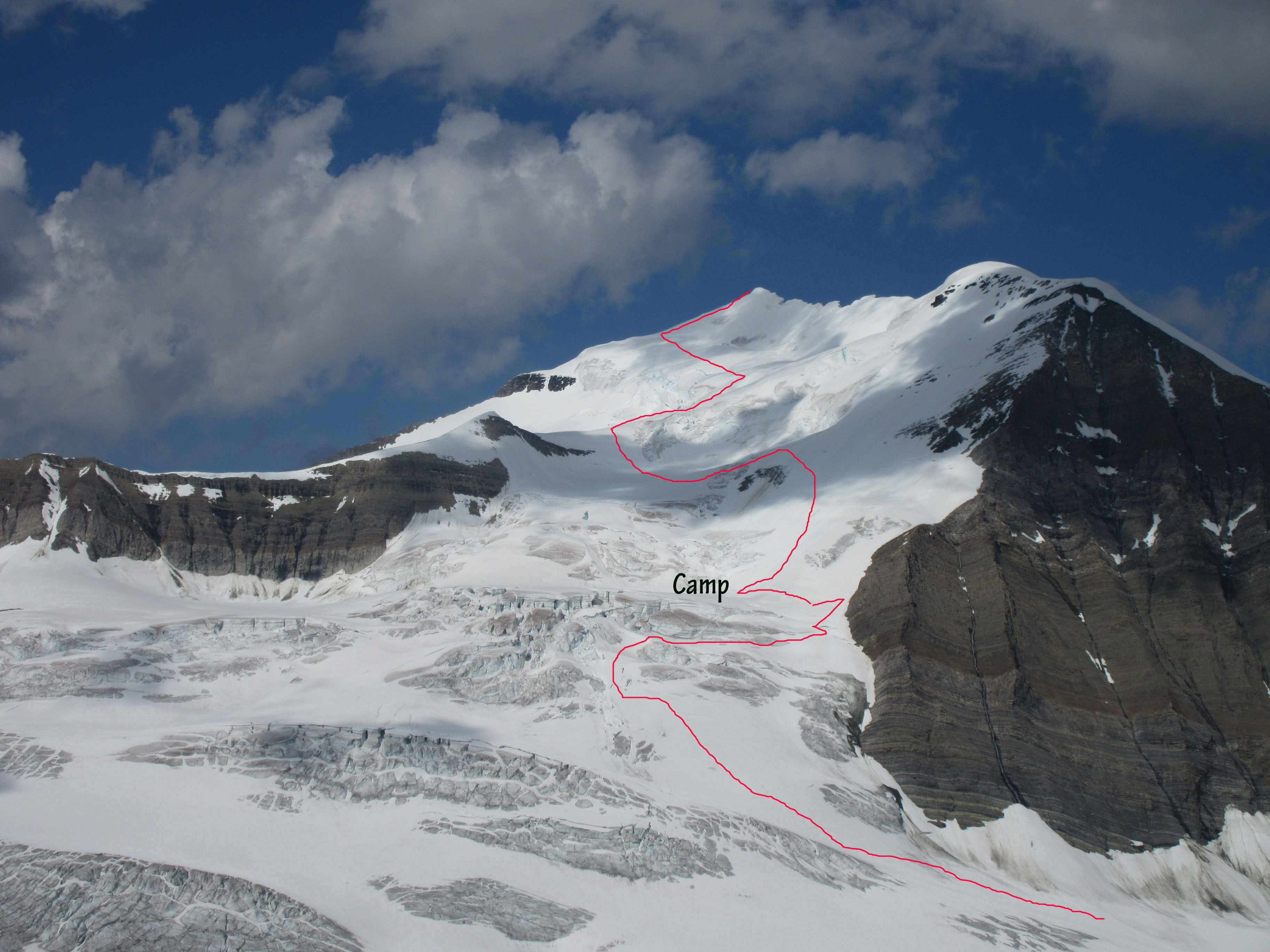
Mt. Clemenceau route we took. Click to full FULL size…
