Mount Romeo
February 4, 2024
1663m
Vancouver Island, BC
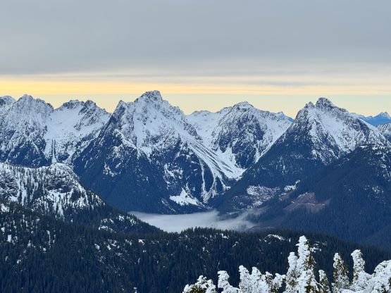
Mt. Romeo in northern Vancouver Island is one of the easiest objectives in the area that boast over 1000 m prominence, as logging roads had been pushed to within 300 vertical meters from the summit on the SW slopes. The roads on the northern island are fortunately not private and not gated so the access is very straightforward for anyone with a reliable vehicle. Over the past few years a few groups of prominence-based peak-baggers had already done this objective so the secret’s out. A winter ascent of Mt. Romeo on the other hand, should not be considered as an option as to take advantage of the easy access one needs the logging roads to be free of snow. This winter is an anomaly that the temperatures had been warm and precipitation events in the form of snow were rare. There had been torrential rain all the way up to the mountain tops over the week prior to the trip, so a lot of the snow had been washed away. This had been a disastrous season for skiers but a dream season for peak-baggers. Earlier in the day Raphael, Kate and I had ascended Mt. Abel and the southern slopes were free of snow all the way to 1300 m elevation, so we were positive to use the same afternoon to make an ascent of Mt. Romeo.
Raphael had done enough research that all I needed was to follow his vehicle. We drove for about half an hour eastwards and then turned off the highway onto Upper Adam Main. A sign at the start indicated active logging for 7 days a week in the area, but this is an extremely large drainage and it’s very possible that the work site was nowhere near our route. This turned out to be the case as we did not encounter any work truck or signs of active logging. About 16 km later we turned onto Campton Creek Main, and it wasn’t until another 6 km later that we finally started to gain some elevation. Up until this point the road could easily be driven in a 2WD passenger car. The elevation here was only 550 m, but we would ascend to 1150 m in the next few kilometers. These few kilometers required a decent vehicle such as a Subaru. A Tacoma would have been nicer but not required. We encountered a few steep and loose sections in addition to several patches of snow. Some of the spur roads were too new to be shown on the Gaia maps (including the satellite layer), so we had to make some guesses. Raphael and I took turn leading and we each made one navigation error, but with the GPS technology in the current era we were able to correct the mistakes almost immediately. We ended up driving all the way to 1150 m. To our surprise there’s another group ahead with a flat tire. Their vehicle was blocking our access but it’s also apparent that we were well within the “walkable range”, so we turned around and parked.

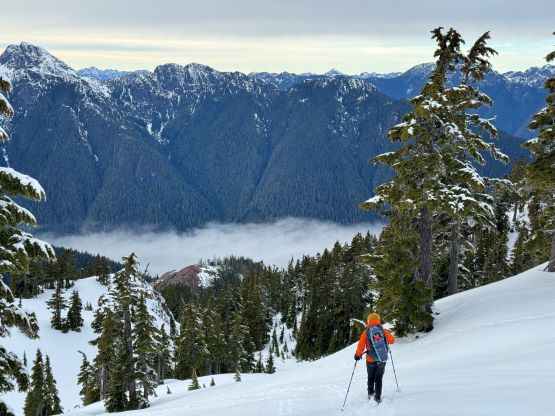
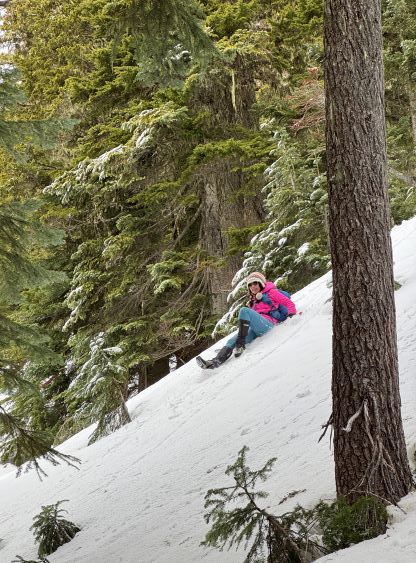
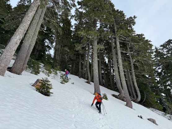
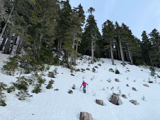
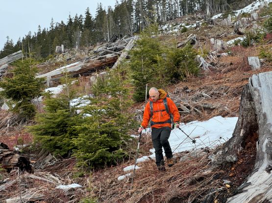
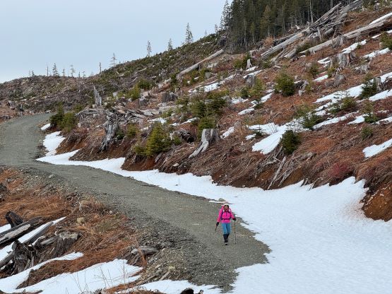
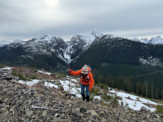
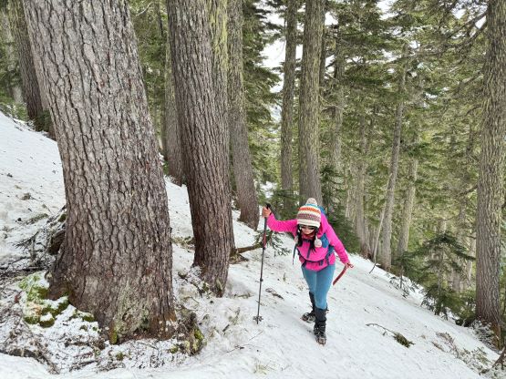
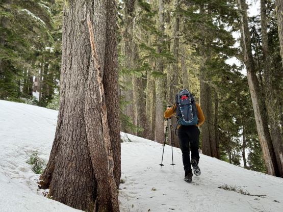
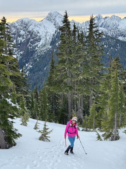
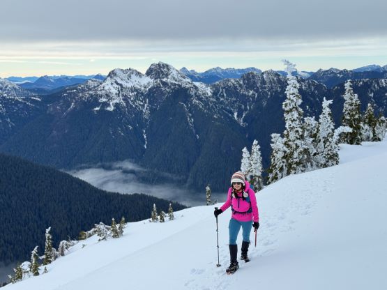
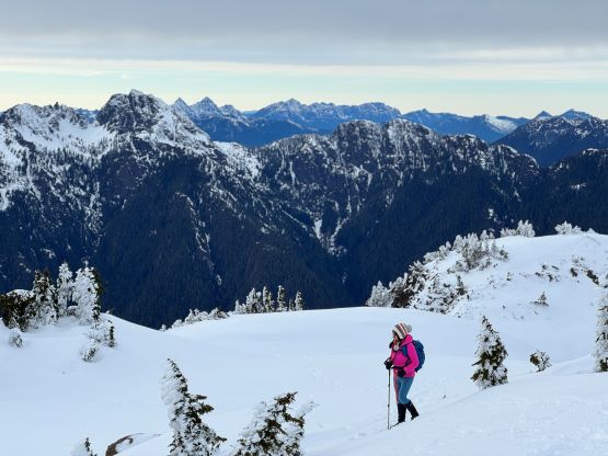
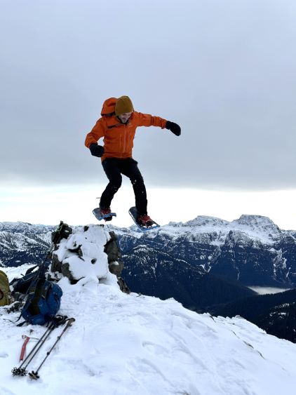
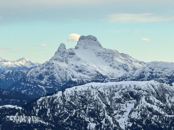
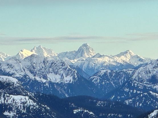
The other group was on their way out and informed us that the snowshoes weren’t needed but crampons were needed. They had also laid a nice track for us to follow. Raphael and I were carrying snowshoes whereas Kate opted to bring crampons. The other group had apparently followed the road to the end but the clear-cuts were nice and open (and sometimes covered in snow). I made some spontaneous decisions to take several short-cuts. Taking short-cuts is in my blood as I absolutely love to not follow the existent path. I think we definitely saved time by doing so. The snow on Mt. Romeo was considerably icier than on Mt. Abel but I still did not think crampons were needed. Kate was slipping so I told her to don crampons, but Raphael and I wanted to do the entire ascent (and descent) sans traction. The forest was nice and open and there’s no bushwhacking. This was contrary to what we had just done on Mt. Abel. Higher up the tracks split and we took the left, traversing branch. Raphael was proposing to ditch the snowshoes and I finally agreed, but then instead of ditching them I opted to strap them on just for the sake reason to justify hauling them up. Kate did not have snowshoes so she would post-hole on top of our tracks in crampons. The 15 cm fresh snow on top of a firm crust had created some slippery conditions, especially for the two of us on snowshoes, but it was manageable. The summit was a bit farther back than I thought, but the views were incredible towards all directions. This summit definitely offered a high reward-to-effort ratio. This is not a “peak-bagger’s summit” and should be on every hiker’s list.


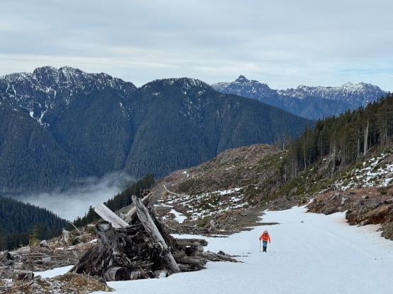


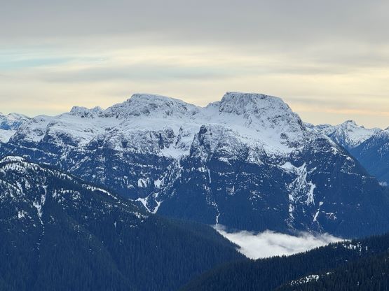


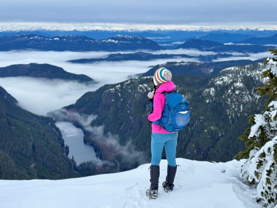
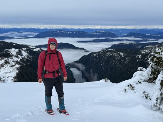


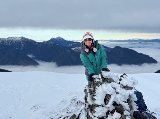
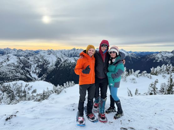
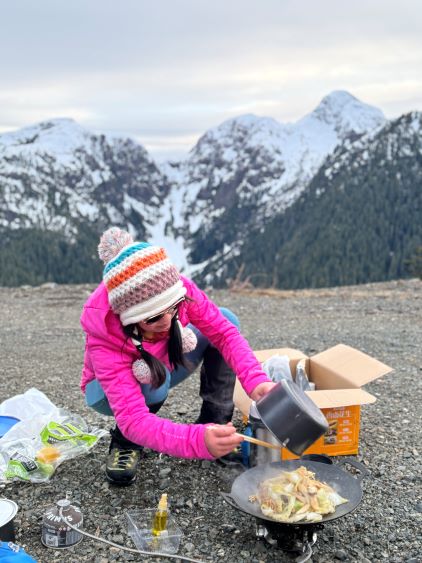
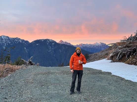
After about half an hour on the summit we started the descent. The light was only getting better and it was tempting to wait on the top for even longer, but I was becoming cold. The sunset would be at least 2 hours away and I wouldn’t want to wait for that long. We all descended without snowshoes nor crampons and finished the round trip in 2.5 hours. We then spent the following hour cooking dinner while soaking in the sunset colours, and then drove back to the highway. Raphael would turn northwards for more peak-bagging on the northern island, whereas I needed to get back home for work on the following day. I wouldn’t need to be back until 3 pm in the afternoon so Kate and I decided to also stay an extra night on the island. We booked the 11 am ferry from Victoria to Tsawwassen and then drove 4 hours southwards to the Greater Victoria area and car-camped at Mt. Finlayson’s trail-head. I was completely exhausted by the time we pulled in at midnight. The weather was still good on Monday and we ended up doing Mt. Finlayson as well as Lone Tree Hill before catching the homewards ride.