Johannesburg Mountain
October 4-5, 2022
2499m
Cascade Pass, WA
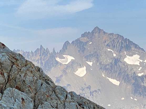
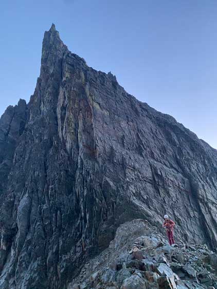
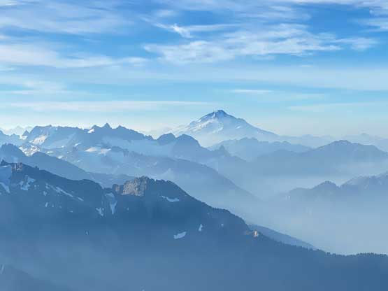
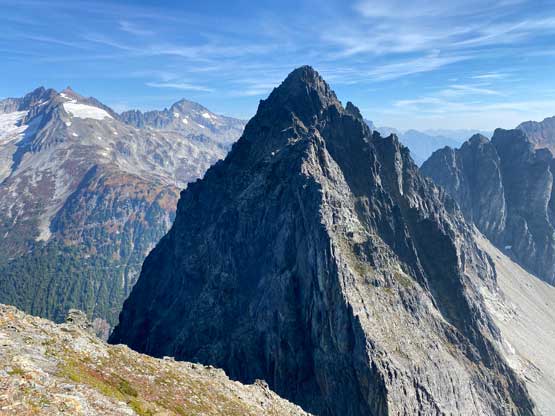
Johannesburg Mtn. does not need much introductory as all the serious folks in Washington knows the reputation of this peak. This is listed in Dallas Kloke’s “Washington Difficult Ten” list means it’s one of the hardest summits in the state even by the easiest possible route. This peak is a stand-alone massif meaning it’s not a rock spire attached to some bigger mountains, and the north face is very visible from Cascade Pass trail-head or better, from areas around Eldorado Peak and Forbidden Peak. My first time seeing Johannesburg Mtn. in person was from Eldorado Peak in June 2017 but an ascent of Johannesburg Mtn. is a serious fair and requires all stars to line up perfectly.
Most ascents of this peak had been done via the aesthetic NE Rib and that’s also my original plan but that route sounds scary and committing. It also requires one to carry all of the climbing and overnight gears over the route as well as to descend the complicated East Ridge without climbing it first, whereas I’m only used to climb and descend the same route of a mountain, usually via the easiest way. The easier East Route had not been very well documented but a few recent trip reports (including one with GPX download on peakbagger.com) had put it back onto my radar and I immediately started to formulate a plan to take advantage of this incredible fall season weather. I was thinking to possibly climb the East Ridge via Doug’s Direct car-to-car but wouldn’t mind a more leisurely 2-day schedule. Further research led to the 2-day decision as I also wanted to scramble The Triplets as it’s a rarely ascended summit. Adding Cascade Peak would be even nicer but I couldn’t find much information about it. My ideal partner for this mission, Elise happened to be available midweek and I spontaneously took 2 days off work. Elise was not able to leave Vancouver until 8 am in the morning on Tuesday so we would only have 1.5 days to be precise.
Elise suggested to push to the summit of Johannesburg Mtn. and bivy on the top but I was not very positive about that. We did not cross the border until 8:40 am and did not make to the trail-head until another three hours later. Elise needed to do the last-minute packing at the trail-head whereas I needed to stuff in a foot-long Subway sandwich and all of that added time, so we didn’t start the approach until 12:10 pm and that’s a tad late for a summit push given the shortness of daylight hours in October. However, I was fairly positive that we could tag The Triplets on Day 1 and camp somewhere in that basin, ideally at C-J col but we would decide one step at a time.

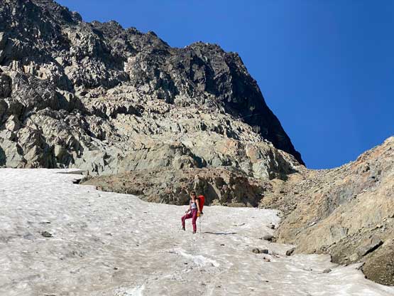
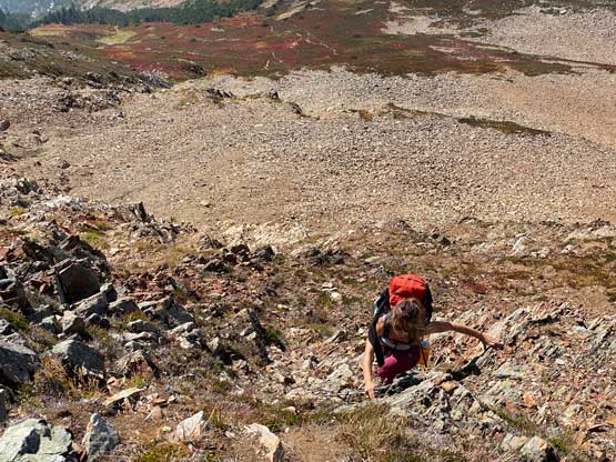
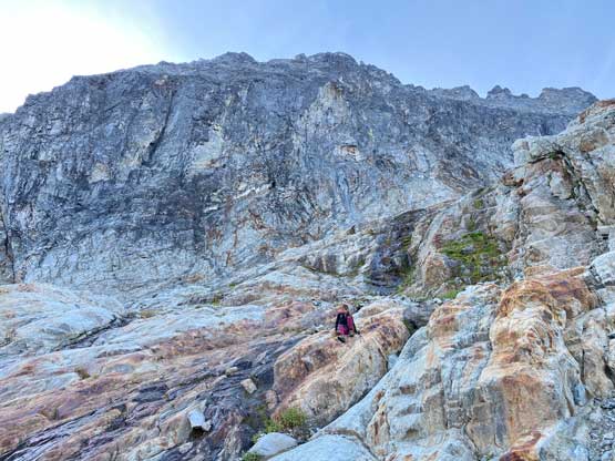
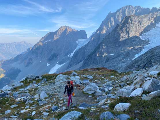
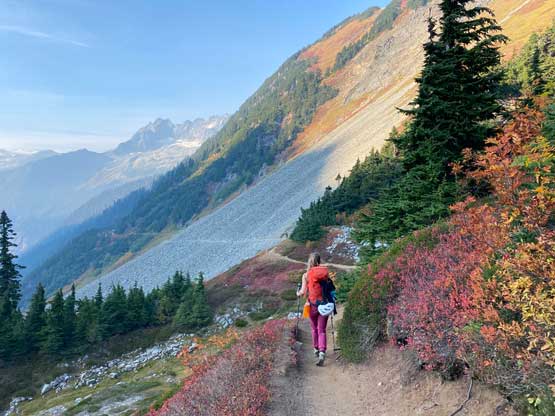
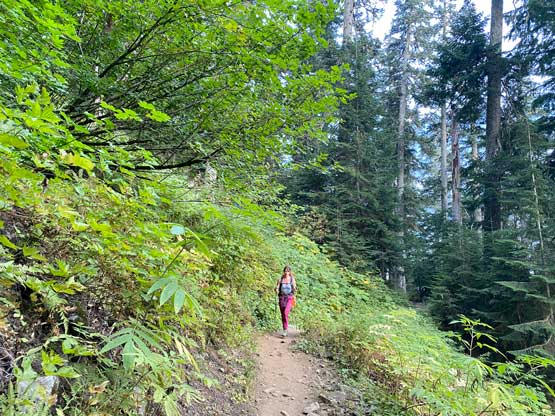
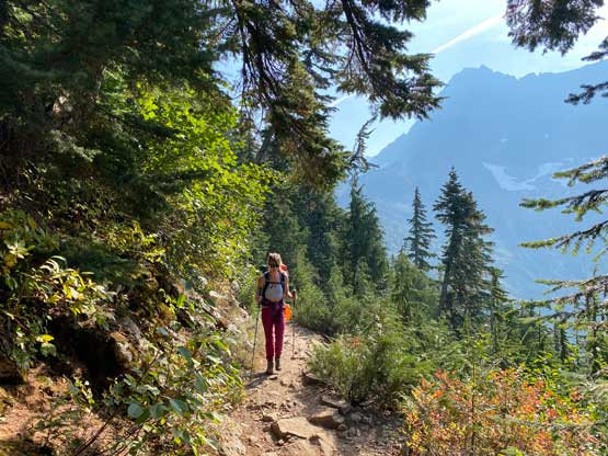
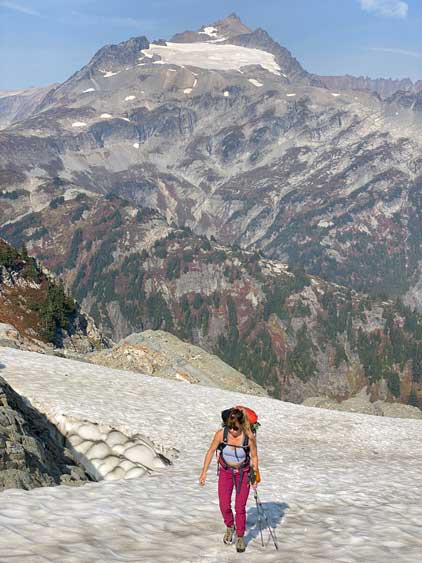
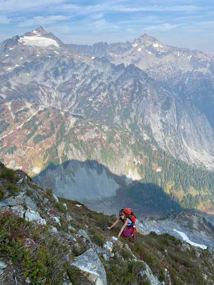
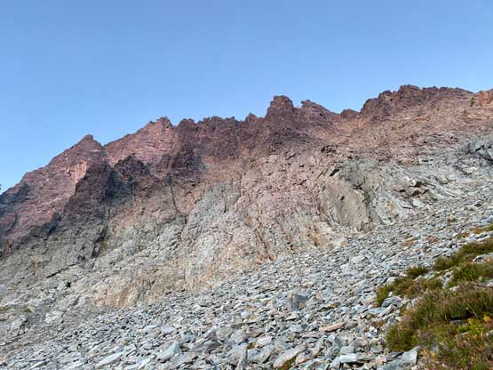
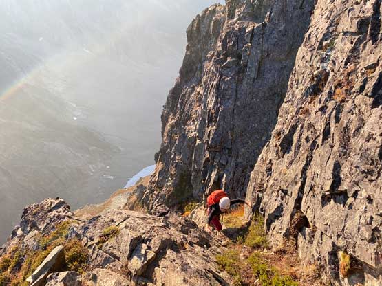
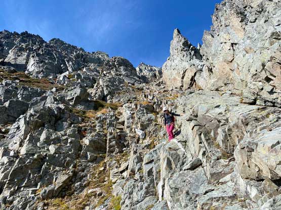
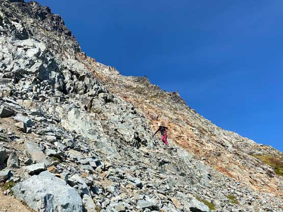
This was my second time hiking up the boring switchbacks towards Cascade Pass within a few days but the first time was entirely in dark both ways so the hike actually felt completely different. We passed countless number of groups along the way that even with the heavy packs we were able to dash up to the pass in 1 hour 40 minutes. I wasn’t particularly pushing the pace but we had to be efficient. We continued plodding for about 10 minutes beyond the pass and then I ditched trail runners for mountaineering boots. The trail that traverses leftwards along the “Ptarmigan Traverse” line was easy to navigate but one particular gully provided some challenges. The compact, hard, moraine type of choss in that gully would force all parties to descend about 50 meters to find a suitable route to scramble out. The previous trip report just a few weeks earlier mentioned this gully, so I aimed straight for the exit of their GPS track by traversing sideways and that saved us at least 30 m of elevation loss. The scramble into the gully was done on some wet and exposed 3rd class slabs and the scramble out of the gully was on loose and compact dirt.
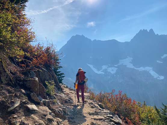

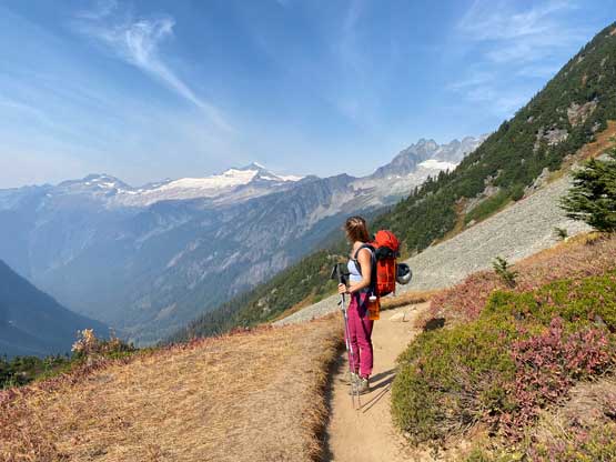


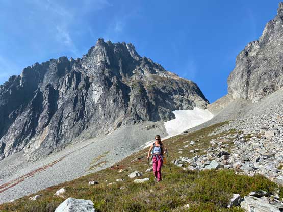
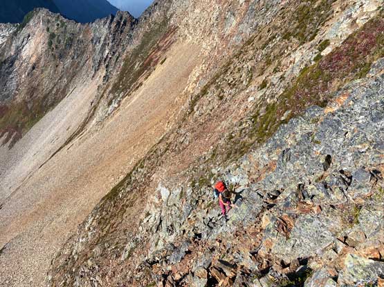
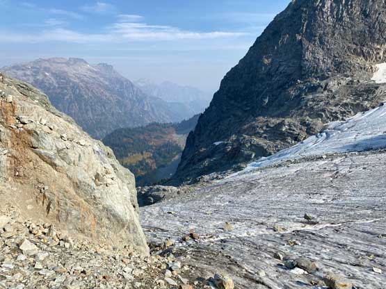
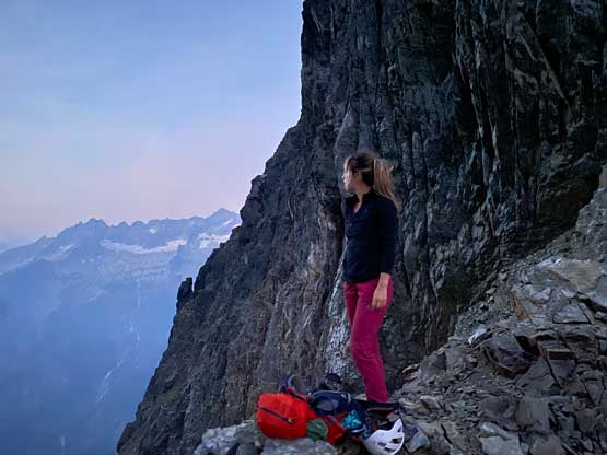
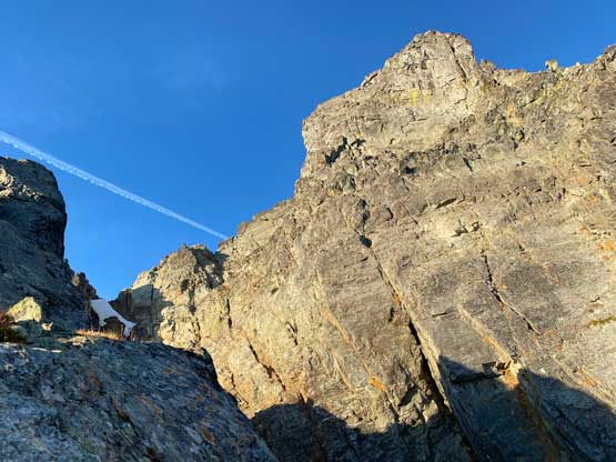
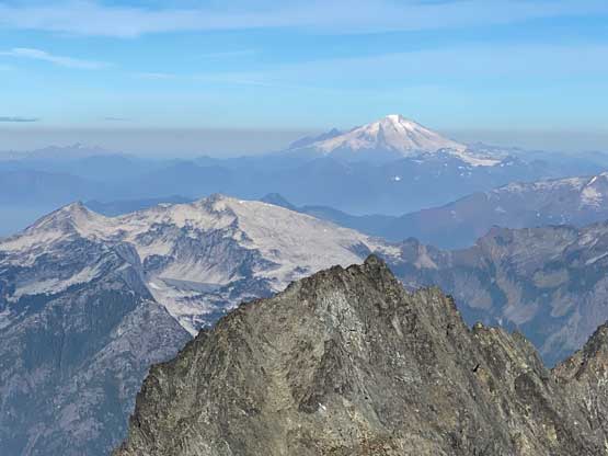
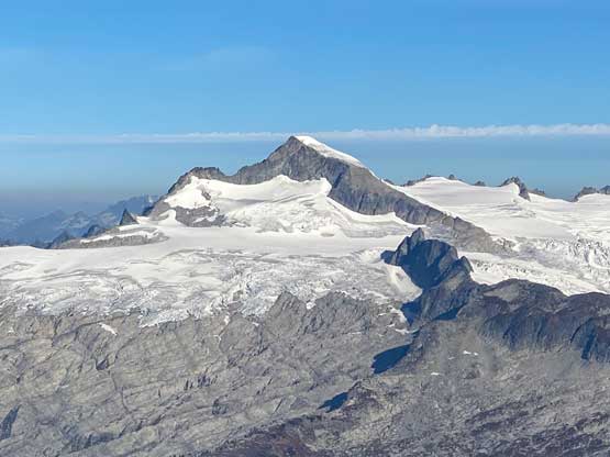
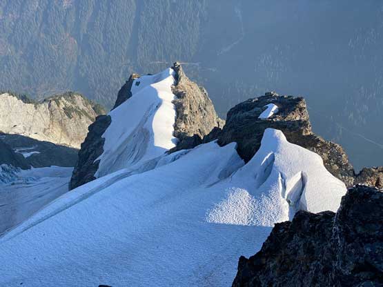
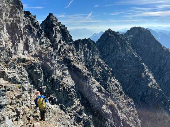
The trail traverses farther out to the east side of Mix-up Peak than I previously imagined so this section took a while. We had to cross a few more chossy slopes in addition to snow patches as well as one small section of dry glacier. Descending onto that glacier was particularly loose and unpleasant. There were also additional up-and-downs to content with. After traversing on that glacier “far enough” we veered climber’s right onto slabs covered by loose rocks. We still exited the glacier earlier than the previous group but both options worked. We then turned climber’s right and did a long and rising traverse on slabs and snow. Before reaching that upper patch of permanent snow field we loaded up the water bottles and this proved to be the final source of running water until we were back to this area a day later. I only loaded up 1 L of water which was just sufficient enough to get the job of this day done. I wished we had loaded up more. The scrambling onto the north ridge “notch” of Mix-up Peak was harder than expected mostly because we blindly followed the GPS track onto more difficult terrain. A day later on the descent we discovered a much better route that stayed within “class 3” range. The route we took on the ascent was farther climber’s right than needed, and involved some class 4 with exposure. The final slope onto the ridge was again, the unpleasant compact type of dirt choss. We were 3.5 hours into the trip at this point and took a much-needed break at the “notch”. I decided to put a quotation mark on the notch as this wasn’t really a notch but rather just one depression point on the ridge. To find this spot on the first try one needs either a GPS track or extensive research beforehand.


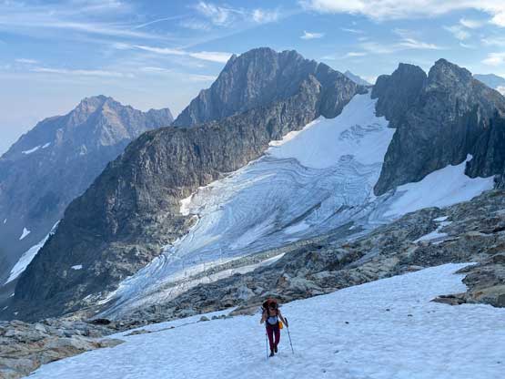


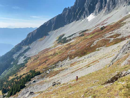
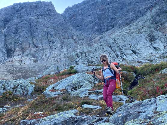
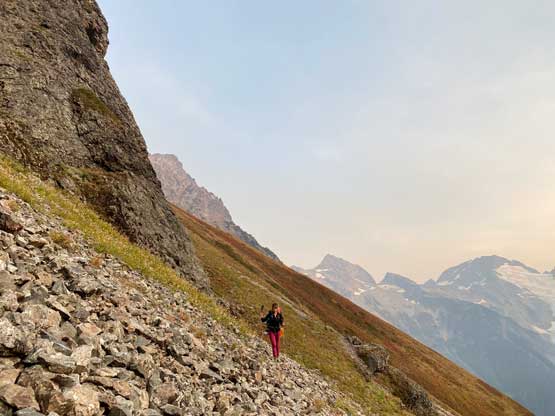
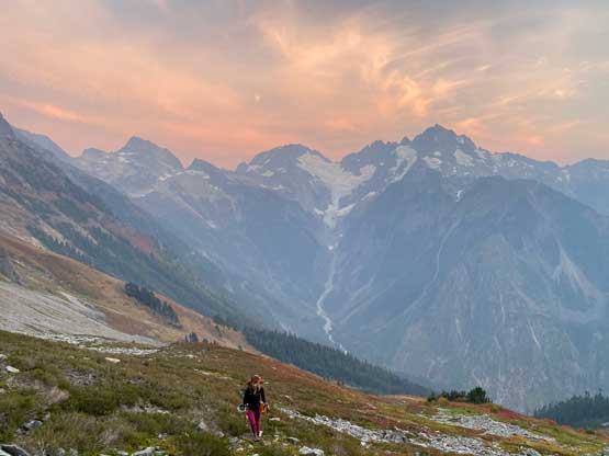
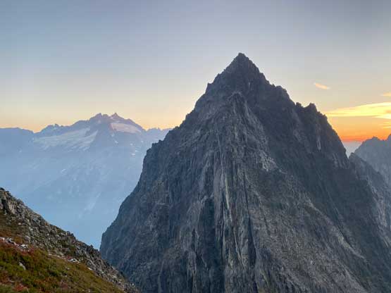
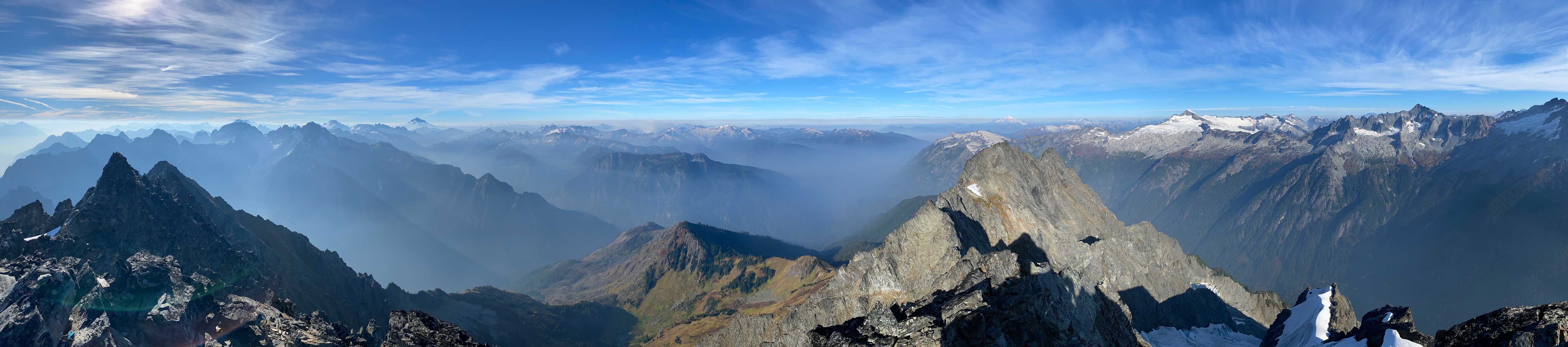
From the “notch” we had to drop 450 m of the hard-won elevation to wrap around the south buttress of The Triplets before making an equally tiring re-accent towards C-J col. The descent off the west side of the north ridge of Mix-up Peak was also harder than expected but this time we definitely did not go significantly off-route. We descended mostly straight down from the “notch” until the terrain forced us to traverse out of the gully towards skier’s right to bypass a steep zone. This section was loose and exposed, but did not exceed “class 3”. It didn’t take us too long to reach the easier terrain. We then crossed path with two climbers who just finished the NE Rib route. I was surprised that they came to climb that route in October but apparently the glacier on the NE Rib was still healthy without alpine ice exposed. After giving them congratulations we stayed high traversing straight across the tedious slopes of heather and choss to the SE Face of The Triplets, ditched the packs and made an 1.5-hour detour to check out that summit. The scrambling on The Triplets was a bit tricky near the top so that wasn’t the 1-hour detour as advertised on some other articles.


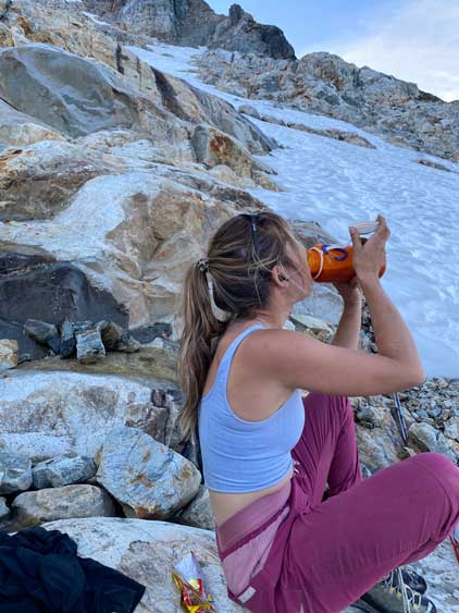
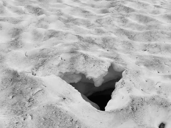
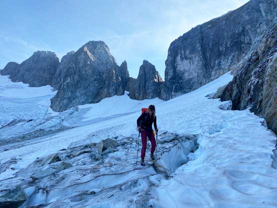
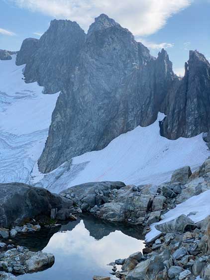
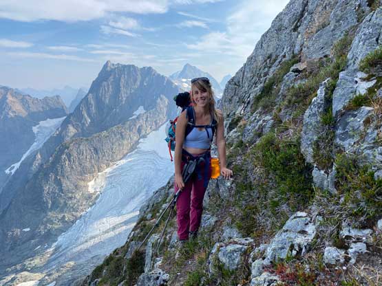
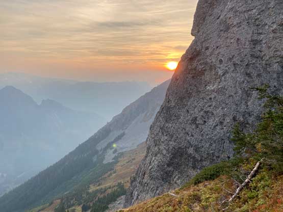
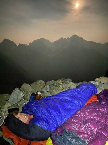
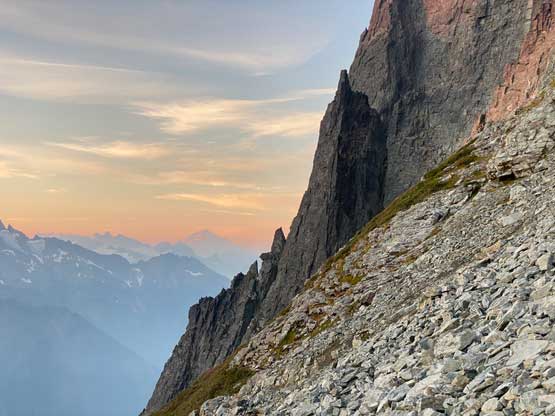
We were racing sunset at this point as we only had about an hour of daylight time left. After descending another 200 vertical meters to wrap around the south side of The Triplets I led us dashing sideways across more choss and heather to a traditional campsite under the snow fields below C-J col. As warned by the other team there was no running water anymore, and the bugs were annoying. They did tell us that the bivy site at C-J col was rather excellent with easily accessible snow, so we had to plod all the way up there. The snow slope took longer than expected and the choss above the snow slope was particularly shitty, but we did eventually reach C-J col without the need to turn on head-lamps. The views at sunset hour looking back towards Mt. Formidable was very memorable. The “excellent” bivy spot was a few meters uphill from the col so we went there first to layout the overnight gears. As planned we did not bring a tent as there’s zero chance of precipitation. I opted to bring my +2C Western Mountaineering bag while lending Elise my -7C bag. I ended up not needing to wear extra layers even in that +2C bag so that tells how warm the night was. On the other hand, I did not bring enough fuel to fully count on melting snow, but we did get most of the job done. I then loaded up the pot with snow and the snow completely melted the next morning giving us another extra L of water.


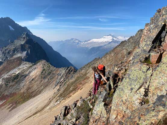
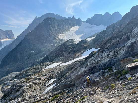
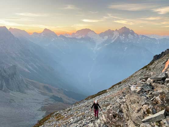
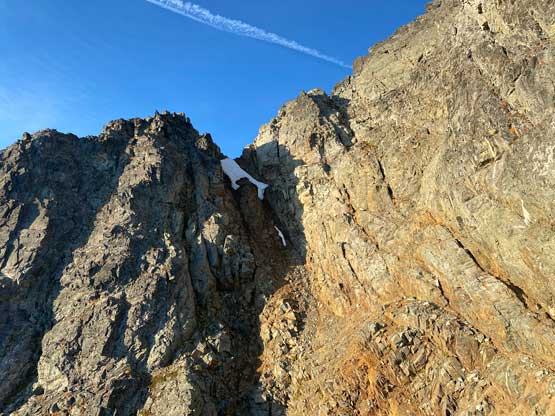
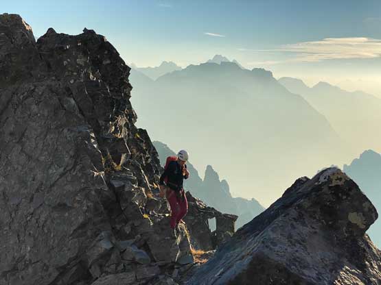
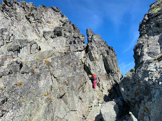
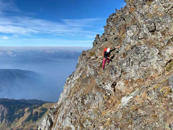
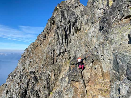
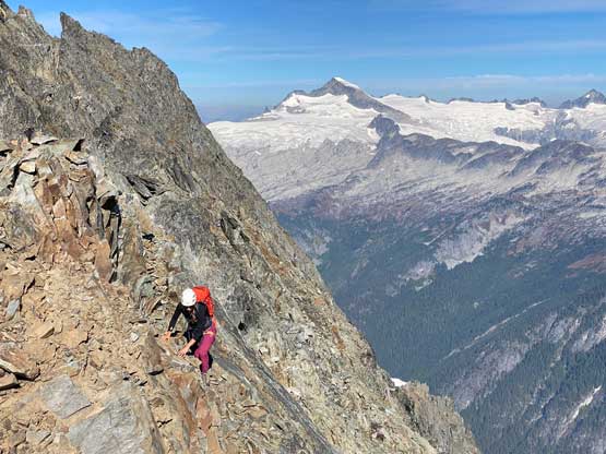
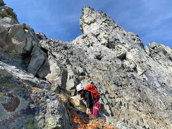
Elise suggested to wake up at 4 am or something but I wasn’t sure about to navigate the complicated east face in the dark, so I set the alarm at 5:50 am in order to be on the face right around the first light. I think Elise appreciated the extra 2 hours of sleep as she had come straight to this trip from an exhausting night shift with only 1 hour of sleep. On the other hand I did not get a lot of sleep as my spot was very slanted and I kept sliding sideways to Elise. I did get enough sleep to get the summit and the drive-home done, so I considered that as “good enough”. The fact we had no fuel meant we wouldn’t be doing hot breakfast so that saved some time in the morning. We put on the harnesses but expected to not need them until the descent and we were correct. The east face appeared intimidating but turned out to be quite chill. There was some 4th class scrambling on the initial step to get onto the “heather ledge” but after that the terrain petered out. We watched some incredible sunrise scenery from this stage of the easier terrain before scrambling into the gully. The gully on the east face was also mostly just 3rd class scrambling but towards the top we encountered a crux section. There were two variations and we picked the left couloir that definitely had a few low 5th class moves that none of us would be keen to down-climb. It wouldn’t be impossible but would be fairly tricky. A rappel anchor was located right next to the exit so we decided to use that a few hours later.

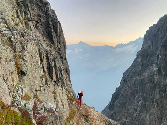


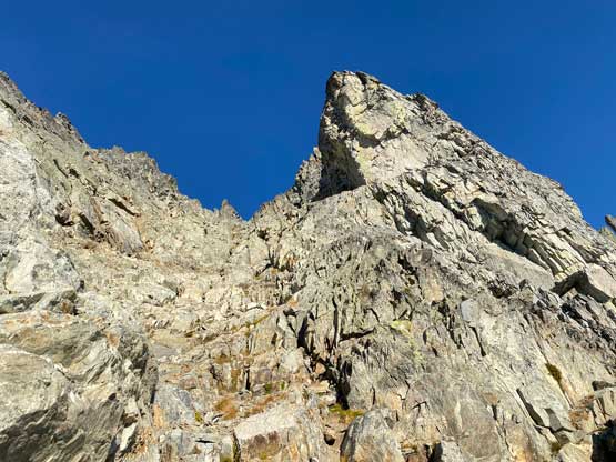
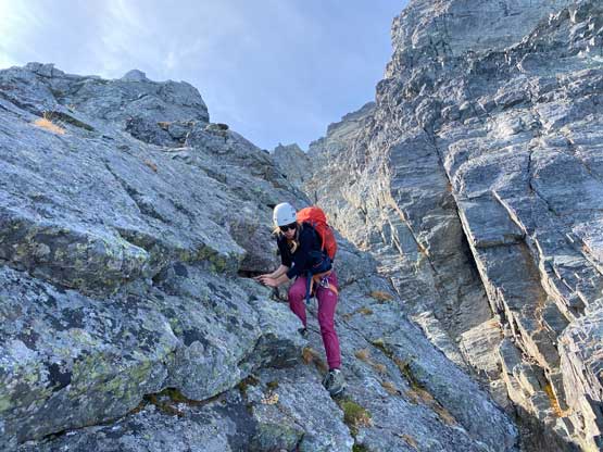
Immediately following the exit of this east face gully we had to scramble across a short but exposed ridge section and this was the key piece of link-up between the two gully system on the east face. There’s one crack and a few vertical steps that felt to be low 5th class but nothing proved to be really tricky. We then traversed across some compact dirt to get into the upper gully. Instead of traversing all the way to the base of the gully I opted to lead us up earlier, mostly to reduce the compact type of choss for as much as possible. The upper gully also involved mostly 3rd class scrambling but did have one steep section of Class 4 in the middle. There wasn’t existing rappel station above the step so we were committed to the down-climb. I did know that the official rappel route was on the opposite side of a wall much farther climber’s right but we did not see the point in taking that. This upper gully was entirely down-climbable so why bother to do 4-5 rappels. It didn’t take us long to top out onto the false summit.


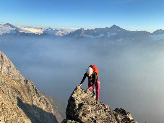


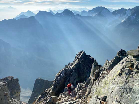
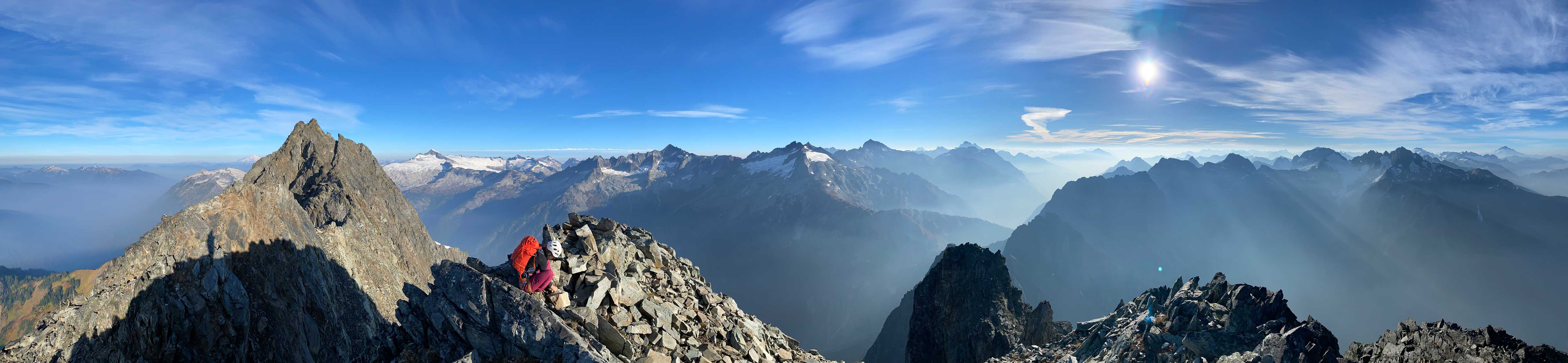
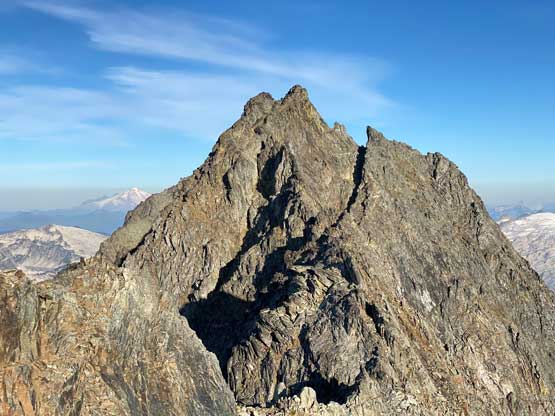
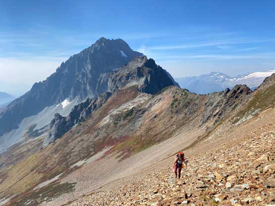
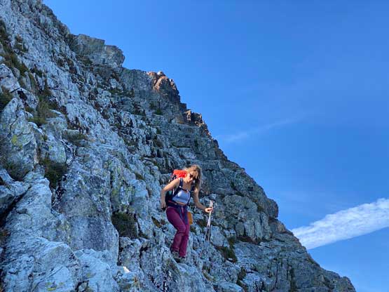
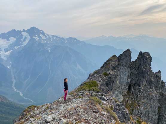
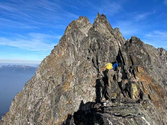
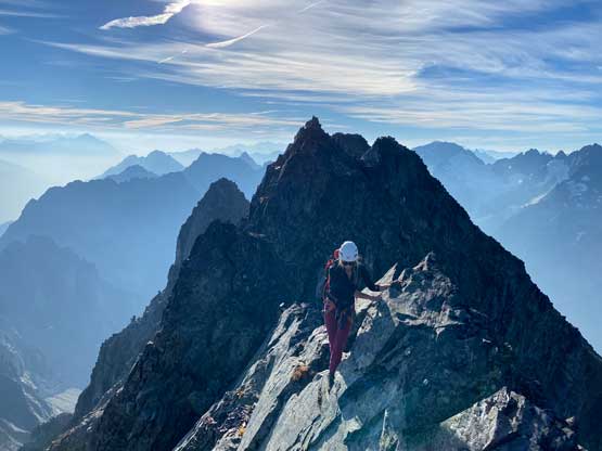
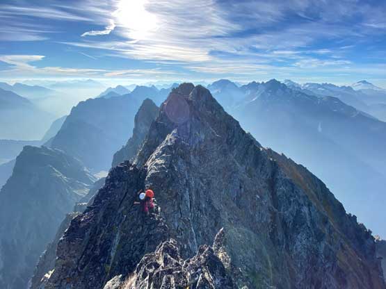
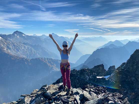
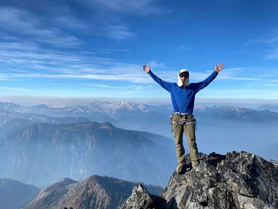
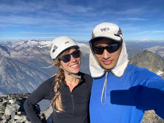
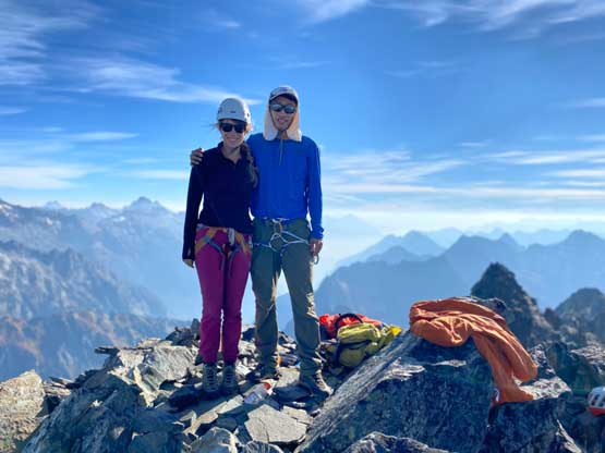
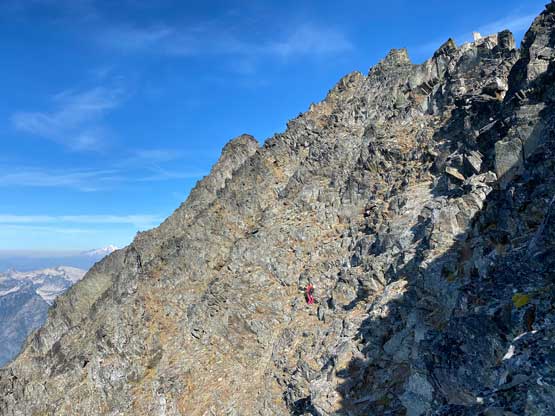
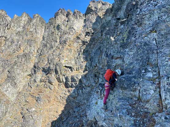
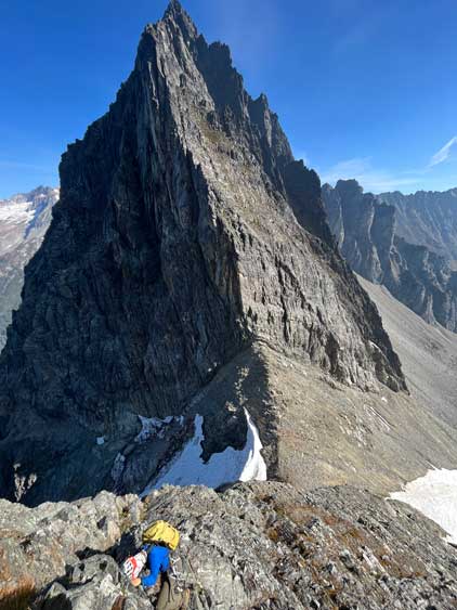
The crux for our ascent was actually the summit ridge traverse. It appeared dauntingly difficult and it sure was. We had the beta that the best route traversed 15-20 m under the ridge on the south side but at least the beginning wasn’t obvious. I started down and led us traversing/descending some shitty 4th class terrain before making the call to scramble back onto the ridge. The terrain that we traversed did not seem to match the beta and the problem was that we didn’t descend far enough. The direct ridge scramble was definitely not the correct way but was fun for a while. After starting to encounter loose 5th class steps we down-climbed southwards and this time we located the ledge with a notable path and cairns. This path led us traversing across numerous gullies all the way to a deep chasm separating the true summit. Upon seeing the chasm we scrambled upwards to the final notch and scrambled onto the true summit from there. The stay on the summit was long and enjoyable as this is a very important peak and we were doing great on time.


On the descent we followed the ledge with cairns for much longer than I thought and it led us bypassing all towers and ridges until the very end (second to last from the false summit). We then scrambled back up onto the ridge crest and even did some traversing on the north side of the ridge, which I would not recommend. We then down-climbed the entire upper gully on the east face as well as the exposed connecting ridge before doing two rappels from one station to the next. The second rappel was rather optional as it only bypassed some class 3 heather ledges for us, but the station was there so we might as well use it. We brought one 30m twin rope in additional to one 30m tagline so we were able to perform 30m rappels. For the bottom of the east face we opted to ignore rappel stations and down-climb, which was rather straightforward. I did have to say that doing the entire route-finding on this peak by myself was mentally draining that I started to feel quite fatigued and needed some rest at camp.


After leisurely packing up the camp we descended choss followed by enjoyable snow to the long and tedious traverse around the south buttress of The Triplets. The day was smoking hot and felt more than July than October and the heat was definitely taking a toll on us. That 450-m ascent was cruel but we managed that with only one short break just before the class 3 section near the top. I was not looking forward to down-climb the east side of the “notch”, but surprisingly I managed to lead us down a line that was much easier than the one we took a day ago. This again proved that sometimes I just had to dip into the unknown following my own route-finding sense instead of following the existing tracks. After descending back to the slabs zone we took a long break as we finally could drink some good water. It’s been a full day since we had seen any running water. The rest of the descent following the Ptarmigan Traverse route back to Cascade Pass was rather uneventful and then we jogged down from the pass to the trail-head in 40 minutes. I don’t normally jog, but Elise had a mission in the Enchantments the day after and we wanted to get out as early as we could. I thought that I needed to take a break somewhere but I did the entire drive-home without feeling too tired, so this trip was really not that big of a deal for us. This is still a dauntingly serious mountain but the type of terrain (loose, complicated but no hard climbing) was exactly where my expertise was and among the 4 of the “Difficult Ten” that I had done, Johannesburg Mtn. was definitely the easiest. The other three are Lincoln, Hard Mox and West Fury.