Mount Septimus
September 1-2, 2021
1948m
Vancouver Island, BC
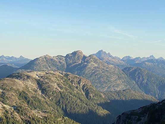
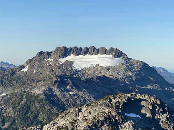
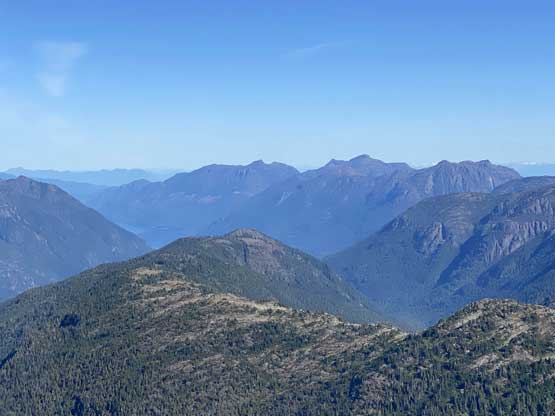
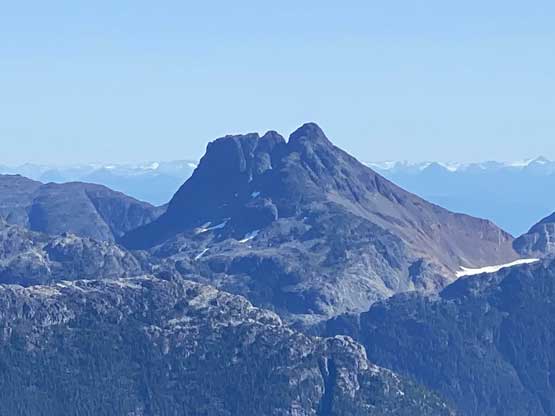
Despite the official status, Mt. Septimus is rather just the western sub-summit of Mt. Rosseau massif with hardly any prominence to speak of. However, the group of peaks on Mt. Rosseau (Mt. Septimus, Mt. Rosseau, Misthorn and Margaret Peak) are so rugged such that each of them offers their own classic mountaineering. In this particular case, Mt. Septimus is listed as one of the 9 “Island Qualifiers” and boasts at least 2 classic routes – the earlier season option, “X Gully to North Glacier” and the late season option, “Route 2 Variation” on the south face. The snow ascent via “X Gully” is in my opinion both easier and more popular but the climbing window is short and the timing is tricky. The rock routes on the south face had gained more attention recently with the “standard route” undergone a few shifts over the years. Nowadays most ascents on this face are via the “Route 2V” which has a handful pitches of mostly 4th to low 5th class climbing. The routes are all reasonably well documented in Phil Stone’s Island Alpine Select which is my reference as well. The rock quality on this face is not very good, but not horrible neither.
I had my eyes on Mt. Septimus for only a month or so when I started to lay out some plans to work on the “Island Qualifiers” list. I had done 4 of them previously without intending to tackle the list, but curiosity led me to research the remaining 5 and the conclusion was that all of them are worthwhile objectives with variety of challenges so I might as well aim to finish it. Among these ones Mt. Septimus made the most sense to ascend in “late summer” conditions via this south face route. I had talked to a few friends over the past few weeks and in the end Lily agreed to join me for the mission. Our plan was to ascend it over 2 days with a camp at Cream Lake. The approach from Bedwell Lake to Cream Lake itself is a worthwhile hiking destination so we might as well take our time to enjoy it. In terms of technical gears we decided to haul two 60 m half ropes, a rack of cams and nuts and rock shoes, and because of the requirement to travel on Septimus Glacier (likely icy) we also had to take mountaineering boots, ice axe and crampons such that my pack weighed over 35 lb at the start, a wee bit heavier than expected for a 2-day outing.
We left Lily’s home around 4:15 am and successfully caught the first ferry from Horseshoe Bay to Nanaimo. The drive from Nanaimo to the trail-head was exhaustingly long. We had to drive all the way to Campbell River and then drive over an hour down south along the shore of Battle Lake into the core of Strathcona Provincial Park. The last few kilometers were on a logging road and the condition was surprisingly rough such that we were glad to have taken my Tacoma all the way there. Lots of cars and SUVs were forced to park before the trail-head but some SUVs made it. Of course the drive was not a problem in my truck but I had to drive slow. This trail-head was a busy place but we later figured out that we were the only party climbing Mt. Septimus and everyone else was there to only hike and/or camp.

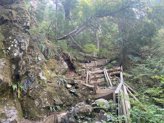
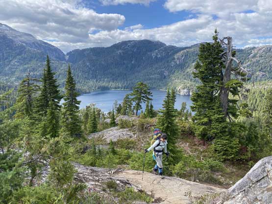
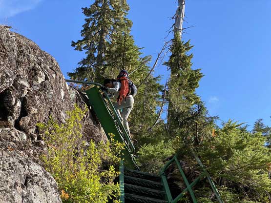
We eventually managed to start the approach at almost 1 pm giving ourselves about 7 hours of daylight to work with. This seemed plenty enough. The trail to Bedwell Lake campground was well-engineered and extremely easy to follow, but the hike was far from “easy”. The majority sections were on roots, rocks, staircases or steel ladders and the amount of up-and-downs were astonishingly frustrating. There’s one major descent between Baby Bedwell Lake and Bedwell Lake and the circumnavigation around Bedwell Lake was also very undulating. We made to the campground in over 2 hours and took our first break there donning sunscreen and sunglasses. There were a shit ton loads of berries and we were somewhat slowed down by them. I do believe the fattiest berries were already taken by other hikers (and/or bears) but we still found plenty of good ones.

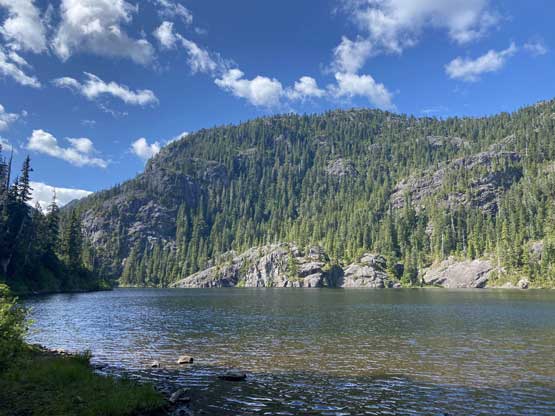
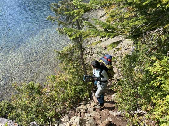
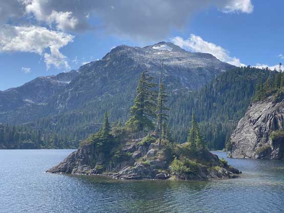
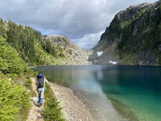
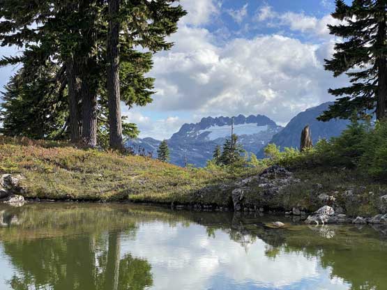
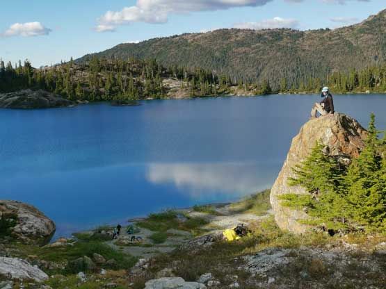
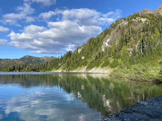
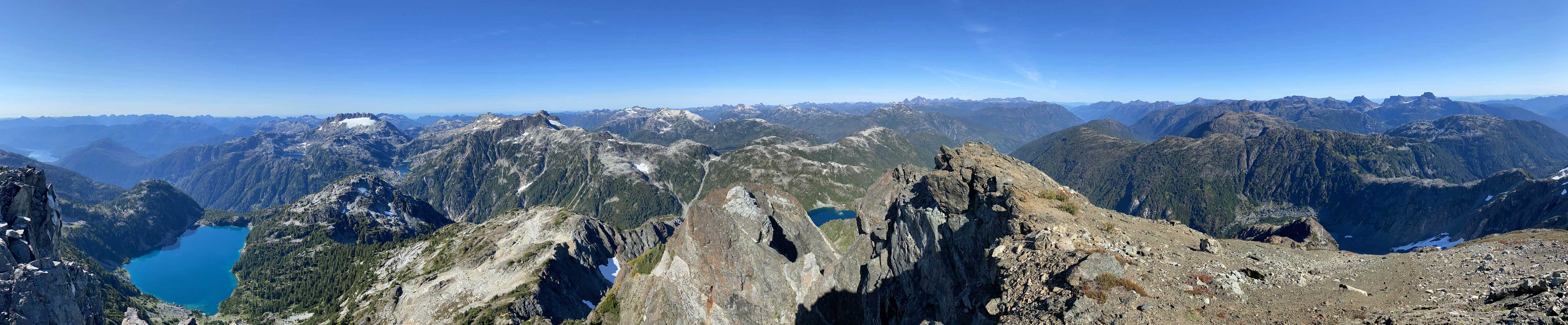
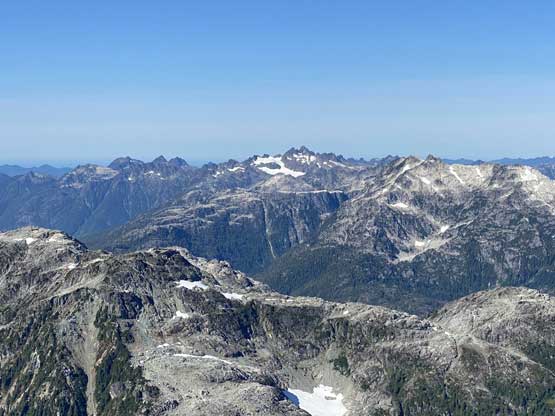
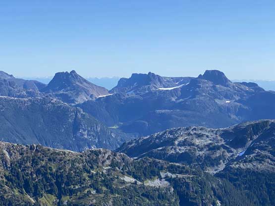
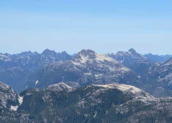
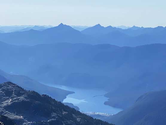
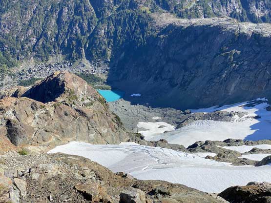
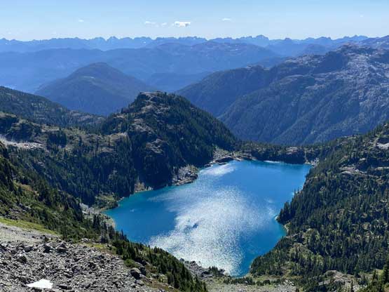
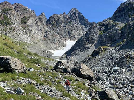
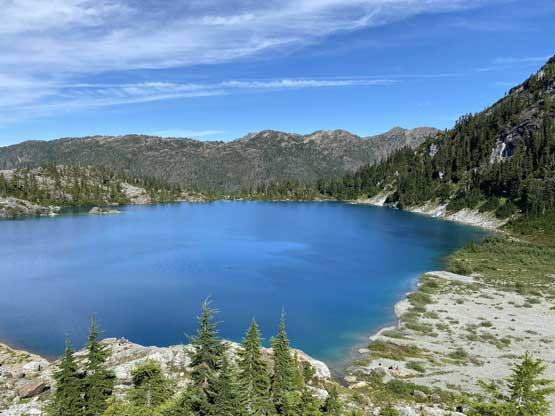
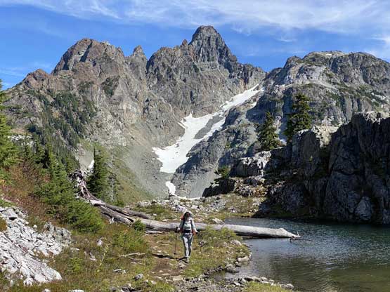
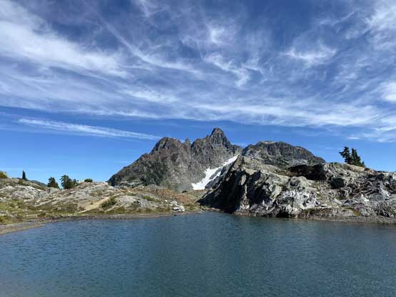
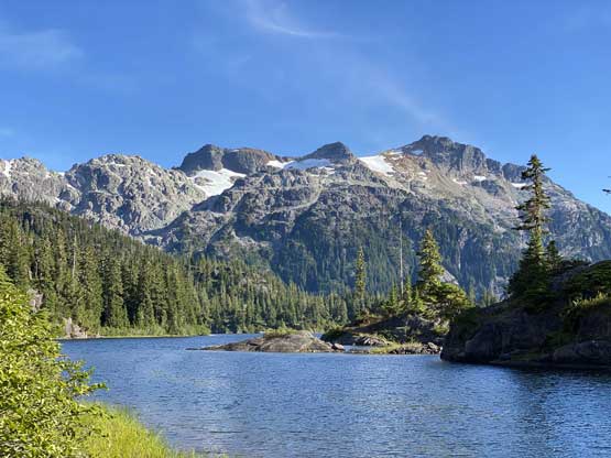
The second half of the approach from Bedwell Lake to Cream Lake was longer than I thought and again, there were plenty of up-and-downs to “enjoy”. The maps labelled this section of the trail “rough” and “difficult to follow” but we found it’s still in a reasonable shape and was still easy to follow. After some steep gain we found a neat rest spot with running water near the outflow of Little Jim Lake. After another much-needed break we carried on, around Little Jim Lake and onto a traversing bench with some micro-terrain. We had to ascend to above 1400 m along this bench but then descend all the way down to 1250 m at Cream Lake. The first sight of the lake was impressive and I could see why hikers march all the way here just to see this lake. The west buttress of Mt. Septimus was also very impressive and so was Nine Peaks to the south. I could see why Mt. Septimus gained a separate name apart from Mt. Rosseau. We certainly slowed down significantly towards the end of this approach taking in the scenery and our approach time was just under 5.5 hours. There was only one party camping at Cream Lake so we were able to find a neat spot to set up the tent. This was really a 5-star campsite but the mosquitoes after the sun came down were brutal. We were forced to have a quick dinner and went to bed early. There was no sunset photo from this trip, unfortunately.


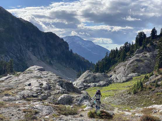

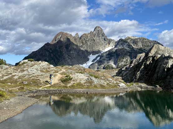
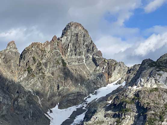


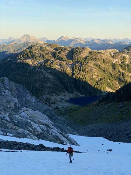
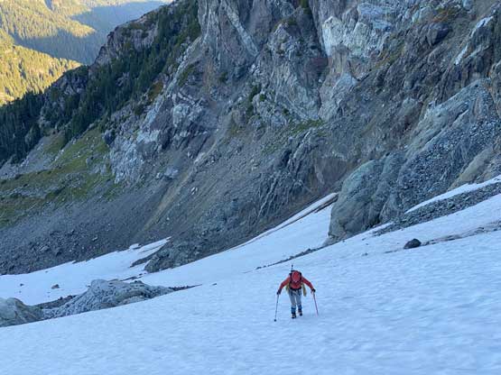
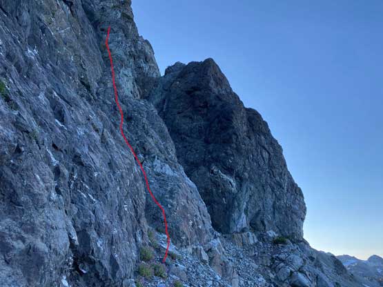
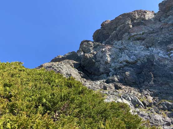
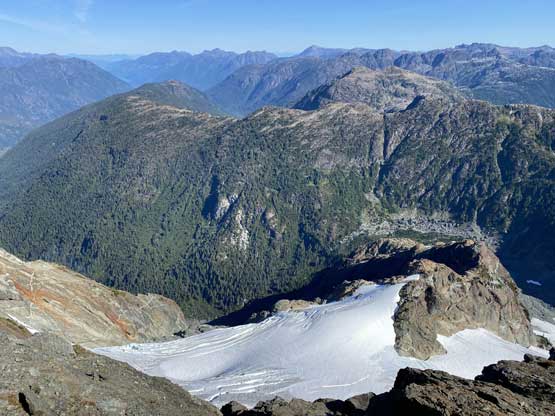
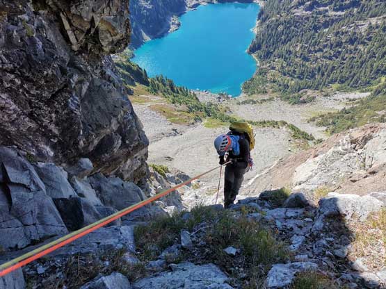
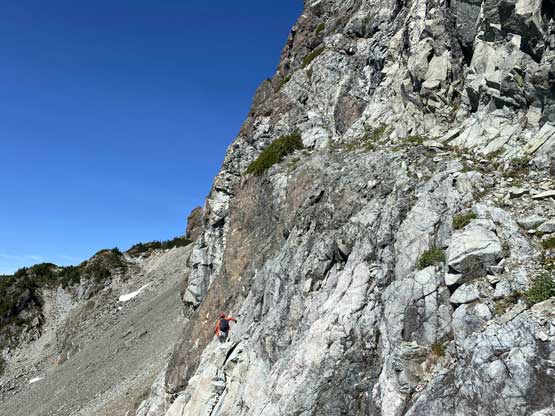
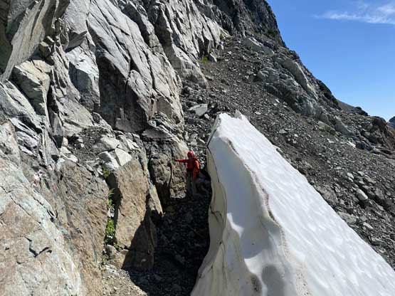
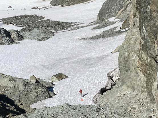
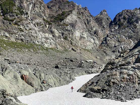
The next morning we woke up at 5:30 am in the dark and got going within an hour. There’s a bit of navigation to hop onto Septimus Glacier and the ascend of this glacier was mostly as expected. The grade was pretty mellow but crampons were definitely needed. There was surprisingly very minimal bare ice but the snow was very hard and icy. The grade was probably around 30 degrees at the steepest sections. The last 100 m to gain the “west shoulder” was supposed to be the steepest but the snow had melted out revealing loose rocks underneath. For us that stretch was an unpleasant, 3rd class scramble on some compact choss. After gaining the shoulder we then easily descended and traversed ~400 m horizontally down the other side to the base of the route. The start of this route was very easy to locate, climber’s left of an obvious gully according to the book. The side-hilling traverse to the start of this route was on the other hand, not very pleasant but I came from the Rockies so I’m used to it.


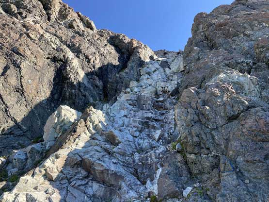
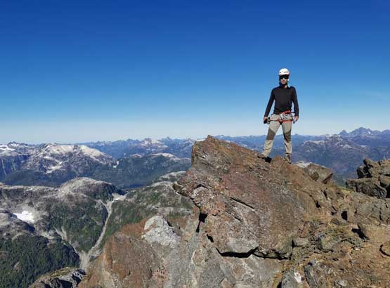
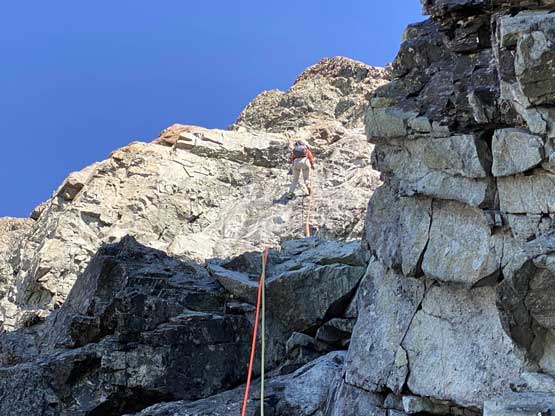
The climbing appeared pretty straightforward but given the questionable rock quality and the uncertainty in route-finding we decided to pitch it out nonetheless. I led the first pitch which was a rising traverse out towards climber’s right to a belay at a cluster of bush. I only put in one piece of pro and ran out the rest, as the climbing was mostly 4th class. Lily took over the second pitch and ascended a line staying on the light-coloured rocks. This pitch had a few stiffer moves higher up and was steeper overall. The belay was again, at a cluster of trees. I led the 3rd pitch, running out a whole 60 m stretch to the “cluster of trees” described in Phil Stone’s book. There were at least two short sections of 5th class climbing and the rope drag was insane. I thought about to put in a pro at the second cruxy spot but the rope drag was already bad enough so I didn’t bother. I had to build my own anchor as apparently I was running out of rope.

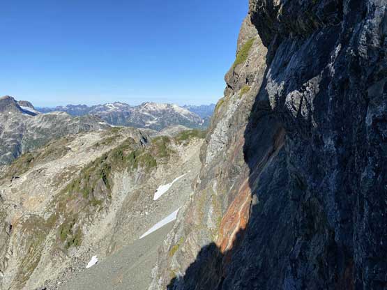

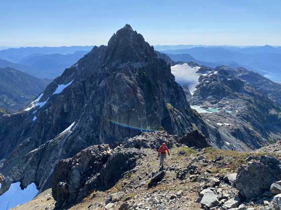
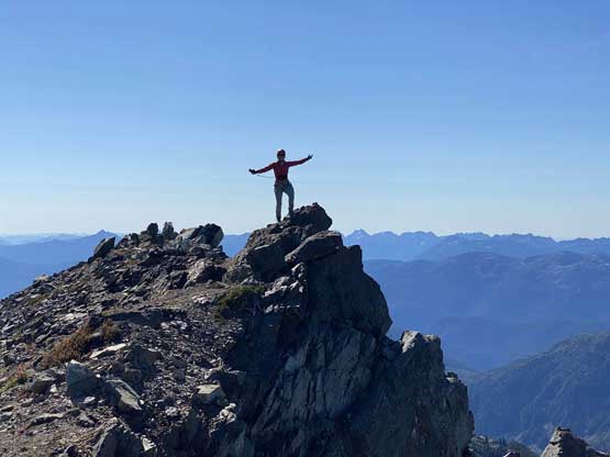
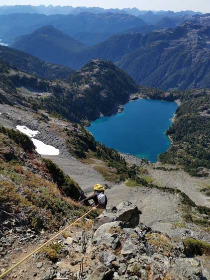
The next stretch was to traverse horizontally towards left and the terrain seemed to be mostly scrambling, so we coiled the rope. Lily taught me the technique called “short roping” which I had only used one time before. We kept short-roping even after this leftwards traverse as the last pitch to gain Septimus/Rosseau col appeared easy as well. There were a few low 5th class moves but the rocks were much better than lower down on the face. After gaining the col we ditched the ropes and swapped footwear from rock shoes to mountaineering boots. The rest of the ascent to the summit of Mt. Septimus was just a “class 2” scramble and was very scenic. To our surprise we were able to catch cell signals from the top so we took our time reconnecting to the society.


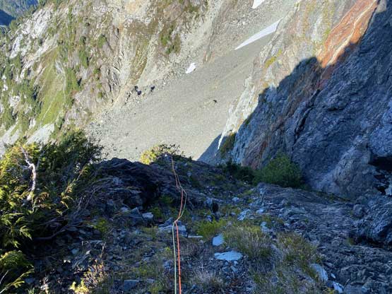
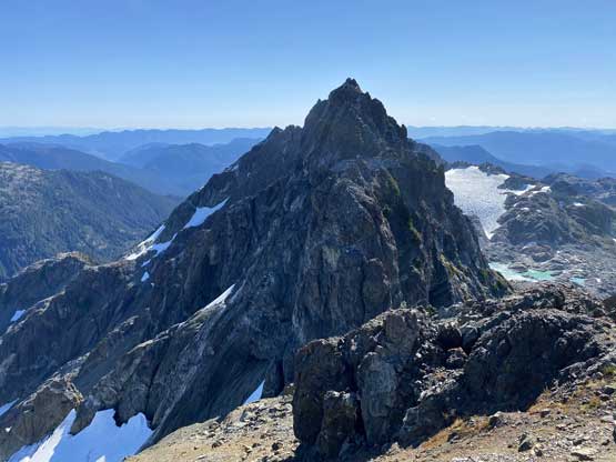
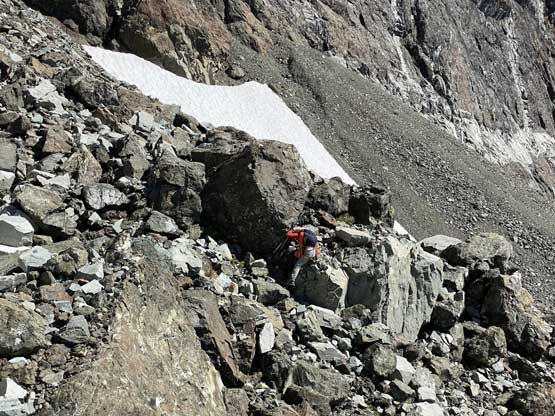
On the descent we traversed skier’s left across a narrow ledge to find the first rappel station. As told by Barry Hansen who’s a veteran climber on the island, we did not follow the “2V” route on the rappels and instead, we descended towards “Route 3” towards skier’s left. With two 60 m ropes we were able to get down in three long rappels from station to station. The last rappel did not position us at the bottom of the face and instead, we had to scramble across ledge and down-climb, but that was pretty straightforward. Lily did not find the easiest route to get down but I found that ledge with some searching. It also appeared that we could have break the last rappel into two as I also saw an anchor about 15 meters above (which we somehow missed). After the rappels we had to traverse across more choss back to the base of “Route 2V” to retrieve some gears that we ditched. After that it was another stretch of annoying traverse to get back to the “west shoulder”. Form there Lily decided to rappel off (another) cluster of trees to avoid down-climbing that compact chossy gully. I felt confident to down-climb so Lily did a full 120-m rappel to even bypass the top section of the snow. I then released the rope and down-climbed to her. The descent of the glacier still required the use of crampons but I took them off after halfway down and just boot-skied the rest.


After packing up the camping gears we had a long haul to get out. It was apparent that we were likely going to miss the 10:40 pm ferry back to the mainland so we did not feel like rushing. We were going to be stuck on the island for another night (which we were prepared for as you never know when you can finish an alpine climb). The 150-m regain above Cream Lake didn’t feel very bad and then we had a long descent passed Little Jim Lake to Bedwell Lake campground. The circumnavigation of Bedwell Lake as well as the regain to connect to Baby Bedwell Lake was the worst. We stayed at around 950 m elevation for over an hour. We were constantly gaining or losing elevation but the next elevation drop was zero. About 20 minutes after passed Baby Bedwell Lake we were finally able to plunge some elevation towards the trail-head. Overall the hike-out took us 4 hours and we were both exhausted from the heavy packs and the fact we had to wear mountaineering boots the whole way.


We got back to the trail-head at 7:30 pm leaving us just over 3.5 hours before the last ferry. Had we pushed we might can catch it, but Lily had to pick up some ice tool picks from a local climber in Comox and I also needed stops for food. Adding in those stops there was no way, so we took our time again. We eventually made to Departure Bay at past midnight, found a spot to park and slept a few hours in the truck. By 5:40 am we woke up again and drove to the terminal, and eventually got back home mid-morning. I slept through most of the day on Friday because I was so exhausted from the lack of sleep three nights in a roll.
