Ogilvie Peak
April 16, 2017
1692m
Hope / Fraser Canyon, BC
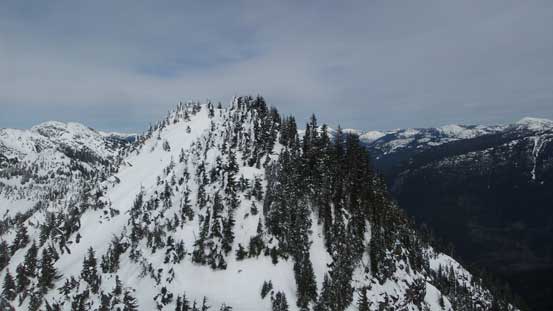
Immediately to the north-east of Hope townsite locates a large vegetated massif that boasts about half a dozen false peaks as well as a steep and cliffy southern flanks, and this is Ogilvie Peak. The eastern and western flanks are less steep but chocked with some heavily overgrown logging roads while the north aspect is an undulating ridge traverse leading towards the higher neighbour – Jorgenson Peak. Despite the proximity to civilization the true summit of this peak rarely sees visitors thank to the bushy nature of this ascent. Few people I knew would be up to give Ogilvie Peak a try and among them, most ended up having to attempt multiple times which seemed like the norm for this group of obscured summits. The status of this peak remained mysterious for many years.
The fact that it’s literally sandwiched among three of the BC’s most travelled highways (Highways 1, 3 and 5) while looming impressively above the town of Hope, and at the same time it’s so obscured that even the most die-hard peak-baggers ended up having to try multiple times really fascinated me. There were literally only two or three trip reports out there on the internet and I had to dig really hard to get any useable route information. The conclusion was that any successful summit bid was done via the system of logging road on the NW side of the massif, starting somewhere around 5.5 km up the Squeah FSR on the east side of Fraser River. Further digging showed that it shared the same approach as Jorgenson Peak and after consulting with various maps, photos and Google Earth for at least an hour I concluded that I really should try tagging both in one shot. The primary objective then got shifted to the higher Jorgenson Peak and from J/O col I would aim at traversing the entire length of the NE ridge over 5 or 6 subsidiary bumps to the true summit of Ogilvie Peak. This route had no previous account on the internet so would be entirely experimental, but as far as my experience went I was fairly confident it would go.
Ascent routes for Jorgenson Peak and Ogilvie Peak. GPX DL
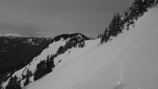
Earlier in the morning I had just made a successful ascent of Jorgenson Peak. The ascent only took 5.5 hours from truck and was much smoother than anticipated. After reversing my tracks back to Jorgenson/Ogilvie col I wasted no time but immediately resumed the plod towards my secondary objective. The steepest section was actually the initial climb out of the col but the snow condition was really good that I didn’t even have to take the snowshoes off. At the maximum grade I did a few tight switchbacks and the problem was solved. The actual highpoint of this first bump was bypassed on the left side followed by a short descent down to bump 1/bump 2 saddle. Ascending towards the second bump I opted to bypass it again, with this time on the climber’s right side. I managed to get a good portion out of the way by traversing onto a gigantic open slope. About halfway across I did not like the feel of the conditions so bailed back and then found a nice and wide ledge to resume the traverse and then bump #2 was bypassed.
This is the steep section out of Jorgenson/Ogilvie col.

Looking down at the maximum grade. Pretty easy going

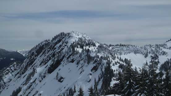
Looking back towards Jorgenson Peak from “bump 1”
From this first bump I got some nice view looking down at the Coquihalla Highway
Looking ahead towards bump #2
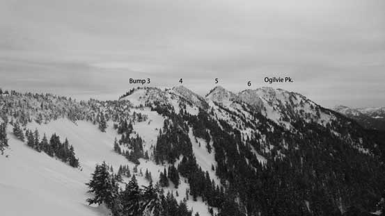
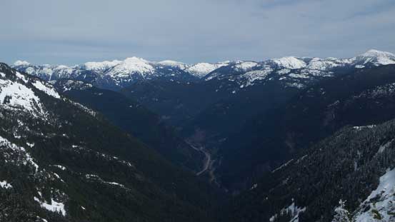
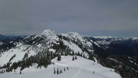
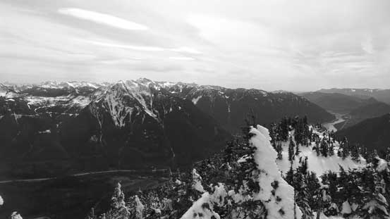
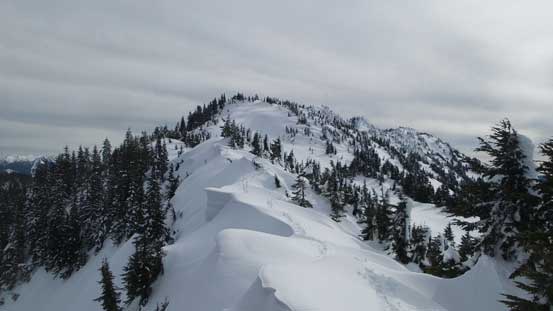
The rest of the undulating traverse. True summit on the far right.
I saw this open slope so went for it hoping to bypass bump 2
Partway across this big slope.

Bump #2 was bypassed.
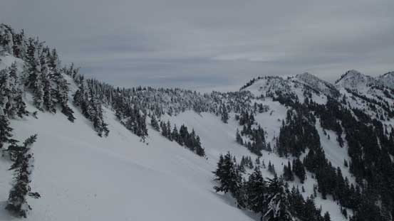
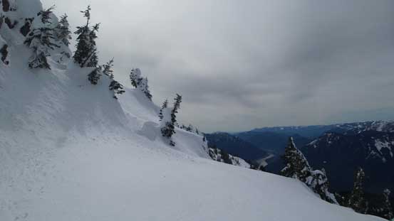
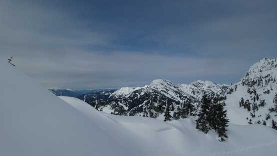
Ascending onto bump #3 started out easily but soon I had to face some heavily corniced sections. Given the recent fatalities I gave each of them a healthy respect. The top of this bump was a flat plateau and then I was off for another brief downhill to the next saddle. Upwards and onwards I again, had to be careful with cornices and near the top of bump #4 I had no choice but to get pretty close to the edge for one short stretch (but without any real exposure). Descending off bump #4 was kind of steep and involved the greatest amount of elevation loss on this traverse. About 50 vertical meters down I was on bump 4/bump 5 saddle looking up at the next section.

Looking ahead shows a corniced ridge leading towards bump #3
It’s a long haul going up this bump.
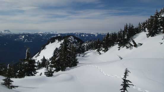
But the views were awesome!

Another picture to show the view from this 3rd bump.

The 4th bump had some huge cornices on the edge.
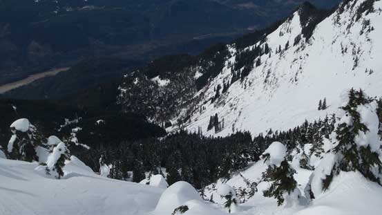
Looking down the “NW bowl” where others came up from. It looked pretty ugly.
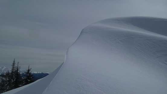
The large cornice near the top of bump #4
Looking ahead towards the 5th bump.
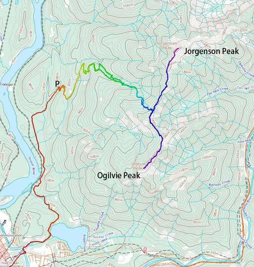
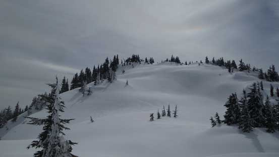
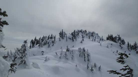
Based on earlier observation I knew bump #5 should be bypassed and I was corrected. There’s a very obvious ledge about halfway up this thing and the traverse over to bump 5/bump 6 saddle was very easy with minimal elevation loss. Grunting up bump #6 was nothing fancier than a plod, albeit a tiring one. Another short, but steep descent (for only 15 meters or so) later I was finally staring at the highest point. Ironically after so much of hard work the true summit was found to be heavily vegetated and I had to walk around the edges to soak in the views.
Partway up bump #5, looking back towards bump #4
Found this wide bench to traverse across bump #5

Looking ahead towards bump #6
Some blue skies were finally starting to show up!
Finally, the next bump would be the true summit!!
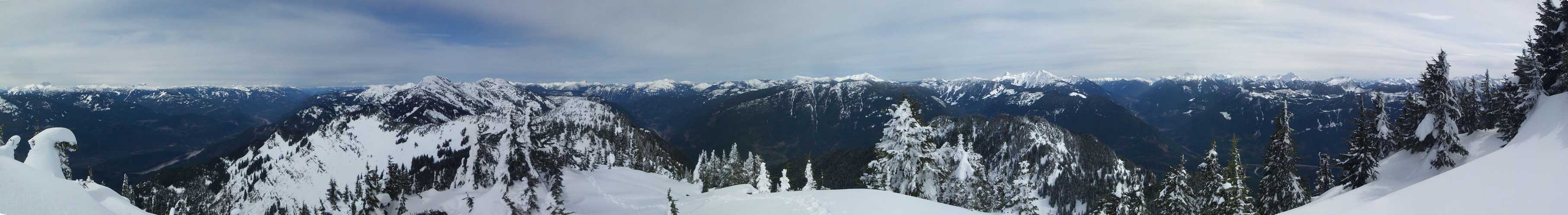
Summit Panorama from Ogilvie Peak. Click to view large size.

Hatfield Peak and Mt. Outram massif
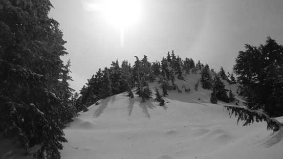
This is looking down at Sunshine Valley and Highway 3 corridor.
Wells Peak left of center and the system of logging roads below.
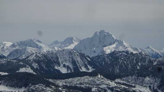
Tulameen Mountain

Needle Peak at the core of Coquihalla Pass area right of center.
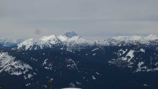
The Old Settler on the skyline
Mt. Grant by Skagit Valley

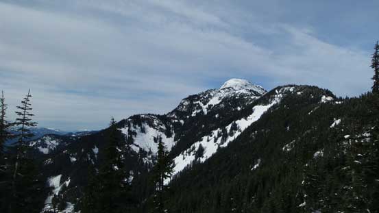
Jorgenson Peak
Another panorama from Ogilvie Peak. Click to view large size.

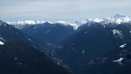
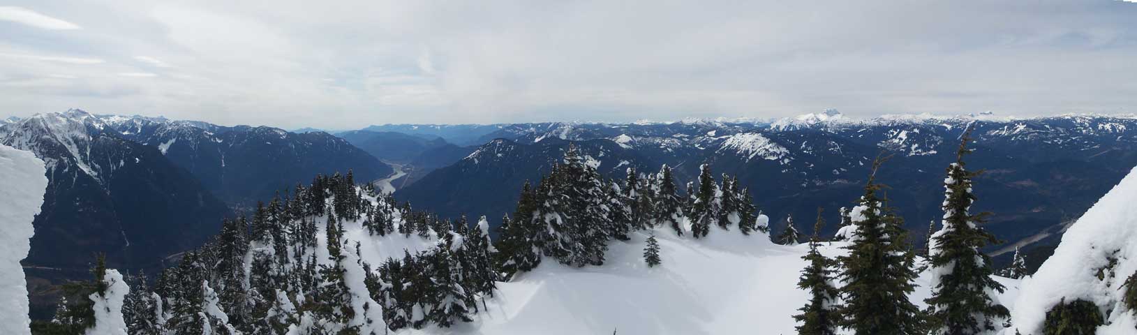
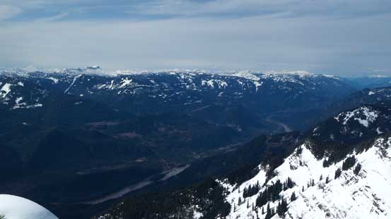
This is the lower Fraser Valley. The Lower Mainland on the skyline.
The N. Face of Hope Mountain properly displaced.
A wider shot of Hope Mountain and the valley Highways 1 and 3 travel through.
A wider shot of Fraser Canyon which Highway 1 travels through.

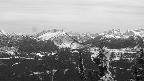
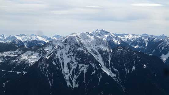
Another view from the summit, looking north towards Jorgenson Peak et al.

Me on the summit of Ogilvie Peak.
I took a lengthy break for more than half an hour up on the summit or Ogilvie Peak but the time was getting on and at this point I challenged myself another mission to get off the mountain before dark, so I had to move on. Reversing those bumps was tedious but at least went by fast. They really weren’t as bad as appeared and in no time I was back at bump 1/bump 2 saddle. The last uphill grunt of this day was soon over and then the plunge down to Jorgenson/Ogilvie col was steep but very enjoyable. Wasting no time I resumed the descent following my exact tracks. The snow condition was so good that for every step down I could glide a bit forward and in no time the 400 m elevation loss was done and I was back on the logging road. I followed this “Jorgenson spur” road to its end just to see how I missed the start in the morning. The misery was solved that I basically didn’t go far enough, but oh well. Onto the main branch I kept the ‘shoes on till where I ditched my sneakers. Putting the dry socks and the sneakers on was definitely the highlight of this trip and the rest of the descent back to the truck was uneventful.
Time to head down.

Bump #5 ahead.

Partway across bump #5, looking back towards the Fraser Valley
Looking up the Fraser Valley. Can’t get rid of these views.
A review shot of the corniced sections
Another wide bench traverse back across bump #2

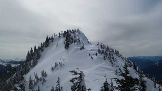
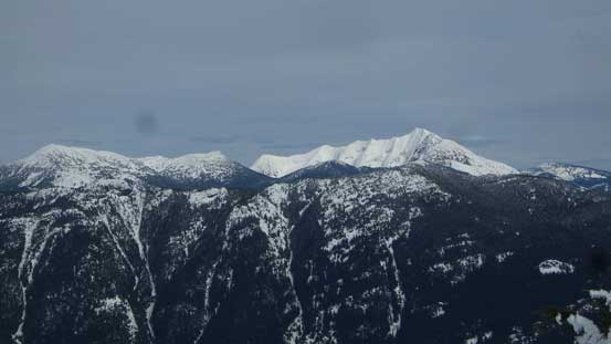
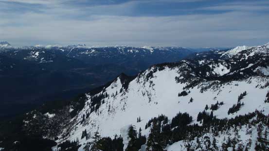
Looking back at the summit of Ogilvie and the bumps I just traversed over.
Down from J/O col now, looking back towards Jorgenson Peak.
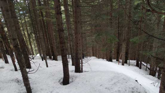
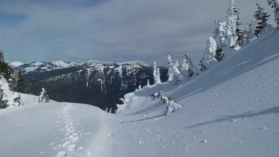
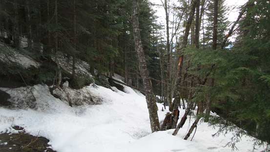
Easy forested travel.
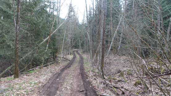
Down to the logging road now.

This is the start of “Jorgenson spur” which was easy to miss.

The lower road.
Note the fresh tire tracks on this road. Not by my Tacoma…
The drive out of the Squeah FSR was fast and fun and I really liked the performance of my new Tacoma. I challenged myself a new mission that was to get back home for a (very late) dinner. Darkness didn’t fall until I got back to near Chilliwack and I was back by around 9:20 pm which was not bad. Overall I’d say this approach (J/O col then NE Ridge) was much better than I thought with many bumps able to bypass without actually traversing up and over. There was no bushwhacking whatsoever thank to the thick snowpack we’ve received in this year, nor any particularly cruxy step to negotiate. The route also did not cross any troublesome chute or slide path for that matter and in the right conditions it’s most just a cruise sailing. The fact that it only took me 3 hours from the summit back to truck proved that so now with the misery resolved I hope there’ll be more of you coming here to enjoy this mountain.
