Glacier Peak
July 9-10, 2017
3213m
Mountain Loop Highway, WA
The namesake peak of Glacier Peak Wilderness is buried literally in the middle of nowhere and is by no doubt the most remote stratovolcano in Washington, and likely also in the whole Cascade Range. For that reason it’s also the least known among the five Washington volcanoes even though it’s much bigger than Mt. St. Helens and only slightly smaller than Mt. Baker. This is very unfortunate. You simply cannot find another one that combines a volcanic ascent with a long trek through rugged Cascades landscape. There used to have a shorter approach back in the days but thank to the deactivation of a key access road that approach is no longer an option. Nowadays almost all parties have to hike in via White Pass from Mountain Loop Highway making an arduous plod with more than 40 km distance and 3000 m cumulative elevation gain. Trail-runners have pulled it off in a single day push but I don’t consider myself as being in that category, so a leisure 3-day trip was planned between Vlad and myself back in this year’s early July.
Towards the last minute numerous weather models had downgraded our optimism so that I figured we had to push making the summit on Day 1 otherwise we might not get a view at all. This meant we had to sacrifice some comforts and pack light, also to get out of town as early as possible and then car-camp at the trail-head. Vlad finished his work pretty early and then we drove across the border without much of a delay. A familiar drive down I-5 later the iPhone app directed me towards Darrington. This was my first time driving Mountain Loop Highway and then at a signed junction we turned onto the rougher North Fork Sauk FSR. My Tacoma handled it without a problem at all and in fact, most cars should be able to make to the trail-head. Lots of cars were parked already but we did manage to find a spot so that Vlad could pitch his tent out. I was too tired to do the same so just past out in the truck.

Glacier Peak via White Pass. GPX DL
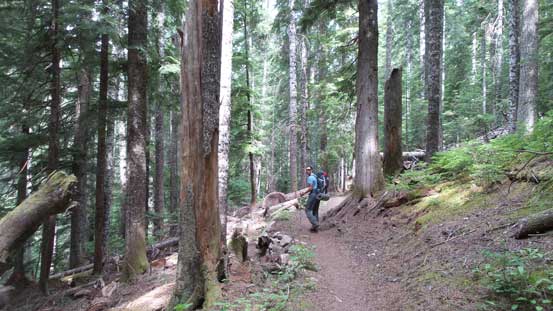
The next morning we woke up in a pitch dark and got going just when it’s bright enough to not require the use of head-lamps. The first 5 miles down the trail was pretty much next to flat and felt almost exactly like the approach on Mt. Olympus, albeit much shorter this time. I opted to use trail-runners for this portion and that turned out to be a good call. The trail might not be as tame as you think thank to a couple overgrown stretches (crossing avalanche paths). We literally had to push through the thick bush and then got soaked in no time thank to the heavy morning dew. Lots of four-letter words were flying around and good thing I brought two pairs of socks. The next thing we arrived at Mackinaw shelter but that thing was old and very ugly-looking. We were not in the mood of lingering so pushed onwards without doing much of a stop at all. Another kilometer later we took a break right before the first switchback.
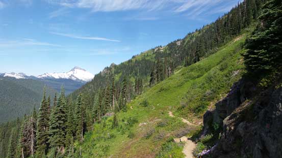
The second stage of this approach is a series of switchbacks up to White Pass. Thankfully much of the trail is high-quality and well-maintained and I managed to wear the trail-runners to pretty high up. Eventually I got sick of the heavy pack so took the 2-kg Nepal Evos out. The last switchback has at least a good mile in its length traversing a long ways due east. The best view was looking back at Sloan Peak. At that time I had no idea, but a month later I went back to Mountain Loop Highway and got Sloan Peak bagged. White Pass was a good place to hang around but we didn’t do so as there’s a cold breeze of wind plus there’s no running water to be found.

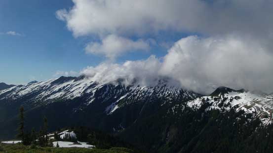
The first view of this trip goes to Johnson Mountain
Finally some sunshine once into the sub-alpine
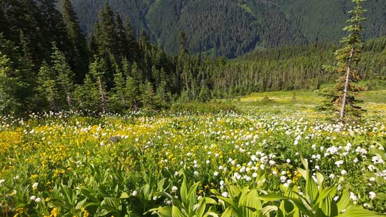
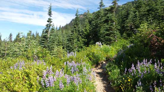
Meadows in July are as beautiful as they get
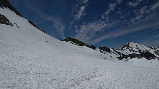
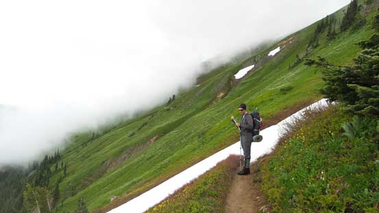
Partway along the long traverse towards White Pass

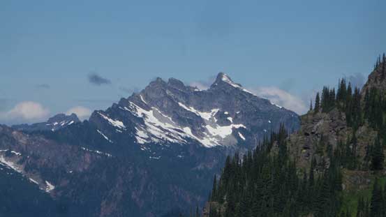
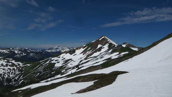
Sloan Peak is the most eye-catching giant nearby

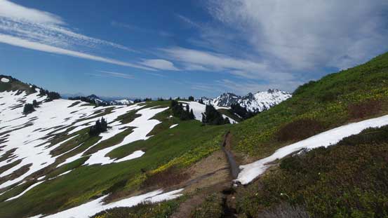
The long grassy slope traverse seems never-ending
Bedal Peak
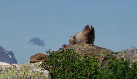
A lovely marmot asking for food
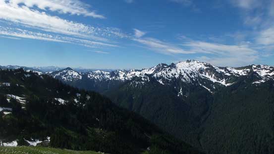
A full view of Pilot Ridge traverse.
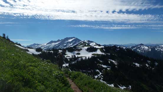
Hiking towards White Pass with Indian Head Peak behind

Arriving at White Pass. Nothing really spectacular here.
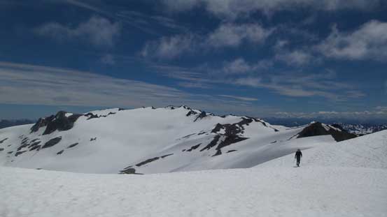
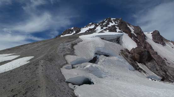
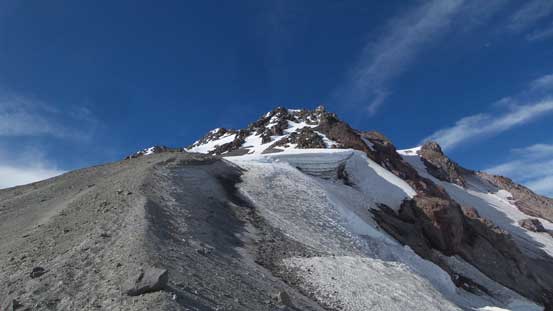
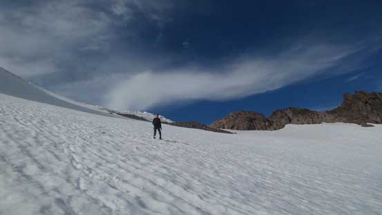
We debated about making an ascent of White Mountain but that’s a foolish idea given that we were pushing to summit Glacier Peak on Day 1, so traversing further east we went. The trail soon became more like a path and then disappeared into some snow slopes. The foot steps from previous parties were still highly distinguishable making easy route-finding for us. The idea was to resist gaining the ridge too soon while traversing across at least two big bowls. Around a broad rib we had to deal with one steep snow slope traverse that required a high degree of concentration. We were too lazy to take ice axe or crampons out so a slip was not an option. It’s pretty obvious where to gain the ridge now as traversing further simple wouldn’t make any more sense. This high col was where we took the second break.
Onwards from White Pass we started encountering patchy snow

Crossing path with a couple other groups who camped higher up
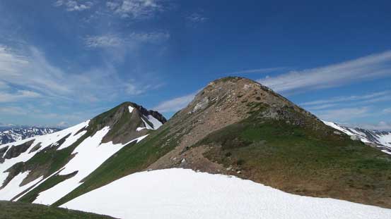
Looking back towards White Mountain

Vlad negotiating a short, but steep traverse

Grunting up towards the “high col”
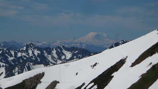
Looking back at Mt. Rainier
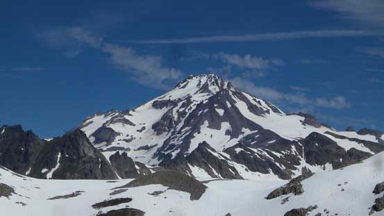
Glacier Peak displaced in front
This is the key access “high col” en route to Glacier Gap
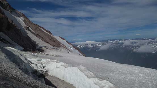
This was also the first time we had sights on our mighty objective – still looking terribly far away so we had to keep plodding. Down into the north side was easy on softened snow and then we picked up the set of tracks again traversing sideways across a couple more bowls. The difference is now we were entirely on snow rather than a mix of grass and snow. The recommended bivy site was right at Glacier Gap but we figured it’s not necessary. We came across a pretty damn good spot about one mile before Glacier Gap and in fact, another party had pitched their tent there. We did the same for simple reason to save 2 extra miles of hauling heavy loads. At this point we were doing pretty good on time so we actually spent that half an hour setting up camp and meanwhile, taking a necessary energy break.
Dropping into the north side bowl it’s winter wonderland now

Plodding across this long but flat stretch. Glacier Peak is slowly getting closer
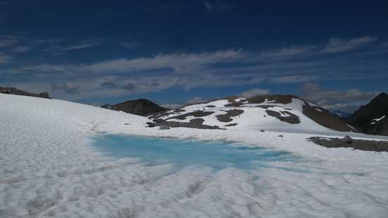
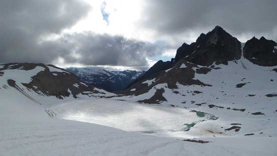
A pool of melt water

Perfect spot to set up camp.
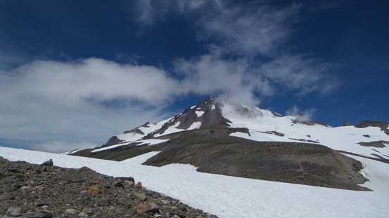
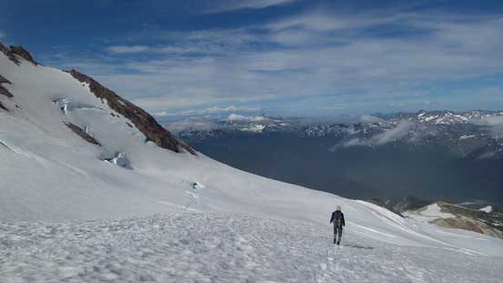
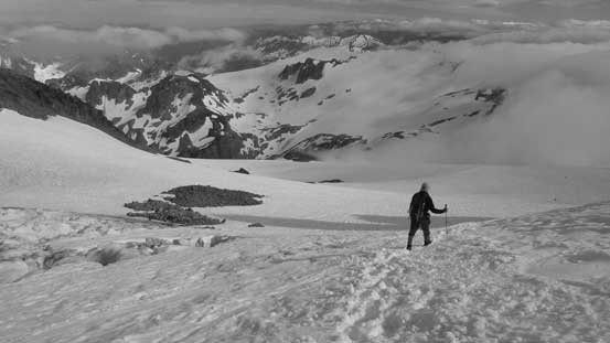
Up we went and again, we had to traverse sideways across a couple more snowy bowls with each one requiring some degree of elevation gain. There’s one major rise done on some moraine type of ground but otherwise it’s an easy plod to Glacier Gap. Quite a few parties pitched their tents at the gap and judging by the emptiness we figured they must have been still on the mountain. There’s a layer of clouds rolling in but at this point we couldn’t do much other than keep plodding. We picked the set of boot tracks up and over the roll ahead with at least 50 m of gain and loss and then we finally started up the main peak proper. It’s also interesting that some sections along the broad south ridge was done on dry, loose volcanic ash type of ground. This was good as after a long day plodding on snow I greatly appreciated some degree of variation. At one point we ditched some food/water and then bailed to the climber’s right side onto snow followed by a long diagonal march across Gerdine Glacier aiming at the col east of Disappointment Peak.

Gaining height now. Looking down at a still-frozen tarn

Vlad gaining Glacier Gap
Upwards and onwards we traversed over another bump
Onto dry ground again. Now following a climber’s trail up the south rib

One last look at Sloan Peak before it’s engulfed in clouds
Plodding up with Kololo Peaks behind as a backdrop

Here’s where we bailed onto Gerdine Glacier. The aiming was right skyline col
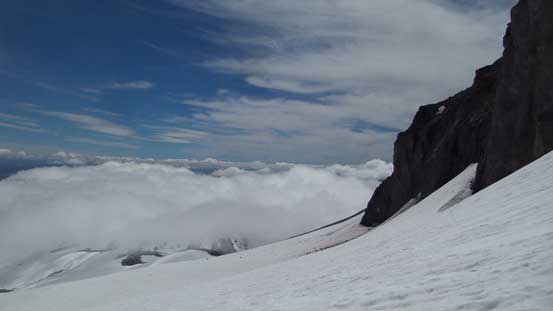
High up on Gerdine Glacier now a layer of low clouds rolled in
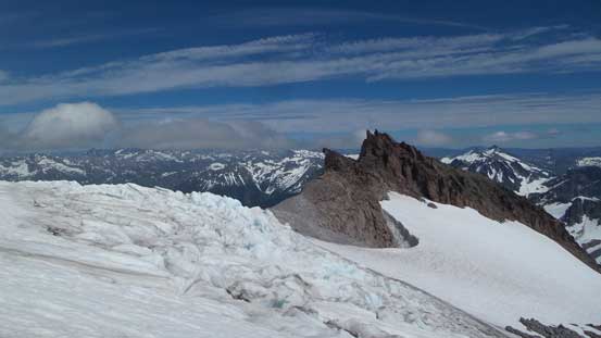
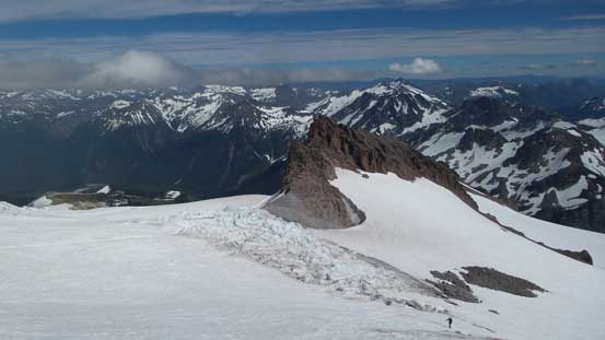
Around the high col we merged onto the second glacier – Cool Glacier and I have to comment that this is a real glacier with lots of crevasses to be aware of. Mid-July was almost too late in the season and right off the bat we had to cross a major crevasse on snow bridges. Having no rope nor equipment we just simply followed the previous parties tracks but had it been thinner I would certainly want to have a bit of safety back-ups. After the crevassed zone we trended slightly climber’s left up Cool Glacier and again, while simply following the other parties’ tracks. Higher up underneath the summit block of Disappointment Peak we crossed path with a roped party-of-three. Later I found out that the leader was the legendary Ed Kenny from Washington Hikers and Climbers. That was quite a cool experience on Cool Glacier but soon enough we reached Glacier/Disappointment saddle and then onto rock gain.
This is the heavily crevassed stretch at the start of Cool Glacier
Vlad plodding onto Cool Glacier

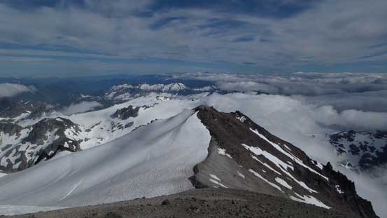
The main block of Glacier Peak now too far away now

The ascent on Cool Glacier was long, but very scenic

Onto rocky ground again
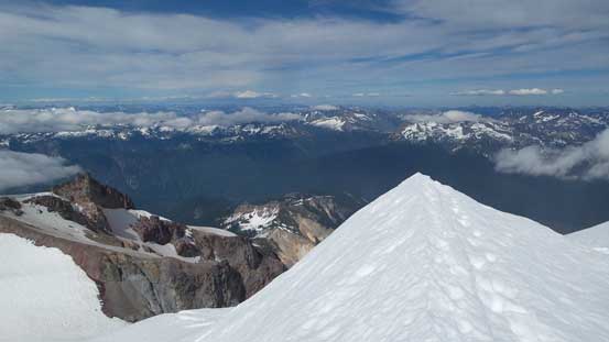
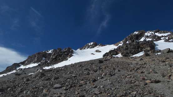
The first half of the final summit push was done on loose volcanic ash but the previous traffics had packed down a zig-zagging trail so we didn’t have to deal with treadmill scree. That was good. Higher up we merged onto snow and this time, the grade was pretty steep but again, the previous parties had done a great job kicking the steps for us. There’s no need to use any special equipment neither and soon enough we topped out. There were two highpoints and we checked them all off just to be sure, but I think the right (east) bump is the true summit. Apart from the taller Bulger peaks there’s not much else to see thank to the layer of low clouds. This was actually my first volcano done with a layer of low clouds so that was very cool nonetheless.
Starting the final summit push
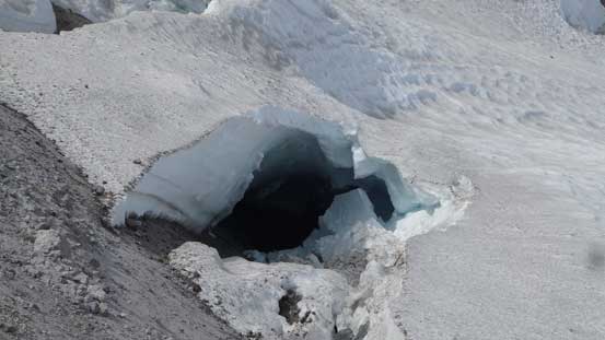
A very large hole on the edge of Cool Glacier

Vlad plodding up. “Plodding” is the theme of this trip…
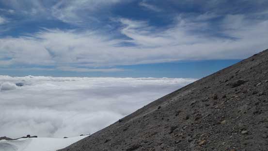
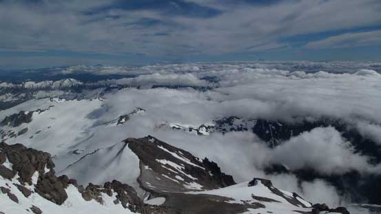
A sea of clouds now looking west
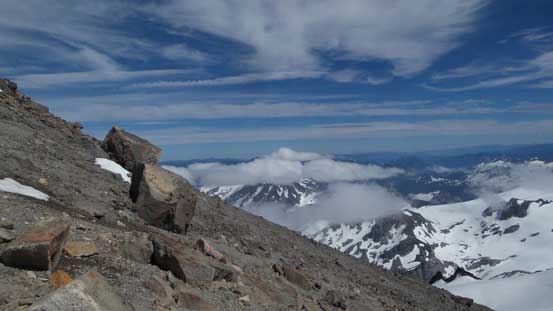
Looking east from high up on the south rib
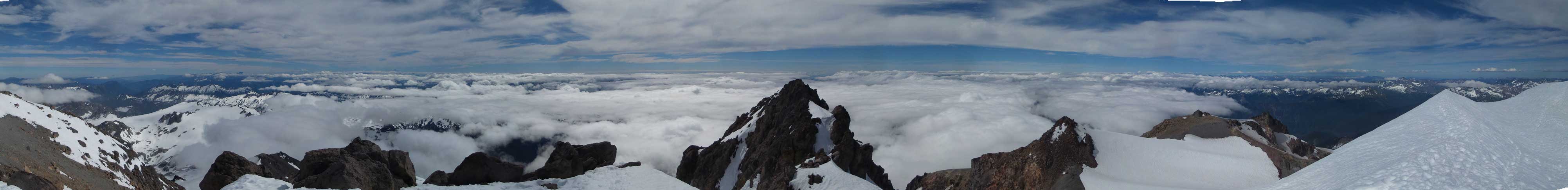
Partial Summit Panorama from Glacier Peak. Click to view large size.
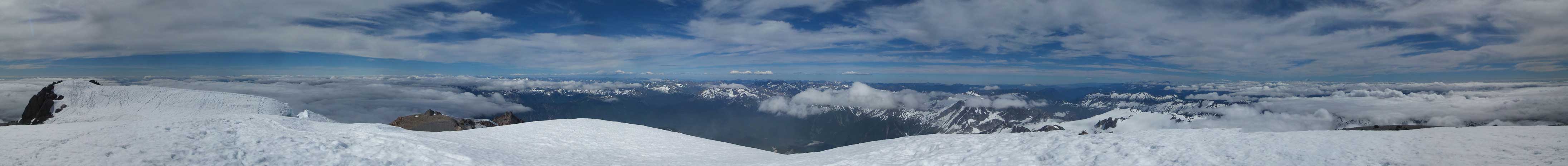
Partial Summit Panorama from Glacier Peak. Click to view large size.
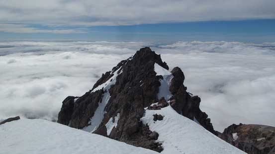
Looking down at a lower pinnacle

Mt. Baker sticking out of the clouds on northern skyline

Kololo Peaks now looks like just a snowy ridge

Vlad gaining the summit plateau
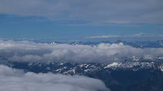
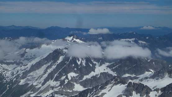
Looking north only the Bulgers could stick out of the clouds

Wondering around the summit
A neat snow arete
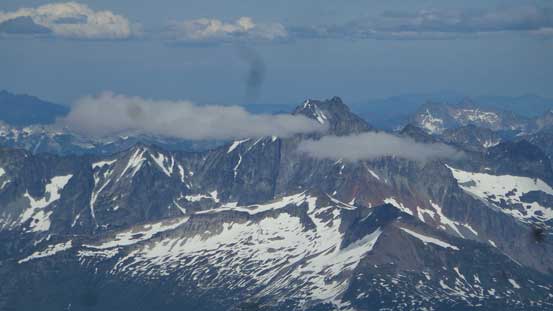
Clark Mountain
Bonanza Peak is the highest non-volcanic peak in Washington

Me on the summit of Glacier Peak
Tired but we had to keep going as the time was slowly getting on. Thankfully much of the descent would be done while plunging down on snow. This was very easy on our knees. For the first part down towards Disappointment/Glacier saddle we really took our time soaking in the views. At the saddle we decided to bag Disappointment Peak as well for simple reason of why-not. There’s no way would I come all the way back here for just Disappointment Peak so it’s a now-or-never kind of thing. After that short detour we continued plunging down Cool Glacier and then Gerdine Glacier. Lower down we entered that layer of mist and had to navigate a good stretch in a white-out. The GPS came handy and soon we joined the lower south ridge and followed it down to the low saddle without much of an issue. We caught up with Ed’s group there and after a brief talk we continued onwards.
Time to head down
One of my favourate shots from this trip.
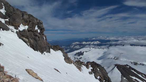
Looking across the south rib into eastern areas
This is the upper mountain. Partly on rocks and partly on snow
Going down on soft volcanic ash was very easy
Looking back
The edge of Cool Glacier

Going for Disappointment Peak since it’s right there

Down from Disappointment Peak now there’s an interesting pinnacle ahead
Descending Cool Glacier
This is the crevassed zone. Pretty sure the snow bridges wouldn’t last much longer
Descending Gerdine Glacier

Ready for some white-outs?!
The upwards slog over the bump north of Glacier Gap was not very inspiring but at least short-lived and then we were back to the downhill mode down to Glacier Gap, and then further down to the west side of Kololo Peaks following our own steps now. A couple more traverses later we were back to camp earning a good hour of daylight time to cook some dinners. Weather appeared to have really moved in but with the primary objective in the bag I was too lazy to fire an inReach message asking around. If weather held we might go for Kololo Peaks and Indian Head Peak making a full 3-day outing and if not we’d just go home. There’s no need to rush in bad weather.
Cool lighting on the frozen tarn

Back to camp at evening hours
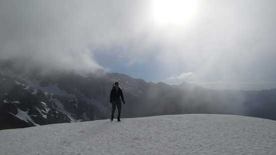
The morning of Day 2 we woke up under marginal weather. Vlad said he would wait at camp but I was in no mood slogging 400 vertical meters solo only to have zero view from Kololo Peaks so we packed the camp and headed out. There’s no point in ascending White Mountain with zero view neither as pretty sure we’d be back to White Pass for the other peaks nearby. While traversing across the snowy slopes I took a spill and fell about 20 feet before managing to arrest using my bare hands. The problem was that I plunged onto an icy spot although the exposure was without much of a consequence but a good remind that accidents happen when you are not alerted.
The morning of Day 2 peaks were all soaked in
Heading home. Cresting this “high col” was cold and breezy
Indian Head Peak also soaked in
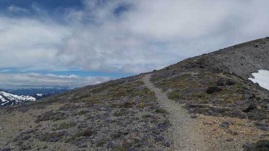
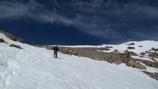
Down from White Pass we were officially below the clouds ceiling but still there’s very minimal to see. All the peaks nearby were soaked in so we just kept plodding downhill. About halfway down the switchbacks I got tired of my boots so swapped them for the trail-runners and the rest of the hike back to parking lot was long, but uneventful. Those overgrown sections were not as wet this time, thankfully.
Descending from White Pass with hardly any view now

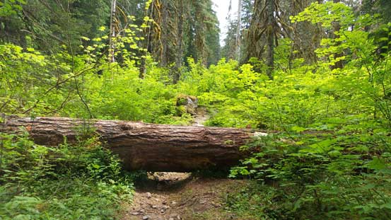
This is one of the few overgrown stretches
As much as the views go along this final 5 mile slog
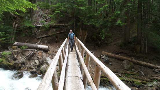
Bridge well constructed though
Someone needs to step-up the maintenance work.
The day was still young which meant we had lots of time to get back home before dinner time. But I needed to find a place for lunch and the most logical stop was the city of Arlington. That was a horrible mistake as to find a Subway my iPhone directed me off the highway for at least 5 kilometers. And then the line-up was so long that I eventually gave up and walked to a nearby McDonald only to find an even-longer line up. I went back to Subway and just sucked it up, swearing I’d never stop in this place for a second time. And that’s the end of this trip.
