Mount Green
April 15, 2020
2040m
Hope / Sunshine Valley, BC
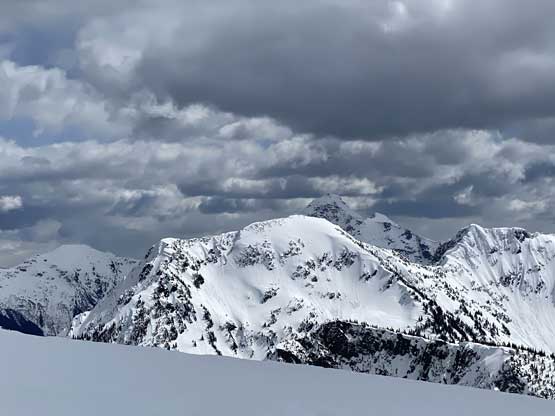
Mt. Green is on the long, undulating ridge between Eaton Peak and Mt. Forddred in the headwaters of Potter Creek not far from Sunshine Valley. This is not an iconic summit but is relatively difficult to access thank to the deactivation of the logging roads in Potter Creek drainage. There isn’t a lot of information online neither with lingering trip reports all dated back to over a decade ago. The primary objective for folks who paid the suffering to trudge that far into the headwaters of Potter Creek is likely Mt. Forddred, and to do both Mt. Forddred and Mt. Green in one single day is surely pushing things a bit, especially with some unknown terrain on the long connecting ridge.
Alex and I decided to take advantage of our friends’ tracks to Mt. Forddred combined with the rare, deep overnight freeze in mid April to make both summits in one day. The season for these peaks are short (March and April) due to the mangled alders on Potter Creek logging roads so the timing aspect is very important. We had an above-average snowpack thickness, a set of broken snowshoe tracks to the summit of Mt. Forddred and some deep freeze hence firm conditions all lined up for this trip. This made me believe that we could actually bag both peaks and I could still be back home in time for the work in evening.. We left Vancouver at 4:30 am in the morning and made to the summit of Mt. Forddred in under 4 hours 20 minutes from the parking lot. Now back down to Forddred/Green col we wasted no time but starting the traverse into the unknown. There was no trip report about the Forddred-Green traverse.

Mt. Forddred and Mt. Green via Potter Creek. GPX DL
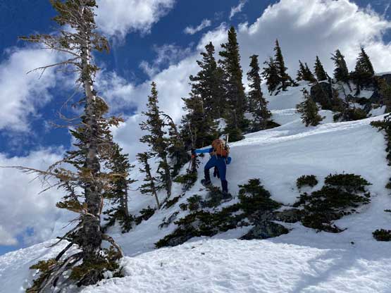
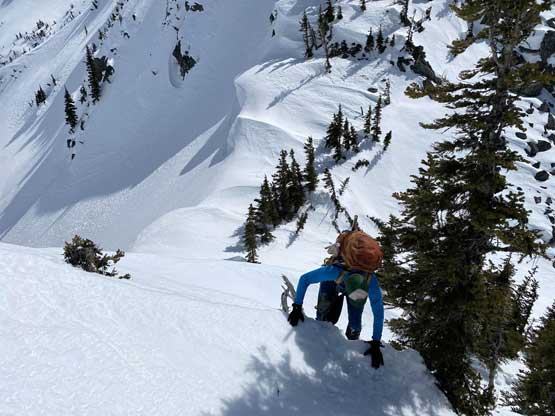
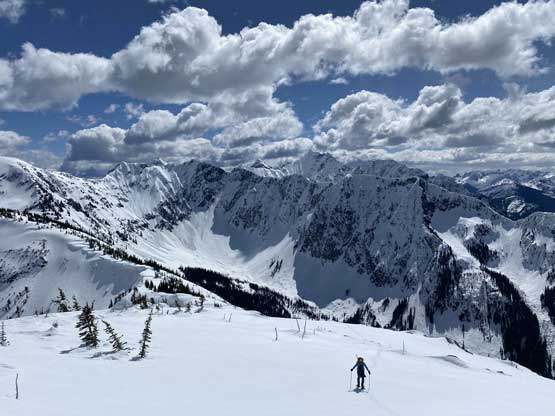
First of all we had two substantial bumps to either traverse up and over or to bypass. It almost certainly made sense to at least bypass the first bump by traversing on the open forest and ramps on the south side so I led a line keeping the beeline low, and it worked nicely. For the second bump I tried the same but ran into steep and difficult side-hilling terrain, but with stubbornness we still made the traverse happen without gaining much unnecessary elevation. The downside was long sections of side-hilling on 30-35 degree snow and sometimes with run-outs. After the two bumps we had a short section of flattish ridge to plod across, and then there came a steep down-climb into a notch. The down-climb surprised both of us and was no easier than the crux step on Mt. Forddred. I gingerly went down wearing snowshoes but had to use vege belays and grab some rocks. The ascent out of the notch was no easier neither that even with careful route-finding that odd “technical snowshoeing” thing was unavoidable. There’s still one stretch of steep grunt before we were officially on the south ridge of Mt. Green.

Steep faces south of Mt. Forddred on some unnamed peaks

Alex traversing just one microscopic section of the second bump…

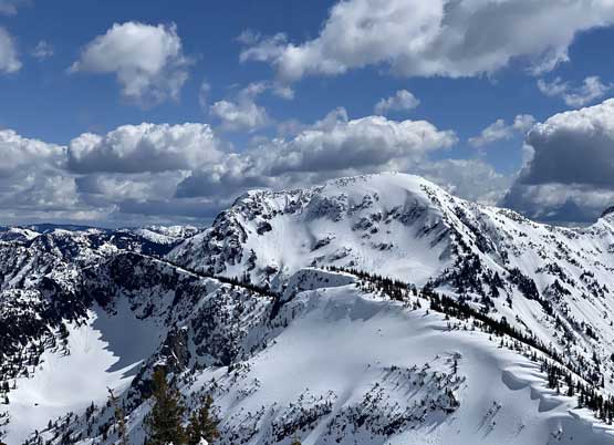
After the two bumps here’s the ridge ahead

Me finding a way down-climbing into the notch. Photo by Alex R.
Alex down-climbing using vege belay
Then, steep ascent out of the notch.
The terrain became gentler here.
This is looking towards the distant Cheam Range

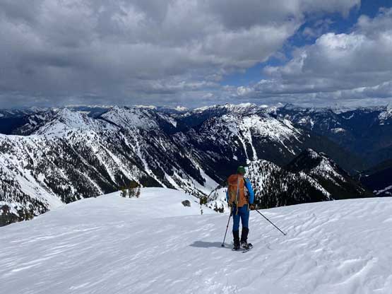
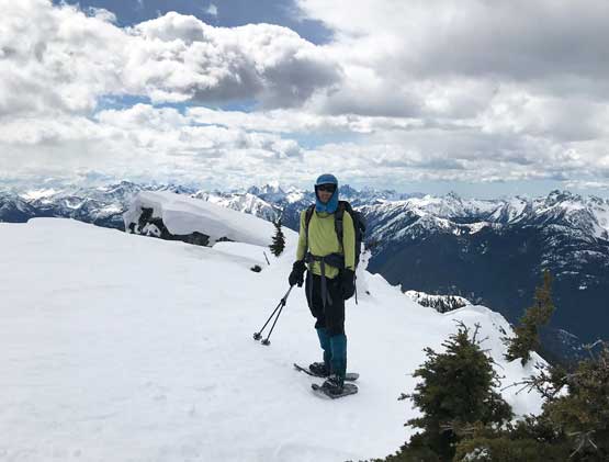
Alex grunting onto the south ridge of Mt. Green.
I was hoping for some easy stroll on the south ridge of Mt. Green but I was wrong. The ridge looked like a mess with giant cornices and micro-terrain. It sure wasn’t difficult but we still had to turn the mental game on, and stay focused. The cornices weren’t difficult to avoid, but some required short detouring to the left (west) side. En route we kept close attention to the planned exit point but didn’t want to get too close to the cornices. We decided to have a look from the summit once we could actually see the other (east) side of this ridge. The traverse to the true summit involved another few annoying, but short elevation loss and seemed to drag on forever. The summit itself was suspected to be on a giant cornice so we couldn’t actually stand on the highest ground to look back at our planned exit point. We did have some glimpses but it looked more involved than anticipated. Alex then threw out the idea to descend the north ridge but I remembered seeing a steep step from lower down on the logging road. We went down for about 100 meters, but still couldn’t see the steep step. After some discussion we opted for not venturing further into the unknown and reluctantly slogged back to the summit, snapped some obligatory photos and retraced our steps south to the only spot that we could actually make a drop-in to the east side bowl.
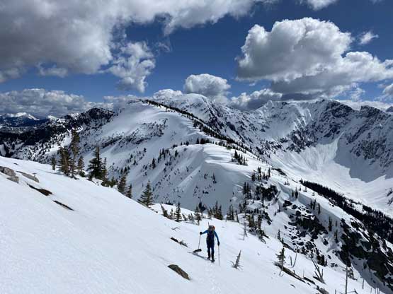
Alex slogging up the broad south ridge.
Looking back at Mt. Forddred

“Cassino Peak” and other unnamed peaks south of Mt. Forddred
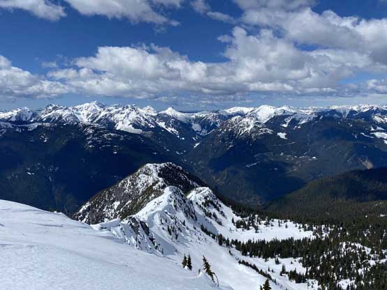
A western view towards Cheam Range in the distance

The long south ridge of Mt. Green

Lots and lots of cornices to avoid…

One gigantic cornice on the false summit

Eaton Peak (west) and Eaton Peak (east) from the summit
Alex scouting out the potential north ridge descent

Mt. Payne in the distance
Mt. Forddred from the summit of Mt. Green

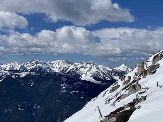
Mt. Baker behind Mt. Rexford and Slesse Mountain
Me on the summit of Mt. Green
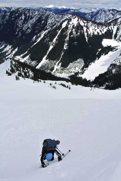
The descent into the east-facing bowl involved a section of short, but 50+ degree down-climbing so we took an energy break and donned crampons and ice axe. This was the only spot that we used the gears on this whole trip. Thankfully the condition was not as icy as it looked. I only wore my soft hiking shoes on this trip so couldn’t do front-pointing on steep snow. I carefully made some bucket steps while planting my ice axe firmly in. I usually don’t bother to plant my axe as I thought it’s inefficient in down-climbing snow, but with the wrong footwear I had to play it safely. Further down we kept wearing crampons until the snow became too soft for boot-packing. We then did a gear transition and easily descended the steep forest on mushy snow. The exit back to the headwaters of Potter Creek and then onto the old logging road took literally no time. The next 2 hours were extremely boring while plodding back down the road, with some moderate post-holing given the softening snow. But at least the grade was mostly downhill. For the river crossing Alex didn’t give it a fuck, but since I brought my proper river equipment I took my time switching footwear. For the last 1 km on Sumallo River Road I just walked wearing river shoes and neoprene socks, which was surprisingly comfortable.

Our line of exit into the east side bowl…
Me down-climbing. Photo by Alex R.

Alex dropping in. 50 degrees at the top.

Descending the east side bowl. Photo by Alex R.
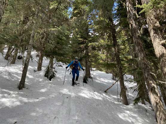
Into the steep forest on deteriorating snow

Back to the logging road now. Mt. Potter ahead

Some alders but not very annoying

A review shot of Mt. Green

Alex plodding. I turned on the music here as it’s so damn boring…
Almost down to the river crossing

Alex crossing Sumallo River

Me finishing the river crossing. Photo by Alex R.
The final 1 km walk on Sumallo River Road back to the truck
Our round trip time was under 9 hours 20 minutes, covering 26 km distance, over 1700 m elevation gain and a variety of terrain. The traverse from Mt. Forddred to Mt. Green and the descent off Mt. Green was more difficult than we had expected. This is a classic Type II fun kind of trip – lots of views, lots of suffering and two remote peaks. I’m glad I never have to plod back up this stupid road that’s for sure.
