Mount Erie
November 30, 2015
388m
Anacortes / Puget Sound Lowlands, WA
Mt. Erie is the highest point on Fidalgo Island and I got this trip idea from simply gazing at the Topo maps. Due to its proximity to San Juan Islands, Straight of Juan de Fuca and the Puget Sound Lowlands this summit would for sure give some interesting ocean / islands views despite its low elevation (less than 400 m). Further research led me to the conclusion that one can typically drive up to the summit via a steep road. On the last day of this extended November high pressure system my motivation level was almost burnt down to zero but the weather was too good to believe. I had to be back to Vancouver by lunch time so the lowly Mt. Erie was in the order. To make full use of the weather I decided to wake up early for some sunrise pictures which turned out to be an awesome area.

Mt. Erie Road direction map
Well, since this is a summit obtainable by driving I’ll have to write a bit about the drive… This was my first time driving directly down south (via King George Blvd, Highway 99 and then Interstate 5) into the mountains and I have to say it’s quite fast. The border crossing had no delay at 5:30 am which was always a bonus. Near Burlington I turned west onto Route 20 (aka. the North Cascades Highway) and entered a thick layer of fog and that lasted all the way to Fidalgo Island. I then followed the Campbell Lake Road, Heart Lake Road and finally, Mt. Erie Lookout road all the way to the summit. Before the trip I wasn’t 100% sure whether or not I could drive up the (very) steep Mt. Erie Road but apparently the Americans did some really good job maintaining it. It’s even paved which was to my surprise… As expected I broke through the fog layer and I made there about 10 minutes before sunrise which was just perfect.
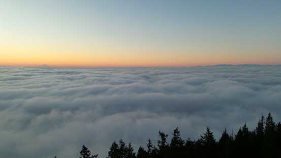
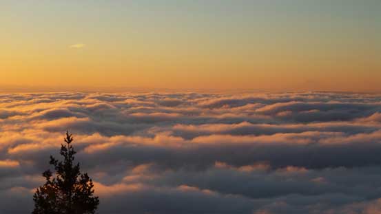
About 10 minutes before sunrise.

The mighty Mt. Rainier looks big even at hundreds of kilometers away!

Sunrise over the North Cascades
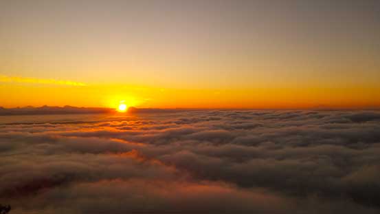
Another picture of the sunrise

More about the sunrise. Note the sunbeam lighting up the clouds
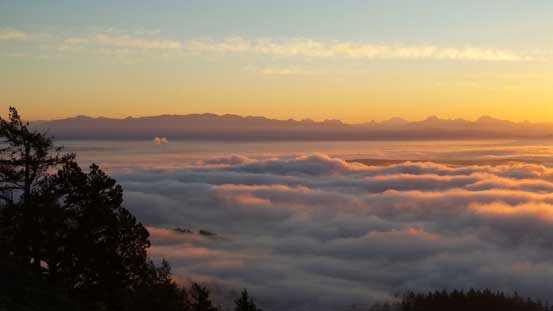
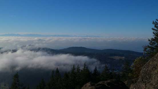
The North Cascades and the sea of fog

A zoomed-in view of Glacier Peak, Whitehorse Mountain and Three Fingers
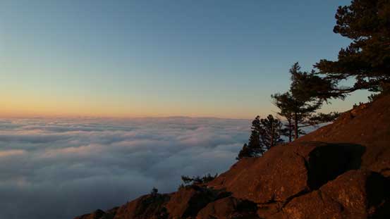
The ocean of fog and the summit lookout

Those peaks in the distance are the Olympics with Mt. Olympus being the highest
Now I couldn’t see Mt. Rainier anymore as it’s getting a bit hazy on the horizon
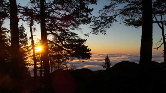
One last picture of the sunrise

And, a panorama view from the summit. Click to view large size.
Towards the end of this incredible morning glow I met a local photographer, Corey Freedman. It was just him and I sharing the summit so we chatted quite a bit especially since this was my first time ever coming to this area. Corey even offered me a free lecture on photography which I greatly appreciated. Little did I know anything about sensors and lenses before so now I know what to look for exactly when purchasing camera gears. It was about 10 am now so I figured the morning fogs must have burnt off so drove back up to the summit.
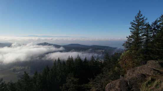
The fog started to lift up, but not completely

The North Cascades across Puget Sound Lowlands
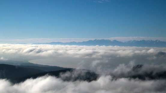
A zoomed-in view towards the Olympics
Same as above looking towards the Olympics across Straight of Juan de Fuca

Mt. Baker on the horizon
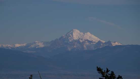
A zoomed-in view of Mt. Baker
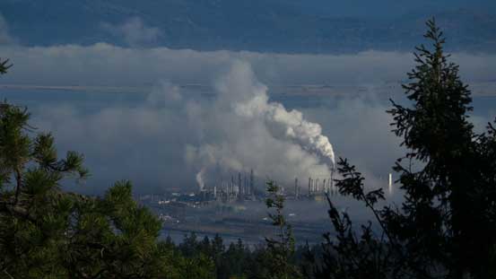
Quite a few industry plants nearby…
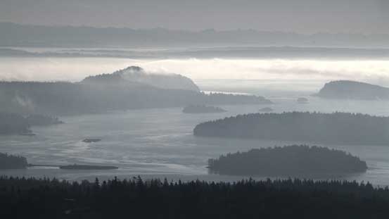
Finally started to see some islands, but the sun was on the wrong direction for pictures
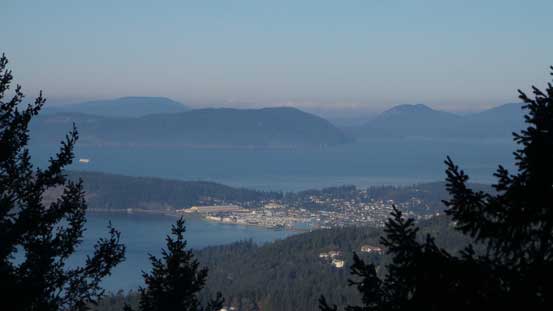
A look at Founder Bay which is part of Anacortes

This is Burrows Island
After taking a few more pictures it’s time to head home. It’s tempting to ascend the nearby Sugarloaf too but I was very low on motivation at this point, plus I was a bit late on time already. The border crossing back to Canada took about 30 minutes and that’s the end for this rare 10-day high pressure system in late November.
