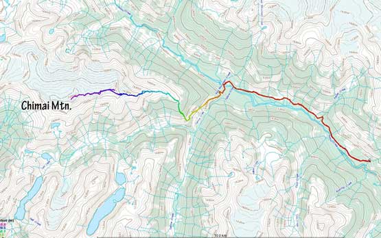
Chimai Mountain
May 8-10, 2021
2306m
Squamish / Ashlu Creek, BC
“Chimai Mountain” is the unofficial name of a broad and glaciated massif that occupies a large area on the south-west side of Ashlu Creek. This peak boasts over 1000 m prominence as well as a handful of unnamed or unofficially-named sub-summits. Back in the days when Ashlu Creek FSR was driveable a ways into the valley this peak had been regularly visited by skiers and climbers but the influx had gradually come to a stop since the road’s deactivation. A number of key bridges including the one bridging the raging torrent of Pykett Creek had been pulled making a foray into the upper Ashlu Creek valley a major undertake. The situation was drastically improved in the last two years credit to the volunteering work done by a number of keen folks including but not limited to David Reid and Jeff Han, that Pykett Creek now had two foot bridges, one more sturdy than the other. The main Ashlu Creek FSR is now driveable to as far as Pykett Creek about 7 km from the deactivation spot although this largely depends on the vehicle and the experience of the driver. A Tacoma with all terrain tires was able to get to “4.5 km ditch” while a Suzuki only managed to the first washout about 0.5 km in.. The “A1100 bridge” across Ashlu Creek was the major uncertainty for Chimai Mountain. The last known report was August 2020 that the bridge was “definitely not in a good shape and would not hold much longer”. Chimai Mountain would still be doable without the A1100 bridge but no longer via the standard Falk Creek/East Ridge route and such would add about a day into the already-long slog.
Sean C. had been planning this adventure for a few months at least and was keen on this past weekend. It took me a long while to decide. On one side I didn’t like the odds of the bridges but on the other side I did agree that Sunday-Monday would be an ideal weather/condition window of which I did not want to miss. I came up with a solution to eliminate the odds of the “A1100 bridge” by taking the “Endall Peak” and NW Ridge route accessed from farther up the valley with a good bridge crossing Ashlu Creek but such would add considerable amount of extra distance and elevation into the trip. Meanwhile I managed to convince Holly to join the mission. I had never hiked with Holly but I knew what she’d done recently and figured that Chimai Mountain would offer some fresh but manageable challenges for her. Holly and I made the last minute decision to extend the two-day trip into three days to make sure we had enough contingency to prepare for the worst case scenarios. Sean had a different schedule that he wanted to finish the trip in two days so that he wouldn’t mess up with his work so the plan was to team up for the ascent but egress separately.
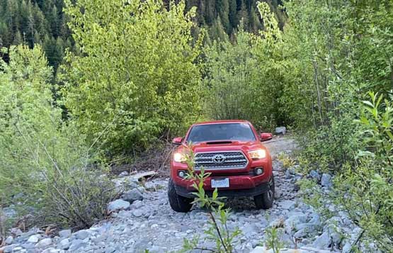
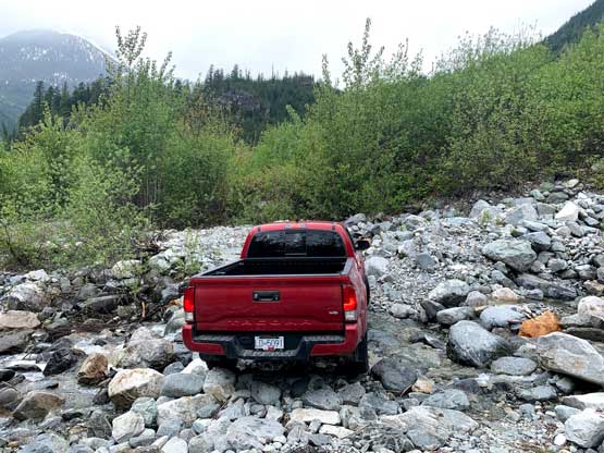
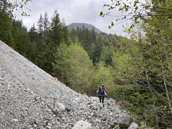
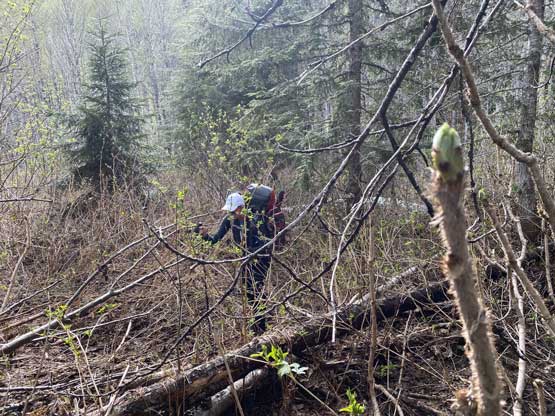
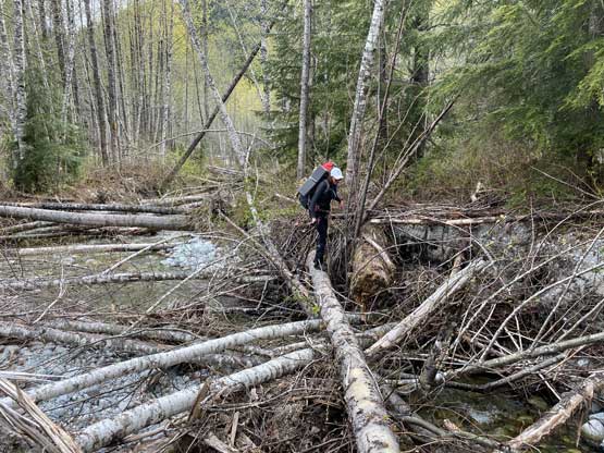
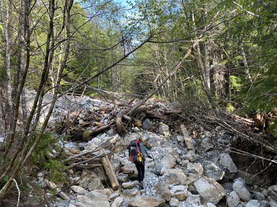
The plan for Saturday was to deal with the unknowns on the road and camp by Ashlu Creek under whatever ridge we would end up deciding on. This would not require a full day but we didn’t want to rush too much, so agreed to start at around 4 pm. I left White Rock after lunch and picked up Holly in downtown. The traffic wasn’t too bad. Another hour and half later we met Sean at the start of Squamish Valley Road. The drive up Ashlu Creek FSR to the A600 junction where the deactivation started was very easy but as soon as we turned onto the deactivated road we were in for some adventures. The first challenge was the bypass around concrete blocks before “50/50 bridge” crossing Ashlu Creek, which was a little interesting in a long bed Tacoma but not bad. Immediately after crossing the bridge we had one minor washout and shortly after that we came to the major washout at Rob Creek. After some inspection I decided to push across in 4Low and although sketchy, wasn’t too terrible. Sean tried hard in his Suzuki but immediately got high-centered. While backing up the front bumper got ripped out. Sean then transported his gears (including a bike) to my truck and we kept pressing on. Immediately after Rob Creek washout we faced a rough section with one serious ditch that to my surprise, did not bottom out my truck. The next worth-noting spot was about 2 km further where a deep but reasonably wide ditch slightly scrapped the undercarriage. There was no additional obstacle but driving across that seasonal closure ditch at 4.5 km seemed impossible without aggressive tires and/or lift so I parked. I had no idea how Matt managed to drive across this ditch a few weeks ago…

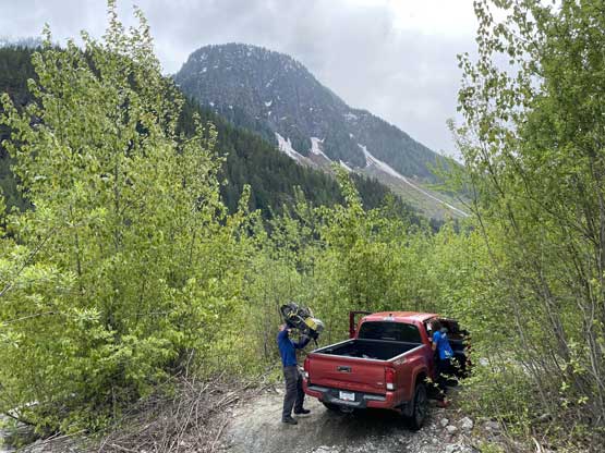
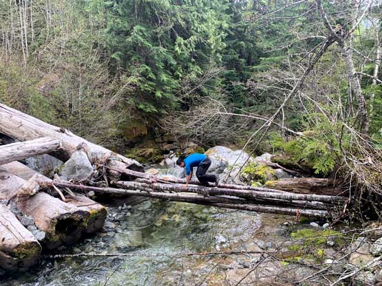
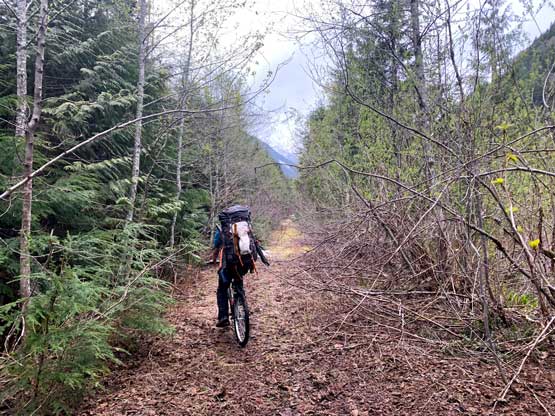
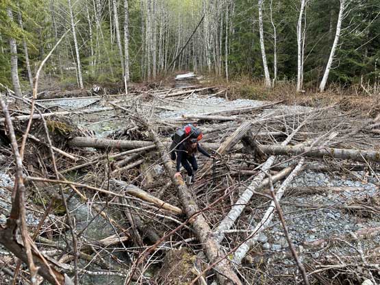
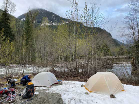
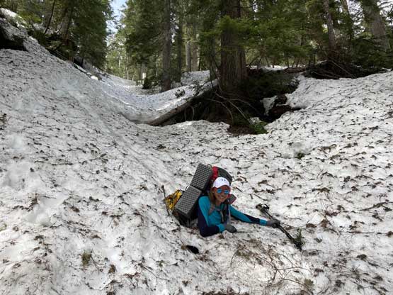
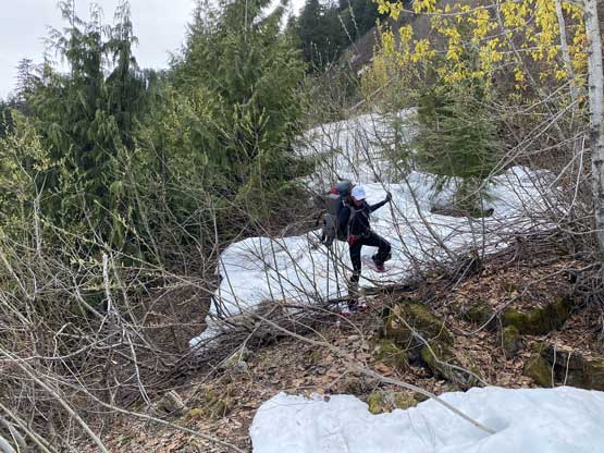
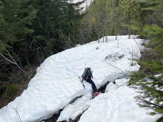
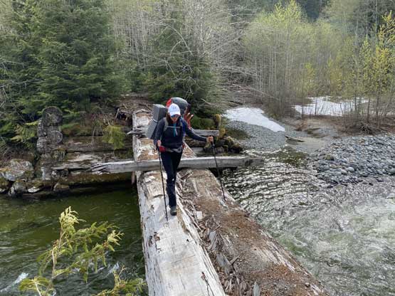
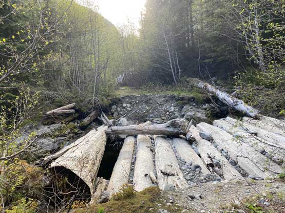
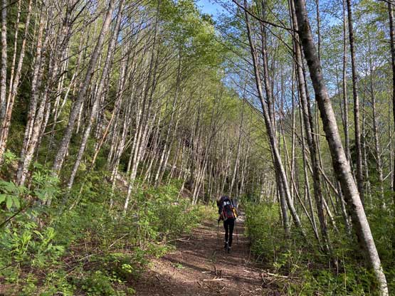
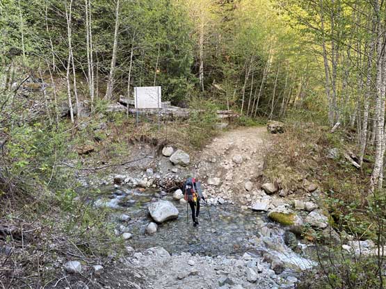
Hopping across the ditch that stopped my Tacoma was trickier than expected that Holly and I ended up taking our shoes off and forded the creek. In the next few kilometers there wasn’t much in terms of worth-noting obstacles so if one could drive across that 4.5km ditch then one could definitely push to near Pykett Creek in the truck. That wasn’t the case for us unfortunately so we had to earn these kilometers. Pykett Creek was not raging on this particular day. There were at least three options to cross. Sean took his boots off and simply walked across with his bike while Holly and I decided to take the new log bridge constructed by David Reid to credit his work. To prove a thing I went back into the creek to test out that older alder-bridge and it was much more solid than I thought. There were a few more kilometers between Pykett Creek and the A1100 turn-off and despite some alders most of the stretch was easy cruising. Sean even managed to bike and/or push his bike to within a kilometer from the A1100 turn-off. At the junction we let Sean to go down to Ashlu Creek to check out the bridge. About 15 minutes later he came back reporting that the bridge was in a surprisingly good shape. We made a spontaneous change of decision here to take the shorter East Ridge (standard) route. The spur road heading down to A1100 bridge had a long stretch of wash-out due to Red Mountain Creek and the bypass involved some bushwhacking through brambles. After walking across the remaining two beams on that bridge we found a nice spot right next to Ashlu Creek and called it a day. It had taken us 2.5 hours on a leisure pace to get here.


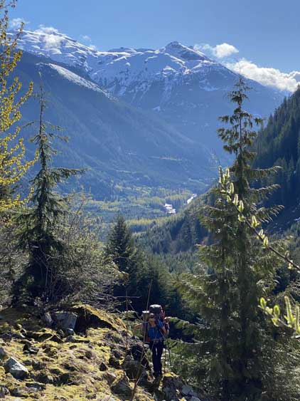
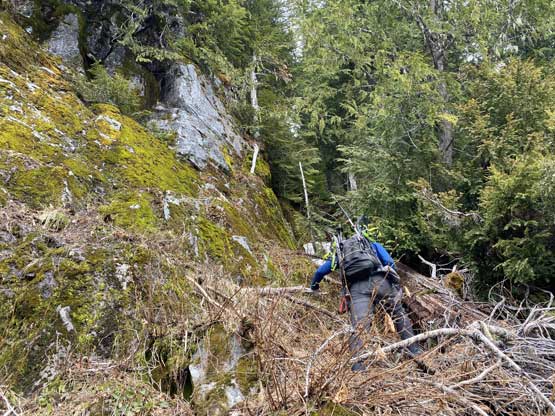
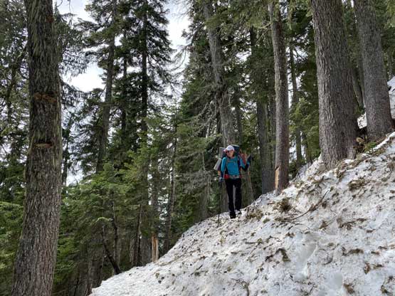
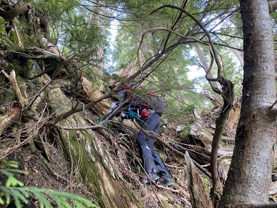
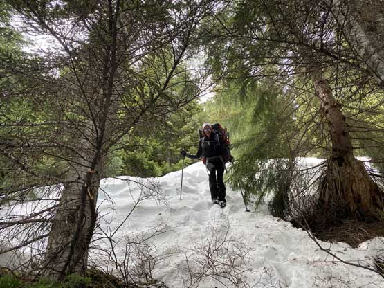
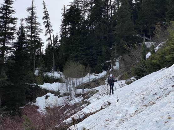
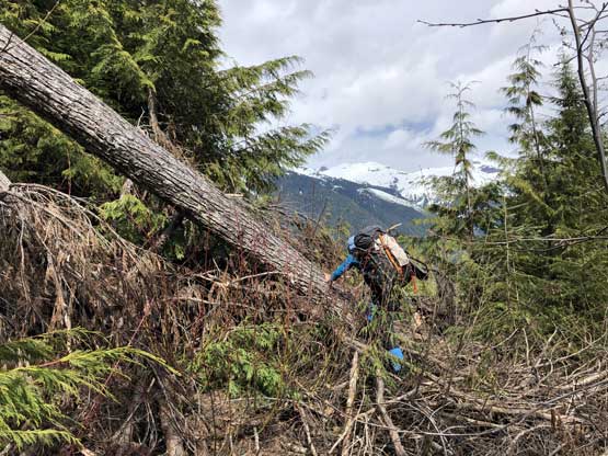
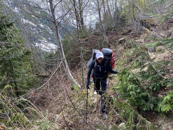
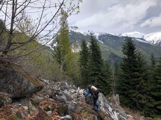
On the second day we woke up not long after sunrise and started at least an hour and half later. Holly and I had the whole morning routine to do including packing the wet gears and that took some time. For the east ridge route we had advices from both Matt J. and Jeff H. that we should take the full east ridge and resist the temptation to ascend too high the Tatlow/Falk Creek Road. However, neither the on-field observations nor the contour lines on the map suggested a possible “easier route” on the lower east ridge, and none of them actually managed to descend the full east ridge to “prove” their hypothesis. As we walked higher and higher on the road we realized that at least the lower parts of this road had seen fresh maintenance such as the alders being cut down, that the bushwhacking was nearly non-existent. The forest to our right was however, downright shitty so we decided to ascend higher on the road and take the route that’s be proven in the old days. The bushwhacking soon took over but never became too sustained (BW3 at the worst). At around 800 m elevation the patchy snow had become continuous that we were able to strap the snowshoes on. I could not comment on the bushwhacking situation on the upper half of Falk Creek Road between 800 and 950 m elevation because for us, that was a cruise sail on a meter to two meters of snow.


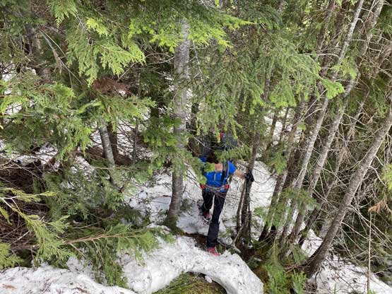
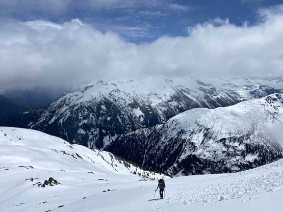
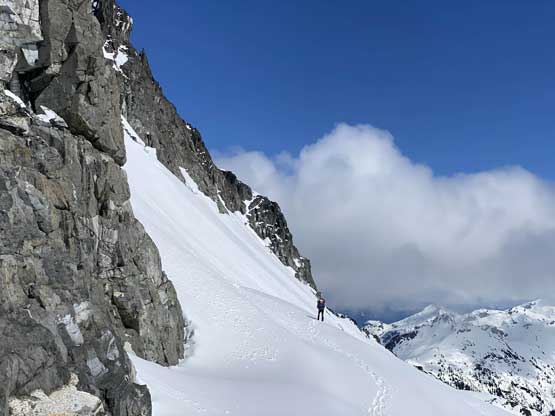
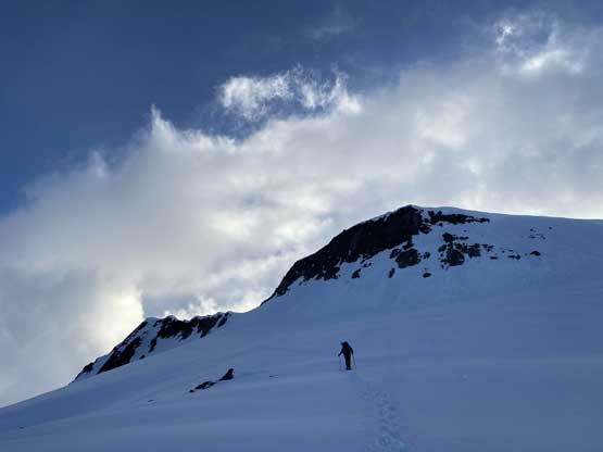
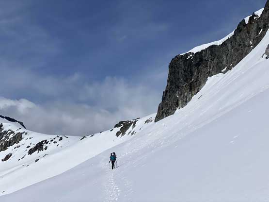
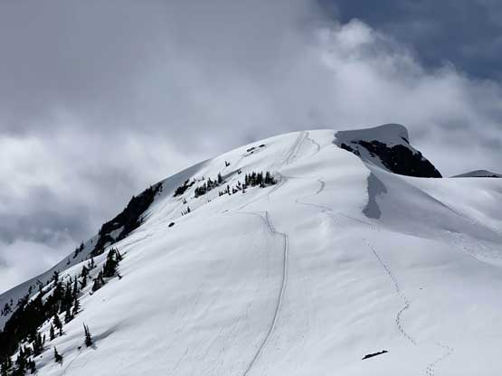
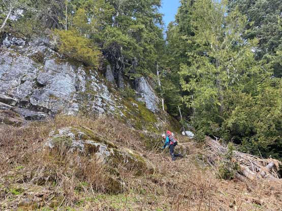
After taking a long break at 950 m corner we left the road onto the “SSE forested rib” fully prepared to deal with a ton of bluffs and unpleasant bullshits. The first hundred meters of elevation gain was indeed not very straightforward with sections of dry patches but nothing really worth noting. Then we hit a prominent bluff. Sean led us ascending a greasy chute to climber’s right (3rd class vege belay) which I managed to ascend without taking the snowshoes off. Above this scrambling section we were finally on continuous snow and although steep, the terrain never threw anymore bluffs on us. I tackled this whole steep section from 1100 to 1400 m on snowshoes while Holly and Sean boot-packed their ways up. By 1400 m we were finally onto the proper east ridge at treeline zone and the post-holing suddenly became heavy that snowshoes were definitely a must. At this point Sean decided to go ahead to tag the summit as he’s on a different schedule. The trail-breaking in the next few hundred meters of gain was very heavy, sometimes knee+ deep on some isothermal slush. The steeper the terrain, the worse the going was. Holly and I discussed some alternative ways to tackle the steep section but in the end decided to just follow Sean’s track as he’s done an amazing job packing down a snowshoe track up that steep and daunting 35+ degree face.


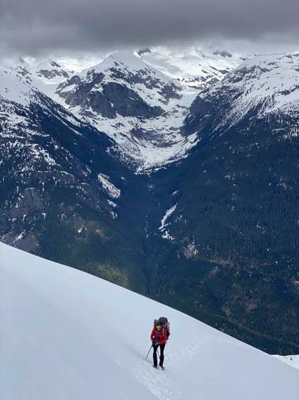
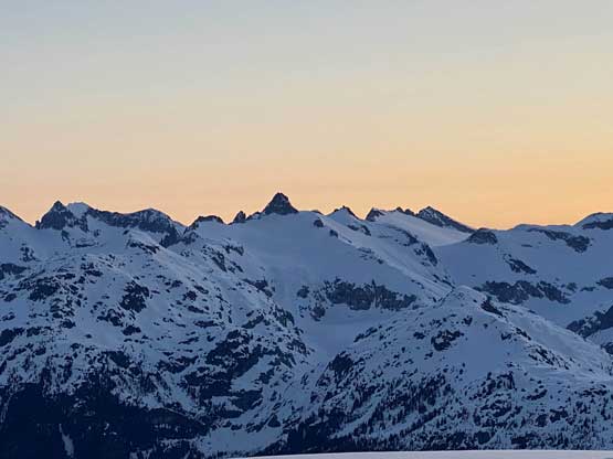
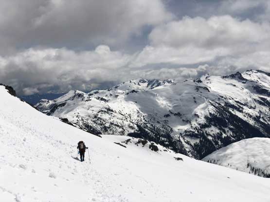
The weather had been a mixed bag up to this point with mostly cloudy skies and sometimes isolated flurries. Above the steep face the terrain became gentler but then there came another stretch of steeps to reach the base of “Chimai E2”. The weather finally improved with more and more blue skies showing up. After another long break soaking in the sun rays Holly and I started the steep traverse under the SE Face of “Chimai E2” and this section was more difficult than I’d ever expected. Sean took a line much closer to the rock that I’d wish but again, since he had laid a track ahead there’s no point for us to do extra work. Once successfully bypassing that sub-summit we had to lose a bit of elevation to descend onto the broad upper east ridge of Chimai Mountain.


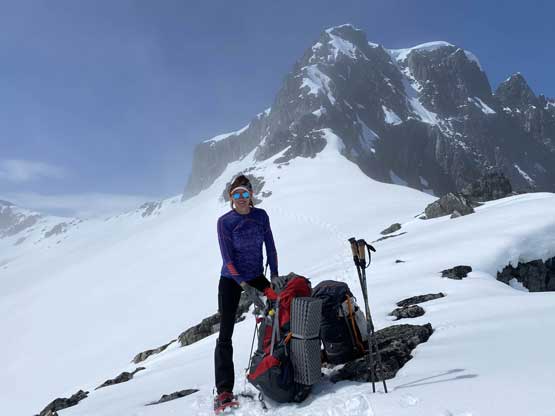


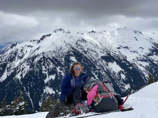
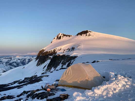
At this point we could have dropped the heavy packs and set up camp anywhere we wanted but we kept plodding until we found the best views on the ridge. There were also patches of dry ground around and that’s important to up our camping comfort. Sean came down from the summit just when we dropped the packs and reported the ascent was “harder than expected” and based on his words we agreed to tackle the summit at sunset instead of dealing with front-pointing in the next morning. Setting up camp didn’t take too long and then we got to relax in the tent for a few hours taking some much-needed naps.

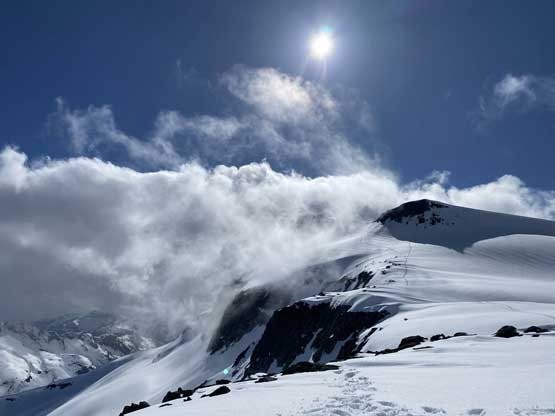


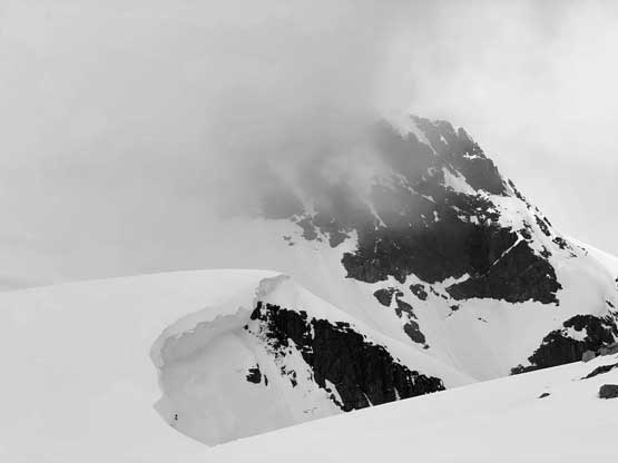
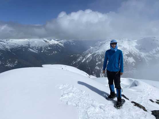
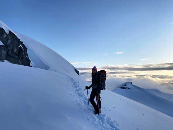
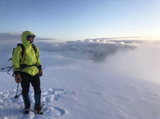
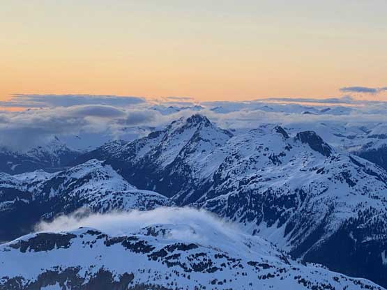
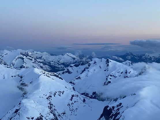
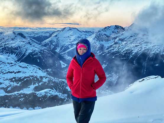
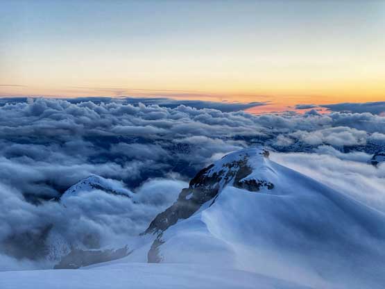
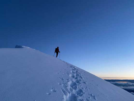
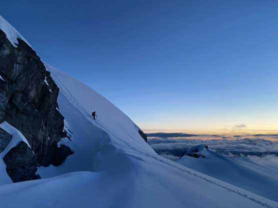
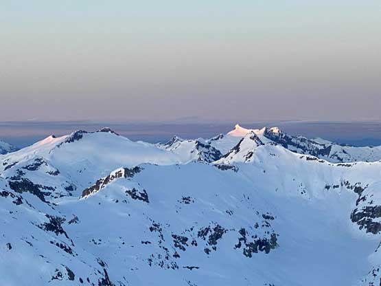
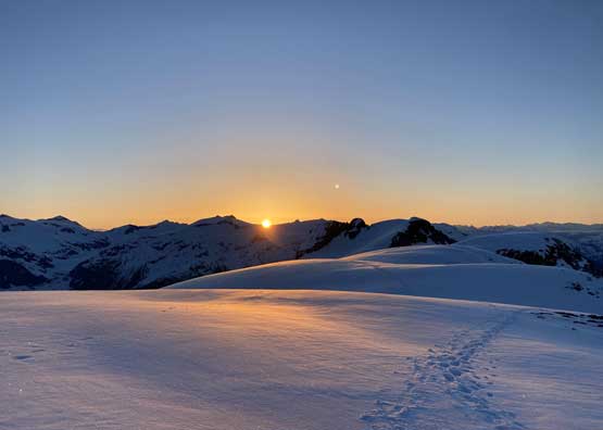
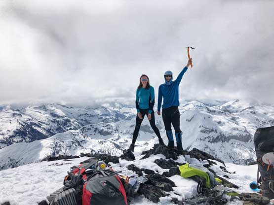
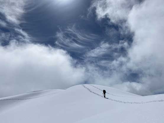
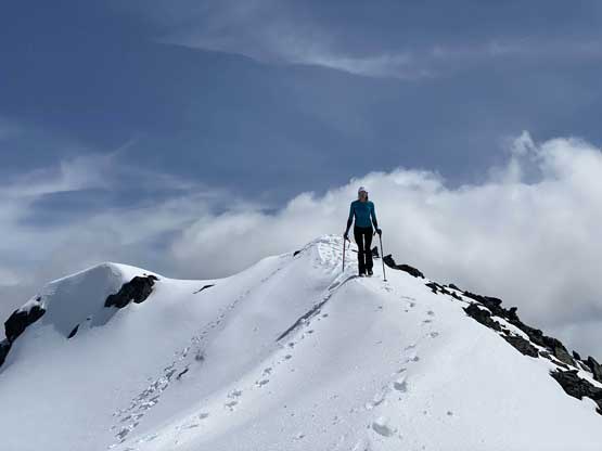
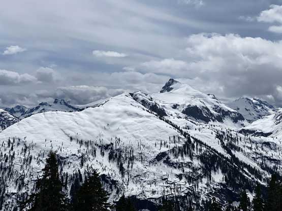
The weather had gradually cleared revealing more and more distant peaks but it was not a bluebird day. We worried that the summit might be soaked in once we got up there but there’s only one way to know. We were only 200 m elevation under the summit and the ascent wouldn’t take much longer than half an hour anyway. Holly and I soon swapped snowshoes for crampons. The snow had already undergone some freezing and the exposure on this upper route was not nothing. The few steps to get onto the summit ridge was 45 degrees and definitely felt like alpine climbing. To gain the true summit again required one pitch of 45-degree snow but the exposure was minimal and the snow was rather soft. We reached the summit about 15 minutes before sunset and the views were as epic as we were hoping for. We did not get the distant views of the peaks until after the sunset but the clouds and fog did make some drastic contracts and special views that one would not get on a bluebird day.


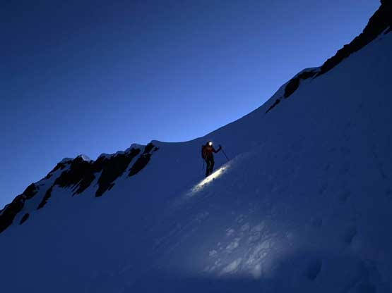
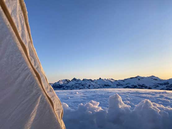
We lingered until the coldness forced us to retreat. The cold wind reminded both of us Mt. Breakenridge that we had just done a few weeks earlier. We descended the last few hundred meters back to camp with head-lamps on and then did some photography. The evening cooking routine took another hour or two and the night was unpleasant for May in the South Coast. It sure felt like February that I was cold even in the -18 degrees sleeping bag.


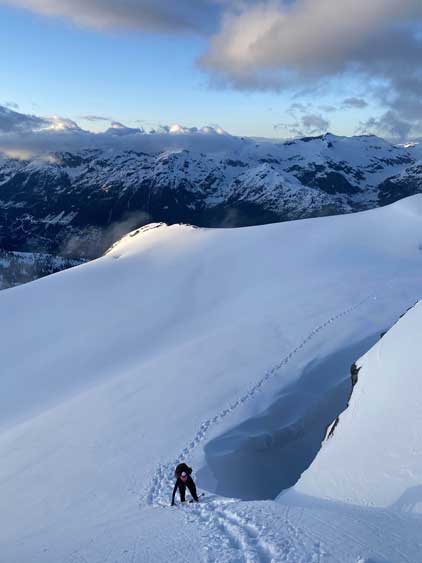
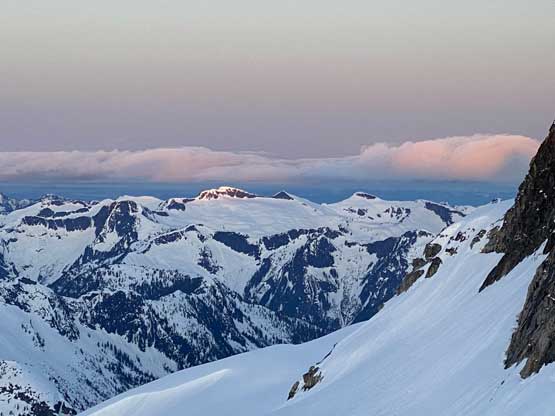
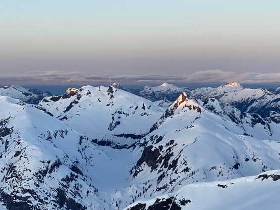
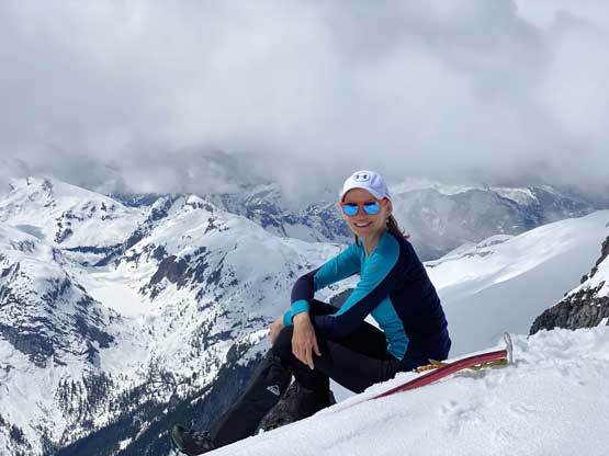
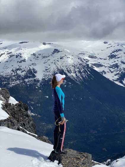
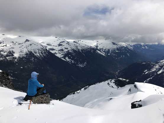
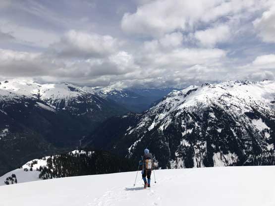
I set my alarm at 5:20 am and forced myself to get out embracing the coldness as the weather was perfectly clear and it’s about 10 minutes before sunrise. I lingered outside until the sunrise show’s over and went back into the sleeping bag for a couple more hours of sleep. We didn’t get up until almost 9 am and spent another hour packing up the tent. The weather had unfortunately gone back to cloudy with occasional white-outs. On the descent we decided to check out that “Chimai E2” summit since the weather improved and we expected some unique views looking down into Ashlu Creek Valley and the decision was proven to be worthy.


The snow had softened but was still hard enough that crampons would be the better tool to tackle that steep traverse under the SE Face of “Chimai E2”. We kept crampons on all the way until descending that 35-degree daunting face. The post-holing on this face was extremely bad on thigh deep isothermal crap but the terrain was a bit too steep to comfortably snowshoeing. Once the exposure died down on the lower half we both took a long glissade to save more post-holing, then finally strapped the snowshoes back on. The descent from this spot down into the steep forest did require the use of snowshoes but once into the lower forest we took them off again. In short time we were back down to that scrambly step and the down-climb was as expected, not very enjoyable especially with this heavy pack. The rest of the descent onto Falk Creek Road and then down on the road was more of a “type 2 fun” with notable amount of bushwhacking and treacherous snowshoeing. Once the bushwhacking’s over all we needed was to put one foot in front of another for a couple more hours down the boring-as-fuck Ashlu Creek FSR. Holly took over the lead once the zombie mode road walking began and two hours later, we were done.


I shouldn’t say we were done yet as driving out of Ashlu FSR was not without hazards. The few deep ditches felt gnarlier than two days earlier that I scrapped the bottom of the truck at least two times. Negotiating the wash-out at Rob Creek also felt harder on the way back due to some uphill angles but I got the job done. We came out to Squamish at around 8 pm and I eventually got back home in White Rock at almost 11 pm. Chimai Mountain turned out to be a long and tiring 3-day trip that except for the lack of technical challenges this sure felt like a proper 11,000ers mission in the Rockies.