Mount Seymour
February 16, 2016
1449m
North Shore Mountains, BC
It’s been a while since my last trip in the local North Shore Mountains so with a (very brief) high pressure ridge sitting “right above the Lower Mainland” I made a spontaneous decision to head out on Tuesday morning. The weather didn’t seem to be 100% stable as I could see clouds building on top of the mountains, but the avalanche condition was “low/low” in the North Shore so there’s overall something encouraging.
Mt. Seymour (and its namesake provincial park) is a famous place overlooking the Greater Vancouver and attracts millions of tourists every year. In fact, over 6 years ago I had already made one attempt on this objective with my parents but we ran out of energy on the first peak (officially known as Pump Peak) and turned around. This time I was aiming to redeem myself on the third (true) peak. In winter condition this isn’t for the faint-of-heart as a 40-degree snow slope must be traversed underneath the second peak, and the condition has to be stable.
Mt. Seymour standard ascent route. GPX DL
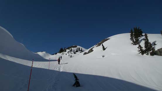
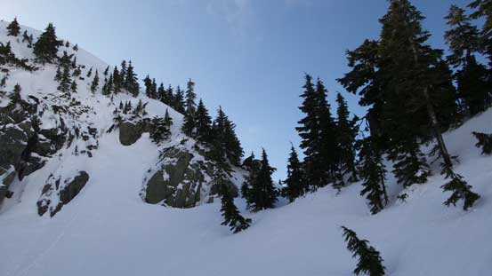
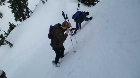
The traffic was horrendous in the morning and I spent almost 2.5 hours from my home to the upper parking lot on Mt. Seymour, and didn’t manage to start my day until 10 am. That’s still okay as hordes of hikers had packed down a very solid trail so my progress was much faster than anticipated. I initially carried my snowshoes on hand and thought I’d strap ’em on at some point, but after roughly 20 minutes I packed them in my backpack instead. The trail was simply too solid for snowshoes and wearing stiff mountaineering boots I could make faster progress on foot. I followed the trail bypassing Mystery Peak on its left side, up and over Brockton Point and then into the SE bowl of Pump Peak. There’s some elevation loss/regain in this section but the trail was still very hardpacked.

A very late-start of my day

Following the obvious trail

Looking ahead to the route. Pump Peak in foreground
Traversing near Brockton Point
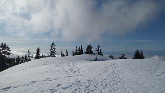
A look towards the north face of De Pencier Bluff.
Looking back towards the summit area of Mystery Peak

Just about to drop into the bowl ahead. About 50 m elevation loss

From the bowl, looking towards Pump Peak
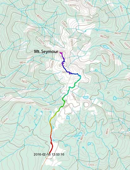
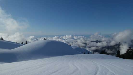
The trail then gained the SE Ridge of Pump Peak and followed it onto the upper draw. The upper draw was a pristine environment with some neat snow slopes around. I still didn’t need to use snowshoes at this point and didn’t strap them on until pretty much on the summit of Pump Peak. I made a very short side detour to check out the summit of Pump Peak and the views were really good. There were already a few hikers hanging around but I had to immediately focus on my primary objective.
Ascending into the upper draw

Very neat terrain around here. Much more pleasant than in summer time…
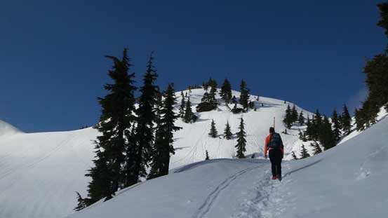
Getting closer and closer now. Still don’t need snowshoes
Gaining the shoulder on Pump Peak, looking over the other side
Ascending to the summit of Pump (1st) Peak
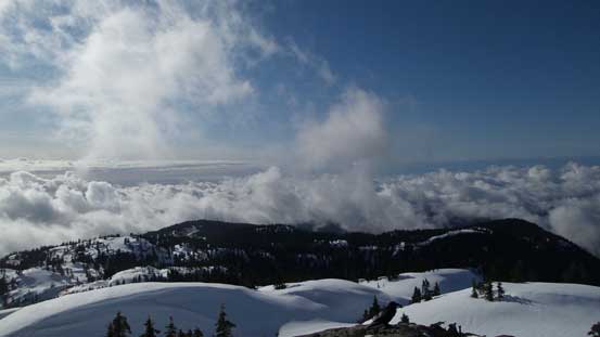
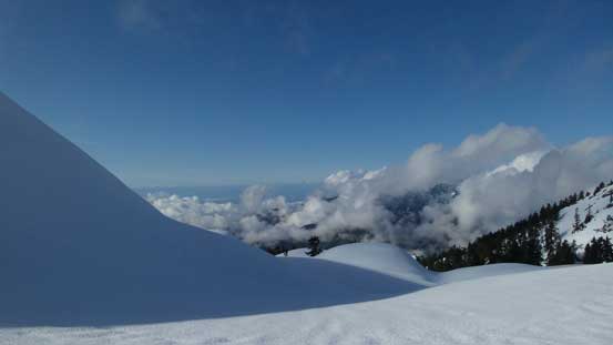
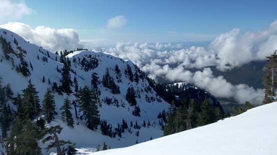
A sea of clouds above the Lower Mainland
Looking towards the 2nd and 3rd peak on Mt. Seymour

A zoomed-in view of the low clouds
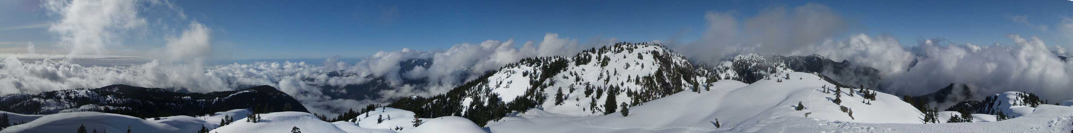
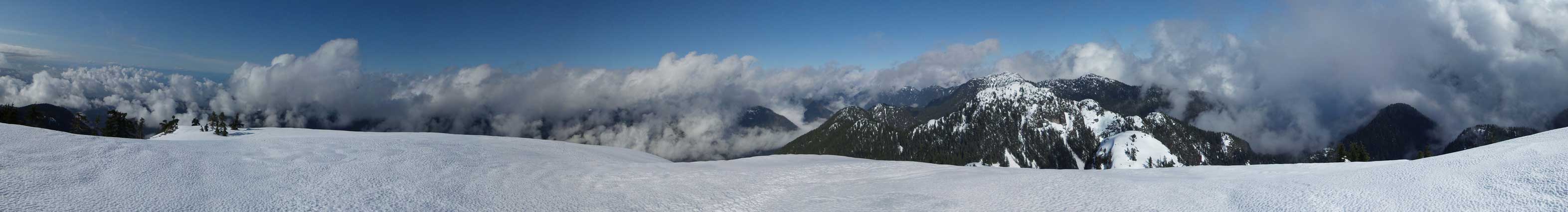
Summit Panorama from Pump Peak. Click to view large size.
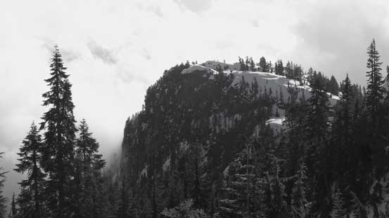
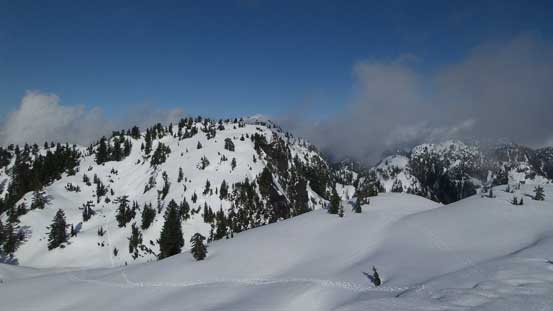
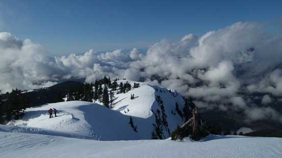
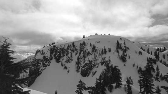
I followed a good set of snowshoe tracks dropping into the bowl between first (Pump Peak) and the second peak. The route up the second peak followed a broad gully feature on climber’s left side and thank to the trail made by the previous group it was pretty much effortless to me. I again, did a side detour checking out the summit of this second peak just for completeness. This peak has been unofficially named “Tim Jones Peak” over the past few years, in honour of Tim Jones, a long time member of North Shore Rescue who passed away in January, 2014 on Mt. Seymour.
The second peak ahead.
Another look at the low clouds

Ascending the gully feature

Looking back towards the 1st (Pump) Peak
A view from the summit of the 2nd (“Tim Jones”) Peak

The summit of the 2nd (“Tim Jones”) Peak
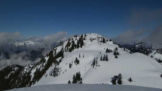
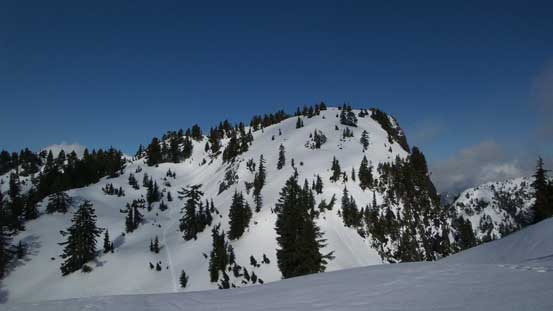
The 3rd (true) summit from the 2nd peak

Some distant peaks showed up. Probably Mt. Burwell but I’m not sure.
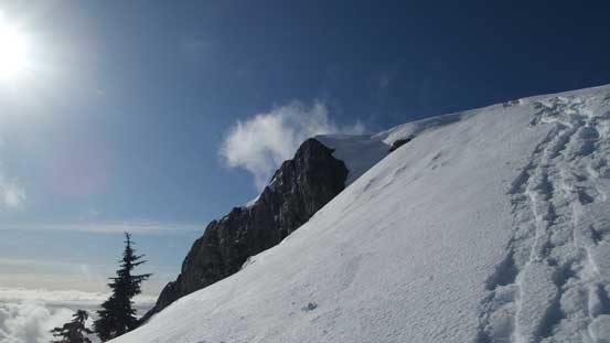
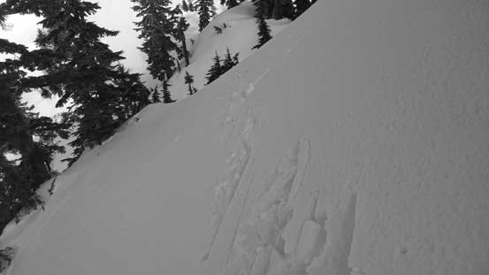
I soon rejoined the other group on the shoulder and we got to focus on the third (true) summit. Mits (whose name that I knew later) decided to follow me. The side-hilling got increasingly steep in no time and with a somewhat hard crust on the surface it started to become sketchy on snowshoes. There’s a bit of run-out and the traverse ahead appeared even steeper (40-45 degrees) so I had to switch my gears to ice axe and boots. Mits wished me good luck and turned around here. There’s fair a bit of post-holing involved at places but in general the step-kicking was great. Down to the second/third col I swapped my gears for snowshoes again.

The steep traverse started here
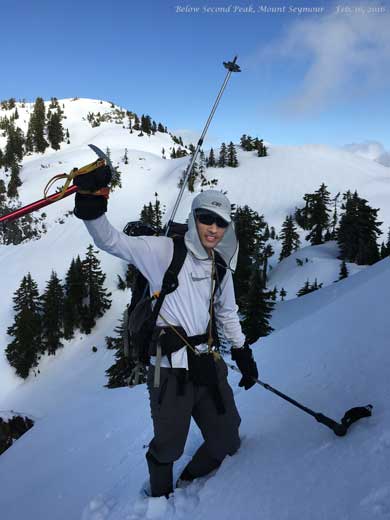
Me ready to traverse. Photo by Mits Naga
It’s quite steep…

Looking back at the traverse.

Down to the col now.
I dropped to the other side of this col
The final ascent on Mt. Seymour’s true summit was also steeper than the previous two peaks. The south slopes had become a bit slushy on the surface thank to the toasty temperature and the sun so I ascended as fast as I could. On the upper slope in order to avoid side-hilling I ascended through a very steep step with some aid from hauling the bush branches and then the summit was shortly reached, about 1 hour 40 minutes after leaving my car. The ascent was a tad faster than what I remembered from the exhausting adventure 6 years ago and I wondered around for quite a bit to soak in the views.

Looking back towards the North Face of the second peak
Another look at the north side of the second peak. There’s no easy way down

Ascending the true summit
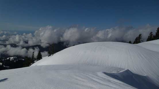
Neat terrain
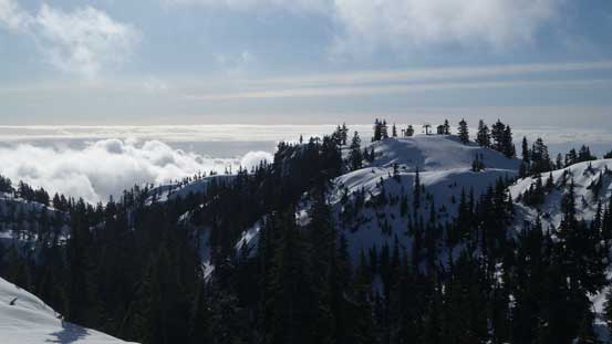
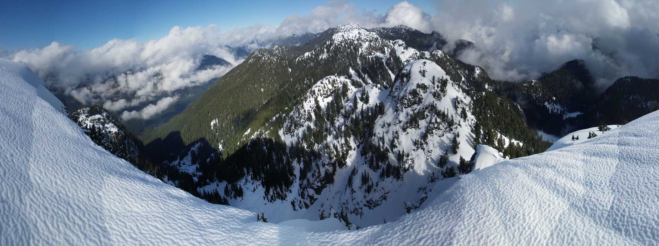
Summit Panorama from Mt. Seymour. Click to view large size.

Clouds were obscuring the peaks along Howe Sound Crest

Looking down at Runner Peak
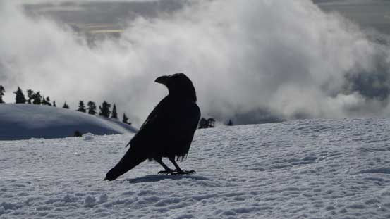
A fat raven on the summit bagging food…
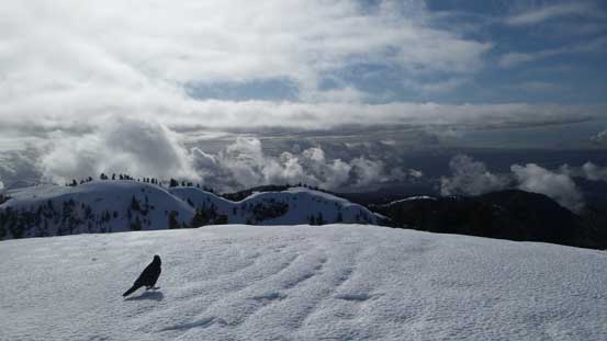
As you can see, some weather was moving in
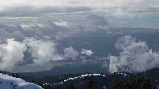
As much of the view as I got towards Vancouver

Mt. Bishop rises behind Mt. Elsay
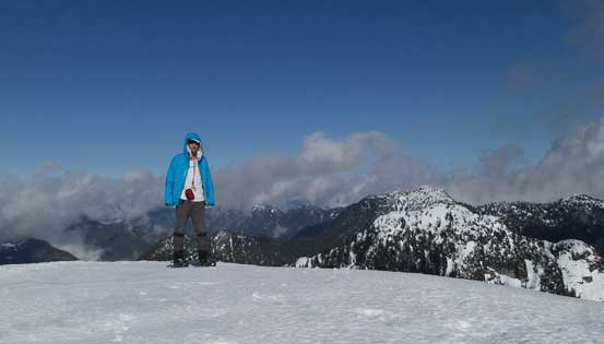
Me on the summit of Mt. Seymour
Another panorama from the summit. Click to view large size.
After staying about half an hour on the summit I figured it’s the time to go home. I was debating about Runner Peak but I wasn’t keen on a few more hours of post-holing (nor was I keen on getting stuck in the horrible rush-hour traffic for the second time in one day). I again, packed the snowshoes for the traverse underneath the second peak. I passed another group on their way to the third peak and after saying “good luck” I resumed the return. Plunging down the second peak beside my uptracks was fast and fun on the somewhat slushy surface. I rejoined Mits near the first peak and we did the rest of the hike-out together. Mits turned out to be an experienced hiker in his 60s who’s also following my blog, and we shared fair a bit of stories.
Another look at the north face of “Tim Jones Peak”
This is the other group traversing the crux slope

Descending from “Tim Jones Peak”, looking towards Pump Peak

Mits re-joining me near Pump Peak

One last look towards Vancouver and the Straight of Georgia

Lots and lots of people on the trail

Time to go home…
Back to the parking lot it was earlier than 2 pm so that left me plenty of time getting back home before the traffics started… Overall this was a great last-minute decision and I got lucky with weather again as I could see lots of clouds hovering around the nearby mountains, but no the one I stood on. I was glad to finally check Mt. Seymour off my list but there’s much more to explore behind Mt. Seymour that I’ll return at some point.
