Mount McRae
June 9, 2019
1534m
Chehalis Area / Harrison West FSR, BC
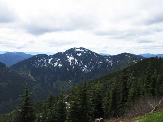
Mt. McRae is rather just a forested hill sandwiched between Harrison Lake and the Chehalis Lake valley but because of the deep, U-shaped nature of the adjacent valleys this peak boasts significant topographical prominence. The prominence of Mt. McRae ranks within the Top 50 in a loosely-defined area of Southwest British Columbia and this peak is getting slightly more popular recently in the peak-bagging community. There are logging roads running to within 100 vertical meters from the summit but the upper roads are heavily overgrown. The best time to hike Mt. McRae is in winter or early spring on snowshoes and that’s exactly how Chris H. and Vlad did earlier in this year. The same route is doable in summer conditions as well but at least 500 vertical meters of bushwhacking is required.
When Adam (Gimplator) threw out the idea to do something in SW BC in this past weekend I naturally threw out Mt. McRae along with several other objectives and not to my surprise he picked Mt. McRae, the least exciting but the most prominent one. Adam managed to convince Connor M. to come along with him from Washington. We all slept in my home in White Rock on Saturday night and did a leisure start on Sunday morning. The drive was longer than expected with at least 25 km on unpaved logging road. The spur roads system above Wood Lake was all exploratory but we managed to drive to ~630 m elevation in my stock Tacoma. The road was narrow, steep with some loose rocks and big waterbars. We parked at about 1.5 km distance short from the end-of-road so not bad, not bad.
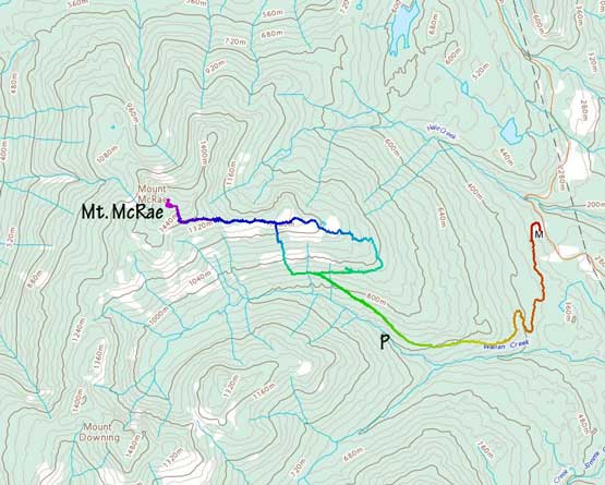
Mt. McRae hiking/bushwhacking route. GPX DL
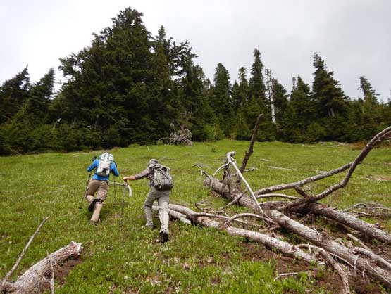
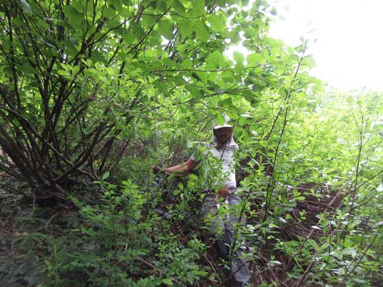
We easily walked to near the road’s end and then it’s time to make a decision. My plan was to do a straight-up thrash from the road’s end for over 500 vertical meters straight to the summit ridge but we spotted a somewhat-maintained ATV track branching off to the right. The road appeared to have some recent traffic so it’s hard to resist. The road was actually in a great shape for hiking but the problem, it’s leading us towards the opposite direction. We briefly explored another spur road but turned around within 10 minutes. The alders were as thick as they could ever get and the swimming wasn’t appealing, so we continued down the ATV road towards the opposite direction. At one point we gave up following the track and entered the bush. The bush wasn’t too terrible and it’s becoming clear that picking our own way in the forest was a better idea than following any form of a “road” in that zone. We crisscrossed several branches of severely overgrown roads and ignored all until the last one running the summit ridge on 1160 m elevation. The road still appeared bad but we decided to explore it and after about 100 m of alder thrashing the road magically cleared up. For the next 2 km or so we stayed on this road and the alders were tolerable on average.

Taco parked
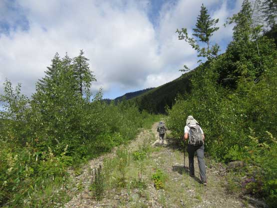
You gotta love walking on logging roads

We found this spur of ATV road so decided to explore.
We tried this connecting spur road and bailed in 10 minutes… It was gross
Back to the ATV track and after a while we lost the tracks

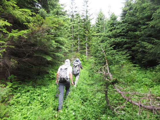
Into the forest we went. It wasn’t pleasant but wasn’t ugly neither

Fast forward. Onto the uppermost road now
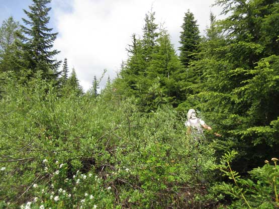
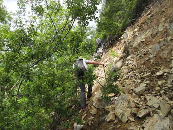
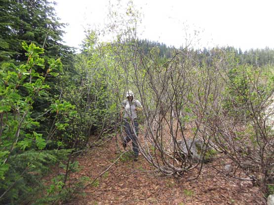
Alder thrashing on the uppermost road running the summit ridge
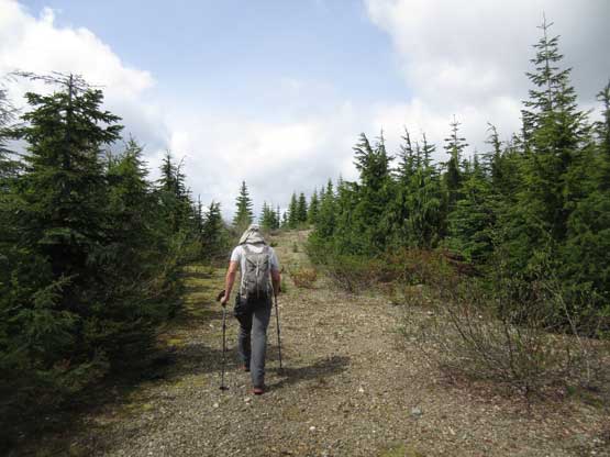
Other parts of the uppermost road was in a good shape
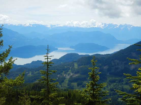
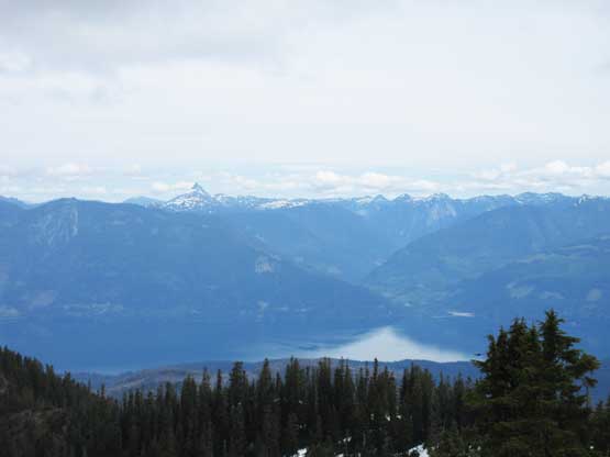
A glimpse of the southern end of Harrison Lake. Photo by Adam W.
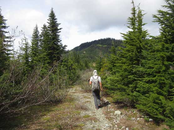
Walking towards the wooded summit…
It appeared that we finally got to near the road’s end and that’s within 100 vertical meters from the summit. From there we ascended initially some open forest to a patch of grassland but the upwards thrashing beyond the top of this grass patch was exhausting. We magically hit continuous snow above 1500 m elevation and that lasted all the way to the actual highest point. The view was not bad but the major summits were hidden in clouds. The weather men had apparently screwed up their job again. The forecast was “mostly sunny” but it turned out to be “mostly cloudy”.
Mt. Downing to the south
Me and Connor ascending the path of grass. Photo by Adam W.
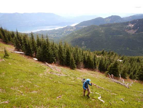
Me plodding up the grass. Photo by Adam W.
Connor bushwhacking
Adam bushwhacking
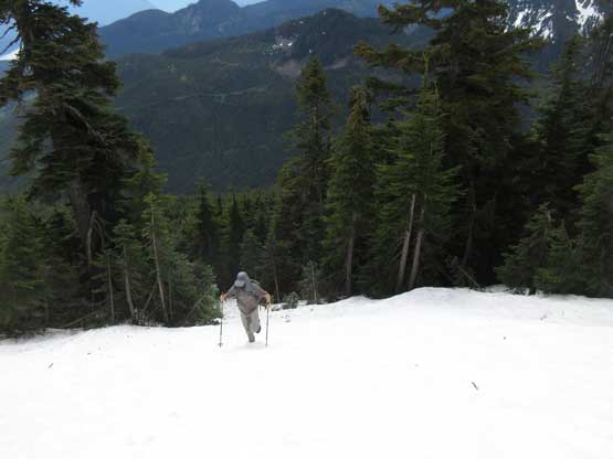
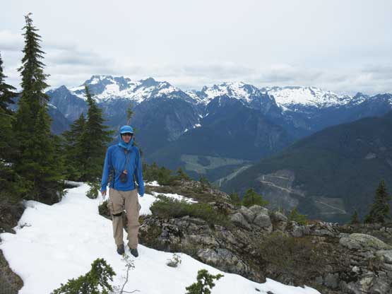
Finally onto some snow. We wished there’d be more snow…

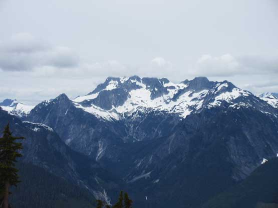
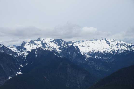
Summit Panorama from Mt. McRae. Click to view large size.

Mt. Ratney, Mt. Bardean and Stonerabbit Peak
Mt. Clarke, Recourse Peak and Viennese Peak above Statlu Lake
Nursery Peak and Grainger Peak

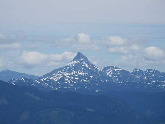
The Old Settler across Harrison Lake
Mt. Urquhart across Harrison Lake
A wider view of Cogburn Creek valley across Harrison Lake
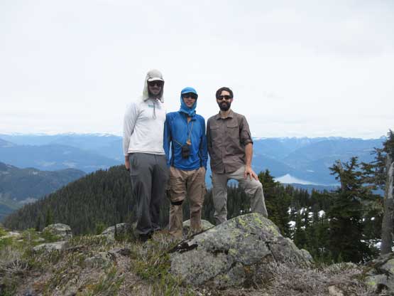
Our group shot on the summit of Mt. McRae
Me on the summit of Mt. McRae
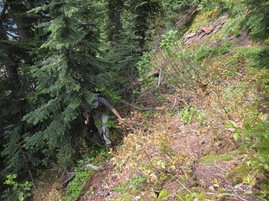
We lingered for almost an hour on the summit because we weren’t in a rush. On the descent we reversed our route down to the uppermost logging road and followed it for about halfway back across the summit ridge. From there we decided to short-cut all the way down to the lowest spur by bushwhacking. The bush was steep and very dense at places – sustained BW3 with sections of BW4 but because of the downhill factor we didn’t find it to be that bad. In no time we were back to the initial spur of road and in another half an hour we were back to the truck.

Time to head down..
Running the uppermost spur road

Into the forest we went…
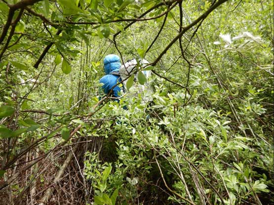
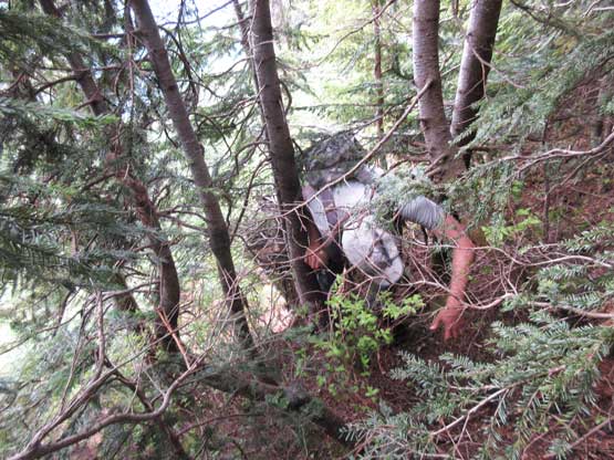
Me battling a thick band of alders. Photo by Adam W.
Adam thrashing through the same band of alders…

Bushwhacking mixed with scrambling. Fun times.

Connor on a tight channel of timbers
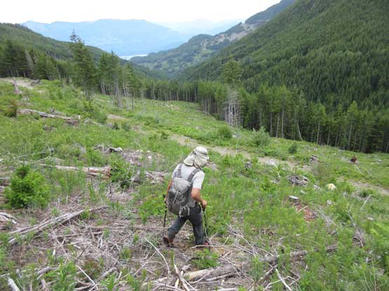
Finally back to the cutblock and soon we would be back onto the road
The drive down to Harrison West FSR required some caution and then we easily cruised back to civilization. The day was still young and we made a spontaneous decision to explore the logging roads on Mt. Agassiz and Mt. Wooside.
