Ledge Mountain
October 9, 2017
1964m
Squamish, BC
Ledge Mountain is rather just one of the satellite peaks of Sky Pilot Mtn. with hardly any prominence, but itself is an imposing spire that catches attention in its own. One would not believe there’s actually a “scramble route” on Ledge Mountain simply based on the profile of it, and in fact the existence of such a “scramble route” is a pure magic. The namesake ledge bisects the otherwise, vertical SE Face providing a Class 3 ramp system. For the most parts this ledge is wide enough to comfortably walk across although the rock quality is loose and down-sloping.
The main problem nowadays is the access difficulty. There used to be an easy approach via Mountain Lake Hut from Furry Creek drainage but now the main logging road is gated right at the start. Even if the gate is bypassible (4×4) the road is significantly damaged such that no motorized access can be made past roughly kilometer-5. The peaks around Mountain Lake hence become more like overnight objectives but there exists another (creative) approach for Ledge Mountain itself. I had no further information regarding this option but I did manage to experimentally link the different pieces together. I would simply repeat the standard route on Sky Pilot past the “Pink Slabs” and then descend its 3rd class South Ridge into the scree basin below Ledge/Sky Pilot. This would offer a fairly direct and aesthetic access with the only downside being that 200 m elevation loss, but it’s hard to complain about that.
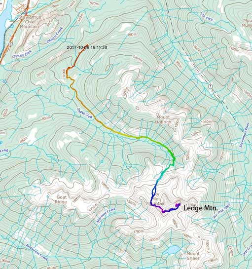
Ledge Mountain via Sky Pilot. GPX DL
I wasn’t sure what to do but then I checked the webcams at 8 am in the morning and made this spontaneous call. About two hours later I parked my Tacoma at the end of Shannon Creek FSR and the last few km was just as rough as I remembered from Mt. Habrich’s ascent a couple years ago. The first hour of this approach is via “Sky Pilot Valley” trail on an old road. I decided to wear the pair of Nike runners while carrying the boots to reduce the pain on my feet. This worked out pretty well and at the end of this official trail I ditched the hikers, switched to my Trango Ice Cubes and then up I went into the woods. The climber’s trail was very well flagged that in no time I broke out of the woods. Another couple hundred meters were dispatched by ascending some talus slopes and the next stop I took a short break at the bottom of Stadium Glacier, applying some sunscreen and donning crampons.
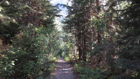
As boring as the “Sky Pilot Valley Trail” goes.
Ascending out of the trees now looking at Mt. Habrich

This is looking down at the rubble bowl I just ascended

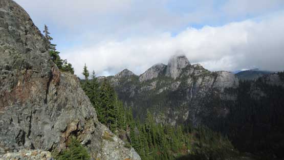
It’s hard to beat the views from Sky Pilot area
There we go this is Stadium Glacier
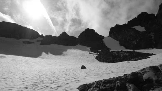
There was still snow on Stadium Glacier but the surface had gone a full depth freeze so crampons had to be used. Ice axe was left in the truck though as the grade is pretty mellow throughout. The worst part was the stretch of talus from the top of Stadium Glacier to the start of Sky Pilot’s west ridge. This section was very loose and on top of that, thank to a northwards angle most, if not all of the boulders were covered by a layer of frost making some very slippery foot placements. The lower west ridge was covered by frost and verglass at places too although didn’t impose much of a problem as I could simply detour around any patch of ice. The actual “pink slabs” were bone dry, thankfully, although the scrambling felt legitimate “class 3”. The rigid mountaineering boots never do super well on slabby terrain and this isn’t an exception. There’s a pair of bolts above the crux if you want to be cautious…

Ascending Stadium Glacier requires crampons on this day

Gaining the west ridge now, looking down at Stadium Glacier
The pink slabs ahead

The top of Mt. Garibaldi massif poking above the clouds

Looking down at the crux pink slabs
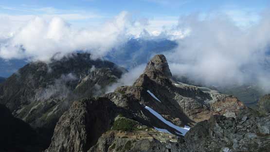
The Copilot looks very striking from this angle…
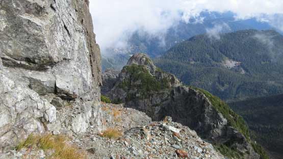
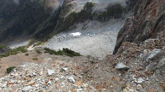
Above the crux “pink slabs” there’s still about 100 m to ascend before intersecting the south ridge. So far till now I was merely repeating my Sky Pilot’s trip but once branching off the south ridge I was on new ground. I had no beta about this south ridge other than it goes at “3rd class”. The descent started off easily but then I was looking down at least a full pitch of steep terrain. This stretch has to be broken down into individual steps with some route-finding in between. The scrambling was again, legitimate 3rd class but easier than the pink slabs on west ridge. The south ridge was surprisingly short and as soon as I could bail onto the scree I did the exact. The aim was the obvious scree basin but there’s lots of descending and side-hilling before I could start up again on Ledge Mountain.
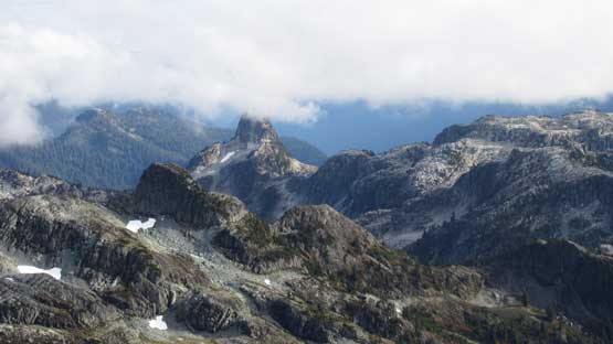
The first sight of my objective

This is the scree bowl I had to aim for. More than 200 m must be lost

From the start of south ridge descent.
This is the steep section I had to descend on Sky Pilot’s south ridge
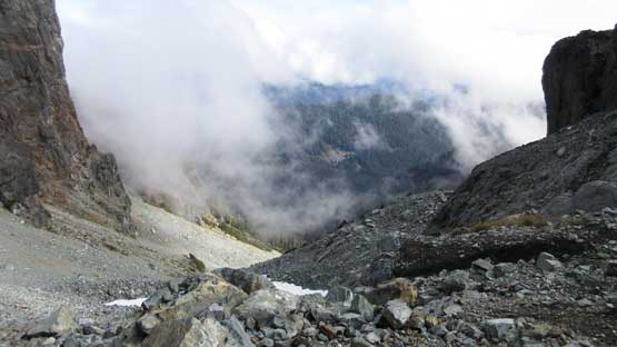
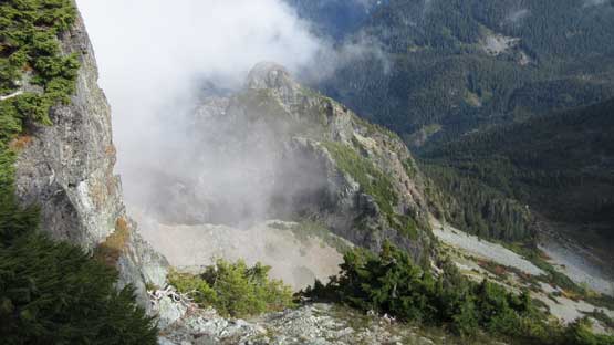
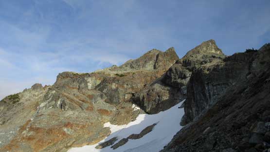
Into the scree bowl…
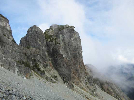
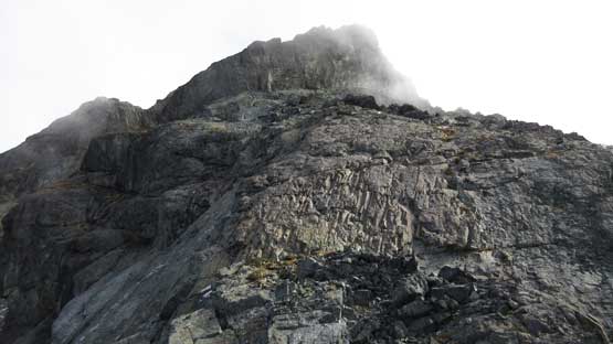
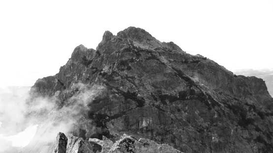
Ledge Mountain looks very imposing
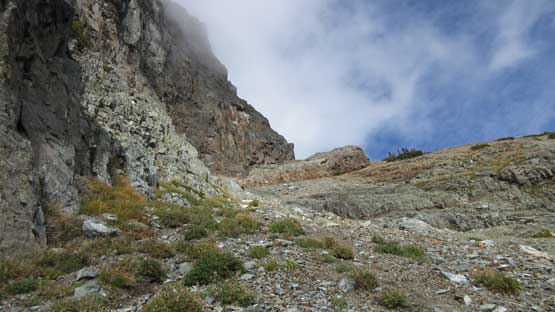
The actual scrambling on Ledge Mountain was quite simple. The first stage was a tedious slog on some treadmill scree to pretty much as high as possible with a slight climber’s right bearing. Near the end of this scree slog the terrain transitions into some ugly down-sloping slabs covered by pebbles and to make it worse I didn’t go far enough to the right. And once around a corner I had to ascend another short stretch of down-sloping ledges to gain the actual “ledge”. Ironically the traverse across this infamous “ledge” was mostly just a walk. The worst came near the end where I must ascend a 3rd class step followed by a few meters of dense bush thrashing. The final ascent to the summit was also characterised by some bushwhacking although keeping a leftwards bearing may reduce the pain.
This is the initial scree bashing. Very bad scree for a while..

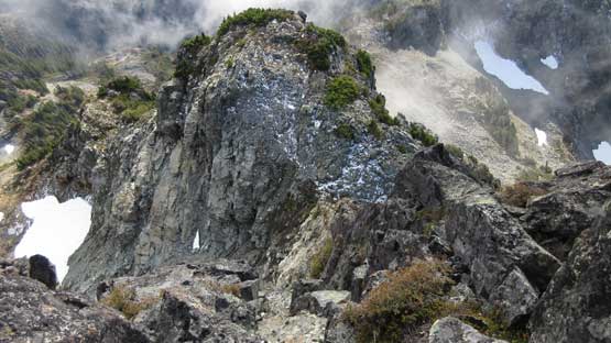
The end of scree bashing where I had to gain the actual ledge
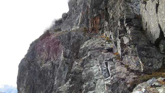
This is the start of that infamous “ledge”. Looks worse than it actually is…
Looking back from the start of that ledge.
This is looking down. The exposure isn’t immediate, but it’s a vertical drop…

About halfway across, looking back. “The Nai” behind
Finishing the ledge now.
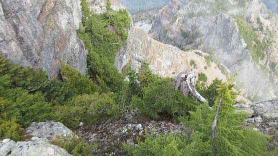
Painful bushwhacking if you don’t know where exactly to aim at…
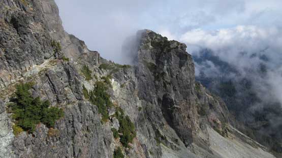
The east side of Sky Pilot Mountain

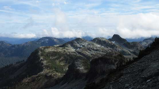
This is looking down at the plateau by Mountain Lake area

The summit is within a stone’s throw now

Summit Panorama from Ledge Mountain. Click to view large size.
Atwell Peak and Mt. Garibaldi massif

Mt. Habrich

Me on the summit of Ledge Mountain
There’s surprisingly a decent cell phone reception so I did the usual social media updates before starting the descent. The time was slowly getting on. Reversing the Ledge Mountain’s scramble was a straightforward process with again, the worst being the section right after exiting from the “ledge”. A strong Rockies resume helped a lot here as nonetheless I cruised down in no time. The scree slog back to the south ridge of Sky Pilot dragged on for a long while but then the 3rd class climb up the south ridge was very enjoyable. Wasting no time I immediately started the west ridge descent and had no problem down-climbing the pink slabs, and then I took another (deserved) lengthy break.
Time to go down… A bit of bush to bash through again.

Onto the ledge now

Down into the scree bowl now, looking back at Ledge Mountain
Mt. Sheer is that peak on right hand skyline

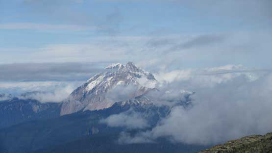
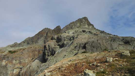
Another review shot of Ledge Mountain
Ben Lomond left of center

Al’s Habrich Ridge with Squamish Valley behind

Mt. Habrich with Black Tusk and Garibaldi massif behind.

This is just above the pink slabs.
Below the crux “pink slabs” all I had to do was being patient. The terrain above Stadium Glacier was not difficult, but tedious, and then descending the actual Stadium Glacier required strapping the crampons on again. The gear transitions are always a tedious process but in some circumstances you just cannot skip them. Below the glacier there’s still at least 300 m of talus to descend before picking up the trail. It seemed like I might not have to use head-lamp at all so I sped things up. The last few kilometers down that boring road was almost completely dark but since the mission was set I just had to push, and I did manage to get back without turning on the illumination.
A review shot of the west ridge of Sky Pilot

A full shot of Al’s Habrich Ridge leading to Mt. Habrich. Traversed it two years ago
Down to Stadium Glacier now. The lighting was too good to now snap more shots

One last look at Mt. Habrich
My round trip time was around, or just over 8 hours which was faster than anticipated. The efficiency of this approach surprised me a bit and I think nowadays this should be the standard route to get Ledge Mountain. It would also make sense to combine Ledge and Sky Pilot into the same trip. But again, the lack of information online is a bizarre thing as I’m sure this route has been done by a lot of folks judging by the sign of human traffics.
