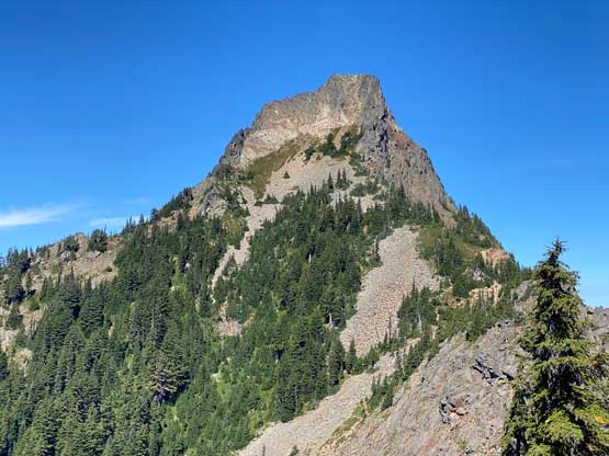
Kaleetan Peak
August 26, 2022
1908m
Snoqualmie Pass, WA
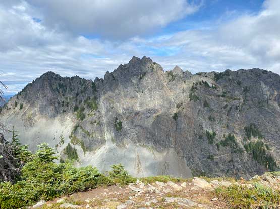
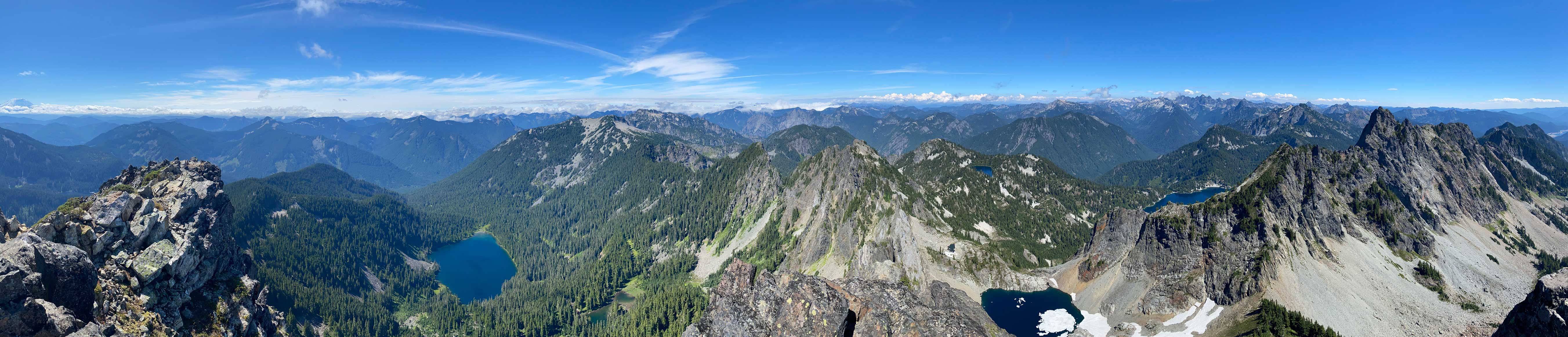
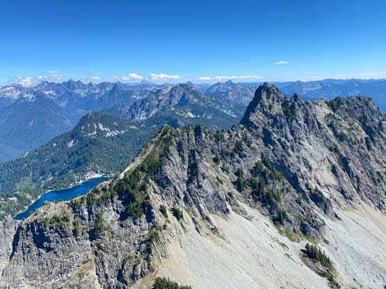
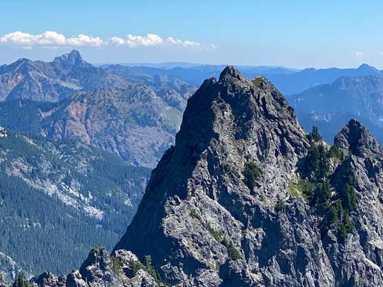
Kaleetan Peak is one of the taller summits immediately to the north of Snoqualmie Pass. This peak boasts over 500 m topographical prominence and a decently iconic profile especially viewed from the north. The standard route is however, mostly a hike with short sections of class 2-3 scrambling near the very top. The approach to Melakwa Lake itself is a worthwhile destination judging by the hordes of hikers going that way. Some of them venture to the false (south) summit but very few actually continue to the true summit of this peak.
The weekend weather was looking questionable but Friday seemed reasonable for areas to the south. I started to think about Chair Peak and reached out a few friends. Silvana was originally planning on Armchair Traverse in Whistler but was convinced to join my trip as the weather didn’t look too promising up north. Karen W. also decided to come at the very last minute. The two of them showed up at my home in White Rock at 5:30 am and I drove us down south to Seattle area and then to Snoqualmie Pass in my Toyota Corolla. Little did we know that the approach to Chair Peak, the Snow Lake trail was closed for this entire season. We were very disappointed to see the closure sign but we had to accept it. I briefly contented about to plainly ignore the closure sign, but the risk of getting caught would be high in this popular area. I immediately pointed out that the nearby Kaleetan Peak could be a decent alternative objective. I did not do any research, but I did have memories from the posts on Social Media in the past several years. I did not recall this peak being a difficult one and there’s a “trail” from Denny Creek parking lot all the way to the summit on my Gaia map. Silvana and Karen essentially bailed on Armchair Traverse to join me on Chair Peak, but this day was doomed to be not a day to sit on a chair so we must hike longer. In fact, Kaleetan Peak is fair a bit longer than Chair Peak.
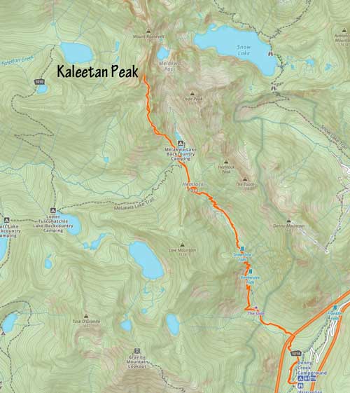
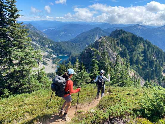
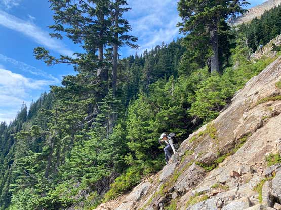
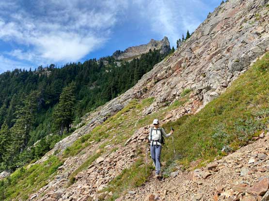
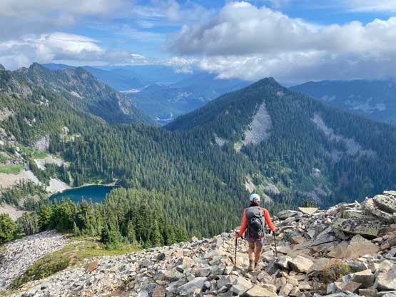
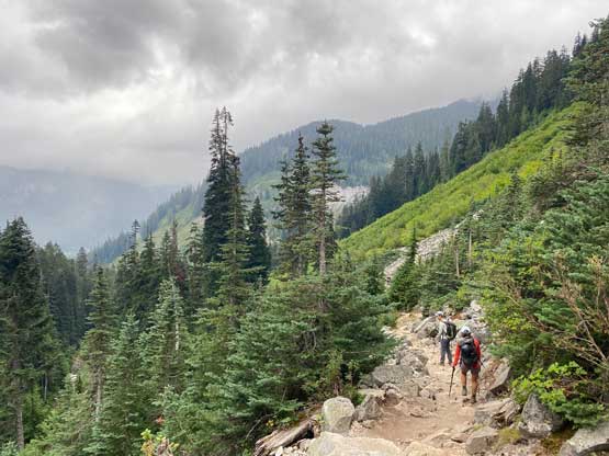
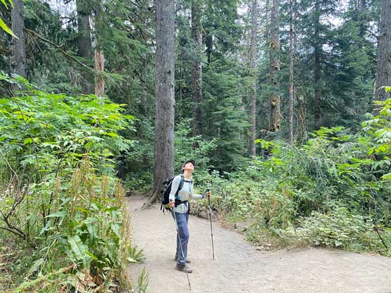
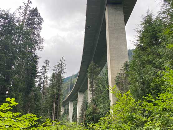
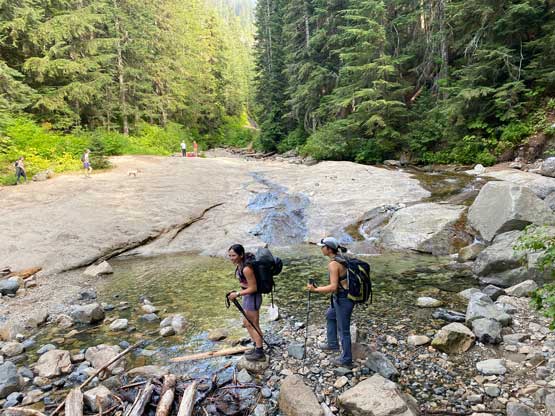
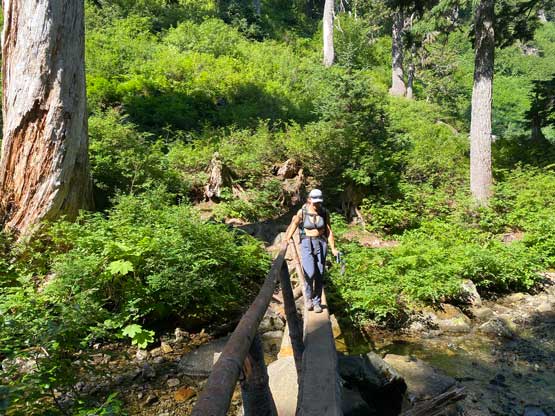
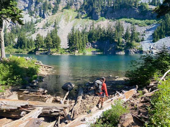
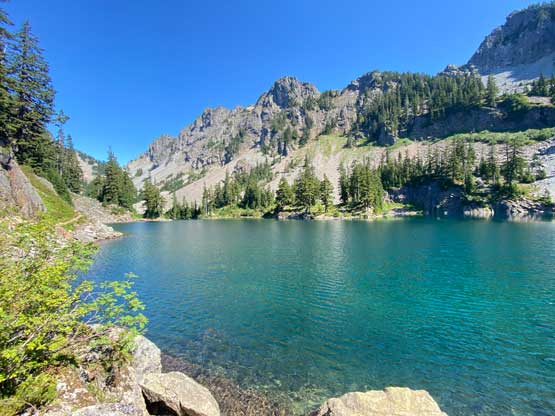
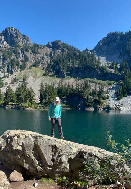
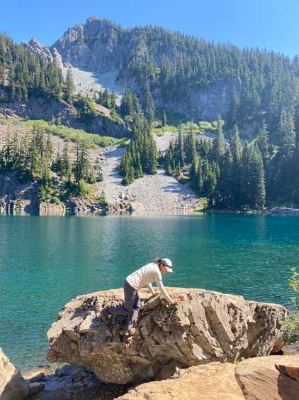
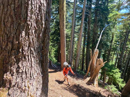
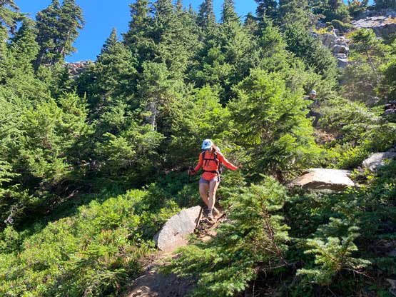
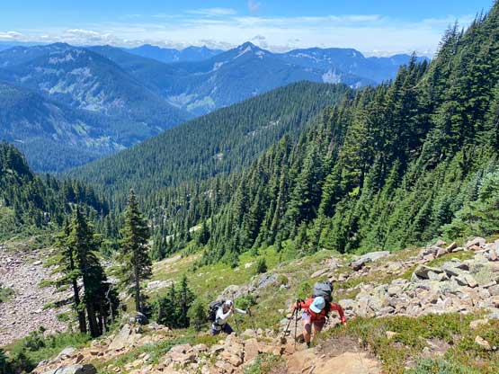
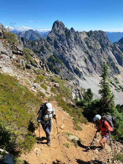
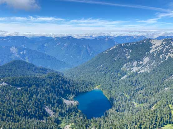
The drive to Denny Creek trail-head was confusing and so was the parking situation. The actual trail-head was blocked by a closed gate so we had to park on the road’s shoulder together with many other cars. At least this trail was not closed. After walking about 500 m to the actual trail-head we started the rather-long approach. Plodding under the impressive bridge under the westbound I-90 was quite unusual for us coming from Canada. We certainly do not have engineering like this up north. The air was also hot and humid such that in no time we all took the shirts off. We then hiked the approach trail at a rather fast pace to make up the time lost in the morning. There had been a rather major traffic delay as well as the change of objective so we were not doing particularly good on time. After what seemed like eternity we crested Hemlock Pass and descended to the outflow of Melakwa Lake losing about 40 m elevation in the way. This lake provided a natural rest spot so we took our time there taking photos and eating food. At this point we were already 7.5 km into the trip and we weren’t even close to the objective yet.

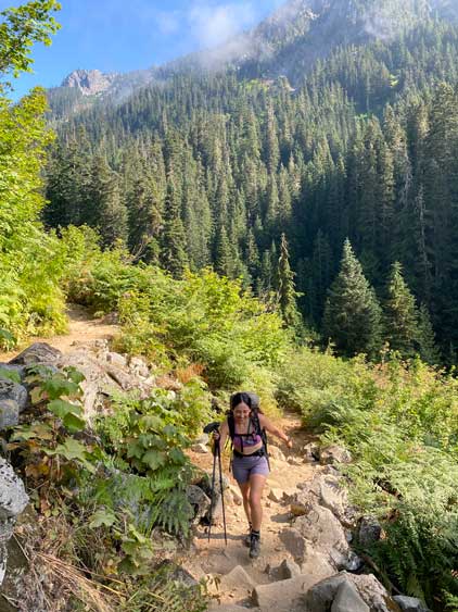


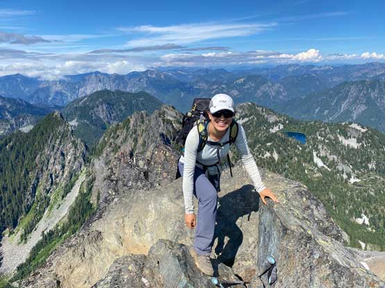
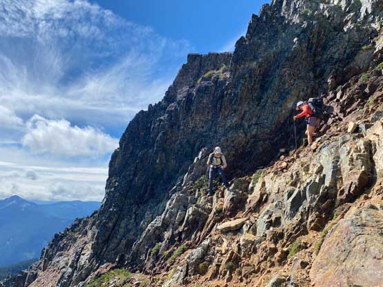
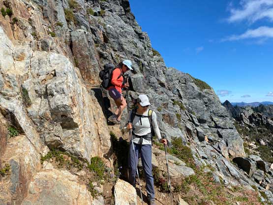
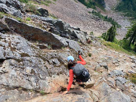
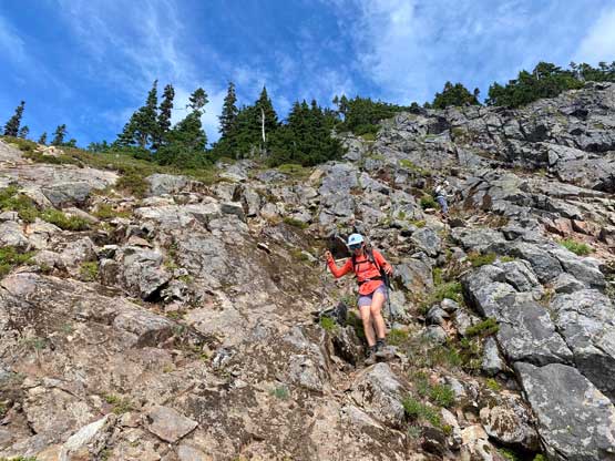
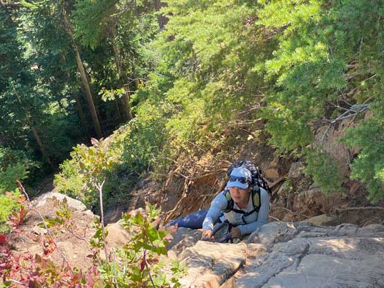
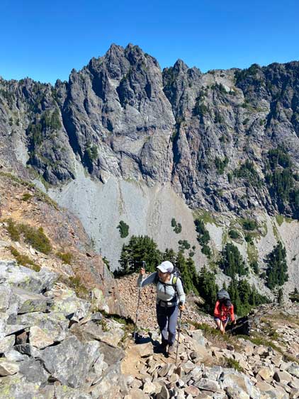
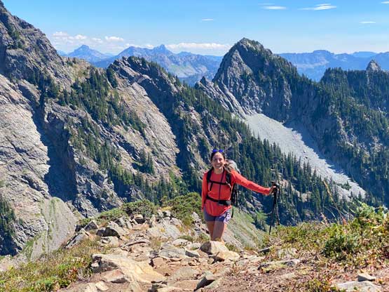
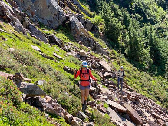
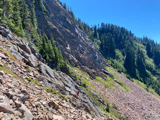
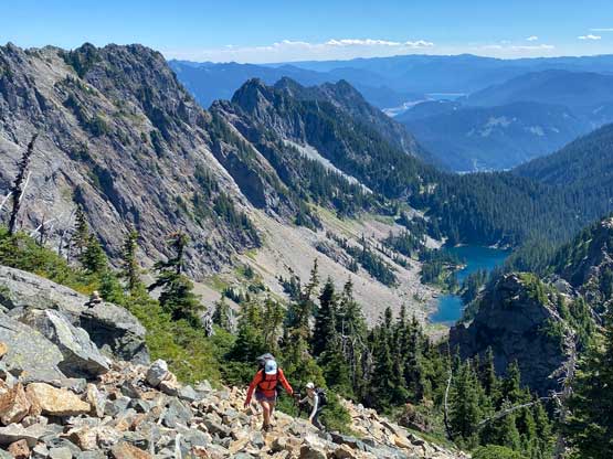
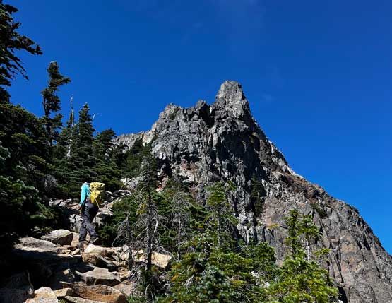
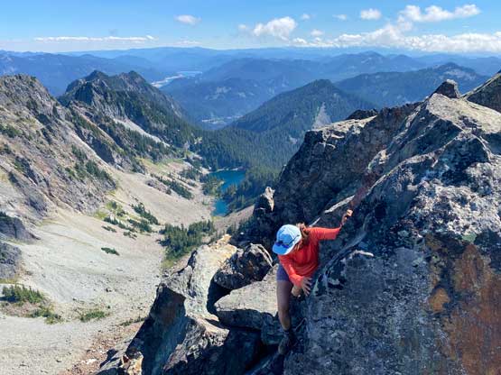
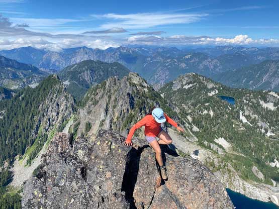
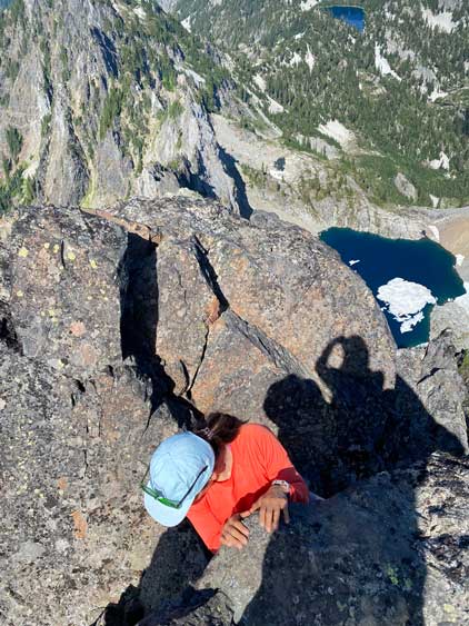
We then picked up the climber’s trail heading up towards the south summit, passing a huge group of high school students. This climber’s trail was in a better shape than expected. The views opened up about halfway up this section of the grunt. After the south summit we had to annoyingly lose more than 50 m of the hard-earned elevation down into the bowl on the SW side of the true summit to bypass some towers on the connecting ridge. We were still following a trail here, but the terrain was steep and started to become rocky. The final 300 m grunt onto the true summit definitely felt like a slog. The scrambling section at the very top was too short to be appreciated. The busy summer season had definitely taken a toll on me as I felt unusually tired on an easy ascent like this.

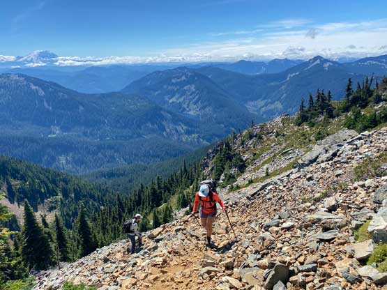

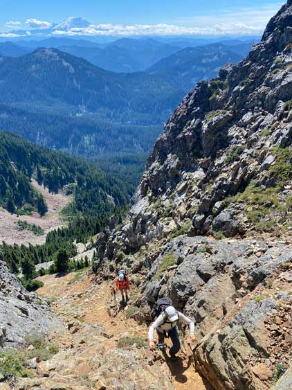
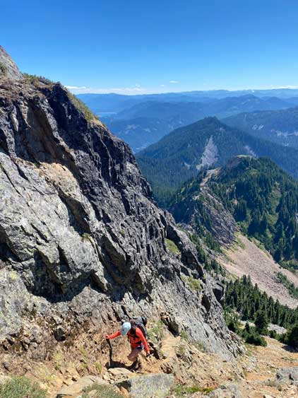


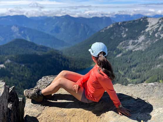
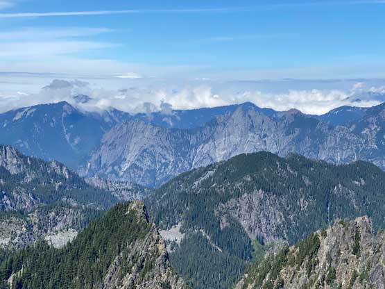


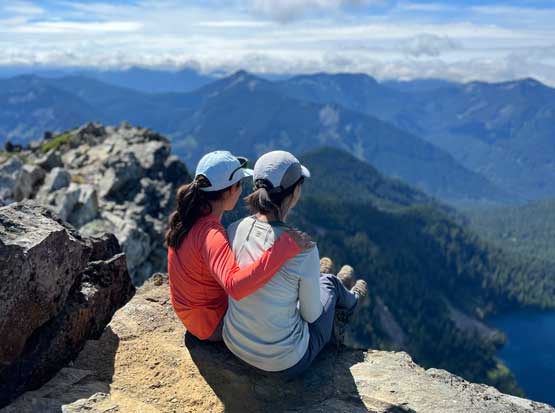
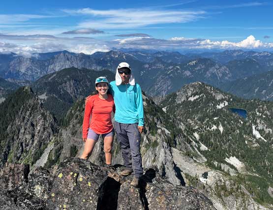
After at least an hour on the summit including scrambling to a detached tower on the north ridge we had to start the descent. A layer of clouds had moved in. The forecast was calling for deteriorating conditions towards the evening so we wanted to get off this peak before rain came. In the end the rain never came even by the time we got home. We mostly just retraced the steps we took but the GPS track suggested that there must be multiple sets of paths on the portion above Melakwa Lake, but all paths eventually converged. Passing that huge group of students proved to be difficult as they kind of refused to step off the trail to let us pass. We really took our time on the descent and plodded out at a leisure pace. The hike-out definitely felt like a slog towards the end but the views from the summit as well as the company made this trip worthwhile. After taking off the dirty cloths I drove us an hour westwards to a Mexican restaurant in Bellevue and then spent at least another half an hour in a McDonald’s to get some free wifi. The drive home was then long and tiring and we eventually got back to White Rock at 10:30 pm.