Mount Thompson
March 9, 2013
3084m
Wapta Icefield, AB
Mt. Thompson was our second objective of this Wapta Icefield snowshoe peak-bagging trip after successfully knocking Mt. Rhondda off our list. This isn’t a small peak, but surely one of the least aesthetic ascents on the Wapta thank to the fact its entire route is pretty much a (frozen) scree slog. The slope is often heavily affected by wind so rarely in a good ski shape. Ben and I would be on snowshoes so we wouldn’t curse that.
Mt. Rhondda and Mt. Thompson standard winter ascent route. GPX DL
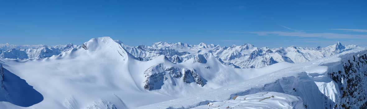
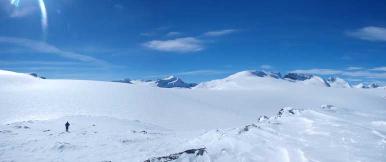
The base of Mt. Thompson’s west slopes appeared “right there”, but that’s a full cross of the Icefield, and that took us quite a while. Due to the fact we ditched gears too early, we didn’t have any down-hill advantage on this section. While travelling on flat terrain, you do really feel the work of trail-breaking, even though the penetration wasn’t that deep.. Since we’d just been up Mt. Rhondda, the best view from this section would be looking back at Rhondda, Habel, and Baker. In fact, the best view from Thompson’s entire slope minus the summit would be looking back at these Wapta Icefield peaks.
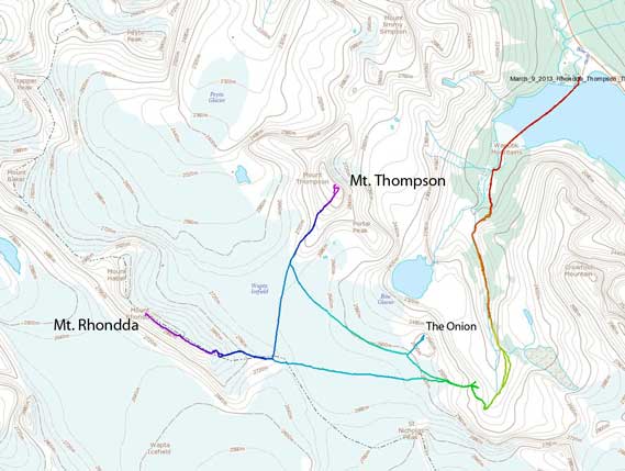
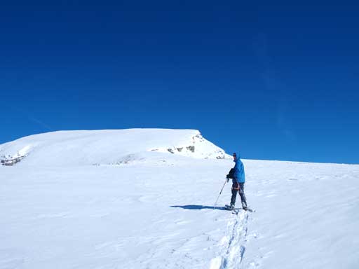
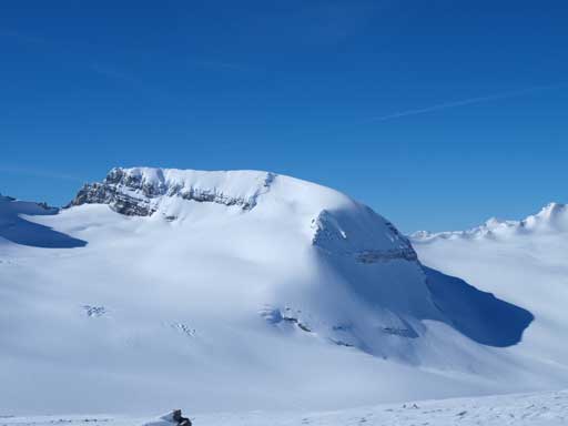
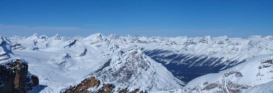
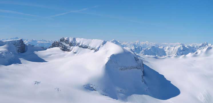
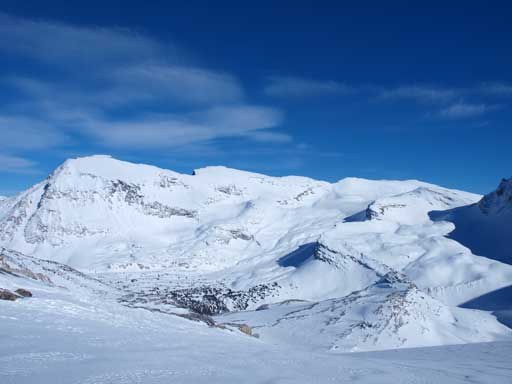
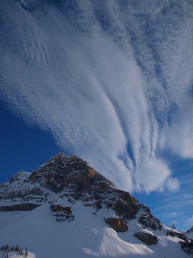
Mount Thompson and its west slope

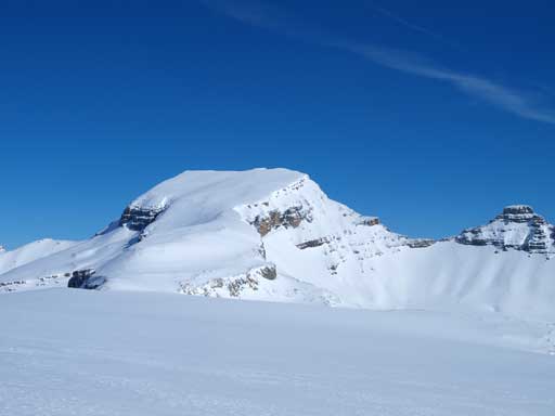
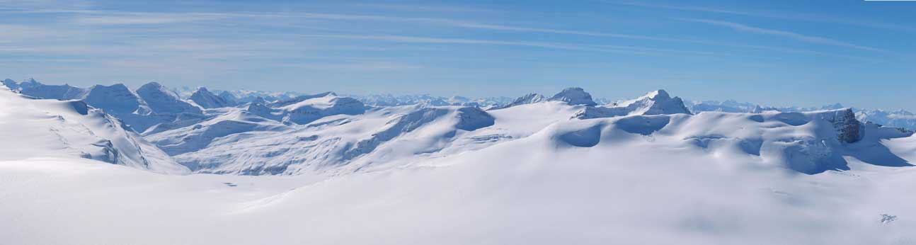
Panorama of Rhondda, Habel, Baker, Trapper, and Peyto
Once at Thompson’s base, we ditched ice axe and some extra gears. The slope was definitely not scree as in the “normal” conditions, and we had to keep snowshoes on. The snow was deep enough so that foot travelling would mean knee-deep post-holing for 400 vertical meters. However, there did have quite a lot of rocks penetrating to or near the surface, and lots of scree bands to go over. This would probably the worst skiing terrain, but on snowshoes, it’s not bad at all. We both started to realize we were nearly running out of water. It was too hot on the Icefield and we had drink a lot. 1L was just not enough for these two peaks… My muffins would require lots of water to consume and I could only keeping up my energy by eating the bars. Ben had the same problem. Not far up we decided to ditch our backpacks to save some weight. We hadn’t even gone 1/4 of the way up at this point, but I must save that last bit of water for the return, so there would be no mean to keep my backpack on anyway. We shouldn’t be that exhausted given our fitness, but since we couldn’t eat and drink, we had to take a breathe for each 5-10 steps up… It felt like eternity, and I knew we had to get up higher than Portal Peak first, then St. Nick, then Vulture, and eventually we had to get higher than Rhondda… The ridge narrowed considerably partway up, and we were forced to stay on left side due to a massive cornice on climber’s right. After this bit, we were on the upper slope.
Trapper Peak, with Mount Forbes poking in the distance.
Peyto Peak
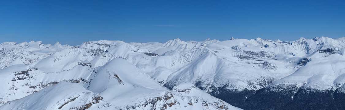
Slogging up Thompson’s west slope

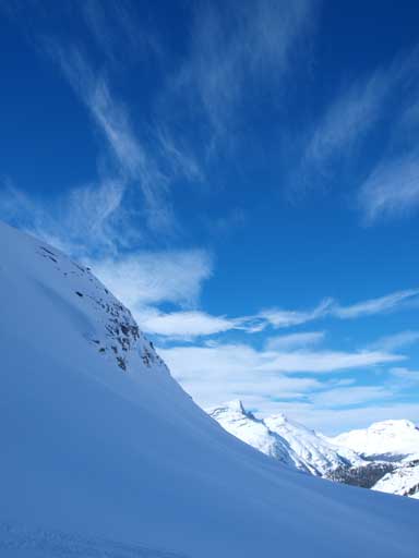
Portal Peak
Mount Habel. Click here to view full size.

Mount Baker
Mount Rhondda
With the urge or bagging another summit, we eventually made to the summit where we could see a plaque. I knew the north summit being at the same height, if not slightly higher, but we were all very exhausted, and that would be enough. The view was needless to say, awesome towards each direction. I especially like the tiny St. Nick viewing from above. Towards highway side, we could see most of the peaks on the east side, including Recondite Peak and Mount Willingdon.
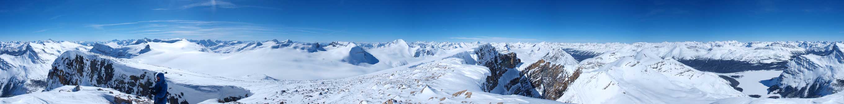
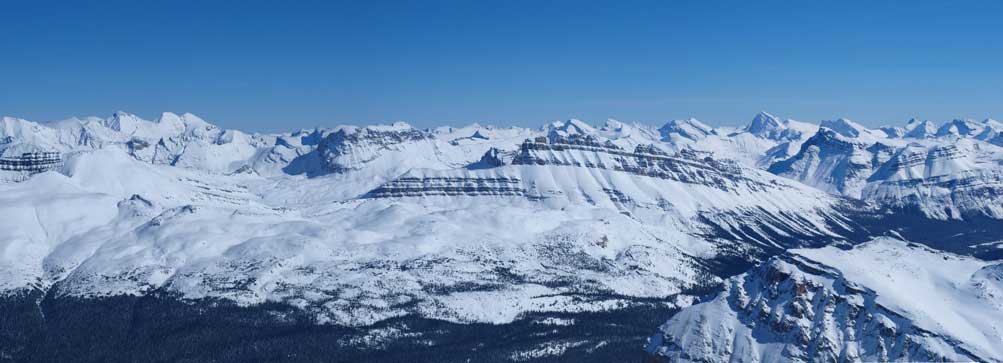
Summit Panorama. Click to view large size
Howse/White P/Chephren/Patterson on left. Murchison Towers at center. Noyes and Weed on right.
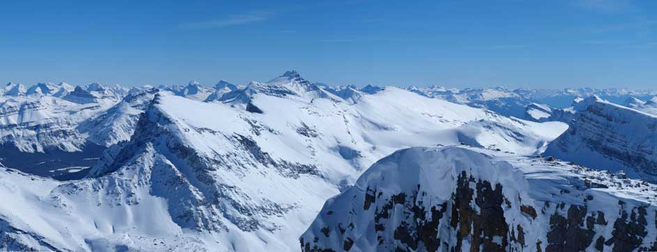
Observation Peak on left, with its sub-peak at center. Recondite poking behind on right.
Three peaks of Willingdon on left. Dolomite Peak at center. You can also see Cataract Peak on right side skyline.
Mount Hector rising behind Crowfoot Mountain at center.
Mount Baker is the prominent one. Freshfield peaks at center in the background. Mount Forbes on right.
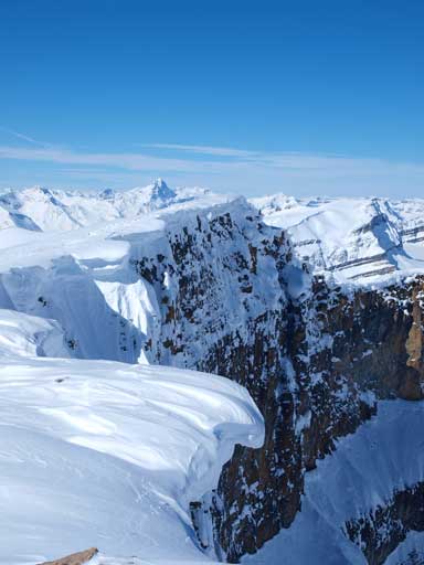
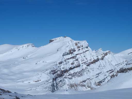
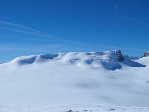
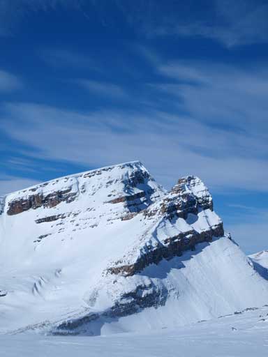
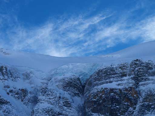
The shear East face of Mount Thompson. Note the cornices
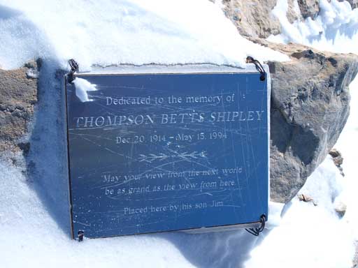
A plaque on the summit.

Looking down to Bow Lake, where we started the day.
Lots of names. St. Nick looks tiny from here, Olive, Balfour and Gordon behind. You can also see Mt. Temple
The west side. The Presidents on left. Mt. des Poilus and Collie rising behind Rhondda on right.
Mount Habel
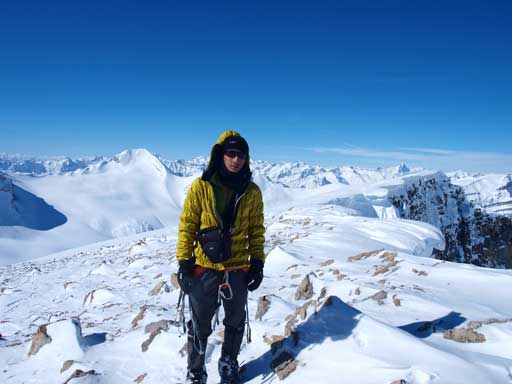
Me on the summit
Again, instead of staying and soaking in the views, we immediately went down after taking summit photos. Plunging-step down the face was soft and fast, and in no time we made back to our backpacks, and then we were at the base. We roped up again. Looking towards the direction of Bow Hut, we immediately realized we had to lose some elevation dipping down to a very broad trench. The elevation regain was killing us, but even though we were exhausted, we could maintain a relatively fast pace at this stage. The cold wind eventually picked up, forcing us to keeping going. Ben hadn’t done The Onion yet, so we decided to grab it, because it’s only a 15 min diversion from our returning line. The view was also very different from my December ascent, with the sun at a much higher angle. Therefore I decided to go up there as well.
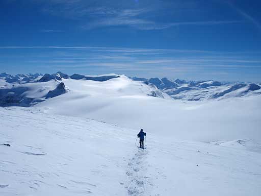
Descending Mount Thompson
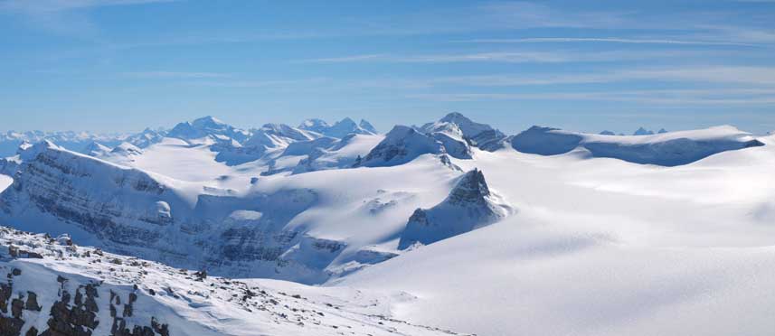
Panorama of Wapta Icefield from The Onion
Mt. Thompson and Portal Peak from The Onion

Mount Rhondda

Ben on the summit of The Onion
Mount Olive and St. Nicolas Peak
Vulture Peak
Crowfoot Mountain
We plunged-down the headwall which was nice and fast and we were all eager to get some water from Bow Hut. We forced ourselves not sitting down because we still had a long way to go. I managed to eat my frozen muffin while drinking lots of water, and that rapidly boosted up my energy level to what it should have been. It still took us a while to get ready though, and once we were out again, we quickly followed the ski tracks down the last steep hill of the day. We got some really good clouds at this point which made us stopping regularly for photos. Since we did the approach completely in dark in the morning, the de-proach would be Ben’s first time seeing this route. We found a couple slabs and cracks on the canyon’s sides, with one nearly being released. Good thing it was a small one.
We were down the last steep slope by now. Some interesting clouds were rolling in.

Looking back at The Onion
Vulture Glacier
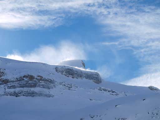
St. Nick, apparently it was very windy up there.
Interesting clouds pattern

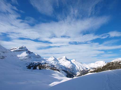
Ready for the canyon section. Jimmy Simpson in the background.
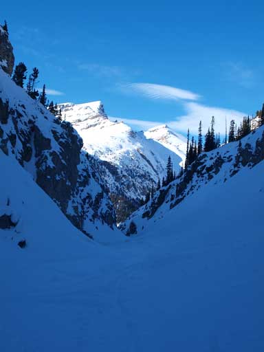
Through the Canyon
We went through the canyon for as fast as we could, and once on the other side, all the difficulties and dangers were past. Up and over the first hill, we were left to the final long flat walk. Again, the clouds made the Lake crossing quite scenic. Checking our watch, we figured that we should speed up to beat 12-hour mark.
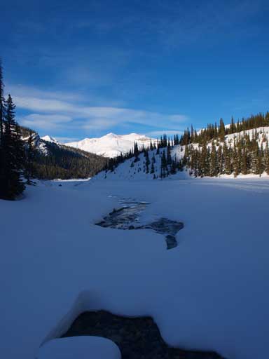
Some open water in the creek bed.

An outlier of Crowfoot Mountain

Interesting clouds
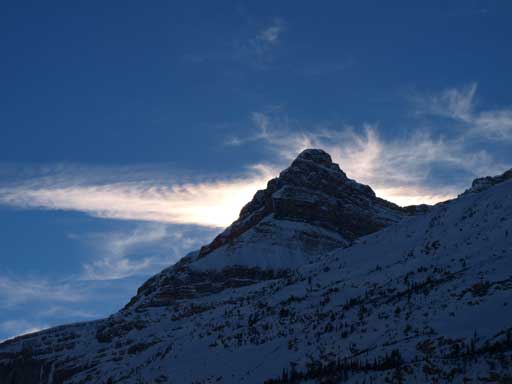
Portal Peak
Another picture of the cool clouds

The Bow Lake crossing, looking towards Bow Peak
Ben had labs to do on Sunday so we drove back home immediately. It was a long drive, but Ben managed to master it with no break except for dinner at Canmore. Overall, Mt. Rhondda to Mt. Thompson to The Onion, 12 hours car to car on snowshoes, under bluebird sky. Can’t ask for better! We both say that we would be back there sooner than later. With 6 Wapta peaks under my belt already, which would be next, Habel, Olive, Baker, Balfour?
