Slesse Mountain
August 15, 2019
2429m
Slesse Creek / Chilliwack Lake Road, BC
The rock fang of Slesse Mtn. is by no doubt the most iconic, and also the biggest prize in the Chilliwack River valley that seems elusive to most other than the elite rock climbers capable of climbing the NE Buttress that goes at sustained 5.8-5.9 for ~20 pitches. Contrary to most climbers I had no desire to climb the buttress because for one reason I’m not specialized in rock climbing at that grade, and more importantly, the climber’s descent route on the W/SW side is reported to be “mostly a scramble” with one pitch of 5.6. My theory of peak-bagging is to prioritize the chance of success but also look for the least physically demanding route. A climber’s route that offers a more direct finish with significantly less amount of physical effort might catch my interest for once in a while, such as the E. Ridge of Mt. Edith Cavell. Otherwise because I have no interest in route-bagging I usually just pick the easiest route on each peak. An ascent of the NE Buttress requires climbers to carry all of the shit over the peak hence significantly increases the physical work, and going too light also means to sacrifice the chance of success. To me that makes zero sense. An ascent of Slesse Mtn. via the descent route from Slesse Creek is not a secret among the SW BC peak-bagging community, but well-labelled online route beta was non-existing thank to some weird culture in this part of the continent that I do not, and will never understand. And because of the 5.6 rating this route had been eluding scramblers for decades.
Over the last three years I had been talking to at least 10 potential partners but the trigger wasn’t pulled until mid August of 2019. As mentioned above the route beta was not mature and I really didn’t know what exactly to expect on that technical pitch and I even heard reports of rope-soloing even on the approach section. I wanted to have a climber with me, if possible. The decision was a spontaneous one. I noticed a mid-week high pressure system kicking in and I happened to be around in the local area. I threw out an instant invite to Jeff H. and sure enough, him and Leo L. (a 5.12 climber) was planning the same trip on the exact same date I was thinking about. Jeff is usually not flexible with timing because of work, family and all kinds of stuffs that one doesn’t want to deal with in a peak-bagging career, but luckily for us, Thursday happened to have the most guaranteed weather in the next short while. I was surprised that Leo would agree to do the descent route with us, and having a real rock climber in the team significantly reduced my stress. I usually have no problem leading 5.6 but SW BC is one region I tend to be a bit more careful because a lot of the peaks here had surprised me by “much harder than expected” technical difficulties, as well as confusing route beta. The three of us figured that a day-trip from Vancouver was more than enough so instead of driving out in the previous evening we opted to wake up at 3:30 am and go from here. The gate at the start of Slesse Creek FSR was open this year. Jeff drove very fast down the roads and we got to the trail-head still in a pitch dark.

Slesse Mountain via W/SW side standard route. GPX DL
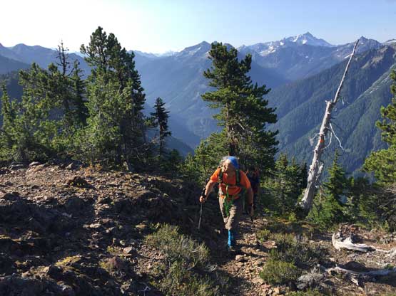
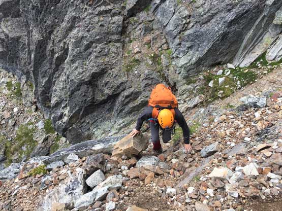
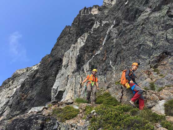
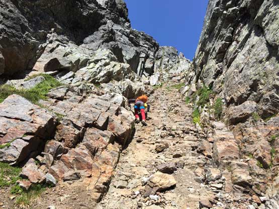
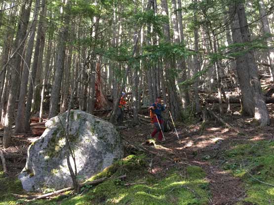
The first half an hour still required head-lamps but soon the sky was lightened up. The first section of the approach involved about 6 km of walking up the decommissioned upper portion of Slesse Creek FSR. The road was overgrown even for walking but it seemed like the locals had been doing some trail maintenance. We loaded our water bottles at the last bridge (creek crossing), fully expecting absolutely no source of water higher up on the peak. The start of the steep grunt was clearly labelled and I swapped trail-runners for mountaineering boots. This trail had reputation and I came here expecting to deal with the steepest trail in my whole career. The reality was very much the opposite. The trail was nicely maintained, clearly marked by orange squares, and although relentlessly steep, was nowhere as bad as some sources made it sound. My guesstimate was that the trail had been improved over the years but whatever there in the past is irrelavent to the future parties. The upper portion had some bluffs and confusing paths but Jeff had done his homework by coming all the way here a month ago in the rain. With his scouting GPX track we made slow, but steady progress and were at the “high knoll” in less than 3.5 hours since starting the day.

Jeff on the upper bluffy and undefined section of the forested grunt
Coming out of the woods, Jeff wondered what’s lying ahead

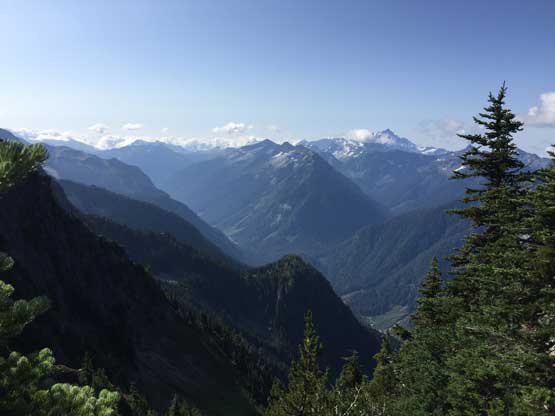
Looking back towards the Border Peaks
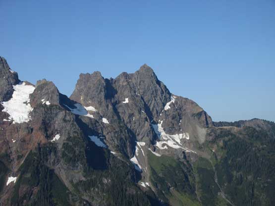
A closer look at Canadian Border Peak that I ascended two years ago.
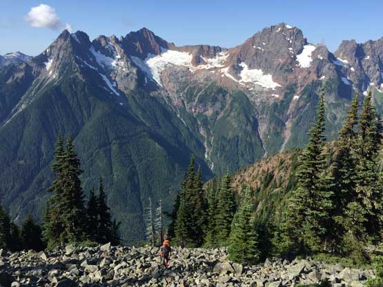
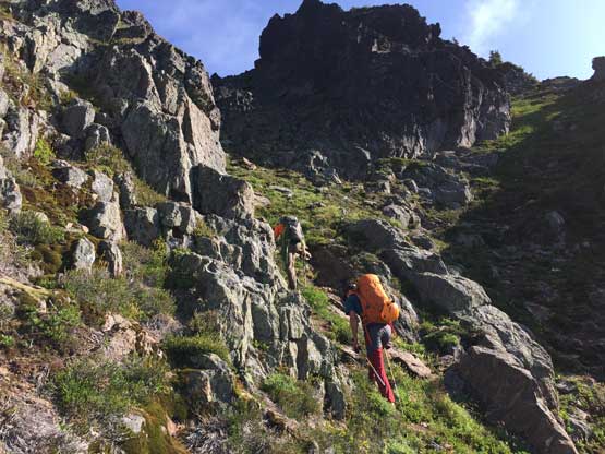
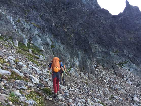
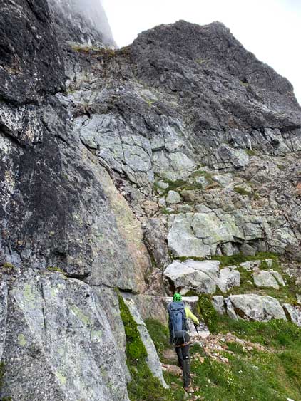
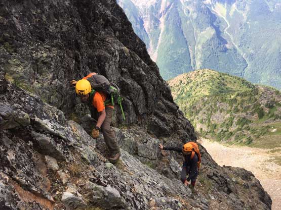
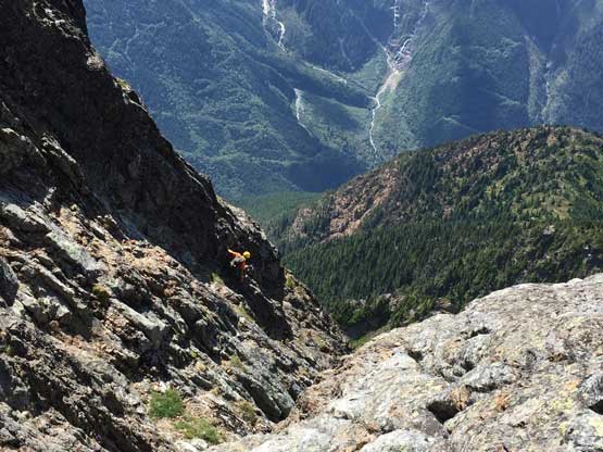
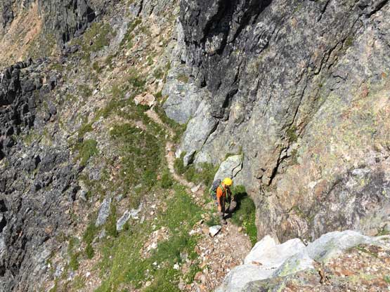
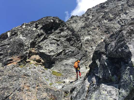
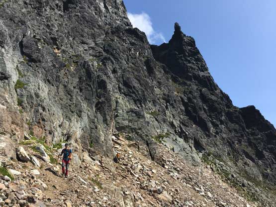
We took the first long break of the day at the “high knoll”. We were still in the shade but the day’s definitely shaping up to be a toast. Resuming the ascent we no longer had Jeff’s scouting beta but the trail was still there and the route was obvious. There were a few boulder fields where we briefly lost the trail. Higher up the correct way was sticking on the ridge crest even after it’s becoming scrambly (class 2+). It might seem that we should descend and traverse underneath the cliffs but paths and cairns on the crest made us sticking to the ridge. We made the right decision, as a clear sideways traversing path occurred after the ridge levelled out near the base of the rock fang. The traversing path led us to the start of the first gully on Slesse’s W. Face and we took some time donning and ditching respective gears.

Believe or not we were still on a “trail” here above the knoll
Leo looks small comparing with Mt. Larabee and American Border Peak

Leo scrambling on the approach ridge. We were on route here
Route-finding was the key on this section of the ridge to stay within scrambling terrain

Leo and Jeff marching up on the steep grassy slopes

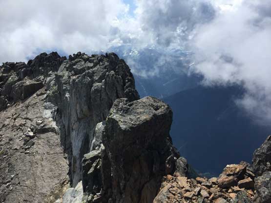
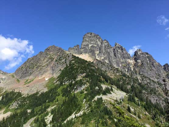
The fang of Slesse Mtn. looms ahead. It looked impossible from here…
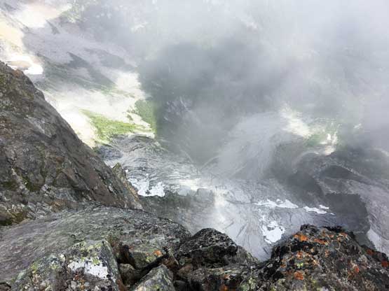
This is looking down the headwaters of Slesse Creek into Washington state
More about the scrambling on the approach ridge

Looking back from above a steep grass section
Leo traversing scree into the bottom of the first gully
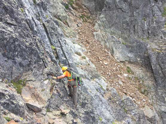
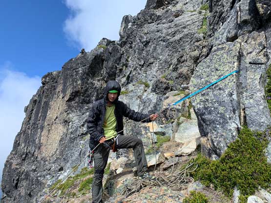
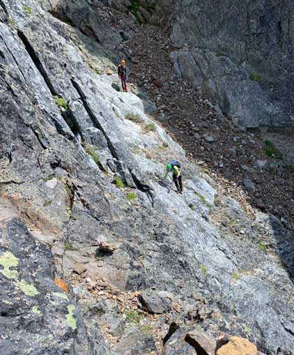
The first gully was much easier than appeared from afar. Other than one awkward chockstone (class 3+) the rest was very easy, albeit on loose rocks. The exit of this gully was also fairly obvious because we had done enough homework. I had no idea why anyone would end up “rope soloing” at this stage unless he/she somehow missed the narrow, rising traversing ledge on the far climber’s right. There was some scrambling to reach the ledge, and although very exposed, the ledge did not involve anything harder than “class 3”, and in short time we past another rappel station and were on a slightly downwards grassy leading into the “middle gully”. The middle gully was steeper than the first one but appeared reasonable to scramble. The exposure was real and the rock was down-sloping but the scrambling was “class 3+” at max. We exited this gully on climber’s right on some mossy and exposed 4th class terrain but Jeff later (on descent) found that sticking to the middle of the gully was the better choice. For those into rope work this gully could be climbed in two short pitches with existing top anchors, or one longer, ~35 m pitch.
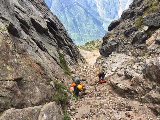
Jeff starting the first gully. Easy peasy…
Leo finishing the first gully
Looking for that “diving board” rock to locate the first key ledge traverse

Leo traversing towards the first ledge that links the first and second gullies
This 3rd class ledge is uber exposed, but not difficult
Me studying the “middle gully”. Photo by Jeff H.
Jeff and Leo starting the first half of the second gully

Jeff and Leo climbing exposed 4th class moss to exit “middle gully”

Leo finishing the last exposed move to get out of the second gully.
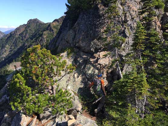
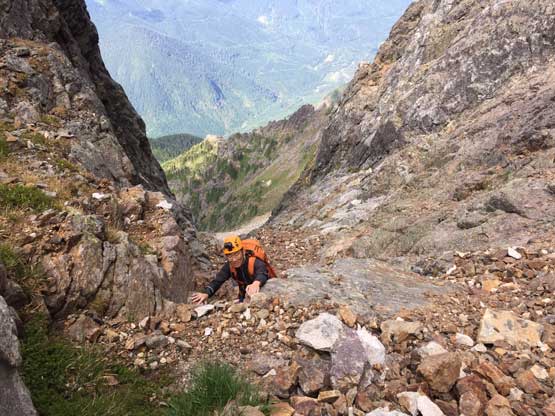
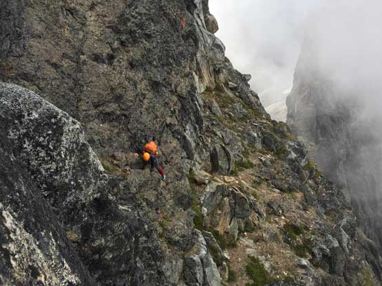
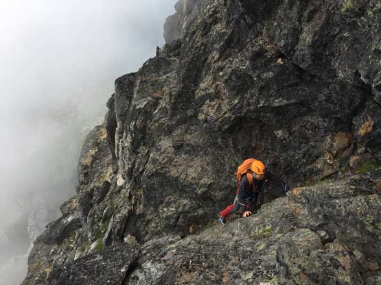
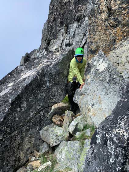
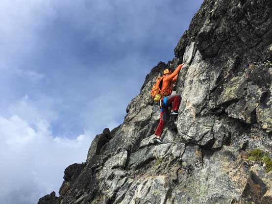
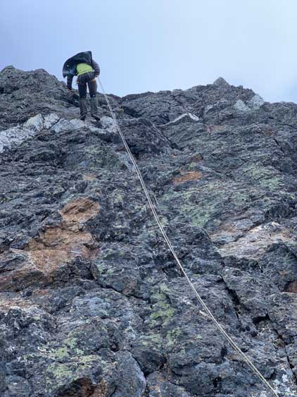
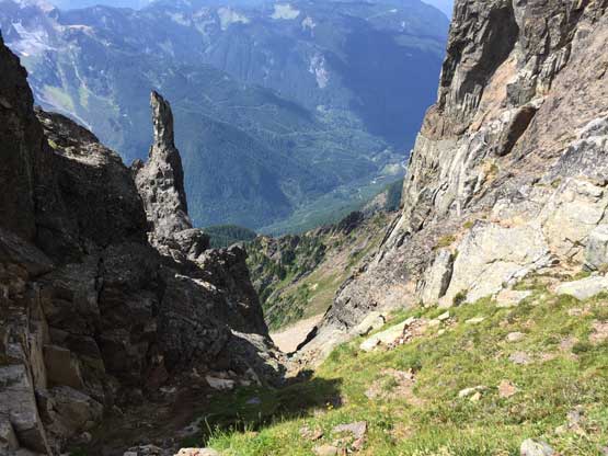
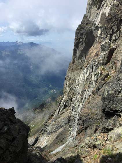
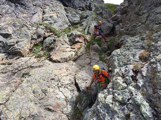
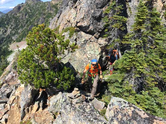
Another wide grassy ledge led us farther out towards climber’s right to the next stage of “class 3+” scrambling on a rib feature (rappel station above). The scrambling was easier than appeared but the exposure could get heady for those with vertigo. Above that stretch we had to do a long and awkward horizontal traverse into the 3rd, also the final gully and this stretch involved a few moves of 4th class. The ascent of the 3rd gully had another awkward chockstone but otherwise, no problem. Reaching the high notch we easily scrambled a short ways to the base of the technical pitch. The pitch looked not too bad, but definitely steep enough to warrant the use of our rope, so we took time donning gears. The far climber’s right side appeared the least steep but to minimize rope drag I led a line, on rock shoes with no backpack just slightly to the right of the fall line. The start of this pitch was 4th class and about 10 m up I certainly had to do a few slabby moves at 5.5 ish grade with only one micro-nut for protection, before the grade eased back to 4th class. I ran the rope past the midpoint for about 40 m total before finding a perfect block of boulder to sling around. I was very surprised to find no existing anchor. Jeff followed using the rope as a fixed line and then I belayed Leo up to the station.

Leo scrambling exposed 3rd class rib above the second ledge traverse
Jeff starting the 4th class traverse into the 3rd gully

Into the 3rd gully, we were briefly back onto easier terrain
Leo slogging up choss in the 3rd gully

Leo partway up the 3rd gully
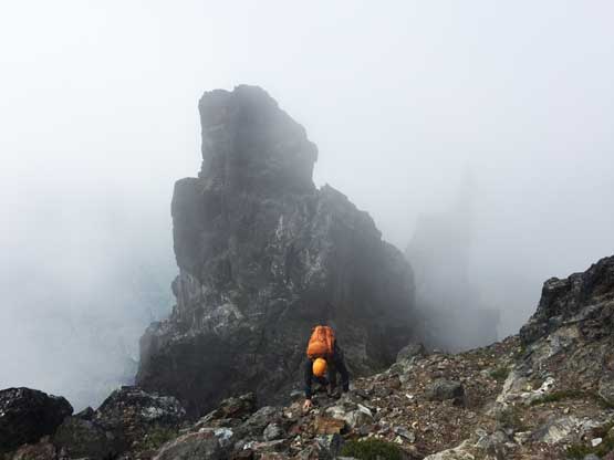
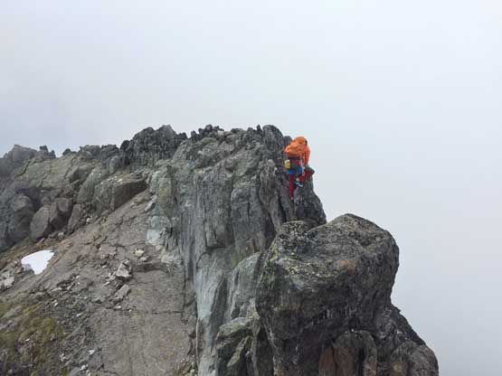
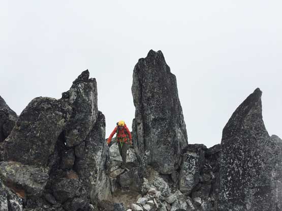
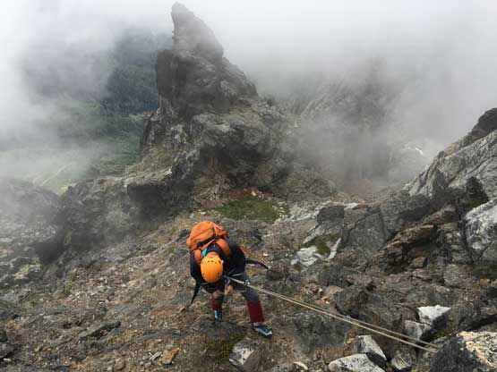
Scrambling into the mist above the high notch
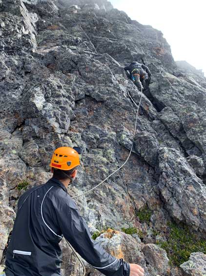
Me leading the technical pitch. Photo by Jeff H.
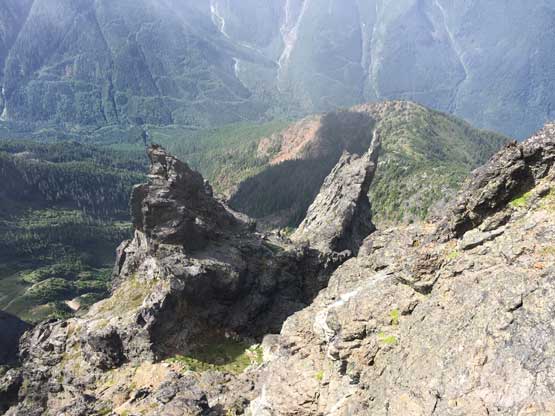
Partway up the pitch, I took a photo looking down onto some impressive spires

Jeff starting the pitch

Jeff about midway up this 40-meter pitch of climbing

Leo climbing the middle section of this pitch. Photo by Jeff H.
Me belaying. Photo by Jeff H.
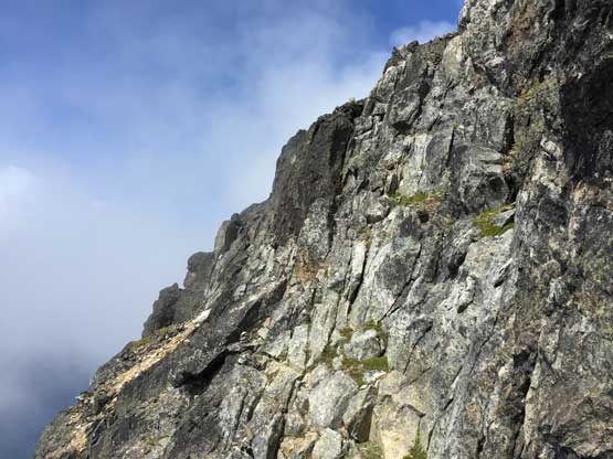
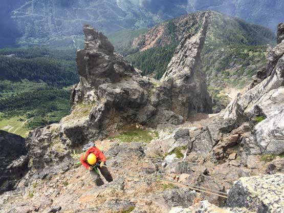
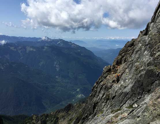
Not knowing what exactly to expect Leo and I continued using rope ascending/traversing climber’s left on easier terrain. Jeff went ahead and claimed there’s no need for any further rope work so we ditched the rope at an obvious place. The route traversed farther climber’s left than I thought but never exceeded “class 3+” on the upper sections. Into the mist Leo and I followed Jeff up a chimney feature and veered right to what we thought was the summit. An empty register confirmed our success but the clouds lifted and we saw another potentially higher point north of us. That’s too close for comfort. The direct traverse looked tricky but we thought there must be a way by dropping a bit on the south side, and we sure found a route. The scrambling was straightforward and we checked out every single high point on that northern summit just to be totally sure. Unfortunately for us the stubborn clouds decided to engulf the summit area for our entire stay so we didn’t get to see much from up there.
Jeff scouting the upper route. Lots and lots of 3rd class

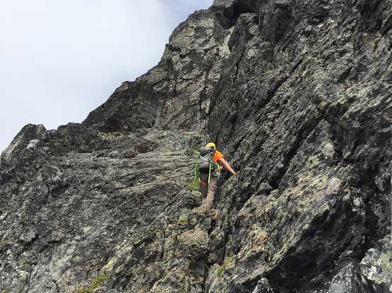
Leo on an exposed rising traverse above the technical pitch
A closer look at Leo on an exposed move
The upper route got some brief sunshine. Jeff’s much higher out of the views
Leo on the “class 3+” move in the chimney to gain the south summit

Me scrambling out of the chimney. Photo by Jeff H.
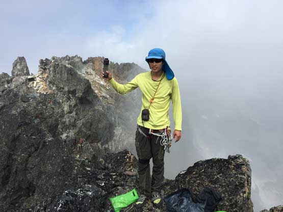
Me on the south summit of Slesse Mtn. holding the register
Looking down the NE Buttress side

Partial Summit Panorama from Slesse Mountain. Click to view large size.

The north summit would be where we headed next

This is looking down the west face towards “high knoll”

A southern view from the south summit. Not a ton to see thank to the clouds

Traversing towards the north summit in fog.

Leo scrambling to gain the north summit
A northern view down towards Crossover Peak
Leo traversing exposed summit ridge
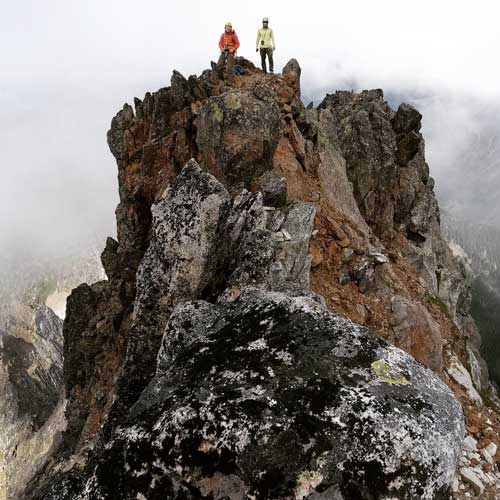
Jeff and I on the north summit of Slesse Mountain
Looking back at the (avoidable) ridge traverse that we did for fun
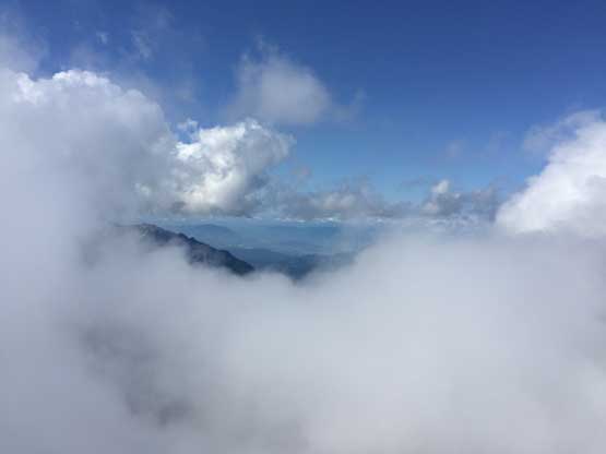
Brief lifting of clouds…
I barely got some services for a live Instagram/Facebook update before we committed to the descent. For that technical pitch we decided to down-climb the upper 10 m past an awkward lieback move to make sure our 60 m would reach the bottom. We found another good block of boulder to easily sling around and made one easy rappel down the technical wall. Future parties can bring more rappelling cords to avoid down-climbing all together. The descent down the 3rd gully was easy but that chockstone did require some thinking out of me. The 4th class traverse was fairly easy and the 3rd class down-climb immediately following was easy, but felt exposed. For that middle gully Leo and I decided to rappel while Jeff opted to down-climb. We all down-climbed the 1st gully.

Leo au-cheval back across the fun summit ridge
Jeff walking through a rock garden

Me scrambling back down the north summit
More about me scrambling. Photo by Jeff H.
Leo down-climbing
Jeff on rappel
Leo on rappel
Me rappelling. Photo by Jeff H.
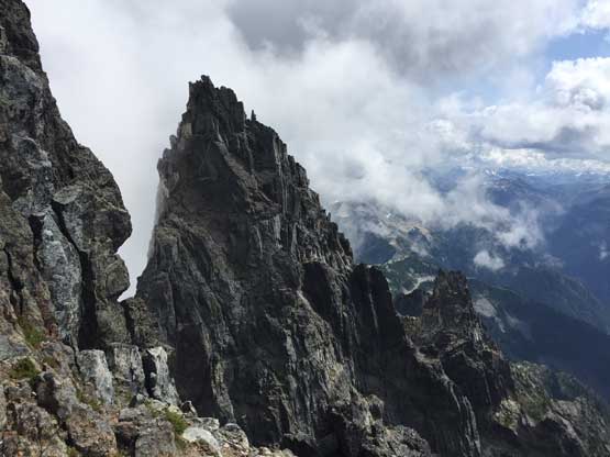
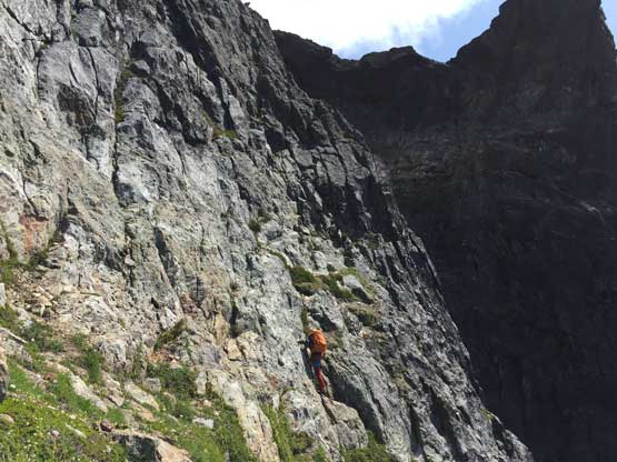
The impressive south peak of Slesse Mtn.
Off the technical wall

Me posing at the “high notch”. Photo by Jeff H.
Looking down the upper portion of the 3rd gully
The terrain here is very steep. Route-finding is the key
Jeff and Leo starting down the 3rd gully

That infamous milk jar rock pinnacle

Jeff almost finished the 3rd gully descent

Leo down-climbing the 4th class chockstone in that gully
Jeff partway across the 4th class traverse

Aim to where Jeff stands. This is very important..
Me on the 4th class traverse. Photo by Jeff H.

Leo on the hardest move along this traverse

This wide grassy ledge would link us to the 2nd gully

To get onto that ledge this is Jeff down-climbing exposed 3rd class rib

The ledge is a perfect spot to study the route
Looking back at Leo finishing the 3rd class rib down-climbing
Jeff down-climbing the 4th class middle gully
Jeff is back onto the first key traversing ledge
Leo and I rappeled the middle gully

Leo down-climbing exposed 3rd class towards the first gully
Down-scrambling easy “class 2” in the first gully

Leo and I down-climbing the 4th class crux in the first gully. Photo by Jeff H.

Finishing the first gully onto easy terrain. Photo by Jeff H.
Off the technical terrain we were back under a bluebird sky and of course the summit area also cleared up. We took our time on the descent taking a ton of photos. Our next stop was that “high knoll” and while descending the steep trail into Slesse Creek we took a ton of stops picking mushroom. Jeff had 20 years of experience of mushroom picking and claimed we must have collected a total worth of more than 100 dollars. I had zero knowledge about mushroom but such found was quite exciting. Jeff offered to give me some but I was too lazy to cook so passed. The final 6 km slog back to the truck was soul-crushing but at least I could appreciate the comfort of the trail-runners. Our round trip time was 13.5 hours with a lot of unnecessarily long breaks including at least half an hour of mushroom picking, and close to 1 hour of stay on the summit trying to catch cell phone services for IG/FB/WeChat updates…
By now we had finished the entire summit block climb and descent

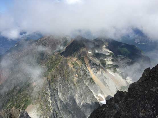
Looking back at the summit fang of Slesse Mountain

Me posing with American Border Peak behind – climbed a month later

Looking down at the steep heather gully we’d descend

Steep grassy and dirt wasn’t pleasant
Still had lots of scrambling and route-finding

One of the few talus fields
Looking back at Slesse Mountain from the “high knoll”

This is looking towards MacFarlane Peak

Committing to the steep forested descent

Leo trying to have some fun… Or not…

Mushroom picking
Almost down to Slesse Creek

The final 6 km of road walking…
Overall I wouldn’t say Slesse Mountain was easy, but certainly not as hard as the 5.6 grade suggests neither. Comparing to other “hard scrambles” in SW BC such as Mt. Rexford, East Lion and Mt. Habrich I think Slesse Mtn. is harder than them all, but not by a significant margin. Comparing to the class climbs in Washington that shares the same YDS grade such as Liberty Bell or the W. Ridge of Forbidden Peak I think Slesse Mtn. is definitely easier. Now with my trip report out this peak should no longer have any mystery. One needs some mountaineering skills but doesn’t need to be a rock climber to summit Slesse Mountain, so go get it.
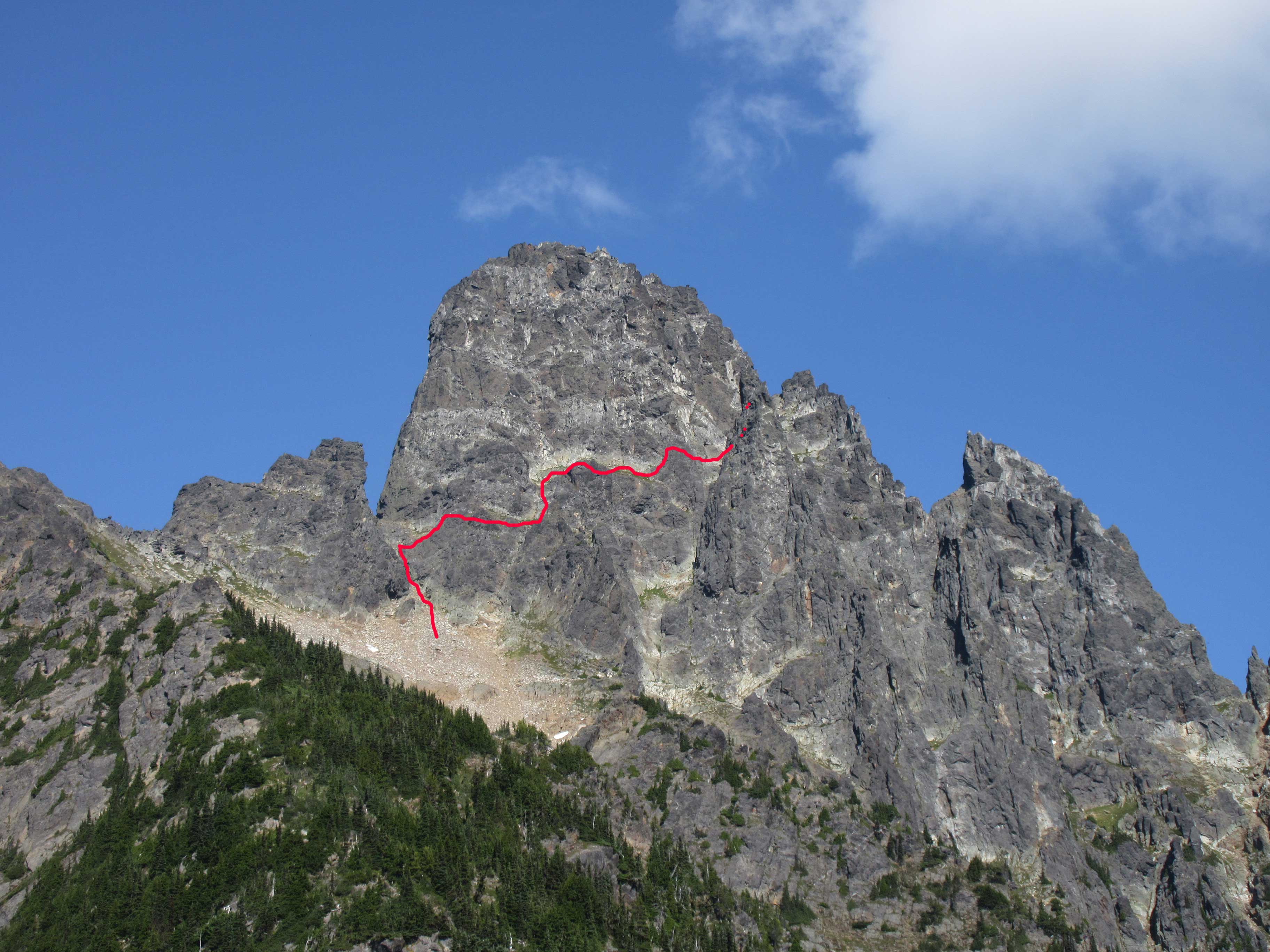
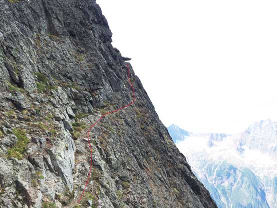
Rough drawn route-topo of Slesse Mtn., W/SW Route. Click to view large size.
