Mica Peak (NV)
January 7, 2022
1755m
Lake Mead East, NV
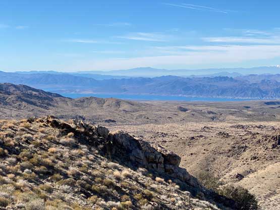
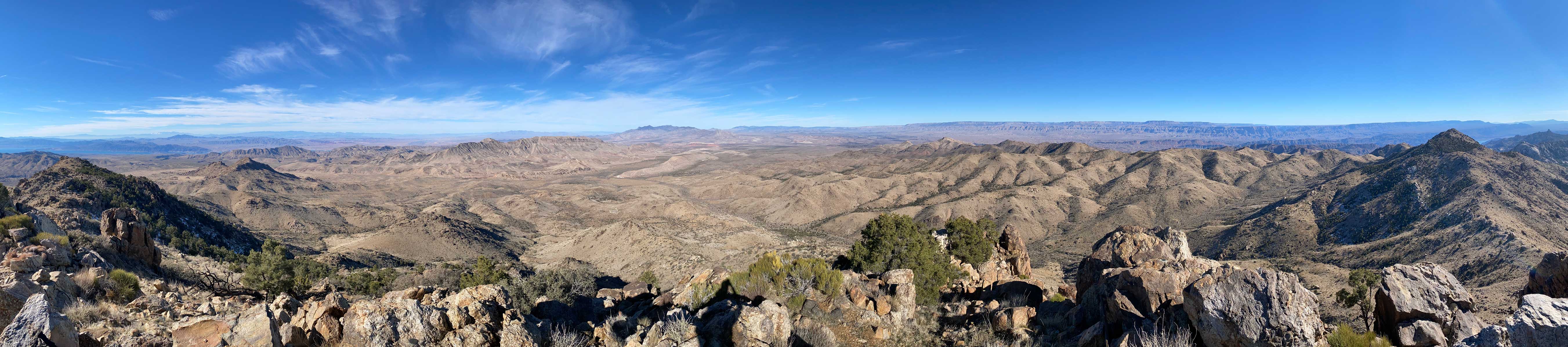
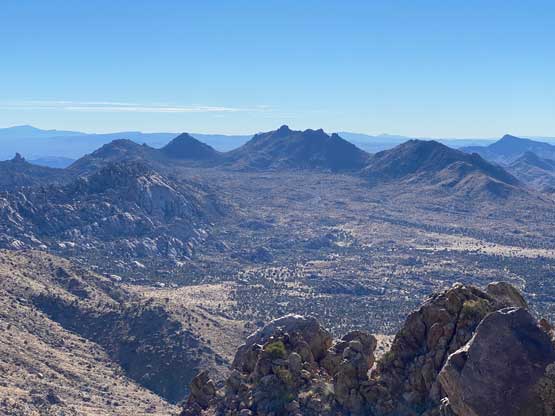
Mica Peak locates in a remote area to the east of Lake Mead. This peak is probably better known as a “dual P1000m objective” together with Jumbo Peak to the south. The official height of Jumbo Peak is 2 feet higher than Mica Peak but 2 feet is well within the error range such that the two peaks are basically equally high. Jumbo Peak boasts over 1000 m prominence but it could well be Mica Peak that actually boasts the prominence. The ascent of Mica Peak is much easier than Jumbo Peak as it’s merely a walk-up while Jumbo Peak is a class 4/5 climb. Rob and I had climbed Jumbo Peak earlier in the morning.
The start of the route is at the broad pass between Mica Peak and Gold Butte. The drive to this starting point is considerably rougher than Jumbo Peak’s such that a 4×4, high clearance vehicle was definitely required. I had no problem navigating the maze of spur roads in my Tacoma. The last spur road was not even marked on the Gaia map but thankfully we had also downloaded the satellite images and the USGS topo map for navigation. Combing all three map layers the navigation was not a problem.
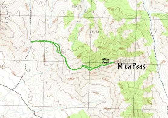
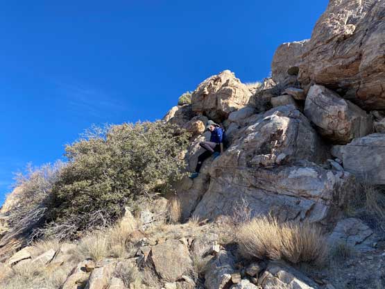
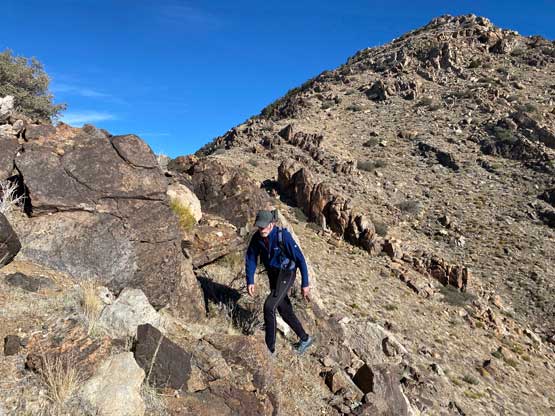
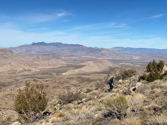
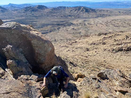
The pass between Mica Peak and Gold Butte was extremely windy such that we could barely get out of the vehicle. We hassled eat some food inside the truck before committing to the windy hike. As we ascended higher on the west ridge system the wind was no longer that crazy, but we were still pushed by the wind from time to time. We mostly just followed the crest of the west ridge all the way to the summit with only small detours mostly on the south side. There aren’t much worth noting about this hike other than the three or four false summits. We all wanted to just get the job done and move on, so those false summits were very frustrating.


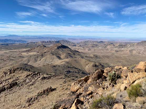


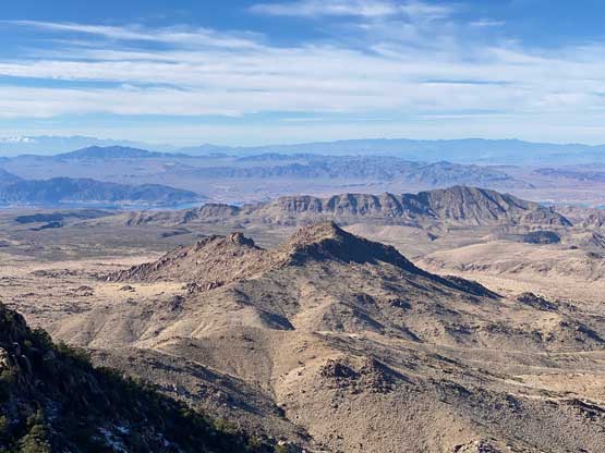


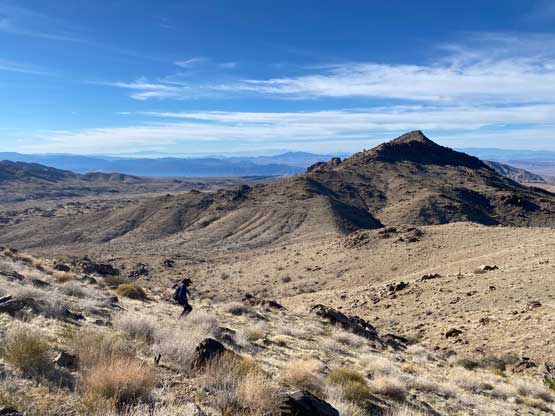
After soaking in enough of the views we rushed the descent. Rob and I took turn setting the fast pace back across the summit ridge. To descend the lower west ridge we got into a jogging mode to finish the round trip in just over 1.5 hours. I then negotiated a different spur road to drive back to the main Gold Butte Road which we followed northwards all the way to Whitney Pocket. We still had a long ass drive northwards to Mesquite before hopping onto I-15 back towards Las Vegas. We got back to Adam’s home at dinner time so we all stuffed in another massive Chipotle bowl. In the evening I booked the PCR COVID test which was unfortunately mandatory to cross border back into Canada. I made a rough plan for the last three days to bag a few more peaks while driving back home via California.