Gravell Peak
May 2, 2021
2082m
Pemberton, BC
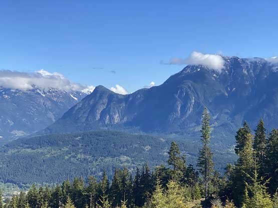
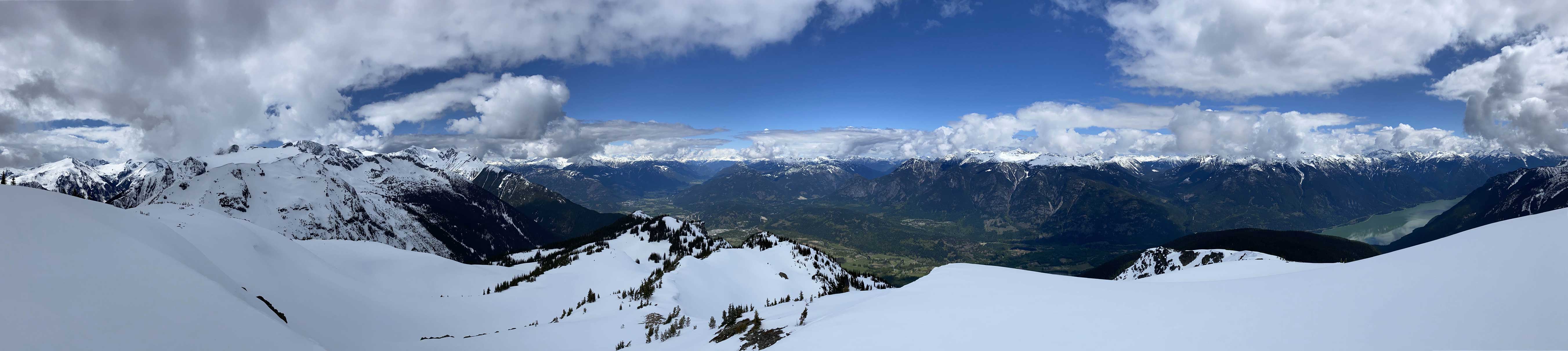
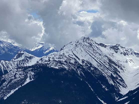
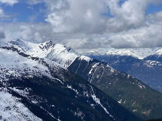
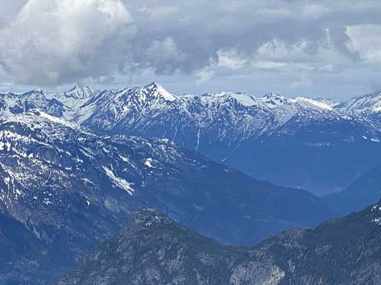
“Gravell Peak” is the unofficial name of the far north-eastern extension of Hibachi Ridge almost 10 km away from the main summit of Hibachi Ridge. “Gravell Peak” itself is not just a bump and instead, boasts 300 m of clean prominence with a steep north face that drops more than one vertical mile down into Pemberton Valley and Lillooet Lake. The NW Ridge route had been well described in Simon’s trip report on ClubTread while the NE Ridge and North Face offers some steeper but more direct options accessed from spur roads off the main Green River FSR.
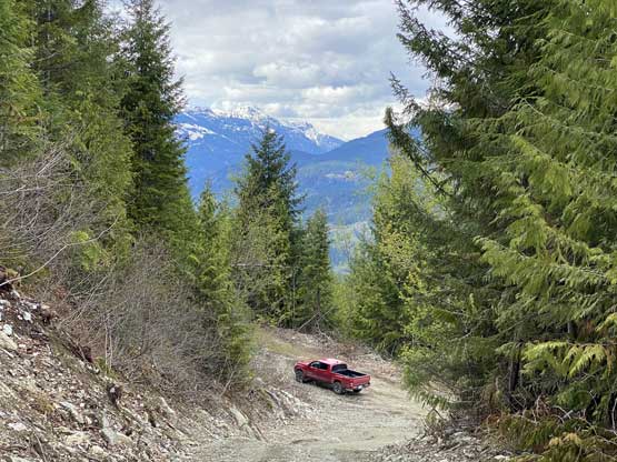
Last year my friends Vlad and Chris had made an attempt but were shut down by active logging. This meant that once the logging’s finished the road access could be significantly improved. I figured the ideal timing would be April or May when the road’s driveable to at least 600 m elevation while the forest still holds enough snow to make a smooth travel. I made a last minute decision to take a chance on this access. I had no idea about what’s currently going on with the logging activities so I did come up with a couple back-up plans that were further to the north. I drove out of White Rock at 9:30 pm after work on Saturday and made to Pemberton at midnight. The Green River FSR was smooth and upon reaching “Gravell East Spur” I was glad to see no sign of “active logging”. The spur road was in an excellent shape that other than a few waterbars one almost doesn’t even need a high clearance vehicle, although to tackle the insanely steep grade the 4WD is still needed. I made to an important fork at 650 m elevation with ease in the Tacoma. The right fork was where Simon took on his ascent in 2013 via NW Ridge but looked overgrown. The spur to the left was freshly graded (could be driven higher) but I did not have firm beta about the NE Ridge nor the North Face. It’s very tempting to take a chance on the NE Ridge but there’s one section that I could not convince myself that’d 100% go based on the satellite images, so I opted to park lower and go with the known. I did decide to carry ice axe and crampons because if the terrain looked feasible from above I would descend the north side making a loop.

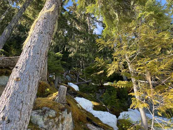
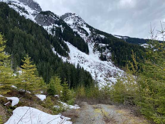
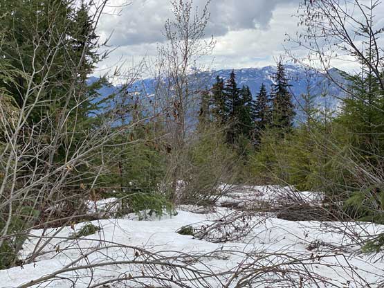
The temperature dropped decently low overnight so there’s no need to wake up early. I decided to sleep in till whenever I naturally wake up and that turned out to be 8 am and I started about half an hour later. The spur roads on Simon’s route were much worse than anticipated with sections of bushwhacking in alders. Good thing I did not try to push my truck any higher on that road as I would end up stuck with nowhere to turn around in the tangled mess. After about 1 km into the plod I was committed to this NW Ridge route but at this point I already counted on descending the other side to forget about these alders. There were spots that I could see some potential short-cuts but I insisted on walking the entire distance of this road to the end. The cut-block above the road still held enough snow to warrant the use of snowshoes, but the mature forest above the cut-block was free of snow. The snowshoes were then stayed in the pack to almost 1200 m where the snow in the forest finally became continuous.


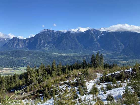


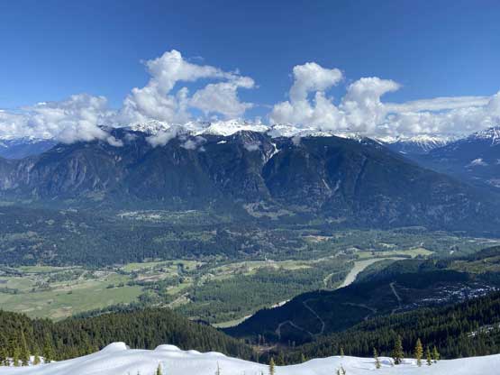
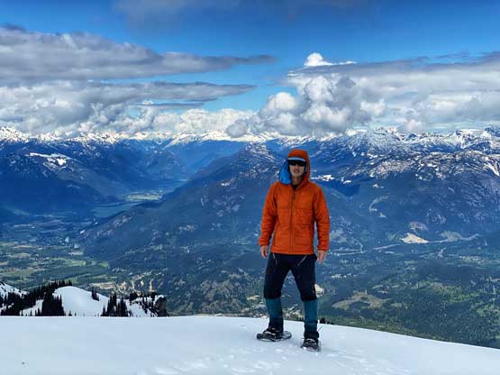
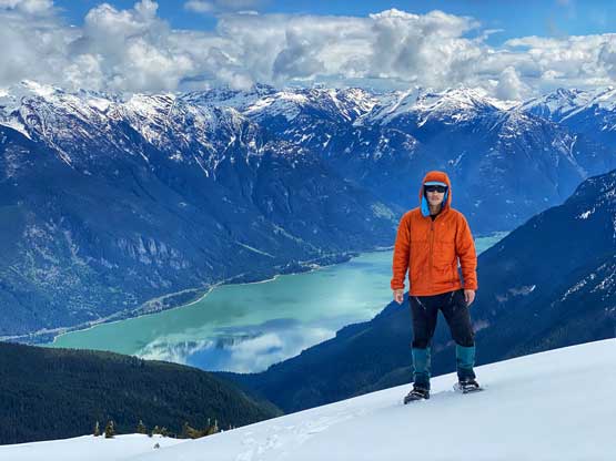
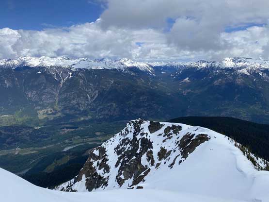
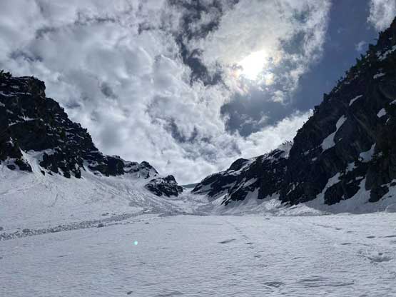
The going in the forest was steep but easy and I just followed the natural trend of the terrain making a few twists and turns and the next thing I popped out onto a small viewpoint at around 1500 m elevation. I remembered Simon mentioning a steep and narrow spot on the ridge at 1700 m that required detouring. With that in mind I decided to completely avoid that section by starting the detour at 1600 m. The snow was a bit too firm to side-hill comfortably on the steep grade so after a while I started ascending straight up through a few steep and open slopes. This got me back onto the ridge at 1800 m successfully bypassing whatever there at 1700 m. The rest of the ascent involving bypassing a minor bump to the right then going up some shallow gulch features to a “col’ on the uppermost south ridge. The weather had been cloudier than forecasted but the views were still great.


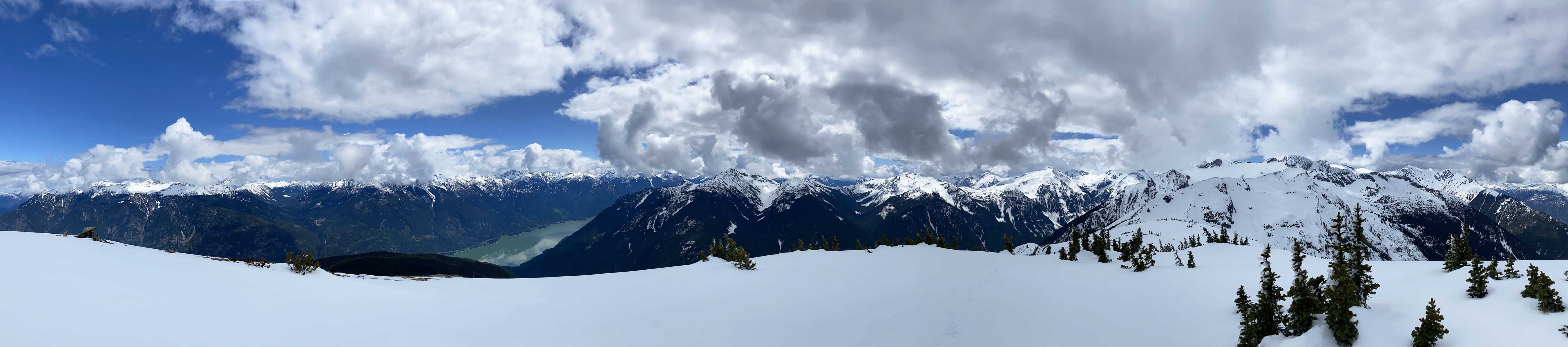


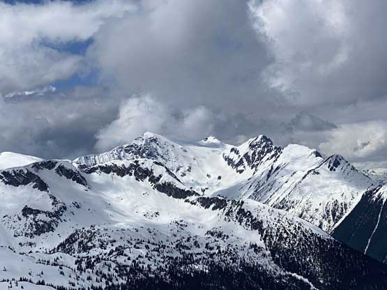
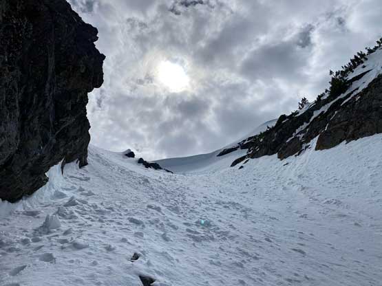
I wasn’t quite sure about descending a route that I did not come up and in fact I didn’t have any beta about the north face nor the NE Ridge, but after about 30 minutes wondering on the summit the curiosity won. Descending the upper NE Ridge involved one steep roll with careful snowshoeing and then I could look down the north face chute with the entire line finally in sight. With that I fully committed the north face descent. I spent a few minutes swapping snowshoes for ice axe and crampons and down I went. The initial pitch required me to down-climb facing into the slope (~40 degrees) and then I could walk down for a while. Towards the “hourglass” the terrain became steep again and now to my surprise, the condition was still decently icy down there. I was not particularly happy with the aluminum crampons and hiking boots. I could not front-point with this set of equipment so I had to kick hard a few times to gain some comfortable purchases. Thankfully the steep constraint was relatively short-lived. Careful footwork was still needed for a long section even after I was able to turn my face outwards. Eventually post-holing took over so I made another transition to take crampons off as it’s time to glissade. The condition was still on the firm side so I had to store the poles and hold the ice axe. This turned out to be crucial as the only way to slow myself down was by doing a proper self-arrest. Then the snow became softer as I lost elevation rapidly such that the glissading started to become enjoyable and not stressful.


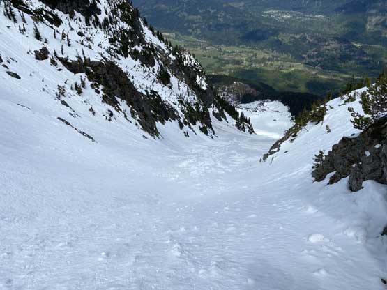
At around 1400 m I disappointedly found out that one of my poles had dropped during the glissade and I had no damn idea where that happened. I had been glissading for at least 300 meters if not more. I considered abandoning it up there but this is a BD Razor Carbon Pro with less than a year’s use and a pair was worth 180 bucks without taxes. As frustrating as it seemed I quickly strapped the snowshoes on, ditched the backpack and grunted my way back up the slope. I decided to re-ascend upward to 200 m and if I still couldn’t see it then I would donate it to the next party. Thankfully the luck’s on my side that I was able to retrieve the pole with just over 150 m of re-ascending. I gave up the idea of doing further glissading due to this mishap and just carefully snowshoed my way down the rest of this valley. At around 1100 m I started to lose the critical snowpack but I was able to weave around alders and had my snowshoes worn all the way down to the roads. To my disappoint the roads weren’t nearly as great as I was hoping for. I removed the snowshoes and thrashed it down anyway, only to discover the new, proper road a few hundred meters lower. The rest of the plod back down to the truck was uneventful. I had cell signal during this entire hike so to kill time I started to socializing on Facebook while walking down on this boring road.


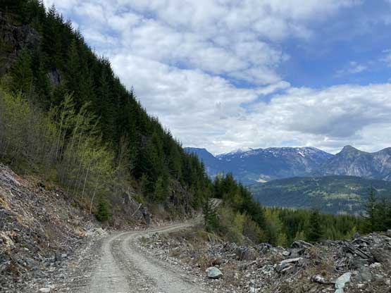
At the truck I did some thorough checks for ticks as I saw as many as 10 ticks on various stages of this trip with some fairly high up on the alpine… I did not discover any tick on myself nor my pack. The drive down the logging roads was actually quite fun with the steep grades. I took my time driving back home from Pemberton as I was doing good on time. I eventually got back to White Rock at dinner time.
