Wiseman Peak
January 24, 2014
2490m
Golden, BC
“Wiseman Peak” is an unofficial name of a small summit in the Dogtooth Range of the northern Purcells. This is the meeting are of three major mountain ranges – the Selkirks, the Purcells, and of course, the Canadian Rockies. Wiseman Peak isn’t a significant mountain by any mean, but does tower above the adjacent valleys by more than 1000 m, and judging by its location I’d expect terrific views on a clear day. I have to thank Golden Scramblers a big time for exploring this objective otherwise I’d never thought about going up there.
With good weather persisting through the second weekend in a roll, Eric and I decided to do our first trip in Golden area and we were excited about it. Eric was very keen to ski it. I thought snowshoeing would make a lot more sense since we could just simply follow Golden Scramblers’ snowshoe tracks up. The snowshoe tracks would be too steep for skiers and we had to break our own trail. But on the other hand, there’s only 1000 vertical meters in the bush so how bad can it be… Eventually I agreed to use skis, but I’d haul my snowshoes up just in case the terrain got over my skiing ability. For a day trip I don’t care too much about this bit of extra weight.
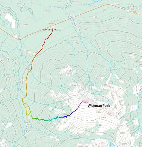
Wiseman Peak winter ascent route. GPX DL
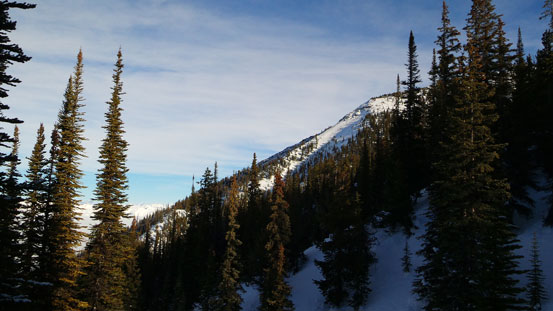
After a tiring and long drive we arrived at Quartz Creek snowmobile staging area (the trail-head), about 40 km west of Golden. We managed to catch up a couple hours’ sleep before starting the long trek in dark. The initial 4 km was following a groomed snowmobile trail up. At the point where we were supposed to turn climber’s left following a cut-block up we got confused. Despite snowmobile tracks the left side appeared to be a large avalanche path so we continued on. After another couple hundred meters we decided to leave the snowmobile trail and start the bushwhack. This initial part of the bush was the worst but thankfully we didn’t need to ski down it since we would re-join the cut block not far up. Continuing up it started to get better. The trail-breaking was also much better than expected, minimal expected for steeper areas. There was a very dense and steep band higher up proved to be very miserable. Eric did a great job leading up through this part. At this point we’d already broken through the low valley clouds and we were expecting terrific views once breaking the treeline.
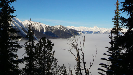
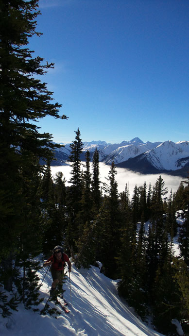
Gorgeous inversion view
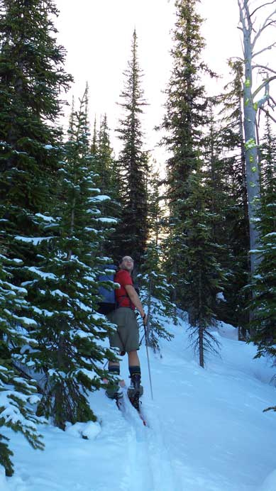
Eric skinning up.
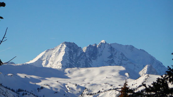
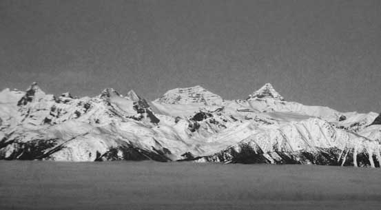
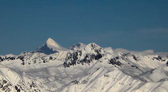
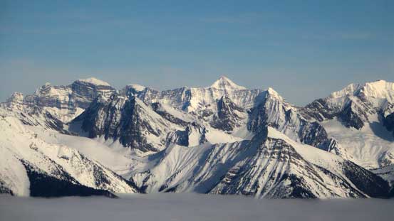
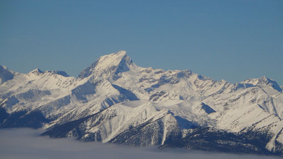
Hermit Mountain and Mt. Rogers massive
After what seemed like another couple hours’ trudging, we could finally get a glimpse of the alpine, and at this point we finally found Golden Scramblers’ old snowshoe tracks. We tried to follow them up but as expected, they were too steep for skiers so we were back to breaking trail again. Thankfully at this point we were not far from treeline. The alpine looked to be very wind-blown, and I decided to eventually ditch my skis at treeline and switched to snowshoes. The snowshoes gave me some extra grip on the icy and grassy slope.
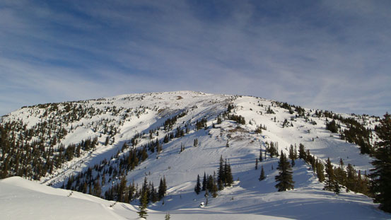
Finally got a sight of the upper mountain

At this point we came across Golden Scrambers’ old snowshoe track
Skinning up a steeper section

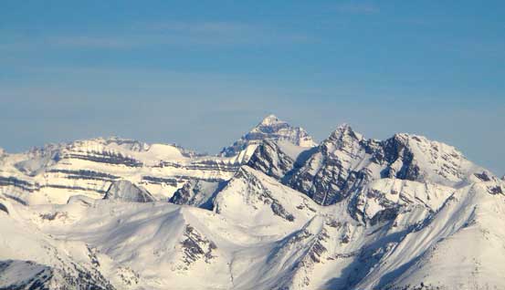
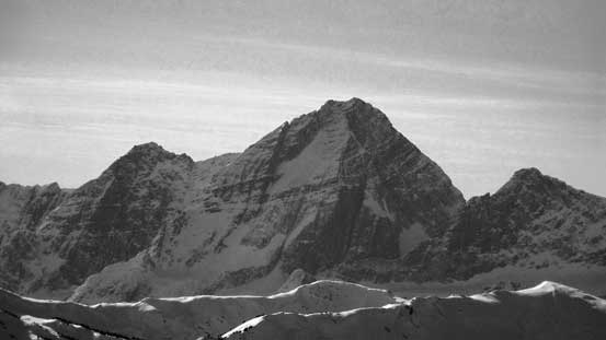
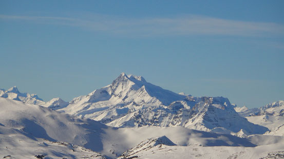
Dawson and Sir Donald
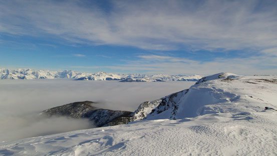
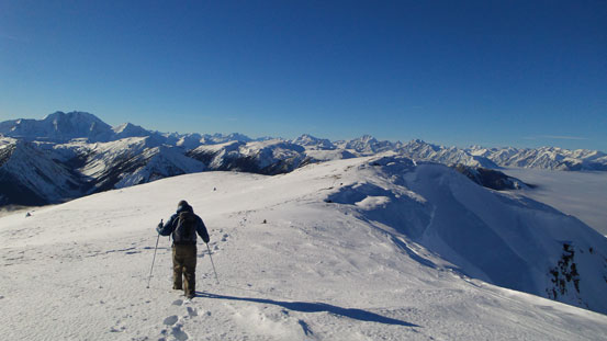
The foreshortened slope in the alpine
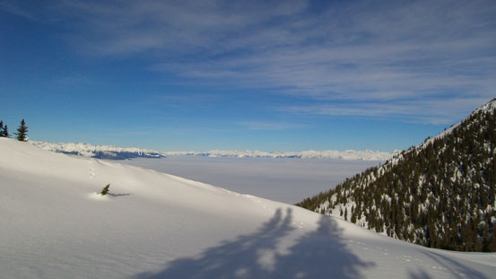
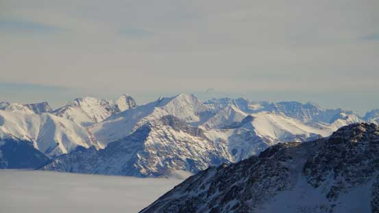
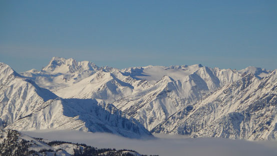
More gorgeous inversion view
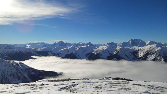
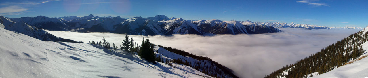
Valley inversion, with Selkirks behind
The true summit on right. We were jumping now!!
What appeared to be a short walk away turned to be a long slog. We discovered one false summit after another, and the slopes were extremely foreshortened. I forgot how long it took us to get there but certainly much longer than anticipated. The summit gives an unobstructed view of the west side of Rocky Mountains, from Mount Clemenceau all the way to Goodsirs. It also gives a head-on view of Selkirk’s giants like Sir Sandford, Rogers, Sir Donald and Dawson. Not to mention the full-on valley inversion. The entire Columbia Valley and Kinbasket Lake Valley were covered by a sea of clouds, with giant faces poking through. A spectacular summit view parallels what’s often expected from a remote 11,000er. It’s certainly one of my favourites to date.

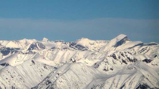
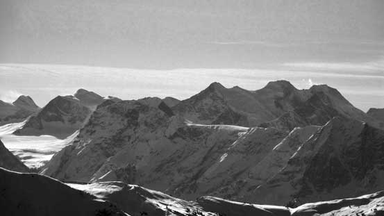
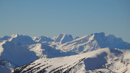
Panorama of Dogtooth Range in the Purcells from the summit. Click to view large size.
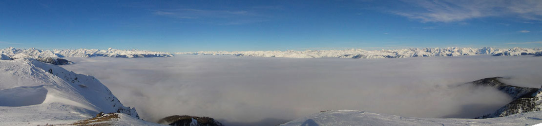
Panorama of the Columbia Valley, click to view large size.
Zooming-in towards Mt. Clemenceau and Tsar Mountain – two of the most remote 11,000ers
That might peak is Mt. Columbia, with North Twin poking behind just to its right
The remote giants up the Bush Road – Mt. Bryce (L) and Cockscomb Mountain (R)
From L to R along the skyline – Mt. Spring-Rice, Fresnoy Mountain and Mt. Alexandra
The big pyramid-shaped peak poking behind is Mt. Forbes

Mt. Laussedat looks quite different from this side than the typical view from Yoho

The massive Mt. Mummery
Giants on Freshfield Icefields – Mt. Dent on the far left and Mt. Freshfield at center
Peaks in the Lake Louise/O’Hara Group
Mt. Dawson massive is the 2nd highest peak in the Selkirks. Deville Neve on left
This is the Roger’s Pass classic – Mt. Sir Donald

Mt. Bonney and Mt. MacDonald

Mt. Tupper
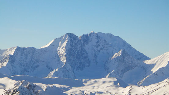
Hermit Mountain and Mt. Rogers massive
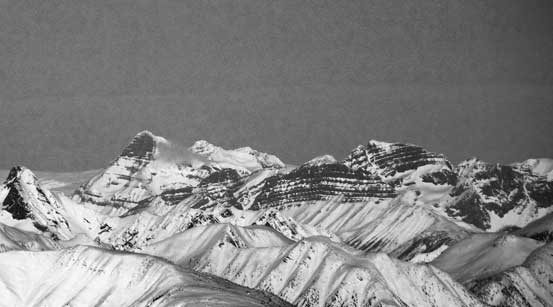
Cool peaks in the Selkirks. One of them is possible Mt. Carson
Nordic Mountain

Iconoclast Mountain
Argentine Mountain on left
Mt. Sir Sandford is the highest in Selkirks
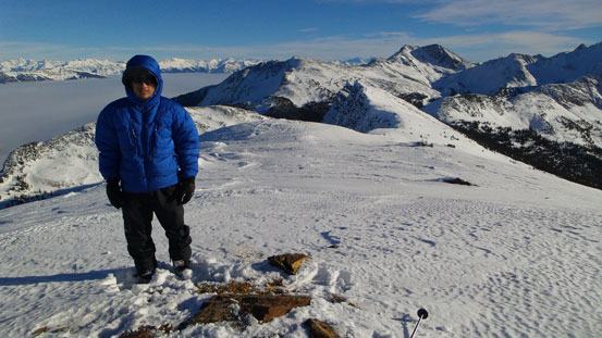
Me on the summit of Wiseman Peak

Me on the summit again
After spending nearly an hour up there it’s eventually the time to leave these views behind. Back to where we ditched the skis it was the time to see how much we could enjoy this descent. We both took the skins off but immediately faced the first problem. The snow was balling under our skis and they provided no glide at all. It felt like snowshoeing down-hill only being much more awkward. We had to take the skis off the scrape off the wet snow for a couple times. The condition barely improved lower down once the trees got denser. Eric again, did a great job leading down that steep and dense band. I was very glad I could manage to “ski” down this part (mostly kicking turn and side-slipping though). I was exhausted lower down but at this point I was already committed to finish the descent on skis.
Leaving the summit behind
One last panorama before going down into the trees

Time to put skis on
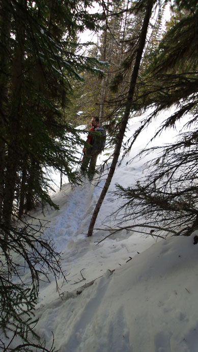
Some sections were not easy…
Eventually after a long time we made down to the cut block. Instead of retracing our tracks down the lowest bush, we ski’d down this cut block. It was good skiing here. We also discovered what was saw earlier wasn’t a giant avalanche path. It was just a man-made clearing. Back to the snowmobile trail, the last 4 km went by fast. Thankfully at this point all the snowmobilers had gone down (otherwise it could get pretty dangerous). We managed to make back barely before getting dark, and our round trip time was about 11 hours.
Overall this was a very satisfactory trip and I’d recommend to both skiers and snowshoeers. It has very minimal hazard. I guess the most dangerous part was dodging snowmobiles on your way down…
