Blustry Mountain
February 21, 2021
2334m
Lillooet / Fountain Valley, BC
Blustry Mountain is the highest peak in Clear Range to the south-east of Lillooet and Fountain Valley. This range sits in the rainshadow of the South Coast mountains and is probably the driest spot in SW BC. This peak itself has a rather broad, dull-looking and dome-shaped profile. What makes this peak stands out is the huge topographical relief. With over 1450 m of prominence this peak is almost an “Ultra” and with this status I’m not surprised that it’s been ascended and logged by quite a few local and international peak-baggers chasing this prominence thing. I too had been looking at Blustry Mountain for a couple years. It seems like most reported ascents were done via trail system in Rough Creek to the south-west of the summit and in summer time, they could drive quite a ways up the spur roads in that drainage. I liked how easy that route sounded but I determined this peak could be done in winter. However, to walk the entire Rough Creek road and to break trail the whole way one probably needs two days for the outing.
Matt proposed a “new” route that connected a few sections of the west and south-west ridges that started right from the powerline off the main Fountain Valley road. This seemed like the shortest and the most direct way to tag Blustry Mountain in winter conditions but the entire route had no road nor trail to facilitate. I had done a few ascents in Lillooet area in winter conditions and I knew they all turned out much harder than what sounded on paper. The forests are generally open but the ridges are usually chocked with dead-falls. The snow condition is rather Rockies than Coast and likely not supportive with or without snowshoes. Nonetheless I agreed with the plan as Lillooet was the only area that didn’t have enormous amount of precipitation in the forecast, but I expected a longish day with some quality suffering. Al and Sean also signed up for the mission and the four of us agreed to meet at Abbotsford at 3:45 am in order to give us plenty of time contingency as this trip had a ton of unknown factors. The ridge-top wind was forecasted to be well over 50 km/h with stronger gusts so we all came prepared this time with goggles and balaclavas.
As usual Matt offered to drive his monstrous sized truck and Matt drove fast. We drove through pouring rain up the Fraser Valley then the Fraser Canyon and the rain stopped shortly before reaching Lytton. The progress was much quicker than I thought. The Fountain Valley Road had signs of closure due to COVID but none of us even bothered to read as it’s clearly not enforced. The road itself was rather narrow and steep with some icy sections but didn’t impose much of a problem to Matt’s truck. We even managed to plow through a few inches of snow a short ways up the powerline road at 820 m elevation, shaving an additional 50 m of elevation gain.
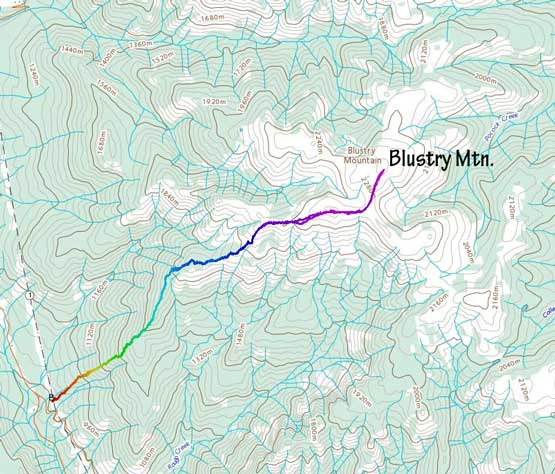
Blustry Mountain via W/SW Ridge. GPX DL
We started the day by gearing up with head-lamps but started the ascent right at the point when it’s bright enough to see without head-lamps. I brought two pairs of snowshoes in the truck and finally made the decision to use the 30′ Lightning Ascents as I anticipated bad conditions higher up, and this turned out to be a great call. The lower forest didn’t have much snow but we opted to use snowshoes nonetheless for some added traction. About 500 m of steep grunt later the snow finally became deep enough for proper snowshoeing, but as expected the snow condition was bottomless and we sank to the bottom even with the ‘shoes on. We took turn breaking trail up onto the ridge top at 1550 m elevation. The going was a bit slow but not horrendous at this point but the real game was the next 500 m of elevation gain. We followed the ridge trending north and then north-east over one or two subsidiary bumps with increasingly heavy trail-breaking effort. The worst was a steep section at around 1850 m where we mistakenly took a line too far climber’s left onto some wind deposited zone. This stretch had some waist-deep trenching even with my 30’ snowshoes. The other guys all discovered some chest deep holes that were hidden by some pick-up sticks.

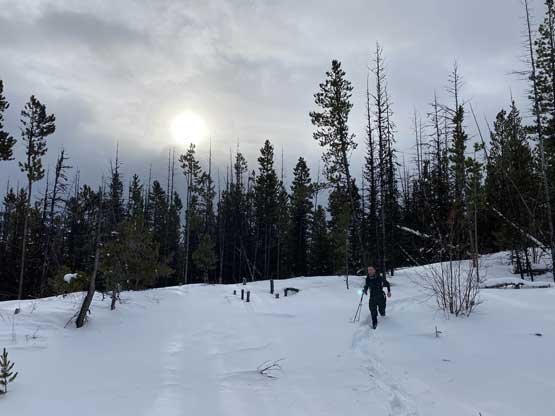
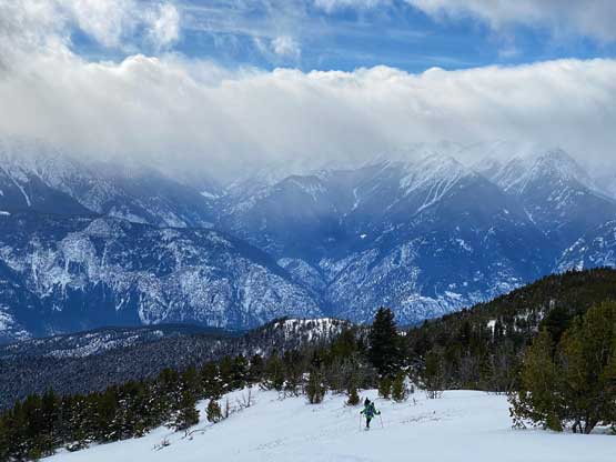
Good time to arrive here not wasting a single minute of daylight time
We followed a mini ridge feature at the lowest stretch

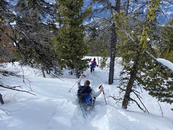
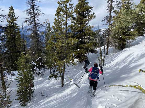
There were some bushwhacking but nothing too serious

Dead falls were the theme of Lillooet area forest
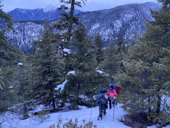
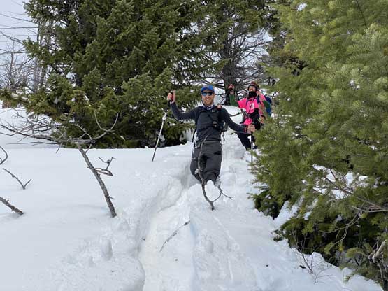
Al marching up. The trail-breaking was getting heavier

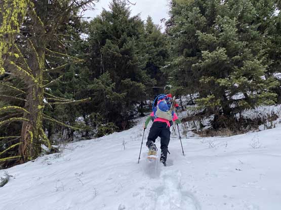
The grade of the lower forest was also very steep and sustained

The going on the ridge was pretty bad on all sheltered spots
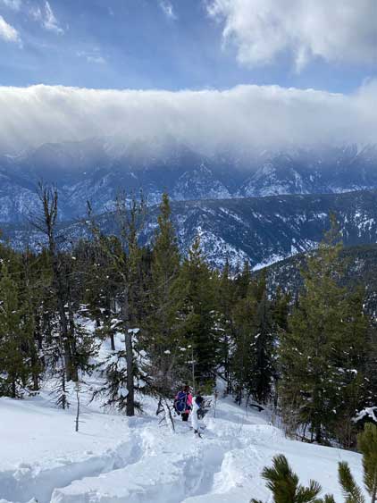
Sean coming up to the first rest stop break

Trying to go around this bump was a mistake.
Heavy duty of wallowing. The snow was absolutely shit with no base whatsoever
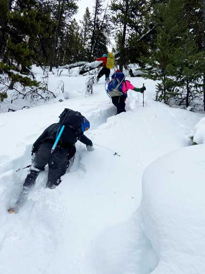
Vertical trenching…

Al, Sean and Matt coming up the worst stretch of wallowing

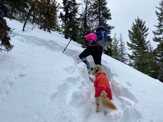
Not sure whether Twig was enjoying this snow or not…
We took a long break once this stretch of horror show was over but the next section was not much easier neither. While traversing up and over a forested bump we encountered unavoidable tight timbers in addition to the knee deep post-holing and the going was pretty slow. The terrain was also undulating and disorienting. After a while we dropped about 30 m down to a forested saddle and dealt with more knee deep post-holing to get out of this saddle on the opposite side. Eventually we came out to an opening area at around 1950 m elevation and the post-holing nightmare finally came to an end. The south-west open slopes were wind swept and the snow depth was only a few inches thick. There were still a few deep stretches but the effort was negligible compared to what we had done lower down.

Sean thrashing through this stretch of dense timbers

Finally emerged out of the trees. Matt and Twig charging up
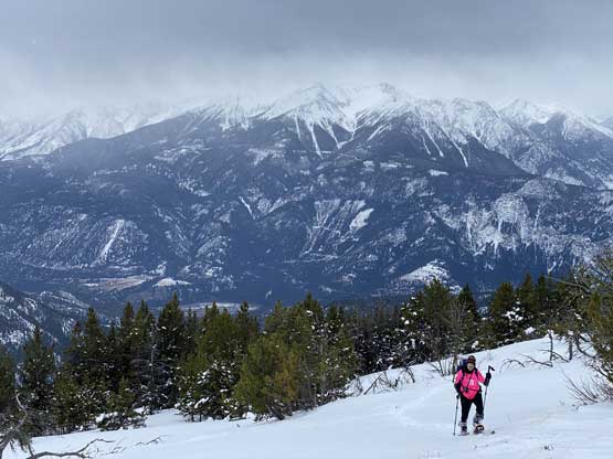
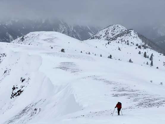
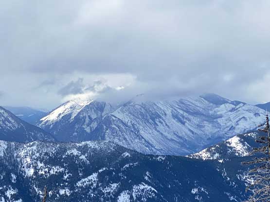
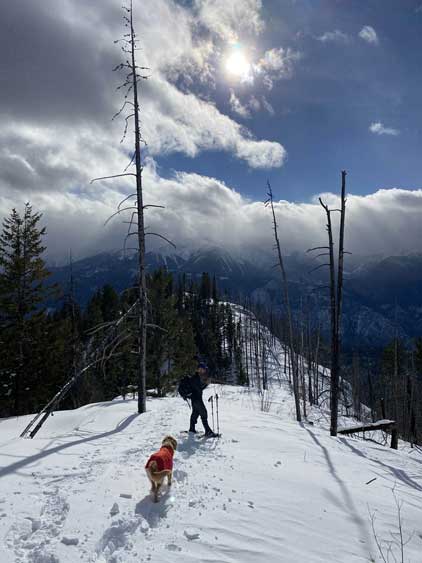
Al coming up with “Towinock Mountain” and its sub peaks behind
The end of this stretch of open slope before the alpine zone

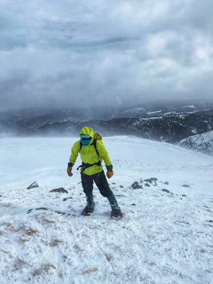
Twig trying to enjoy the last bits of calm before embracing the winds
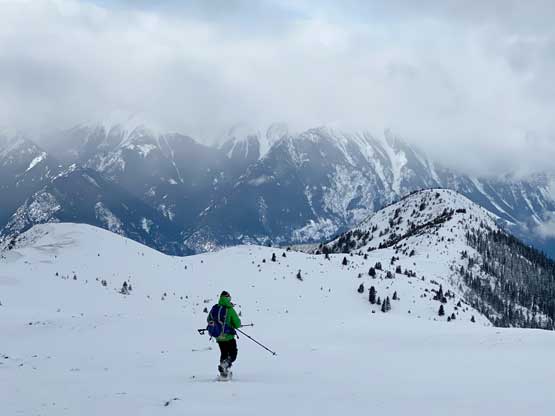
The wind suddenly picked up as we crested the west ridge in the alpine zone. A few of us took our time donning goggles and balaclavas and into the zone we plodded. The wind was mostly blown from behind and the ridge was mostly blown bare so the eastward traverse up and over a sub-summit was easier than I thought. The worst was the final push onto the true summit via its south ridge. The wind was blown from the side and the gusts were really picking up. Thankfully it’s not a long stretch and we soon all reached the very top. Taking a self-timed group shot on the summit was unfortunately, not possible.
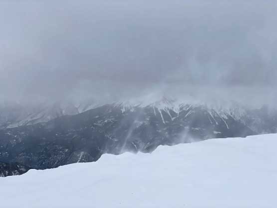
The typical wind gusts on the alpine zone
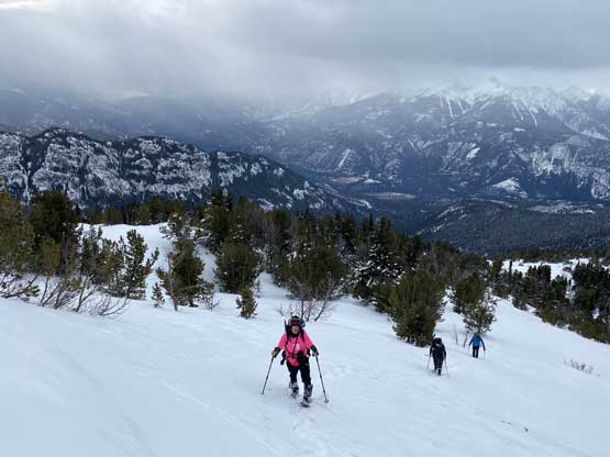
Al plodding up one of the several bumps on the west ridge

Matt and Twig went far ahead to tag the summit

To the north is Cairn Peak, only marginally lower than Blustry Mountain
Me on the summit of Blustry Mountain

Sean, Al and Matt on the summit of Blustry Mountain
The descent back through this alpine zone was the worst as we had to face into the wind. The Storm Degree Parka came handy as otherwise I would have been cold. Taking pictures in this wind was actually the crux since my iPhone required me to take gloves off for any operation. We all zoomed down to treeline to finally take an overdued break. I was very hungry at this point but the alpine was just too harsh to stop and eat. Descending back through the bottomless powder was much easier than going up but not effortless. We had to be careful about holes and pick-up sticks that were hidden under the snow, and the bushwhacking also required caution as the branches were very stiff and pokey. The sun surprisingly came out for a while as we descended the lower ridge section facing south. For the final descent back to the truck we all opted to take snowshoes off and slipped and slid on the steep grass. I’m more comfortable handling terrain like this wearing my stiff mountaineering boots. I did not wear them on this day, so I opted to descend a little slower and more cautiously than I normally would.
Sean fighting the head winds on the descent off the summit

Matt and Twig descending with Askom Mountain as a backdrop

Another photo of Matt and Twig descending far ahead
Al descending with views gradually showing up

This is looking across a sub-ridge towards Fraser Canyon far low down
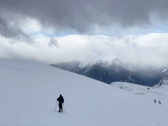
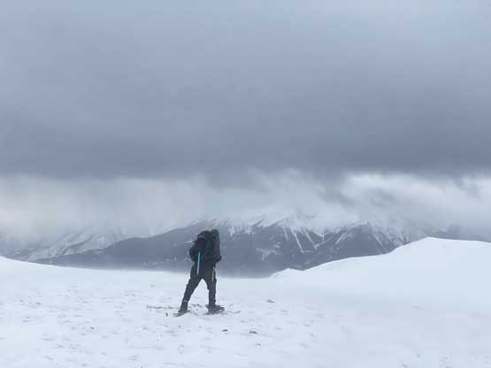
Sean descending the still-gusty alpine terrain
Fountain Ridge in full show in foreground

This is looking down into Fraser Canyon and sub-peaks of “Towinock Mountain”

Sean continuing the descent towards treeline zone

Al catching a hidden pick-up stick and taking a face plant…
Sean taking a fall as well trying to glide on his snowshoes
Al descending yet another open stretch with more views now
We took a short-cut to avoid that waist deep section
Joining our up-tracks. The post-holing was pretty heavy even on descent

There were a ton of dead-fall fields.

Al plodding back across the burnt forest stretch

“Fons Peak” in foreground is the highest on Fountain Ridge.
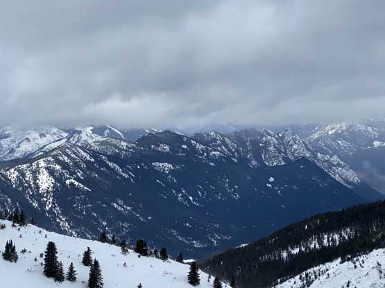
Mt. McLean the highest on Mission Ridge was still engulfed in clouds
Sean and Twig descending

We were not expecting sunshine on this day

The last bits of descending on the ridge before bailing down the forest
The typical descent in the upper forest

We took snowshoes off in the lower forest. It was steep and slippery

Done. It’s truck time now…

An obligatory tailgate shot before hitting the road
The round trip time was 8.5 hours so despite the harsh conditions and weather this trip turned out shorter than anticipated. I think we all pushed very hard and this ascent was certainly a team-work effort with some strong determination and perseverance. Matt again, did a fantastic job driving us back into the Lower Mainland and we all got back home at a reasonable time.
