Pelion Mountain
July 22, 2018
2312m
Squamish / Squamish Valley, BC
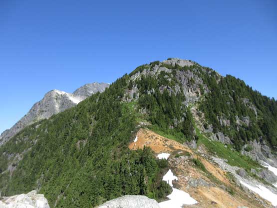
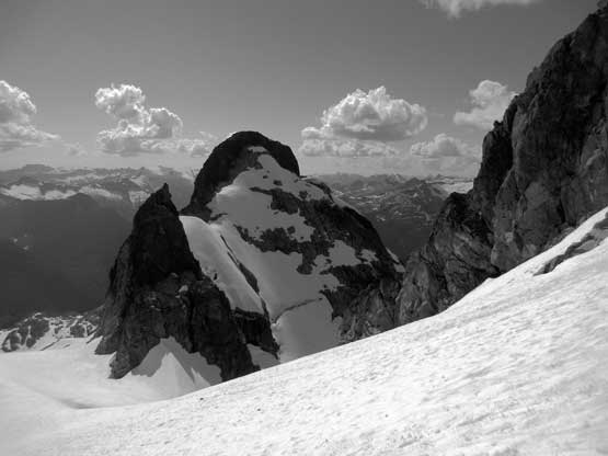
Pelion Mountain is a beautiful summit guarding the northern end of Tantalus Range, and despite the close proximity to Mt. Tantalus this is still a major summit very recognizable from almost anywhere along the Sea to Sky Corridor. It’s taller than its guidebook neighbour, Ossa Mountain, and has no “scramble route” to the summit. To me this is what makes Pelion Mountain more appealing… The first ascent party did it from the south side by a sea-level bushwhack but nowadays the standard route starts from Sigurd Creek trail. It’s also a sea-level-up kind of push but at least the vegetated section is done on a maintained trail. The standard ascent route crosses several small glaciers on the N/NE side of the peak and ascends some exposed 3rd-4th class rock (or mixed, depends on the conditions). It seems like this peak is most attempted by ski mountaineering parties in the time frame of “late spring”. The abundance of snow coverage does smooth a lot of things out, but does make the final ridge traverse a real mountaineering practice.
It’s also worth noting that the standard route of Pelion Mountain shares 90% of it with the North Ridge route of Mt. Tantalus and for solely this reason I had absolutely no desire to do Pelion Mountain on a spring skiing trip. It’s not an easy haul to get that far up on the shoulder and once I do get there I would want Tantalus, Zenith, Pelion (and possibly Ossa) all bagged in the same batch, and this would have to be in late July time frame. Alex, Ben, Matthew and I shared the same thoughts on this group of peaks and once seeing a solid window forming up we pulled the trigger. Earlier in this trip we had already ascended Mt. Tantalus and Zenith Mountain.
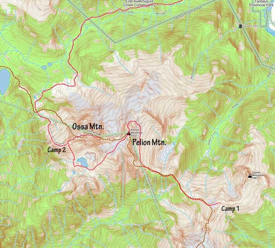
Pelion (up NE Ridge down SW Face) to Ossa Traverse route.
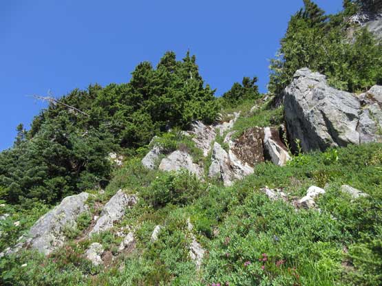
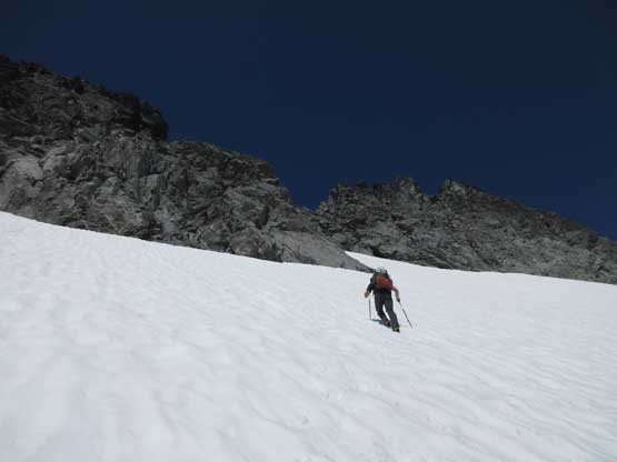
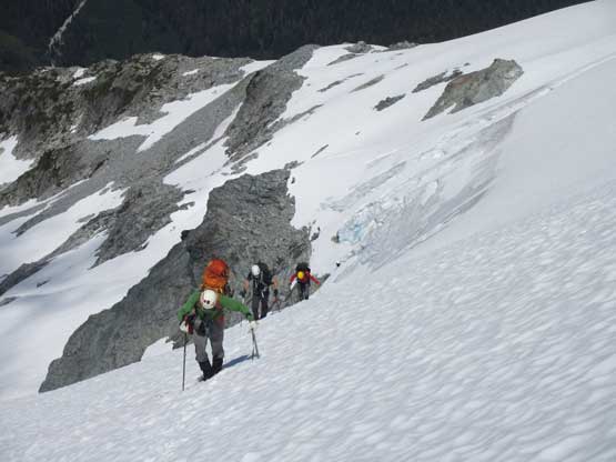
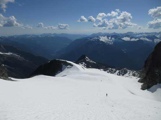
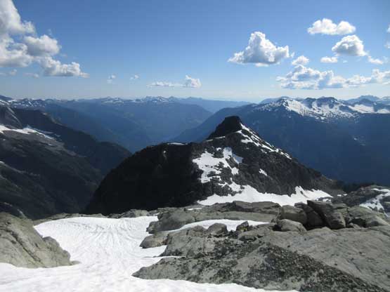
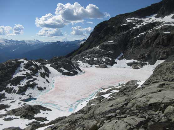
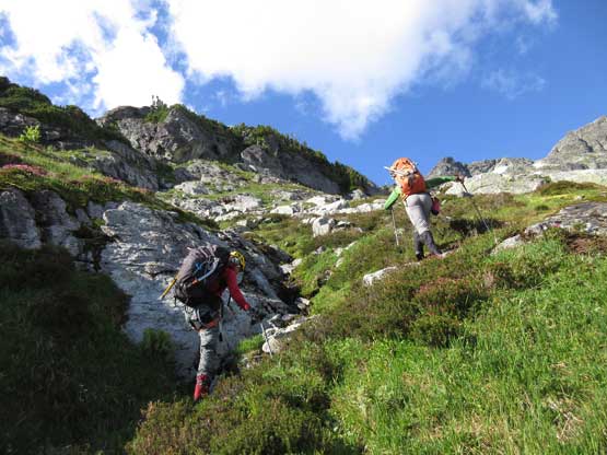
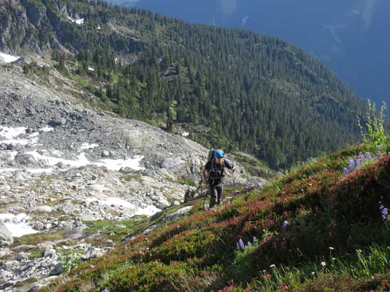
From our camp near Pelion/Zenith col we crossed several mellow snow slopes and descended easily down into the lowest point, about 200 vertical meters below our camp. This is not the most pleasant terrain to travel through but is surely a lovely place with two beautiful tarns competing against each other. The upper tarn is actually a 5-star bivy site. We didn’t use it because that would be too far away from Zenith Mountain. Upwards and onward we soon faced that infamous of “vertical moss” pitch that several parties had to rappel (N-S direction), or pitch out with crampons on (S-N direction). Upon examining up-close we decided to just scramble it and despite the heavy packs it felt pretty straightforward. The vegetation was all bone dry and grippy so that’s probably what made the difference. We continued over one or two smaller bumps before ascending steeply onto the snow bench underneath Pelion Mountain. This snow bench would lead diagonally up towards the distant “Pelion’s shoulder”, although the view was foreshortened.
Leaving our camp beside Zenith Mountain in the morning
Me and Ben with Zenith Mountain behind. Photo by Alex R.
Alex and Matthew descending towards the first tarn.

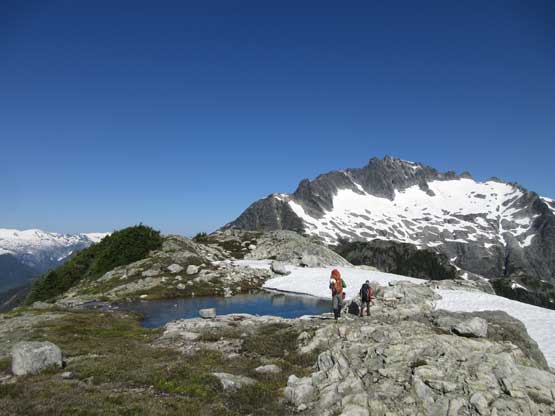
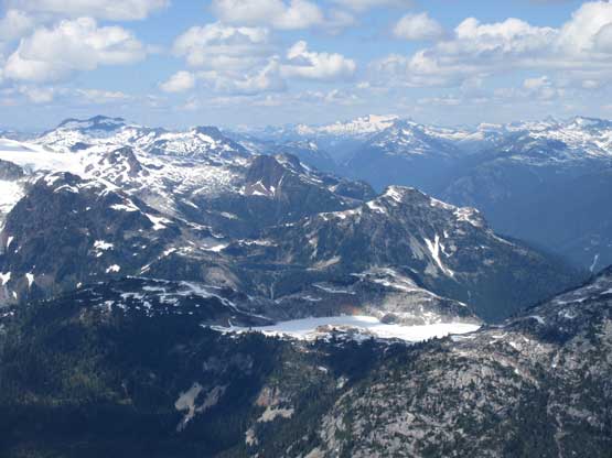
The first tarn with Pelion Mountain behind
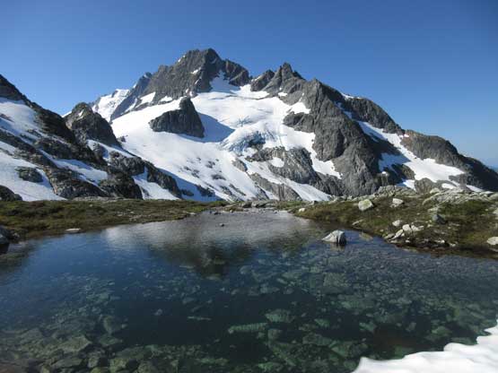
This is still at the first tarn, with Mt. Tantalus behind
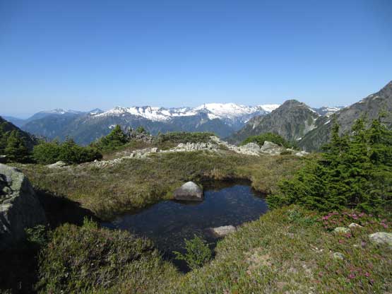
Lovely terrain along Pelion-Zenith ridge, but not the most pleasant to travel
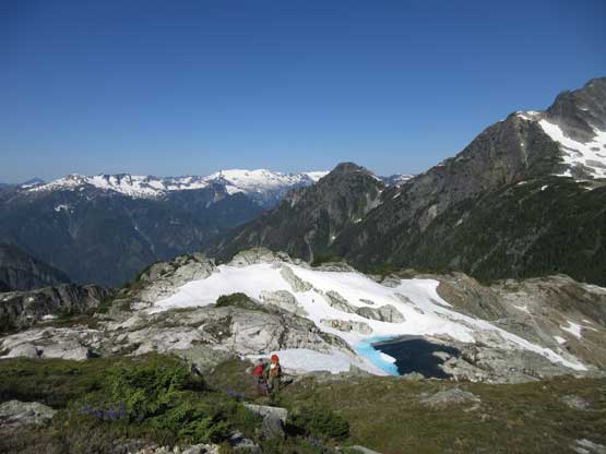
Descending open country towards the second tarn
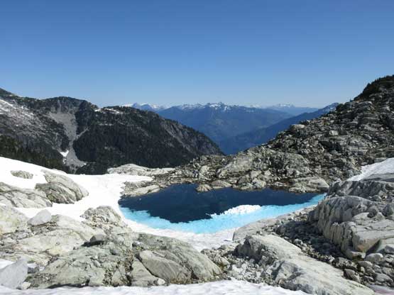
This is the second (lower) tarn. Not as pretty as the first one
Time to slog up again. This is that tricky bump
At the base of the “vertical vege” pitch

After some discussions we decided to scramble it. It wasn’t bad at all
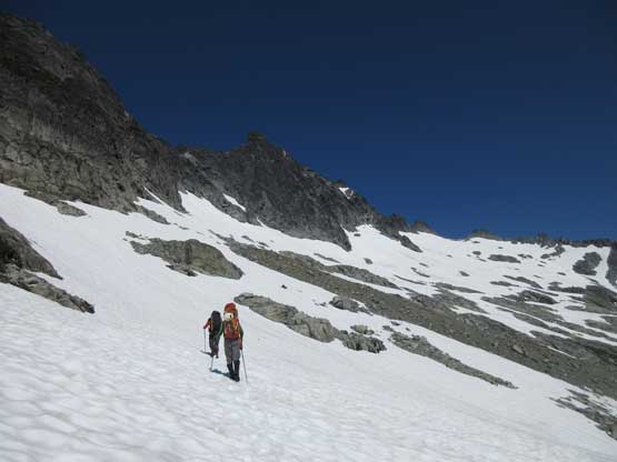
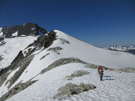
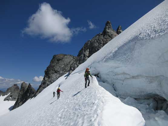
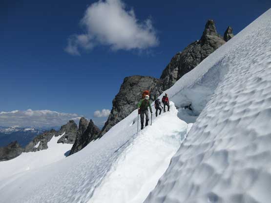
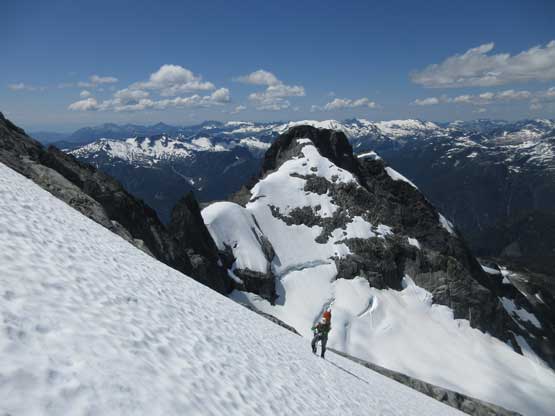
After another long while we were at the long-ass traverse now
Matthew partway across the snow traverse with Mt. Tantalus behind
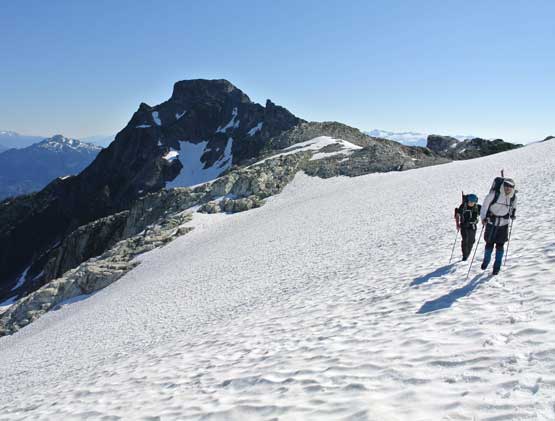
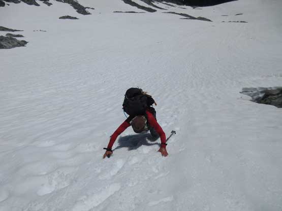
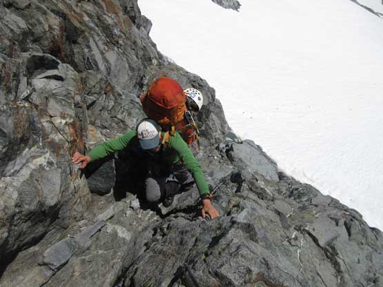
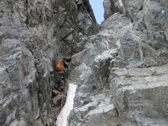
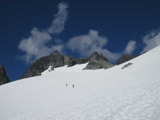
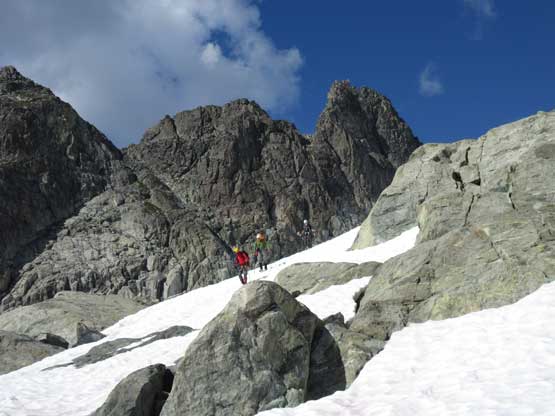
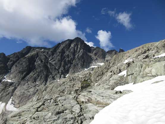
Matthew and Ben took turns leading across this long ass stretch of diagonal side-hilling bash. It was not pleasant as expected, but the snow was soft enough that we didn’t have to do a lot of gear transitions. Our plan was to ascend up and over the summit to explore a more direct route to Ossa Mountain later in the day, so we wouldn’t be going all the way to “Pelion’s shoulder”. This is a critical part of the route-finding. Instead of traversing onto the broad shoulder our aim was a small, technical col in between two rock spires. It appeared far from “correct” but I had done enough research and I knew that was for sure the way to access the upper hanging glacier on the north side (which was not visible at this point). The snow angled up to over 40 degrees and then we had to do an awkward transition onto rock over a sketchy moat. The rock appeared to be troublesome but we decided to solo anyway, and it sure was – a sustained pitch of stiff 4th class brought us to the col. We barely made it without having to mess around with ropes.
Ben leading up the increasingly steep snow slope
The terrain’s over 40 degrees and we should have donned gears, but too lazy to do that
After an awkward transition onto rock we had to climb this… Photo by Alex R.
Alex squeezing up a tight move. It was very difficult with an overnight pack…
We continued soloing sustained 4th class terrain. This would be snow in May
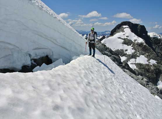
Finally gaining the col and we had access to the upper glacier.
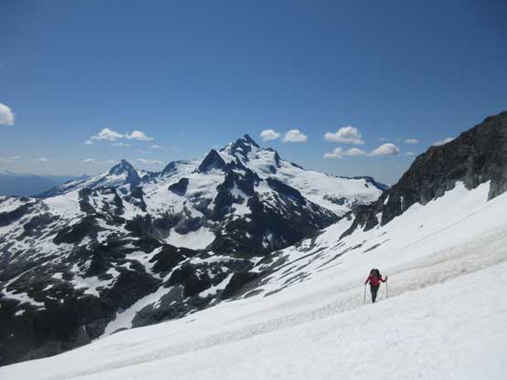
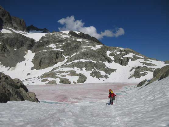
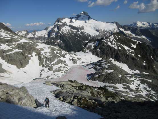
Onto the upper glacier we picked up the tracks set by the legendary Eric Carter and his group just a couple hours ago. The glacier started out easily but immediately after gaining some elevation we faced a gigantic bergschrund spanning across the entire slope. The only pass was on the far climber’s right side and thankfully it still went. Above the schrund we zig-zagged on increasingly steep, but still easy slopes to the upper reach of NE Ridge.
As we gained elevation we soon saw that gigantic bergschrund
Traversing high on the upper glacier
Guys checking out the gigantic bergschrund
Me on the lip of the bergschrund. Photo by Alex R.
We crossed the schrund and this is another shot
Continuing up. It’s steep, and foreshortened
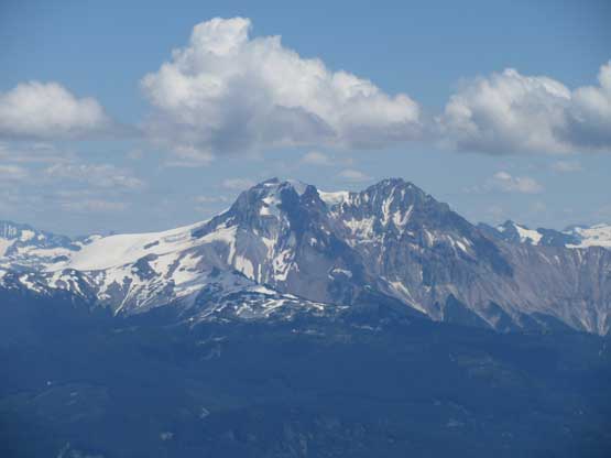
Alex with Ossa Mountain behind
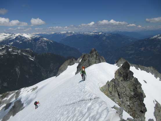
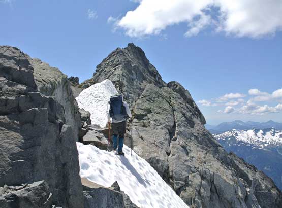
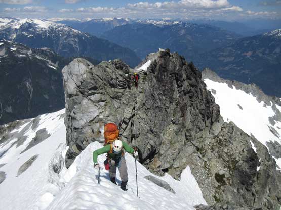
Gaining the NE Ridge finally
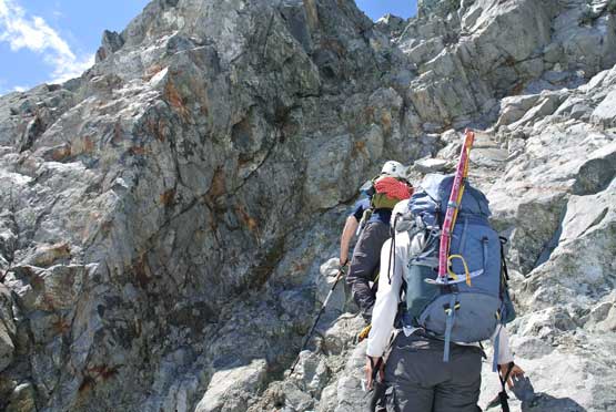
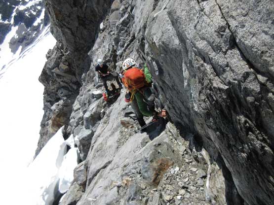
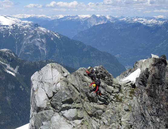
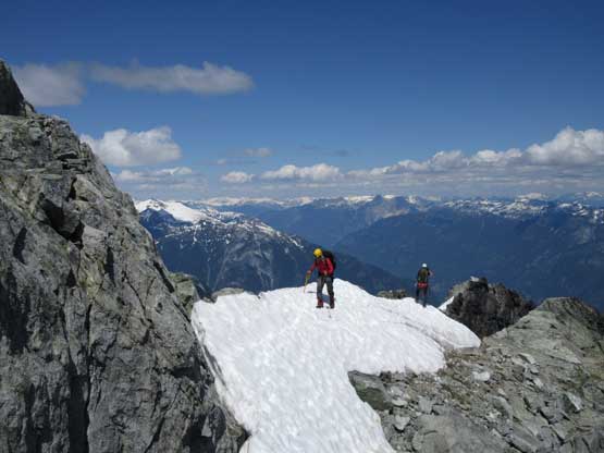
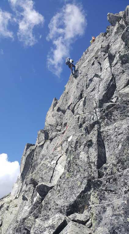
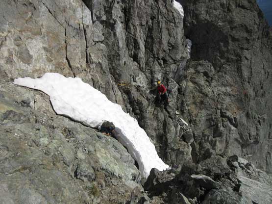
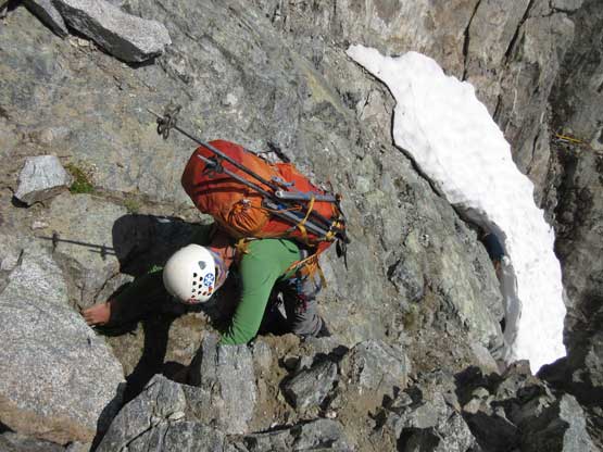
The ridge started out easily on a snow arete but soon the snow ran out. There were at least two more patches of snow higher along the ridge so we didn’t bother to transition gears. The crampons were kept on and it sure was awkward, but we made it work. There’s some exposed 3rd-4th class moves with crampons on. Once the snow totally ran out we removed the snow gears and scrambled exposed 3rd class to the highest point. We carried everything up there because we were going to descend the SW Face. It looked nowhere “easy” but we could rappel.
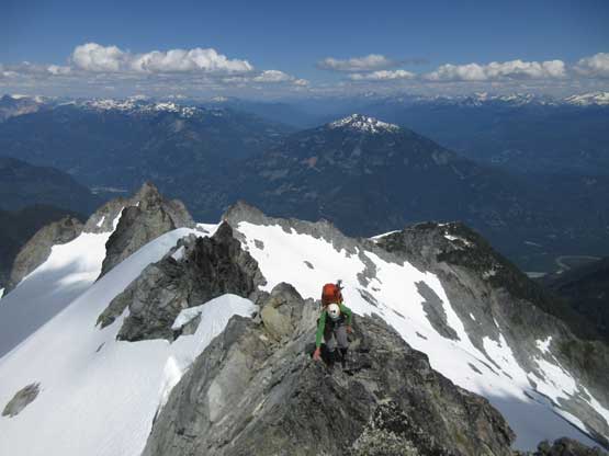
Me leading across the NE Ridge. It’s not easy. Photo by Alex R.
Alex tackling the first exposed snow arete
Meanwhile Matthew and Ben are having some fun time with the rock section
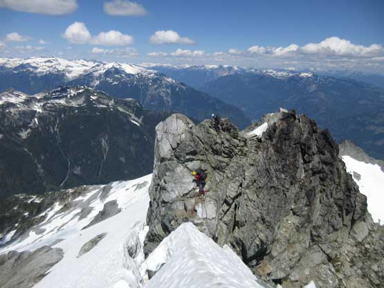
This tower was very interesting especially with crampons on..
Matthew and Ben on the second snow arete traversing
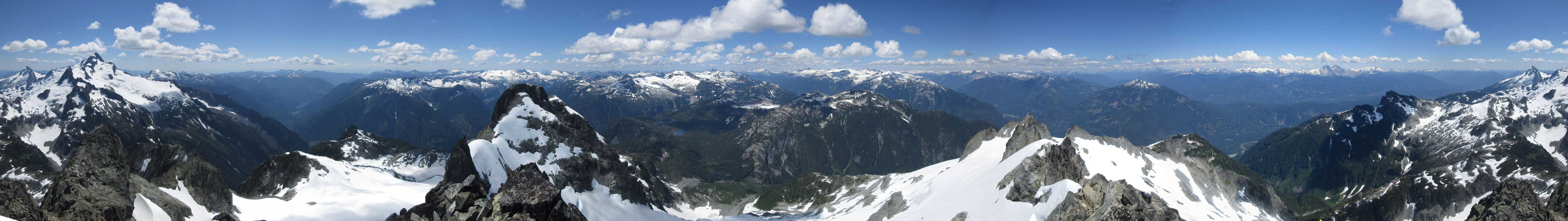
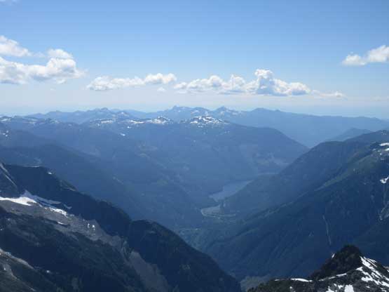
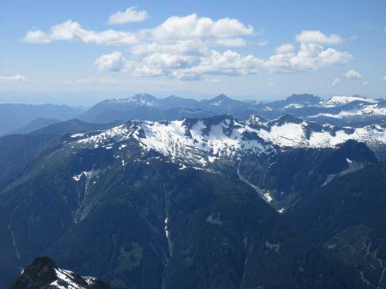
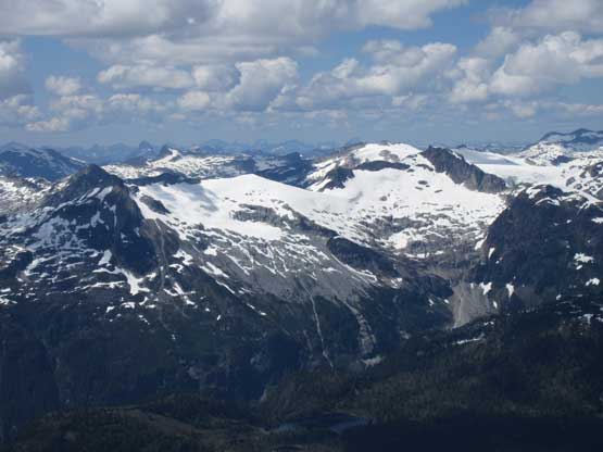
Summit Panorama from Pelion Mountain. Click to view large size.
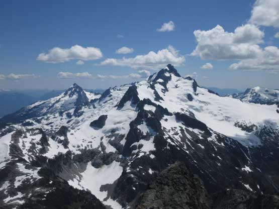
Looking back at Mt. Tantalus which we ascended the day before
This is looking far down into Clowhom Lake valley. This is rarely travelled
Phantom Mountain in foreground
The massif of Mt. Jimmy Jimmy which I soloed last year
If you know this ares you can spot Sigurd Lake (frozen) and Coin Lake, and Coin Peak
A zoomed-in view of Mt. Garibaldi massif
Alpha Mountain
A wider shot looking back towards Sea-to-Sky Corridor
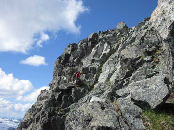
Alex scrambling exposed 3rd class to reach the summit
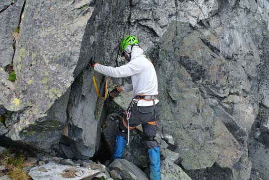
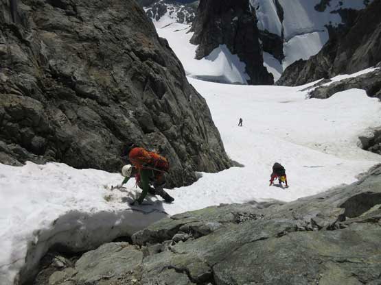
The SW Face descent was the experimental part of our design that we had no idea whether or not it would go. We did bring enough gears to do several 30-m rappels, if needed. Upon checking our the immediate surroundings we found a rappel station not far from the summit, and then there went the first full-length rappel. This got us about 1/3 of the way down the face and then we had no idea where to go. The terrain funnels us to go downclimber’s left into a “gully” feature but one could not easily get down into the gully. We slung another boulder with a piece of webbing and went for another 30-m rappel. This one was considerably more awkward than the previous one. The problem? There’s still no easy way to get down onto the south glacier but we had a couple options. We had reached snow in the gully but we had to descend over an overhanging moat/bergschrund. This could be done by rappelling off a picket but Matthew went around to search for other options, and sure he found one. We all down-climbed some dirty 3rd class, made a sketchy gear transition and down-climbed some 45-degree snow in an adjacent gully. Once everything’s over we were down onto south glacier and by now all the technical climbing was behind but we were still on exploratory terrain.
Me on the first rap. Photo by Matthew B.
Mathew exploring the unknown SW Face. We had to find a way down
After a while we decided to rappel off this block. Photo by Alex R.
Alex on the second (more difficult) rappel
We ignored the third rappel and went to search for a scramble route.
It sure was awkward but we all managed it.
After another awkward transition we got down down-climb some steeps
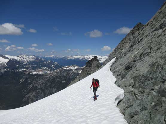
I had put at least a couple hours digging the south side of Pelion/Ossa to decide what would be the best way to link them up and the conclusion is that we probably had to drop all the way down to that lake. This was still fine as comparing to doing each via the standard route we still saved 500 m of elevation loss/regain. It turned out that we did have to descend all the way to the lake. The outflow was easily crossed on a snow bridge and contouring the south/west shore involved some annoying micro-terrain with up-and-downs. The 300-m ascent up the south slopes to the high shoulder on Ossa Mountain was straightforward, thankfully. It was just steep, but without any real scrambling and the next thing we dropped our packs and got the tents set up beside a large patch of snow.
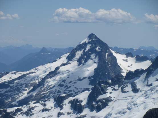
Ossa Mountain looks really cool from here
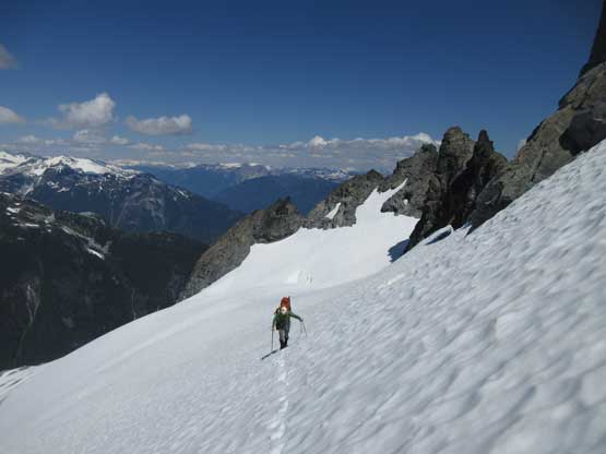
Plunging down the relatively unknown south glacier of Pelion Mtn.
This is looking back towards the summit. The face we descended looks terrible
Down, down and down with route-finding
We zig-zagged trying to stay on snow.
After a long while we were not far from this frozen lake
This is looking at the south face of Ossa Mountain
Contouring around this lake was frustrating
And then we had to scramble up some steep greens
Ben soldiering up
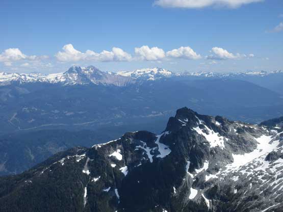
We were not far from Ossa’s shoulder now. Looking back at Mt. Tantalus
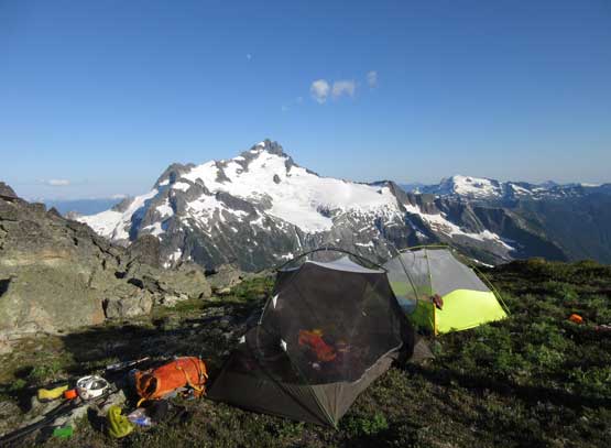
We got our tents set up before going for Ossa Mountain
At this point our decision was to ascend Ossa Mountain right around sunset, as why not…
