Mount Brew
July 6, 2021
2891m
Lillooet, BC
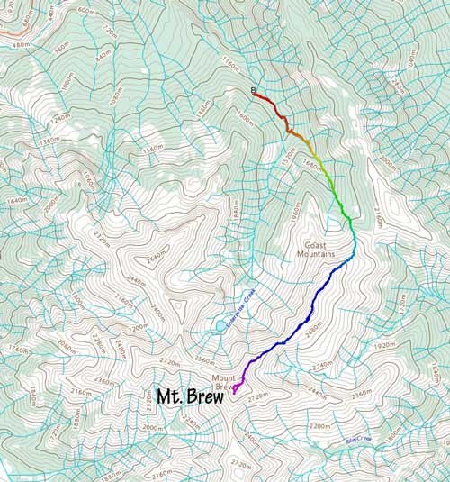
Not to be confused with Mt. Brew near Whistler, this one is also in the South Coast ranges and has the exact same name but is a whole lot bigger in size. It’s the 5th highest peak in the loosely-defined region of “SW BC”, looms 2500 vertical meters above the town of Lillooet and Fraser Canyon and also boasts over 1000 m of prominence. This peak may appear like a “walk up” as the summit is broad and dome-shaped but the most logical route nowadays is the NE Ridge, which contains fair amount of 3rd class scrambling on loose and exposed terrain. The long and undulating south ridge from “Towinock Mtn.” used to be the way to go, but the Lillooet locals had barricaded Texas Creek Road and meanwhile, the Enterprise Creek FSR was improved and a trail was cleared from the driveable end all the way to the treeline on Mt. Brew’s NE Ridge. These days Mt. Brew can be easily ascended as a day-trip via NE Ridge and Enterprise Creek approach, but the drive is still a massive one for those living in the Lower Mainland.
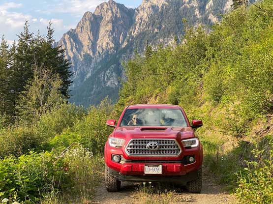
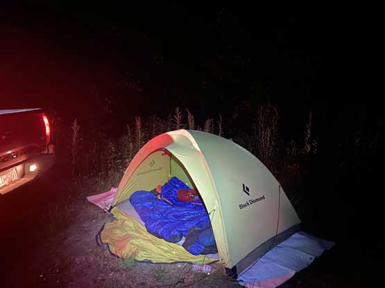
In the last few years the internet had seen quite a few detailed trip reports of the NE Ridge and the conclusion I got was to wait till it’s bone dry. People had climbed this route with snow but it sounded unnecessarily sketchy whereas in dry conditions it could be fun scramble. I talked to Holly the day before in the morning as I was looking to get out for a day-trip and among the few suggestions she picked Mt. Brew and the plan was to head out in the evening and car-camp at the trail-head. This meant we both had only a few hours to get ready and that was not an easy task considering we both had other commitments during the day. We did make it work and by 7:20 pm I picked her up from downtown, and three hours later we were in Pemberton. The drive up and down the Duffey Lake Road was a slow show in the dark as I must pay attention to animals, and the 10+ km of ascent on Enterprise Creek FSR was also a slow crawl. The road was never in a “rough” shape but had numerous water bars and some steep grades. By the time we finally parked at the driveable end it was already 1 am and we still had to set up the tent. Needless to say, this was an exhausting push.
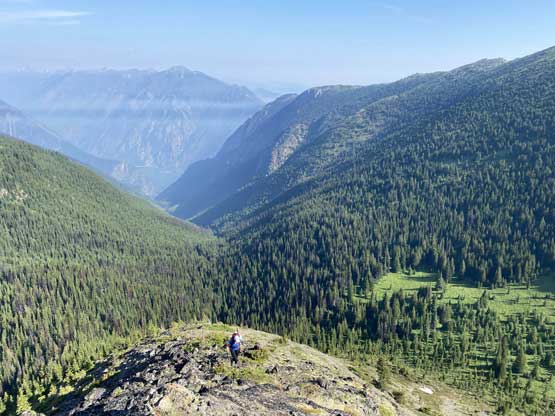
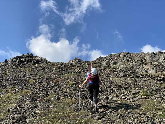
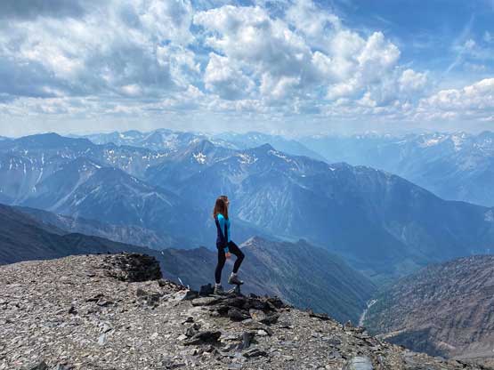
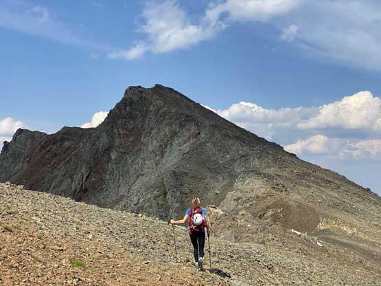
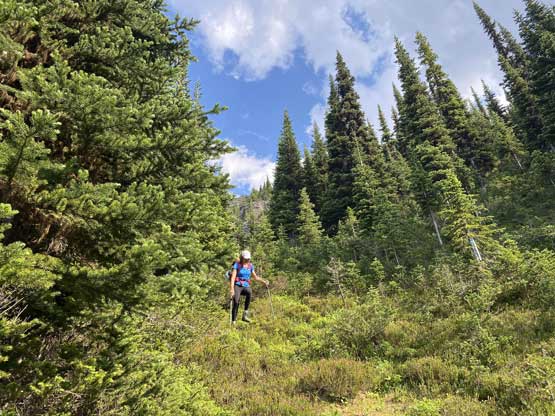
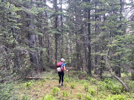
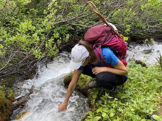
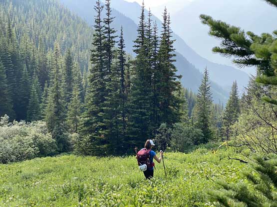
The next morning we agreed to wake up at 6 am and started the day an hour later. I was hoping for an earlier departure time but we were just too tired. It had been quite a push for me since Elkhorn Mtn. as I was either driving or hiking for like 6 days in a roll and most of the days I did not get enough sleep at night. In the morning I did a bit of extra work to pack the tent even though we did not expect anyone else to show up and steal our gears. The trail started by descending towards Enterprise Creek then crossed the creek on some decently well-constructed foot bridges. The trail work was amazing. There were some blow-downs but overall the trail was very easy to follow. Things became trickier as we ascended higher and the trail became faint and undefined whenever we were crossing an avalanche path. The grass was also soaked from either yesterday’s rain, or the morning dew such that we were both drenched in literally no time. The grade of this trail was sustained and steep, for 600 m ascent out of the forest. The mosquitoes were horrendous at the treeline zone such that the first energy break was a lot less enjoyable than it should. The view looking back down towards Seton Lake was great but we just couldn’t enjoy it as much due to the bugs.


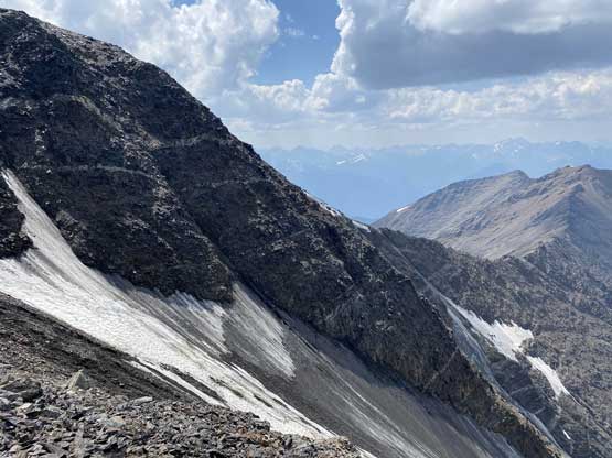
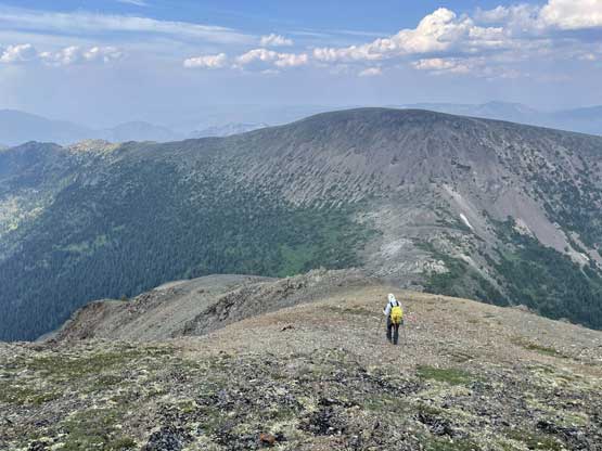
To gain the lower NE ridge I did not follow the GPX track sent by my other friends and instead, we picked a direct line by gaining the ridge that’s immediately ahead. This was a bit of a gamble but in the end worked our perfectly and shaved off some distance. The original track traversed towards the broad pass between Mt. Brew and “Brew NE5” and that seemed unnecessary. After this short bits of variation we still had a few hundred meters of slog on easy terrain and then we found ourselves traversing a broad and flattish ridge for a few kilometers horizontal.

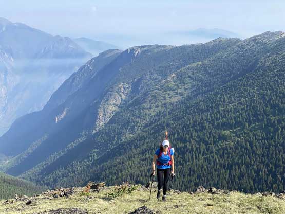


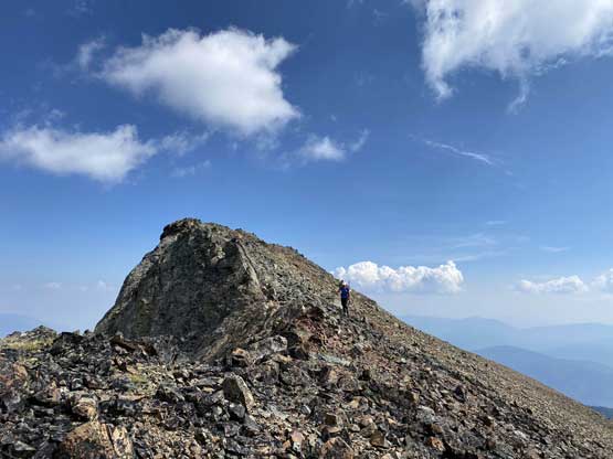
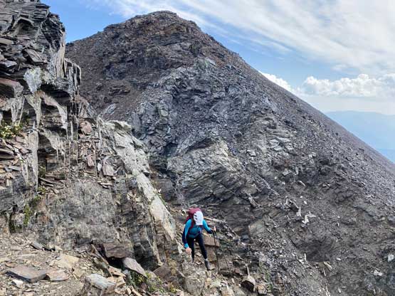
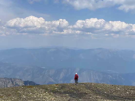
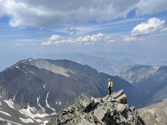
Over 100 m of the hard won elevation must be lost unfortunately while descending towards the “notch” on Mt. Brew’s NE Ridge. We thought about to bypass some of the undulating terrain but in reality the only route that makes sense is the stick on the ridge crest. Just before descending into the chasm we took another break ditching ice axe and crampons as they sure appeared not needed on this day. We also donned helmet because the scrambling appeared loose. The notch itself looked worse than it was such that the ascent out of it was rather fun. This trip started to remind me the good ol’ Canadian Rockies terrain that as long as you stick your nose into it some weaknesses will always appear.
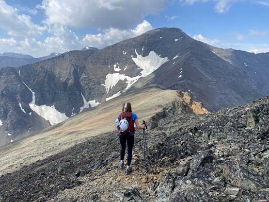

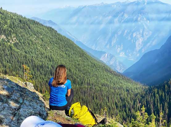
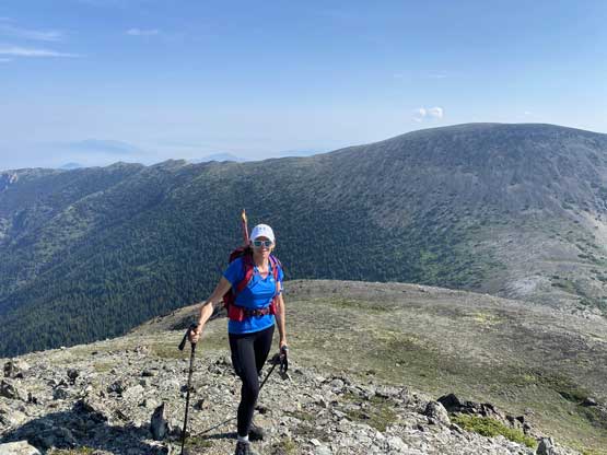
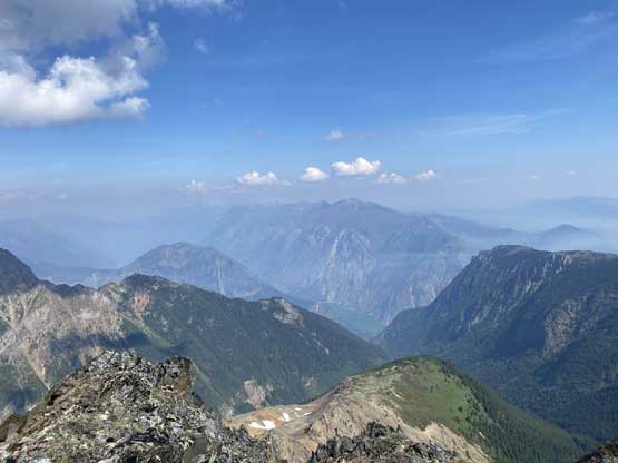
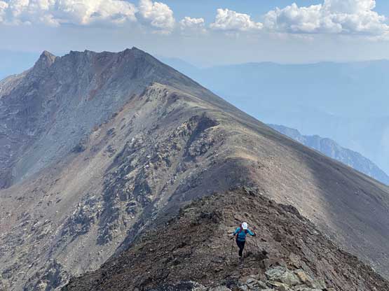
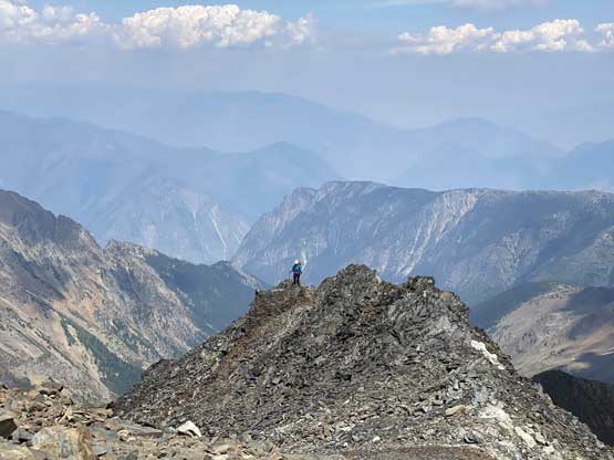
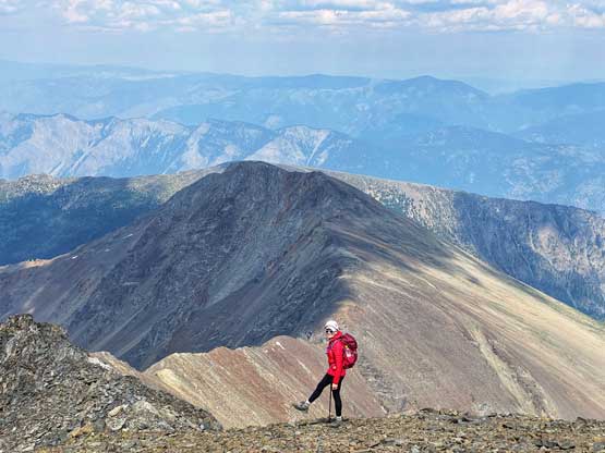
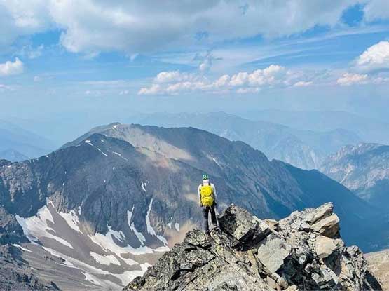
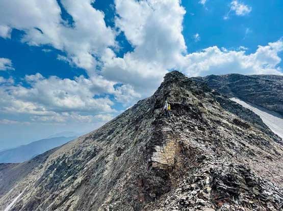
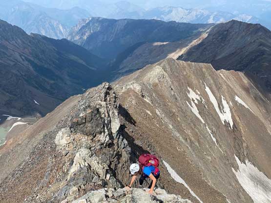
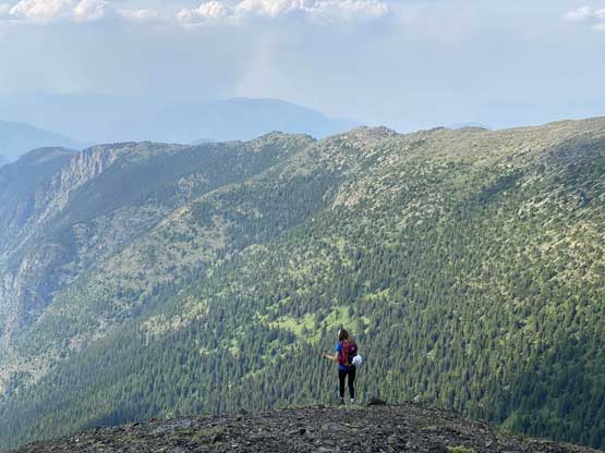
From the bottom of the notch we still had 400 m to gain to reach the summit. The lower half of this final NE Ridge ascent was again, mostly on easy terrain but the upper ridge offered some decently challenging scrambling with route-finding. For most of the time we attacked the ridge directly head-on and that proved to be the best solution. The scrambling was again, not as difficult as it appeared from afar. There’s one buttress higher up that I opted to bypass by traversing an exposed ledge out climber’s right. Holly chose to follow Al’s GPX track by traversing/ascending loose 3rd class terrain on the left side. Both lines worked and after that we just had to slog to the highest point. The very top of this mountain was boring and too flat for the views, so we kept traversing until we were on the edge of some drop-offs on the opposite side of the summit plateau. We took a loads of photos and at least an hour of break. I even fell asleep for a bit but the downside was the presence of mosquitoes even at this elevation.


On the descent I decided to use Holly’s variation around that buttress and then we simply just stuck to the ridge crest and down-climbed the series of 3rd class steps. The rocks were loose but I never felt horrified. From the bottom of the notch we again, thought about to bypass the chuck of elevation regain but upon consulting with the maps we realized that the best way was again, sticking to the ridge crest and embracing that 100+ meters of slog. After that we had an easier time descending the lower NE Ridge with improved lighting in the late afternoon hours. The mosquitoes of course came hard on us while we descended into the trees such that we were decently rushed to hike down on that steep trail. This peak might not feel like much on paper considering how much elevation one has already dispatched by driving up Enterprise Creek FSR, but overall it’s still a massive day with 1900 m cumulative elevation gain.


Our round trip time was 12 hours. As always we did move quickly but we took massive breaks here and there including at least 1.5 hours of break on the summit. The downside of the leisure pace was the lateness of the day. It was 10 pm when we eventually got back to Pemberton and even the McDonald’s was closing. I really wished we could have camped for another night but Holly had work the next day. I eventually dropped her off in downtown past midnight and got back to my home in White Rock after 1 am. A total of 11-12 hours of driving, 12 hours of hiking with only a few hours of sleep in the middle. That was a bit too much for me. I would have felt perfectly fine back in my Rockies time but I’m no longer 19 years old anymore. It was a great hike though and I’m super happy about this trip.