Dickerman Mountain
December 5, 2017
1756m
Mountain Loop Highway, WA
Dickerman Mountain is the official name but this objective is more commonly known as “Mt. Dickerman” in the hiking community. But because I’m a peak-bagger I have to stick with the official name. So where the hell is this Dickerman? Folks from Vancouver, British Columbia probably have never heard of it but for those from Seattle, Washington this is one of the most popular hikes along Mountain Loop Highway. The elevation gain is reasonable for the averaged crowds. The same route can also be done in winter conditions which further enhances its popularity.
My inspiration mostly came from some recent posts in the “Washington Hikers and Climbers” Facebook group. Despite some heavy recent snowfall that trail had just been broken to within 300 m from the summit. I’m a huge fan of saving easy summits for winter and this immediately got me interested in this particular objective. After a bit of internal debates I opted to abandon my original plan (a peak up the Duffey area) and drove down south instead. And because this was supposed to be pretty short I didn’t wake up until 6:30 am. About 4 hours later I parked my Tacoma at the trail-head. The road was completely free of snow so I could have got by with just the Corolla. But better safe than sorry. Meanwhile two other hikers showed up who later recognized me out in that Facebook group.

Dickerman Mountain hiking route. GPX DL
This was the first day of a major warming trend so I did expect the tree bombs to fall off but little did I know it was literally showering in the forest. There were massive chucks falling off on a regular basis too. Thankfully I did come prepared with a helmet and right off the bat I had to put it on. Even so I was scared as you simply wouldn’t know when a big chuck’s gonna fall on yourself… I did make a mistake for not bringing a pack’s cover. My “wallet” is just a zip-lock bag and that’s 100% waterproof which is OK, but I forgot to protect my passport from the liquid water. The result? It was completely soaked… Thankfully I noticed that when I did the first food/water break and that prevented further damage on my passport. At about 4000 feet elevation this trail crosses a drainage and then the snow depth had some dramatic increase. Another 300 feet later I started to post-hole and then the snowshoes were strapped on.

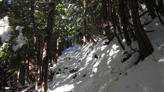
This is the very lower reach. Pretty sure these snow are all gone now.
The snow’s becoming continuous

Transitioning into the winter wonderland
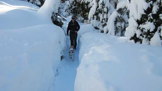
I don’t know what’s the story behind making this trail…
The trail then ascends a broad shoulder feature aiming at the distant lower west ridge. Once it touches the edge the view into the north side was inspiring to say the least and then I got a sudden boost in my energy. Meanwhile the boot paths slowly made a transition to a snowshoe trail and it’s becoming clear that I was following a previous snowshoe party’s tracks up. Not to my surprise these guys stopped at about 200 m below the summit and opted to call it a day there. I went over for a short conversation before resuming on. For me myself it made no sense to quit at this point but the trail-breaking was tough going. The penetration wasn’t too bad with my 30′ Lighting Ascents but the wet surface snow had created some serious balling problem under my ‘shoes. The added weight was surely a pain but with perseverance the conditions slowly improved as I worked towards the summit.

Here’s roughly where I donned snowshoes.

Upon hitting the lower west ridge I could see the NW Face.
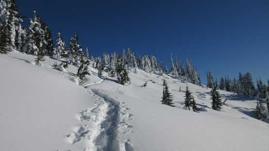
Upwards and onwards. The trail would stop soon.
Looking back.
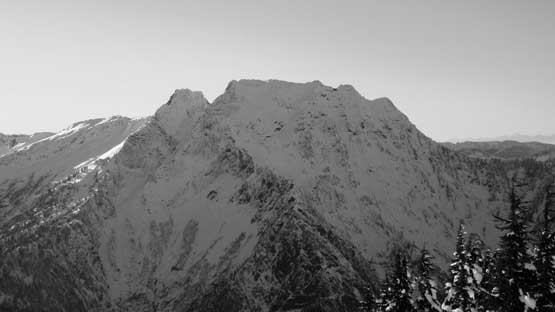
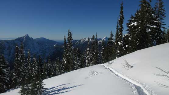
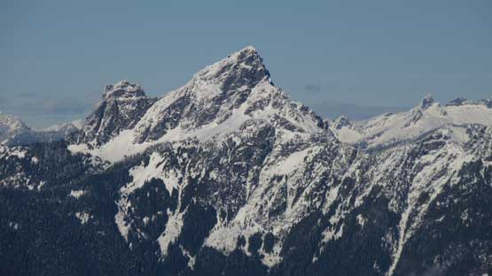
Big Four Mountain apparently doesn’t get a lot of ascents

Now I’m on my own breaking trail… Heavy duty…

At least the views were getting amazing.
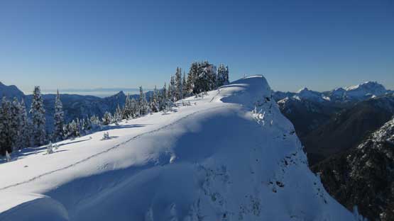
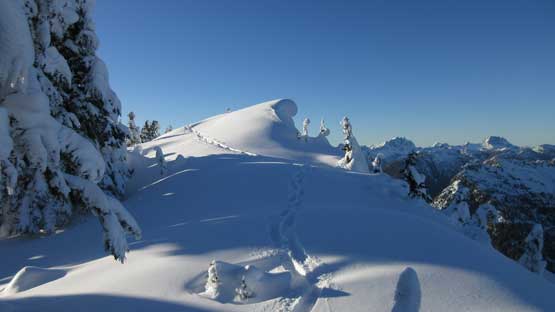
A straight-up beeline bearing had got me to the summit ridge about 150 meters west of the highest point and the highlight of this day was traversing this stretch of ridge. There were massive cornices dangling over hundreds of feet’s cliffs on the north side and that added a bit of mountaineering feeling. The highest point was disappointingly wooded so I carried on to the next highpoint on the east side. That was a gorgeous spot with mind-blowing views towards all directions and despite the lateness I opted to do a long summit stay. It’s particularly satisfying to look at the giants nearby knowing I’ve already tagged a few of them in the last two years.

This is where I hit the summit ridge.
Looking north towards White Chuck Mountain

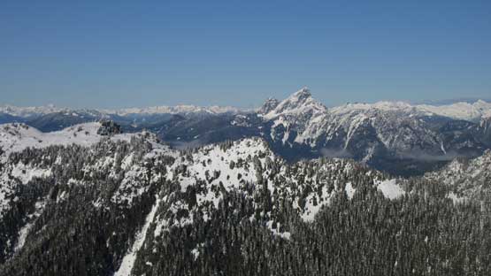
Three Fingers and Whitehorse Mtn. are the icons nearby
Traversing the summit ridge was very scenic

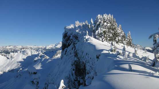
Winter wonderland!!

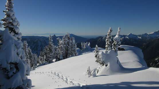
My lone snowshoe tracks on the virgin snow…

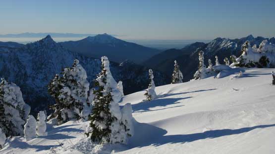
This is a southern view from the traverse. Del Campo Peak on the skyline
A view from the true summit. Too bad it’s mostly wooded.

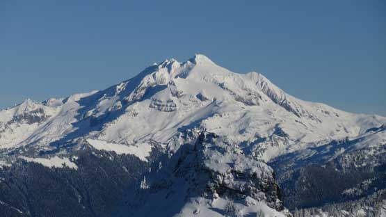
This is looking over Twin Peaks towards Glacier Peak

Mt. Forgotten with Mt. Pugh behind

Mt. Baker behind Stillaguamish Peak

Three Fingers

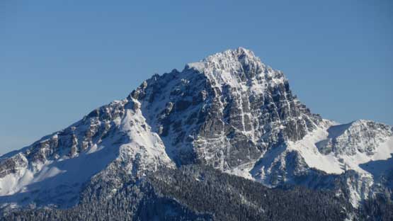
Whitehorse Mountain

Mt. Shuksan
White Chuck Mountain

Mt. Forgotten

Dome Peak
Glacier Peak
The “Matterhorn of the Cascades” – Sloan Peak
Looking back towards the true summit from the eastern sub-summit

Panorama from Dickerman Mtn. Click to view large size.

The rugged Monte Cristo Group

Me on the summit of Dickerman Mountain
Eventually I realized it’s time to head home and just after reversing the summit ridge traverses I met the two girls on their way up. We had previously met at the parking lot and it’s good to see them pressing on. After a short talk we resumed our own paths. For me the next stage was a enjoyable plunge down on snowshoes and I stayed on the soft powder for as much as possible to save my knees. This worked pretty much just as expected, and as soon as the path became supportive enough I took the ‘shoes off and started plunging on foot. The fact I was wearing a pair of Nepal Evos helped with edging and balancing. Descending a slushy trail is always an enjoyable thing if you have the right footwear. In no time I caught up with the party-of-three. And again after a bit of short conversation I past them and resumed my own path. The new task was to get back to the parking lot before head-lamp time and I surely succeeded on that. The whole descent took me less than 2 hours which was not bad, not bad.

Back to the true summit, looking east towards Sloan Peak on the horizon
Reversing my own snowshoe tracks back across the summit ridge

This particular step is a bit steep and exposed
Mt. Pilchuck on the western horizon

The two girls would later watch sunset from the top.. How cool would that be!

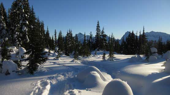
I resumed my descent. Now down to the “meadows” area

Beautiful tracks with the Monte Cristo Group peaks behind
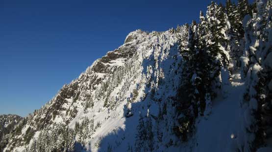
Another shot of the NW Face of Dickerman Mtn.
Almost back into the woods…
Not wasting any time I immediately started the engine. The drive out of Mountain Loop Highway was very windy and as soon as I got some cell signals I loaded my next destination onto the Waze app. This is an app that likes to direct you onto some less known paths and it surely got me onto some very narrow and windy roads. I had absolutely no idea where I was going but the next thing, I was back in Arlington. Onto I-5 my next stop was the Olive Gardon in Burlington. I killed about 2 hours in the restaurant before resuming the northwards drive, and the final crux, the border crossing was without event, and this concluded another productive day in the mountains. Objective highly recommended.
