Mount Warren
August 4-6, 2020
3362m
Jasper / Icefield Parkway North, AB
Mt. Warren is one of the 4 additional “lucky” peaks that made into the fabled Canadian Rockies’ 11,000ers list in the 3rd edition of Bill Corbett’s book. Among these four, Mt. Warren is the one that’s generally accepted to be definitely above that magic elevation threshold so regardless one’s attitude towards the added peaks this one needs to be done. The standard route of Mt. Warren involves only steep snow up to 40-45 degrees but the main challenge is the approach. There are only two ways to get there. The normal route traverses the entire stretch of Brazeau Icefield from Icefield Parkway and involves a massive, 400-meter elevation drop on the icefield and in dry years the glacier travel can be problematic as well. The other option involves significantly less hiking and glacier travel, but requires one to canoe across the entire stretch of Maligne Lake and bushwhack. This might sound easy on paper, but paddling 20+ km down a lake that’s often windy is not for the inexperienced neither.
About 7 years ago I did my first trip onto the Brazeau Icefield with Shaun Vincent and Clayton (Candy Sack) from ClubTread and climbed Mt. Brazeau, Valad Peak and Mt. Henry McLeod but didn’t do Mt. Warren. The farther and more remote summit wasn’t even on our agenda because we weren’t seriously going after the 11,000ers list. Now 7 years had elapsed and I only had 3 11,000ers left to finish the list, so I must come back even if that meant I had to repeat the unpleasant slog. I would consider the Maligne Lake option but only if I had more experience in water sports and we had an electric motor to ease the paddling effort. I had none, so the standard trudge from Icefield Parkway was the only option. Finding the correct window in this summer had also proven to be tricky and frustrating thank to the heavy spring snowpack and wetter-than-normal weather. I thought about Mt. Warren starting from June but the trip didn’t happen until early August, and even that, the window was marginal with bluebird weather but freezing level of 4500 m. This, combined with the heavy snowpack made snowshoes and avalanche gears essential for the mission. Steven N., Oakley W. and I pulled the trigger at the last minute and I needed one day to pack up and drive to the Rockies.
Thank to the paved highway I just drove the Corolla to save some gas. I made to Jasper in the evening and communicated with the group for some last minute checks. It turned out that none of us had enough bug spray and we were told the bugs were relentless this year. I searched around the town and only managed to get a canister that’s as big as a bear spray. Then I drove southwards to Athabasca Glacier’s parking lot. Steven N. and I spent another hour sorting out gears and then slept in our respective vehicles. The plan was to camp high up on Brazeau Icefield and climb Mt. Brazeau on Day 1, so we needed an early start. At around 4 am the alarm went off and we drove to the Poboktan Creek parking lot. There was a warden station right at that parking lot so we didn’t want to risk car-camping there.
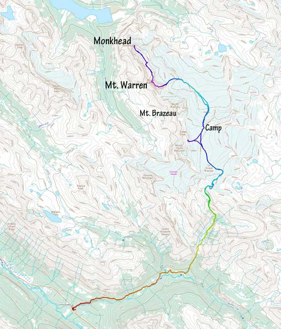
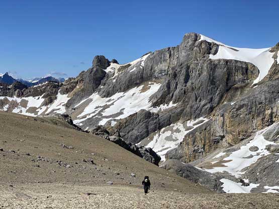
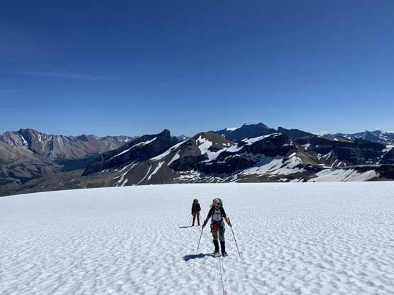
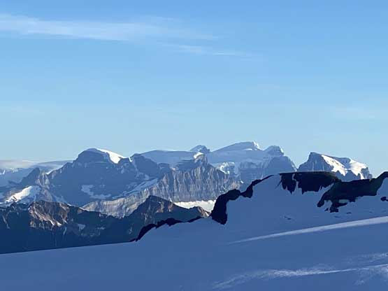
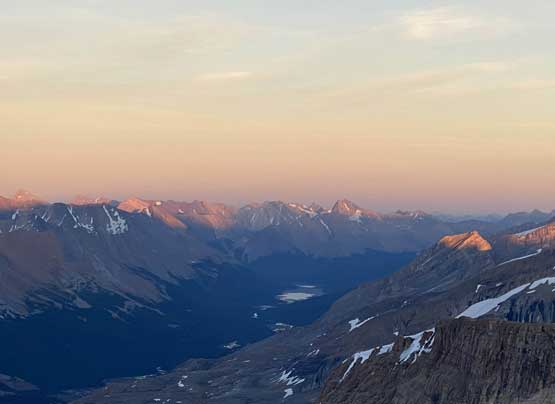
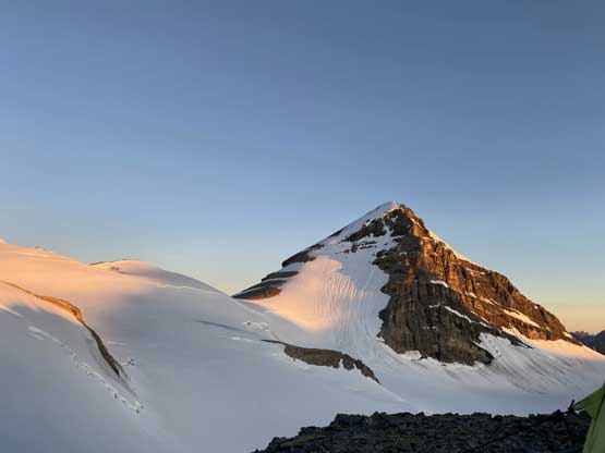
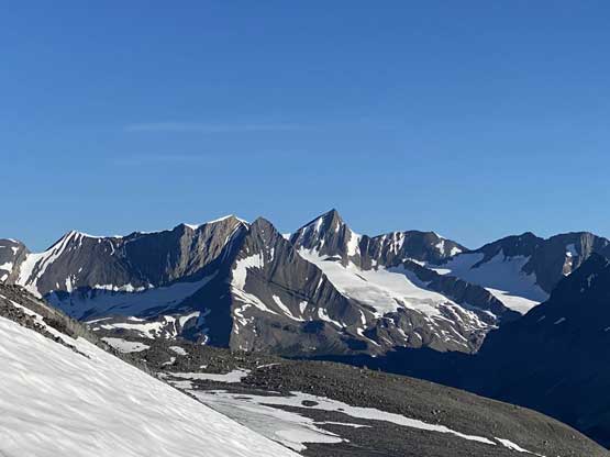
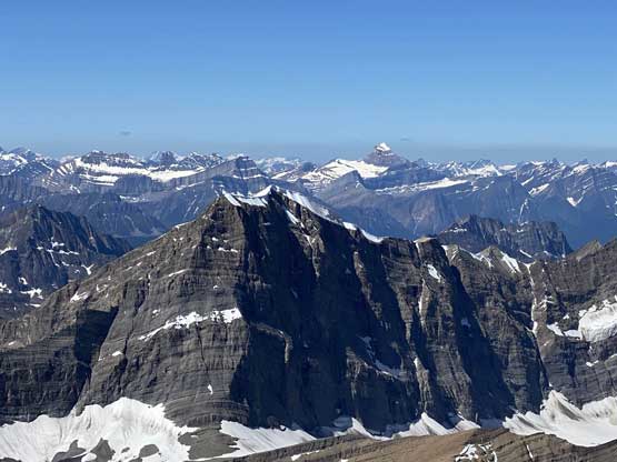
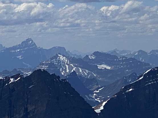
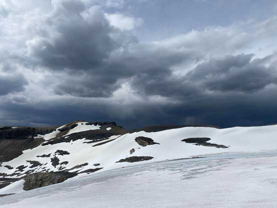
Mt. Warren and Monkhead from Icefield Parkway. GPX DL
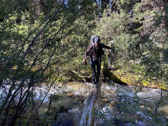
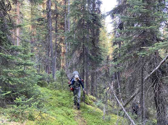
We quickly shouldered the heavy packs with mine and Steven’s both around 45 lb and Oakley’s even heavier. We had to carry snowshoes, mountaineering boots, glacier gears, 2 pickets, 8 screws, two ice tools, crampons, gears to camp at 3000 m on an icefield and food for 3.5 days so there’s really not much room to lighten things up. The initial slog up the Pobotkan Creek trail was uneventful that we made to the climber’s trail turn-off in about 1.5 hours. The climber’s trail was better defined than what I remembered from 7 years ago, that we had very minimal problem following the trail to the meadows/swamp section where we took the first break of this day. Steven N. then realized that his camera’s battery was completely dead so he ditched the camera under a big boulder. From there we easily plodded across the swamp section without wetting our feet but had to cross at least 1 creek on a sketchy log. We picked up the trail again ascending steeply on the south side of a waterfall towards the back end of this valley, but eventually did have to do some light bushwhack to exit the green zone. I wouldn’t say this approach was pleasant, but comparing with the nasty bushwhacks I’ve done in the BC Coast this was nothing.

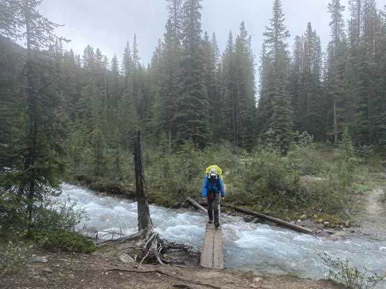
A hiker’s footbridge on Poboktan Creek trail
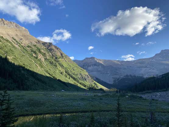
After a while we arrived at the meadow/marsh area, still in the shade
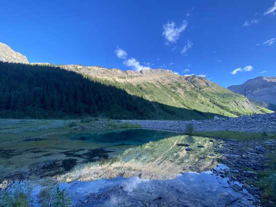
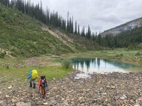
I remembered this tarn from 7 years ago!

Panorama from this tarn. Click to view large size.
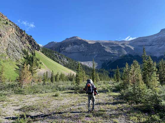
Steven N. marching up the valley
Oakley crossing a slippery log on one of the few creek crossings
Picking up the trail again towards the end of valley
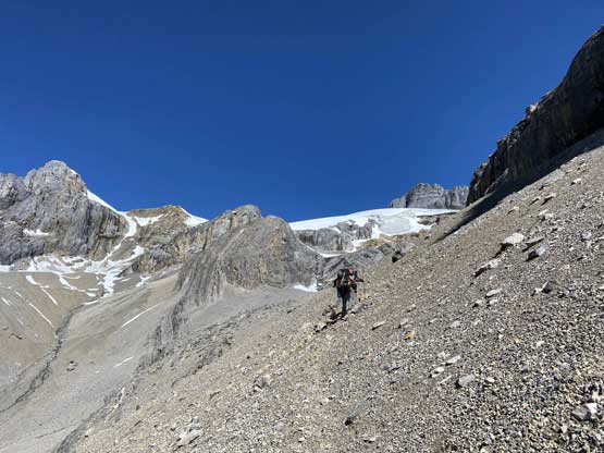
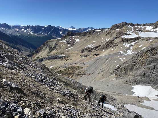
We then easily ascended beside the creek on scree following a path and some cairns, and picked up the correct traversing bench aiming for the distant Swan Pass. The path on the scree was again, fairly well-defined and we had at least two sets of GPS tracks to follow, so there’s literally no reason to screw up this section. The upper stretch below Swan Pass had some unpleasant and compact dirt type of moraine but not very troublesome. We all managed to reach the bivy at Swan Pass in just trail-runners. At the pass we took a long break ditching some unnecessary gears and swapping footwear and then hopped onto the lower glacier. We plodded across this short section on ice and then scrambled up more moraine and choss to access the main Brazeau Icefield.

Dropping slightly to beside this creek

Oakley hiking up beside the creek on paths and trails

A while later we were high above the creek on a traversing bench
Traversing this scree bench towards Swan Pass
This section had some horrible scree and compact hard choss
Ascending onto Swan Pass

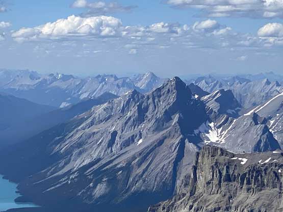
The north face and NE Ridge of Mt. Alberta from Swan Pass
At the pass looking at an outlier of Mt. Henry McLeod and Brazeau Icefield

We lost 50 m elevation and plodded across this short stretch of dry glacier
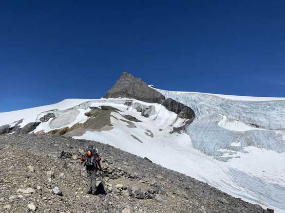
Once onto the main icefield we immediately roped up and strapped the snowshoes on. It sounded funny to snowshoe in August but on this trip they were mission-essential. The navigation on Brazeau Icefield was a little bit disorienting but with the modern technology all I needed was to check GPS for every few minutes and we never got off-route from my previous trip’s track here. The plod towards the shoulder of Mt. Brazeau did drag on for a long time. We were all tired and the terrain just never seem to get closer but all we needed was some perseverance and then we were at the base of Mt. Brazeau setting up camp. Steven and I even managed to find a dry spot to pitch out our BD Hilight but Oakley had to sleep on snow. Once the tents were set Steven and Oakley went for Mt. Brazeau and I just chilled at camp. I was glad that I didn’t have to repeat that peak as for them, the first day turned out to be an exhausting 16-hour fest. I went a short ways up a nearby highpoint for some views of sunset and that’s it. We cooked dinner well into the night and set up the alarm at 6 am for the following day.
Walking up the only stretch of dry glacier on the main icefield.
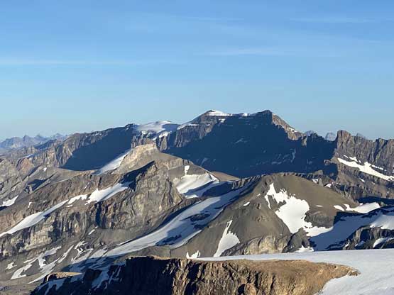
“Moriah Peak” on the far side of Brazeau River valley
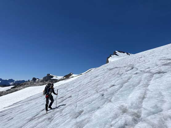
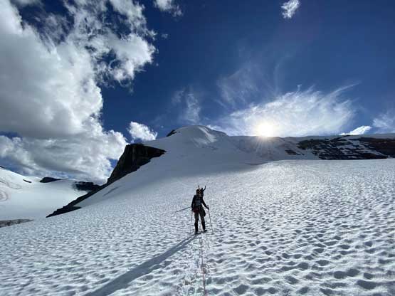
The mundane plod across Brazeau Icefield on snowshoes
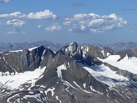
Valad Peak looks kinda cool from the icefield

A long while later this is our tent with Mt. Brazeau behind

Looking down across the eastern, lower section of the icefield
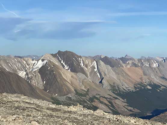
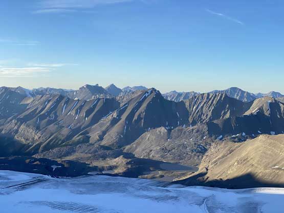
The typical Rockies’ front range peaks on the east side of Brazeau River

Brazeau Lake in the far distance
Poboktan Mountain is almost 11,000 feet but it’s not…
North Twin and Twins Tower in the far distance
More front range peaks. I don’t think they have official names
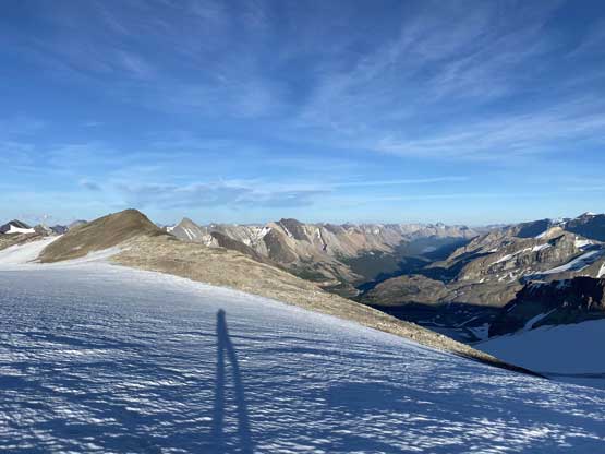
My shadow and the Brazeau River valley

Sunwapta Peak, Mt. Athabasca, Lyells and Mt. Forbes on the horizon

A closer look at the north face of Mt. Kitchener
A northern view into some very remote part of Jasper National Park

Another photo of Valad Peak, albeit from a very different angle
One more photo of Brazeau Lake in the distance, at sunset time
Poboktan Mountain catching the evening alpenglow
Evening glow on the north glacier of Sunwapta Peak

Moriah Peak et al. catching the evening glow

Maligne Mountain in the distance

Steven and Oakley came back and we started cooking dinner in dark
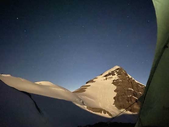
Mt. Brazeau lit up by the moon light
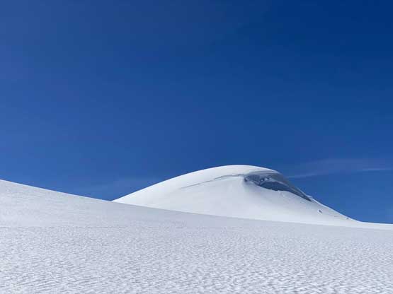
The plan for the second day was to day-trip Mt. Warren and Monkhead from our high camp and we expected something like 14-16 hours. To access the lower, eastern section of Brazeau Icefield we descended a stretch of steep scree beside a wall of cliff and hopped onto the snow. There was a bit of radiation freeze overnight but we strapped the snowshoes on nonetheless and easily plodded down to the low point, more than 400 vertical meters lower than our camp. I was surprised that we could still stay on continuous snow even at the lowest section and once the sun’s out, the snow softened considerably but with snowshoes, the post-holing was minimal. The crevasses were nicely filled in, thankfully. Once at the low point we turned out bearing at the distant east ridge of Mt. Warren. To access the upper mountain we had to scramble up some scree and choss. We thought about ditching snowshoes there but decided to carry them onto the upper mountain, which turned out to be a great call. There was still a stretch of glacier to ascend/traverse to the base of the snow climbing where we finally could ditch the ‘shoes. In retrospect we should even carry the snowshoes all the way to the summit ridge as the post-holing was pretty bad up high near the summit.
Morning alpenglow on Mt. Brazeau just when we got up
Another photo of Mt. Brazeau from our camp

Oakley descending scree to access the lower icefield

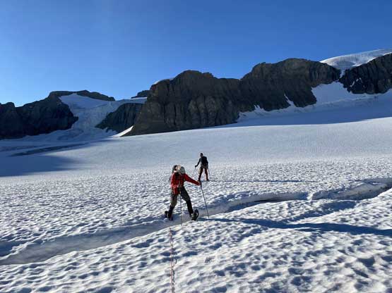
Snowshoes on and here we were plodding across the lower icefield

Mt. Brazeau from a slightly different angle

We still had fair amount of elevation to descend
Stepping across some running stream of water

Started to finally see the north face of Mt. Brazeau
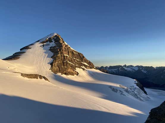
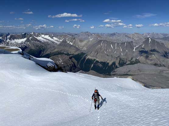
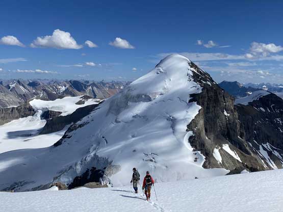
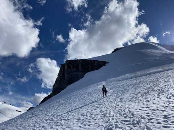
Mt. Warren finally got closer
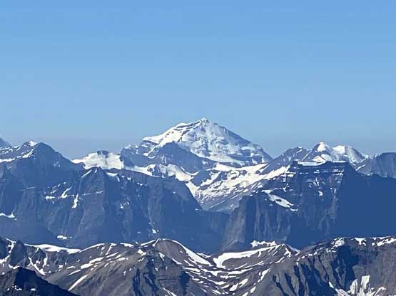
Maligne Mountain
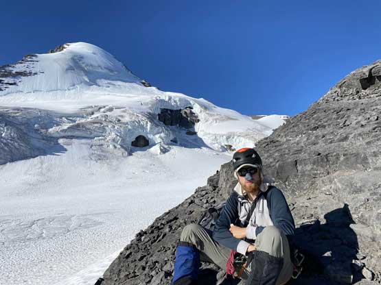
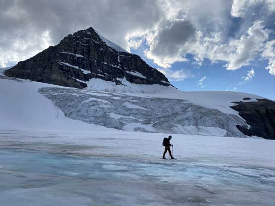
Steven N. taking a break with the north face of Mt. Brazeau behind

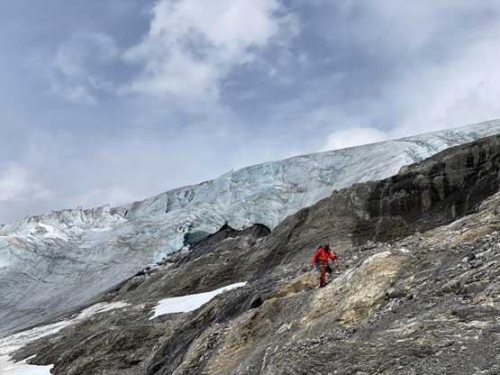
There’s a section of scrambling to access the upper glacier of Mt. Warren

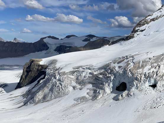
The north face of Mt. Brazeau with a huge glacial cave

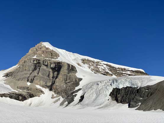
The east face/ridge of Mt. Warren displaced in front
We also unroped at the bergschrund because none of us wanted to stay roped for a steep snow ascent without putting in protections. The lower half of the face had some deep isothermal snow that the post-holing was averagely knee deep. I trended climber’s left once feeling the snow wasn’t getting any better and thankfully the condition improved marginally. We then took turn breaking trail up towards the summit ridge and we did hit more deep and isothermal stretches. We all had some concern about the snow stability on descent but there were options including waiting several hours into the night to descend, if we had to. Traversing towards the south summit was more interesting than I thought with several snow aretes and semi-exposed zones, and of course, a shit ton of post-holing that made me wish we had brought the snowshoes up this high. The south (higher) summit unfortunately did not offer any view of Maligne Lake so we kept traversing to the north summit before taking a break. Traversing between the two summits also had more interesting terrain, but nothing difficult, and the north summit even had a register… Oakley opted to chill on the summit of Mt. Warren but Steven N. and I were keen on Monkhead. It looked uninteresting from climbing perspective but we knew it’s a seldom-ascended summit and the views were supposed to be ass-kicking so we had to press on. It turned out that the descent to Warren/Monkhead col had the only ice climbing of this entire trip. The detour to Monkhead is written in a separate trip report as it’s a different summit.

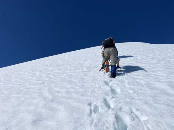
Steven and Oakley climbing up the lower east face/ridge of Mt. Warren

Higher up on the face of Mt. Warren
Steven N. took over the lead breaking trail

The terrain eventually mellowed out

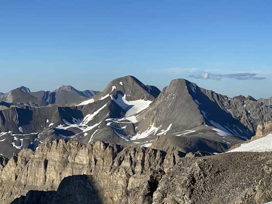
Coronet Mountain in the foreground

The traverse towards the south summit.

Plodding across flat snow with a shit ton of post-holing

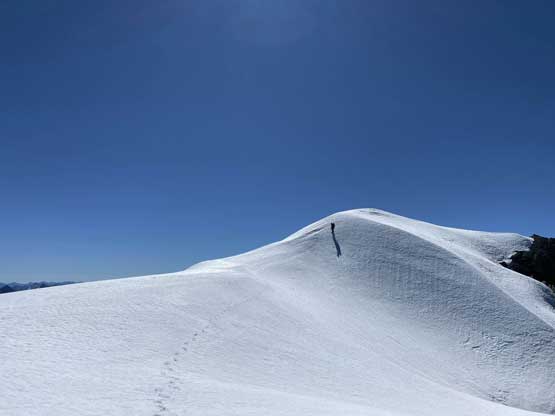
Oakley approaching the summit of Mt. Warren

Mt. Mary Vaux in the foreground

Catacombs Mountain is that fat snowy peak on the horizon

A super zoomed shot of the north face of Mt. Alberta

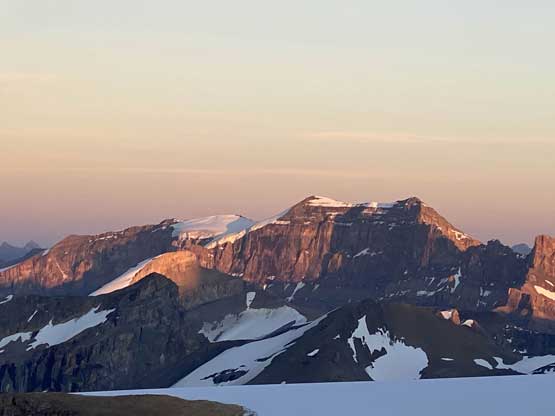
A wider view to the west.
Steven starting the traverse towards the north summit

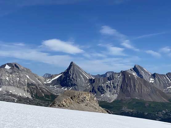
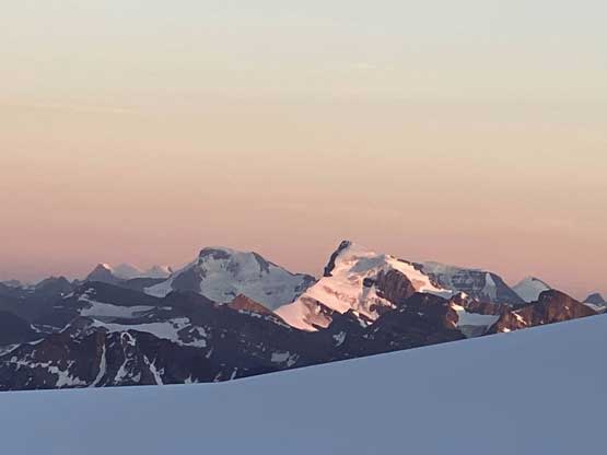
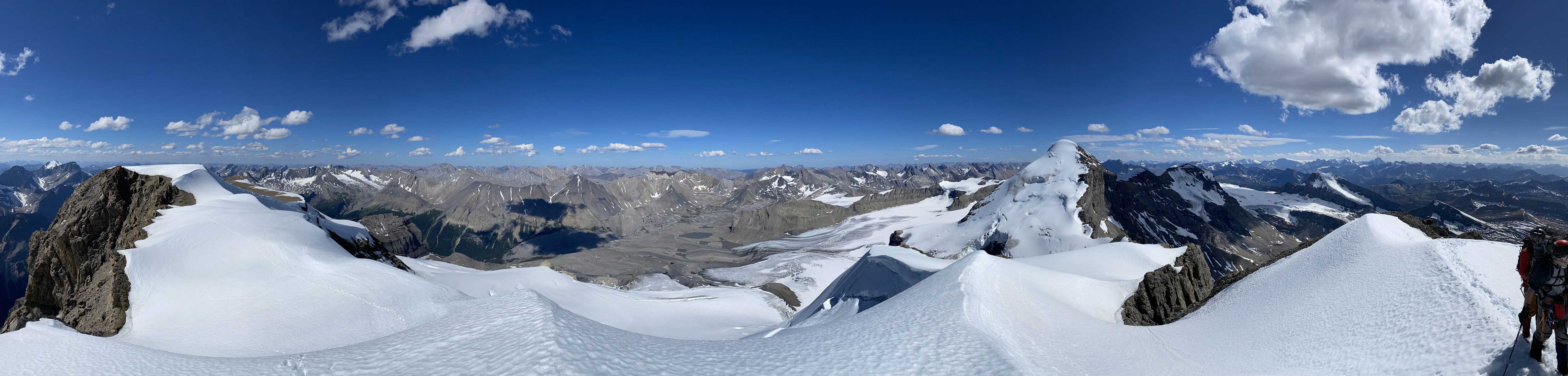
Summit Panorama from the north summit of Mt. Warren. Click to view large size.

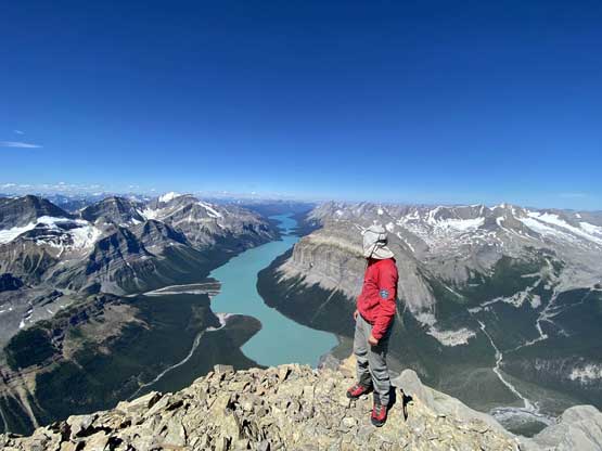
Seeing Maligne Lake made our day!

Mt. Unwin and Mt. Charlton

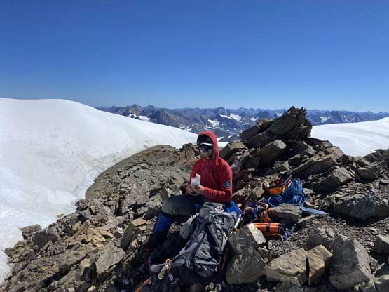
Me on the summit of Mt. Warren – 56/58 of 11,000ers!
A closer look at Mt. Mary Vaux in the foreground

Mt. Fryatt in the distance
A very zoomed shot of Mt. Clemenceau – the 4th highest in Rockies
We found a register on this lower, north summit
A while later this is Steven on the summit of Monkhead Mountain

Steven climbing back up Mt. Warren from Monkhead

Panorama view from Mt. Warren. Click to view large size.

Coronet Mountain was actually my first summit in this area, 7 years ago
Mt. Edith Cavell on the left

Oakley on the south (true) summit with Mt. Brazeau behind

One last look at Maligne Lake
A closer look at Samson Peak

A closer look at Mt. Unwin and Mt. Charlton
One last look at Maligne Mountain

Mt. Balinhard a remote front range giant in the far distance
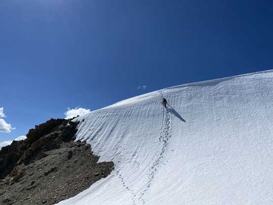
Down-climbing a short but very steep roll
Traversing back towards the south summit
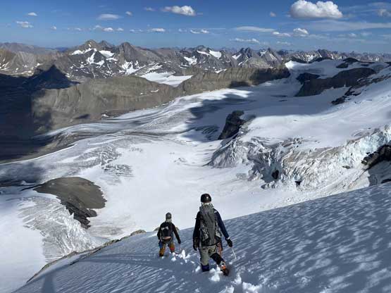
Once back to the summit of Mt. Warren the three of us then easily plunged down the summit ridge to the start of the steep descent off East Face/Ridge. None of us wanted to wait till the evening but we all had concern of the stability. We carried some rocks and tossed them down the face for like a dozen times. We triggered several size 1 slides although nothing seemed to step down, so we gingerly down-climbed the face mostly facing into the slope. The rest of the descent to the lower Brazeau Icefield was uneventful but plodding back across that lower section was not very pleasant even with snowshoes on. The snow was thin and isothermal and we even had to plod across an area of “swimming pool”. Our boots got pretty soaked. The re-ascent back to camp was not going to be pleasant but the chilly wind kept us pushing at a fast pace. I didn’t want to stop to take gloves out so pushed hard in order to stay warm, and this eventually turned out to be a 14-hour day, which wasn’t bad at all.

Oakley on the south (true) summit of Mt. Warren
Summit Panorama from Mt. Warren. Click to view large size.

Time to leave this beautiful summit
Plodding down with the north face of Mt. Brazeau as a backdrop

I let them plodding ahead so that I could take more photos

A full show of the north face of Mt. Brazeau

Tossing rocks down hoping to trigger some slides…
The snow was very soft but we had to get down..
A while later we were off the steep face

The north face of Mt. Brazeau again
I really liked the glacial scenery in this area
A review shot of the steep face of Mt. Warren

One more photo of the north face of Mt. Brazeau
Oakley finding a way to not get wet. It wasn’t quite possible…

Plodding back towards camp. Over 400 m elevation regain…

Almost back to camp now…

It’s dinner and tent time again..
The plan for the 3rd day was to tag Valad Peak and Mt. Henry McLeod and hike out but we didn’t manage to wake up early. The alarms failed and we woke up at literally 8 am and didn’t get going until 9 am. That was still fine. I led us snowshoeing back across the icefield aiming for Valad/Henry McLeod col. The last 100 m to gain the col had some crevasses. At the col Oakley and I decided to chill while Steven N. tagged both peaks by himself in under an hour. I had done both of these peaks and I had no desire to repeat. Then the plunge and glide down the icefield was super fun and we even strapped the snowshoes on for that lowest and flat section. There were quite a few pools of water on that dry glacier and the snowshoes actually provided a bit of extra flotation although my boots were already soaked through. We could see a band of dark clouds moving in from west at a rapid pace even though the weather forecast did not suggest that. By the time we finished the gear transition at Swan Pass we were literally 10 minutes away from being soaked in a blizzard. The precipitation didn’t come very heavily but the winds were strong. We descended the scree for as fast as we could and pushed all the way back down to the meadows/swamp section before taking a break. The precipitation stopped but the bushes were very wet. I opted to wear the wet mountaineering boots all the way down to Poboktan Creek trail to save the dry shoes for the final 1.5-hour hike out, which turned out to be a decent idea.

Plodding back across Brazeau Icefield on Day 3

A while later this is Steven descending the choss band
Unfortunately a very dark band of clouds moved in…
Oakley scrambling down with some icefalls behind

The icefalls and seracs on Brazeau Icefield

Oakley plodding back across that short stretch of dry glacier

Steven descending from Swan Pass in rain

Finding this ramp and a trail on it was important

Oakley descending into the valley

The weather was really turning shit
It was very soggy to plod back across the marsh/meadows zone
Finally back to Poboktan Creek trail

The trail’s becoming wider and wider

As typical as the last 6 km went
We spent almost an hour unpacking and relaxing at the parking lot but eventually we had to resume our own way. I opted to drive to Jasper for food and cell services taking one tourist stop at Athabasca Falls. I liked to stop there for some photos as a gigantic waterfall like that is something that I don’t normally see in the coast. While order the North Face Pizza I browsed all weather forecasts learning that some unstable weather and new alpine snow’s on the way so I decided to drive home. I made to Blue River that evening and resumed the rest of the drive back home on the following day. I did do a quick stop in Kamloops tagging a small summit, Ironmask Hill for simple reason of why-not..
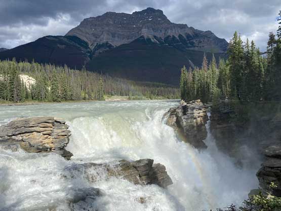
A tourist stop at Athabasca Falls
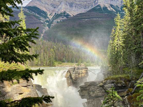
I was happy to capture this rainbow…
