Lunette Peak
August 22-23, 2020
3428m
Mt. Assiniboine Provincial Park, AB/BC
Lunette Peak is rather just a pimple on the SW Ridge of Mt. Assiniboine and really does not appear like a separate summit. It also boasts no more than 50 m of prominence making it indeed a very insignificant bump. This “peak” is however, officially named and included in the fabled 11,000ers of the Canadian Rockies list. The name and the inclusion is mainly due to the climbing history. Apparently the first ascent party made the summit of this “peak” in a white-out thinking that they had made the summit of Mt. Assiniboine itself… They later found out the mistake.
The ascent of Lunette Peak is by no mean as “easy” as its prominence suggests. There’s only one route that makes sense. The SW Face might not appear “technical” enough in the right conditions, the ascent requires 1000 vertical meters of complicated route-finding in some typical 3rd and 4th class Rockies choss, which is further complicated with some steep snow climbing in the lower sections. The descent usually requires several rappels although competent parties could down-climb the whole route. This is not a difficult objective in the 11,000ers, but also not the easiest one.
Having already climbed the classic North Ridge of Mt. Assiniboine (my 7th 11,000er) I knew the sole reason to return for Lunette Peak was to finish this list. Since then 7 years had elapsed and towards the end of August 2020 my count was at 56/58 leaving only Lunette Peak and Lyell 4 behind. I chose to finish the list on Lyell 4 as it’s the more aesthetic and also the harder of the two, and that meant I had to go grab Lunette Peak soon. Upon seeing a window forming I threw out an open invite on the 11,000ers Facebook group and to my surprise, a total of six signed up within a couple hours. This is not an ideal objective for a large group but I figured with our combined experience we could have made it work. I had climbed with Steven N. and Natalia but this would be my first time meeting Jesse, Yanick and Noah. All of them are exceptionally good climbers and the stoke level was high.
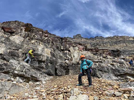
The plan was to climb Lunette Peak as well as Mt. Assiniboine via the unaesthetic SW Face but as always, the plan would change and the trip turned out to be Mt. Sturdee and Lunette Peak. We did not end up climbing Assiniboine thank to the fresh dump of snow and verglass. Once making the decision I drove out of Vancouver in Friday morning and drove through the interior without much of a delay. I did not want to rush the drive so gave myself a full day to get to Golden. I slept in my truck somewhere in Golden and resumed the drive to Radium in the following morning. Natalia and I agreed to meet in Radium and we then would meet the rest of the group at the start of Settler’s Road. By 10:30 am all six of us had made to the meeting spot. The drive to the trail-head was easy and uneventful following the GPS directions. The final stretch was a big rough but doable in just 2WD… There was already a group at the parking lot and they almost immediately recognized me as well as Steven Noel from the Facebook group.

Lunette Peak SW Face and Mt. Sturdee. GPX DL
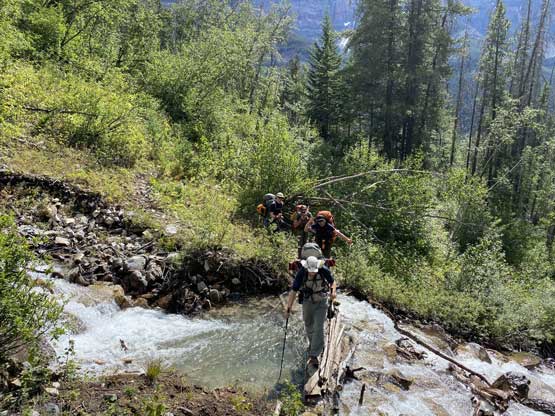
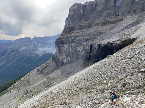
There’s little worth documenting about the first 6 km or approach to Assiniboine-Lunette junction except for an improved foot bridge crossing one of the sketchy creeks. The rest of the plod was done on a nicely-maintained trail with minimal views. At the junction we took a long break and then headed right towards Lunette Lake. The lake’s reached in short time. We easily rock-hopped across the outflow and ascended steeply up the forested rib following flagging and a not-so-obvious climber’s trail. The quality of this climber’s trail wasn’t very impressive with many indistinct and confusing sections but the general bearing was to go straight up this forested rib. We weren’t quite sure the exact elevation to traverse right out of the forest. In retrospect we should have gone further, but our ascent line wasn’t too bad nonetheless. We made a long and diagonal rightward traverse out of the forest and across several scree slopes, as well as one avalanche path that had some minor bushwhacking.
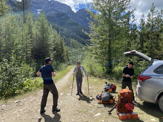
The party at the parking lot..
One of the small creek crossings on the trail

Natalia having fun so far despite the heavy pack

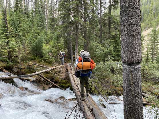
Steven crossing the major creek on a nicely placed foot bridge
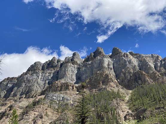
Impressive walls on Aye Mountain

Hoping across the outflow of Lunette Lake

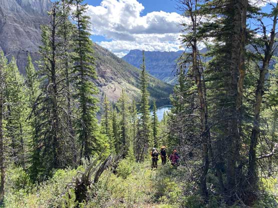
Mt. Assiniboine and Lunette Lake

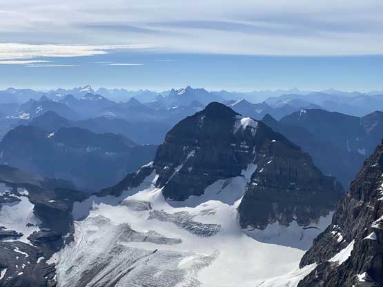
Mt. Sturdee has some impressive profiles from this angle

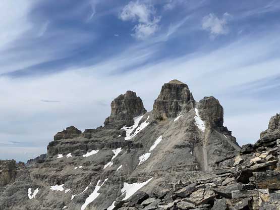
A zoomed-in view of the SW Face of Mt. Assiniboine and Lunette Peak
Ascending the climber’s trail above Lunette Lake
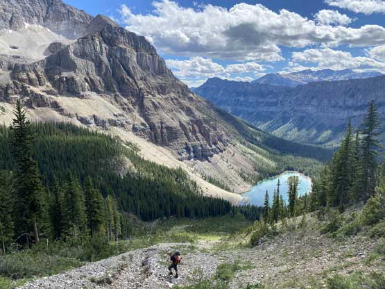
Traversing scree slopes now, high up above Lunette Lake
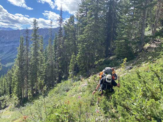
A bit of bushwhacking because we couldn’t find the goat trail
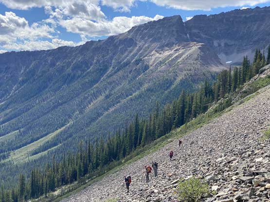
Our group traversing the endless scree slopes

Another photo of the scree traverse above Lunette Lake
We traversed all the way to the stream that drained from the bivy site. The terrain was quite loose and steep so I made a footwear transition from trail-runners to Trango Towers mountaineering boots. For the final 200 m to the bivy site we all picked some slightly different paths. I stayed climber’s right of the creek/waterfall which involved some 3rd class scrambling on wet rocks. The bivy site at 2400 m was indeed a 5-star one with nice and flat grassy platforms as well as running water. I think the approach had taken us under 4 hours on a fairly leisure pace and now we had almost 6 hours to kill before sunset. The new decision was to ascend Mt. Sturdee which turned out to be a fairly fun climb.
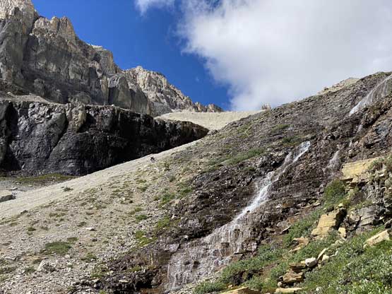
Scrambling up climber’s right of this waterfall

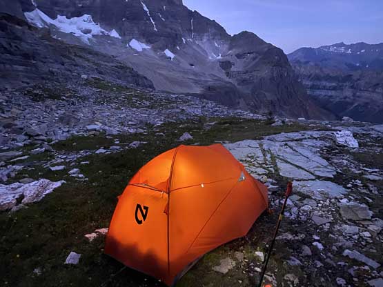
My tent with Mt. Sturdee behind

This is the looking-up view from our camp
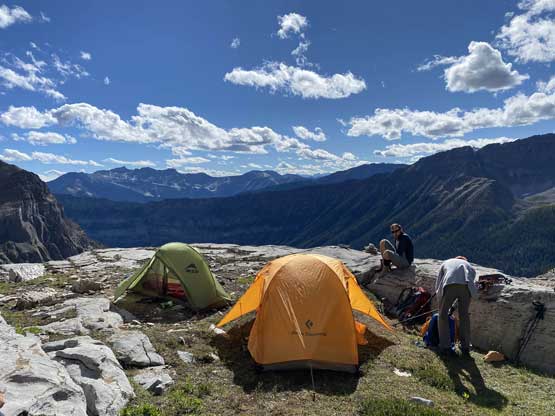
We brought a shit ton of camping gears up to this point..
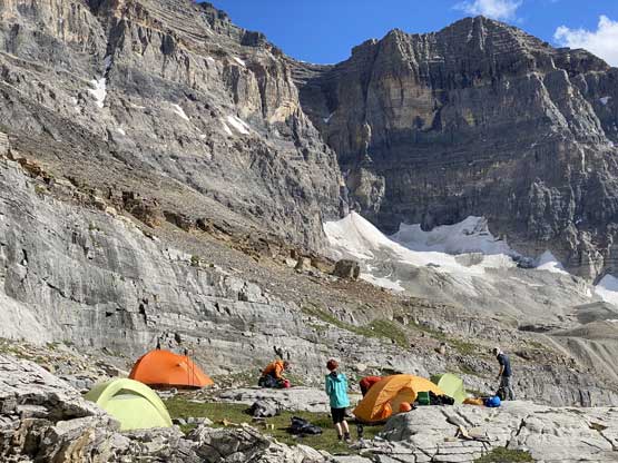
Our very luxurious camp under Aye Mountain
Steven climbing Mt. Sturdee above Assiniboine/Sturdee col
Steven now rappelling off Mt. Sturdee after a successful climb
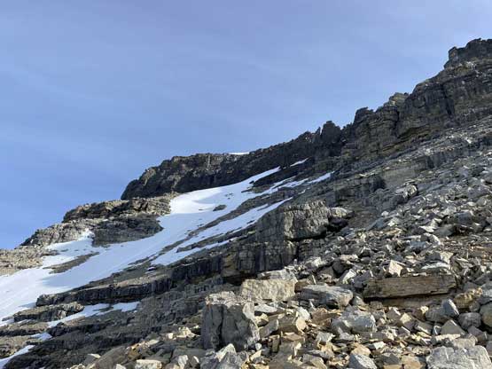
The ascent of the SW Face can be broken down into several stages. The first stage was the lower triangular face. There are apparently quite a few options and one can choose between a steep snow couloir versus some 3rd to 4th class choss with route-finding. We picked the former mainly because we had brought the snow gears and wanted simplicity. The snow couloir had the least amount of uncertainty in terms of route-finding and probably worked the best for our group-of-six in terms of rockfall hazard. The couloir had undergone a complete overnight freeze meaning we pretty much had to front-point the whole way up. The grade was mostly around 40 degrees so one tool felt sufficient enough. The transition from snow onto rock to exit climber’s right side was awkward but the terrain was never worse than “difficult scrambling” and the next thing we were above the triangular face looking at a short stretch of flat ridge at 2800 m elevation before the “middle zone”.
We woke up at dawn to prepare for an early start

Leaving camp at the first light

More scree slogging

Into the lower couloir. Initially without snow

Noah climbing up the lower snow couloir

It’s like this for a long time

Noah now exiting snow onto some very shitty terrain
I didn’t like the snow-to-rock transition here

Finishing the lower triangular face, now with Aye Mountain behind
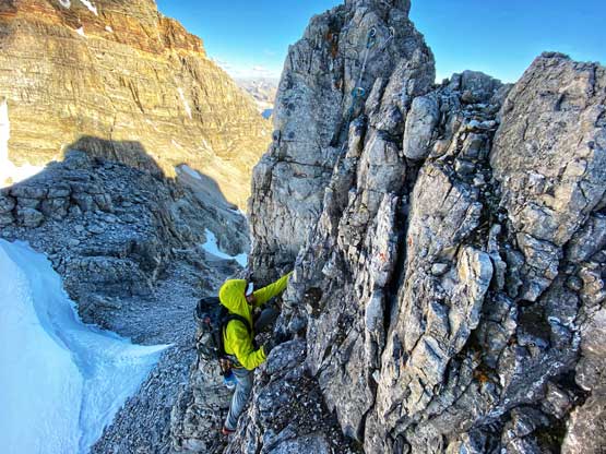
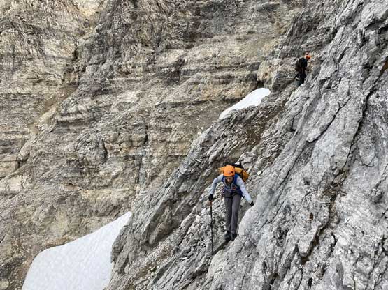
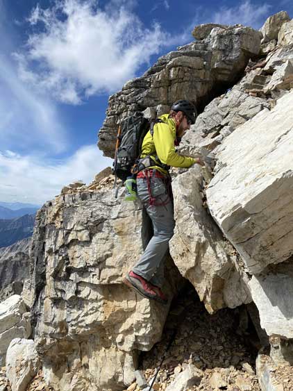
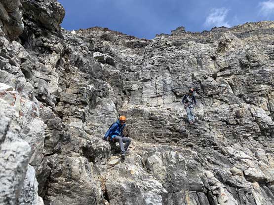
The middle section of this face appeared daunting but actually not. It seemed like rock climbing was definitely required but a route would always present itself upon closer examination. The terrain was the classic Rockies chossy ledges that the challenge mainly came from to find the weaknesses through each short cliff band. The scrambling never exceeded “4th class” and the route also had some cairns helping the navigation. We started by traversing a bit towards climber’s left side and climbed a short wall of 4th class, then slowly worked our way towards the right side. There was one long horizontal traverse out to the right above 3000 m onto a verglassy corner. We scrambled through the 3rd class icy corner onto the upper face. The upper face was actually quite easy as we just had to plod up some loose scree towards Assiniboine/Lunette col.

Yanick leading the way towards the middle face

Steven scrambling up the typical terrain

Traversing climber’s right now
Aiming for this key notch to hop over to the other side
The typical scrambling on this route

More choss… Yes…

Around that verglassy corner now
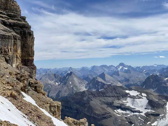
Onto the upper face, looking ahead towards the 3200 m zone
For a while we had to plod up some tedious scree and rubble
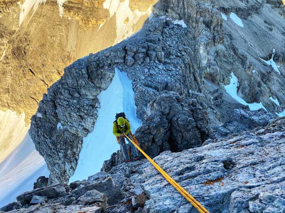
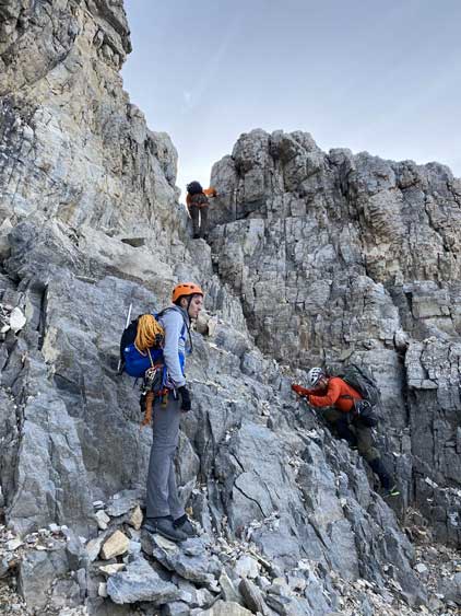
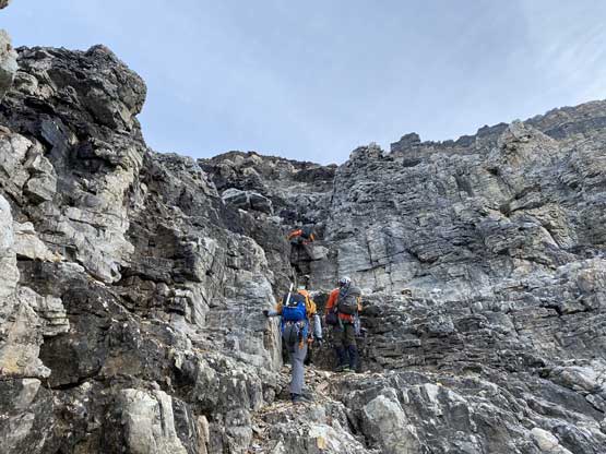
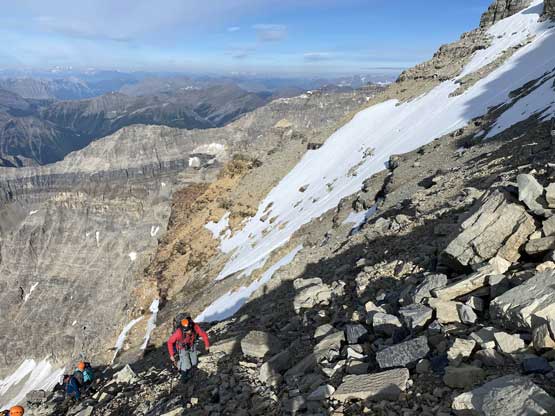
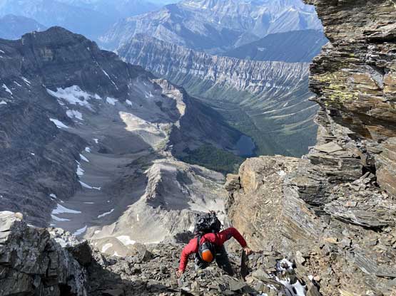
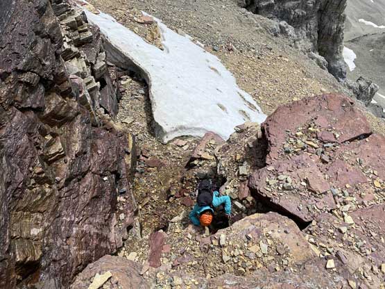
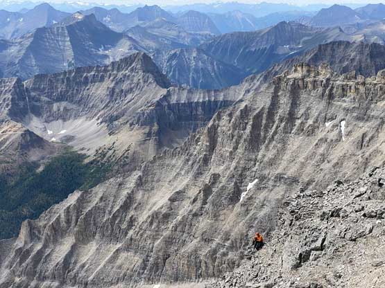
The easiest option would be to strap crampons back on and ascend snow to pretty much near Assiniboine/Lunette col but the terrain on climber’s right looked easy enough that none of us proposed the snow option. We stuck on climber’s right side of the snow couloir and made through a series of 4th class ledges and gullies. One particular gully appeared quite difficult so we traversed rightward on an exposed ledge and scrambled up more 4th class gullies. The verglass had made the scrambling sketchy that for one section we opted to offer a top rope belay for a few of us. Beyond that we found another (wider) scree ledge under the summit block of Lunette Peak and found more 4th class choss to scramble through. The attack of the very top was actually on the climber’s left side where we had to commit to a few tricky moves but the left-hand-side summit ridge was only 3rd class.

Steven and Noah with Aye Mountain behind

Scrambling up beside the snow gully

Traversing right on a very obvious ledge

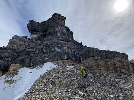
Jesse went higher to scope out more route options

Natalia coming up a verglassy and chossy gully
Noah traversing across an exposed step

The typical scrambling on the summit block
Natalia coming up a down-sloping step
Steven ascending onto the final summit ridge
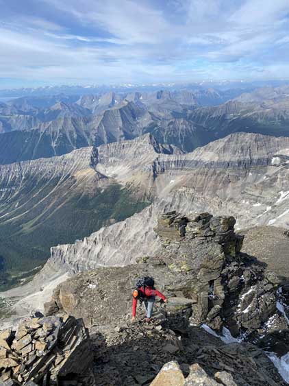
The last few steps to the summit
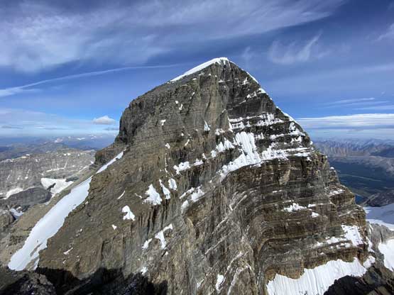
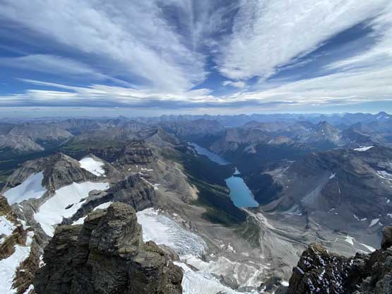
Mt. Assiniboine from Lunette Peak
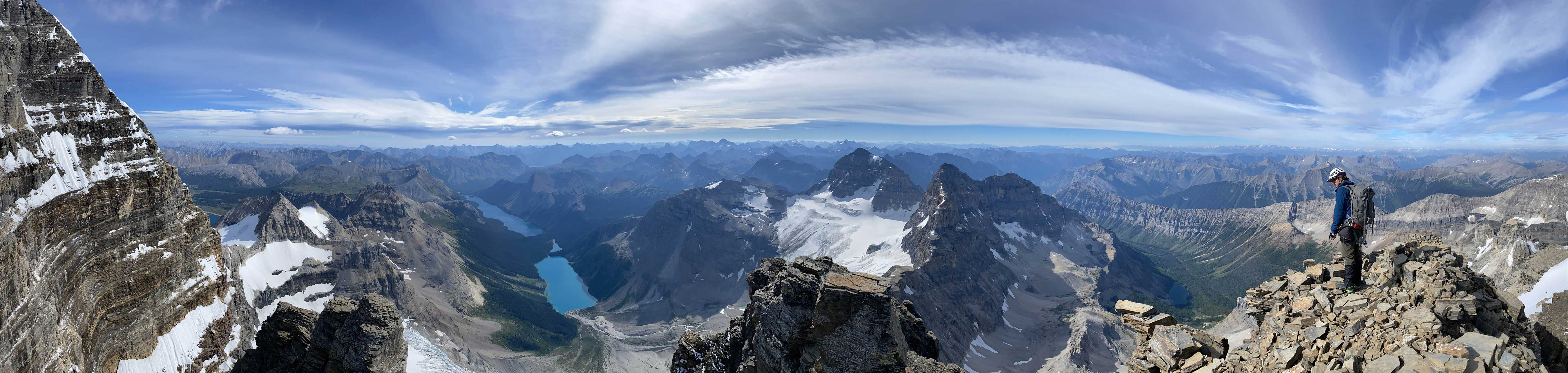
Partial Summit Panorama from Lunette Peak. Click to view large size.

Partial Summit Panorama from Lunette Peak. Click to view large size.
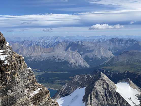
Looking down towards Assiniboine Pass and core areas

Marvel Lake in foreground with familiar Kananaskis peaks behind
Eon Mountain in the foreground
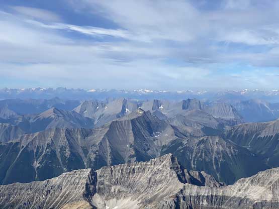
The West Range peaks in foreground with Purcells horizon behind

Me on the summit of Lunette Peak. 11,000ers 57/58
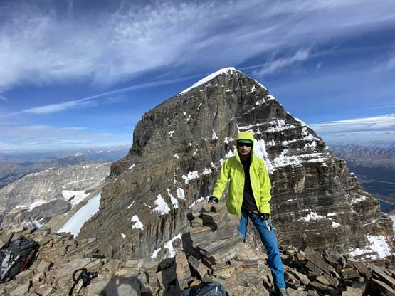
Me on Lunette Peak with Mt. Assiniboine behind
A wider view of Marvel and Gloria Lakes
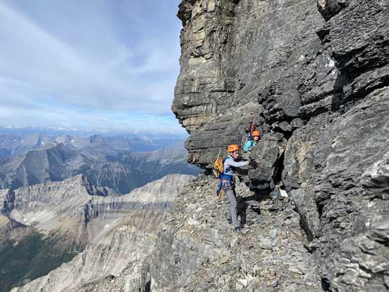
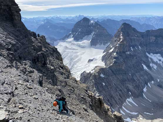
We didn’t linger too long on the summit because some of us still wanted to climb Mt. Assiniboine and we also knew the descent would be slow in a large party. A few of us made several rappels down the summit block while a few of us down-climbed back to just under Assiniboine/Lunette col. It seemed like the upper face of Mt. Assiniboine was still holding fair amount of verglass so they made the decision to not climb it, so we turned our attention to the descent and the new goal was to get out on this day. We did a few more rappels because we didn’t want to get into the snow on the upper face. In total we probably did about 6 rappels although a few of them were very optional. The descent back through the middle face was uneventful although managing rock fall was indeed challenging. For the lower face we split up with Jesse, Yanick, Noah and Natalia doing one additional rappel into the scree bowl on skier’s left side. They would eventually walk around the lower triangular face back to camp. The problem was the rappel station being questionable and our rope wasn’t long enough to reach the bottom. Yanick went down first but had to down-climb some sketchy terrain. We had about half an hour’s discussion of this situation and the final decision was to rappel a single strand while Steven N. and I would down-climb the snow gully instead. Steven and I were confident about the snow route and this also helped managing rock falls. The snow descent required a lengthy facing-in down-climb but it was fun. We eventually got back to camp at pretty much the same time.

Steven leading down one of the summit block rappels
Back to near Assiniboine/Lunette col, looking back

It’s a team work to set up the next rappel

Steven partway down the next rappel

Jesse wondering what’s next…

Steven leading down another rappel

Finally back to easier ground
Mt. Sir Douglas dominates the horizon
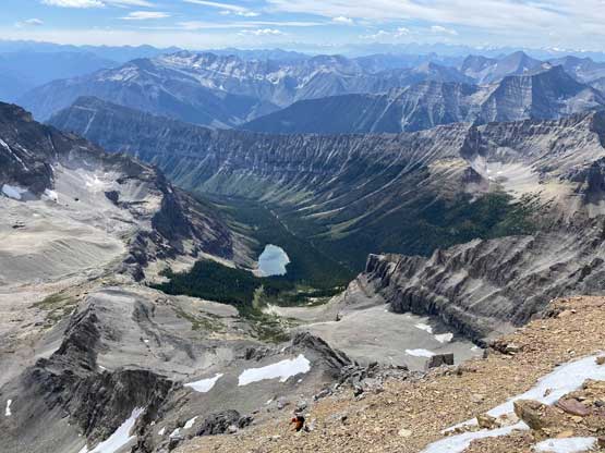
It’s a long ass way down to Lunette Lake
Natalia down another tricky step
Scrambling down into the “middle face” now
Steven down-climbing a tricky step
Yanick looked small in this terrain
Noah descending the typical terrain on this SW Face

Jesse descending the typical terrain

The choss and cliff bands were never-ending
A closer look at Mt. Sturdee, our objective in the day before

Yanick wondered about an alternative descent route

Noah rappelling into the alternative descent

Steven down-climbing a tricky step in the snow couloir

Down-climbing for at least 200 vertical meters
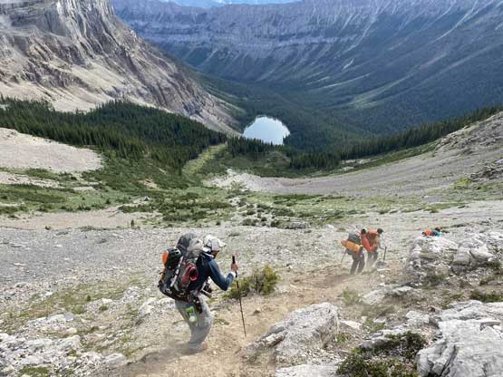
We were in no rush so took about an hour to pack up the tents. We descended a slightly different line from camp to the forested rib staying generally above our ascent line and this worked out better. We managed to avoid bushwhacking and even found a goat trail on the scree traverses. Once back onto the forested rib we descended some steep and loose and sparsely treed terrain to pick up the climber’s trail. The rest of the descent back to Lunette Lake and out to the parking lot was boring and tedious, but not difficult. We managed to get out with at least an hour’s spare before dark.
Leaving camp now. We stayed higher on descent
Scree surfing

We followed a goat trail back to the wooded ridge

Assiniboine Lake way down below

Down to Lunette Lake now, looking back

The very boring hike-out…
At least this bridge was a little bit entertaining…
Overall I would say the climb of Lunette Peak was better than expected with generally acceptable scrambling quality and decent views. This also felt like a completely different trip than my Mt. Assiniboine ascent because I climbed the opposite sides of this mountain. I still wouldn’t recommend this peak in its own unless you just have to work on the 11,000ers list, but if you do come up here, it’s not as bad as you might expect.
Throughout the trip a few of us had made some tentative plans to go into the Lyells in the middle of the following week as the long term forecast looked great. Once we were back in cell range we confirmed the plan as the weather forecast didn’t change. With only one rest-day between Lunette Peak and Lyell IV I drove to Canmore with Steven N. to refuel, and there went the last 11,000er trip of mine.
