Bombtram Mountain
January 29, 2021
1830m
Coquihalla Pass, BC
“Bombtram Mountain” is the unofficial name of the peak immediately to the south of Box Canyon not far from Coquihalla Pass. The name suggests that avalanche control has been carried out on or near this peak by explosives. This peak has a flat top with even trees on the summit, but the bottom sections are guarded by steep forest and bluffs, and because of that winter is the only season that makes sense. The standard route goes up the very steep forested NE Ridge with a steeper (40+ degrees) finish at the treeline zone near the summit. The steep roll can be bypassed by traversing to the north ridge but such route still involves fair amount of travel on avalanche terrain. I’m vaguely aware of another route that uses the logging cut on the north side of Box Canyon (perhaps the skier’s exit) to avoid the steep forested approach, but I’m too lazy to find out as for snowshoers we prefer to go straight up the forest.
I had been considering this summit for a few years but I always felt nervous to solo the aforementioned steep slopes. Whenever the avalanche forecast gave the “green light” I always ended up on other, bigger objectives. The shortness of this ascent (1000 m straight up from highway) suggested I could do it as a before-work exercise. This past Friday finally saw me planning Bombtram Mtn., together with Mel, Iliya and Elise. Neither the condition nor weather forecast was “ideal” but with the four of us I figured we could make it work. To make sure I could get back home in time for work we agreed to meet at Abbotsford around 5 am and start the ascent an hour before sunrise.

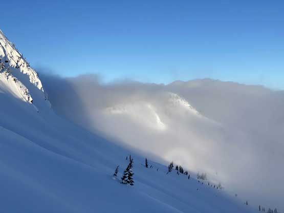
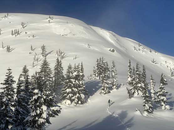
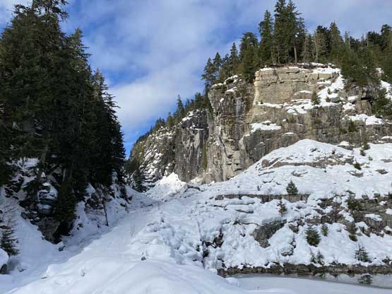
Bombtram Mountain from Box Canyon. GPX DL
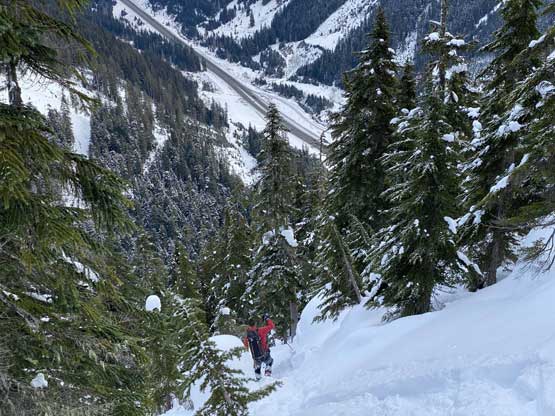
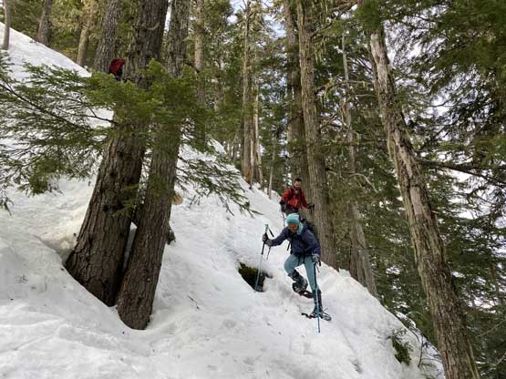
The parking was on a small pull-out right at the start of the route on the opposite side of Coquihalla Highway and we luckily were able to turn-around right at the spot. The first short stretch was walking on logging roads with some up-and-downs and then we bailed into the clear-cut following GPX track sent by Alan Blair. The ascent through the clear-cut was not a big deal on this particular day thank to the hard-as-fuck crust that provided solid purchase on the snowshoes. Then there came the forest. In no time the going became really steep (40 degrees ish) but we were lucky to pick up an old set of skin tracks. The skiers seemed to know what they were doing that we were able to follow their tracks weaving around a few very steep bluffs. The snow was quite icy but we all made it work without even taking the snowshoes off. Higher up the terrain became mellower but the trail-breaking took over. The weather was cloudier than expected but we could see some blue skies above. After a while we realized we might actually break through the cloud layer.
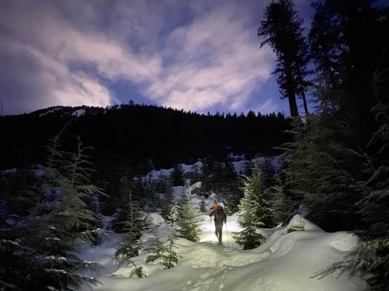
Iliya ascending the cut-block in dark
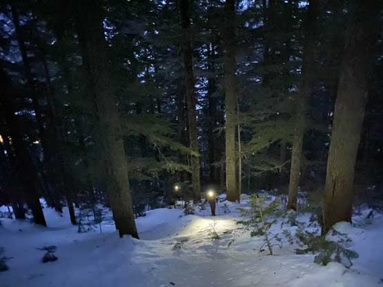
Into the mature forest now, still in pitch dark..
Mel leading the trail-breaking

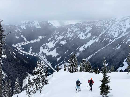
Iliya and Elise following up with Coquihalla Highway behind
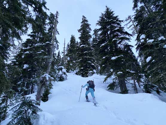
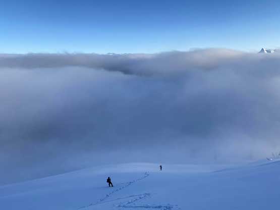
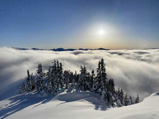
Mel did all of the trail-breaking. At one point I asked her to go onto the ridge crest instead of wallowing on the north aspect under the ridge as the recent SE wind had deposited fair amount of snow on the lee side. This worked out nicely as the trail-breaking was indeed much easier on the ridge. At the base of the steep pitch we indeed broke through the cloud layer, treated by some fantastic views that none of us was expecting from this day. I took over the lead to put in a set of snowshoe track straight up the middle of the steep pitch. It looked a bit intimidating from afar but turned out to be decently straightforward. There was some “technical snowshoeing” needed but such was not a problem for us.
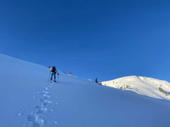
Mel already above the cloud layer.

Elise breaking through the clouds

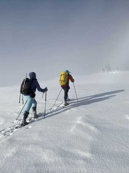
Mel continuing charging up the NE Ridge
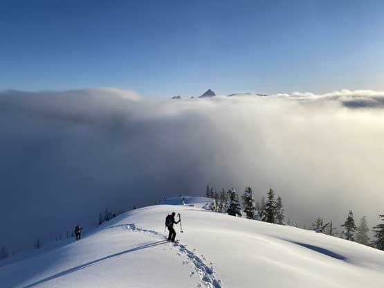
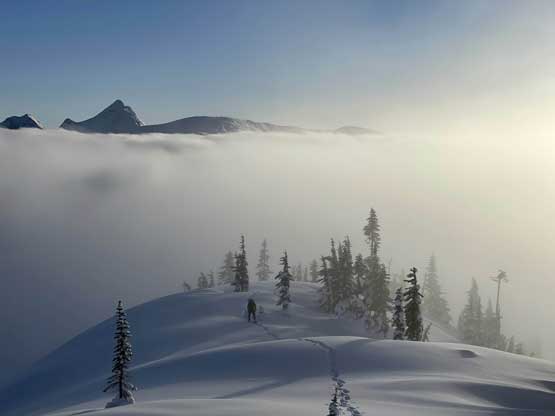
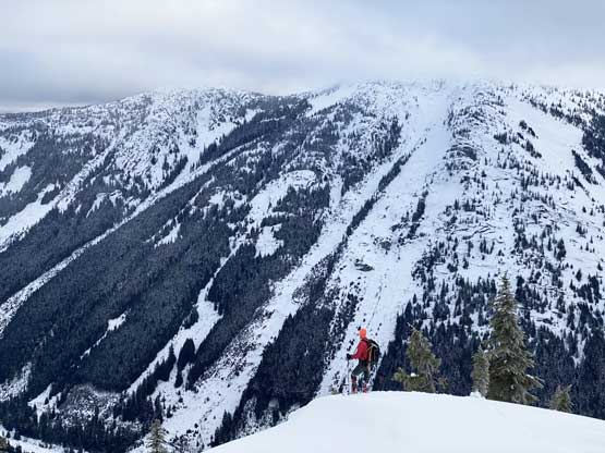
This picture shows the other route that traverses towards the north ridge
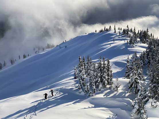
Elise and Iliya almost back onto the NE Ridge
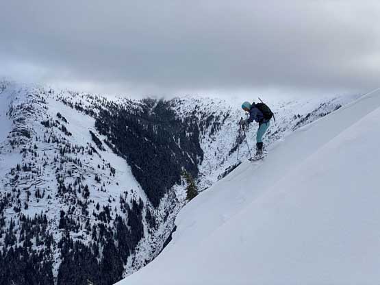
Elise admiring the morning views on the NE Ridge
Iliya does his obligatory photo pose
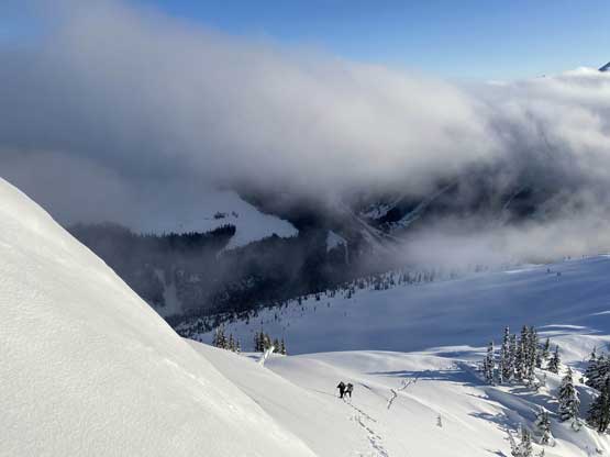
Mel leading towards the base of the steep pitch

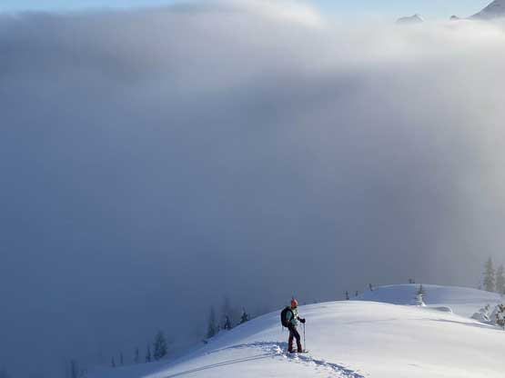
At the base of the steep climb, looking south
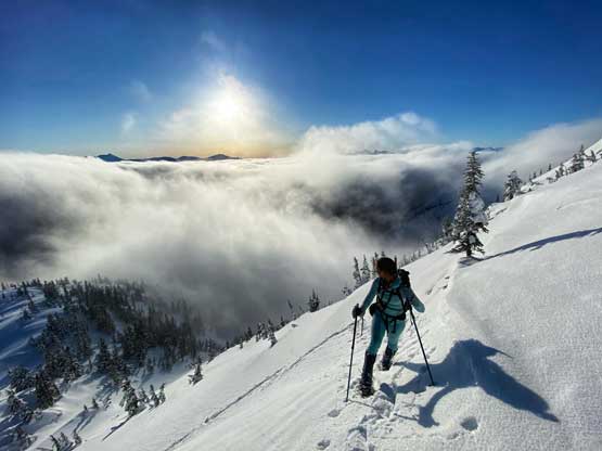
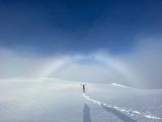
None of us came here to expect having this sort of inversion views
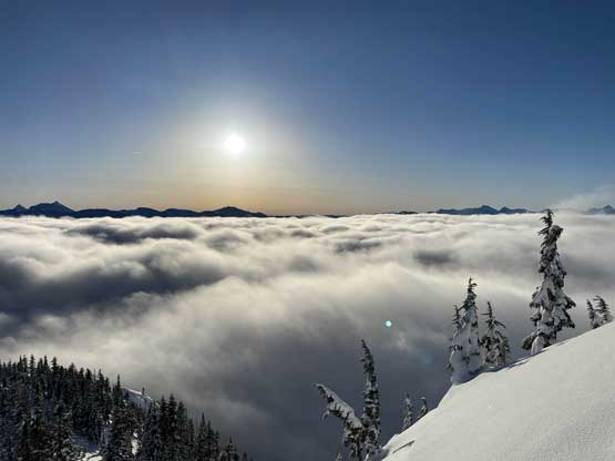
Another photo of the morning sun above the inversion layer
Me with Needle Peak and The Flatiron behind. Photo by Mel O.

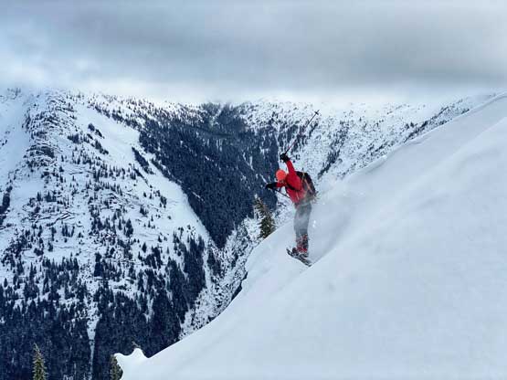
Mel starting the steep pitch following my “duck walk” tracks
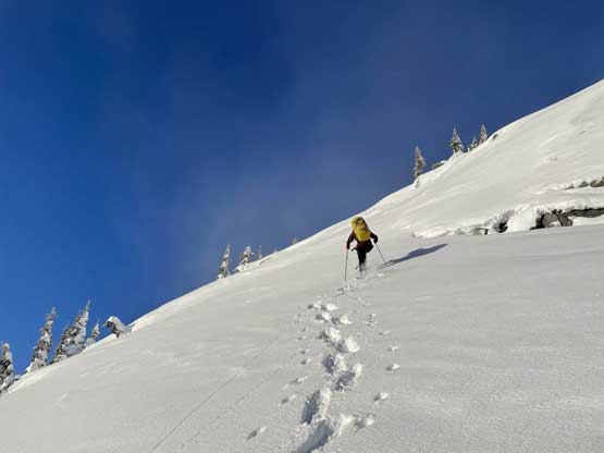
Me leading the middle section of this steep face. Photo by Mel O.
Iliya and Elise at the base of this section
Partway up, looking back..
Mel finishing this steep stretch.
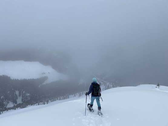
Unfortunately the clouds rolled back in once we all finished the steep pitch. The true summit was still a ways away and we no longer could see a damn thing from here onwards. The lighting was still not very bad and we were able to take some cool photos in the fog. The summit stay was short-lived thank to the white-out conditions.

Plodding across the very broad summit ridge with up-and-downs
Iliya walking into the sun fog gate

Me and Mel plodding. Photo by Iliya K.
Me and Mel approaching the summit
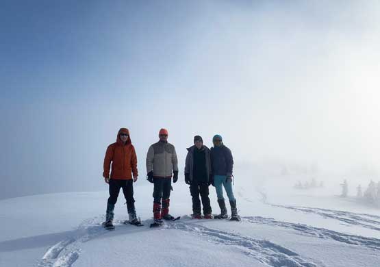
Our group shot on the summit of Bombtram Mountain
On the descent the other three decided to glissade the steep pitch while I gingerly and awkwardly walked down on our tracks. We descended below the cloud layer. We were able to see the highway and Box Canyon for the rest of the descent but the sun never came out again until the very bottom. The descent back through the forest was treacherous to say the least with the steep grade and icy conditions, but again we all got down without having to take snowshoes off.

Iliya opted to glissade this entire stretch of steep zone
Dark and cloudy…
Mel and Iliya plodding down the easy sections of this ridge
Iliya found another spot to pose for a photo
Iliya practicing his snowshoe jump turns
Mel trying her snowshoe jump…
The forest became steep in no time…
One of the icy and awkward stretches lower down
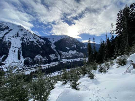
Back into the cutblock looking at Portia Peak
We all had some fun time gliding down this cutblock

This step in the cutblock wasn’t as fun though…
Back to the entrance of Box Canyon.
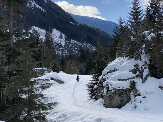
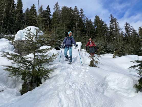
Elise on the final road-walk
Our round trip time was 4 hours 15 minutes counting everything, which was pretty much as expected. Elise did the driving while I tried the hardest to catch up some sleep. Back to Abbotsford I took a lunch break in the Donair Fair then leisurely drove back home, earning myself over an hour’s napping time before work.
