Mount Bryant
November 17, 2012
2629m
Kananaskis – Elbow/Jumpingpound Area, AB
One week after the awesome trip to Valemount, I found myself driving south down Highway 2. A couple of roads will be closed by December 1, so I was more interested in those areas. So I set my objectives to Bryant and Howard. My partner for Bryant will be Travelin’ Jones (Neil), while Andrea Battistel will accompany me on Howard. The road condition wasn’t as bad as a week before, and temperature was much milder, around 0 degree even in the evening. My wind shield didn’t even freeze up overnight, but that didn’t matter as I gonna squeeze in Neil’s car. Powderface Trail could be very icy and I definitely don’t wanna drive it without winter tires. The condition was better than I thought, and we made to Upper Canyon Creek parking area with no problem.
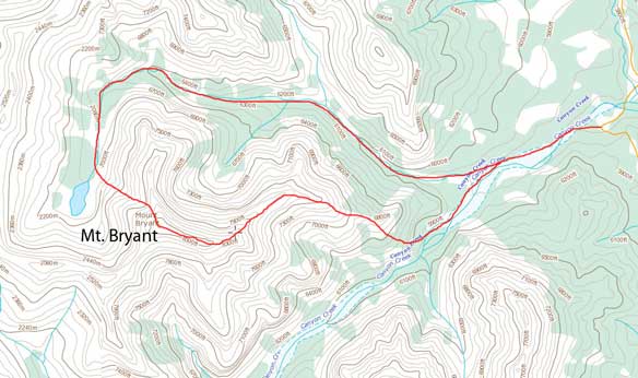
Mt. Bryant scramble route via NW slopes and then down E. Ridge
Due to the front range location, Elbow area was much less snowy. There was no need to bring snowshoes. We soon started the slog up Upper Canyon creek. Due to the snow cover, we didn’t bother to find a “path”, but just simply walked straight in. About 25min we made to the junction where the standard route leaves the main creek bed and goes up the right hand branch. We both wanted to try the difficult east ridge route but I voted for descending it rather than ascending, simply because I didn’t want to increase the chance of failure. The cruxes are near the summit so we wouldn’t get ourselves into trouble if the route doesn’t work. So we started the even longer slog up the right-hand-side branch. There’re a couple of boulder sections that slowed us down a bit due to the snow, but generally we could manage to hike on a fast pace.

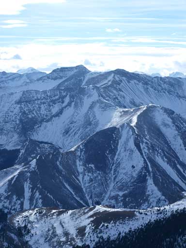
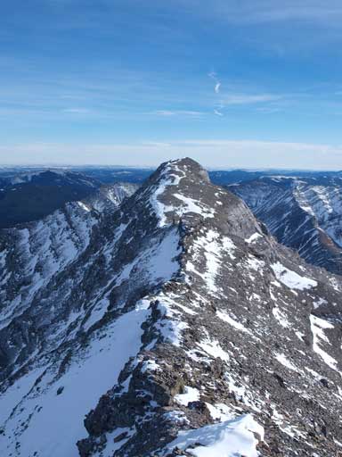
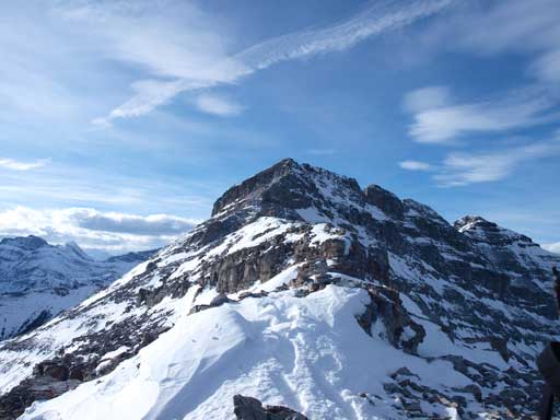
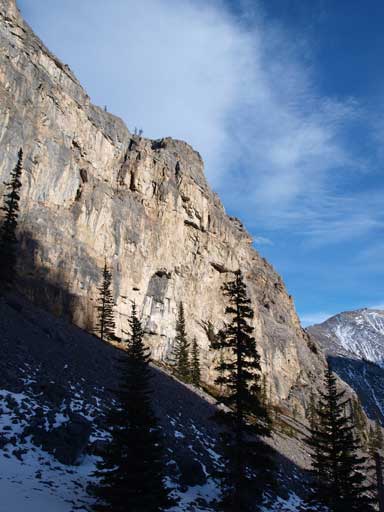
A closer look at East Peak of Bryant
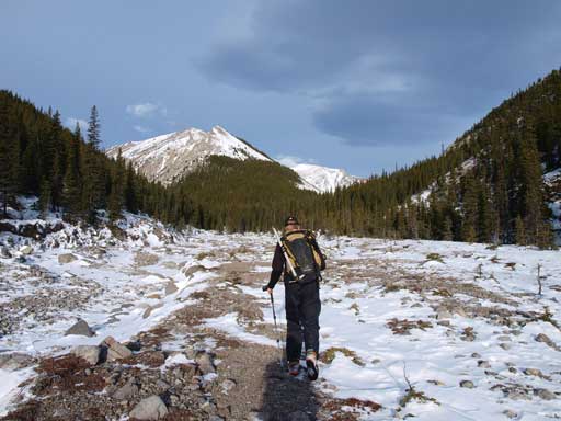
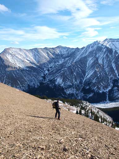
Going up the long creek bed
After a long time of hiking, we suddenly found a cairn on the left side of creek bed, and a faint snow covered trail. We didn’t know if we should follow this trail up but our logic was, it makes no sense if this isn’t the correct trail. So we left the creek bed and followed this trail steeply up forested slope. It didn’t take long to break through the trees, and now we were contouring around treeline towards the Bryant Lake.
In order to avoid elevation loss, we decided to take a short cut over two short rock bands, and straight up the slope towards the summit. The rock hard and icy snow made things much trickier than anticipated. It could be much easier if we put crampons on, but oh well.
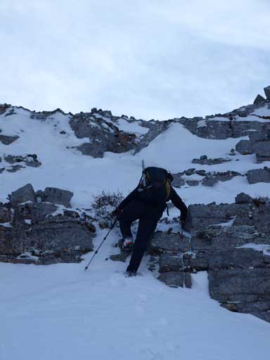
Neil led up a trickier icy step
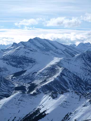
Soon after this big of challenge, we were facing at the huge foreshortened slope leading straight towards the summit. The summit is higher than everything else surrounding, so my suggestion will be keeping eyes on other peaks so you won’t get fooled by the view. You should constantly look back and you’ll be surprised by the views. The frozen Bryant Lake shows up, and then the infamous 4 peaks of Lougheed, Sparrowhawk & Bogart, and then Fortres/Gusty/Galatea group shows up behind Mount McDougall. One way up: 3 hours.
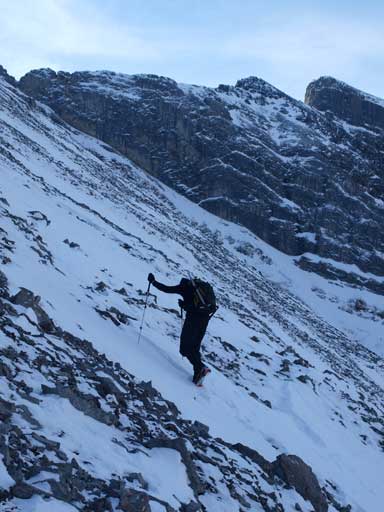
Neil slogging up the typical slope
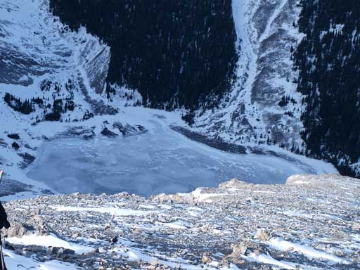
The frozen Bryant Lake

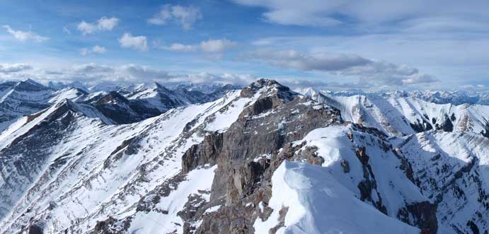
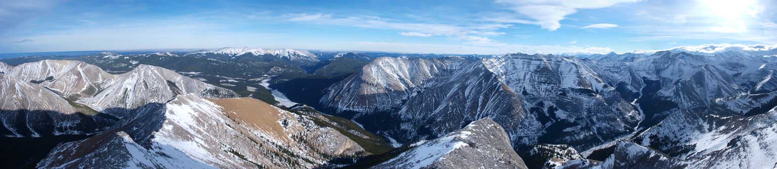
Summit Panorama. Click to view large size
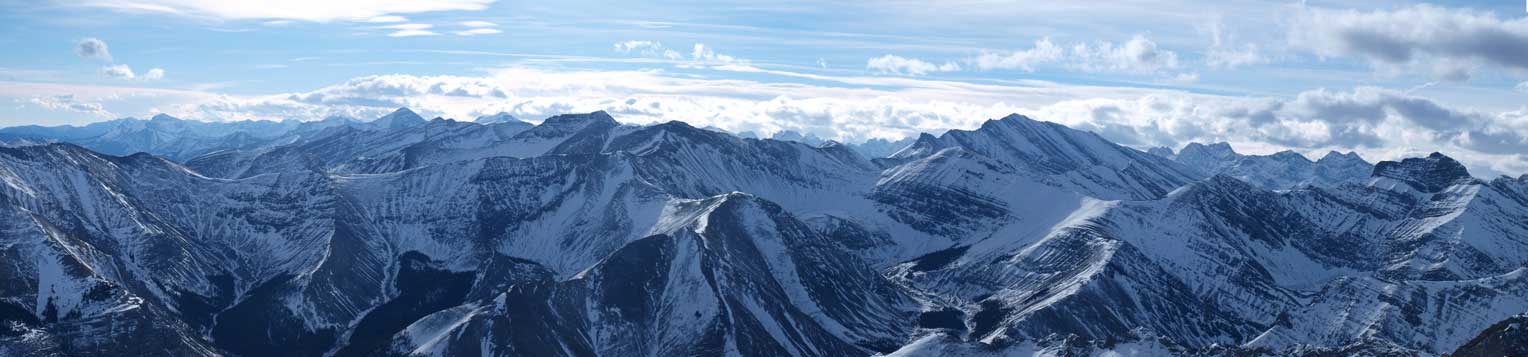
Panorama looking South. More front country peaks in Kananskis
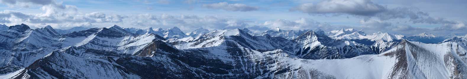
Panorama looking towards Kananskis Valley. You can see the 4 peaks of Lougheed.
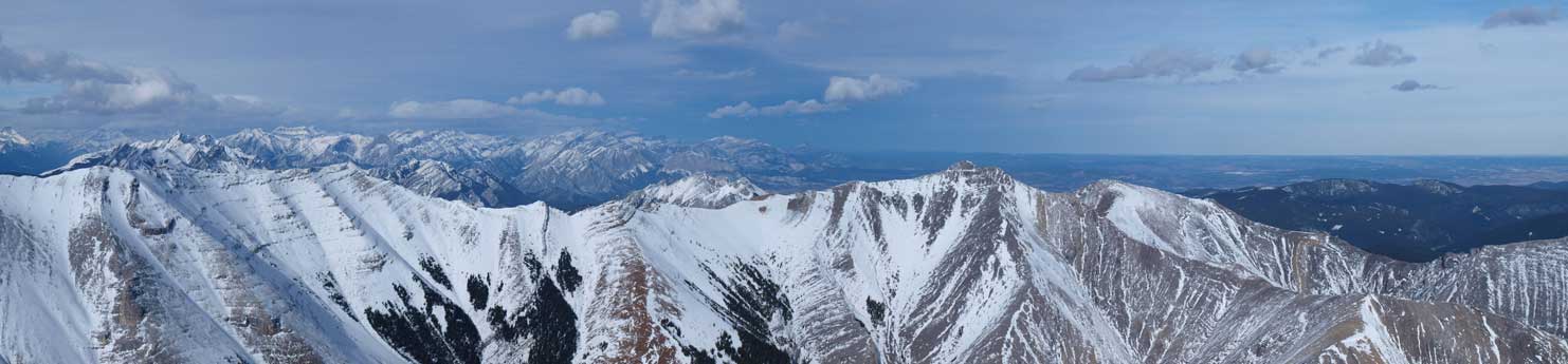
This is towards North. You can see the distant peaks North of Bow Valley.
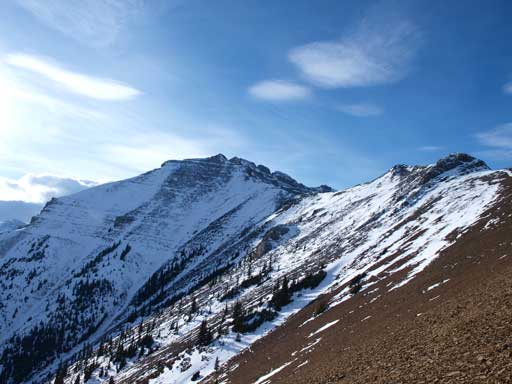
Mount Howard
Fisher Peak
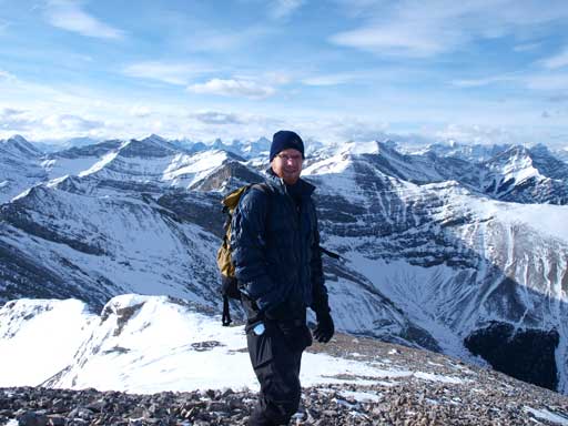
Neil on the summit
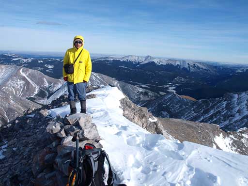
Me on the summit
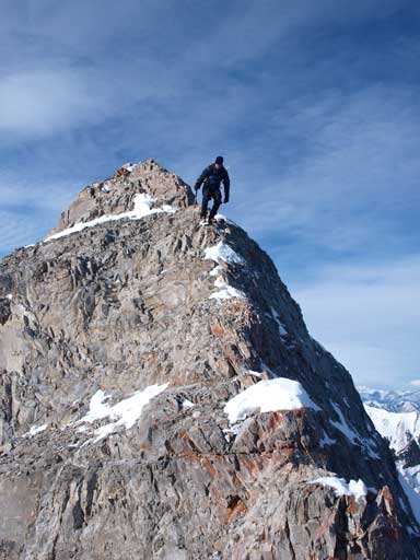
It was a bit windy on the summit, so we didn’t stay long. We tried to follow the exact ridge crest down the East Ridge, over a couple of slightly exposed sections, then up a scree ramp to another high point. Now as Nugara mentions in his book, things start to get trickier.
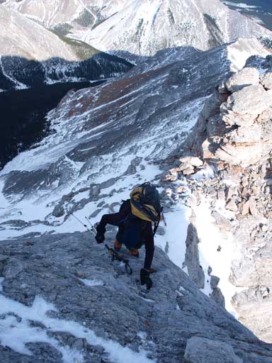
The initial part of East Ridge wasn’t that difficult
Neil negotiating the first exposed section.

Same as above
Traversing around a corner

Cross a tricky slope that could slide…
Good thing it didn’t slide

Ascending this obvious scree ramp
Building a cairn around a corner.
Looking towards the true summit from East Summit

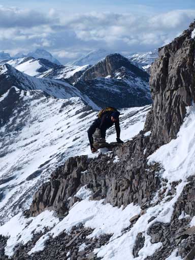
Tricky down-climb
Same as above
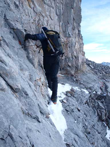
This step is not necessary, but the rock is very solid. Neil took the challenge while I descended on skier’s right side (only moderate level). I confirmed that the descend would work, but he needed to traverse towards my side after the most challenging moves as the last bit of his line was actually overhanging. I ended up ascending towards him and helped him selecting footholds, the holds are tiny at places. I’m very impressed. I’m sure this won’t be find in any scrambling book if it’s a must. After that we could aim for the “orange scree slope” described in Nugara book.
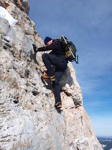
Neil down-climbing his optional challenge
Panorama towards Canyon Creek and Compression Ridge. The orange scree is obvious.
Looking back at the East Peak

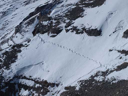
Interesting snow formation
Looking back at the mountain, just before starting the scree run.
Now it comes the scree run

Looking back at this scree section
Back into the trees, there’s still awesome views

Same as above
We ended up doing some bushwhacking after the orange scree run. It wasn’t long before we made back to Canyon Creek. Another 40min walk we were back at car. Since we still had about 1.5 hours of daylight time, we decided to tick off Jumpingpound Mountain as we were there anyway.

[…] Steven Song – Mount Bryant […]
[…] Steven Song – Mount Bryant […]