Sherpa Peak
August 11-12, 2022
2623m
Leavenworth / Enchantments Area, WA
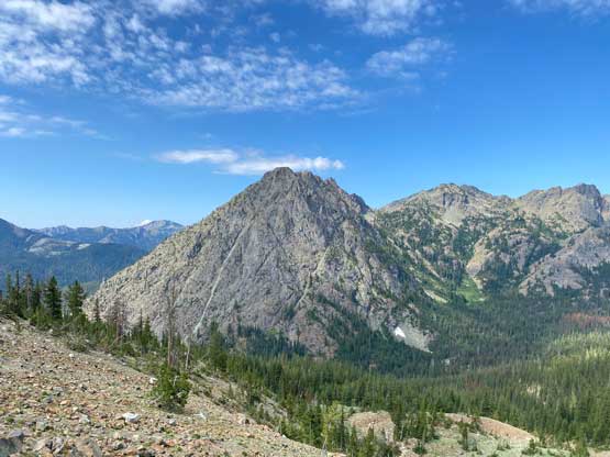
Sherpa Peak is rather a sub-summit on the massif of Mt. Stuart but it does boast over 100 m prominence above Sherpa/Stuart saddle as well as an iconic profile. This peak is steep from all sides with no “easy” route to the top. About 6 years ago I scrambled Mt. Stuart. During that trip the rugged tower of Sherpa Peak caught my attention but I did not know anything about it until I did some research at home. There are two routes with the East Ridge being the easier option, albeit still requiring a rope for at least the descent. The west ridge is the more commonly-used route and more of a classic climb in the area with 5-6 pitches of technical climbing. The official grade is 5.4 but many people would say the crux (Pitch 5) deserves a mid-5th class rating. The approach of this peak is the same as Mt. Stuart by plodding up and over Longs Pass and the climb is usually done in two days with a bivy at around treeline. However, Elise and I ended up doing Sherpa Peak via west ridge as well as Argonaut Peak via south route in the course of 2 days.
The plan for this trip changed a dozen times mostly due to the unpredictable weather. The overall pattern wasn’t very stable but at the last minute we decided the Leavenworth area would be stable enough to attempt something cool. I instantly recalled that Sherpa Peak is something that I needed a rope and a partner and I also recalled there are two routes on this peak. Elise is always easy on objectives and being a peak-bagger I was tempted to just pick the easiest route (east ridge), but I resisted the temptation and decided on the west ridge. I figured that we should have no problem climbing a few pitches up to mid 5th class so might as well climb a classic in the area. The original plan was to just climb Sherpa Peak over 2 days so we really didn’t need to rush on Day 1. In order to avoid the Seattle traffic we opted to drive to the trail-head, about 4 hours from my home in the previous evening. We left White Rock at around 4 pm, had a dinner in Issaquah and arrived at the trail-head at 10 pm. That night we got hammered by thunderstorms and we didn’t manage to start the hike-in until 10 am in the morning. None of us felt motivated to repack with all the wet gears but eventually we had to face it. The worst was to pack the wet tent with all the dirt from the ground…

Elise then led us dashing up the endless switchbacks and in a single shot we arrived at Longs Pass, more than 600 m elevation gain in 1 hour and 10 minutes. The air was smoking hot with humidity so we took a break at the pass. I needed to drop the heavy pack for a few minutes to rest my shoulders. We then dashed down the north side of the pass, following a not-so-great trail into Ingalls Creek valley losing about 450 m elevation. We took another break filtering some water, crossed the creek on a log and hiked another kilometer to the start of Sherpa Peak’s climber’s trail.


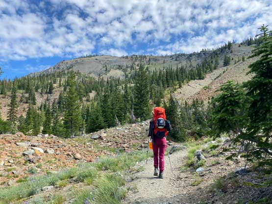


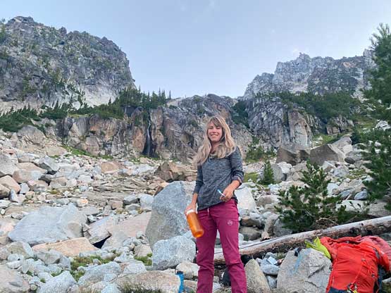
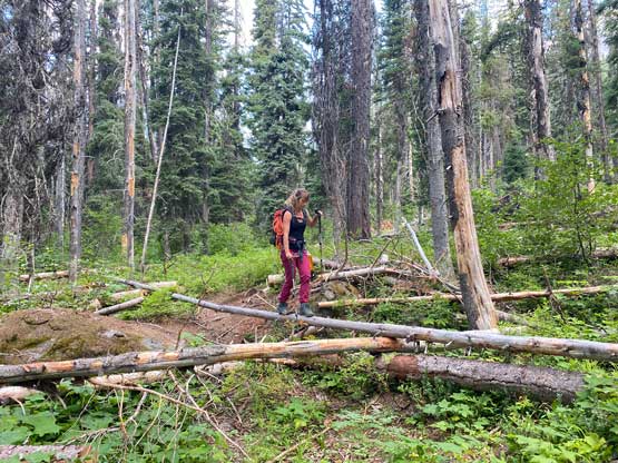
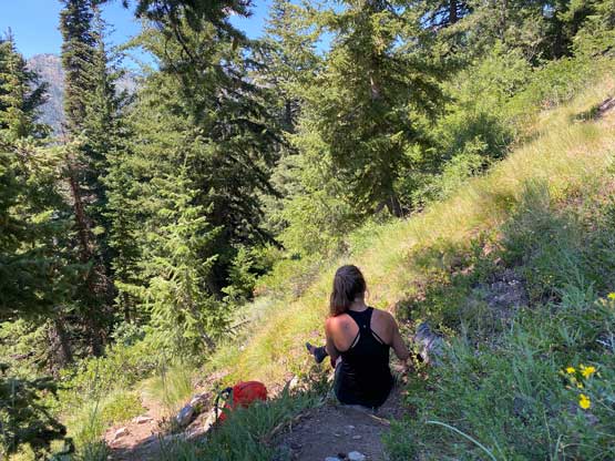
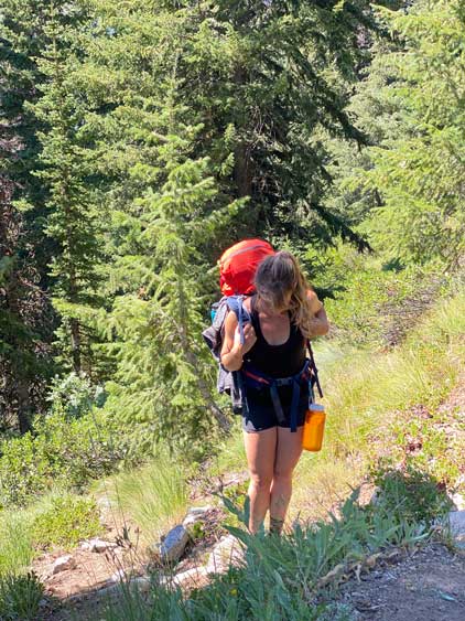
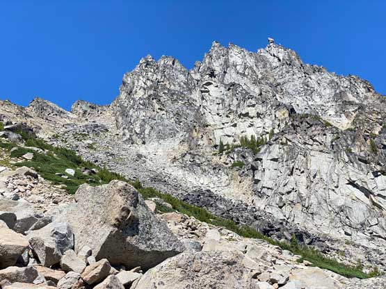
The trail was easy to locate thank to the few GPX tracks that I pre-loaded into the Gaia app. The quality of this trail was actually better than expected. There were definitely some degree of thrashing but the entire trail was easy to follow so we couldn’t complain about that. The hotness and the humidity did make the ascent rather miserable as we were both drenched from the sweating in literally no time. As expected the progress was slow but at least steady. At around 1800 m we faced that stretch of not-so-great terrain where we must slog up some loose and steep scree while traversing to a shoulder on climber’s right. Somewhere in this stage I had to call for a break to switch footwear from trail runners to mountaineering boots. I was very tempted to do this whole trip in just trail-runners and rock shoes but at the very last minute I opted to pack the Trango Techs “just in case”. I was damn glad I did that because I had never gained enough confidence to scramble rough terrain in just the trail shoes (not sure how and why so many of you can do that). I instantly felt much better with the rigid boots. After traversing over that shoulder we side-hilled into the drainage and then boulder-hopped to the “low camp” at 1950 m elevation, about 2 hours after leaving Ingalls Creek trail. Earlier in the day Elise had mentioned that maybe we should climb Sherpa Peak in the evening of the first day so we could also do Argonaut Peak in this trip. Initially I was like meh but then we were moving much faster than most groups did on the approach so we should have a chance. After making up my mind we did the camp set-up as quickly as possible (under half an hour), repacked and that was 3 pm when we left for Sherpa Peak’s climb.


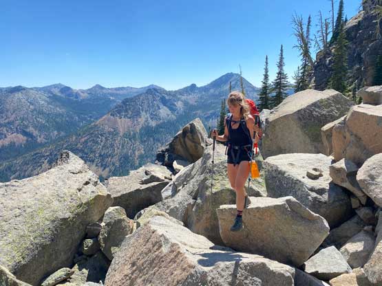

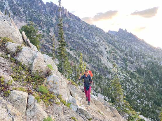
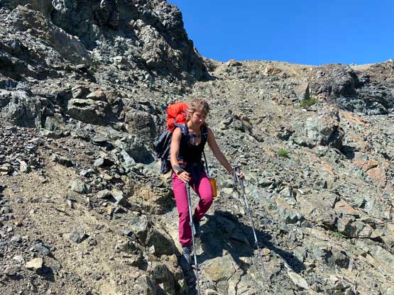
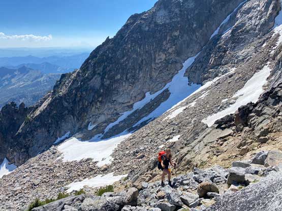
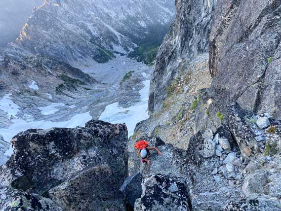
The ascent from the camp to the notch on Sherpa Peak’s west ridge (the start of the route) involved over 500 m elevation gain on either heather slopes or boulder fields. This section was longer than expected and took us about an hour. The route-finding wasn’t super obvious neither so I had to consult with the GPS multiple times. Firstly we ascended towards climber’s left onto a grassy ramp and then ascended more or less the middle of the valley, hopping on car-sized boulders at places. Nearing the notch the terrain started to become loose. The scramble up onto the notch was 3rd class and we both ditched the boots along with some extra gears after hitting the ridge.
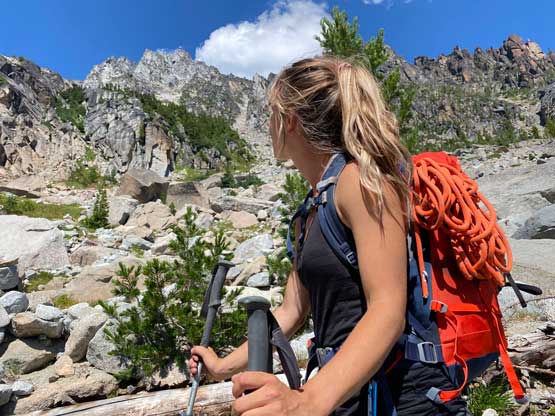


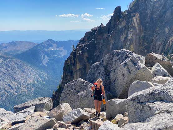
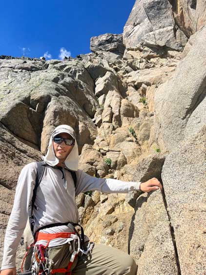
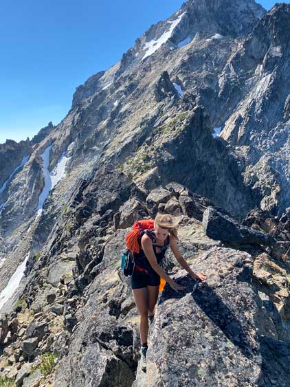

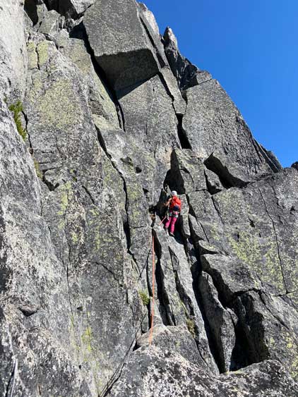
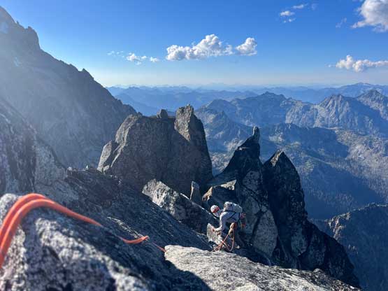
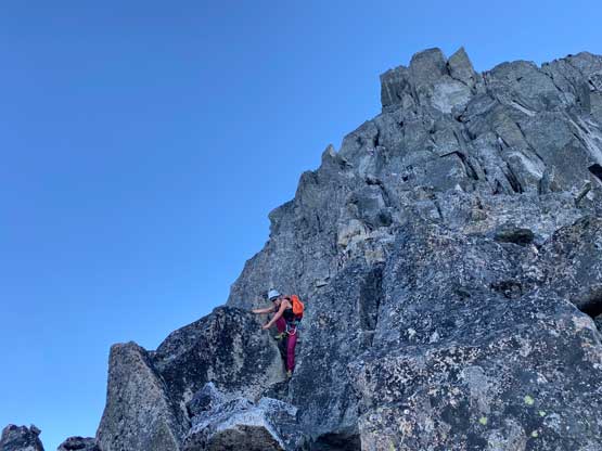
The original plan was to let Elise lead all the pitches on the ridge since she needed to build experience but now with the change of plan (climbing Sherpa Peak in the evening of Day 1) we must be as efficient as possible to get back to camp before dark. The most efficient way was to free solo the route so that’s the new plan. The first pitch was supposedly only 4th class and the second pitch was low 5th class. These two pitches were rather trivial and we soloed up in no time. The 3rd pitch was also rated “low 5th” but the climbing started to become real here, with several exposure and more sustained moves. We also soloed this pitch but we probably should have pitched it out. We then scrambled across a knife-edge ridge and made a tricky down-climb onto some easier terrain. The supposed Pitch 4 was just a scramble so we did not take the rope out until arriving at the base of the crux pitch (Pitch 5).


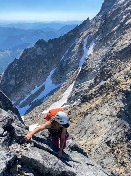
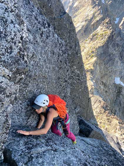
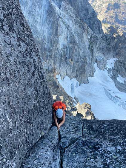


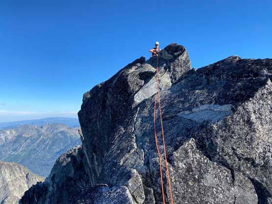
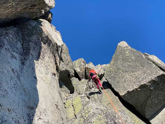
The crux pitch supposed to have a “bear hug move” near the top that some would rate 5.6/7 so we definitely wouldn’t keep soloing. I found a boulder to build a belay station and Elise started the leading. Elise ended up breaking this pitch into two smaller pitches. The first half was rather trivial that she only put in one nut about halfway up but the second half was indeed quite tricky. We used a few cams including the size 3. The “bear hug move” wasn’t using the two cracks as both of us actually hugged the block using corners and it worked. The terrain above this pitch was back to mostly 3rd to low 5th class but since the rope’s already out we decided to properly pitch out to the summit. I led the 6th pitch and Elise led the final summit ridge traverse. There wasn’t an anchor on the very top of this peak so she had to build a gear anchor to belay me across. We then took turn traversing to the next high point just to be sure. Eric Gilbertson had surveyed years ago that the infamous “balanced rock” is marginally lower, so that’s good news as to climb the balanced rock would be 5.10, much more beyond our level.

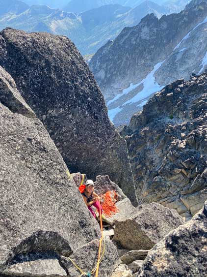


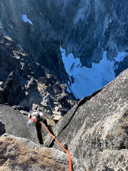
We had been doing great on time so the decision was to rappel everything back to where we stashed the shoes and poles. The first rappel was more of a ridge rappel and was rather awkward and a few of the other rappels did not quite follow the ascent route, so the route-finding was rather tricky. There were also a long scrambling section between the 2nd and the 3rd rappel. I think our final rappel was off-route as we ended up on the north side of the ridge and had to scramble/solo a pitch of sketchy 4th class with loose rocks to get back onto the ridge. We still had over an hour’s daylight time when we got back to the stashed gear and that’s plenty enough to get back to the camp. The descent was rather tedious with mostly boulder hopping. We eventually did have to turn on the head-lamps while cooking and eating dinners. With another long day ahead we did not stay up but immediately went to bed.


The alarm went off at 4:30 am but we snoozed to 5 am and we were both feeling extremely lazy to get going, but since the plan’s made to also bag Argonaut Peak we had to get up eventually. After packing up the tent we spent less than an hour descending to Ingalls Creek trail and then repacked and ditched all of the unnecessary gears. I descended in my mountaineering boots and planned to also use them on Argonaut Peak’s ascent, but there was 2.5 km of trail to cover between these two peaks, so I opted to wear trail-runners on this stretch and carry the boots. I decided to just use my 20L pack for Argonaut Peak so the harness had to be worn and the boots had to be dangled on my harness.